
Workflow
for Spatial Data Management Based on Models
Use case:
Land Administration

WORKSHOP
Model Driven Architecture
INTERLIS
UML INTERLIS Editor
ili2db / QGIS Model Baker
LADM
Conclusions
Agenda

Start conceptualizing, not thinking on technology.
Describe well your conceptual model, it would become a reference for everybody.
Choose your preferred technology stack to work with your data, the model is technology agnostic.
Generate your applications automatically from models.
Model Driven Approach
INTERLIS
INTER Land Information Systems (1991)
Conceptual descriptive language
Object-oriented language
Platform and system neutral
Includes classes, attributes, structures, domains, relations, constraints, units, etc.

INTERLIS WORKFLOW
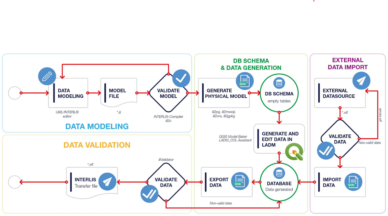
INTERLIS Workflow (1)
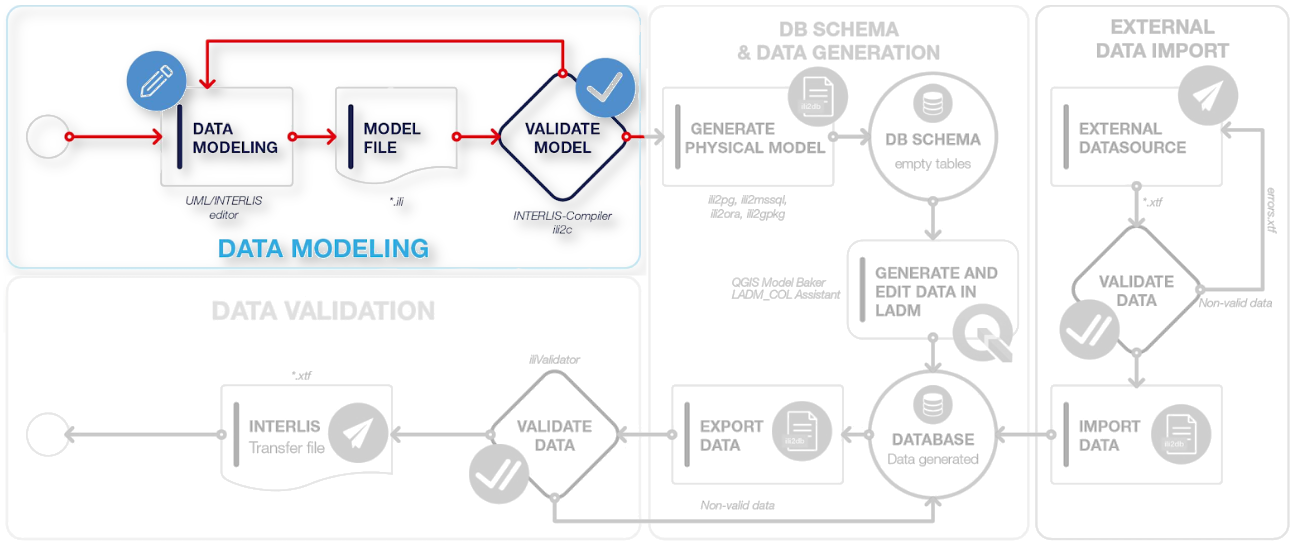
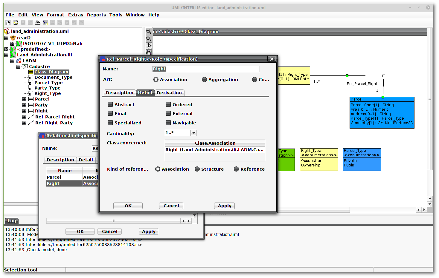
UML INTERLIS Editor
Open Source project
Create, display, and manipulate data models
Reads and writes INTERLIS syntax and GML schemas
Documentation of models
UML INTERLIS Editor
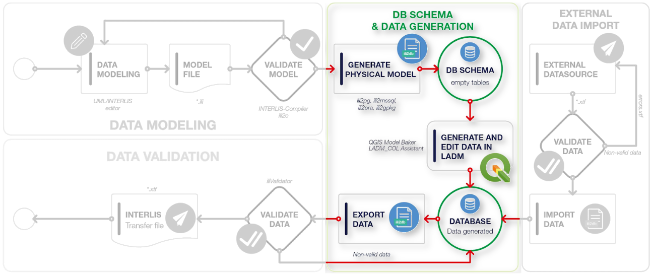
INTERLIS Workflow (2)
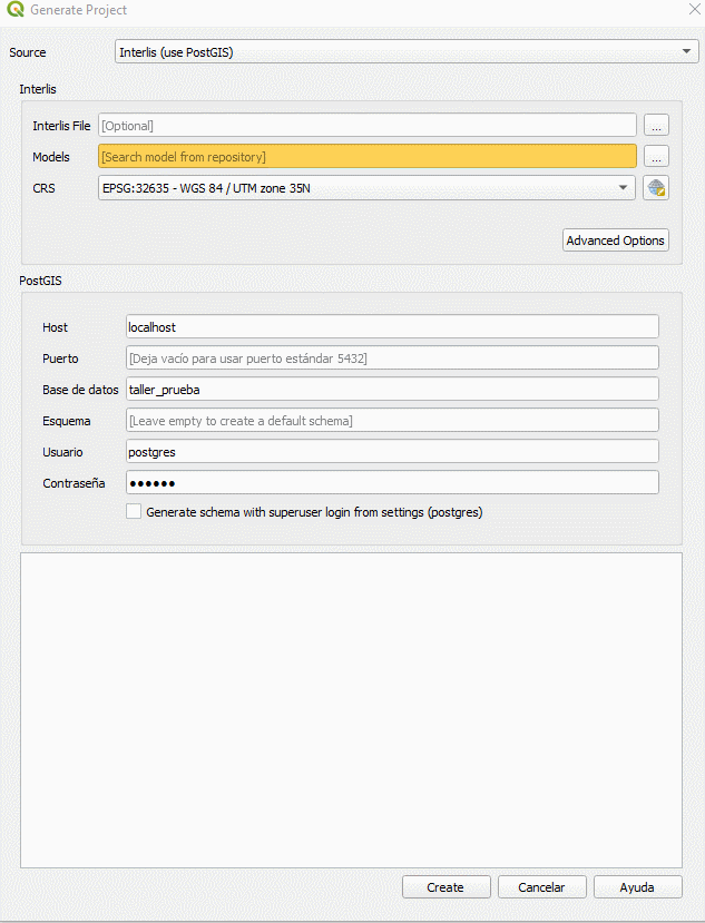
ili2db

Create a physical database schema based on an INTERLIS model
Validate, import and export data in the INTERLIS exchange format
Open Source project
Several DB engines supported:
Pg, GeoPackage, Oracle, SQL Server, ...
ili2db

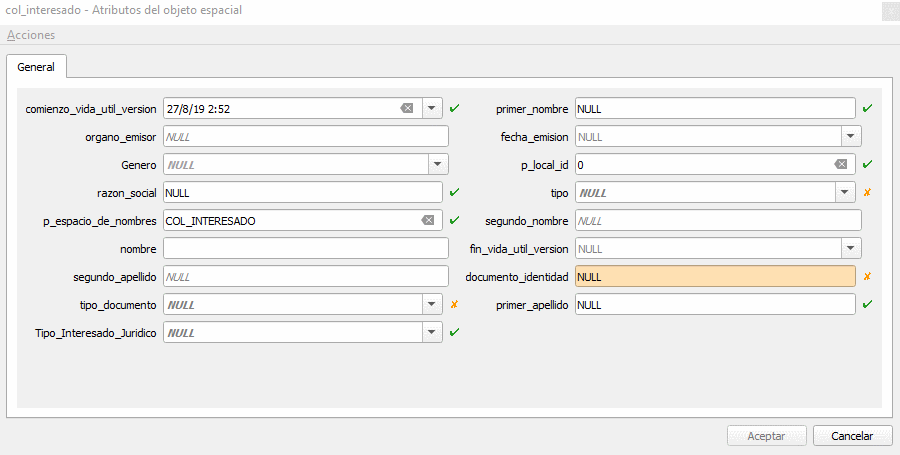
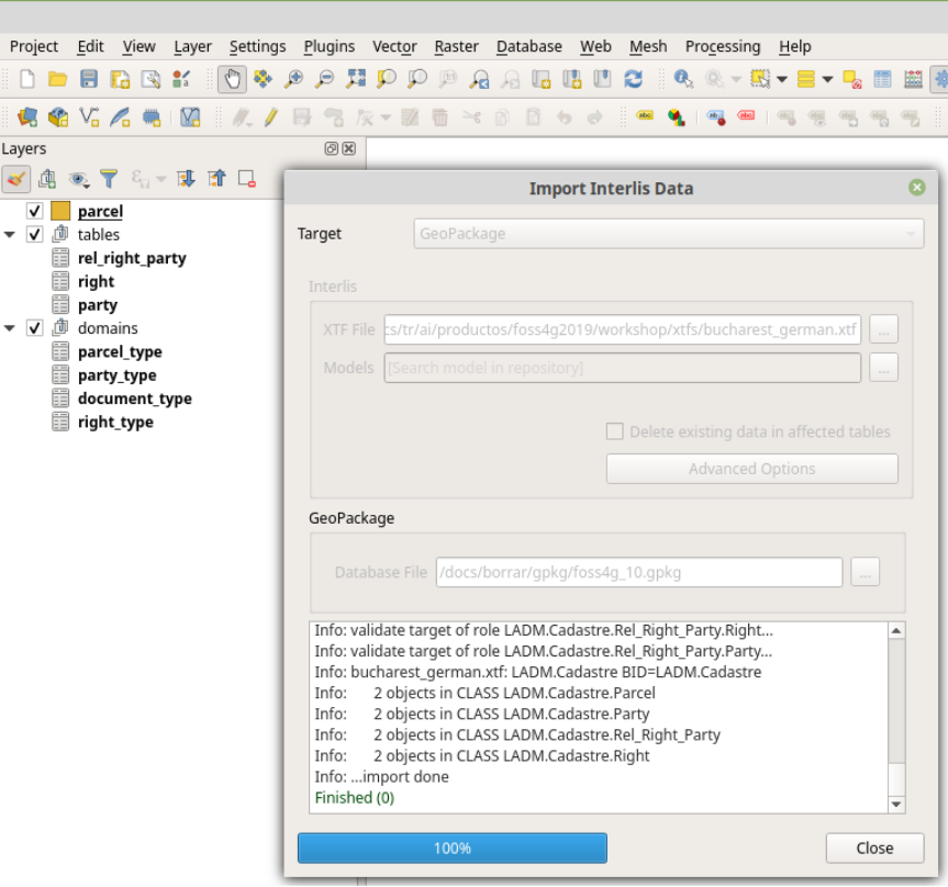
QGIS Model Baker


Plugin for QGIS 3.x
Creates DB schemas and provides the layers and editing forms based on the schema.
Exports structured data to INTERLIS transfer format (XTF).
QGIS Model Baker
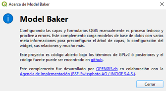
QGIS Model Baker
INTERLIS Workflow (3)
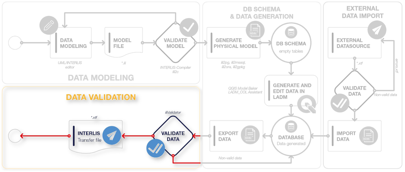
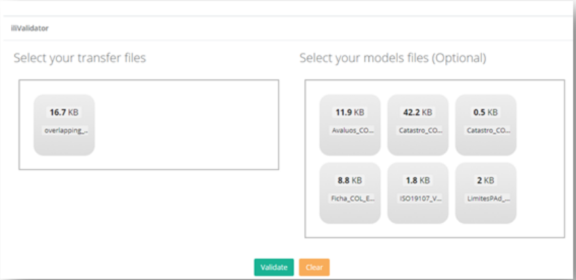
Data Validation


Data Validation
INTERLIS Workflow (4)
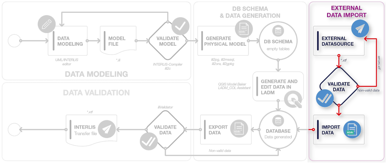
External Data Import
Land Administration Domain Model
Semantics for Land Administration.
Descriptive standard, implementation is up to you.
Supports customization according to specific needs by country, institution, etc.

Land Administration Domain Model

There is a language that allows us to implement the MDA approach: INTERLIS
Conclusions
An ecosystem of software around INTERLIS enables us to work on different technology stacks an even to get automatic applications for data capture and validation.
Mulțumesc mult!

https://github.com/AgenciaImplementacion

https://www.youtube.com/AgenciaImplementacion
https://www.proadmintierra.info
https://slides.com/proadmintierra/foss4g_workshop_interlis
Slides
Workshop FOSS4G Bucharest 2019
By germap
Workshop FOSS4G Bucharest 2019
Workflow for spatial data management based on models (Use case: Land Administration)


