GeoDev Meetup

5:30-6:30pm Registration and Social
6:30-7:00pm Intro, What's New, and Demos
7:00-7:20pm Keynote: Christopher Moravec
7:20-7:30pm Break
7:30-8:00pm Lightning Talks
8:00-8:30pm Giveaway, Networking, and Social
Welcome!
Your hosts
Esri Portland R&D
Mike Wilburn
Justin Colville
What about you?
GeoDev on Social Media
Facebook
- http://facebook.com/EsriGeoDev
- @EsriGeoDev or #geodev
- search "Esri GeoDev"
- follow @EsriGeoDev

Lightning Talks
- "On-the-fly Web Map Built with Python and Leaflet” - Baofeng Dong
- "Facilities GIS" - Paul Platosh
- "Widgets?" - Shad Campbell
Events
events.esri.com
DevSummit
esri.com/DevSummit
Raffle tonight!


User Conference

esri.com/UC
Online
what's new
ArcGIS Online
- Customize your landing page when logging in
- Data loading directly from other cloud providers
- Content updates - imagery, elevation data, expanded support for multiple languages in our vector base maps
- Update and append data to existing Feature services
- Prepare Map areas for offline use
- Define an Area of interest for a hosted feature layer view
- Enhancements in Arcade expressions to support geometry operations
- Measure distances in 3D
Complete cloud-based mapping platform
https://blogs.esri.com/esri/arcgis/2017/09/20/whats-new-in-arcgis-online-september-2017/
https://blogs.esri.com/esri/arcgis/2017/06/28/whats-new-arcgis-online-june-2017/
https://www.arcgis.com/apps/Cascade/index.html?appid=3271f9b87c394c07b4a871257a5dc46b
https://storymaps.arcgis.com/en/app-list/
https://wadnr.maps.arcgis.com/apps/Cascade/index.html?appid=36b4887370d141fcbb35392f996c82d9
Web APIs
what's new
ArcGIS Web AppBuilder
developers.arcgis.com/web-appbuilder
JS API 3.23/4.6
developers.arcgis.com/javascript
3.23
- Arcade geometry operations
- New named vector basemaps
4.6
- Directions widget
- DistanceLineMeasurement3d widget
- New named vector basemaps
- Smart mapping
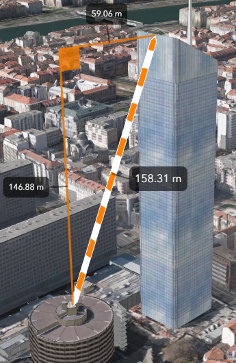
Extend the 3D engine
(Experimental...but pretty cool)
https://arcgis.github.io/presentations-devsummit-2017/extending-3d-engine/
- http://mapit.mapsdevext.arcgis.com/home/webmap/viewer.html?webmap=2671dbf1dc7b4fbb8e5b65dfae4a2c04
-
https://developers.arcgis.com/javascript/latest/sample-code/layers-pointcloud/live/index.html -
https://esri.github.io/Manhattan-skyscraper-explorer/ -
https://blogs.esri.com/esri/arcgis/2017/07/14/manhattan-skyscraper-explorer/ -
https://github.com/Esri/Manhattan-skyscraper-explorer -
https://developers.arcgis.com/javascript/latest/sample-code/visualization-vv-color-animate/index.html
Native
what's new
AppStudio for ArcGIS
create native apps
scroll for details
ArcGIS Runtime
developers.arcgis.com/arcgis-runtime
Quartz Update 2
What's coming?
- Scene analysis (viewshed, line of sight)
- Geotransformations
- Offline maps (pre-planned, vector tiles)
- Routing (closest facility, service area)
- WMS
- Shapefile
- Time
- Geopackage
ArcGIS Python API
developers.arcgis.com/python
ArcGIS for Developers
https://developers.arcgis.com
Sign up for a free developer subscription!
ArcGIS for Developers
1,000 free credits, code: PDX1117GEODEV
code expires: Dec. 12th
credits expire: May 28th
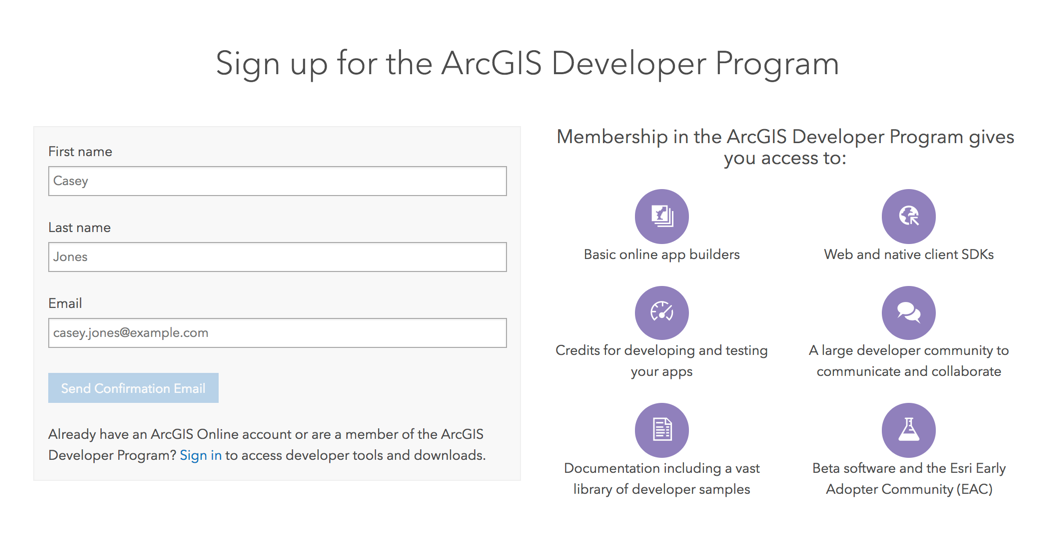
https://developers.arcgis.com/sign-up
Text
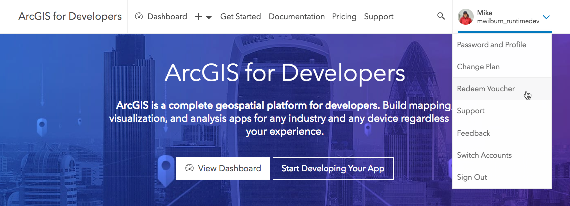
Voucher redemption

Social Coding
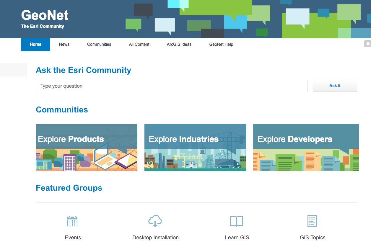
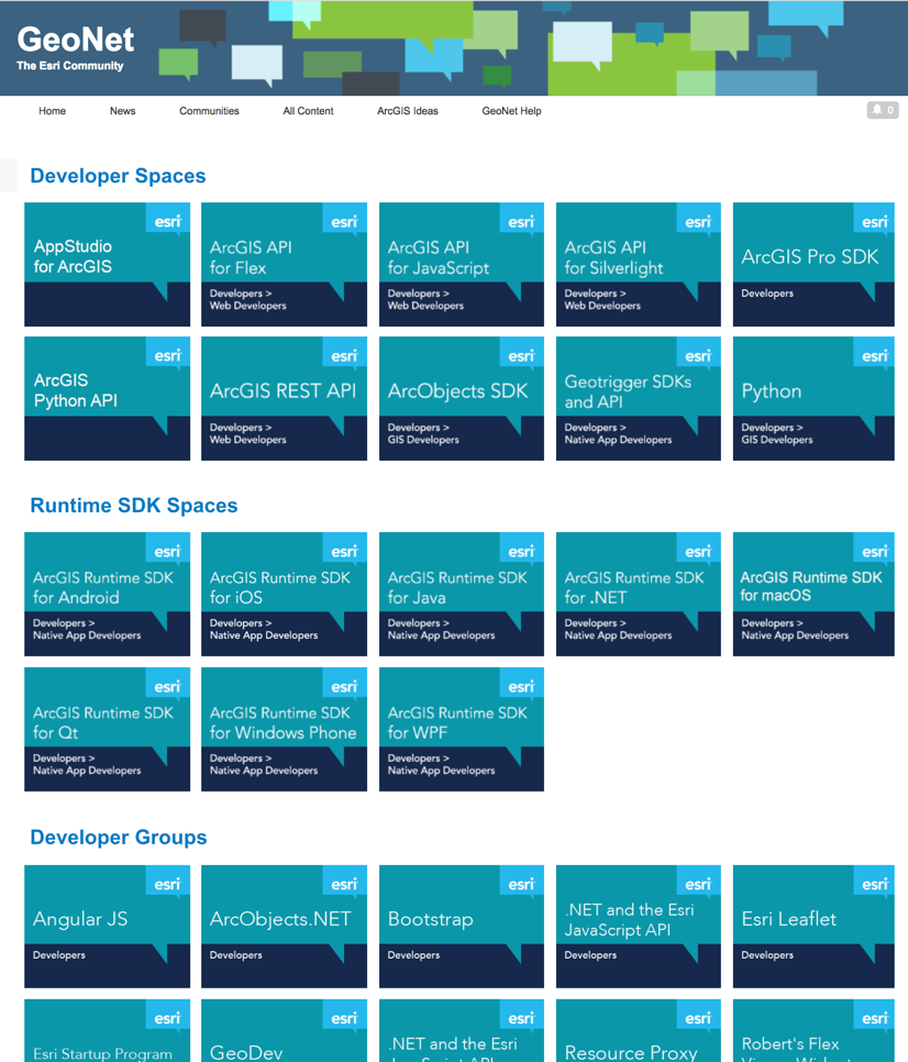
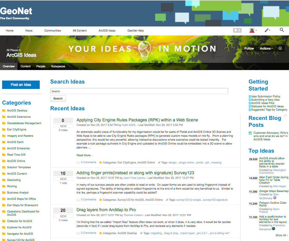
GeoNet
Esri's online community - community.esri.com
esri.github.io & github.com/esri
Web Development
Data Management
Native Development
Spatial Analysis
Publishing and Sharing
Resources
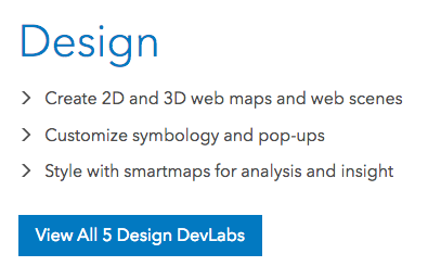
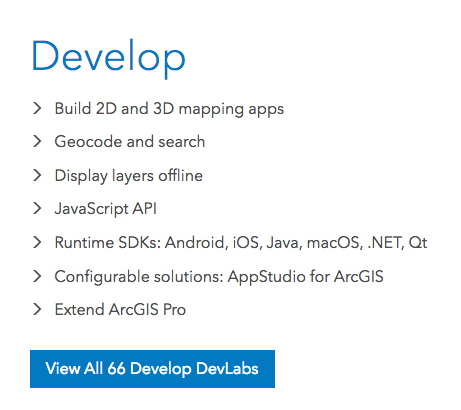
ArcGIS DevLabs
https://developers.arcgis.com/labs/

>
>
ArcGIS Example Apps
https://developers.arcgis.com/example-apps
video.esri.com
ArcGIS Code Sharing
codesharing.arcgis.com
Other Resources
training.esri.com
ideas.arcgis.com

Instructor-led: on site
E-learning: web course, tutorials
We're Hiring!
careers.esri.com
Show me something cool!

ArcGIS Runtime AR/VR
Private beta for .NET only
(Android & iOS forthcoming)
Want an invite?
ArcGISRuntimeARVRBeta@esri.com
ArcGIS Runtime AR/VR
Community announcements?
Let's hear from our keynote speaker!
Christopher Moravec:
"Risk Frontier"
GeoDev Meetup Portland Nov 2017
By mikewilburn
GeoDev Meetup Portland Nov 2017
November 2017 Esri Portland GeoDev meetup!


