GIS 506 Environmental Planning Applications
April 13, 2017
Peter Keum
peter.keum@kingcounty.gov


Part I - GIS in KC WTD
Part 2 - Various Tools
Part 3 - GIS + Vertical Industry (Technology Trend)


GIS in WTD
-
Data collection (GPS)
-
Database Development/Maintenance
-
Cartographic Production (paper/web): Data Visualization.
-
Program and Project Support
-
Spatial Analysis Developement
Combined Sewer Overflow

CSO = Stormwater (90%) + Sewer (10%)


1881 New York - 2.5 million pounds of horse manure per day
(not too) long time ago.... galaxy far away
Joseph Bazalgette


Modern Sewer Conveyance System
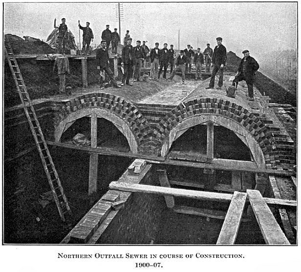
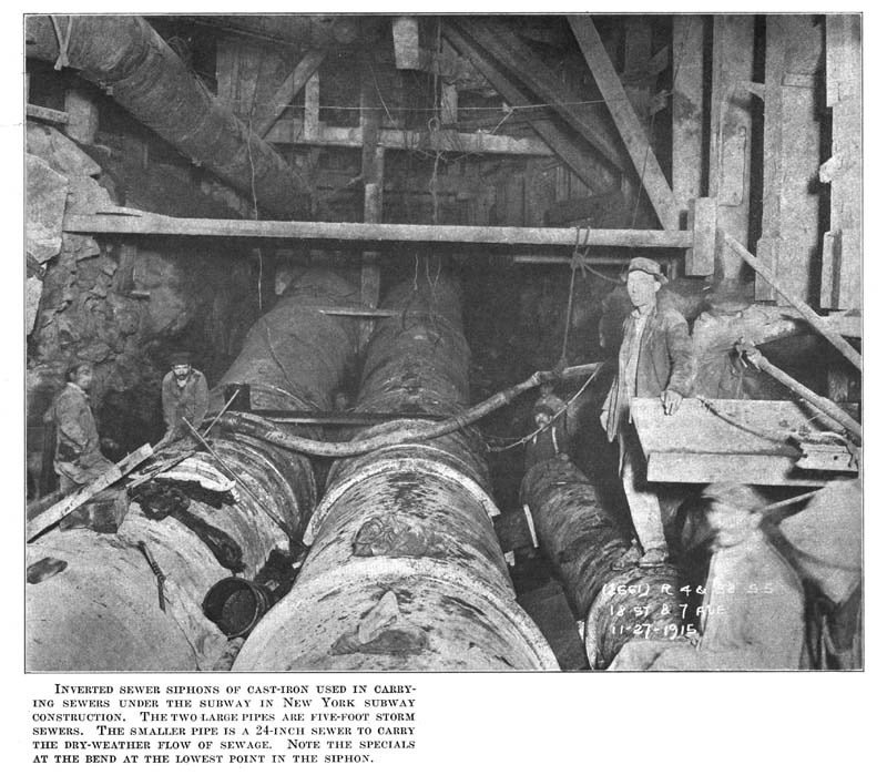

Combined Sewer Overflow (CSO)
Stormwater (90%) + Sewer (10%) = CSO

NPDES - National Pollutant Discharge Elimination System (NPDES) Permits

Why CSO Status Viewer?
Regulatory Requirement
- Non-Interactive
- Not Enough Information
- Can Not Zoom
- Hard to update Basemap
Meets the Purpose BUT ....

Assembling Pieces
- Python
- GitHub
- geoJSON
- Leaftlet JS
- Javascript
- HTML
GitHub site


Old
Current
gh-page + Leaflet.js

Finished for now....

Part 2 - Tools


CUGOS
Cascadia
Users
of
Geospatial
Open
Source


www.cugos.org
Part 3 - GIS + Vertical Industry
Future of GIS

GPT
General Purpose Technology


GPT
"GPT always needs complements"

+
=

+
=
"GPT always needs complements"
+
=
Urban Planning
You
+
=
Utilities
You
+
=
Social Justice/Equity
You
+
=
Environmental
Science
You
GIS
Companies are using maps not just as nice features but to drive revenue as core components of their offering. Maps are no longer just a good way to visualize content, they are core to competitive advantage.
Companies are thinking more creatively about how to combine location with outside content and internal business data to differentiate products


For Next Time....
Meetups
Learn and explore mapping technologies through tutorials
Thank You
peter.keum@kingcounty.gov
GIS /Sewer & Urban Planning
By Peter Keum
GIS /Sewer & Urban Planning
Presentation for UW-Tacoma MS in Geospatial Technologies. Spring Quarter -Environmental Planning Applications


