Anhhuy Vis
Nothing
TOWARDS MOBILE INTELLIGENCE - LEARNING
FROM GPS HISTORY DATA FOR COLLABORATIVE RECOMMENDATION
Teacher assistant: Tô Hoài Việt
Execution:
1112445 - Trương Anh Huy
1112448 - Nguyễn Duy Khanh
1112458 - Nguyễn Nhật Minh
CONTENT
1/ Introduction
2/ Problem is mentioned in magazine
3/ Methods proposition
4/ Experiment
5/ Conclusion
1/ Introduction
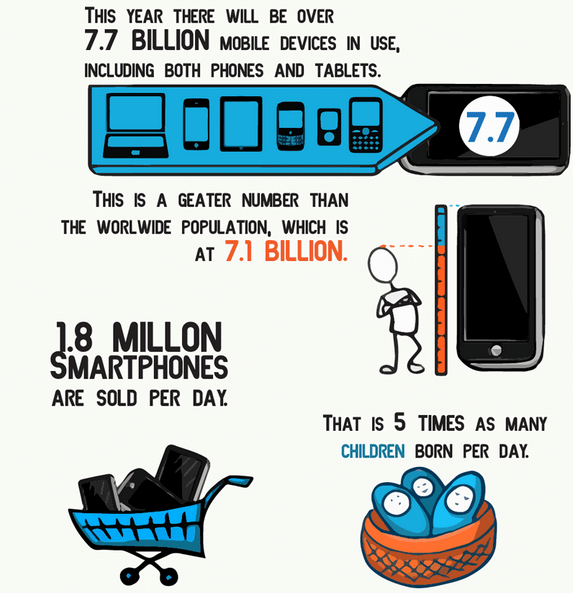
- Golden age of mobile ( almost have GPS )

[ Source ]
[ Source ]
1/ Introduction
- From user's history ==> we have a big data of user location.
- From user's sharing or reviewing ==> we have more semantic data.
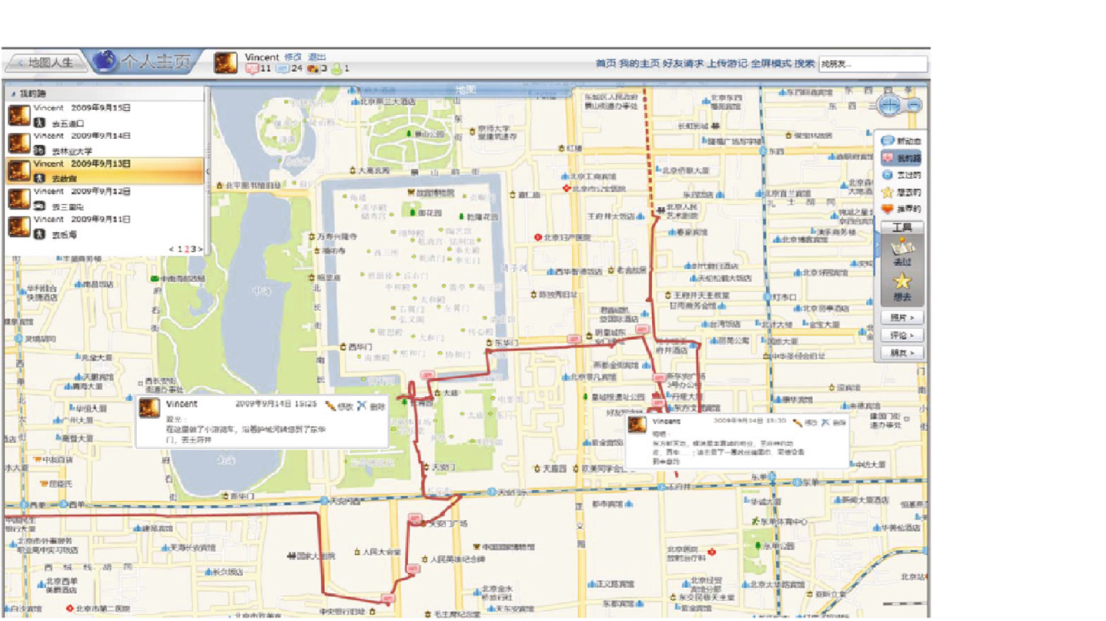
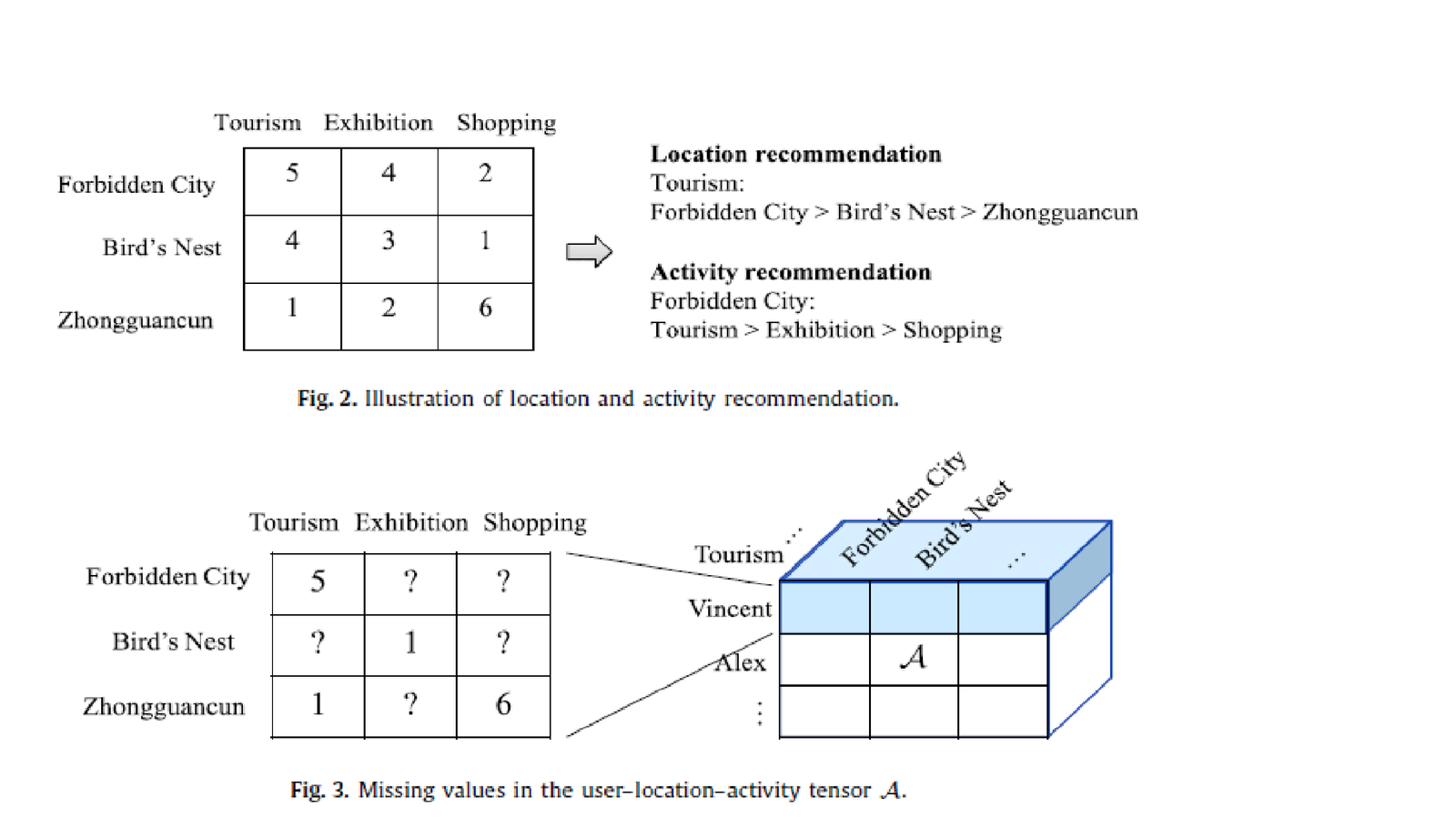
Example was given in magazine
Traveling around Forbidden City
2/ Problem statement
- Extract entities user - location - activity in tensor 3-D
- Pridict value for missing entities and fill
then base on ranking -> give recommendation
- Directly uses ranking loss as object function
-> better than predict missing value?
- Two main categories :
+ Memory-based: rating data to measure similarity between
matrix entities
+ Model-based: relying on matrix factorization to uncover latent
factor that explain observed rating
3/ Methods proposition
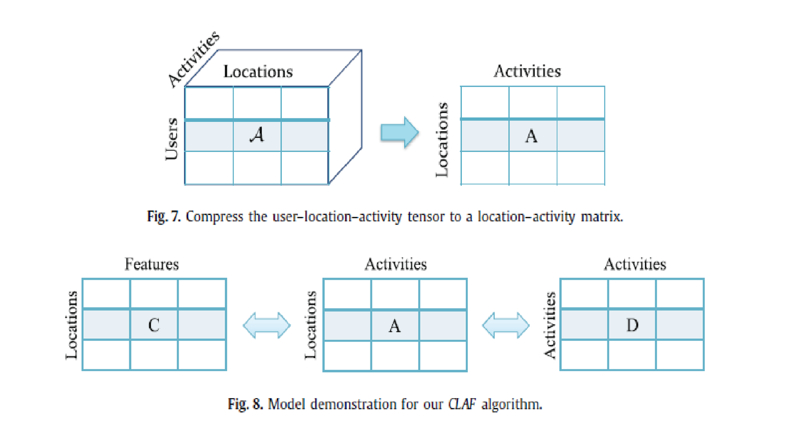
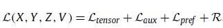
- Collaborative location and activity filtering (CLAF): model-based
+ compress the 3-D U–L–A tensor into a 2-D L–A matrix
+ use collaborative filtering to predict its value
Ex: location i has activity j, location i' similar i
-> value for activity at i' ?
This algorithm is focused on general recommendation, so that the system gives same recommendation results to different users.
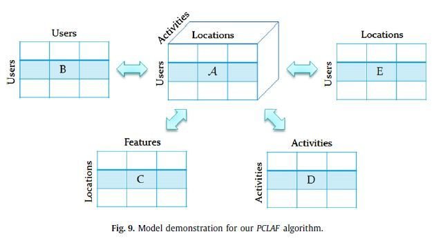
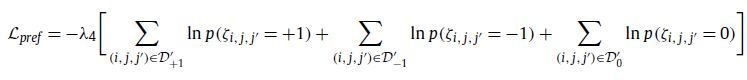
- Personalized collaborative location and activity filtering (PCLAF):
using model-based
+ use CLAF model
+ extend users-users to get information as much as possible
+ useful to formulate the user preferences on each location
learning strategy may take an indirect route to solve the problem
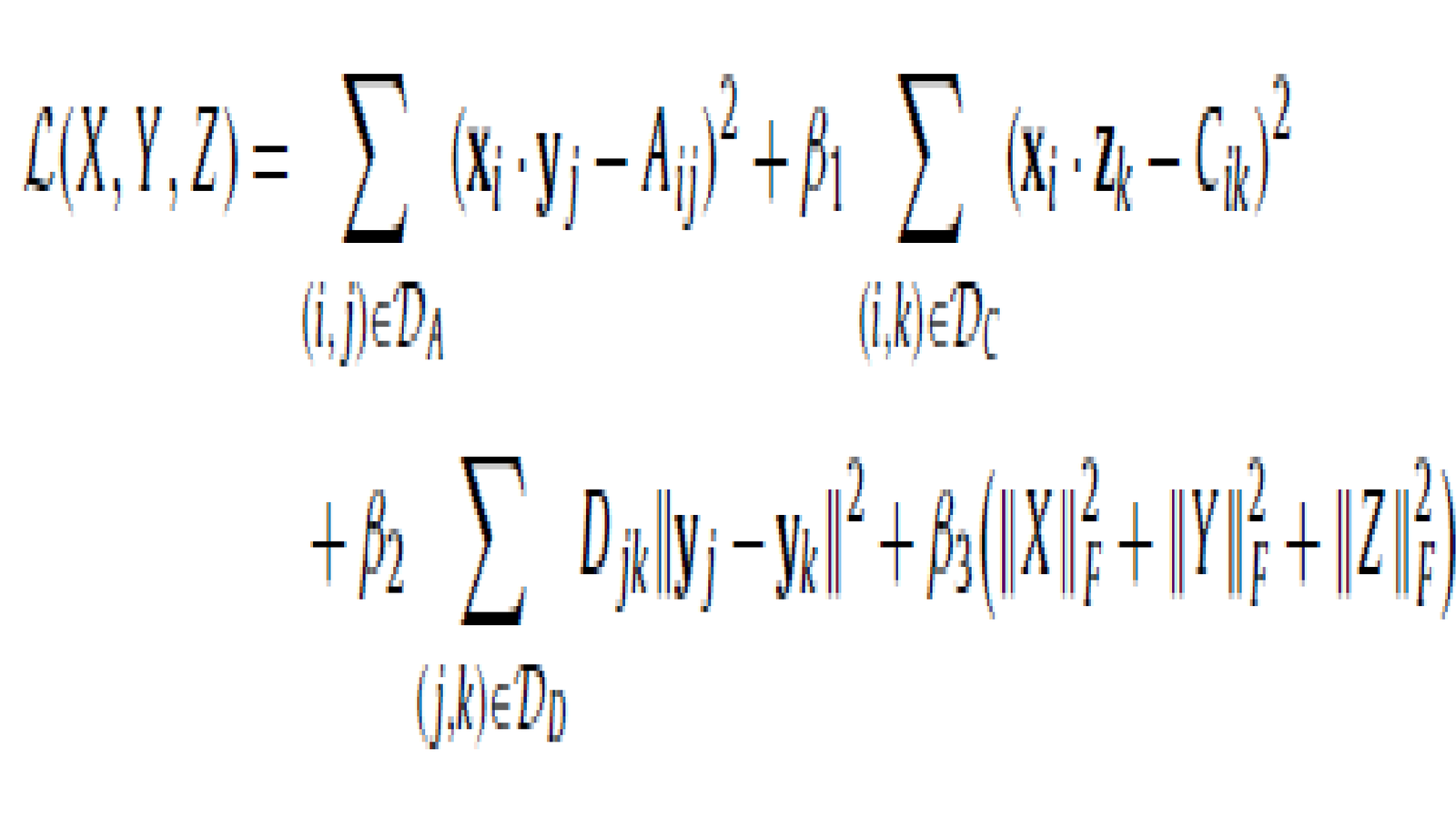
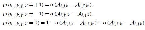
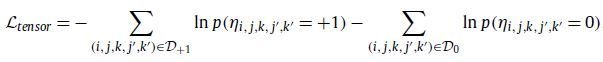
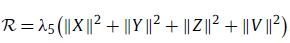
Ranking-based personalized collaborative location and activity filtering (RPCLAF): using model-based
- takes a direct way to solve the recommendation
- using ranking loss as the objective function
Some advantages:
+ more consistent with the final goal
+ rating pairs as input -> more data for training
+ ranking-loss is potentially useful

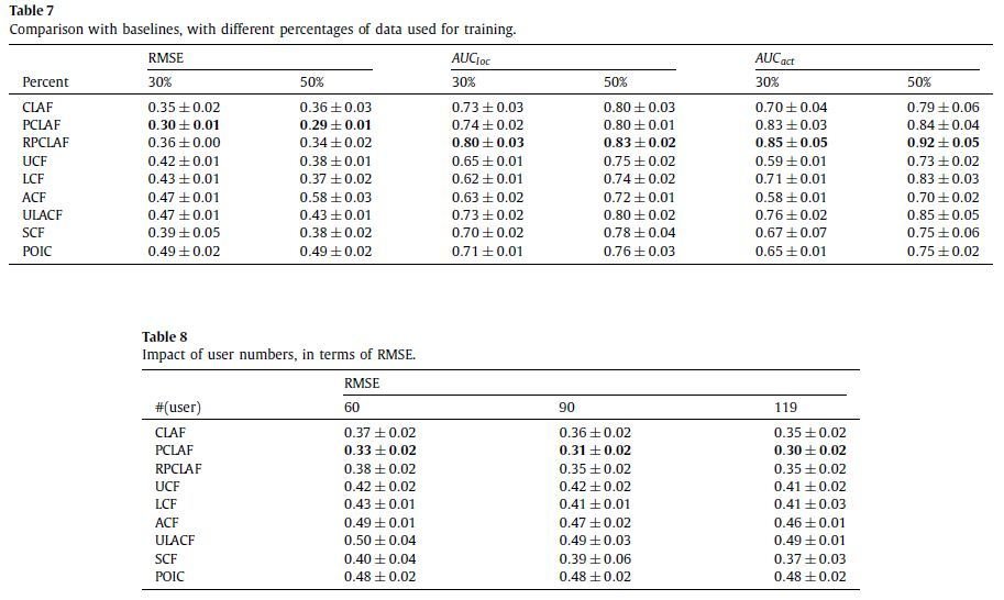
4/ Experiment
- 13,000 GPS trajectories
- 4,000,000 GPS points
- length of around 139,000 kilometers
- 119 users, 68 locations and five activities
- each user has 8.9 comments on average
5/ Conclusion
- if we want to do something, where shall we go?
- if we visit some place, what can we do there?
- performance of CLAF, PCLAF and RPCLAF
By Anhhuy Vis