The History of Information Graphics
Lesson 8
- thematic cartography
Categories
What?
How?
Topic
Method
-
geology
-
ethnicity
-
religion
-
transport
-
weather
-
elections
-
diseases
-
dot
-
line
-
choropleth
-
diagram
-
"heat"
-
distortion
-
gridding/hexbinning
-
arc
-
3D column
-
spike
weather
Edmond Halley - An Historical Account of the Trade Winds, and Monsoons, Observable in the Seas between and near the Tropicks, with an Attempt to Assign the Phisical Cause of the Said Wind, 1686

Edmond Halley - An Historical Account of the Trade Winds, and Monsoons, Observable in the Seas between and near the Tropicks, with an Attempt to Assign the Phisical Cause of the Said Wind, 1686

Alexander von Humboldt - Isothermes according to latitude and longitude lines, 1817

WC Woodbridge - Isothermal map based on Humboldt's observations, 1823
Francis Galton - First modern weather maps, Meteographics, 1863
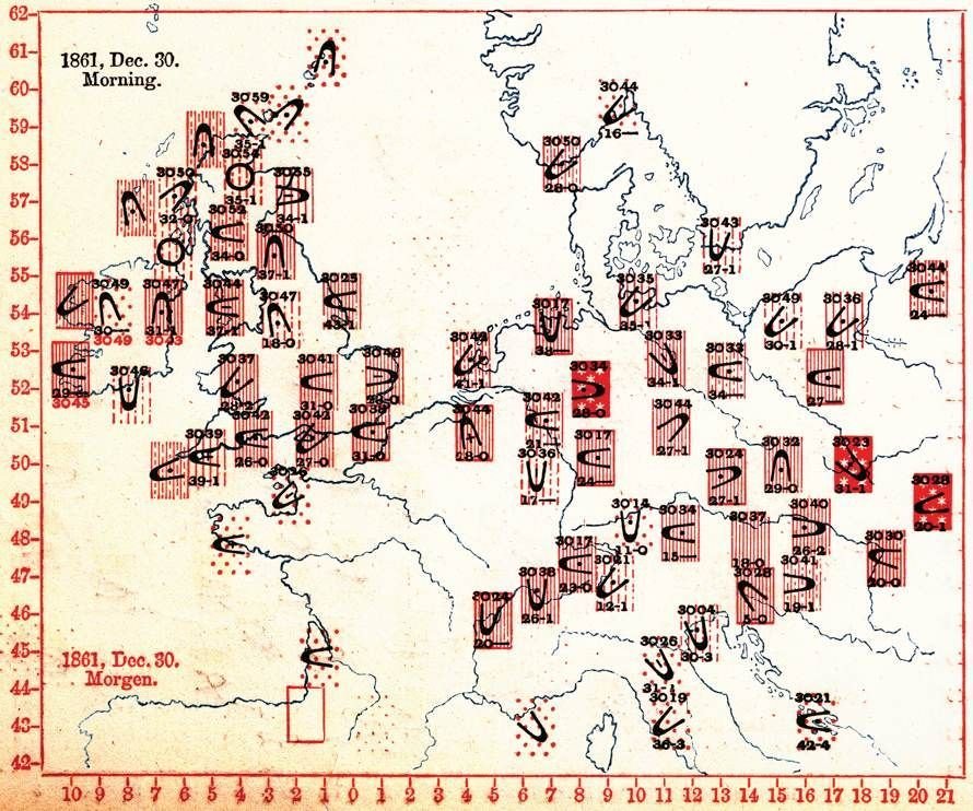
Francis Galton - First modern weather maps, Meteographics, 1863

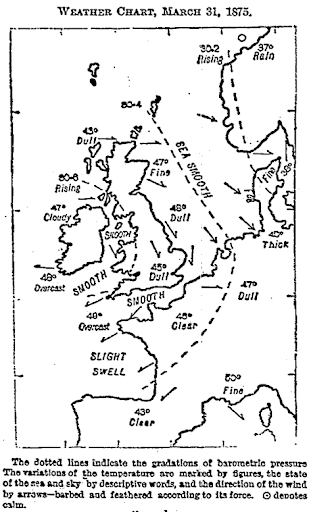
Francis Galton - The first published weather map in newspaper, The Times, 1875
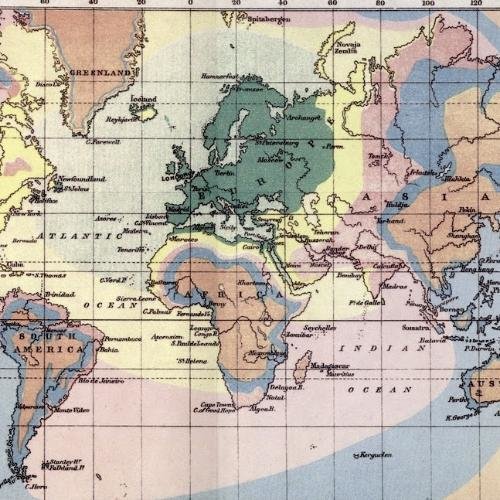
Francis Galton - Isochrone map, 1881

http://hint.fm/wind/
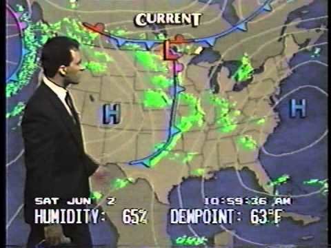
Weather Channel 1990
Tim Meko - Washington Post, 2019


Geology
Johann Friedrich Wilhelm von Charpentier - First geological map, 1778

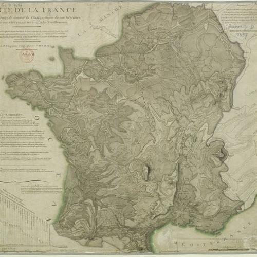
Marcellin du Carla-Boniface - Isoline topographic map
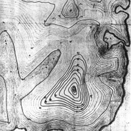
Jean-Louis Dupain-Triel, 1798
William Smith, 1815

People
Charles Dupin, choropleth map, 1826

André Michel Guerry - Comparative choropleth maps, 1829

Frére de Montizon - Point Density Map, 1830

Frére de Montizon, 1834

James Cowles Prichard and Alexander Keith Johnston - Ethnic Map, 1843

Leon Montigny
Election Map of Paris, 1870

Charles Booth - Poverty Map of London, 1889

Florence Kelley (1859–1932)
Chicago Wage Map
1895

Pál Balogh, Kocsárd Proff - Ethnic Map of Hungary, 1902

Pál Balogh, M. Kocsárd - Ethnic Map of Hungary, 1902

Racial Dot Map http://racialdotmap.demographics.coopercenter.org/

Economy and transportation
Wilhelm Crome - Economy of Europe, 1782

Franz Raffelsperger - Postal Network of the Habsburg Empire, 1826

Henry Drury Harness (1804–1883)
Transport flow map inbound Dublin, 1837

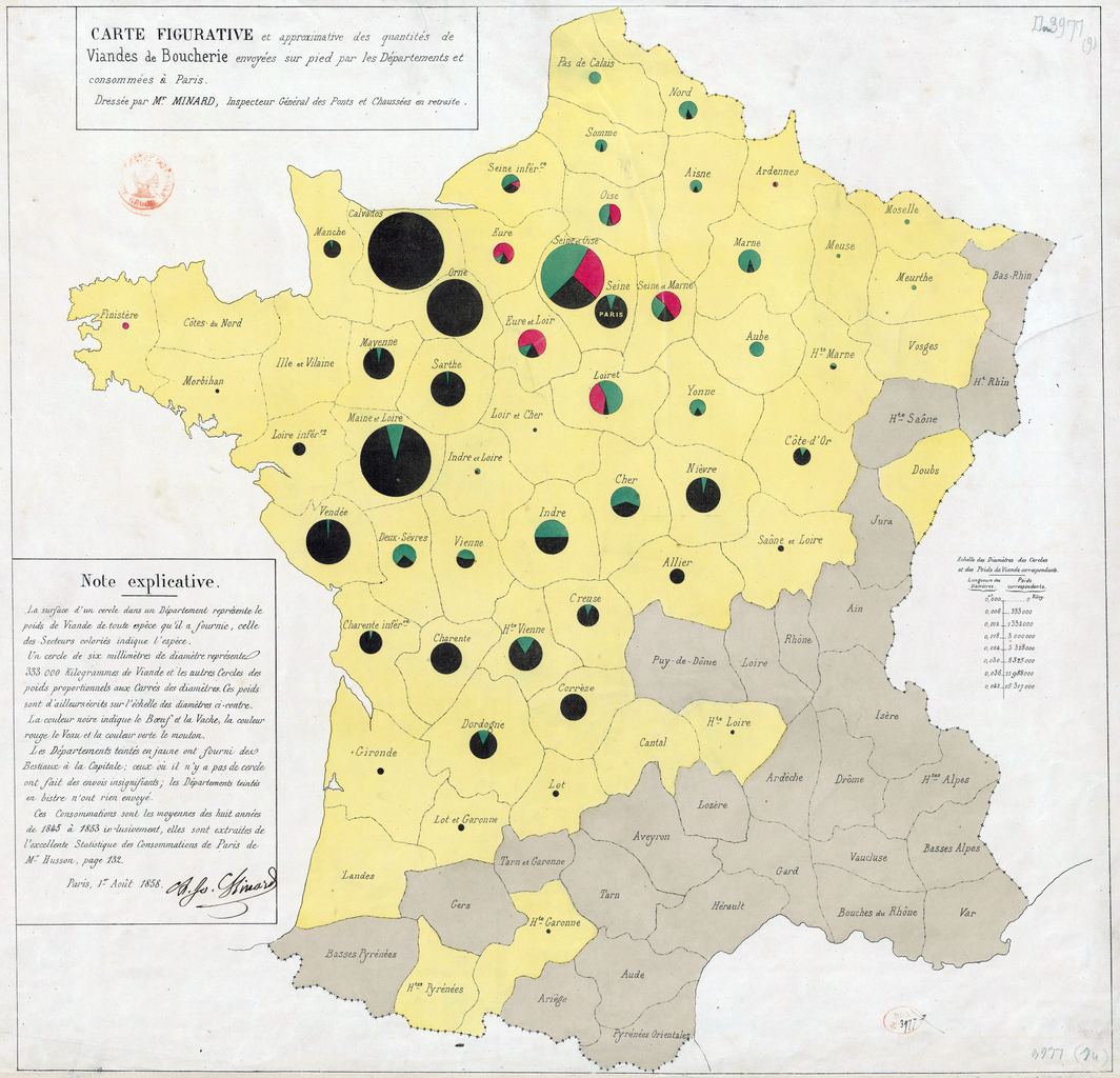
Charles-Joseph Minard, diagram map, 1858
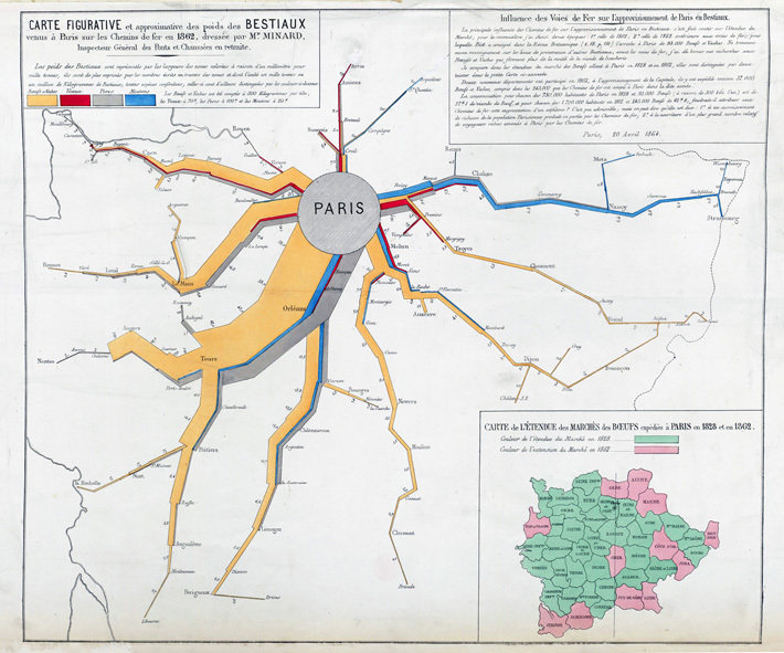
Charles-Joseph Minard, flowmap, 1862
Charles-Joseph Minard, flowmap, 1869
Figurative Map of the successive losses in men of the French Army during the campaign in Russia 1812–1813

Martin and Chevalier - Isochrone map, 1882

Emile Cheysson et. al - Anamorfic Map, 1889

Copy of History of Information Graphics 8 - thematic cartography
By Attila Bátorfy


