PHC6194 SPATIAL EPIDEMIOLOGY

Course Overview
Hui Hu Ph.D.
Department of Epidemiology
College of Public Health and Health Professions & College of Medicine
January 9, 2019
Syllabus
Introduction to Spatial Epidemiology
Virtual machine setup
R crash course
CARTO account
Syllabus
Key Points on Syllabus
- Instructor Information and Office Hours
- Course Content
- Attendance
- Homework
- Course Project
- Proposal
- Final report
Instructor Information and Office Hours
Tell us
- your name
- what program you are in
- any experience working on spatial data
- what skills you want to learn from this course
Course Content
- Course Overview
- VM setup, R crash course - Spatial Data Engineering
- Basic SQL
- PostGIS
- Geocoding
- Spatial data linkage - Spatial Data Visualization
- QGIS
- R and Carto - Spatial Data Analysis
- Disease mapping: smoothing and interpolation
- Disease clustering: densities and spatial autocorrelation
- Ecological analysis: mixed-effects models
- Geographically weighted regression
- Bayesian models: JAGS and R-INLA
Optional Textbook
Lawson AB, Banerjee S, Haining RP, Ugarte MD, editors. Handbook of spatial epidemiology. CRC Press; 2016 Apr 6.

Attendance
- Attendance is mandatory
- UF policy for excused absences applies (must notify instructor in writing before class when possible)
- Each unexcused absence results in a 1.5% deduction from the final grade
- >3 unexcused absences results in failure
Homework
- 6 homework assignments
- 10% each
- the highest 5 grades will count towards the final grade
- Often simple exercises
- Requirements:
- turn in assignment no later than 11:59 pm on the day it is due
- late assignment will NOT be accepted
- no handwritten assignment
- DO NOT copy others' work
Course Project
- Requirements:
- must include spatial data engineering, analysis, and visualization
-
You can work individually or work as a team
If choose to work as a team:
- each team can have up to 2 members
- clearly delineate roles and responsibilities of each team member -
Project Due:
- January 30, 2019: form a project team
- March 20, 2019: midterm presentation and project proposal
- Apr 17, 2019: final presentation
- Apr 24, 2019: final project report
Midterm
- Project proposal:
- Abstract: up to 1 page
- Project description: up to 5 pages
~ Specific Aims/Objectives
~ Background and Significance
~ Approach/Research Design
~ Timeline
- Citations: no page limit, use the Vancouver style
- Single column, single spacing; Arial or Times New Roman font; font size no smaller than 11 point; tables and figure labels can be in 10 points; minimum 0.5 inch margins
- Proposal presentations:
- up to 15 slides
- up to 15 minutes presentation with 5 minutes Q&A
- send the slides to instructor at least 3 days in advance
Final
- Final Report: up to ten pages (including references)
- Abstract: no more than 250 words summarizing the project
- Introduction: a short background and objective(s) of the study
- Methods: design, setting, dataset, approaches, and main outcome measurements
- Results: key findings and visualizations
- Discussion: key conclusions with direct reference to the implications of the methods and/or results
- References: please follow the Vancouver style
- Final presentations:
- up to 15 slides
- up to 15 minutes presentation with 5 minutes Q&A
- send the slides to instructor at least 3 days in advance
Grading
- Attendance: 5%
- Homework: 50%
- Midterm (project proposal and presentation): 15%
- Final (project report and presentation): 30%

Introduction to Spatial Epidemiology
What is Epidemiology
Epidemiology is the study of the distribution and determinants of health-related states or events in specified populations, time, and place, and the application of this study to the control of health problems
Last JM, Abramson JH, Freidman GD, editors. A dictionary of epidemiology. New York: Oxford university press; 2001.
Why Place Matters?
P = G + E
Phenotype
Genome
Environment
T2DM, Cancer, LBW, PTD
Polymorphisms
Infectious agents
Nutrients
Pollutants
Drugs


Individual's Health
Behavior and Intrinsic Biological Factors
The Total Environment
Natural
Built


Social


Ultraviolet radiation:
- May cause skin cancer and melanoma
- Recent studies also showed associations between UVR and increased mortality due to CVD, cancer, and respiratory diseases
Radon gas:
- Natural radioactive decay of uranium
- May cause lung cancer
Air pollution:
- Clean Air Act (1970, 1990)
- Outdoor air pollution:
6 criteria air pollutants - PM, SO2, CO, NOx, O3, Pb - Indoor air pollution: tobacco smoke, combustion products, radon gas
Climate change:
- Extreme temperature and precipitation
- Associated with increased mortality and morbidity
Food access, Walkability, and Greenness
- Associated with physical activity, obesity, and cardiometabolic outcomes
Lead:
- No safe level of lead exposure has been identified
- Even low levels of lead can cause neuropsychiatric function and potentially lead to behavior problems
Education, Poverty, and Safety
- Important health determinants
What is Spatial Epidemiology
- The description of spatial patterns of disease incidence and mortality -- English 1992
- Concerns the analysis of the spatial/geographical distribution of the incidence of disease -- Lawson 2013
- Encompasses research that incorporates the spatial perspective into the design and analysis of the distribution, determinants, and outcomes of all aspects of health and well-being across the continuum from prevention to treatment -- Kirby et al. 2017
Spatial Epidemiology vs. Health/Medical Geography
- Not synonymous
- Spatial Epidemiology refers to inquiries that use epidemiological study designs that involve spatial data or spatially derived information about study subjects, health facilities, or sources of exposure, with primary focus on populations
- Health/medical geography encompasses research applying geographic analytical methods to health, disease, or health care issues, with primary focus on spatial patterns and context
History of Spatial Epidemiology
- Hippocrates (460 BC – 377 BC), father of medicine and ancient Greek physician, understood the the effect of location on one’s health:
- people living high elevation or in drier, less humid area were less likely to have a disease than those living at low elevation near waterway
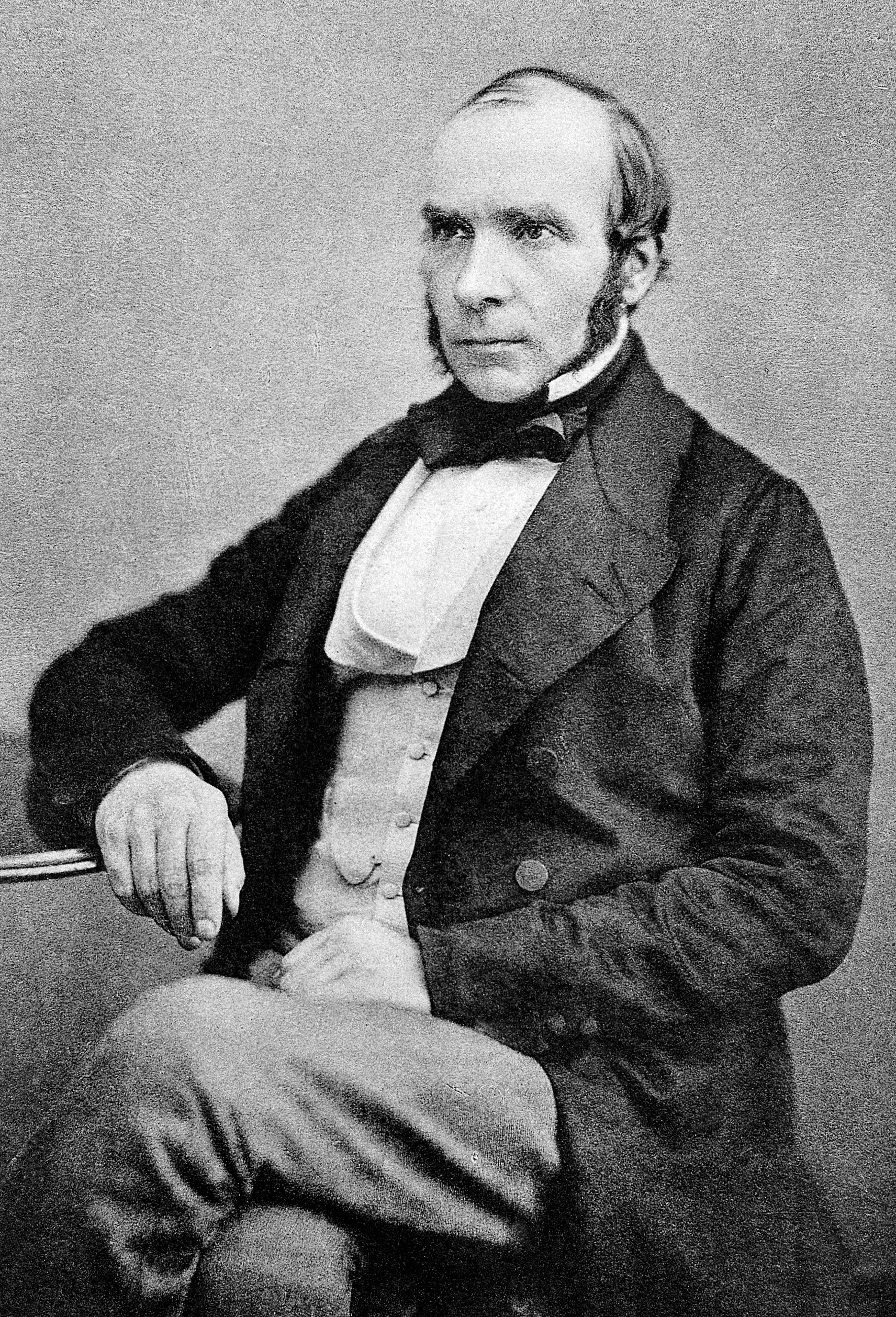
- John Snow (1813 – 1858), father of modern epidemiology, conducted an outbreak investigation in London, which is regarded as the beginning of Epidemiology as well as spatial epidemiology.


Original map by John Snow showing the clusters of cholera cases in the London epidemic of 1854
Concepts of Place and Neighborhood
- Some examples:
- women living in rural areas may have to travel longer distances to reach mammography facilities, potentially leading to a decrease of breast cancer screening or a delay in their diagnosis
- children living in a pedestrian friendly environment where parks and playground are readily accessible are more likely to engage in physical activity, reducing the odds of obesity
- Documenting the role of the geographic environment where individuals live and interact will improve the understanding of health outcomes, and have deep policy implications for local interventions and resource allocation
Definition of Neighborhood
Lovasi GS, Grady S, Rundle A. Steps forward: review and recommendations for research on walkability, physical activity and cardiovascular health. Public health reviews. 2011 Dec 7;33(2):484.
- Many ways to define a neighborhood
- The neighborhood definition chosen for use in a research project is usually the result of a compromise between data availability, the conceptual relevance for the outcome being studied and confidentiality concerns
Role of GIS in Spatial Epidemiology
- Geographic information systems (GIS):
- computer-based systems for the integration and analysis of geographic data
- GIS has been used in many epidemiological applications:

- disease mapping
- rate smoothing
- cluster or hot spot analysis
- spatial modeling


Role of GIS in Spatial Epidemiology (cont'd)
- To create spatially explicit variables
- availability and accessibility (food access)
- built environment measures (land use)
- environmental exposures (air pollution)
- demographic indicators (poverty)
- To measure and describe the extent of spaital relationships
- calculate distance between two points
- quantify spatial dependencies in analytic models
- identify locally varying predictors

Source: https://thebluereview.org/food-access-and-food-deserts-in-ada-county-idaho/
Methodologies in Spatial Epidemiology
- Geocoding and uncertainty
- Distance estimation
- Residential mobility
- Data linkages
- Disease mapping
- Spatial and spatio-temporal clustering
- Small area estimation
- Spatial regression models
Virtual Machine Setup
R Crash Course
What is R?
- An object-oriented programming language focused on manipulating and analyzing data
- everything in R is an object: e.g. datasets, functions, models, etc.
- An open-source language
- anyone can contribute to the R project, and develop and distribute code to run in R
- One of the most popular languages used by statisticians and data sicentists
CARTO Account
CARTO for students accounts
PHC6194-Spring2019-Lecture1
By Hui Hu
PHC6194-Spring2019-Lecture1
Slides for Lecture 1, Spring 2019, PHC6194 Spatial Epidemiology


