
UW Workshop
ArcGIS API for Python
November 6, 2018
Our contact info
Python:
David Martinez, dmartinez@esri.com
JavaScript:
Andy Gup, agup@esri.com
Python
Why Python?
- Popularity
- Productivity
- Interoperability
- Solves the “two-language” problem
- Scientific Python ecosystem
- Community


What is the ArcGIS API for Python


ArcGIS
Intro to the ArcGIS API for Python
- Guide
- API Reference
- Many Samples
Quick Overview of the ArcGIS API for Python
-
A Pythonic GIS API
- Corresponds to best practices
- Uses standard Python constructs
- Data structures with clean, readable idioms
- Easy for a Python programmer to use ArcGIS
- Easy for an ArcGIS user to script and automate their GIS

ArcGIS API for Python and ArcPy
-
ArcGIS API for Python
- Script against a portal
- ArcGIS Online or ArcGIS Enterprise
- Python 3.x
- Analysis, Portal Admin, Content Creation, Big Data Analysis
-
ArcPy
-
ArcGIS Desktop
- ArcMap - Python 2.x
- ArcGIS Pro - 3.x
-
ArcGIS Desktop
- Mostly Geoprocessing
- Some map automation
ArcGIS + Jupyter =


Four Different Personas
-
Analysts and Data Scientists
-
Power Users/Developers
-
Content Publishers
-
Org Adminstrators
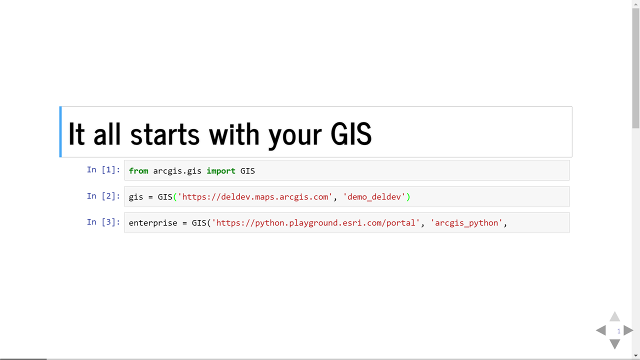
Introducing the GIS Module
Your gateway to scripting a Web GIS
Install the ArcGIS API for Python
You can install the Python API with or without ArcGIS Pro
If you have Pro on your machine, Conda and Jupyter Notebook is already install for you
Install using ArcGIS Pro
Python Package Manager
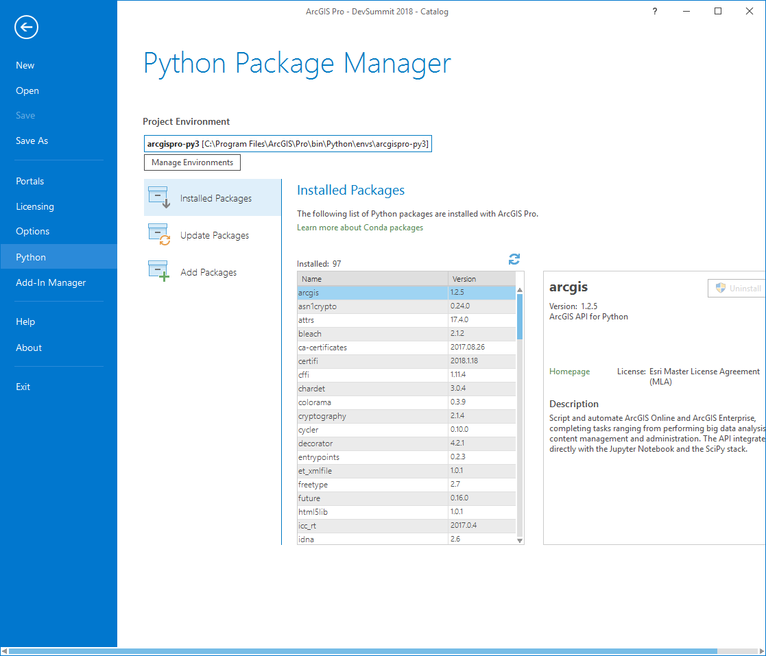
How do I get the API
- By using Conda
- What is Conda?
If you don't have ArcGIS Pro
- You will need to install Anaconda (We Need to install)
- https://www.anaconda.com/download/
Install ArcGIS Package
- Type the following into the Anaconda command prompt
- conda install -c esri arcgis
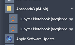
Start Jupyter Notebook
- There will be an icon under the Anaconda3 (64bit) apps in Windows
Resources
- Download these files and extract
- Copy to the local C:\ drive on the root
- Folder Structure:
- Data - contains sample CSV files and images used in exercises 4, 6, and 7.
- Shapefiles - contains shapefiles used for exercise 3.
- Exercises - contains all the exercises for this workshop
Demo

Exercise 1
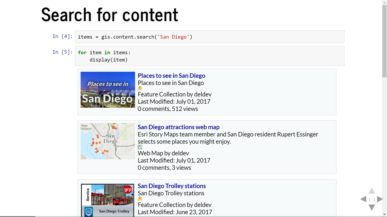
Ex1_hellomap
-
Create a notebook for this exercise

Exercise 2
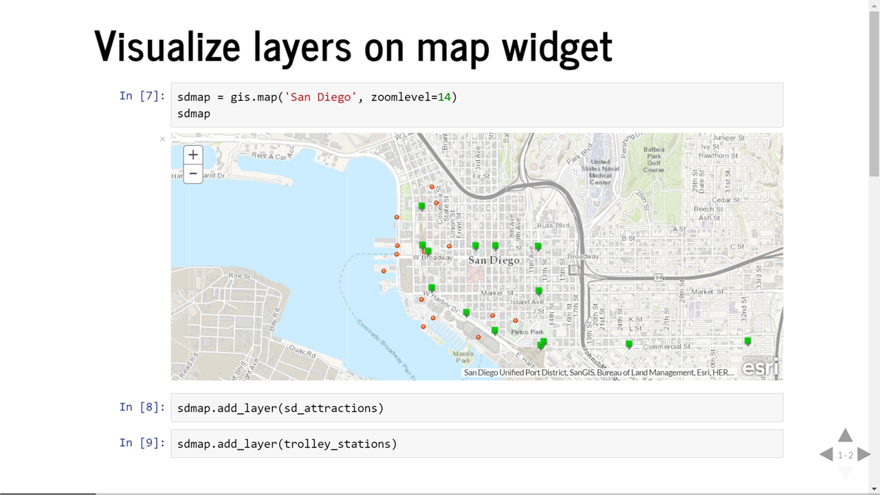
Ex2_mapwidget
-
Create a notebook for this exercise
- Publishers can create feature, tiled map, vector tile and scene services.
publish(publish_parameters=None, address_fields=None, output_type=None, overwrite=False,
file_type=None, build_initial_cache=False)
Exercise 3
Ex3_publish_all_shp
- Create a new notebook for this exercise. After you complete this exercise log into ArcGIS and go into my content to view your items published
Exercise 4
Ex4_publishingFeatureLayerFromCSV
- Create a new notebook for this exercise. After you complete this exercise log into ArcGIS and go into my content to view your items published
Exercise 5
Ex5_accessing_and_visualizing_feature_data
-
Create a notebook for this exercise
Exercise 6
Ex6_overwrite-featurelayers
-
Create a notebook for this exercise
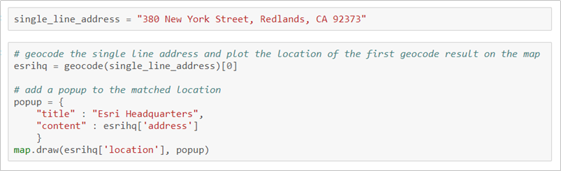
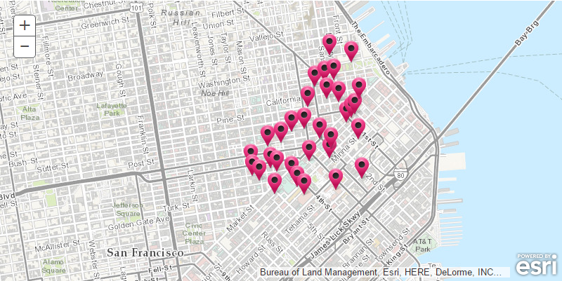
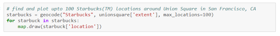
arcgis.geocoding module

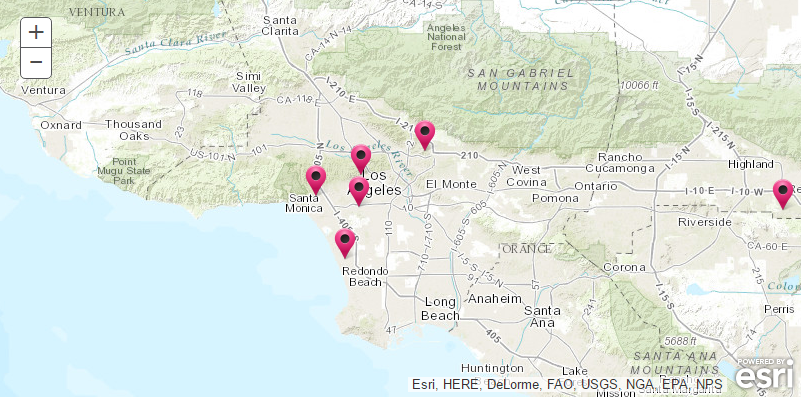
Points of Interest
- Cultural or geographic landmarks
- Businesses by name or category
- Administrative divisions
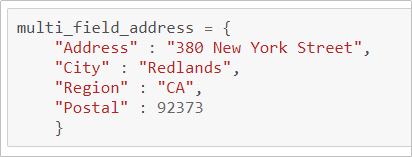
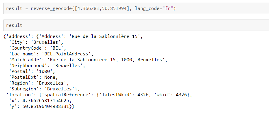
Determines address at a particular x/y location

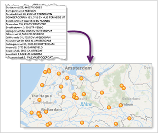
Geocode an entire list
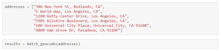

Exercise 7
Ex7_batchgeocode
-
Create a notebook for this exercise
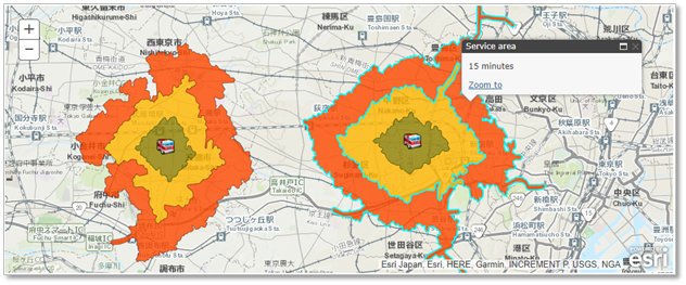
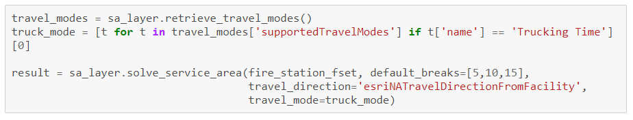
arcgis.network.analysis module
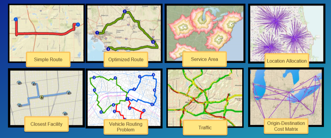
Commercial grade, traffic aware routing and directions for multiple travel modes
Exercise 8
Ex8_spatial_analysis
-
Create a notebook for this exercise
Exercise 9
Ex9_finding_hospitals_closest_to_an_incident
-
Create a notebook for this exercise

UW Workshop
By dmart
UW Workshop
A workshop for university of Wisconsin focusing on ArcGIS API for Python


