Felix Kunde
slides.com/fxku/postgis-v3
3
About Me
Database Engineer @ Zalando
Geoinformatics background
Guest lecturer on spatial databases
Postgres Operator, 3DCityDB and pgMemento
@FlxKu

What is PostGIS?
- Extension to PostgreSQL database
- Comes with it's own datatypes for geodata
- Supports coordinate reference systems
- Spatial indexing for fast geo queries
- Open Source under GPLv2
- More infos under http://postgis.net/

+
Why is it great?
- Faster and more robust than your GIS
- So much geo power with just some SQL
- Great acceptance in the spatial industry
- Follows international OGC/ISO standards
- Build on top of one of the best databases
PostgreSQL
Forks & Extensions

Sharding
GPU
Time Series
Cloud
DW / MPP / Hadoop



Streaming SQL

NoSQL





PG-Storm


@delawen on PostGIS day

The
hidden
Things
NeW On-Disc format
- More optional bytes for new things
- Probably: Efficient point type
- Probably: Faster joins
- Maybe: Precision model
- Upgrade support (no dump and restore)
Minimal Toast Decompression
- Big geoms are sliced and compressed
- When read, decompression takes time
- Postgres 12 can "sneak" into first slice
- E.g. read BBox to decide to skip geom
Optimizer
Support Functions
-
Problem <v3: Function inlining to trigger index
- Hard for planner to consider parellel query
-
Solution: Give optimizer insights about functions ...
- ... and see more parallel spatial queries
ST_Intersects(geom1, geoms2)
SELECT geom1 && geom2 AND _ST_Intersects(geom1, geoms2)
SQL function
triggers index
C function
ST_Intersects(geom1, geoms2)
SUPPORT postgis_index_supportfn
C function triggers index
O
L
D
N
E
W
Breaking Things
Postgis_raster
my_postgis_db=# ALTER EXTENSION postgis UPDATE TO '3.0.0';
WARNUNG:  unpackaging raster
WARNUNG:  PostGIS Raster functionality has been unpackaged
TIP:  type `SELECT postgis_extensions_upgrade();` to finish
      the upgrade. After upgrading, if you want to drop raster,
      run: DROP EXTENSION postgis_raster;
ALTER EXTENSION

my_postgis_db=# SELECT postgis_extensions_upgrade();
HINWEIS:  Packaging extension postgis_raster
Strip Minor from lib
-
Before: ALTER EXTENSION postgis UPDATE first to fix it
-
Now: Lib is called postgis-3.so for all minor releases
-
Upgrade your Postgres with pg_upgrade and get the new PostGIS functions when running ALTER EXTENSION etc.
$> pg_upgrade
ERROR: could not access file "$libdir/postgis-2.5": No such file or directory
Broken indexes
- REINDEX your HASH indexes
- REINDEX your BTREE indexes
- REINDEX your nD spatial indexes
- But hey, SP-GiST and GiST now support nD box operators for overlaps, contains, within, equals
Bye Bye
- ST_Accum(), use array_agg
- ST_AsGeoJSON(version, geometry)
- ST_AsKML(version, geometry)
- Remove SFCGAL support for functions which are already covered by GEOS
- postgissvnversion() > postgislibrevision()
- liblwgeom headers, librttopo if you need
- PostgreSQL 9.5 support (3.1+)
The
Shiny
Things
Demo Time
SELECT ST_GeneratePoints(poly, 3)
FROM geom, generate_series(1,5);
same result
O
L
D
N
E
W
SELECT ST_GeneratePoints(poly, 3)
FROM geom, generate_series(1,5);
SELECT ST_GeneratePoints(poly, 3, seed := 1)
FROM geom, generate_series(1,5);
random result
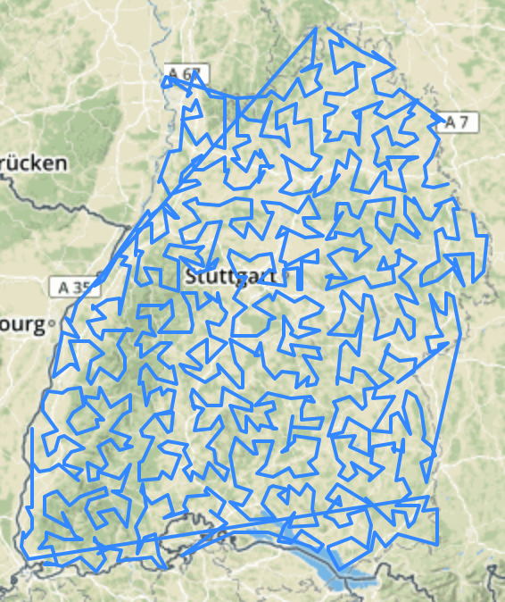
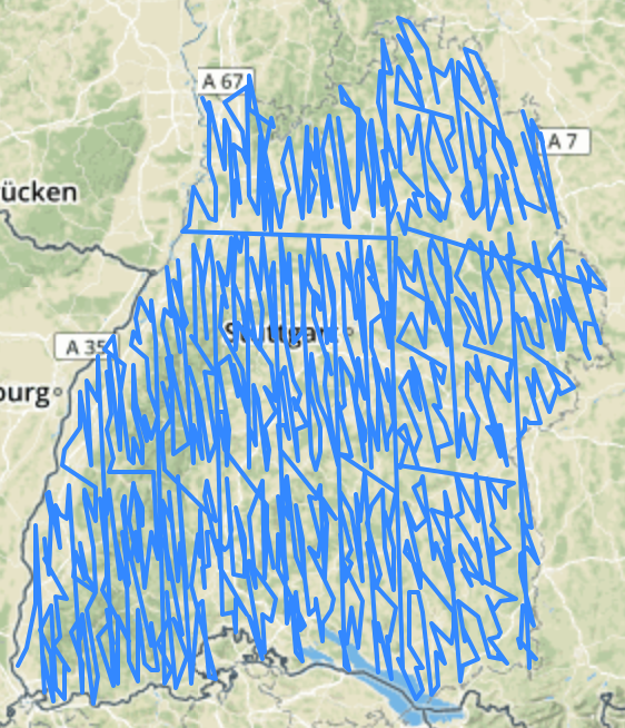
Really Random Points
Hilbert Curve order
- Switch from Z-Curve in 2.x to Hilbert Curve
- More compact spatial alignment
- 30% faster algorithm also boosts GiST creation
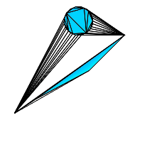
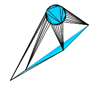
Playing with TINS
- ST_ConstrainedDelaunayTriangles in SFCGAL
- TINs can be passed to GEOS functions
- Now supported by all output functions
- ST_3DIntersects (2D, Solid), ST_3DDistance (Solid)
PostGIS
PostGIS SFCGAL
More LRS for polygons
- ST_LocateBetween/Elevations now support:
- GeometryCollection, Polygon, TIN, Triangle
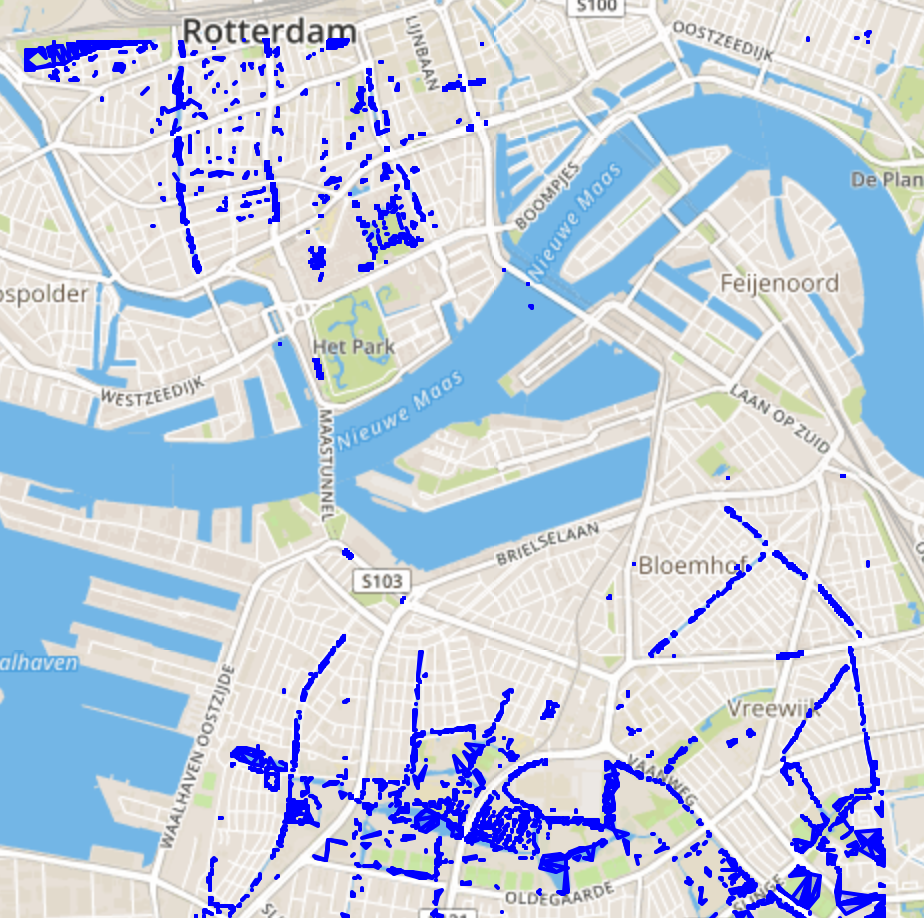
triangles < -2m

Topology tests for Geometrycollection
- ST_Overlaps, ST_Contains, ST_ContainsProperly, ST_Covers, ST_CoveredBy, ST_Crosses, ST_Touches, ST_Disjoint, ST_Relate, ST_Equals now work with GeometryCollection
- Think about all the queries where you needed to ST_Dump before (like after ST_LocateBetween ;)
geom::json
- Geometry can be casted with ::json / ::jsonb
- ST_AsGeoJSON( record ) > GeoJSON Feature
- Geography columns supported when in row
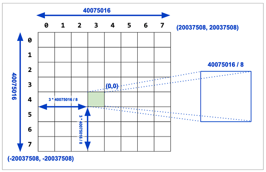
faster vector Tiles
- BBox of Tile per zoom level
- WebMercator (EPSG 3857) bounds by default
- Custom bounds possible
- Margin in PostGIS 3.1
Grids (3.1)
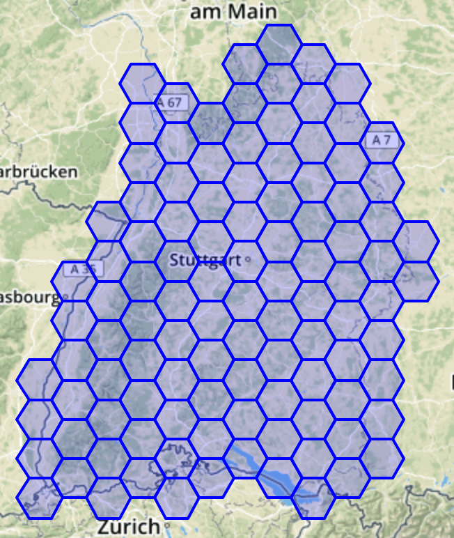
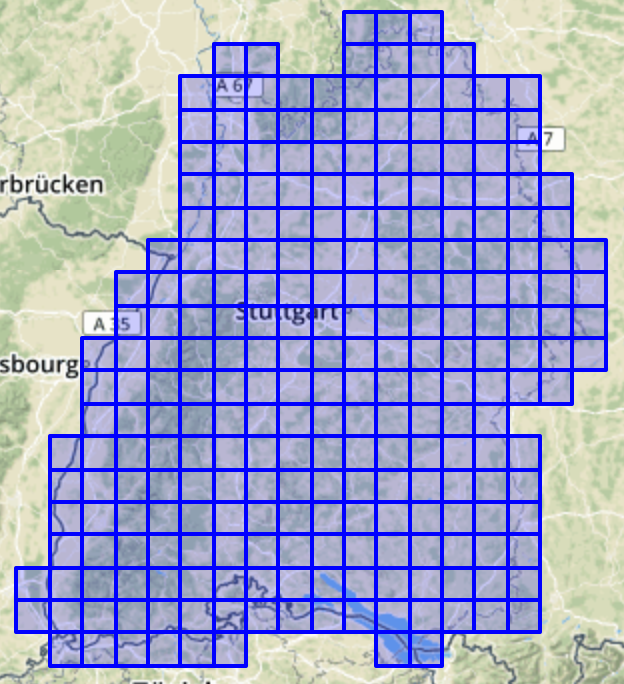
ST_SquareGrid
ST_HexagonGrid
Default 3D/4D (3.1)
- Additional argument for ST_ForceXXX functions
- Define default Z/M, still 0 when left out
- [open] Have ST_SetZ, ST_SetM function
Hidden HeroEs


- Many performance improvements
- postgis_geos_noop (SQL <-> GEOS)
- More precise datum transformation
- WKT projections support
- out-db raster support since 2.4
- check out ogr_fdw extension!
- Make it totally independent
- New: ST_ConstrainedDelaunayTriangles
PostGIS Future
2020/21
- New efficient geom types? External storage type?
- Point density surfaces (weighted, kriging)
- Tolerance & Precision (#1629)?
- Much work in GEOS 3.9
- 3D-aware geography?
- Index-only scans with geometry?
- https://trac.osgeo.org/postgis/wiki/PostGIS3
Thanks
to
Regina, Paul, Sandro, Darafei, Raúl, Bborie,
Alex, Andrea, Andreas, Anne, Arthur, Barbara, Bas, Ben, Bernhard, Bill, Björn, Brian, Bruce, Bruno, Bryce, Carl, Charlie, Chris, Christian, Dan, Dane, David, Eduin, Even, Esteban, Frank, George, Gerald, Gino, Guillaume, Iida, Ingvild, Jason, Jeff, Joe, Jorge, Jose Carlos, Julien, Hugh, Kashif, Kevin, Klaus, Kris, Kristian, Laurenz, Leo, Loic, Luca, Lucas, Maria, Mark, Markus, Mateusz, Matti, Maxime, Michael, Mike, Nathan, Nathaniel, Nicklas, Nikita, Norman, Olivier, Pierre, Rafal, Ralph, Rémi, Richard, Silvio, Steffen, Stephen, Steven, Sunveer, Tom, Vincent, Yuri
Teams behind GEOS/JTS, Proj, GDAL and (SF)CGAL!
The whole PostgreSQL community!
The funding companies, organisations and individuals!
PostGIS 3
By fxku
PostGIS 3
FOSSGIS 2020 Vortrag
- 4,835


