Collect & Manage Geospatial Data Edits with GeoSHAPE
slides.com/geoshape/geoshape-geogig

Who am I?
Syrus Mesdaghi
Co-Founder
syrusm@prominentedge.com
http://prominentedge.com
What will we cover?
- What is GeoSHAPE
- MapLoom
- GeoNode
- GeoServer
- GeoGig
- Installing GeoSHAPE
- Demo
- Roadmap
- Q&A
Developed Under ROGUE-JCTD Project
- geoshape.org
- github.com/rogue-jctd

- Goal: streamline collaboration on geospatial data between distributed partners
- Since 'partners' can include different government agencies, organizations, volunteer groups
- GeoSHAPE had to be free and open source
- Easy to deploy
- Each partner will have their own instance of GeoSHAPE
- Can edit and synchronize with other instances
- Initial funding of GeoGig
- Fully operational in disconnected mode
- Can edit and synchronize with other instances

GeoSHAPE Components
MapLoom
Web-based Viewer/Editor With GeoGIG integration
github.com/rogue-jctd/maploom

MapLoom
- Developed to address our challenges with GeoExplorer
- OpenLayers 3 + Angular + Bootstrap
- We embed it in GeoNode, but can be stand alone
- Bring in layers from local and remote servers
- Supports time dimension
- GeoGIG Integration
GeoNode
Manage Layers, Maps, Users & Groups
github.com/GeoNode/geonode/

GeoNode
- Hides GeoServer's complexity when dealing with layers and users
- Allows you to customize your web application
- Upload / Download Layers
- Save / Load Maps
- Manage Users and profiles
- Manage Groups
- Manage Permissions
- Edit Styles

GeoServer
Serves GIS Vector & Raster data through OGC Standards
github.com/geoserver/geoserver

GeoServer
- Does a lot of the heavy lifting behind the scenes
- Manages data sources
- Supports numerous spatial formats
- Exposes OGC standards for accessing layers

GeoGig
- A data source that focuses on versioning vector data
- De-centralized Version Control System
- Heavily inspired by Git, but it is not Git
- Instead of versioning text files, it versions layers / features
- You can commit, pull, push, branch, merge, revert, clone, shallow clone, sparse clone, and many operation which exist in git
- Should be used instead of PostGIS only when history matters
- GeoGig optimized for history
- PostGIS optimized for performance
- github.com/locationtech/geogig

Arbiter
Mobile application for viewing / collecting data
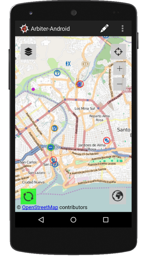
Arbiter
- Mobile application for viewing / collecting data
- Allows you to easily attach photos to features
- Designed to works in disconnected mode
- It downloads the vector data based on your area of interest
- Uses mbtiles for the basemap
- Native Android UI + Open Layers
Installing GeoSHAPE
- See doc on geoshape.org
- Install git, virtual box, and vagrant
- run vagrant up
Software Components (RPMs)


:8000
:80/443
:8009
:9200
:5672
:5432

GeoGig


GeoServer
GeoSHAPE
Demo!
Roadmap
- Geogig 1.0 is at RC-3
- postgres backend
- geopackage import/export (with auditing)
- Powerful discovery of layers in maploom
- Ability to bring in data from more remote sources
- Security Updates
Final Thoughts
- We contribute all changes back to each project
- Use can use GeoSHAPE in whole or individual components
- Several companies/organizations have been contributing back
- Currently accepting pull requests ;)
Q&A
Collect & Manage Geospatial Data Edits with GeoSHAPE
By Geo Shape
Collect & Manage Geospatial Data Edits with GeoSHAPE
This talk demonstrates creating and editing vector data backed by a distributed version control system through both web and mobile clients. The web and mobile clients will be used to collect geospatial data which are coupled with the authors information. By harnessing the power of GeoGig, the powerful open-source geospatial versioning technology, we will demonstrate how easy it is to quickly add, delete, and edit features, as well as rollback edits or commits through an intuitive web editing interface. We’ll demonstrate viewing the history of changes to particular features as well as the history of changes to a layer. The demo will also show how to perform comparisons between different versions to view changes to feature geometry and attributes. We’ll also show the conflict resolution capabilities of GeoSHAPE, a free and open-source geospatial platform.
