
ArcGIS Platform Tech Briefing
TAMUHack

GIS
Geographic Information Systems
Variety of mapping functions integrated into nearly all industries
Geographic Data
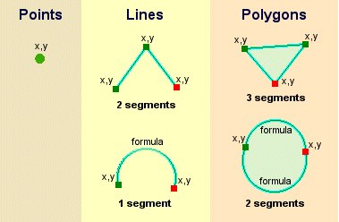
Real-World Features
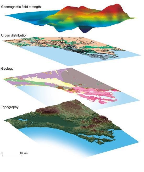
Information Layering
Storage and overlays -
Layering of data and interactions
exposing spatial correlations
Maps and GIS -
reveal relationships between
seemingly unrelated things or events
Services
Accessed through REST endpoints so can be consumed by any language issuing requests
- Routing
- Spatial Analysis
- Elevation
- Directions
- Geocoding
Links
ArcGIS Online
https://arcgis.com
ArcGIS for Developers website
https://developers.arcgis.com
ArcGIS for Developers
https://developers.arcgis.com
1. SIGN UP
2. REDEEM VOUCHER
3. DEVELOP
VOUCHER CODE
TAMUHACK
ArcGIS DevLabs
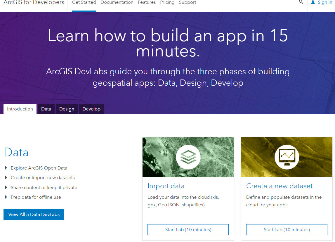
https://developers.arcgis.com/labs/
$1000.00
TechTalk:
Sat. 1-27-18
2:00 - 3:00 PM
developers.arcgis.com/
TAMUHack Intro: The ArcGIS Development Platform
By John Yaist


