383
2,000,000
(2 Million)
15,000
178,000,000
(178 Million)
Guess??
383 Miles
of Pipe
2,000,000 (2 Million) People
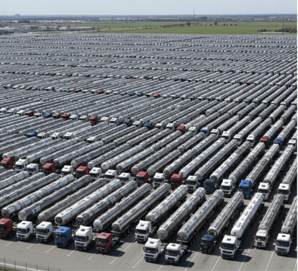
15,000 Trucks
178,000,000 (178 Million) MGD (Million Gallons/Day)

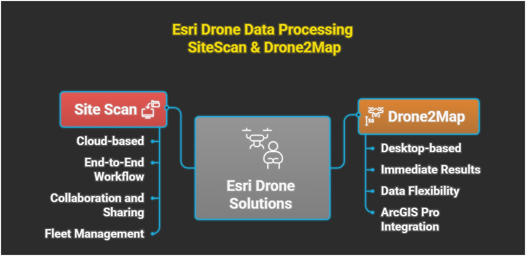
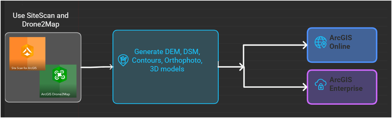
Drone to map, Now What?
KC Wastewater Drone Program to support sustainable infrastructure with GIS
WAGISA, Bellevue
May 20, 2026
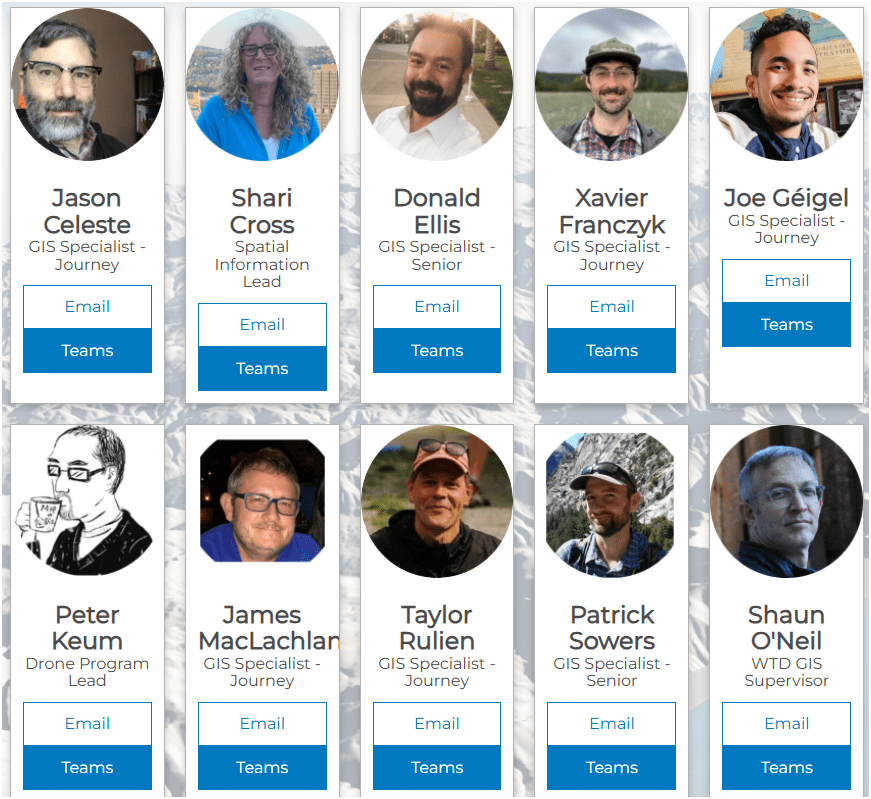
Jason Celeste
Joe Géigel
Peter Keum
WTD Drone Program
We Came, We Flew Up, Up and, We Mapped..

OR

-
WTD Drone Program
-
GIS Data
-
Integration Product

King County Wastewater Treatment by Numbers
-
2 million residents
-
34 Agencies
-
424 square miles
-
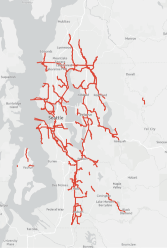
383 miles sewer pipeline (2.5 inch to 14 ft)
-
74 facilities (PS & RS)
-
3 Treatment Plants: 180 MGD ~ Max. 460 MGD

Seattle, WA --> Medford, OR
-
10 GIS Specialists
-
4 FAA Certified Pilots
-
3 Studying to be Certified
-
Two Interns
-
Olivia
-
Max
-
Supervisor

BUT.....There are 17 county agencies support
King County GIS Data Library System
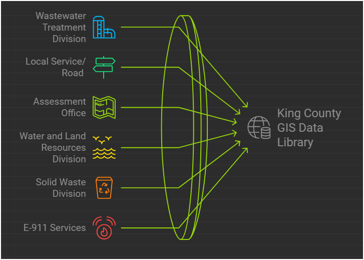
WTD
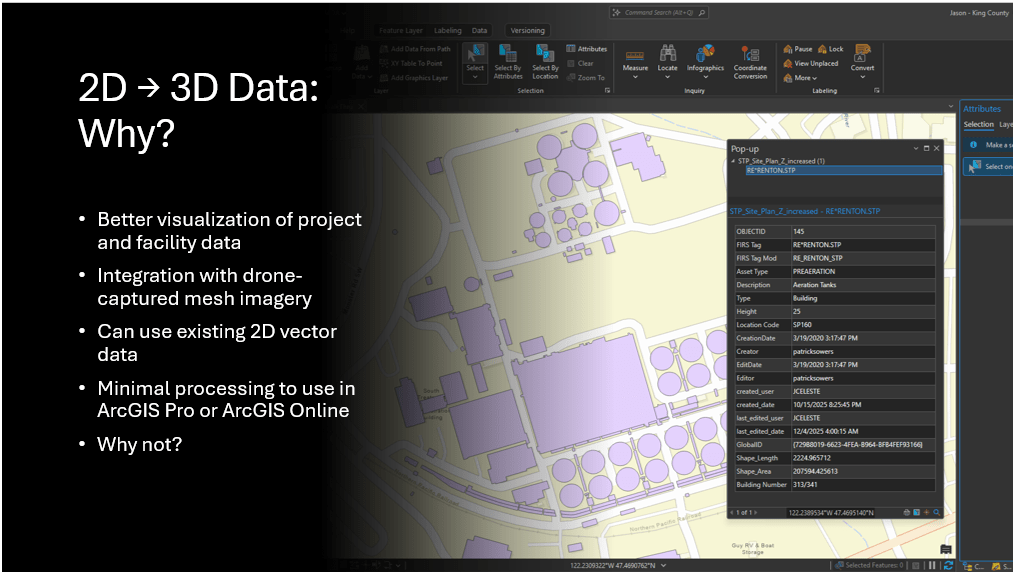
GIS Data:
The core of a GIS is its Database
WTD GIS Drone Program
May 2026
- Four FAA Part 107 Drone Certified Pilots - WTD GIS Specialists - 3 More Training
- Assisting other departments to stand up their own drone programs (WLRD/ SWD/ Local Service/ KCIA/ FMD)


Joe
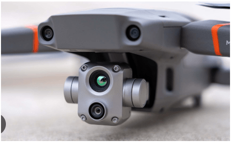
DJI Mavic 2 Pro (1)

Mavic 2 Ent. Adv. (1)

Mavic 3 Ent (2x)

2021
2022
2023
Matrice 4 Ent. (1)
2025
Total: ~ $27,000
Latest Hardware

$11,000
All WEather
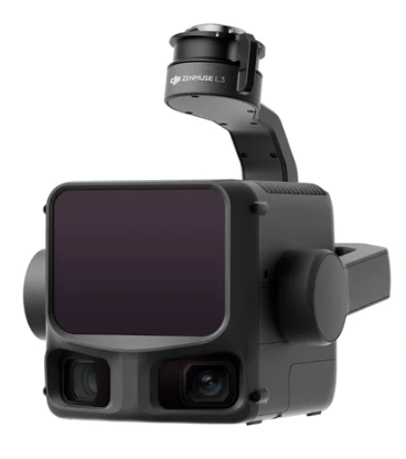
L3 - lidar
~ $ 18,000
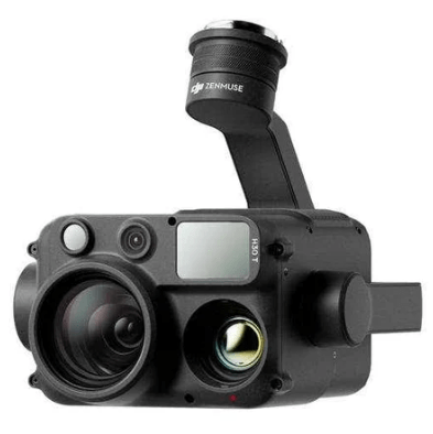
H30T - Thermal
~ $ 12,000
1. Aircraft + Sensor (Data Collection)
2. Data Processing & Analyzing (GIS)
3. Information Products
=
+


1. Platform + Sensor (Data Collection)
2. Data Processing & Analyzing (GIS)
3. Information Products


Standard Drone Workflow


AND

Drone

GIS
Great Combo?
&
Great combo !
GIS & DRONE


Great combo !
GIS & DRONE


Why Use Drones?
1. Easy - Simple with little effort

Automatic
Repeatable
Why Use Drones?
2. Efficient - Results without waste
Safety of staffs & Save Time & $$

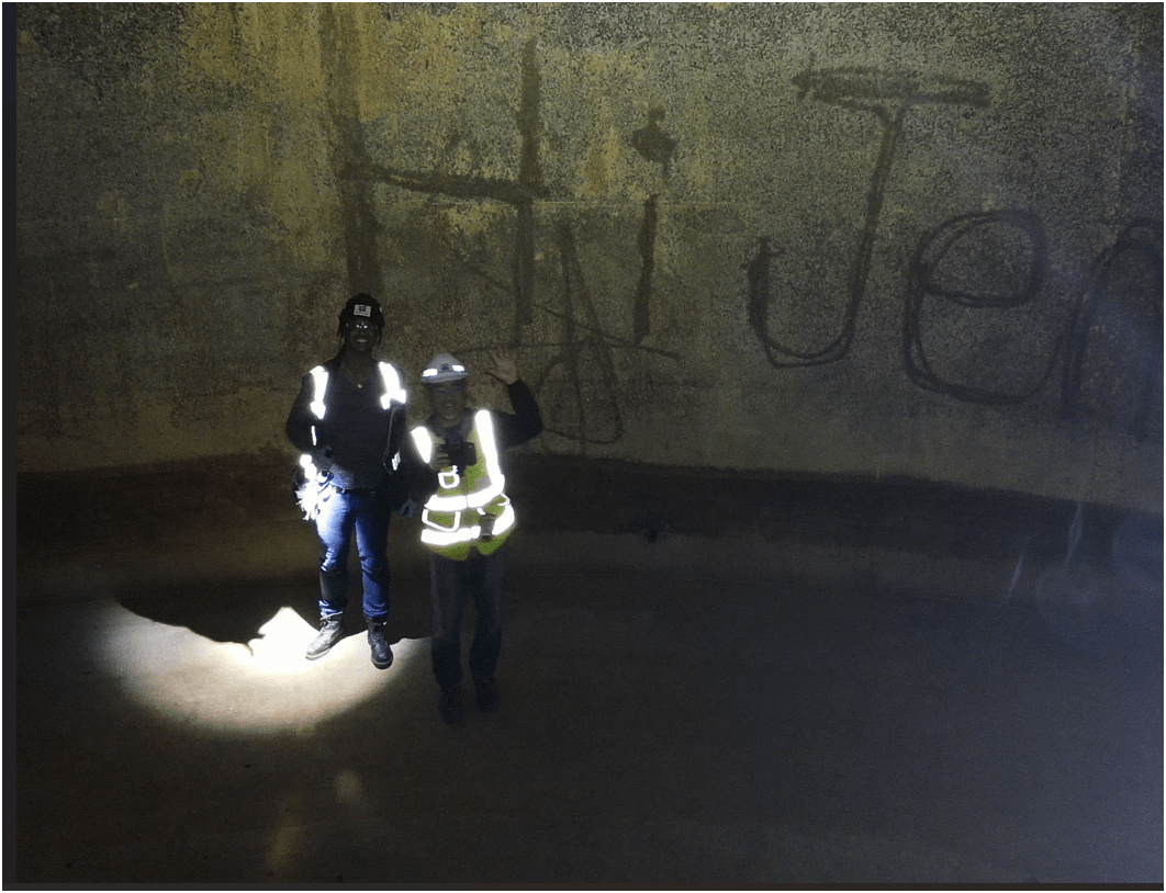
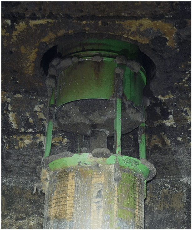
Inspecting Inside Digester
Safety of staffs & Save Time & $$
Why Use Drones?
3. Effective - Producing Results


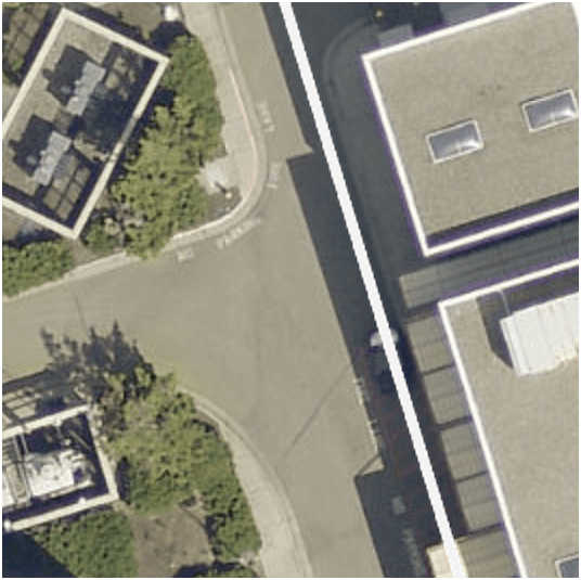
0.50 in/px
June 2025
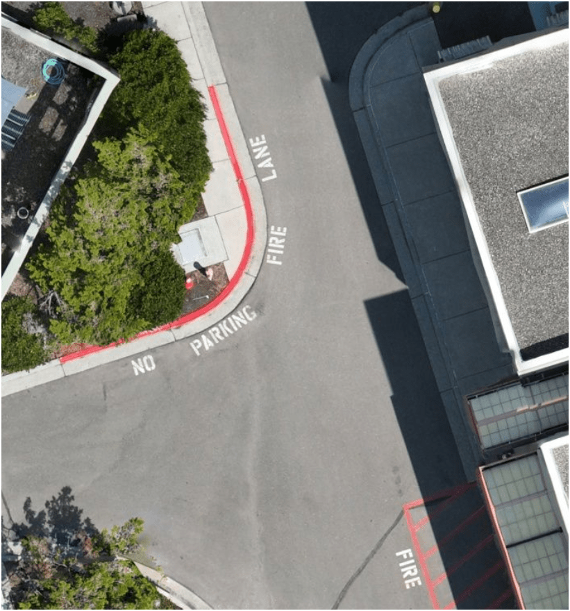
6x time the resolution
(from KC Aerial Imagery - June 2025)
Will Update the Diagram
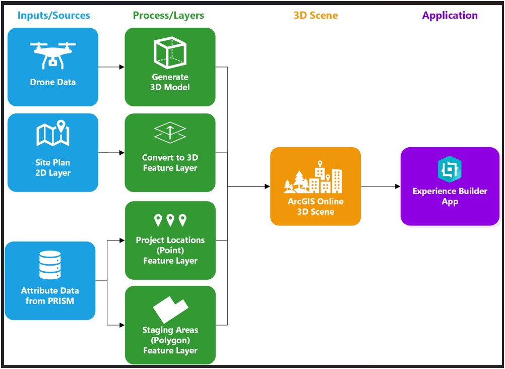
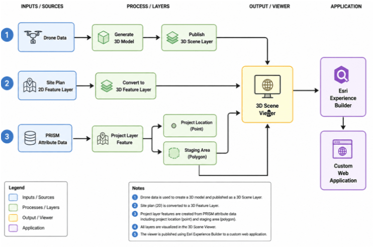
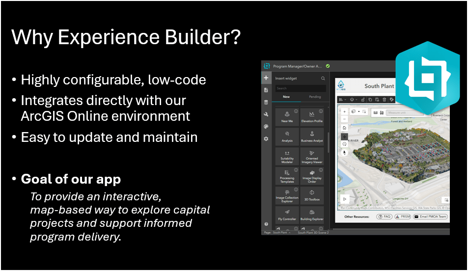
Drone to Map to App
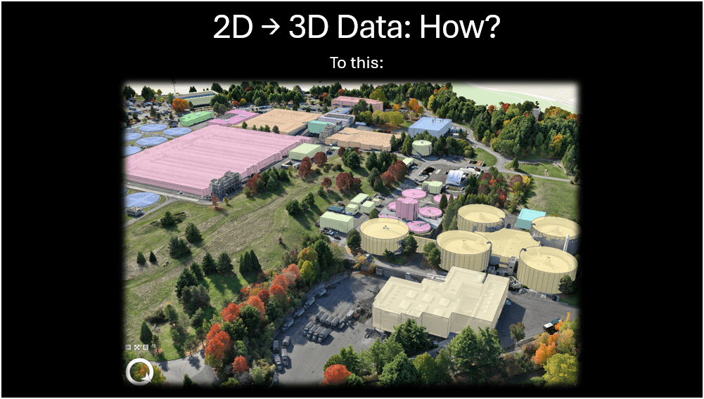


Integrating 3D Scene Layer with 3D Model
South Treatment Plant - 3D Scene Viewer (Web App)
Examples - Integrating with GIS
Examples - Integrating with GIS


END
for now
Thank You
jceleste@kingcounty.gov
jgeigel@kingcounty.gov
peter.keum@kingcounty.gov

peter.keum@kingcounty.gov
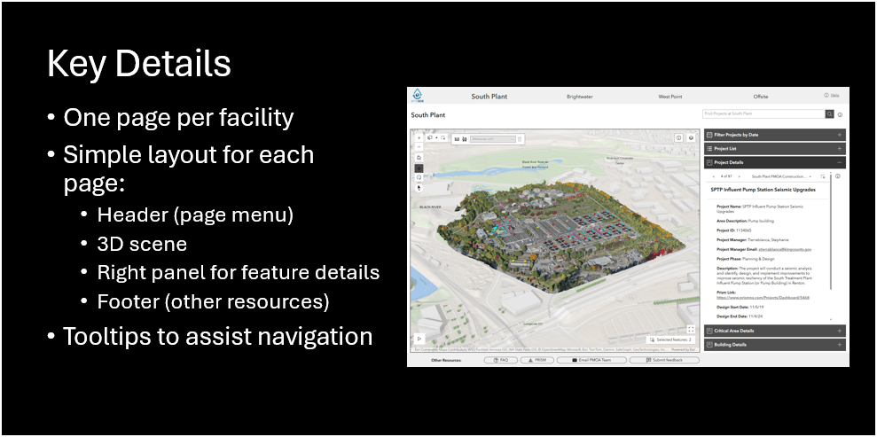
Copy of 2026 WAGISA - WTD Facility Capital Project Viewer
By Peter Keum
Copy of 2026 WAGISA - WTD Facility Capital Project Viewer
May 20, 2026 - WAGISA 2026 Presentation: Drone to Map, Now What? - collaborative presentation with Jason and Joe, showing South TP construction project portal


