383
2,000,000
(2 Million)
15,000
178,000,000
(178 Million)
??
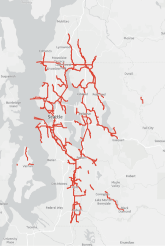
383 Miles
of Pipe
2,000,000 (2 Million) People
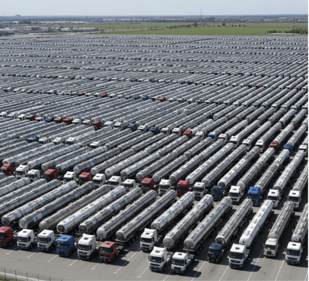
15,000 Trucks
178,000,000 (178 Million) MGD (Million Gallons/Day)

King County Wastewater Treatment
- GIS & Drone - How We Use it
- Future of GIS (personal view)
April 23, 2026
Peter Keum, MS, GISP
WTD Drone Program Lead/ GIS Analyst
- We protect public health and the environment by collecting and cleaning wastewater while recovering valuable resources for a thriving Puget Sound region.
KC Wastewater Treatment Mission Statement

King County Wastewater Treatment by Numbers
-
2 million residents
-
34 Agencies
-
424 square miles
-
383 miles sewer pipeline (2.5 inch to 14 ft)
-
74 facilities (PS & RS)
-
3 Treatment Plants: 180 MGD ~ Max. 460 MGD

Seattle, WA --> Medford, OR
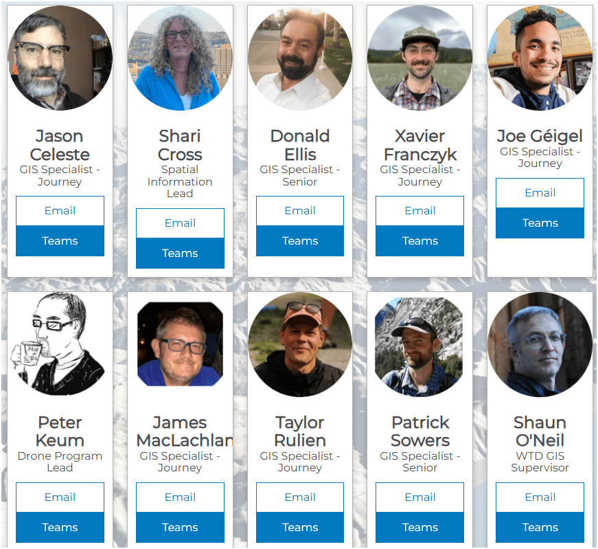
WTD GIS Team
- 10 GIS Specialists
- 4 FAA Certified Pilots
Supervisor

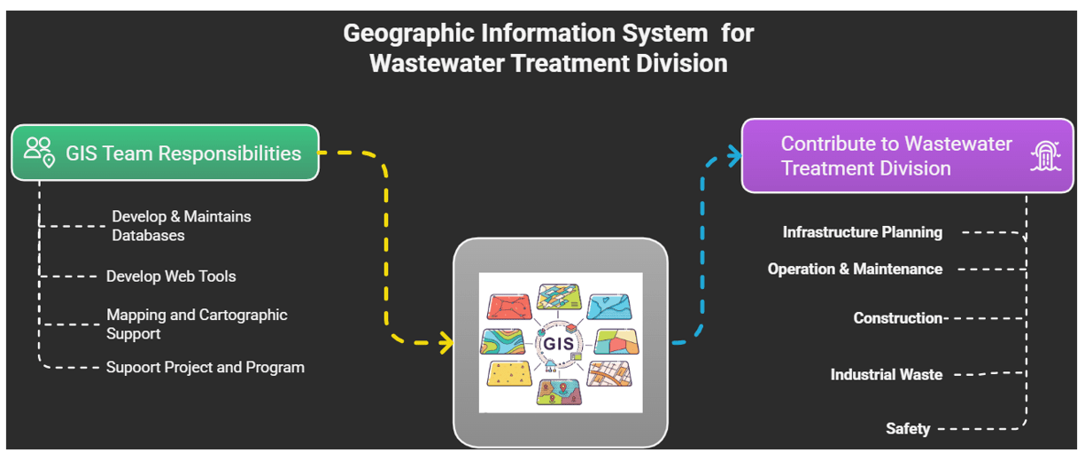
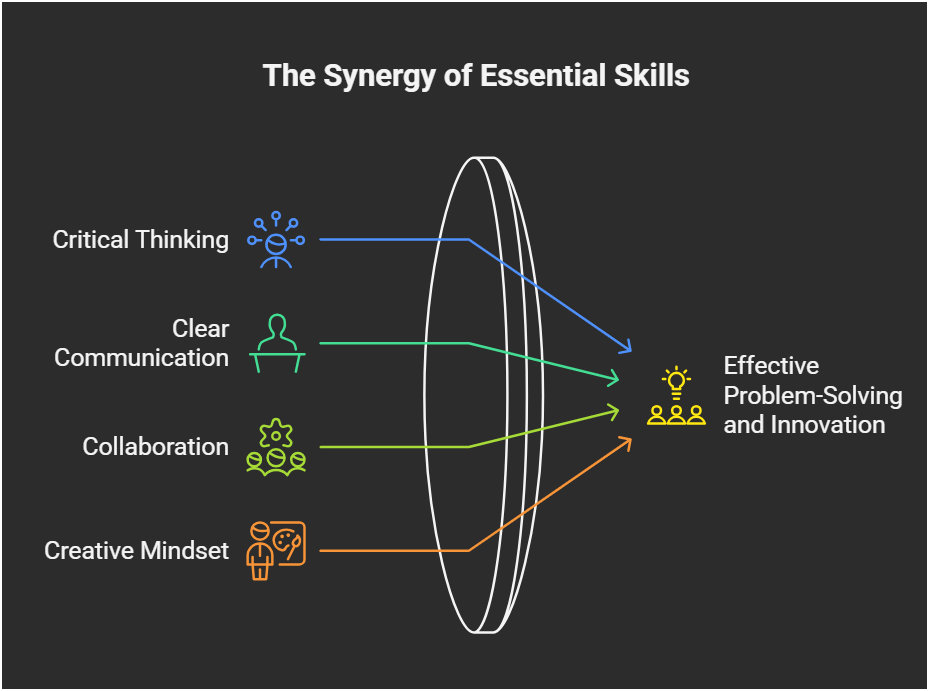
Why Use GIS?

GIS
Decision Makers
WTD GIS
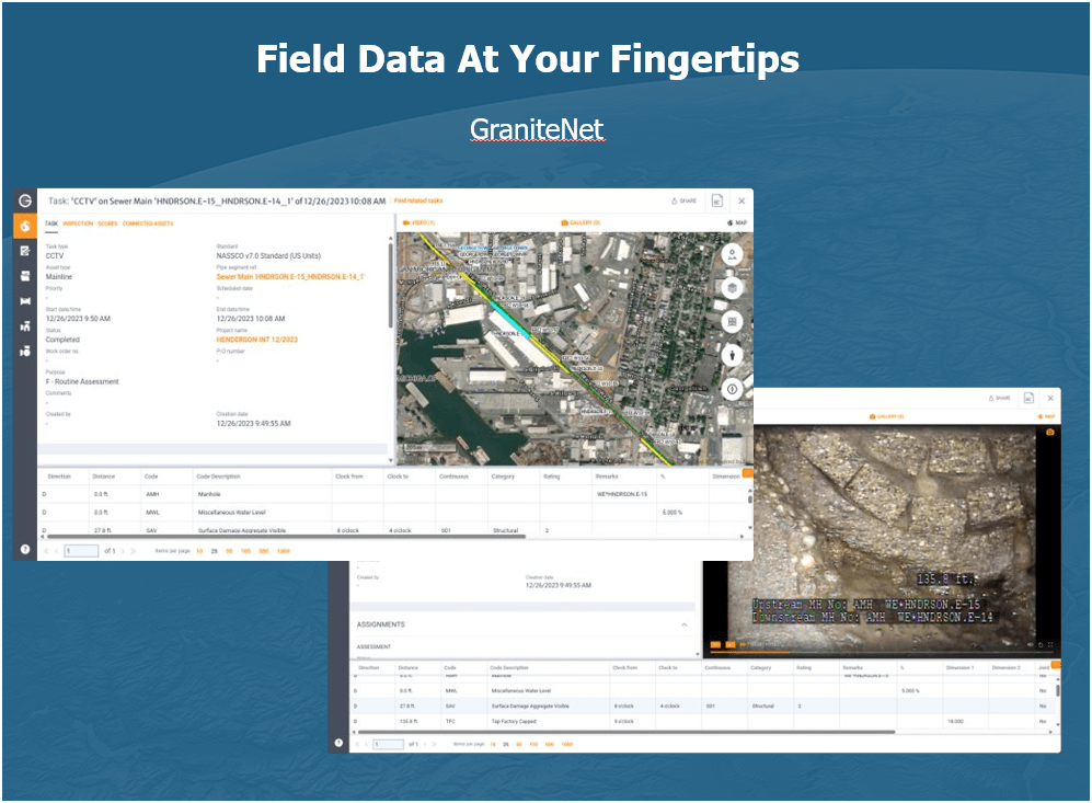
Maintain Sewer GIS Data
-
FIRS (Facility Information Retrieval System) Data
- Maintenance Hole
- Pipes
- Pump Stations
- Regulator Stations
- Treatment Plants
- Outfalls
- Flow Monitors
- CP Stations
- Connection Points
- Site Plan Data
- 3D Models
- Drone Collected Data
- .... many many more

WTD
GIS
DATA
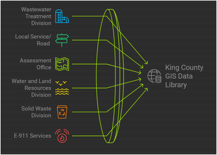
GIS Data:
The core of a GIS is its Database
BUT.....There are 17 county agencies support
King County GIS Data Library System
WTD
GIS Data:
The core of a GIS is its Database
Program Support
- CSO (Combined Sewer Overflow) Control Program
- Modeling Group
- CIFM (Conveyance, Inspection, and Flow Monitoring) Group
- Asset Management Program
- Capacity Charge
- ....many other sections


Projects & Programs Support
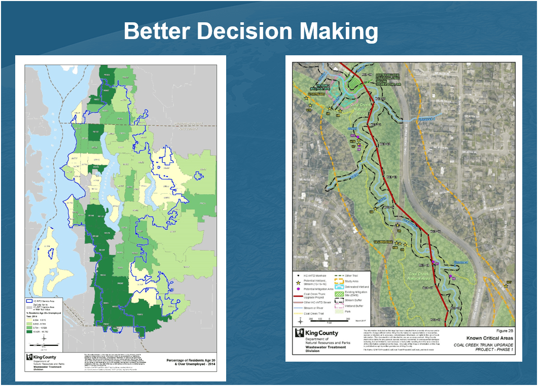
WTD GIS
Lake Hills / NW Lake Sammamish


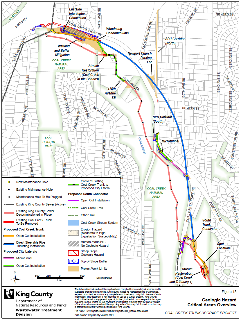
Coal Creek Trunk Upgrade


Georgetown Wet Weather Station


North Mercer Interceptor & Enatai Interceptor Upgrade

Program Support
- CSO (Combined Sewer Overflow) Control Program
WTD GIS


KC & SPU
CSO Real-Time Status Viewer
RainWise
Basin Address Look-Up App
CSO Report
Program Support
- CSO (Combined Sewer Overflow) Control Program
- GSI (Green Storm Infrastructure) --> RainWise Program
WTD GIS


Program Support
- CSO (Combined Sewer Overflow) Control Program
- GSI (Green Storm Infrastructure) --> RainWise Program
WTD GIS


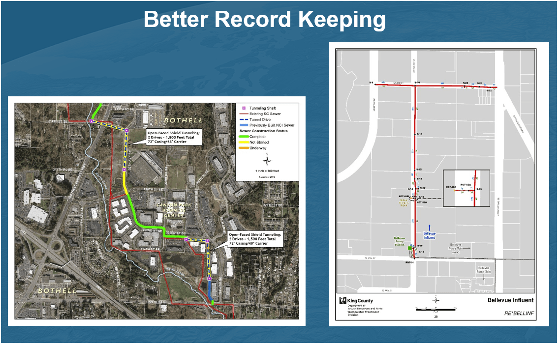
Projects & Programs Support
WTD GIS
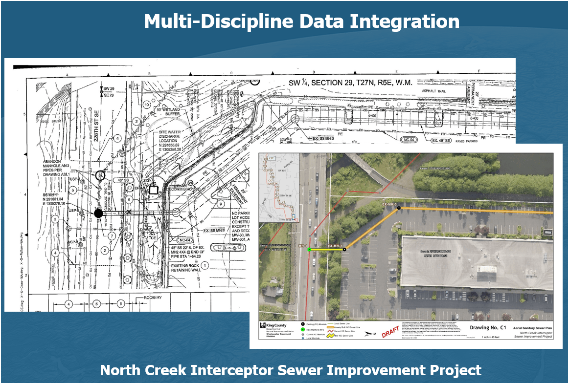
Projects & Programs Support
WTD GIS
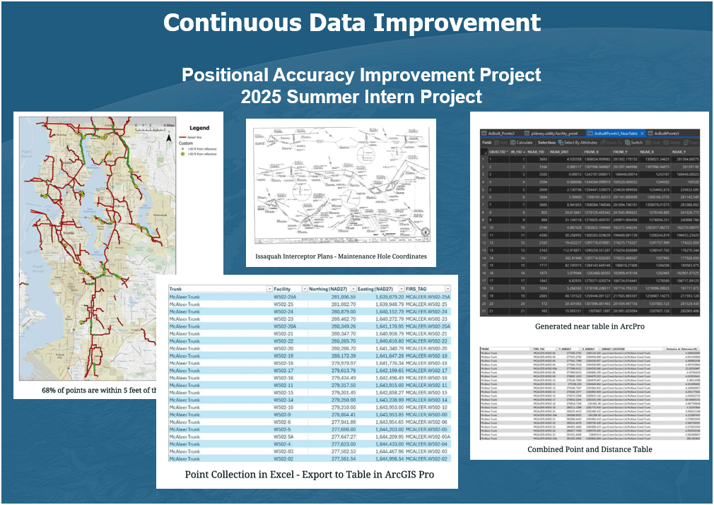
Projects & Programs Support
WTD GIS
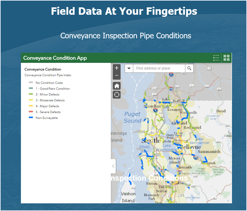
Projects & Programs Support
WTD GIS
Projects & Programs Support
WTD GIS
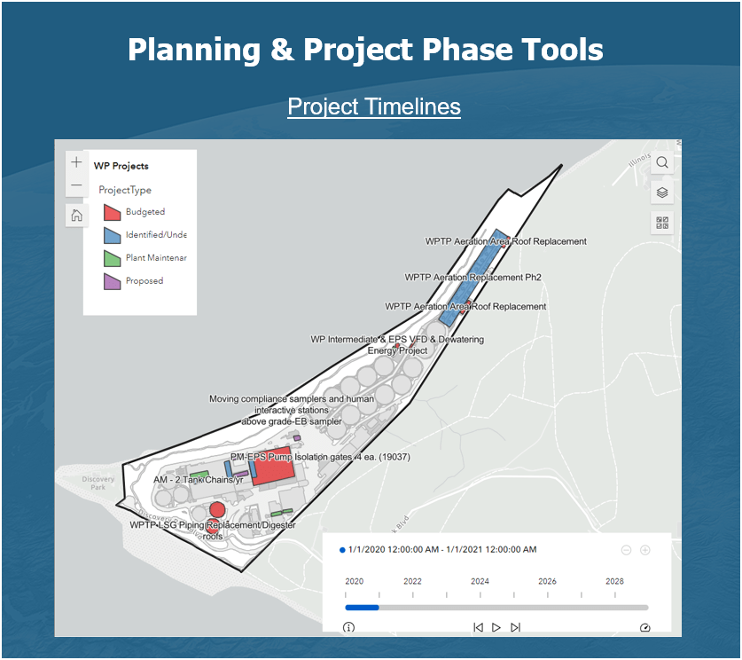
Projects & Programs Support
WTD GIS
Projects & Programs Support
WTD GIS
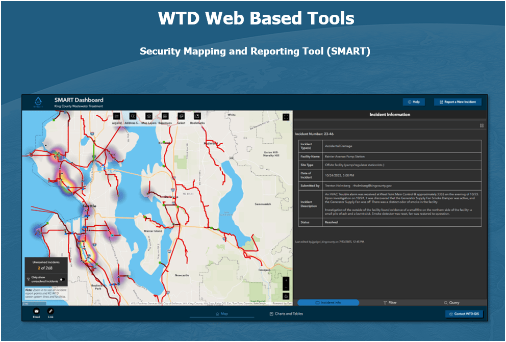
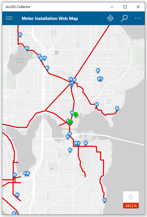
Program Support
- Modeling Group & CIFM Group
Meter Installation Tool

ESJ Support


SVI for Chelan CSO Basin
Program Support


Inspector
"Sewer"
Gadget
WTD Drone Program
We Came, We Flew, We Mapped..
Peter Keum, GISP
Drone Program Lead/GIS Analyst

RPAS - Remotely Piloted Aircraft System
FAA Definition: Remotely piloted Aircraft system operated by a pilot via ground control or on-board computer.


Background Information
RPAS Categories
Small
- Size: 1 - 2 meters ( 3 ft - 6.5 ft), < 55 lbs.
- Control: Visual line of sight, Radio control
- DJI M3E, M400, ScanEagle
Medium
- Size: Equivalent to a car, ~ 1000 lbs.
Large
- Size: > 30,000 lbs.

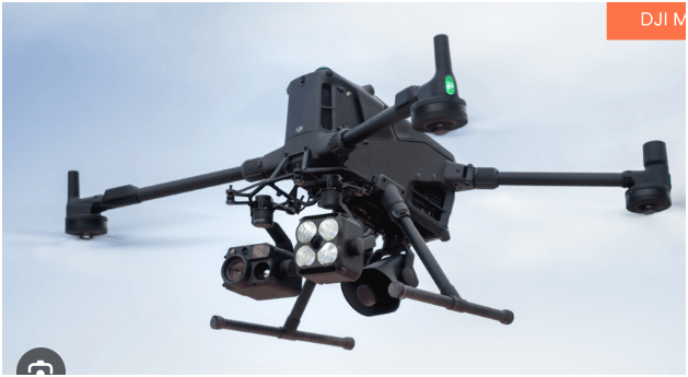

RPAS as Platform
Multi-rotors
Fixed-wing & VTOL

- Shorter flight time (< 45 min)
- Cover smaller area
- Highly maneuverable
- Less expensive
- Access to confined spaces
- Long flight time (+ 40min)
- Covers very large area

(vertical take-off & land)

Sensors Payload

Multi-spectral
Thermal Infrared

Lidar Camera

High resolution digital camera (100 MP)

Methane Gas Detector

Sensors Payload
High resolution digital camera


Sensors Payload
LiDAR Sensor - aka Laser Scanning
Outdoor
Indoor


DJI Air & Mavic 2 Pro < $1800
Aertos 120 $25,000 +
Eilos 2 $48,000 +
DJI Matrice 300 $12,000 +


Outdoor
- GPS Signal
- Automated Planning and Flight
- Even, Diffuse lighting
- Open space
Indoor
- No GPS signal
- Limits on speed and motion
- Manual flight control
- Tight spaces
1. Aircraft + Sensor (Data Collection)
2. Data Processing & Analyzing (GIS)
3. Information Products
=
+


1. Platform + Sensor (Data Collection)
2. Data Processing & Analyzing (GIS)
3. Information Products


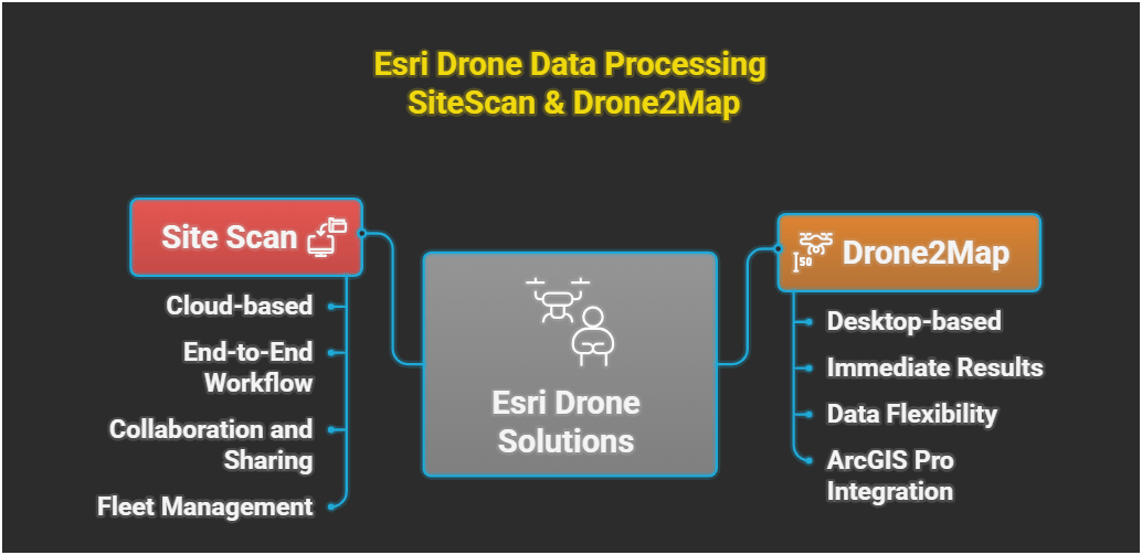
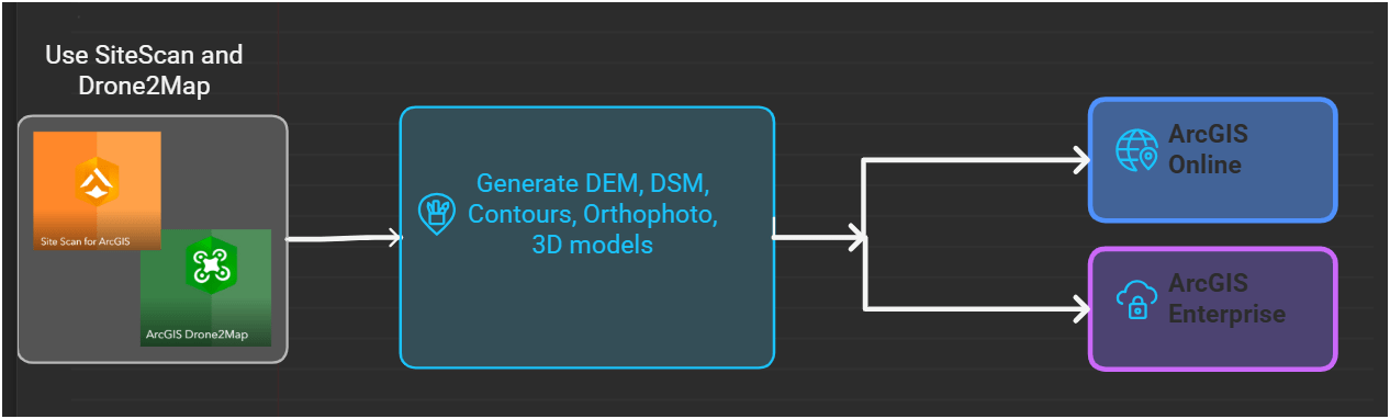
Standard Drone Workflow

Drone

GIS
Great Combo?
&
Great combo !
GIS & DRONE


Great combo !
GIS & DRONE


WTD GIS Drone Program
April 2026
- Four FAA Part 107 Drone Certified Pilots - WTD GIS Specialists (Jim, Patrick, Joe, and Peter)
- Assisting other departments to stand up their own drone programs (WLRD/ SWD/ Local Service/ KCIA/ FMD)


Joe
Inspecting Inside Digester (2024)
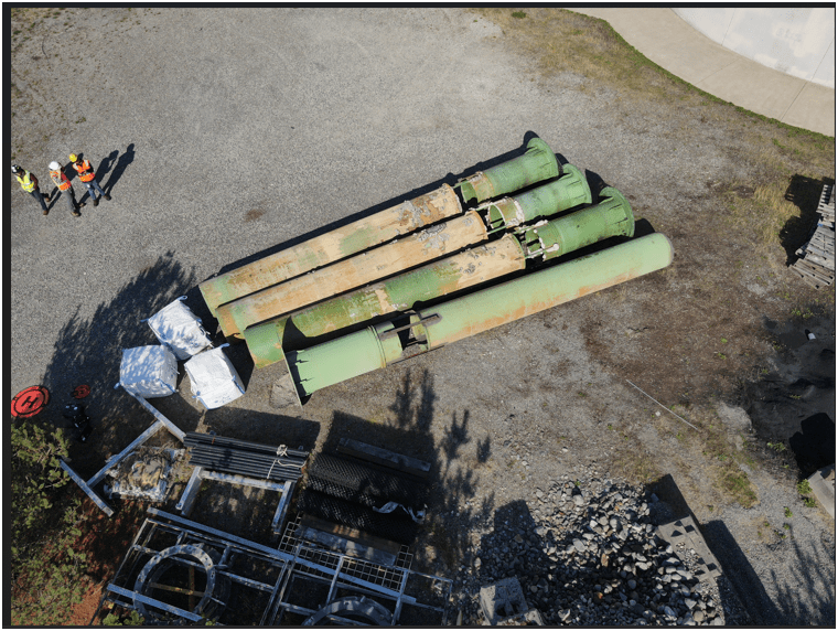
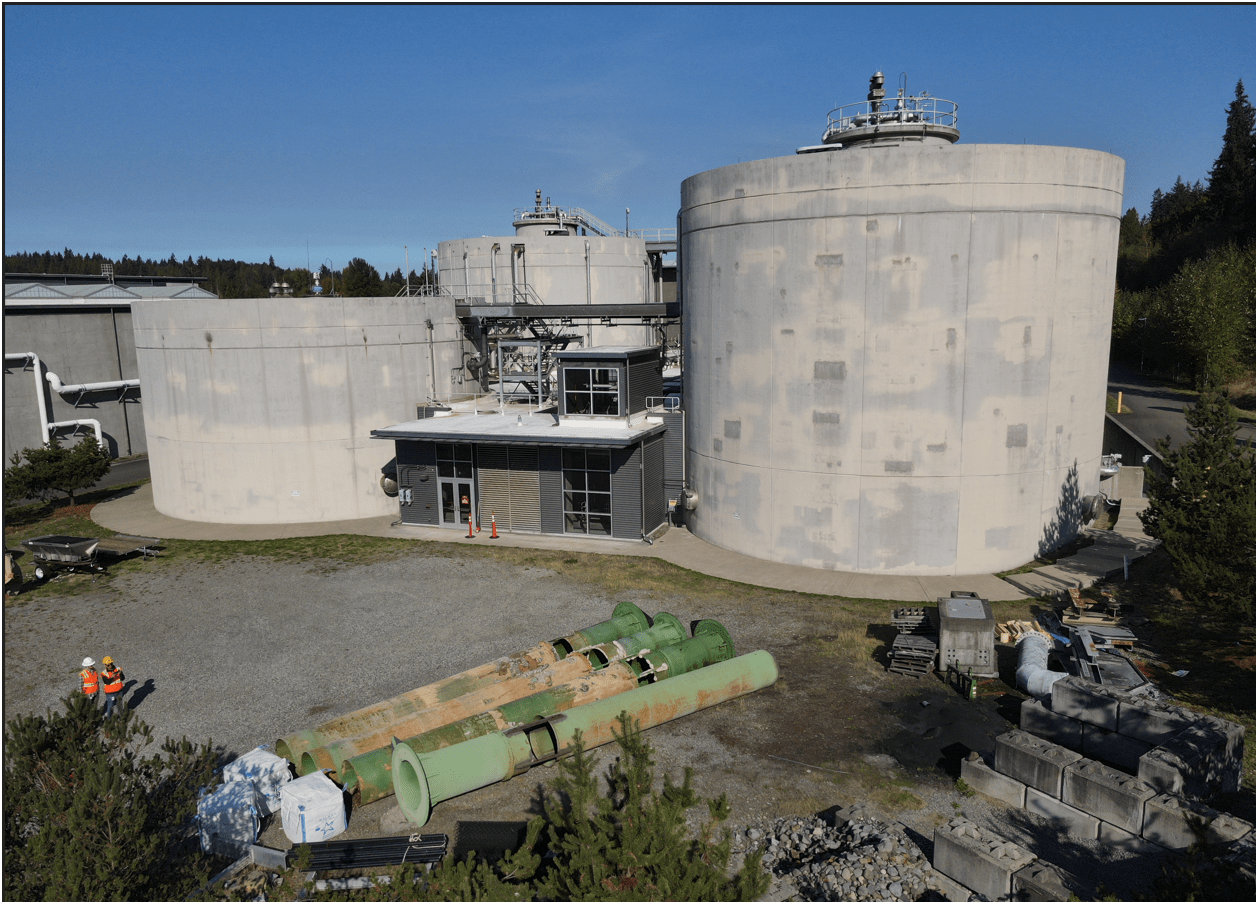
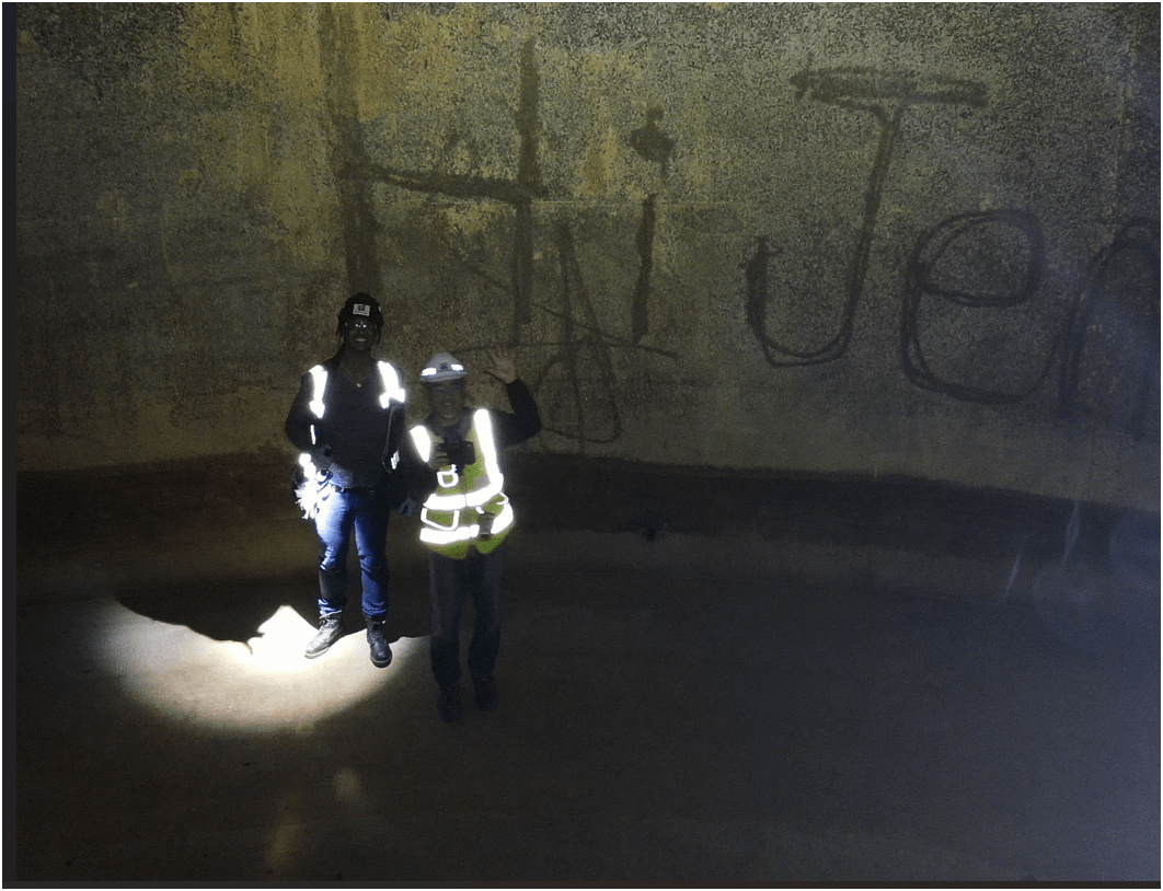
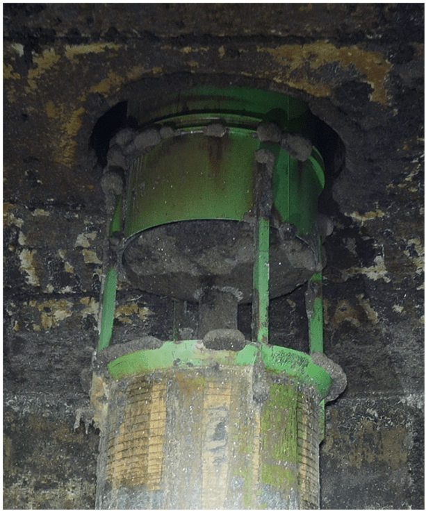
Inspecting Inside Digester
Safety of staffs & Save Time & $$
Why Use Drones?


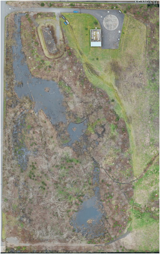
South Treatment Plant
Primary Division Channel
Increase Safety for Staff
2. Efficient - Results without waste
Safety of staffs & Save Time & $$
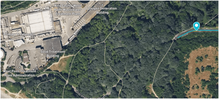
West Point
Treatment
Plant
Discovery Park
Blvd
Dec 2024
Why Use Drones?
3. Effective - Producing Results


Update 2D aerial map

0.57 in/px
Sept 2023
3.0 in/px
2023 KC Aerial
3. Effective - Producing Results
0.50 in/px
June 2025
6x time the resolution
(from KC Aerial Imagery - June 2025)
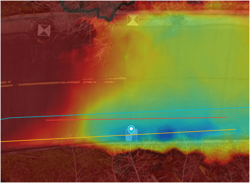
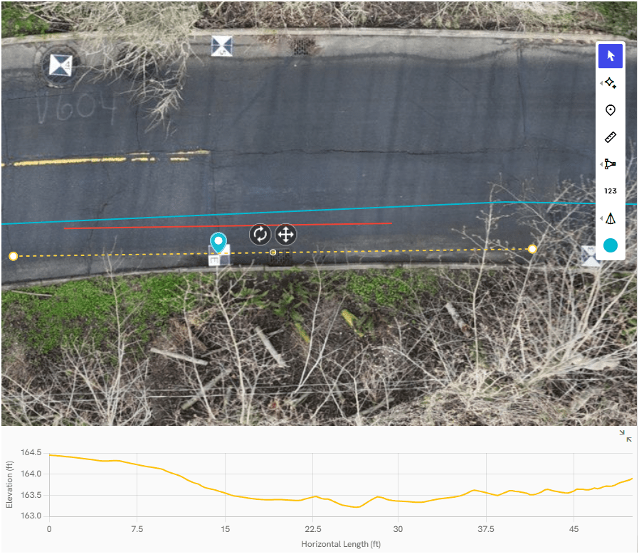
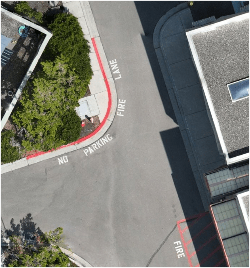
Monitoring & Mitigation (ECSS)
March 2022
April 2024
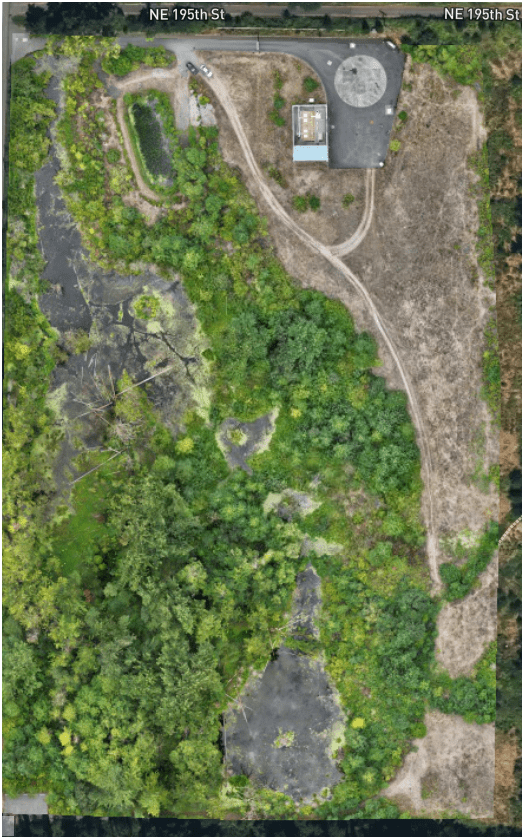
August 2025
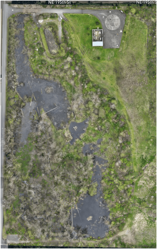
3. Effective - Producing Results
WTD Examples: 2D Aerial
Brightwater Treatment Plant - Construction Aeriation Building
Standard Drone Workflow

AND

Examples - Integrating with GIS
Examples - Integrating with GIS
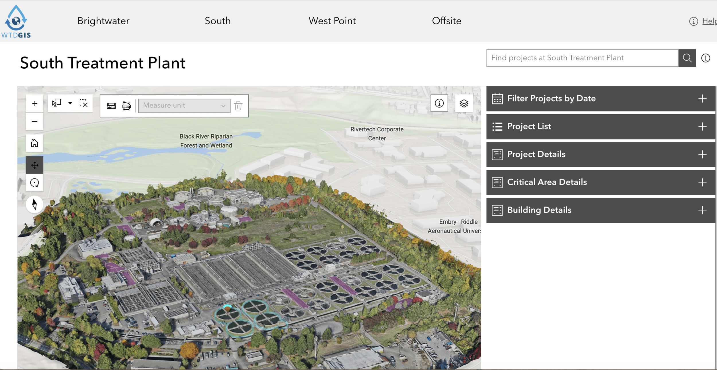
Examples - Integrating with GIS
Construction Site Monitoring
3. Effective - Producing Results
Construction Site Monitoring
3. Effective - Producing Results
Ship Canal Water Quality - TBM
3. Effective - Producing Results
Heat Resource Recover - Energy District (Dexter Ave)
3. Effective - Producing Results
Proof Of Concept
Lidar SLAM Handheld Unit
Video of Scan Path
Proof Of Concept
Lidar SLAM Handheld Unit
Examples
Proof Of Concept
Lidar SLAM Handheld Unit

WHOA!
Future GIS & Success (personal view)

Post Graduate
GPT
General Purpose Technology


GPT
General Purpose Technology
- Steam Engine
- Electricity
- Internet
NOT


Generative Pre-Trained Transformer
"GPT always needs complements"
+
=
Urban Planning
+
=
Utilities/Engineering
You
+
=
Social Justice/Equity
+
=
Environmental
Science
GIS
GIS
GIS
GIS
You
You
You
GIS
Companies are using maps not just as nice features but to drive revenue as core components of their offering. Maps are no longer just a good way to visualize content, they are core to competitive advantage.


+
=
YOU
Text
GIS


Just another tool in the toolbox


Famous Original Quote
They Both are RIGHT!
Resources & Connections


END
for now
Thank You
peter.keum@kingcounty.gov

peter.keum@kingcounty.gov
2026 - UW GIS Certificate Class GIS & Drone
By Peter Keum
2026 - UW GIS Certificate Class GIS & Drone
Presentation for 2026 UW GIS Certificate class - April 23, 2026


