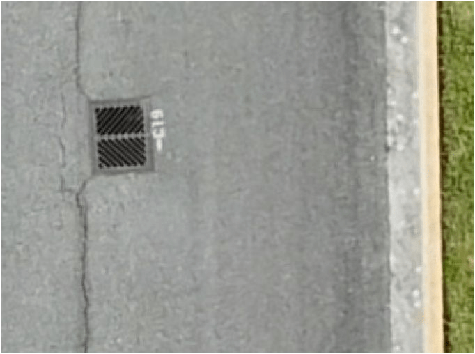
Workshop #2 : Integrating Drone Data into Your GIS Workflow
WAGISA Conference, Tacoma, WA.
June 16, 2025
Keisha Chinn: WSDOT - Enviromental Information Program Manager
Peter Keum, GISP - KC Wastewater Treatment - Drone Program Lead
Introduction
-
Name
-
Organization, if there's one
-
Level of understanding
1.1
Let's get started!
1.1
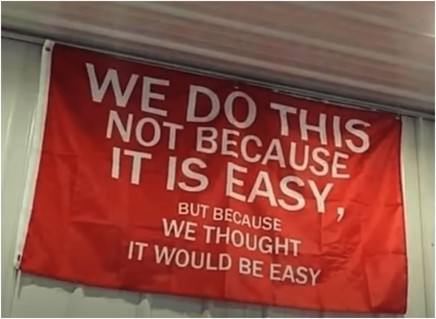
Not Easy!
but....
1.1
Schedule: Part 1
Break (10 min)
Break (10 min)
( 8:30 AM - Noon)
1.1
Quick overview of part 1
Schedule: Part 2
Break (10 min)
Break (10 min)
( 1:30 PM - 5:00 PM)
1.1
1.1
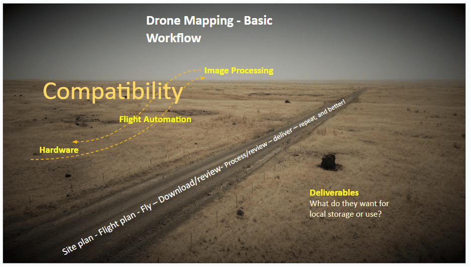
Photogrammetry = taking measurement from photos
Data Processing
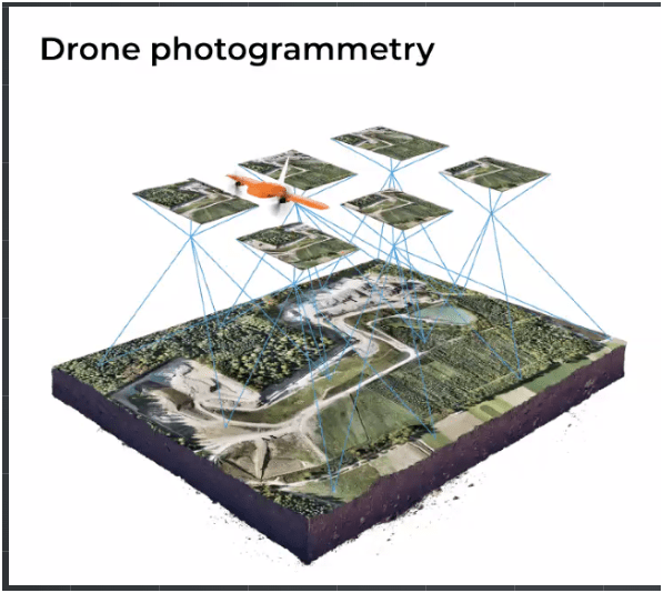
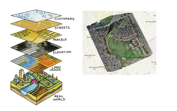
Drone Photogrammetry is the process of using drone-captured images to create accurate 3D models or/and maps of the real world
1.1
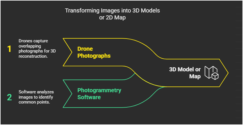
Drone Photogrammetry
1.1
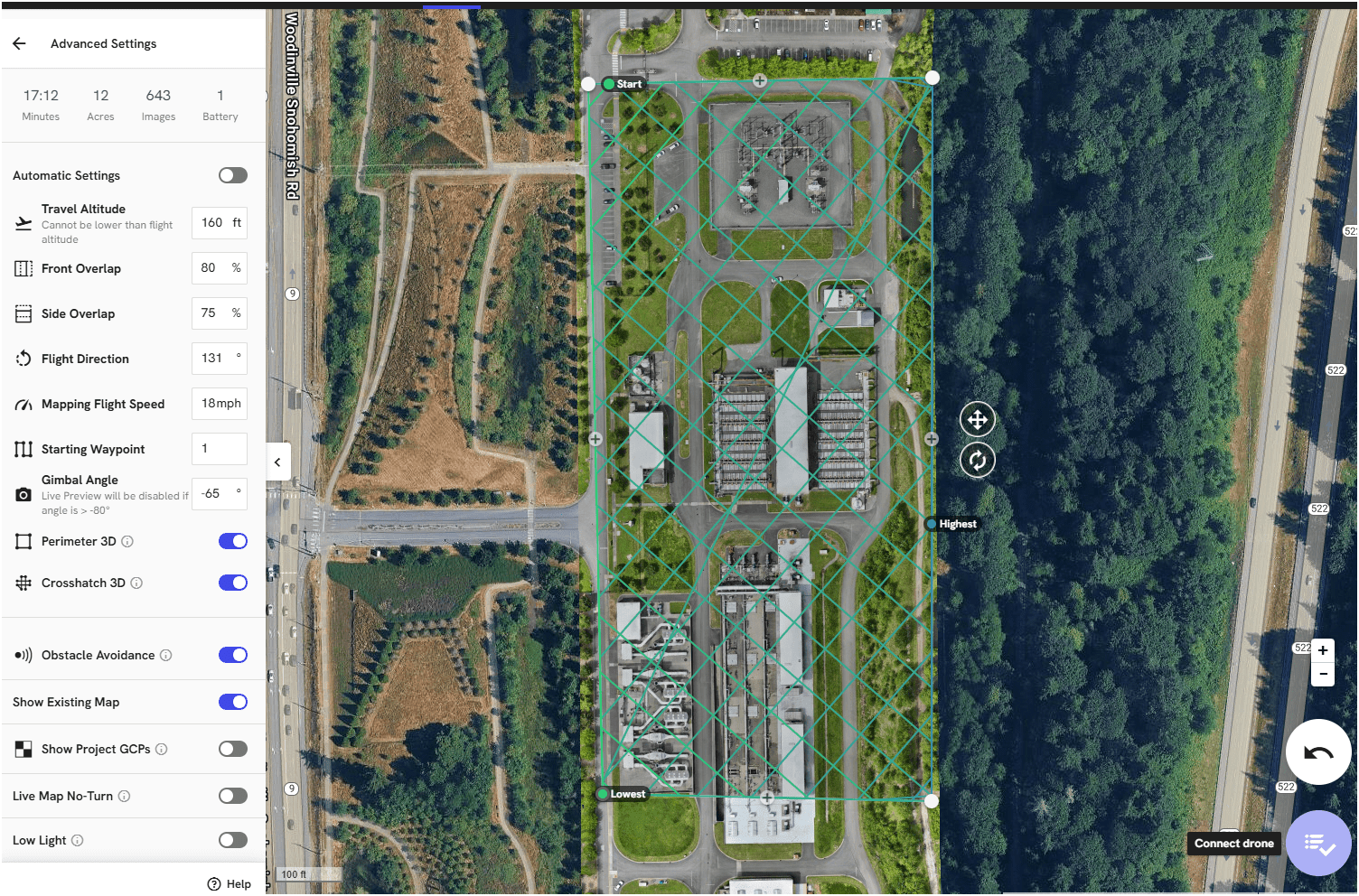
Mission Planning Software (data collection) - Flight Control App
- Fly Consistently for overlapping images
- Can fly manually but it's like mowing with scissors


1.1

1.1

1.1
1.1
Ground Sample Distance

"the distance between the centers of two adjacent pixels in an image measured on the ground."
Smaller GSD the higher the resolution
1.1
1.1
GSD ~ 0.48in/px
1.1
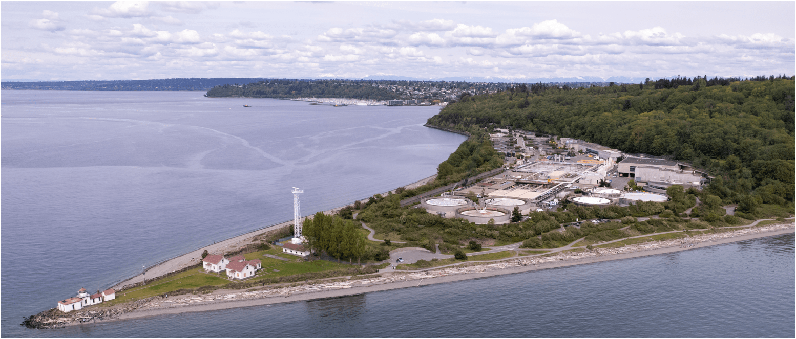
- Update 2D aerial map


GSD
0.57 in/px
Sept 2023
GSD
3.0 in/px
2021 KC Aerial
1.1

1.1

Input Sequences for 3D Model
#1
#1
#2
#3
#4
1.1
Keisha

Leveraging Drones for Accurate Aerial Mapping & Benefits
1. What is it? - accuracy
2. How to create it? - hardware/software (workflow)
1.3
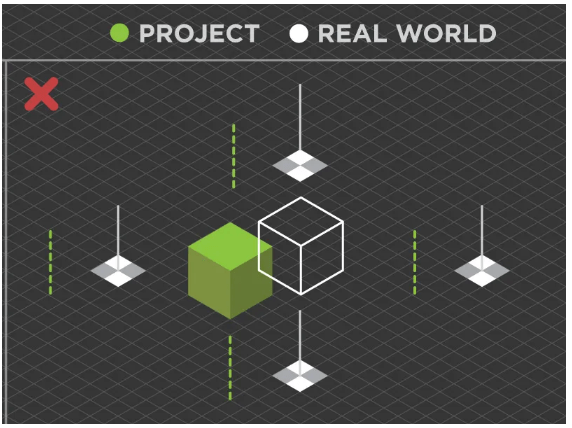
1. What is it? - Relative vs Absolute Accuracy
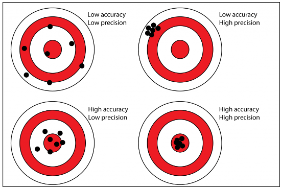
Accuracy & Precision
1.3
1.3
1. What is it? - Relative vs Absolute Accuracy
Relative Accuracy - Accurate Internal Measurement
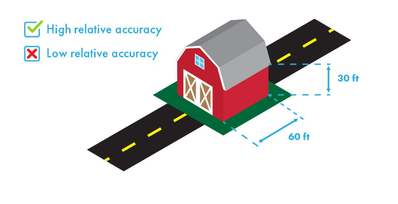
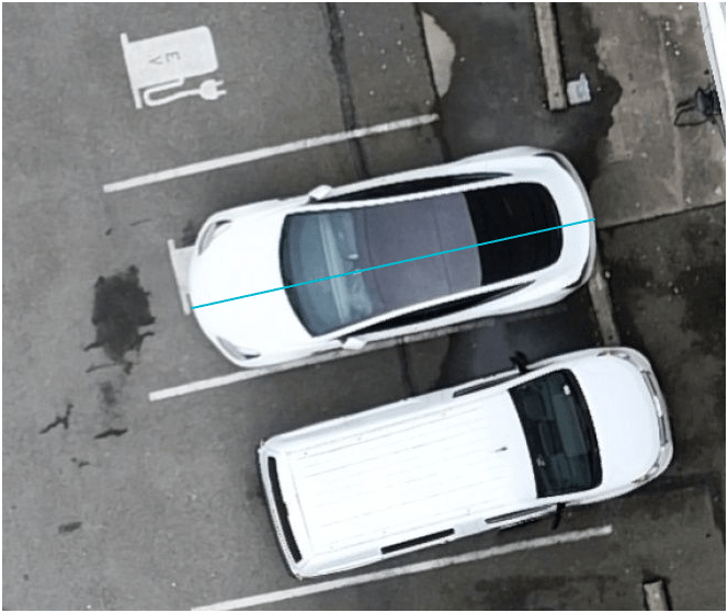
15.68 ft
1.3
1. What is it? - Relative vs Absolute Accuracy
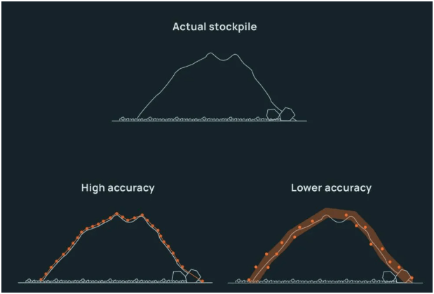
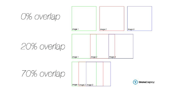
Relative Accuracy - 3 things that impacts
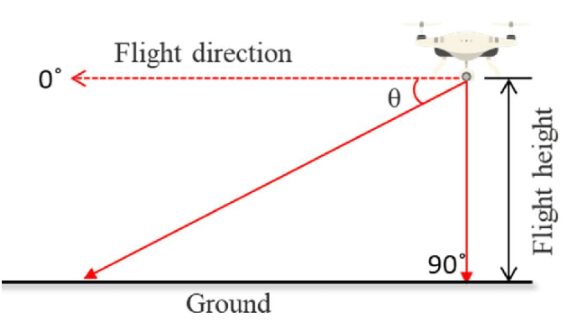
- Flight height - Lower and Slower
- Image Overlap - Minium of 70%
- Photo angles
1.3
1. What is it? - Relative vs Absolute Accuracy
Absolute Accuracy - How closely the collected data match their real-world position
1.3
2. How to create it? - Hardware/Software (workflow)
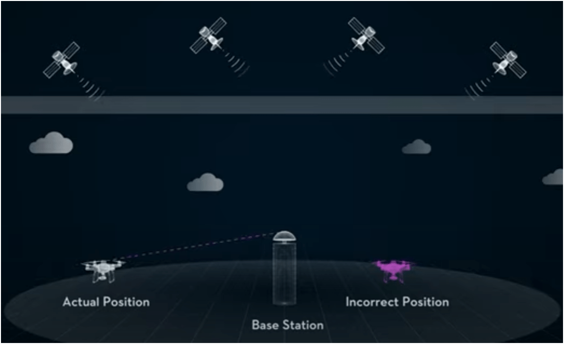
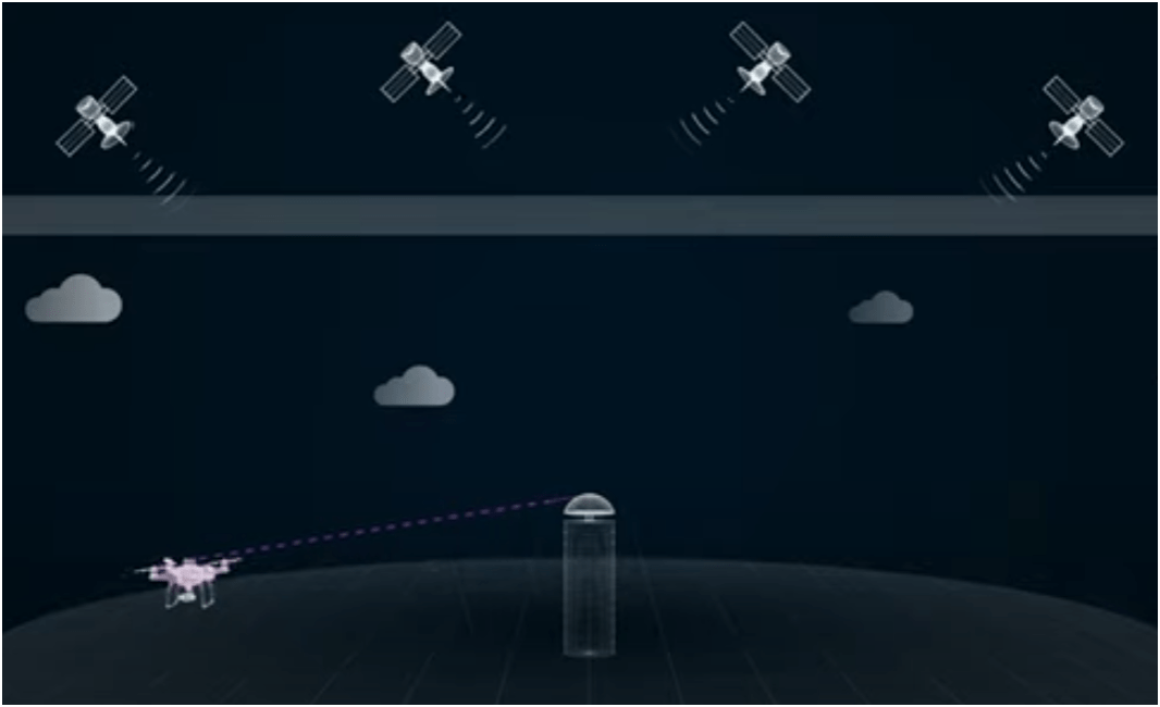
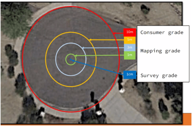
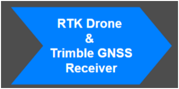
RTK = Real Time Kinematic
No RTK Drone Error : (3 to 5 feet)
RTK Drone Error: 1 ~ 4 cm
1.3
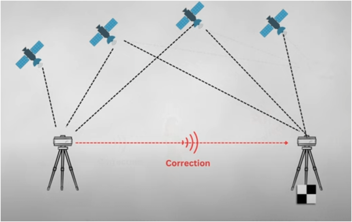
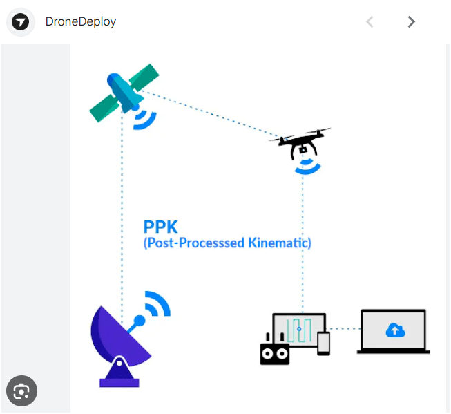
RTK - Real-Time Kinematic
PPK - Post Processing Kinematic
1.3
Ortho imagery being corrected to GCP
1.3
1.3
2. How to create it? - Hardware/Software (workflow)
Leveraging Drones for Accurate Aerial Mapping & Benefits

1.3
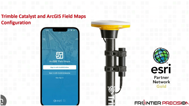
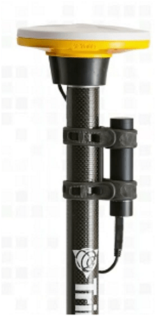
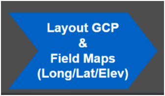
Trimble DA2 Catalyst + Esri Field Maps

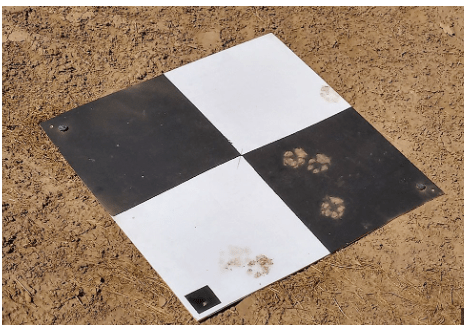
Min. 5 GCPs
add
Checkpoints
2. How to create it? - Hardware/Software (workflow)
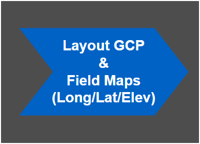
Step: 1
1.3
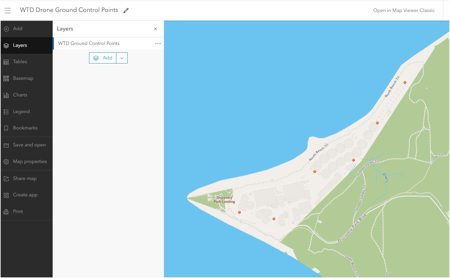
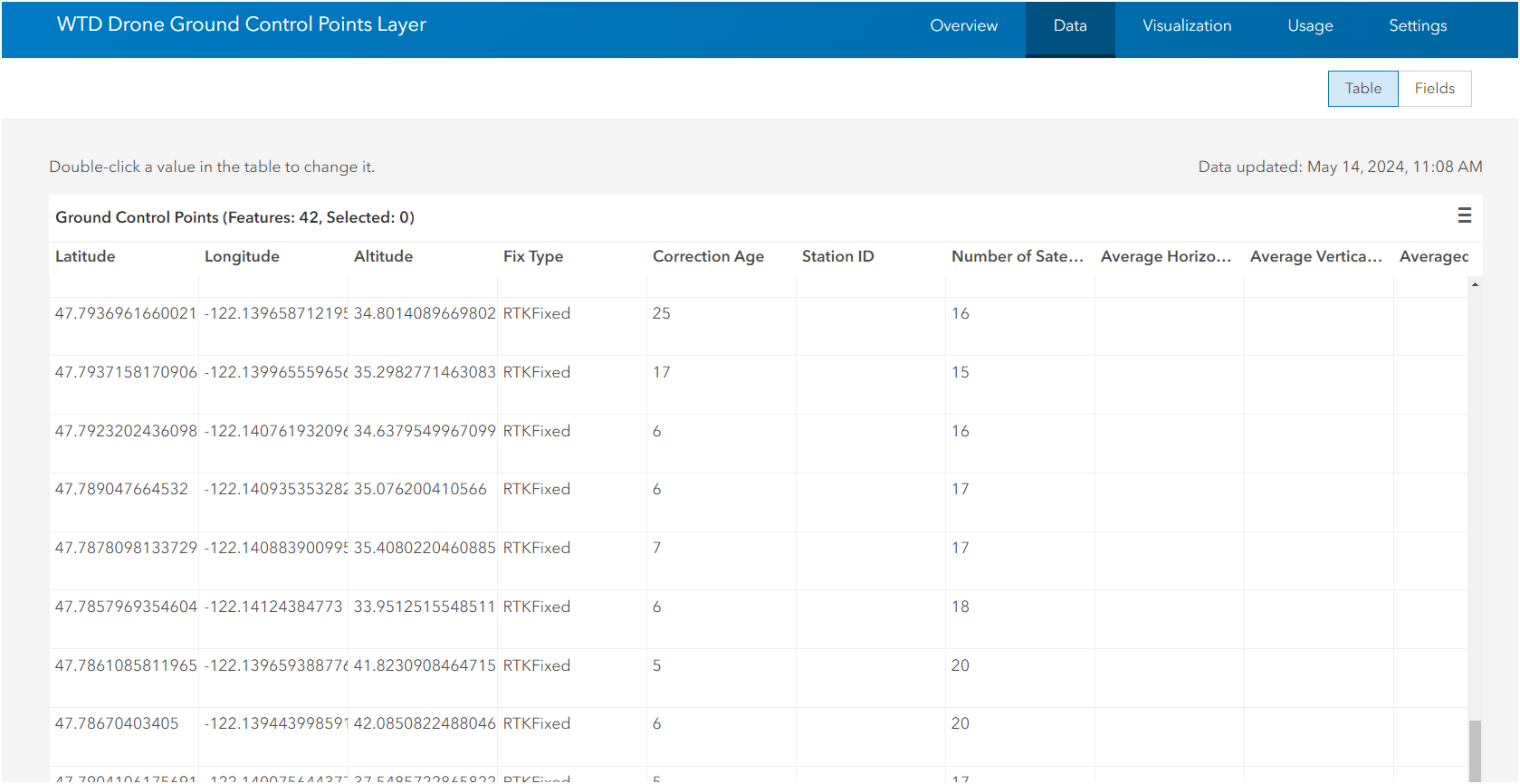
ArcGIS Online
Hosted Feature
Layer
1.3
2. How to create it? - Hardware/Software
Trimble DA2 Catalyst ($400) + Subscription + Esri Field Maps
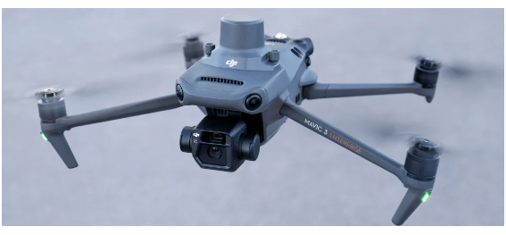
DJI Mavic 3 Enterprise RTK Receiver
~ $4300
Step: 2
1.3

2. How to create it? - Hardware/Software (workflow)
1.3
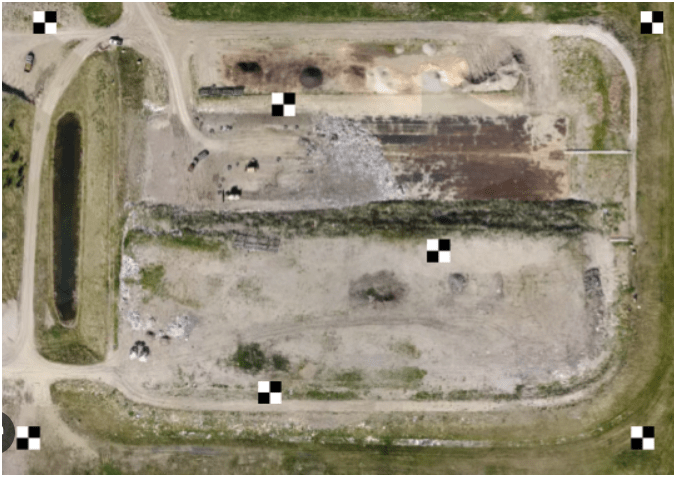
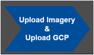
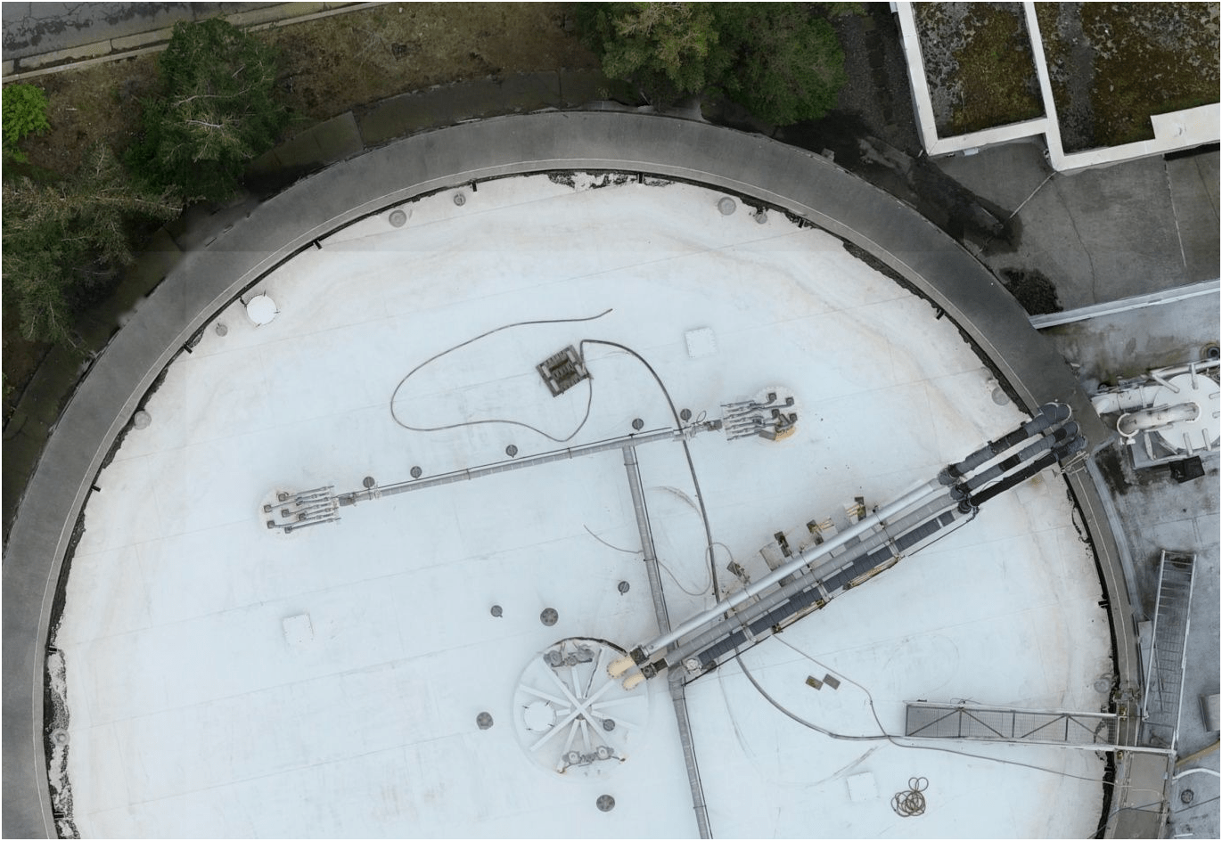
Examples
Images = 1008
GCP = 6
RMSE = 1.35 in (3.49 cm)
Ground Sampling Distance = 0.57in/px
1.3
Keisha
1.4
Schedule: Part 2
Break (10 min)
Break (10 min)
( 1:30 PM - 5:00 PM)
Keisha
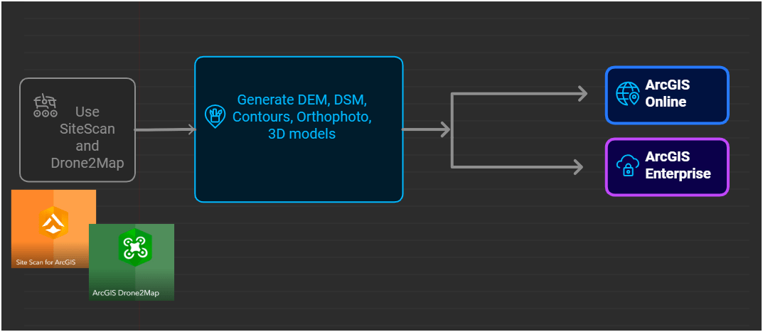
KC WTD Processing Software
- Mission Planning
- Data Processing
- Product Sharing
- Multi-level
2.2
- Public
- No AGO Account
- Group Sharing
- Share with everyone
- Security


- Internal Only
- No AGO Account (KC)
- Group Sharing
- Selected Data to share
2.2
Environmental Monitoring
August 2022
March 2022


April 2023
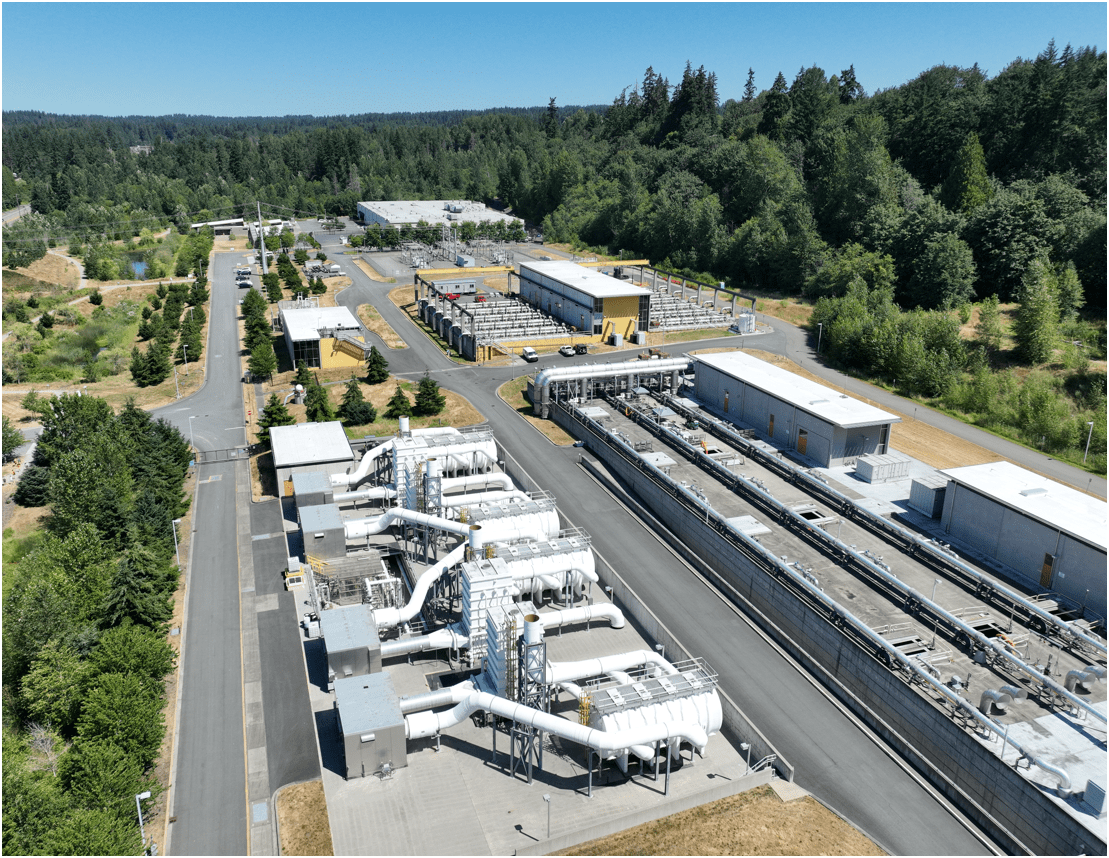
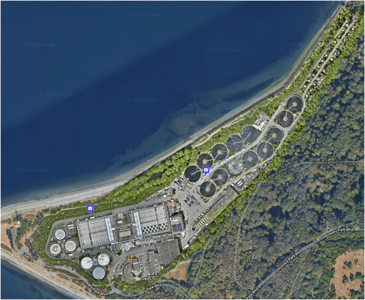
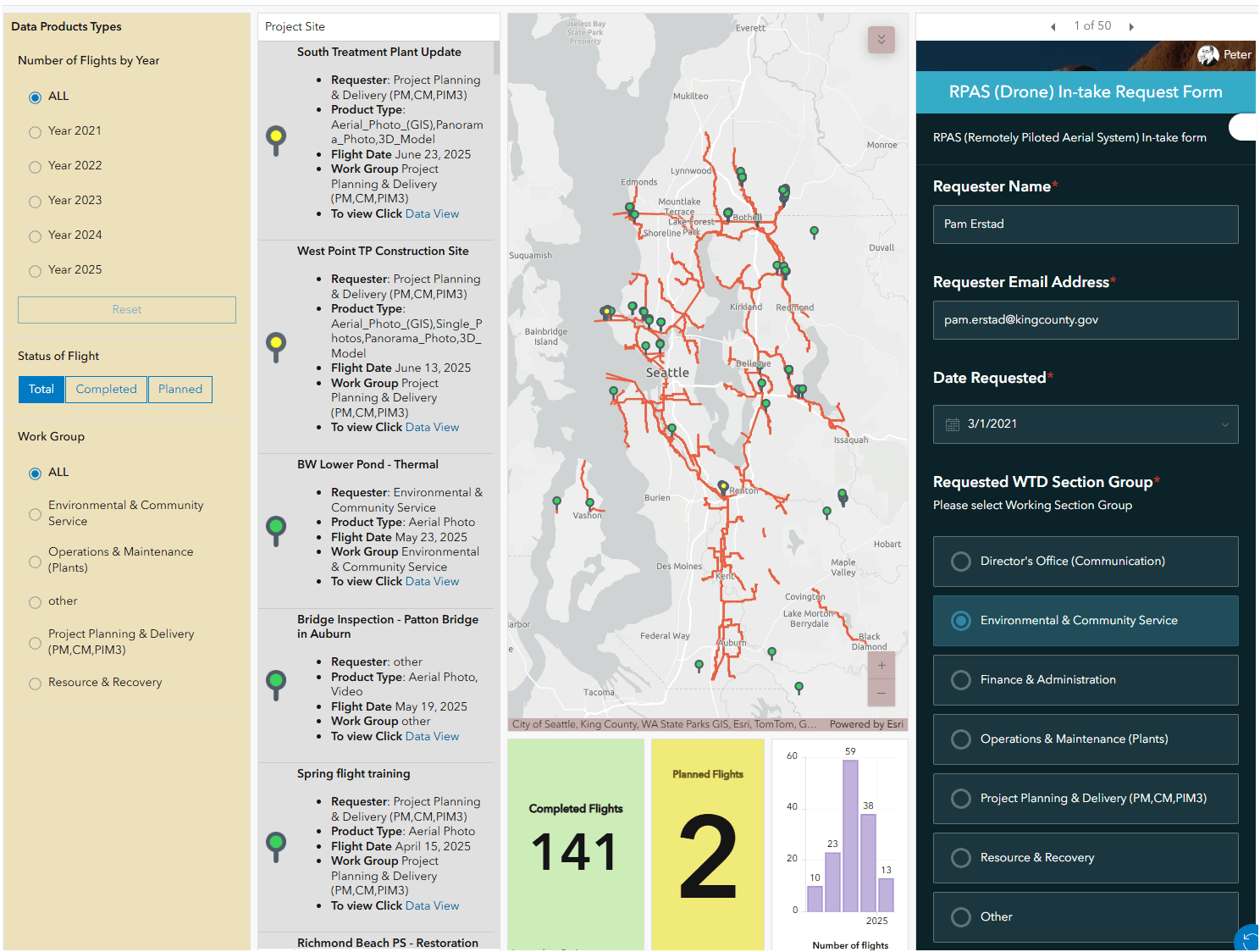
KC WTD Examples
Mitigation and Monitoring Group
2.2
-
Update 2D aerial map - DroneDeploy
KC WTD Examples - Operation & Project management

1172 Photos
0.57in/px
2.2
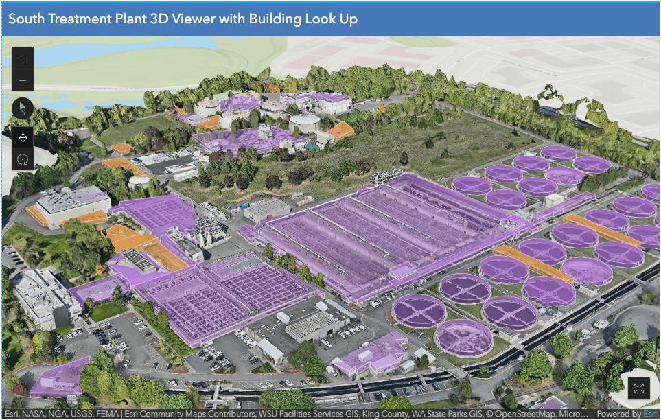
Esri 3D AGO Scene Viewer App - South Treatment Plant
2.2
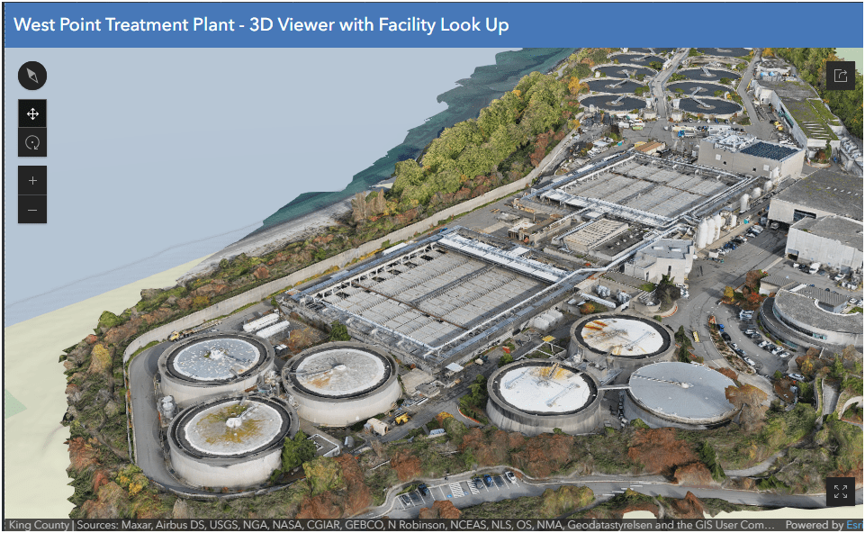
Esri 3D AGO Scene Viewer App - West Point Treatment
2.2
Schedule: Part 2
Break (10 min)
Break (10 min)
( 1:30 PM - 5:00 PM)
Schedule: Part 2
( 1:30 PM - 5:00 PM)
- Survey123 -> Dashboard
- Integration with ArcPro
- Drone2Map & SiteScan to AGO/AGE App
3.1
Esri Survey 123 -> Dashboard
Flight Management
3.1
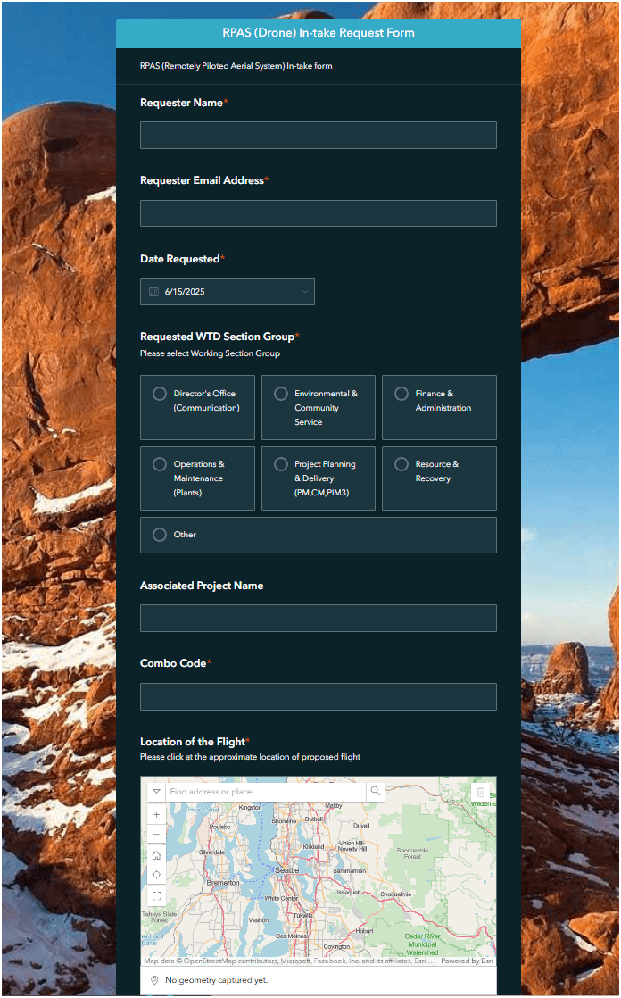
Survey123 Web Form
- Keep Track of flight requests
- Location of flights
- Classify types of flights
- Integrate w/ GIS
Esri Survey 123 -> Dashboard
Flight Management
3.1
- Sharable
- Editable
- Report generating (if needed)
- Public
- No AGO Account
- Group Sharing
- Share with everyone
- Security
- Internal Only
- No AGO Account (KC)
- Group Sharing
- Selected Data to share
3.1
3.1
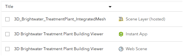
Scene Layer (hosted)
Web Scene (3D)
Instant App
Hosted Feature Layer
Web Map
Web App
Value of layers
-
Update 2D aerial map - DroneDeploy
KC WTD Examples - Operation & Project management
1172 Photos
0.57in/px
3.1
AGO Tile Layer
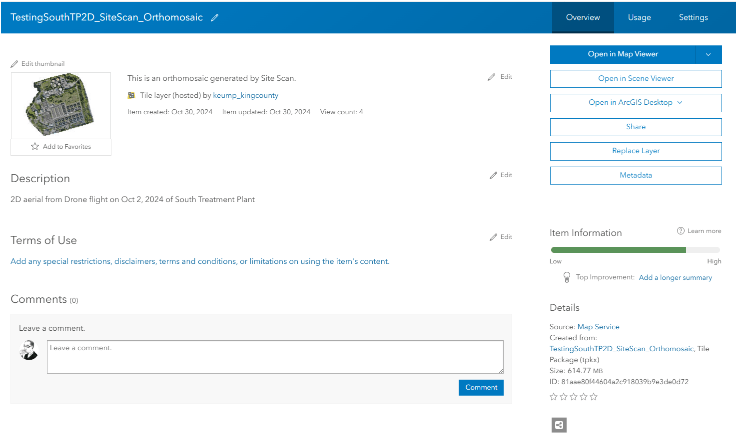
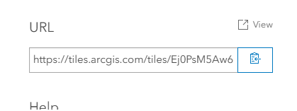
3.1
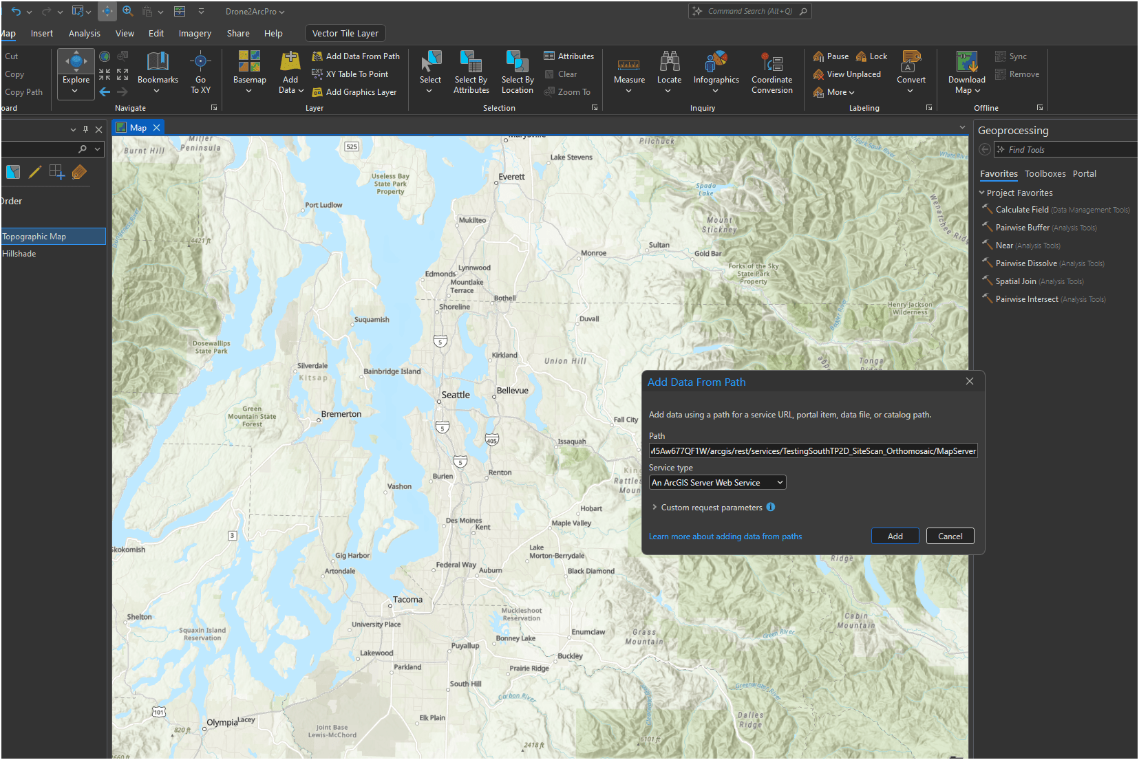
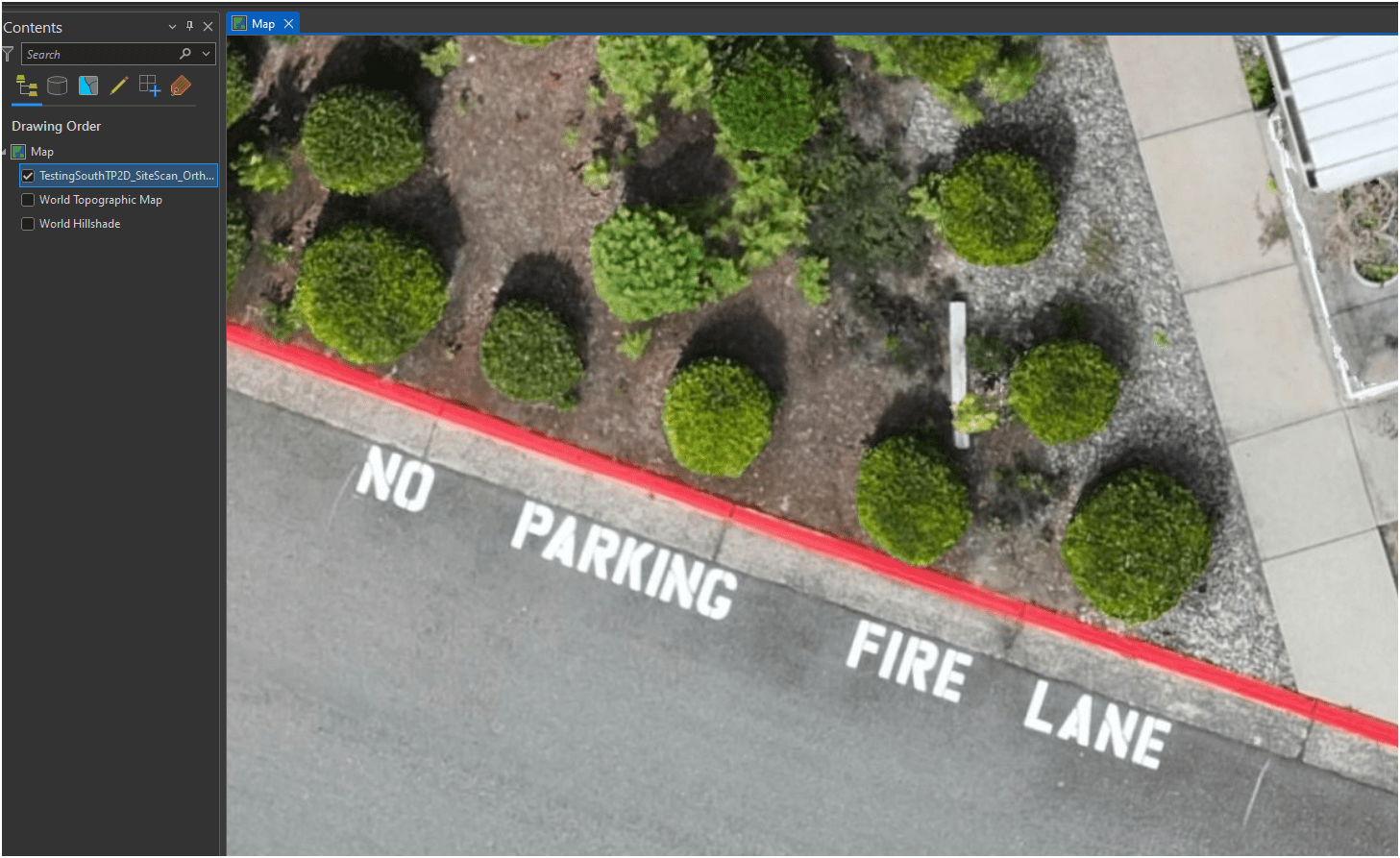
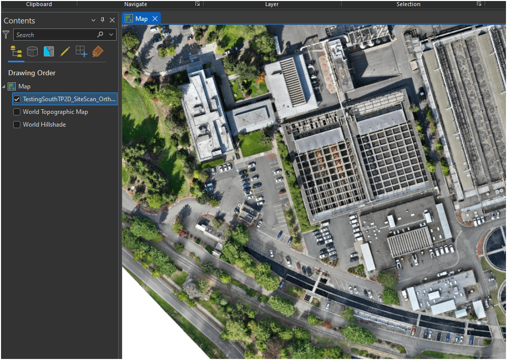
AGO Tile Layer --> ArcPro
3.1
AGO Tile Layer --> ArcPro
3.1
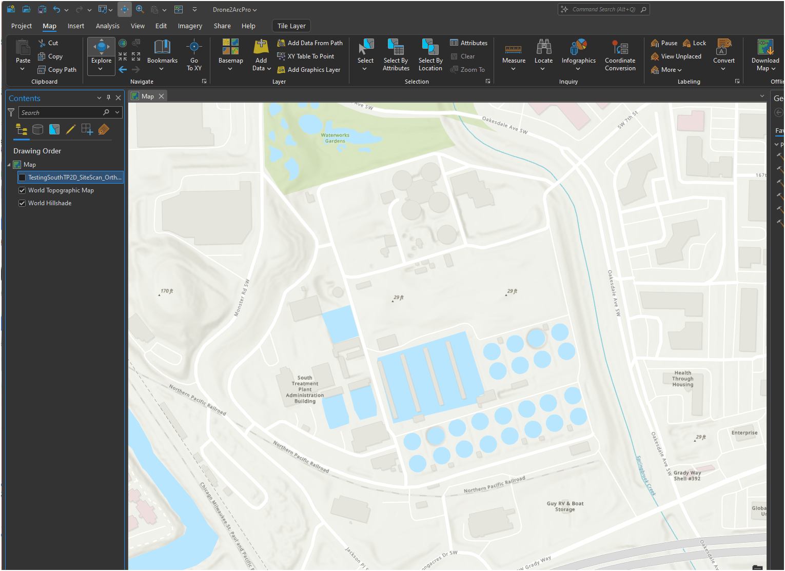
AGO Tile Layer --> ArcPro
3.1
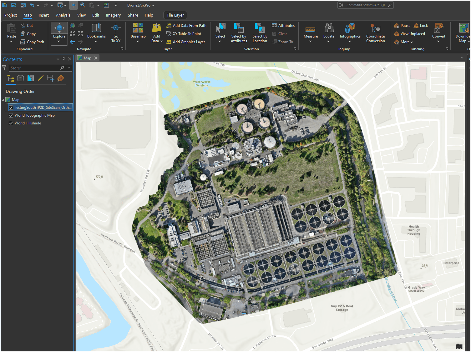
AGO Tile Layer --> ArcPro
3.1
Lastly, Oriented Image Viewer
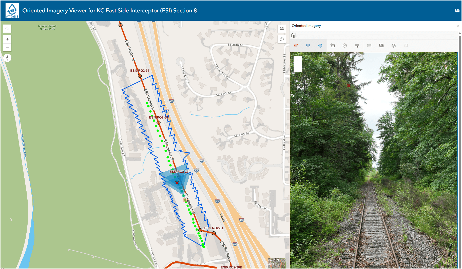
3.1

3.1
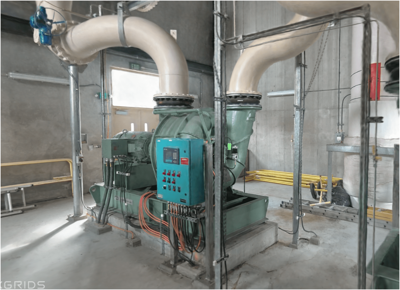
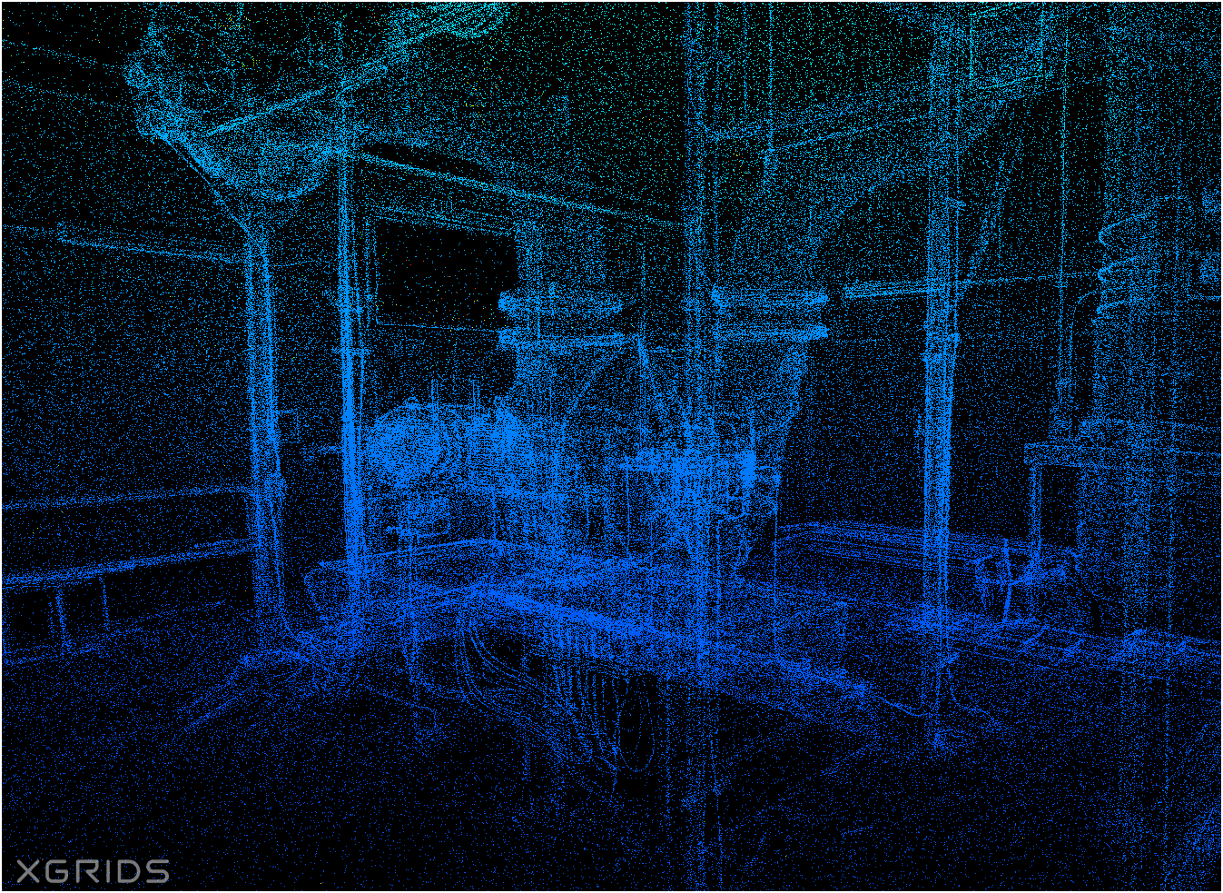
Proof Of Concept
Lidar SLAM Handheld Unit
Video of Scan Path
3.1
Proof Of Concept
Lidar SLAM Handheld Unit
Walk through 3D model
3.1
Proof Of Concept
Lidar SLAM Handheld Unit
Examples
3.1

END for now.....
Washington GIS Association Drone Special Interest Group


- Email Sign-up
- Resources
- Every 3rd Thursday
- ZOOM Meeting
- 165 Members
- Monthly Meeting - Every 3rd Thursday over Zoom
- Share resources online
- Help educate and introduce new users to the field of drone mapping and GIS

2025 - WAGISA Drone Workshop Part 2
By Peter Keum
2025 - WAGISA Drone Workshop Part 2
Drone workshop for 2025 WAGISA - this is Part 2: Best practice of flying drone & integrating drone to GIS


