WTD GIS
May 8, 2025
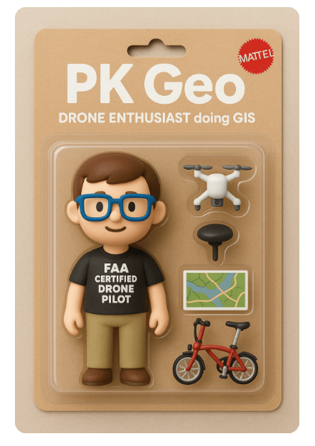
Peter Keum, GISP
WTD Drone Program Lead/ GIS Analyst
How do we use it
&
Future of GIS (Personal View)
& DRONE


CUGOS

Maps


Maps Are Useful!

Maps Are Cool!

Maps Are Beautiful!


Source: Scott Reinhard
Ancient Map - Saint Belec,
Brittany France

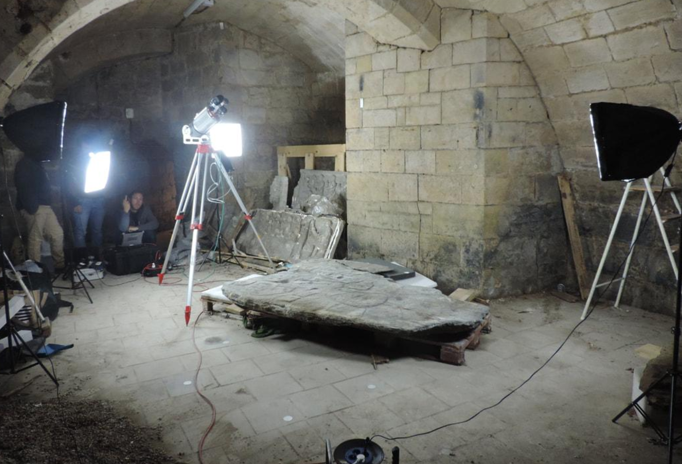
And Maps Have Been Around for Awhile
Maps Tell a Story


John Snow 1854 Cholera Map


Broad Street - City of Westminister, London, England
John Snow 1854 Cholera Map

#1: Water Pump
#2: Work House
#3: Brewery

GIS
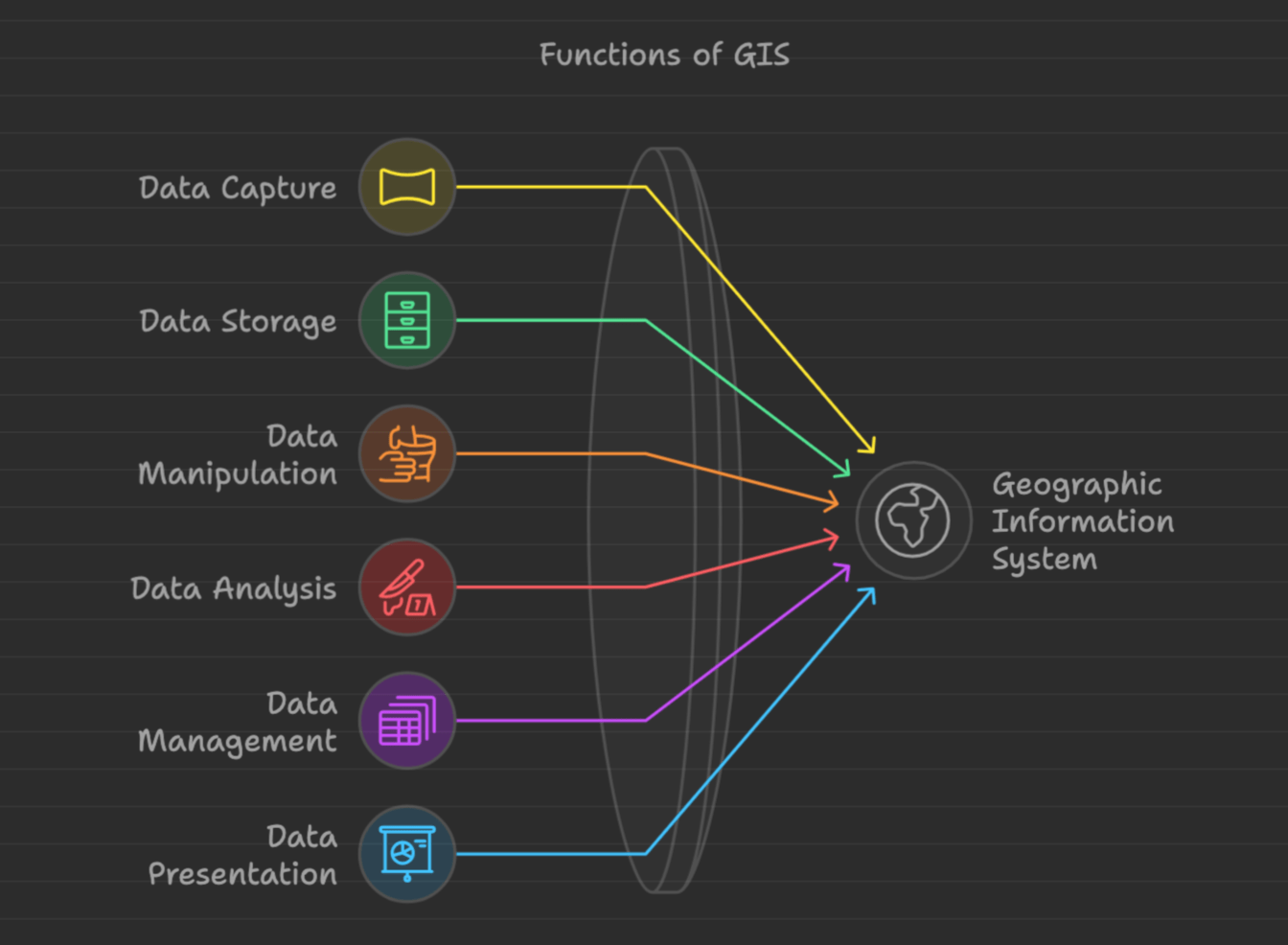
GIS : Geographic Information Systems
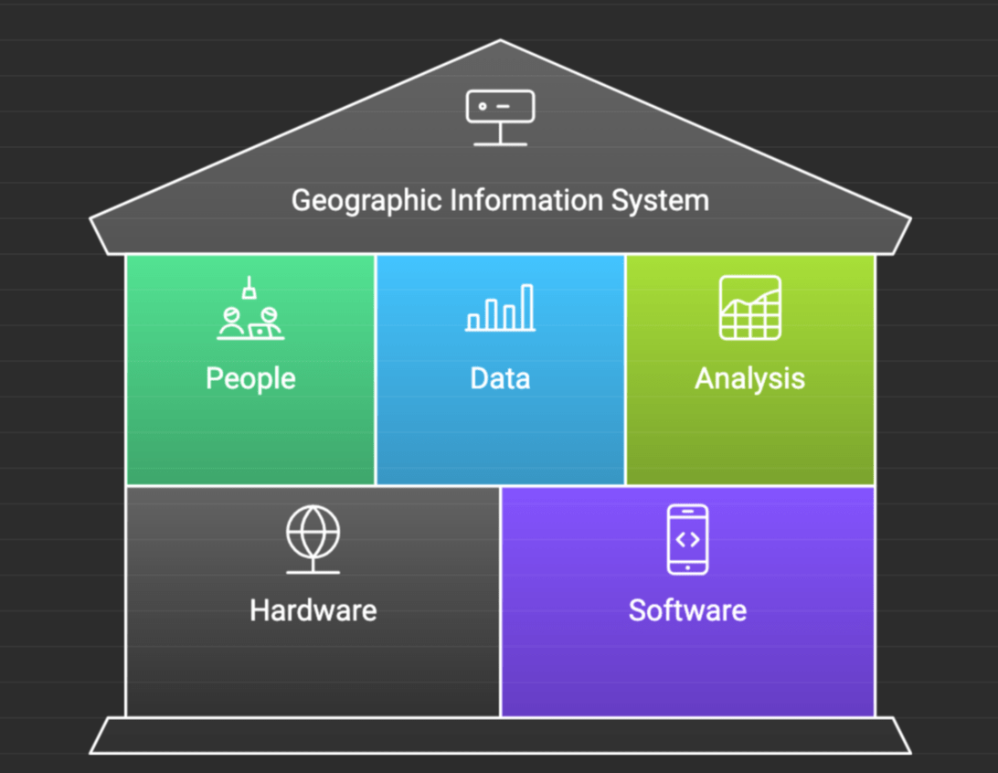
Geospatial Data
- Where?
- What?
- How?
- When?


(GIS Professionals)

Serious Answer

Not So Serious Answers


That's Me :)
Funny Ones

Funny Ones

Why Use GIS?

GIS
Decision Makers
But Be Aware of Dark Side


WTD GIS
How do we use it
& DRONE

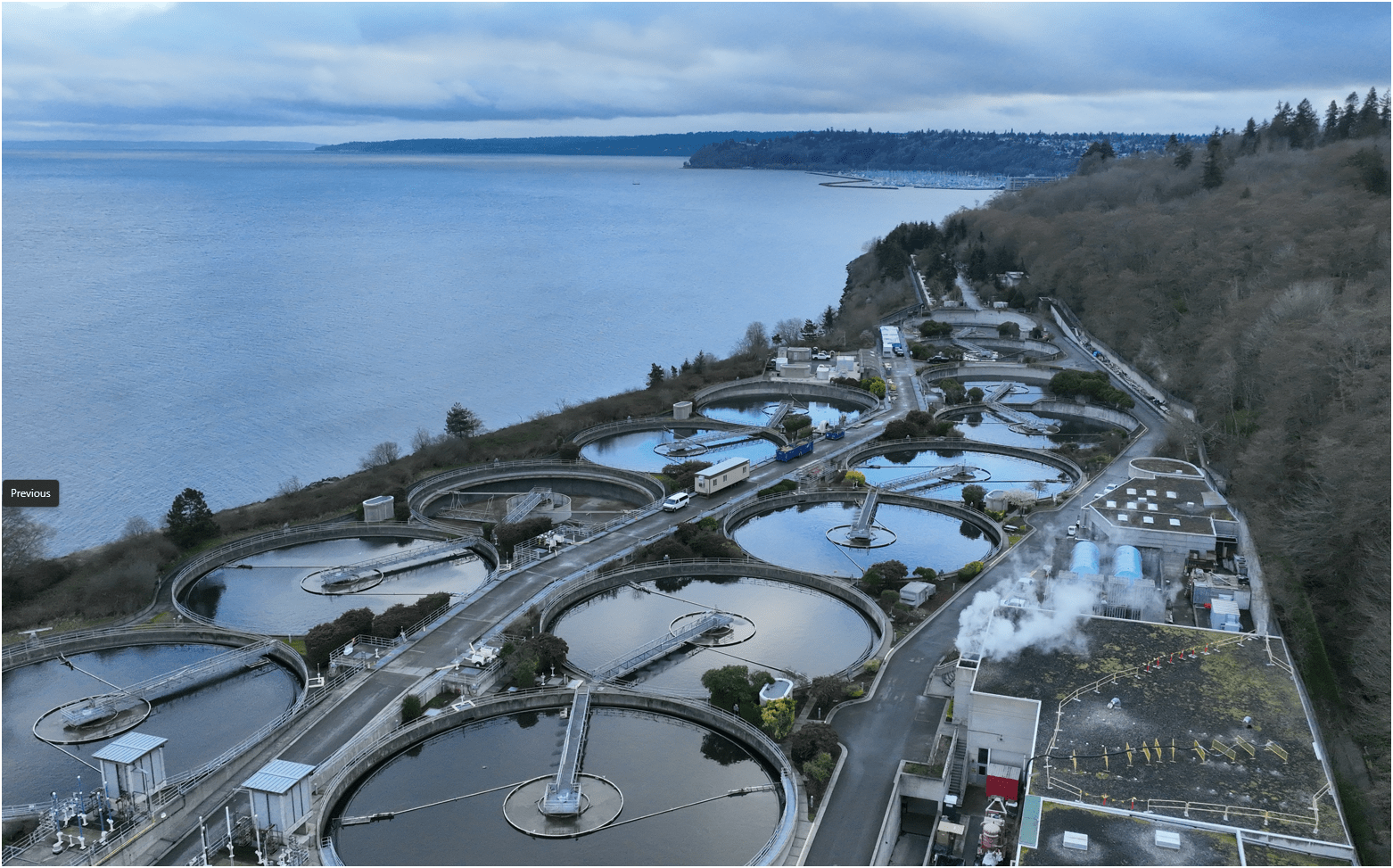
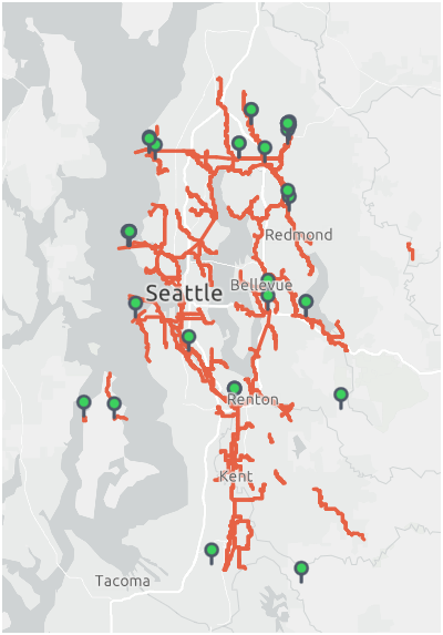
King County Wastewater Treatment by Numbers
-
2 million residents
-
424 square miles
-
383 miles sewer pipeline (2.5 inch to 14 ft)
-
74 facilities (PS & RS)
-
5 Treatment Plants: 180 MGD ~ Max. 900 MGD

Seattle, WA --> Medford, OR

WTD GIS Team
7 GIS Specialists

Supervisor
WTD GIS
Maintain Sewer GIS Data
-
FIRS (Facility Information Retrieval System) Data
- Maintenance Hole
- Pipes
- Pump Stations
- Regulator Stations
- Treatment Plants
- Outfalls
- Flow Monitors
- CP Stations
- Connection Points
- Site Plan Data
- 3D Models
- Drone Collected Data
- .... many many more

WTD
GIS
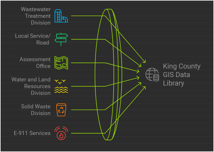
DATA
There are 17 county agencies support King County GIS Data Library System
WTD
Project Support
- Capital Construction Projects
- New Treatment Plants
- New Coneyance System
- Upgrade facilities
- many, many, more...
WTD GIS
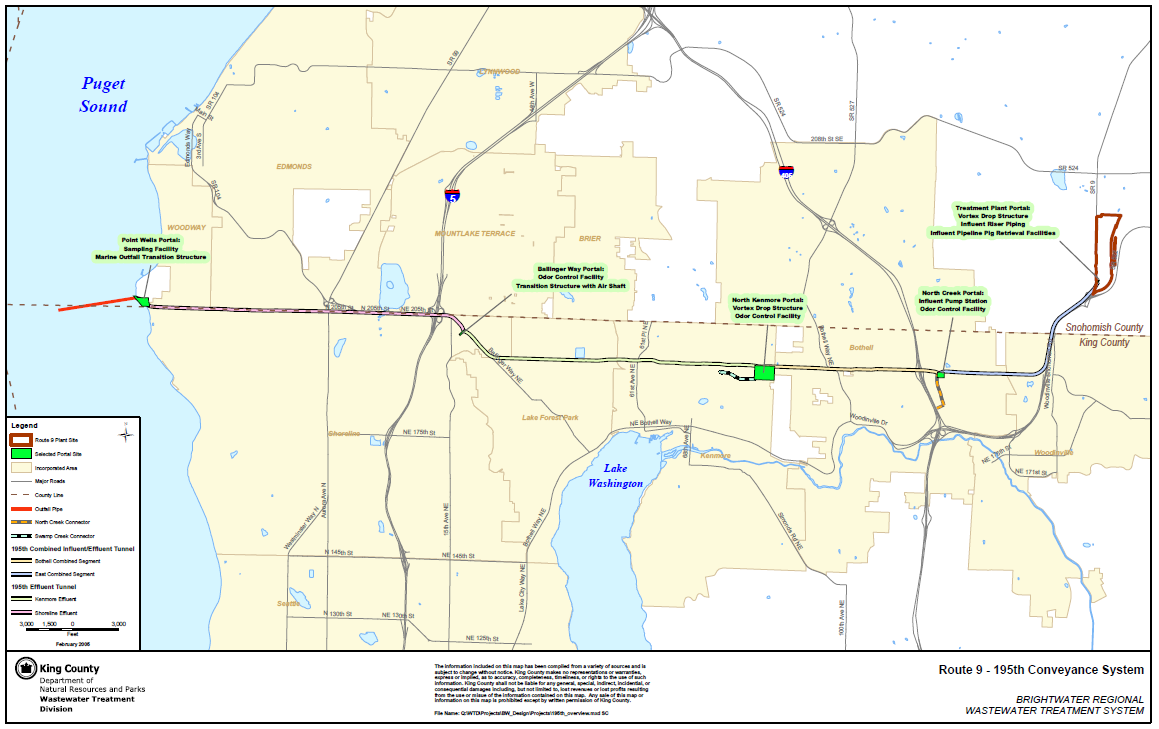
Feb 2005
Rt 9 - 195th (Brightwater) Conveyance System

Impacted Parcel Analysis

Lake Hills / NW Lake Sammamish


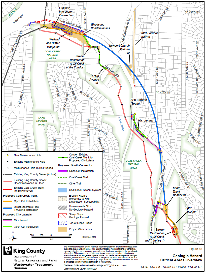
Coal Creek Trunk Upgrade


Georgetown Wet Weather Station


North Mercer Interceptor & Enatai Interceptor Upgrade

Multi-Discipline Data Integration
North Creek Interceptor Sewer Improvement Project

Program Support
- CSO (Combined Sewer Overflow) Control Program
- Modeling Group
- CIFM (Conveyance, Inspection, and Flow Monitoring) Group
- Asset Management Program
- Capacity Charge
- ....many other sections


Program Support
- CSO (Combined Sewer Overflow) Control Program
WTD GIS


KC & SPU
CSO Real-Time Status Viewer
RainWise
Basin Address Look-Up App
CSO Report
Program Support
- CSO (Combined Sewer Overflow) Control Program
- GSI (Green Storm Infrastructure) --> RainWise Program
WTD GIS


Program Support
- CSO (Combined Sewer Overflow) Control Program
- GSI (Green Storm Infrastructure) --> RainWise Program
WTD GIS


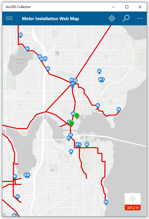
Program Support
- Modeling Group & CIFM Group
Meter Installation Tool

Program Support
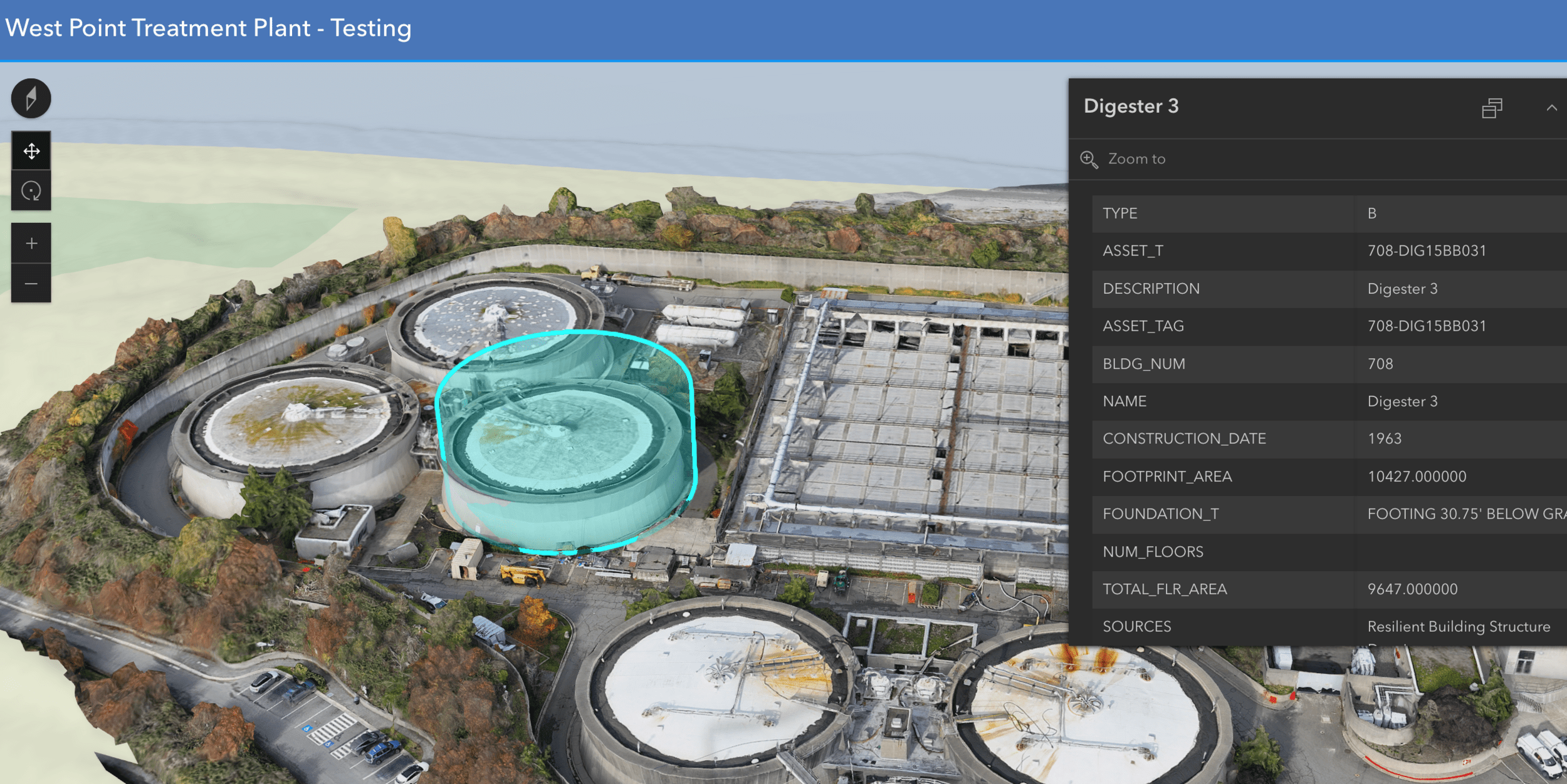
- 3D Modeling Rendering

Program Support
- 3D Modeling Rendering
Program Support
- CIFM (Conveyance, Inspection, and Flow Monitoring) Group

ESJ Support


SVI for Chelan CSO Basin

Program Support


Inspector
"Sewer"
Gadget
How do we use it
WTD DRONE
RPAS as Platform
Multi-rotors
Fixed-wing & VTOL

Shorter flight time (< 45 min)
Cover smaller area
Highly maneuverable
Less expensive
Access to confined spaces
Long flight time (+ 40min)
Covers very large area

(vertical take-off & land)

1. Aircraft + Sensor (Data Collection)
2. Data Processing & Analyzing (GIS)
3. Information Products
=
+


Drone

GIS
Great Combo?
&

1. Platform + Sensor (Data Collection)
2. Data Processing & Analyzing (GIS)
3. Information Products


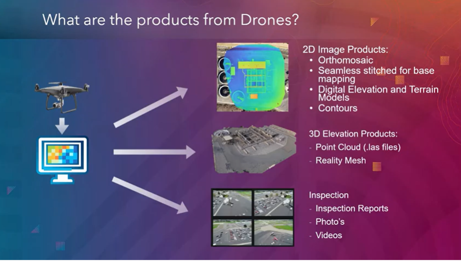
credit: Esri

Information Products
Great combo !
GIS & DRONE


GIS Integration


Summary of KC Wastewater Treatment Division RPAS Program

People
+
Technology
+
Organization
=
RPAS Program
April 2025
Four FAA Part 107 Drone Certified Pilots - WTD GIS Specialists (Jim, Patrick, Joe, and Peter)
Helping other departments to stand up their own RPAS programs


Joe
Outdoor
Indoor
DJI Mavic 2 Pro < $1,800

DJI Mavic 2 Pro Ent. Adv ~ $6,500
DJI FPV w/ Modification ~ $1,300


Mavic 3 Ent
~ $3,800

20 MP/ 56x zoom
20 MP
12 MP/ 32x zoom
+ Thermal


Matrice 4 Ent
~ $5,300


2021
June - Dec.
2023
Jan. - Nov.
Number of Flights
2022
Jan. - Dec.

+ 480 %
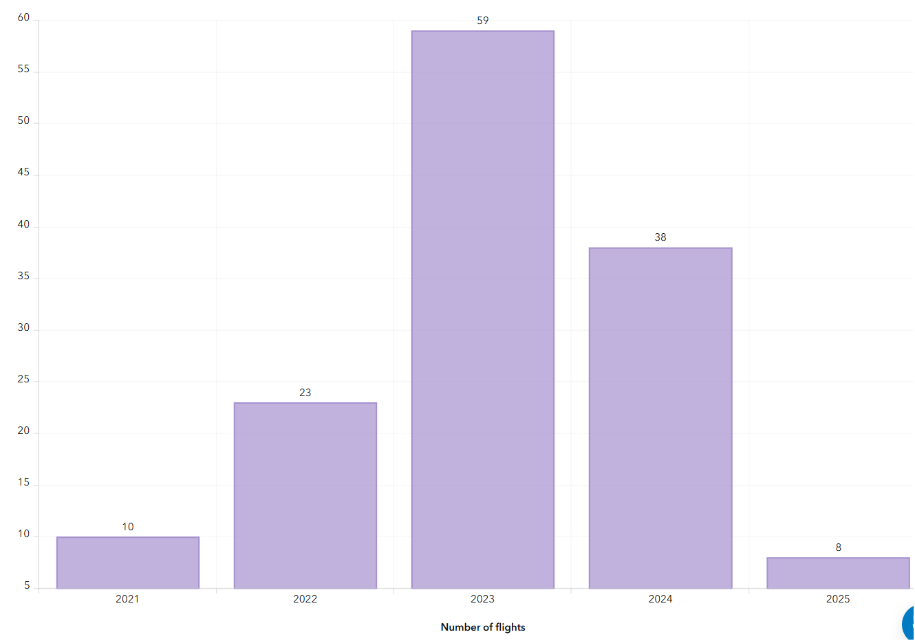

2024
Jan. - Nov.
Why Use Drones?
3 E's
-
Easy
-
Efficient
-
Effective
Why Use Drones?
Easy - Simple with little effort
Efficient - Results without waste
Effective - Producing Results
Why Use Drones?
1. Easy - Simple with little effort

Automatic
Repeatable
Example: Auto flight plan
Result 3D Model
Why Use Drones?
2. Efficient - Results without waste
Safety of staffs
Save Time & $$

Why Use Drones?


South Treatment Plant
Primary Division Channel
Increase Safety for Staff
Why Use Drones?
Increase Safety for Staff


Why Use Drones?
3. Effective - Producing Results


Environmental Monitoring
Examples - Effective
August 2022
March 2022


April 2023
Update 2D aerial map
Examples - Effective

1172 Photos
0.57in/px
Update 2D aerial map
Examples - Effective


0.57 in/px
Sept 2023
3.0 in/px
2021 KC Aerial
Why Use Drones?
Repeatable & Recordable & Searchable
West TP Power Upgrade Site Sept 22, 2022
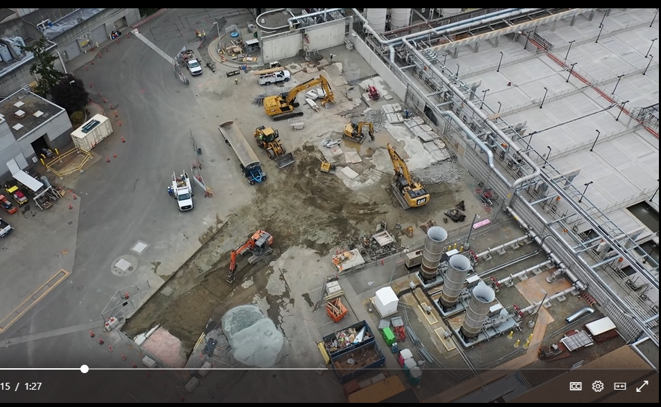
Why Use Drones?
Repeatable & Recordable & Searchable

West TP Power Upgrade Site Jan 25, 2023
Why Use Drones?
Repeatable & Recordable & Searchable
West TP Power Upgrade Site March 25, 2023
Esri 3D Scene Viewer App
poly.cam - West Point TP Digesters
poly.cam - 3D Gaussian Splats
Esri 3D AGO Scene Viewer App - South Treatment Plant
GIS + Vertical/Horizontal Industry (?)
Future of GIS (personal view)

GPT
General Purpose Technology


GPT
General Purpose Technology
Steam Engine
Electricity
Internet
NOT


Generative Pre-Trained Transformer
GPT

+
=

+
=
"GPT always needs complements"
+
=
Urban Planning
+
=
Utilities/Engineering
You
+
=
Social Justice/Equity
+
=
Environmental
Science
GIS
GIS
GIS
GIS
You
You
You
GIS
Companies are using maps not just as nice features but to drive revenue as core components of their offering. Maps are no longer just a good way to visualize content, they are core to competitive advantage.
Companies are thinking more creatively about how to combine location with outside content and internal business data to differentiate products


+
=
YOU
GIS
Just another tool in the toolbox


"First do it, then do it right, then do it better."

Credit: Addy Osmani
Doing is Learning, but...

Doing with mistakes?

It's still learning!
A
B
L

C
Tobin Bradley, Mecklenburg County, NC
Resource Links
Cascadia
Users
of
Geospatial
Open
Source
"A place to learn all things GIS and maps"


- Email Sign-up
- Resources
- Every 3rd Thursday
- ZOOM Meeting
- 165 Members
END
for now
peter.keum@kingcounty.gov


peter.keum@kingcounty.gov
WTD GIS & Drone - Presentation UW GIS Cert. May 8, 2025
By Peter Keum
WTD GIS & Drone - Presentation UW GIS Cert. May 8, 2025
Presentation on to UW GIS Cert. Program on-line students: Objective: 1. WTD GIS and project & data & drone 2. Skills sets to support those items. 3. GIS View - industry overview


