The Sky's the Limit: KC Wastewater Drone Program To Support Sustainable Infrasture.
Peter Keum, GISP
Drone Program Lead/GIS
November 19, 2025
WTD Drone Program
We Came, We Flew, We Mapped..
Peter Keum, GISP
Drone Program Lead/GIS
November 19, 2025

From Buzz to Business
- Where are We Now:
-
- Hardware/Software/Pilots
-
Things We've Done and Doing:
- Integration of Drone with GIS
So Let's Dive in!

King County Wastewater Treatment by Numbers
-
2 million residents
-
34 Agencies
-
424 square miles
-
383 miles sewer pipeline (2.5 inch to 14 ft)
-
74 facilities (PS & RS)
-
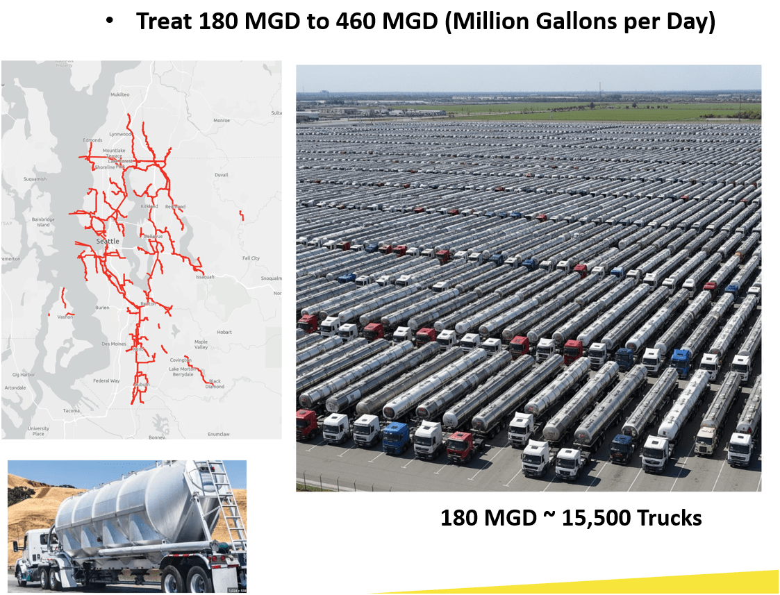
3 Treatment Plants: 180 MGD ~ Max. 460 MGD

Seattle, WA --> Medford, OR
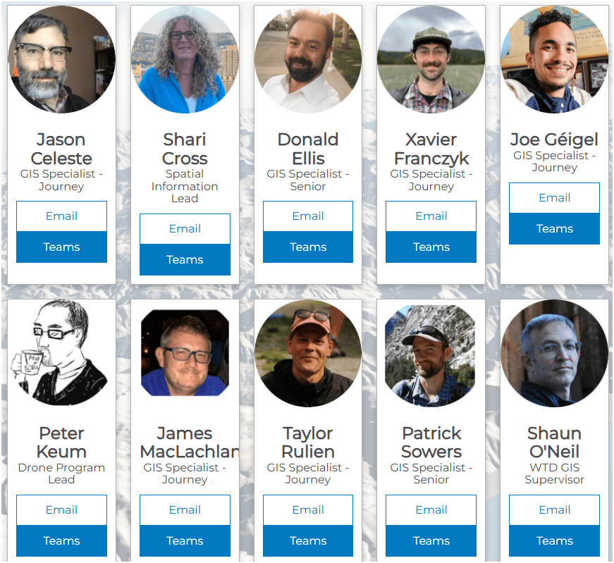
WTD GIS Team
- 10 GIS Specialists
- 4 FAA Certified Pilots
Supervisor
KC Wastewater Treatment Drone Program

People
+
Technology
+
Organization
=
Drone Program
Building Drone Program
S3E3
NOT
R2D2

Building Drone Program
S3E3
-
Easy
-
Efficient
-
Effective
-
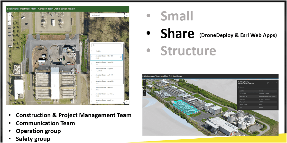
Small
-
Share
-
Structure
WHY?
- Ensure Continous Operation
- Support Capital Delivery & Maintenance
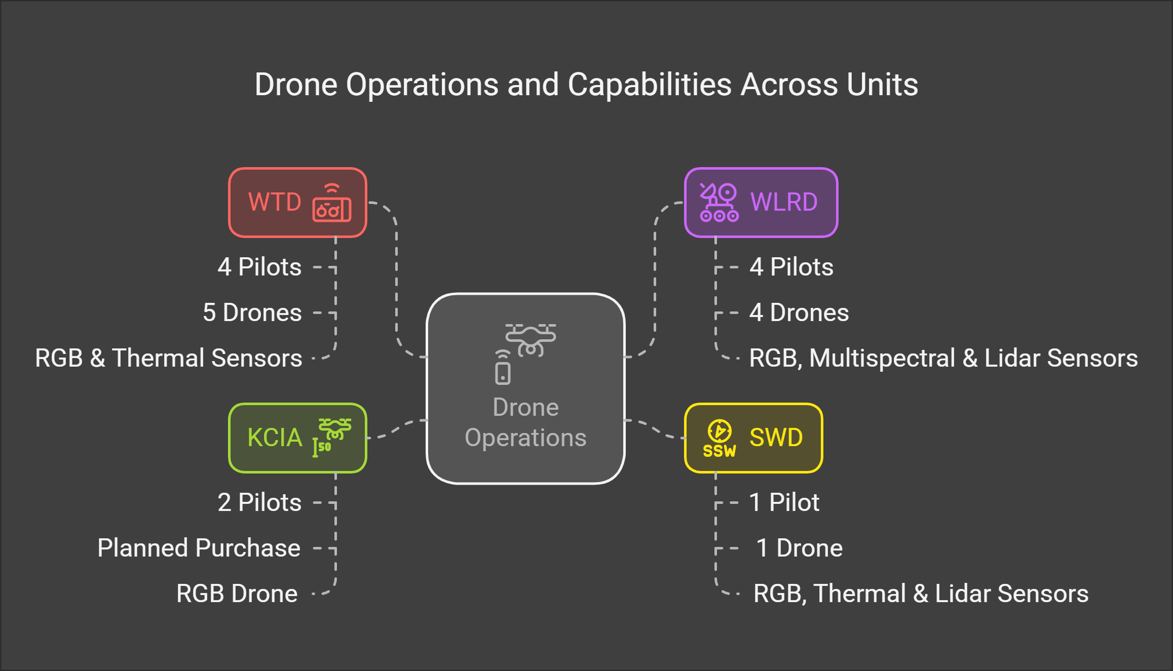
WTD GIS Drone Program
November 2025
- Four FAA Part 107 Drone Certified Pilots - WTD GIS Specialists (Jim, Patrick, Joe, and Peter)
- Assisting other departments to stand up their own drone programs (WLRD/ SWD/ Local Service/ KCIA/ FMD)


Joe
DJI Mavic 2 Pro (1)

Mavic 2 Ent. Adv. (1)

Mavic 3 Ent (2)


2021
2022
2023
Matrice 4 Ent. (1)
2025
Total: ~ $27,000
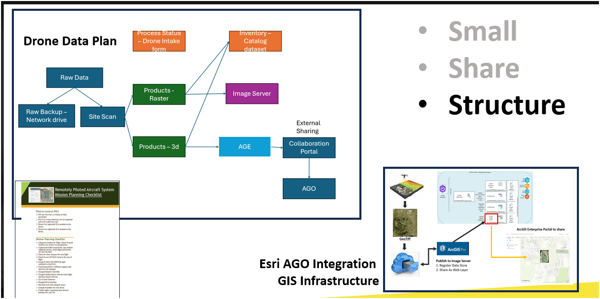
-
Small
-
Share
-
Structure
S3
Wish List Hardware :-)

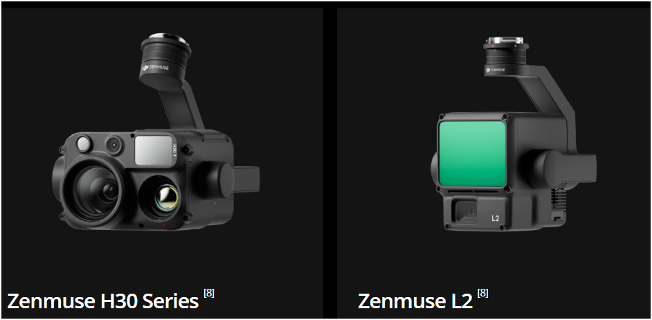
$11,000
All WEather
RGB Camera
~ $10,500
Lidar Sensor
~ $ 17,500
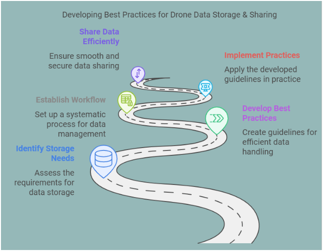
Standard Drone Workflow


AND

S3
S3
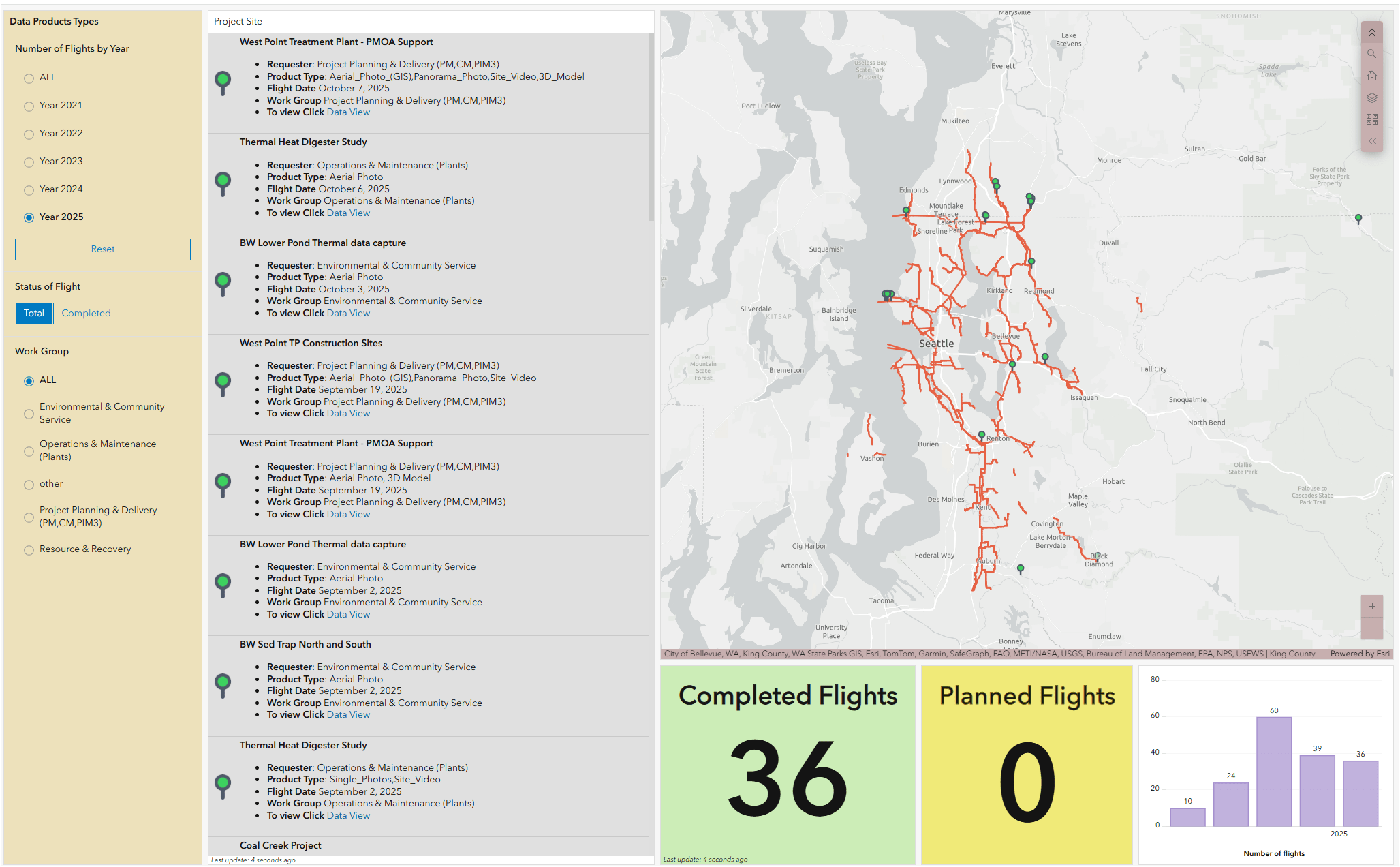
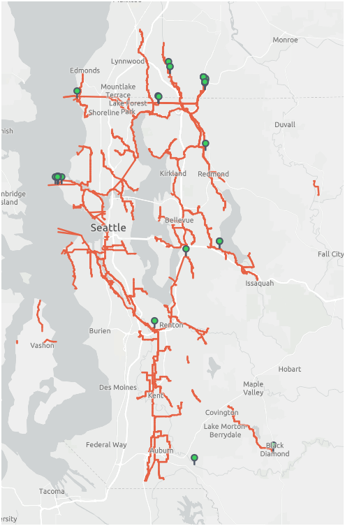
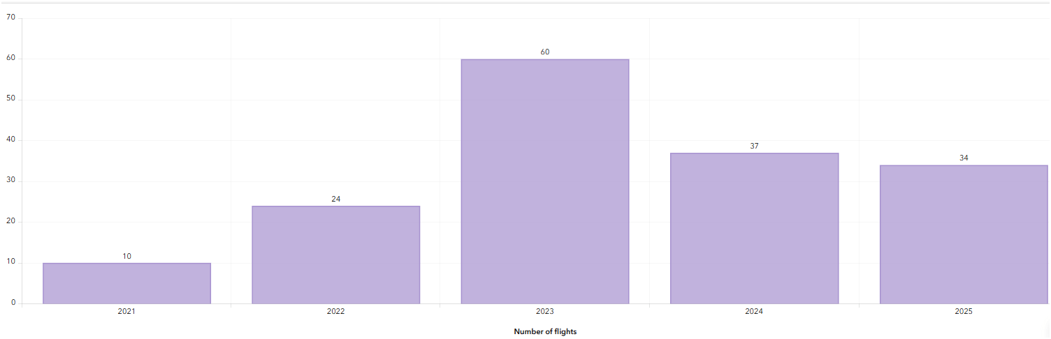
WTD Drone Dashboard


2021
June - Dec.
2023
Number of Flights
2022

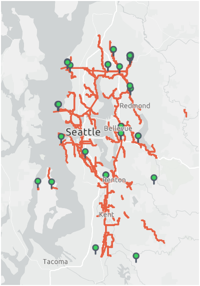

2024
2025
Jan. - Oct.

From Buzz to Business
Quick History-
Where are We Now:Hardware/Software/Pilots
-
Things We've Done and Doing:
- Integration of Drone with GIS
Building Drone Program
S3E3
-
Easy
-
Efficient
-
Effective
-
Small
-
Share
-
Structure
Why Use Drones?
1. Easy - Simple with little effort

Automatic
Repeatable
E3
Flight Control App
- Automate Flight Planning - Fly Consistently for overlapping images
- Can fly manually but it's like mowing with scissors


Why Use Drones?
2. Efficient - Results without waste
Safety of staffs & Save Time & $$

E3
Inspecting Inside Digester (2024)
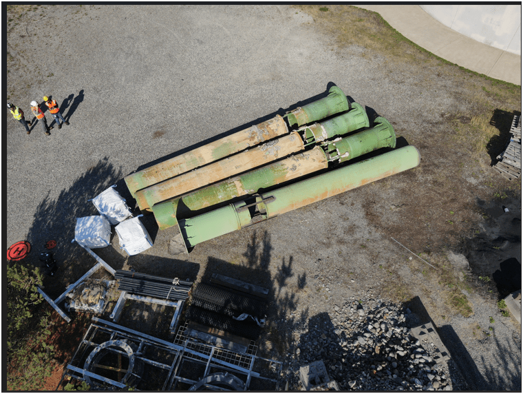
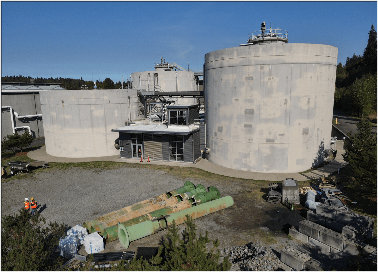
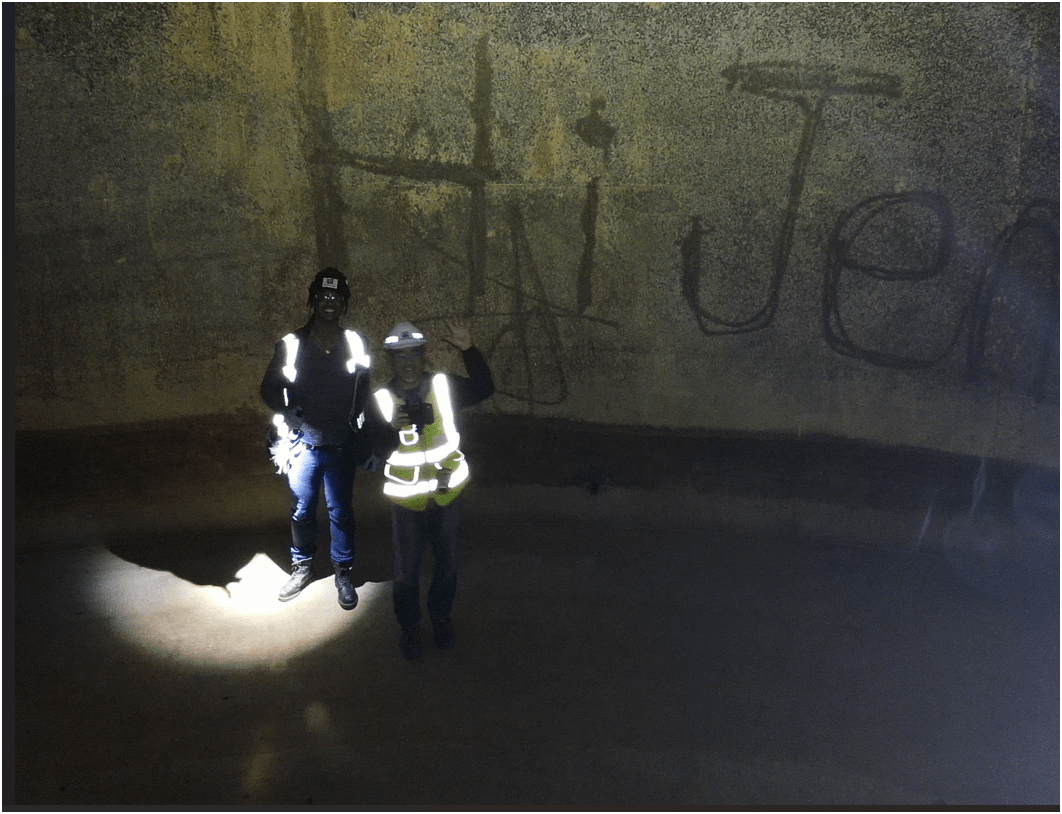
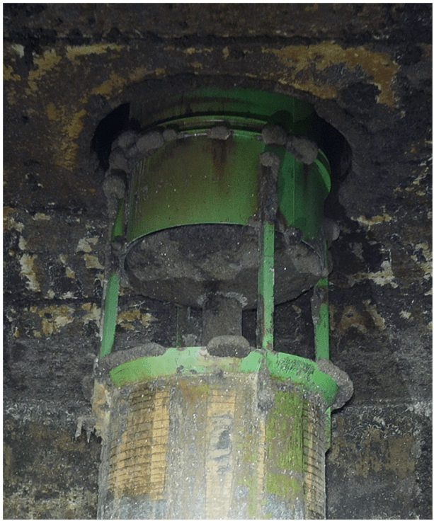
Inspecting Inside Digester
2. Efficient - Results without waste
Safety of staffs & Save Time & $$
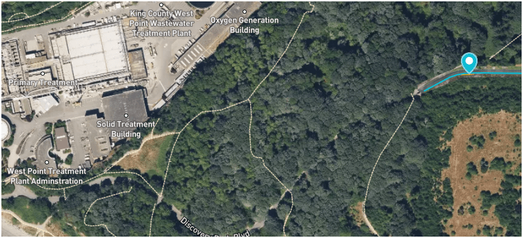
West Point
Treatment
Plant
Discovery Park
Blvd
Dec 2024
E3
Why Use Drones?
3. Effective - Producing Results


E3
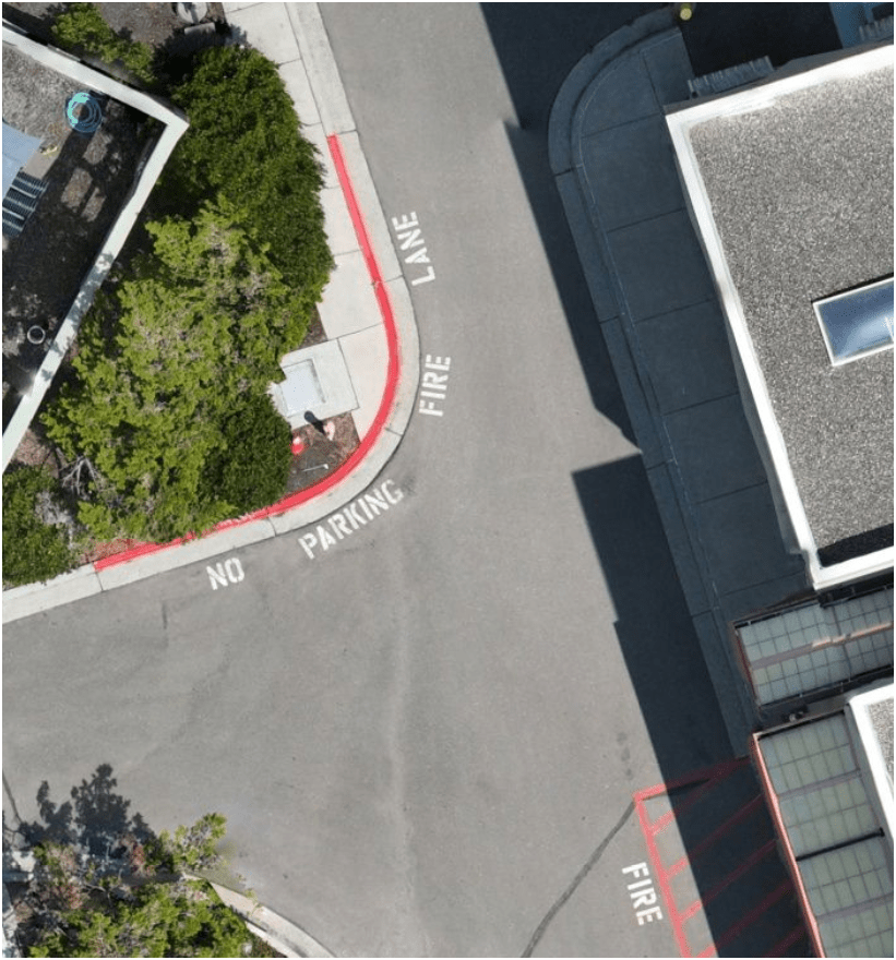
- Update 2D aerial map

0.57 in/px
Sept 2023
3.0 in/px
2023 KC Aerial
3. Effective - Producing Results
E3
0.50 in/px
June 2025
6x time the resolution
(from KC Aerial Imagery - June 2025)
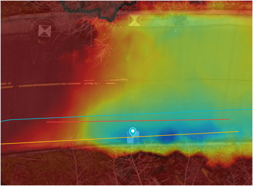
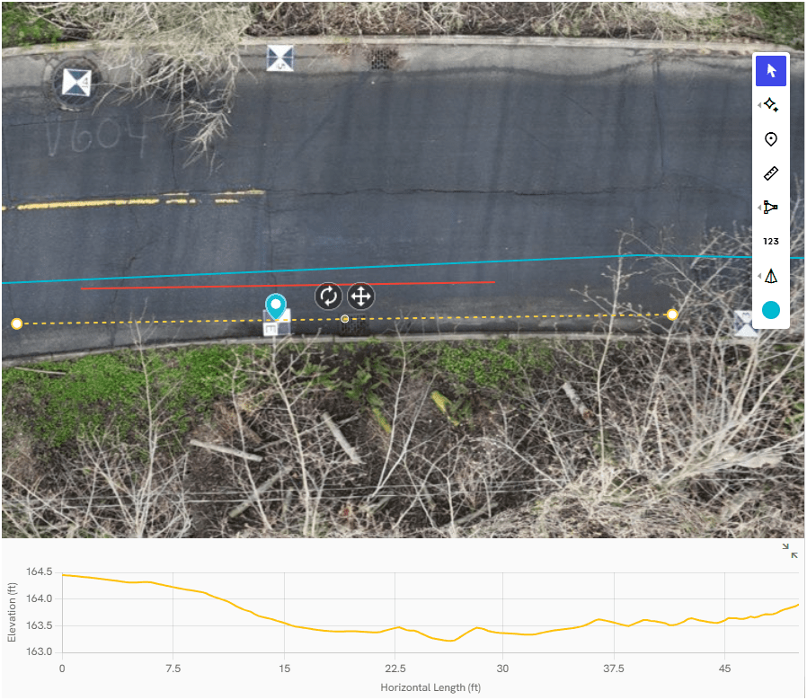
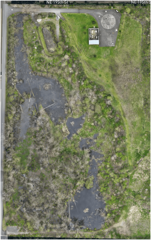
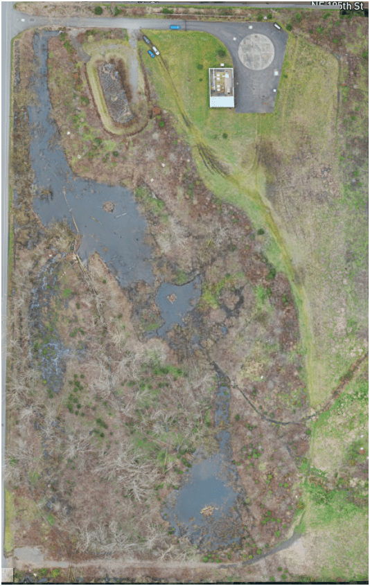
- Monitoring & Mitigation (ECSS)
March 2022
April 2024
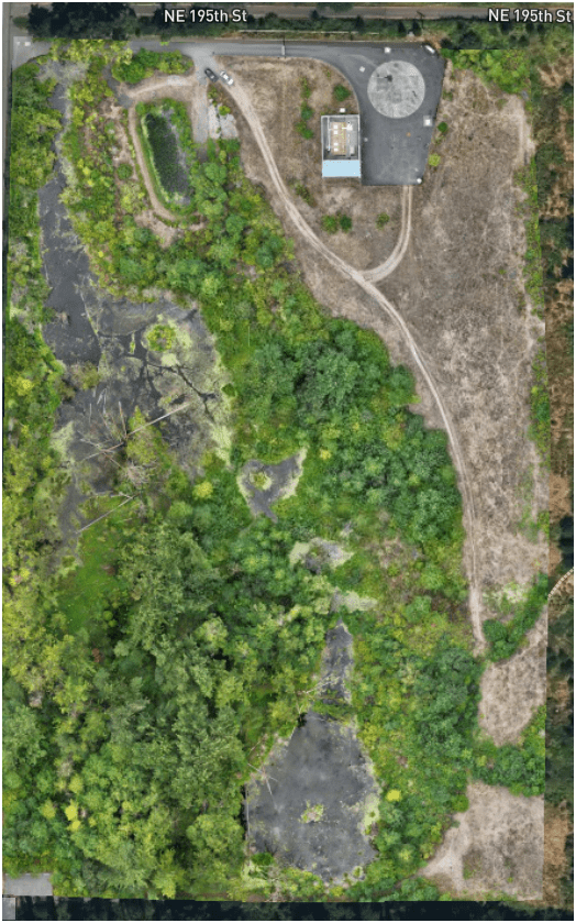
August 2025
3. Effective - Producing Results
E3
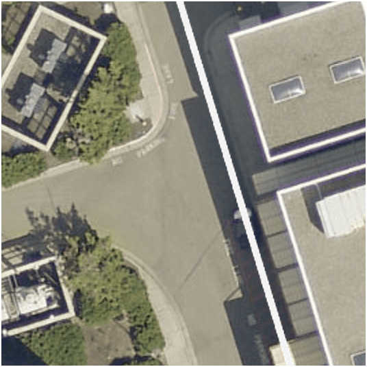
- Construction Site Monitoring
3. Effective - Producing Results
E3
- Construction Site Monitoring
3. Effective - Producing Results
E3
Ship Canal Water Quality - TBM
3. Effective - Producing Results
E3
Heat Resource Recover - Energy District (Dexter Ave)
3. Effective - Producing Results
E3
Examples - Integrating with GIS
Examples - Integrating with GIS
Examples - Integrating with GIS
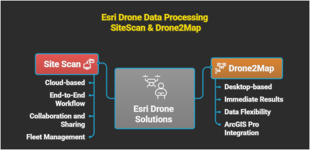
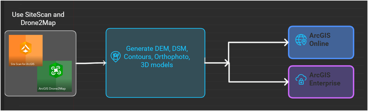
Integrating Drones with KC GIS
Proof Of Concept
Lidar SLAM Handheld Unit

WHOA!
Just another tool in the toolbox

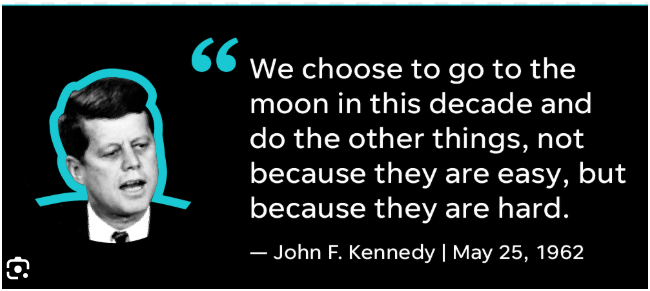
Famous Original Quote
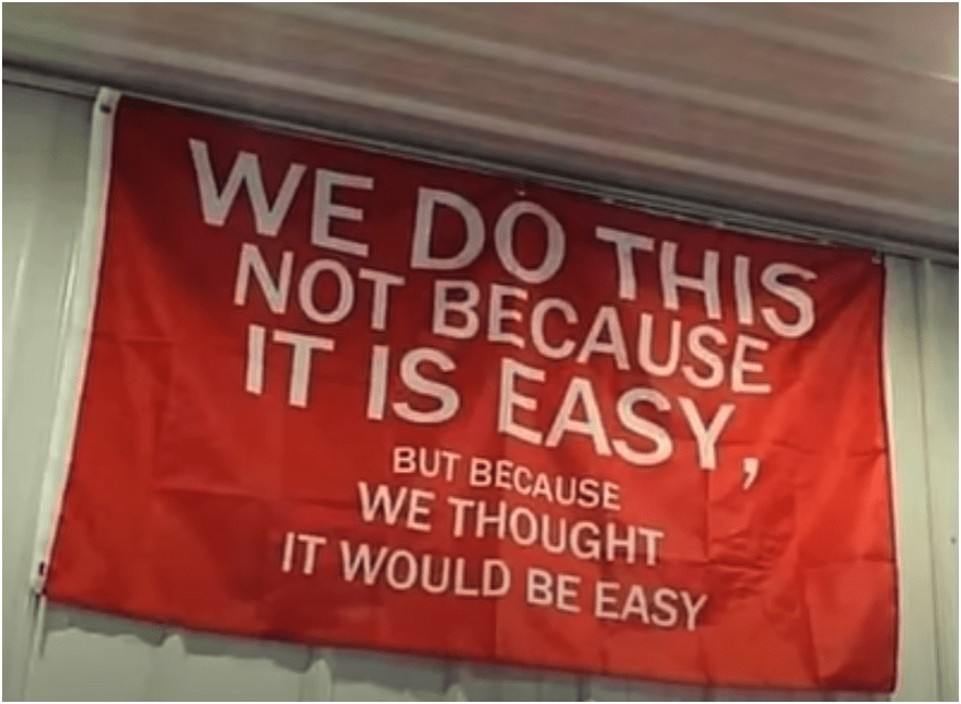
They Both are RIGHT!
1.1

END
for now
Thank You
peter.keum@kingcounty.gov

peter.keum@kingcounty.gov
GIS Day Nov 2025 - KC WTD Drone Program Status
By Peter Keum
GIS Day Nov 2025 - KC WTD Drone Program Status
Presentation for 2025 KC GIS Day - Current WTD Drone program status - where are we now..


