(a
Nice
To
Meet
You
presentation)
THE CONTEXT
(where we are and why we are here?)
EO - IT
(Earth Observation - Information Technology)
Largest European Network in the field of Earth Observation
International Studies - Prototypes - Operational Applications
Technology Transfer from Research to Industry
Competence Center for the National System of Civil Protection
The Topic
(what is the matter we are facing?)
Activities involving spatial data
Environmental Planning
Resources Monitoring
Emergencies Management
Fleets Management
GeoFencing
...
... So we NEED
Maps
... So we Produce
Maps
... So we Browse
Maps
... and we query
Maps
RELATED ISSUES
(what people need to deal with maps?)
we need: DATA
from all possible sources


we need: Interoperability
Standards
Everywhere delivery/fruition
Cooperation

we neeD: Application Logic
putting data together can't be enough

we neeD: Business Intelligence
use data for spatial report and decision support

What we Do
(activities, products and knowhow?)
SPATIAL DATA INFRASTRUCTURES
that means
Big and Scalable HW/SW architectures for:
Geospatial Data Preparation and Collection
Geospatial Service Delivery
Web Application for Geospatial Analysis
# Using onlyOpen Source Solutions and Technologies
Just an example of SCHEMA
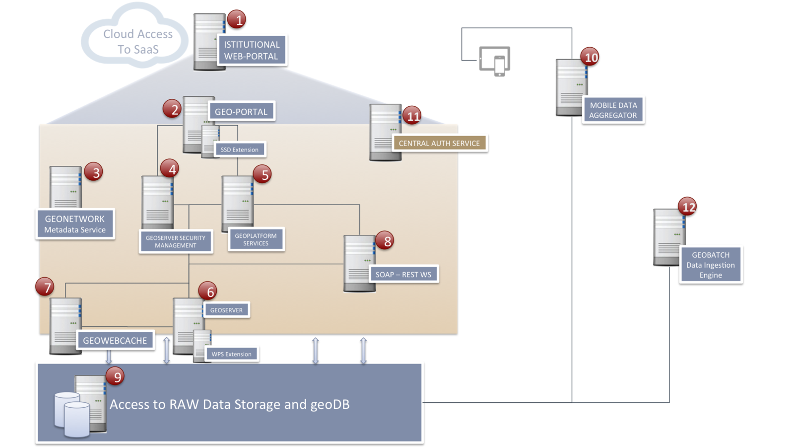
JUST AN EXAMPLE OF SCHEMA
We can notice:
Many components involved Many Applications Many Services A look inside

Geospatial data PREPARATION ...
RAW data must often be
normalized
:
we use powerful tools for
data pre-processing
GEOSPATIAL DATA PREPARATION ...
Spatial Reference System TransformationGeo-rectify File format ConversionData Ingestion from acquisition stationInterpolations...
... & Collecting
clustered geo-database with:

GeoSpatial Service Delivery
Scalable Clustered OGC Compliant Server Infrastructure
(WMS, WFS, WCS )
with:

Geospatial Analysis performing
Rich Web Applications built with:
Extensible framework
Want new features? Add a widget!
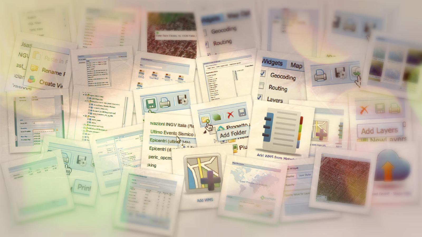
Widgets Example
Map Widget
Manage the map control (Zoom, Pan, Layer ordering)
Layer Tree Widget
Organize your layers
Add Layer Widget
Select layers from WMS list
Upload Widget
Add your local shapefile or Geotiff Widgets Example
Manage Users Widget
Create / Edit / Delete Users
Manage Roles Widget
Assign privileges to users (can do this - cannot do this)
Styler Widget
Compose custom themes for layers
Manage Projects Widget
Many map projects for every user
Web Process Service Widget
Activate server side elaboration process passing parameters and obtain spatial results (geometries and new layers)Widgets Example
Attribute Filter Widget
Apply filters on Features values and show on map only the filtered geometries
Time Filter Widget
Reproduce Time Series with PLAY/PAUSE controls
Geocoding Widget
Search a location and Zoom to somewhere
Feature Editor Widget
Edit data (geometries & attributes) directly on map
???
Widget
Any other specific job can be implemented by a new widget!SCREENSHOTS!

A GLOBAL UI VIEW OF A GEO-PLATFORM BASED APPLICATION 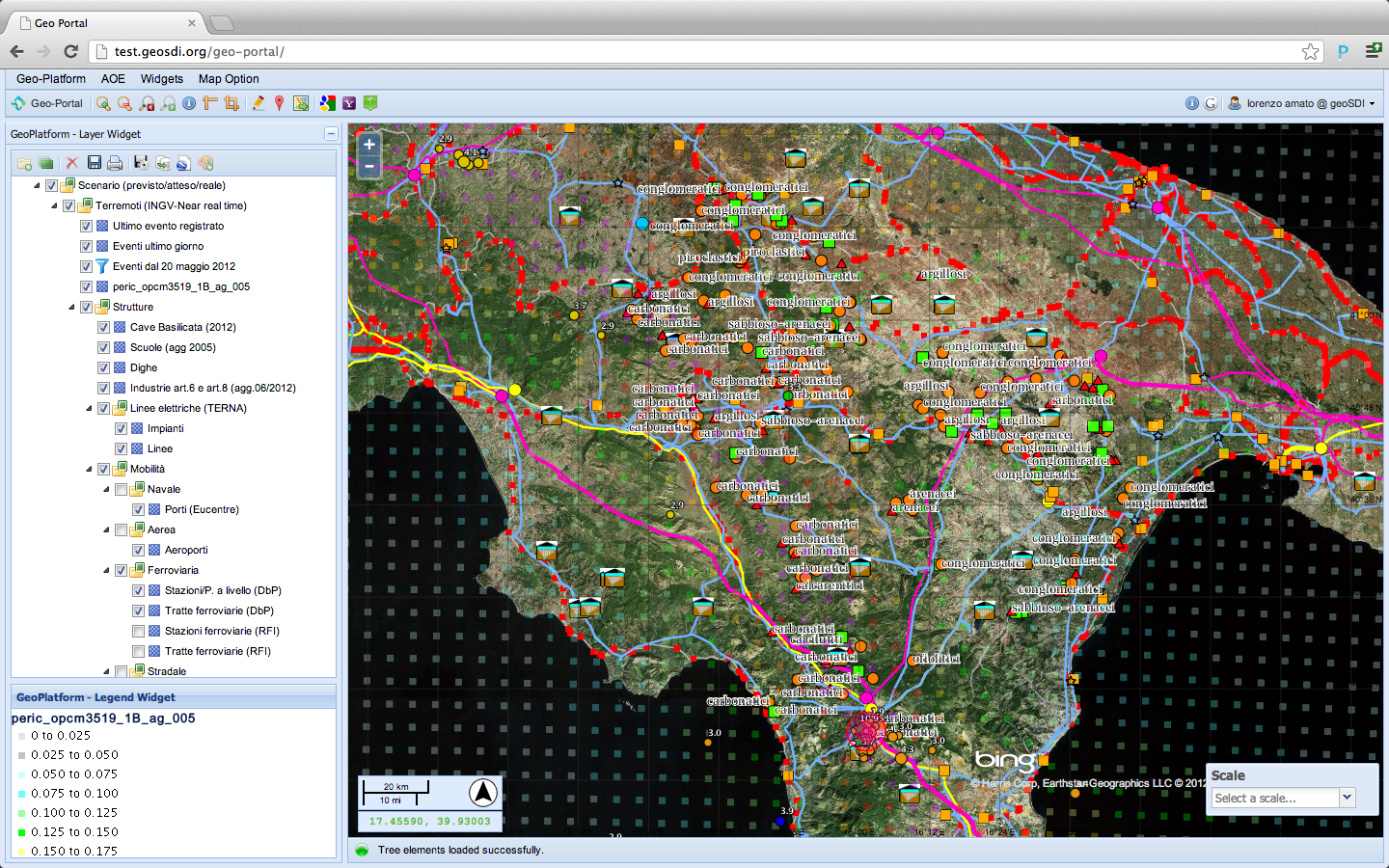
BASE MAP SELECTION WIDGET 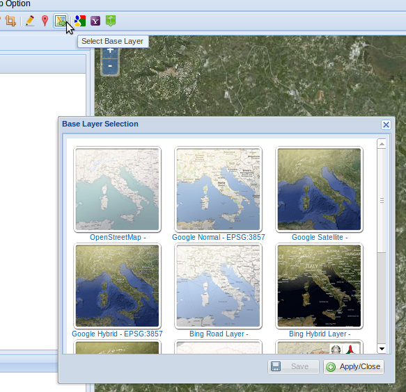
WEB DRAG & DROP LAYER POSITIONING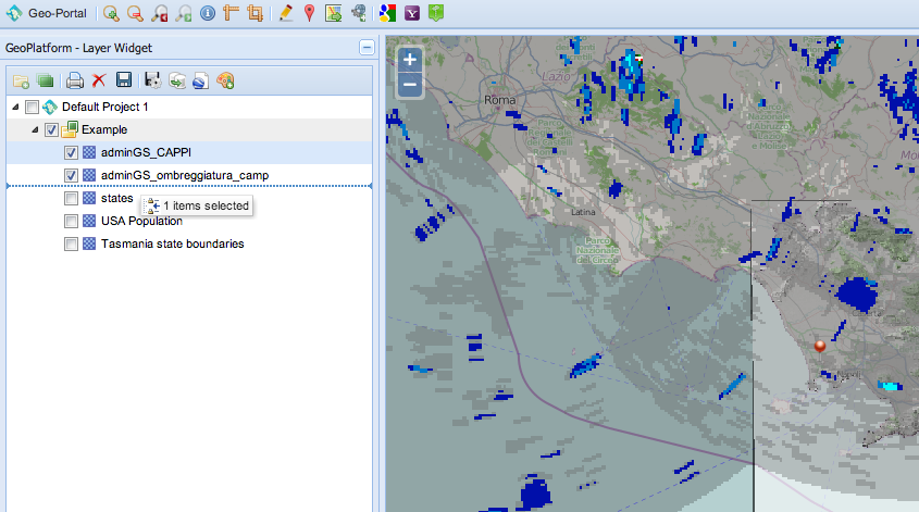
CUSTOM STYLER WIDGET (1)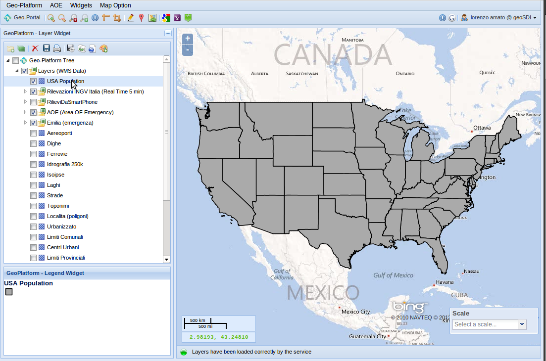
CUSTOM STYLER WIDGET (2)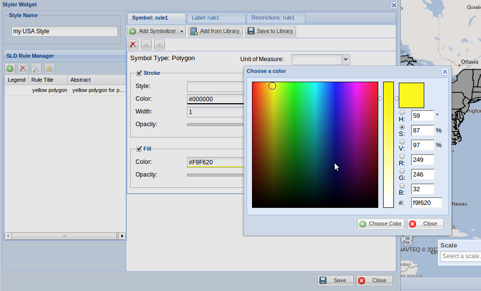
CUSTOM STYLER WIDGET (3)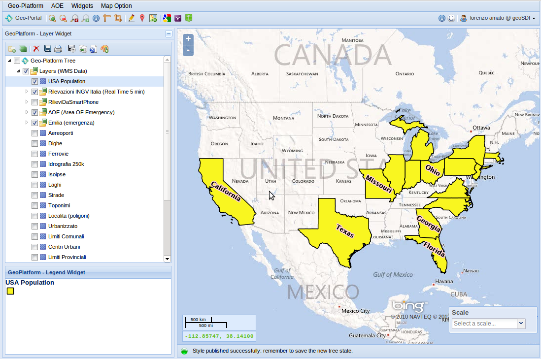
DYNAMIC DATA MONITORING
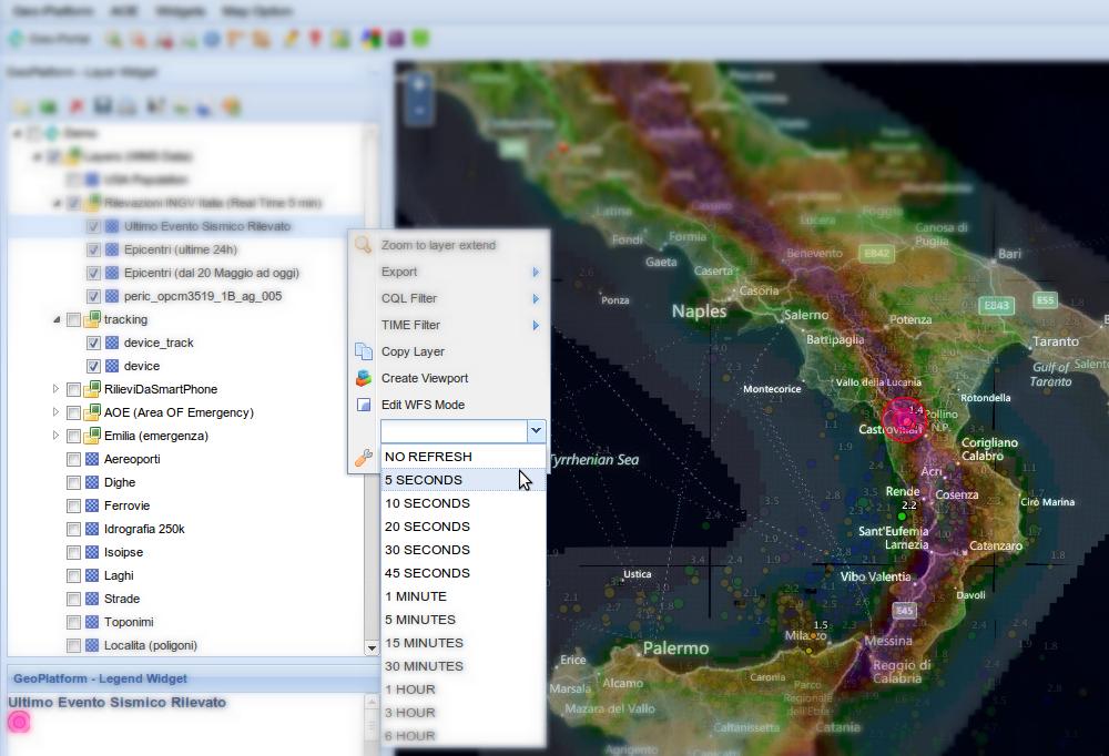
TIME SERIES REPRODUCTION (1)

TIME SERIES REPRODUCTION (2) 
TIME SERIES REPRODUCTION (3)

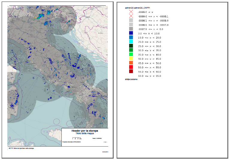
MAP PRINT WIDGET (1)
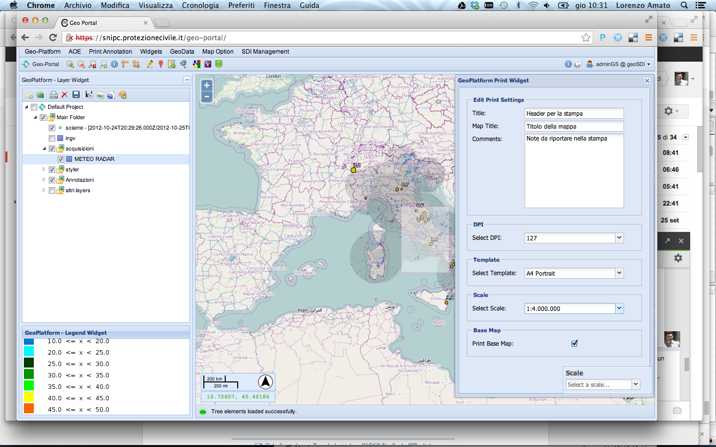
MAP PRINT WIDGET (2)
WFS-TRANSACTIONAL FEATURE EDITING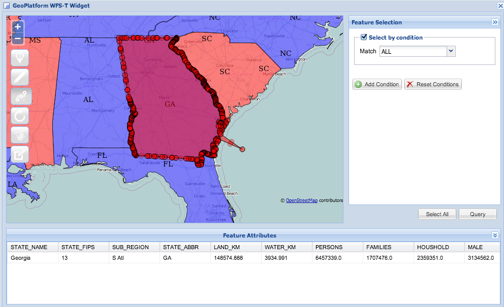
Some Examples
(Is there any actual application?)
Italian NAtional CIVIL PROTECTION
INFORMATION About
Federate System
20 Regions (Functional Centers) 27 Scientific Competence Centers Many Foundations Many Universities
Some Important Cases
(National/ International Management)
(National/ International Management)
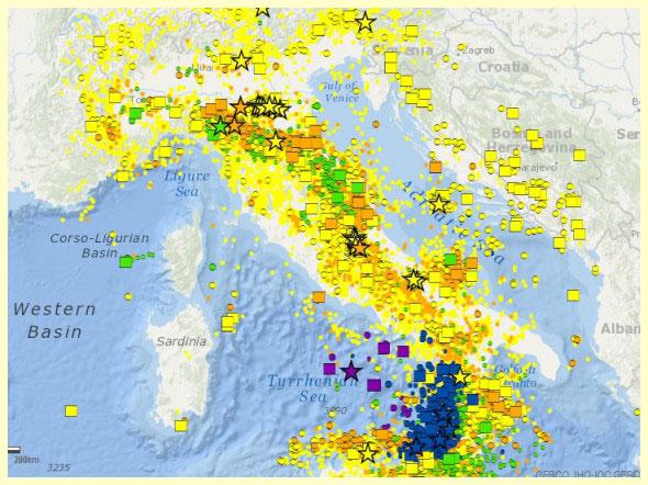
L'Aquila Earthquake - 2009 G8 Summit - 2009 Haiti Earthquake - 2010 Emilia Romagna Earthquake - 2012 Flood in the province of Modena - 2014 INTERESTING FEATuRES
CAS (Central Authentication Service) - SSO WPS (Web Process Service) Interfaces Metadata Catalog Integration Easy and Fast Upload of Local Data Online geoData Rectify & Transformation tools Data Ingestion from seismic and weather stations
... screenshot of a SEISMIC EMERGENCY SIMULATION map project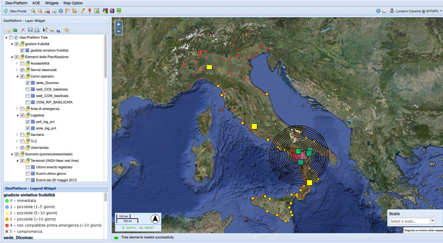
EUROMED PPRD SOUtH
(Programme for the Prevention Preparedness and Response to Natural and Man-Made Disasters)
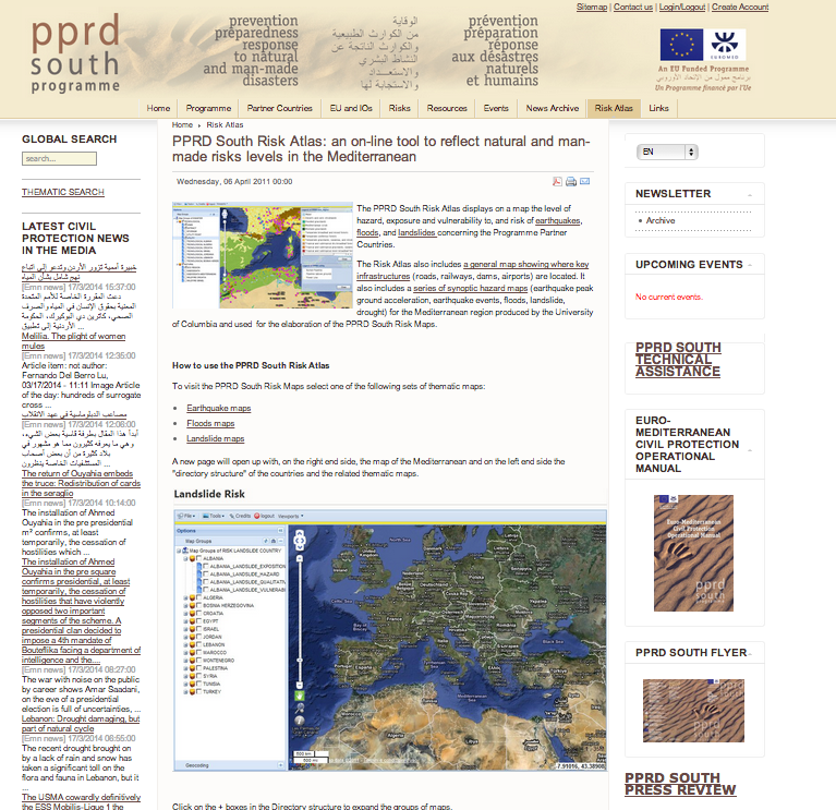
INFORMATION About
14 Mediterranean Countries involved
Albania - Algeria - Bosnia & Herzegovina - Croatia - Egypt - Israel - Jordan - Lebanon - Montenegro - Morocco - Occupied Palestinian territory - Syria - Tunisia - Turkey International projects on
Flood Risk Earthquakes Risk Landslide Risk UN-World Food ProgramME
INFORMATION About
Food Assistance
to more than 97 million people in 80 countries
3.7 million tons of food30 ships, 50 aircraft and 5,000 trucks INTERESTING FEATuRES
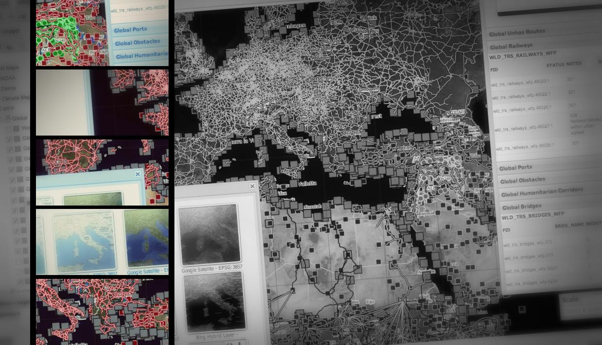
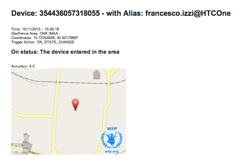
Fleet Monitoring (Tracking using GPS Android mobile App) Fleet Management Center (Device registration, Geofencing area definition, user lists for alert notification) GeoFencing (Alerting System when a vehicle transits in a geographic area) 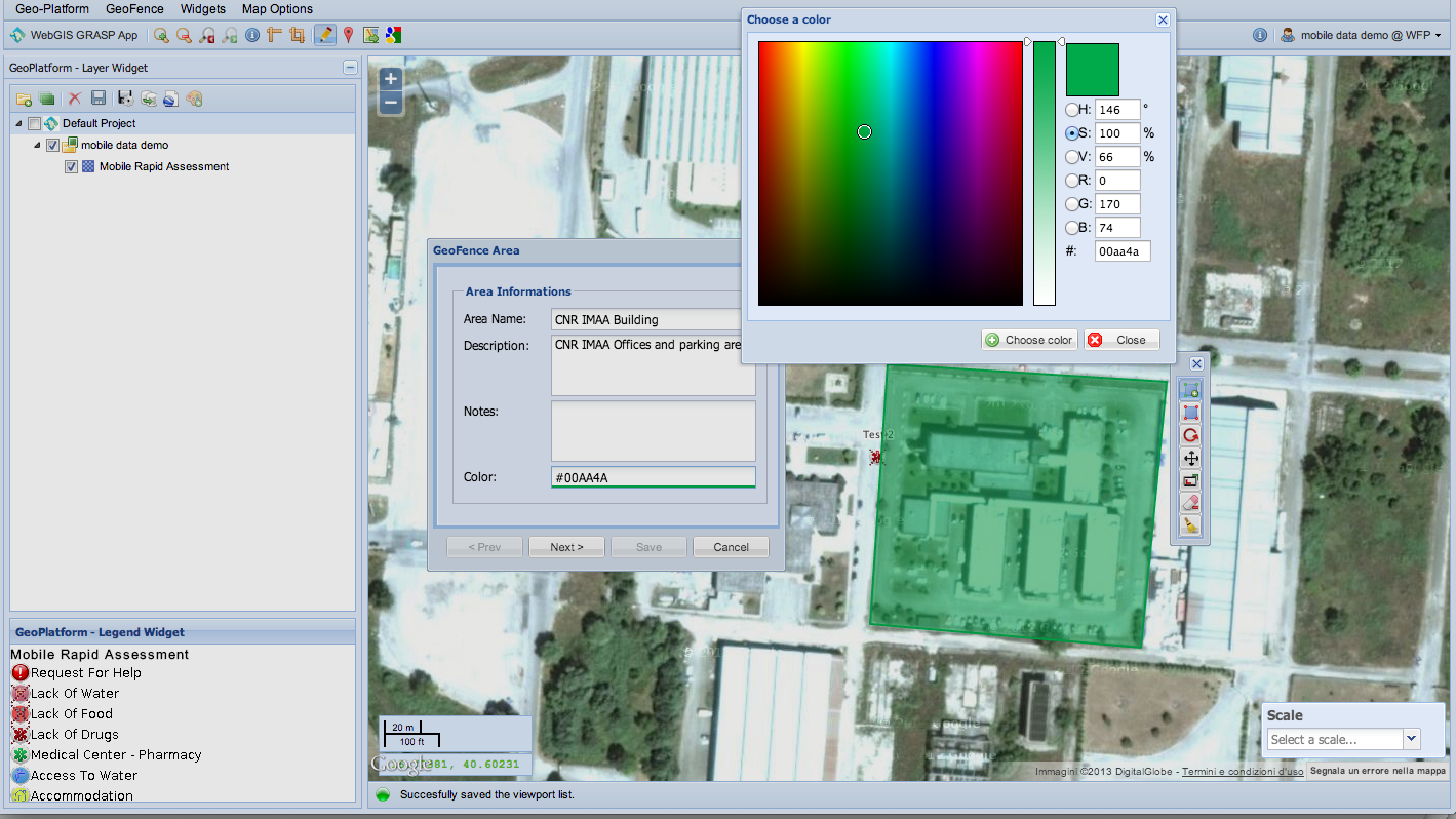
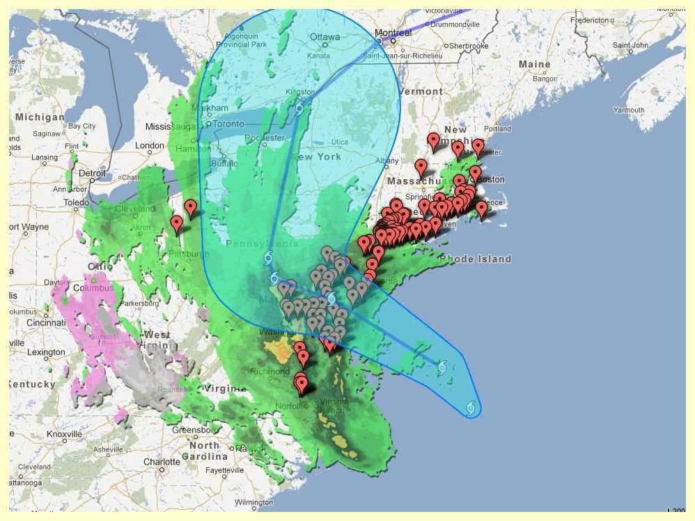
Typhoon Haiyan
Builded ScenarioMGCP DATA from Australian PartnerPortrayal Service Replication in OGC SLD Standard
Various Data Sources
UN Word Food Programme (WMS layers)EU Copernicus Management Services – previowsly GMES (geoRSS layers)JRC (raw data uploaded on a dedicated geoSDI geoServer)MGCP (raw data uploaded on a dedicated geoSDI geoServer)Open Street Map Community (daily updates cached in geoSDI geoServer)Google & Bing Providers Base Maps
Military IGM Data + MGCP Data 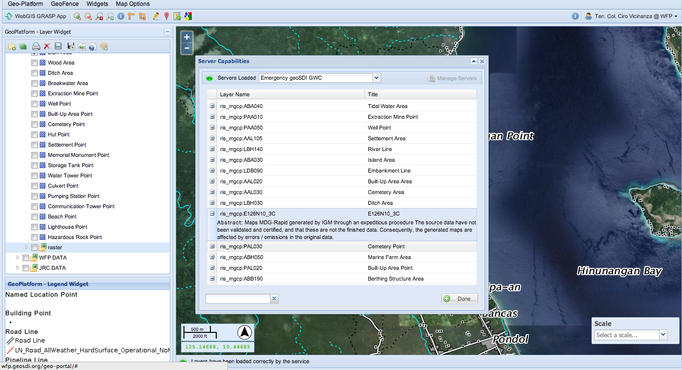
Another screenshot: Military IGM Data + MGCP Data 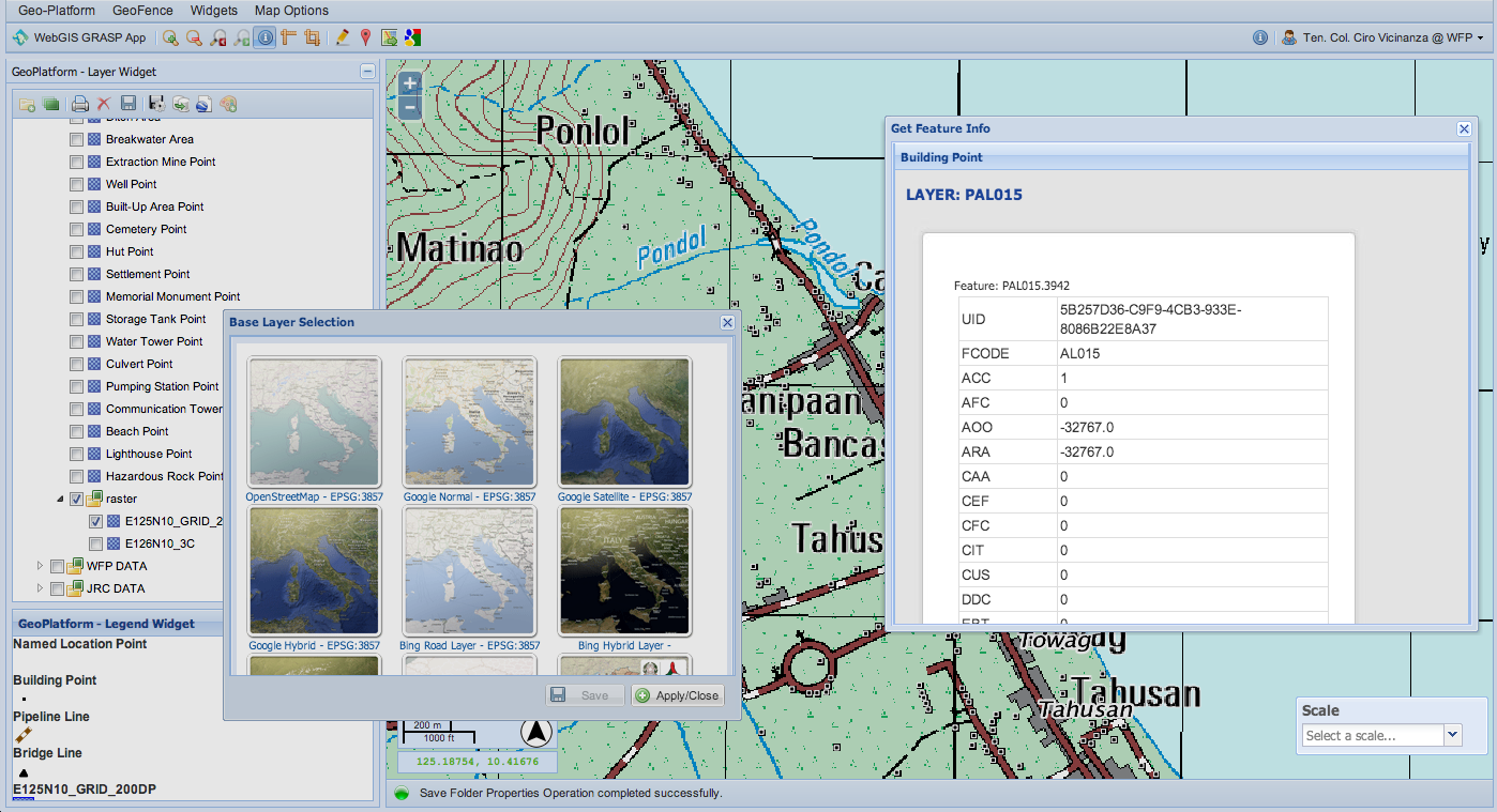
Military MGCP Data + Digital Globe Google Post Event Map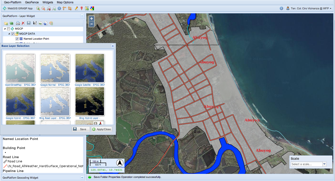
Portrayal Rendering using OGC SLD standard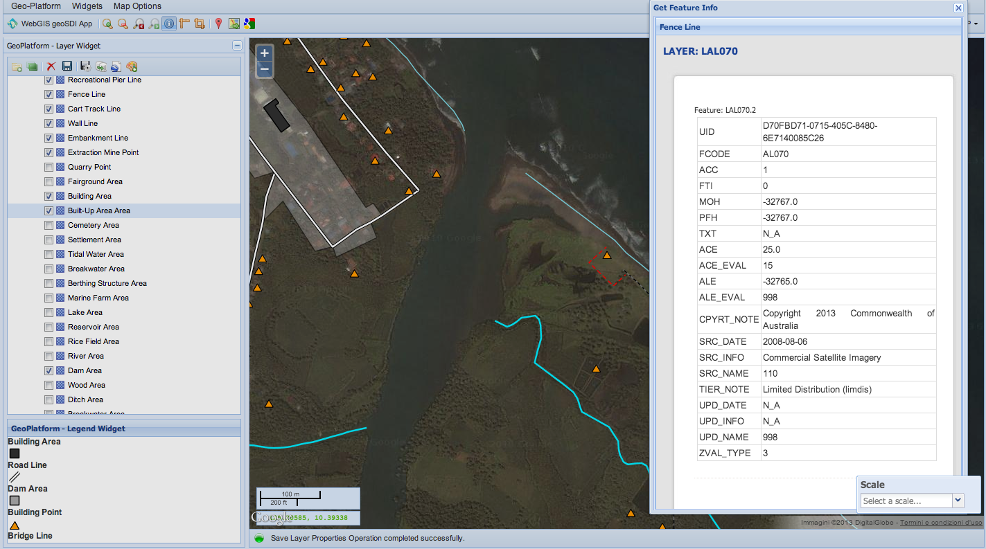
national military research
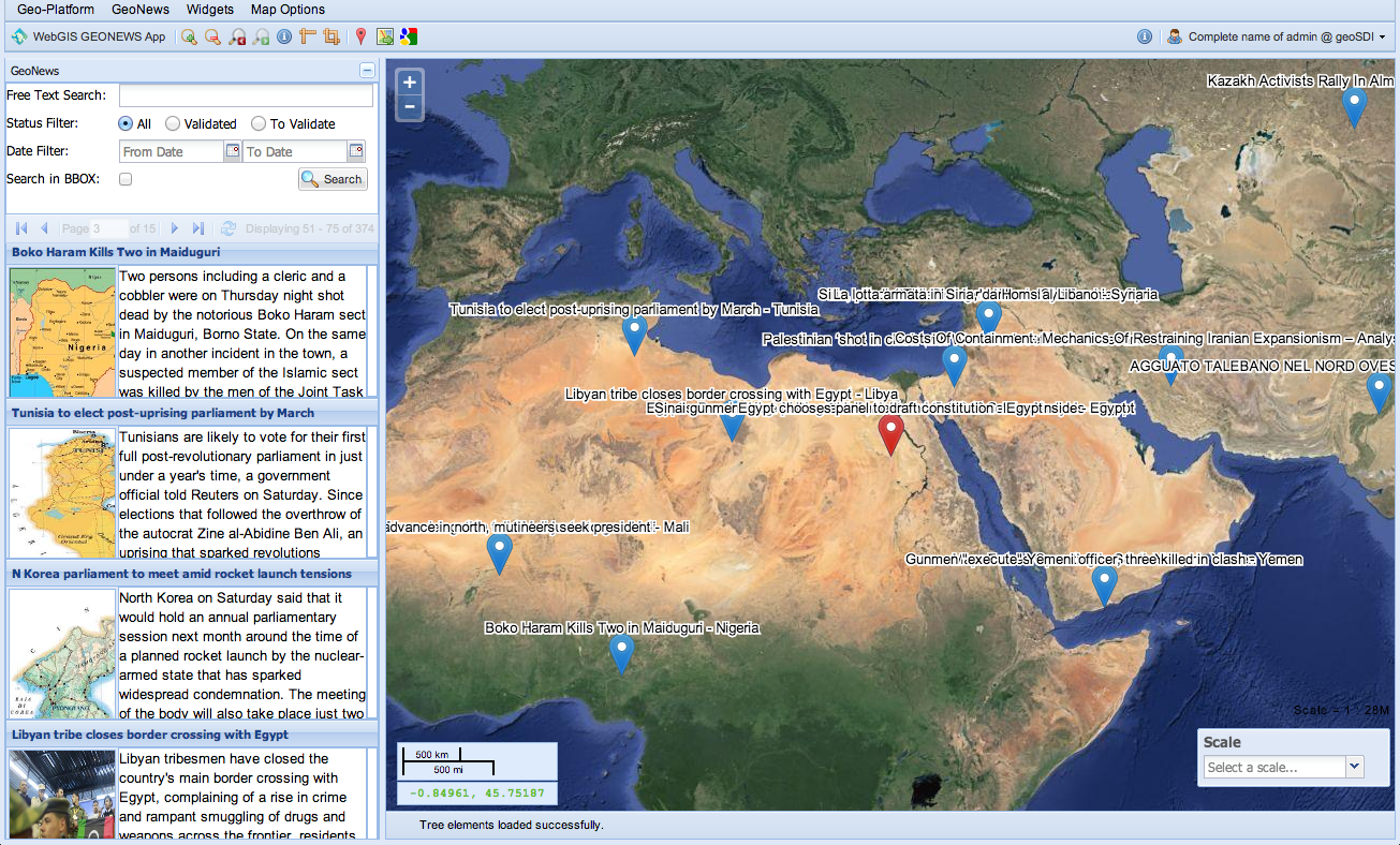
Intranet Spatial Data Infrastructure Integration with OSINT System
(Open Source INTelligence)Elasticsearch Engine for geo-indexing of News 
Let's Demo
(Sounds great. Can we try it?)
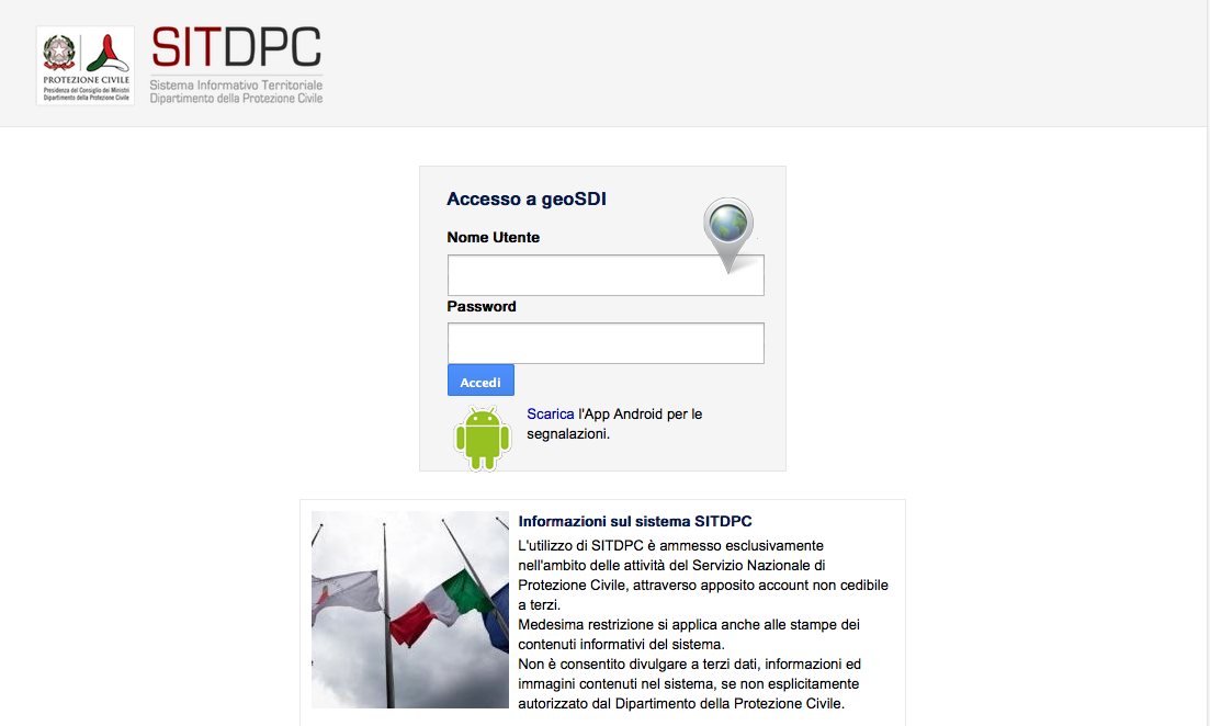
SNIPC
https://snipc.protezionecivile.it/
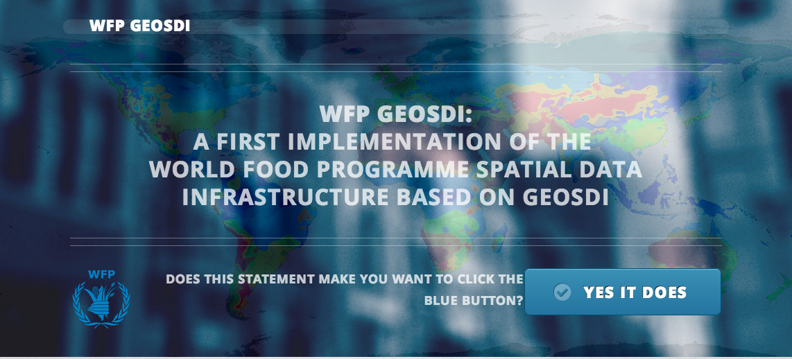
WFP
http://wfp.geosdi.org/
(mgcpdemo mgcpdemo)
INTEGRO
(VPN connection; demo data)
geoSDI
By lorenzo_amato