Data Sharing and Publishing...
HISTORICAL & ReaL-Time
http://slides.com/rfarren/oceanwise-data-publishing/live
-
What do we mean by publishing data?
-
Publishing data - traditional methods
-
Publishing data - web services
-
Case Study (Ocean Database GeoServer & OpenLayers)
- Publishing historic and real-time data
- Publishing non-spatial data
- Publishing re-purposed map outputs
in this presentation:
http://slides.com/rfarren/oceanwise-data-publishing/live
What do we mean by publishing data?
Exporting Data?
Styling data to create a map?
Making data available (sharing)?
Producing meaningful metadata?
Making data searchable so it can be found?
a combination of all of these?
From data - to published data
Data
Map
+ Styles
Crown Copyright 2014 - Not to be used for navigation
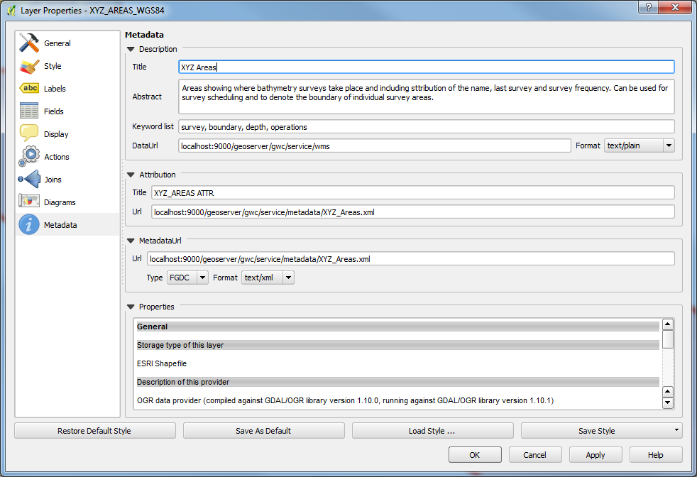
From data - to published data
Map
Useful Map
+ Metadata
Crown Copyright 2014 - Not to be used for navigation
From data - to published data
Useful Map
+ Open Formats
GeoJSON
SpatiaLite
GeoTIFF

Useable Map
Crown Copyright 2014 - Not to be used for navigation
GeoJSON
SpatiaLite
GeoTIFF
From data - to published data
Useable Map
Searchable
Accessible
- Data Registers
- URI's - Linked Data
- Search Engines
- File download services
- Online data portals
- Web Services (WMS WFS WCS)
Published Data!
Data
Data + Styles = Map
Map + Metadata = Useful map
Useful Map + Open Data format = Useable map
Useable Map + Searchable + Accessible = Published Map!
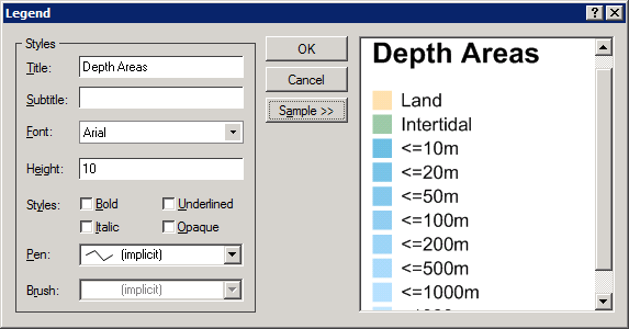
The data publishing pyramid
Does a PDF document count as published data?
YES!
...
...
but...
to be truely published it needs to:
- contain or reference appropriate metadata
- be searchable (this means online)
- be accessible (this means online)
Publishing data - traditional methods
Spatial
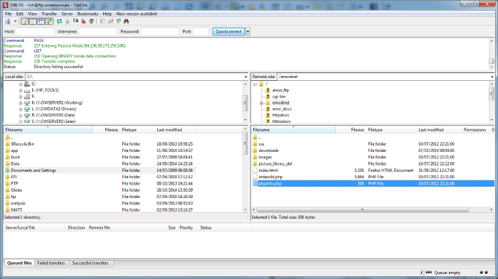
FTP
CD-ROM / USB drive
Published data links

http://mysite.com/data/mydata.json
http://mysite.com/metadata/mydata.xml
Publishing spatial data - web services
What are they?
- Standardised ways to deliver spatial data content via the web, as a response to url requests.
- The most common are: WMS, WFS, WCS
How can I use them?
- By entering a valid url request in a browser
- By embedding a web service client within a web page
- Using GIS software
=
Publishing spatial data - web services
Here is a GET command for a WMS:
Publishing spatial data - web services
What's so good about web services?
- Access data as needed - directly into the application for which it will be used.
- Link to the data directly from the metadata / data register / website.
- Control who can access the data and how + who can edit and who can view.
- Update data effortlessly and seamlessly
I want one - can I get my own?
YES! Publishing data with web services is easy
now
Case Study - Ocean Database and Geoserver
Using Geoserver to publish a variety of spatial datasets from Ocean Database and consuming them using OpenLayers
- An open source package to host web services
- Recognised and supported by the OSGeo community
- Makes it easy to produce/manage web services
- Driven by a simple web interface
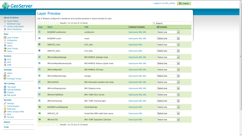
What is GeoServer?
Case Study - Ocean Database and Geoserver
What Data?
A variety of slow-changing and real-time data provided by ABP Southampton including:
- Bathymetric survey data
- Designated survey areas and currency
- Designated dredge areas and schedules
- Mooring areas
- Real-time envionmental monitoring data
- Asset management data (navigational aids)
- Real-time hazardous activity data (diving, hot works, refuelling)
Case Study - Ocean Database and Geoserver
Concept:
Ocean Database
GeoServer
OpenLayers


Stores & manages historical and real-time data
Processes data into published web services
OpenSource Javascript library creates user interface in web-browser
Case Study:
Ocean Database | Geoserver |OpenLayers
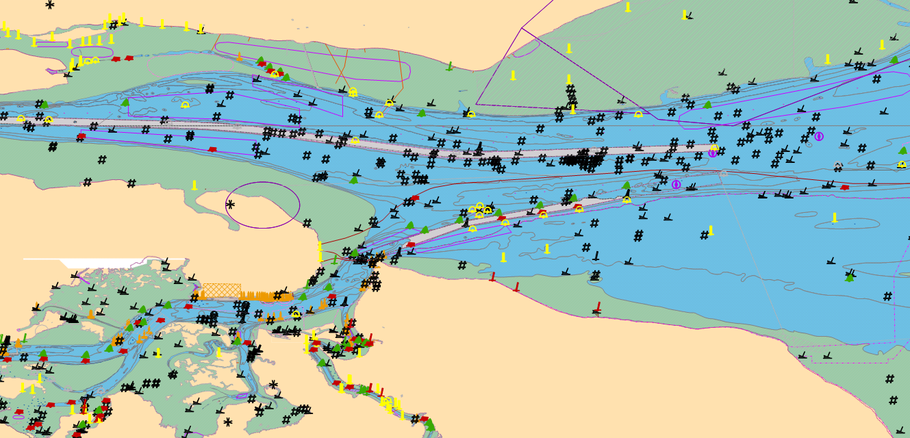
Result:

Crown Copyright 2014 - Not to be used for navigation
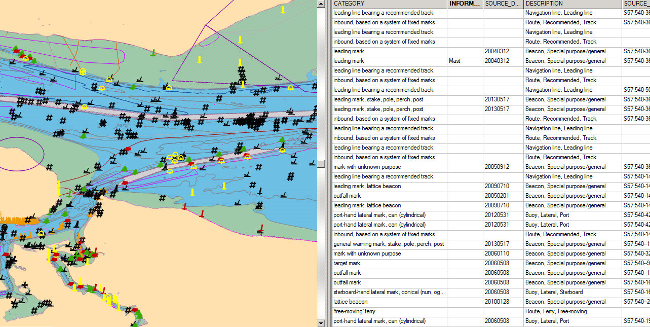
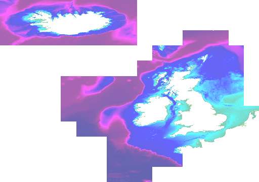
Basemap - ENC WMS by Geomod
Case Study:
Ocean Database | Geoserver |OpenLayers
Crown Copyright 2014 - Not to be used for navigation
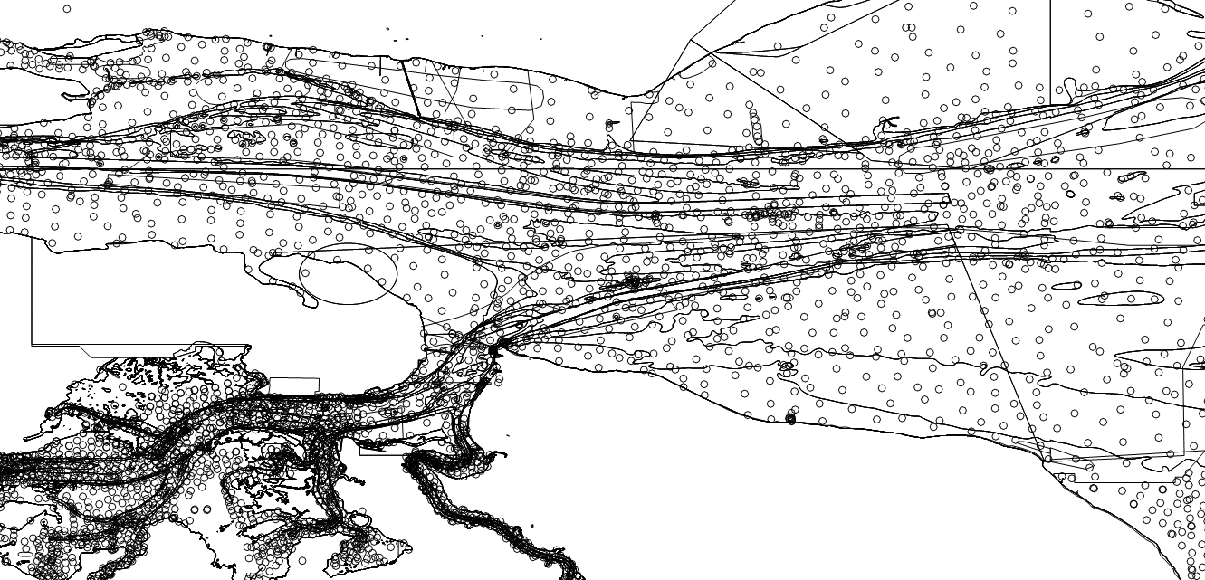
Surveys - Depth areas produced by Maritime Toolbar
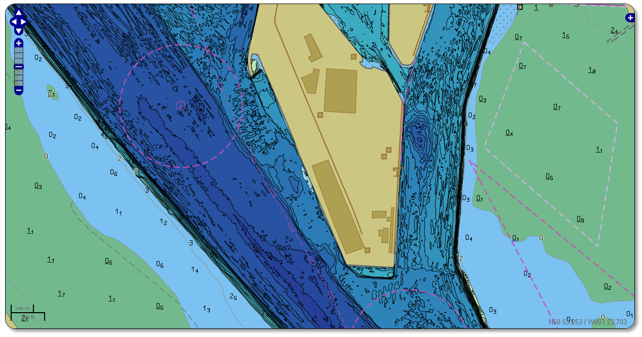
Case Study:
Ocean Database | GeoServer |OpenLayers
Crown Copyright 2014 - Not to be used for navigation
Surveys - Re-purposing with GeoServer to show target depth achievement

Case Study:
Ocean Database | GeoServer |OpenLayers
Crown Copyright 2014 - Not to be used for navigation
Designated survey areas - real-time link with data currency
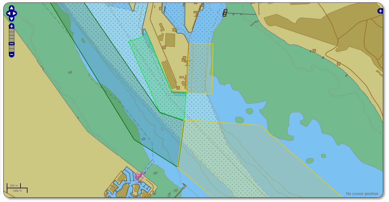
Case Study:
Ocean Database | GeoServer |OpenLayers
Copyright 2014 Boscalis and ABP Southampton
Other datasets to be included:

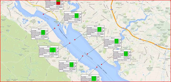
Real-time environmental monitoring data including threshold alerts and attribute display
Case Study:
Ocean Database | GeoServer |OpenLayers
Other datasets to be included:
Real-time environmental monitoring data including threshold alerts and attribute display
How?
- New records entered in Database as live data arrives
- GeoServer marks affected WMS tiles for update
- OpenLayers loads new data every minute
Case Study:
Ocean Database | GeoServer |OpenLayers
Copyright 2014 ABP Southampton
Other datasets to be included:
Asset Management data. Data sheets about Navaids can be entered into Ocean Database and published in the web service to the relevant port personnel or wider
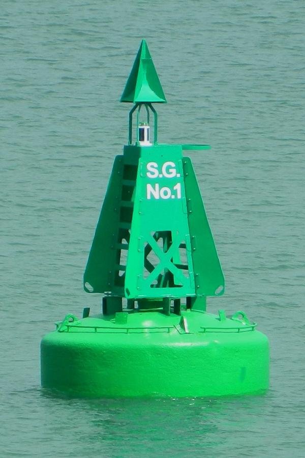
Case Study:
Ocean Database | GeoServer |OpenLayers
Other datasets to be included:
Asset Management data. Data sheets about Navaids can be entered into Ocean Database and published in the web service to the relevant port personnel or wider
How?
- Excel data loaded to Ocean Database
- GeoServer responds to WMS GetFeatureInfo request - providing attribute data to the client
- OpenLayers displays the attribute data in a web-layout, alongside spatial data
Case Study:
Ocean Database | GeoServer |OpenLayers
For demo's and discussions:
Please come and see me during the break
Thank you for listening!
OceanWise - Data Publishing
By Rich Farren
OceanWise - Data Publishing
Data Sharing and Publishing... Historical and Real-time. Presented at the OceanWise Marine GIS user conference, November 18th 2014, London UK.

