Web mapping for offshore decision support
Sam Franklin
GIS Manager
sam.franklin@lr-senergy.com
Oceanwise Marine GIS Workshop
London, 17-11-2015

Overview
- About
- Stack (briefly)
- Survey Use Cases
- Construction Use Case
- Summary
about
- Geospatial Lead @ LR Senergy
- Energy Consultancy + Software Business
- Survey Group :: Survey project management, Engineering, Geoscience, Geospatial consultancy
- Web application (Software-as-a-Service)


Desktop Studies
Stack:

data-store
servers
front-end
3rd party
product


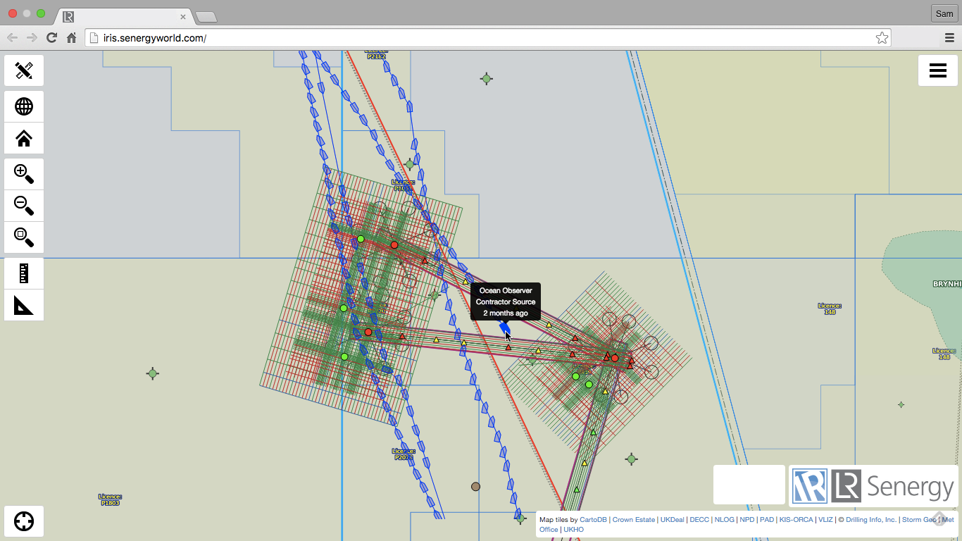
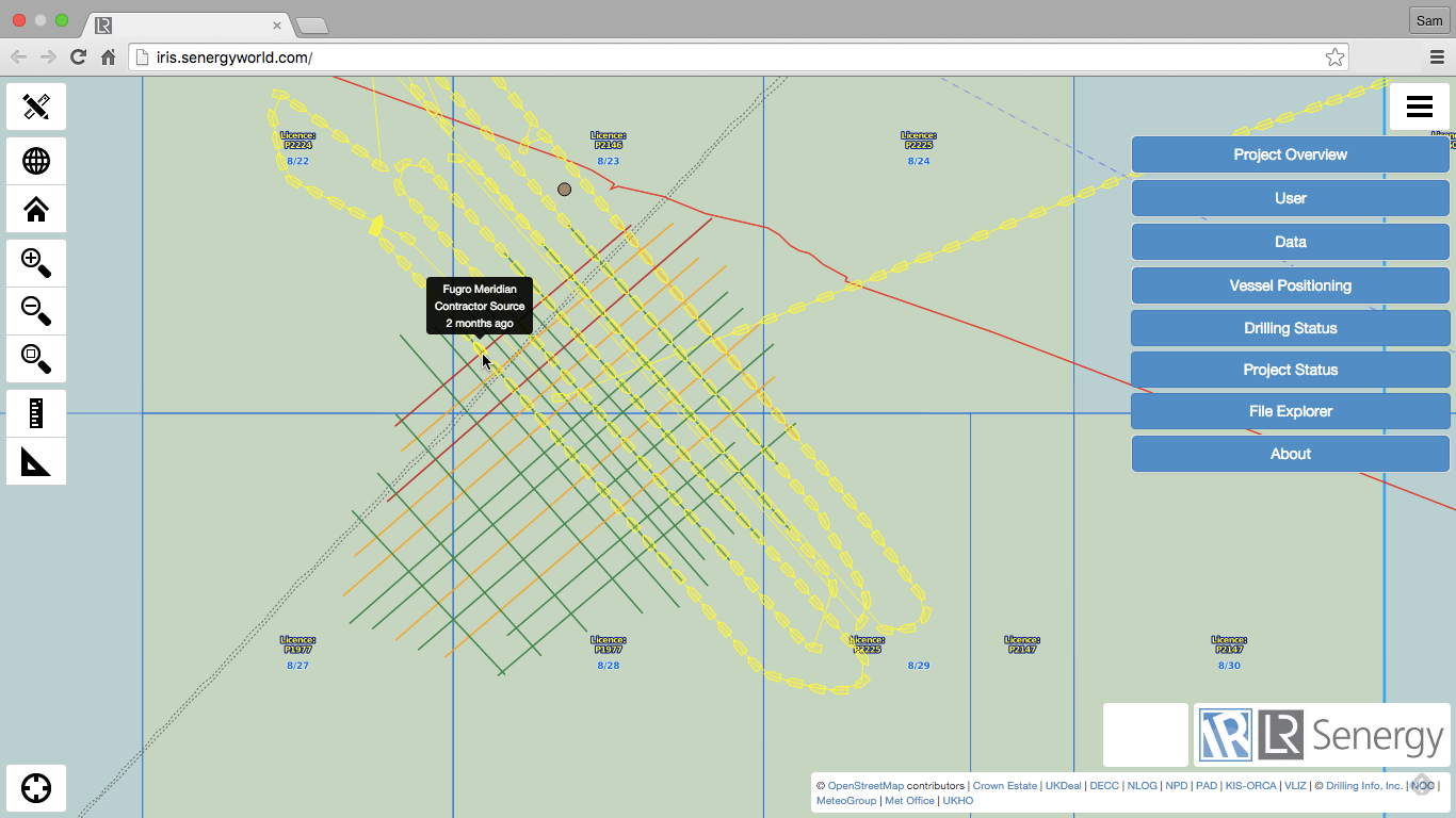
Iris
1 Where is the boat?..................................................
What is most frequently asked question of a survey department?

2 Is the boat operational yet?...................................
Vessel on Weather
Vessel on operations
What is most frequently asked question of a survey department?
1 Where is the boat?..................................................
2 Is the boat operational yet?...................................
3 How is the survey progressing?.............................
Status Traffic-Lights
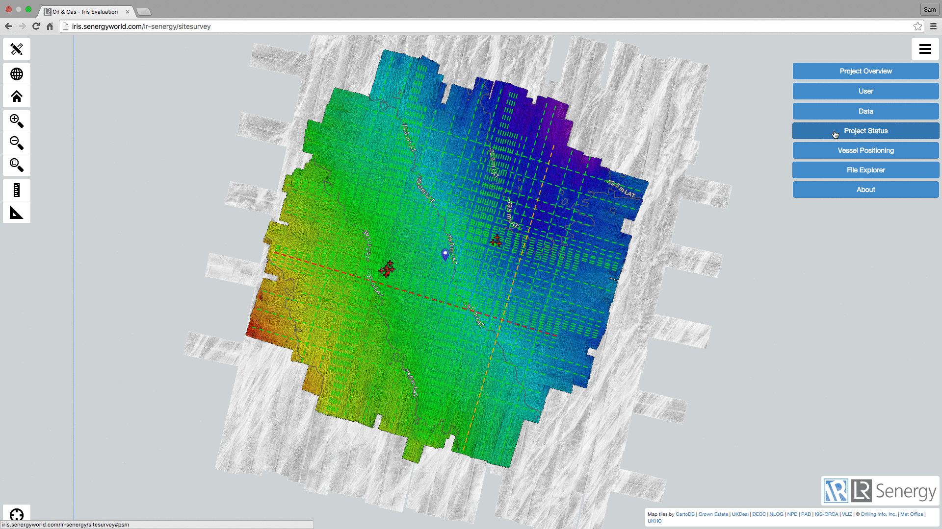
Project "Status" Dashboard
What is most frequently asked question of a survey department?
1 Where is the boat?..................................................
2 Is the boat operational yet?...................................
3 How is the survey progressing?............................
4 Do we have confidence in the forecast?..............
Metocean Ground Truth
Offshore Construction
-
Requirement to track all vessels in the project area
-
No AIS coverage = team is "blind" to vessels.
V-NODE T-AIS
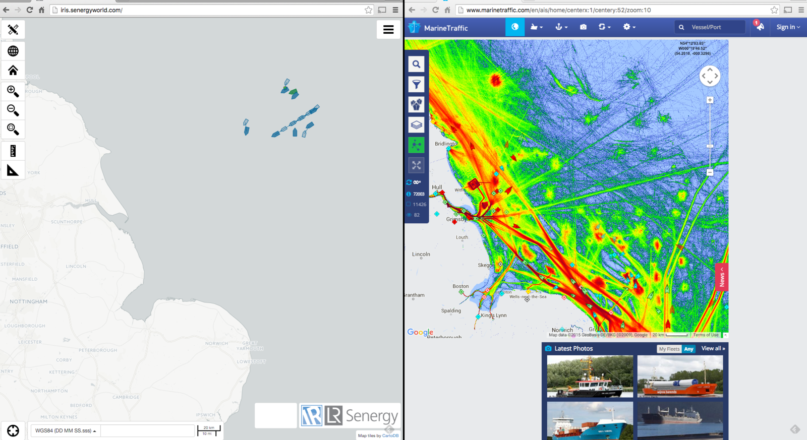
Vessel Heatmaps
-
New data source = users get ideas!
-
Surprised by level of fishing activity
Surprising Outcome
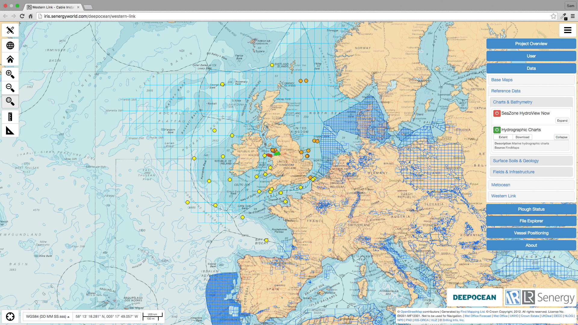
Pipeline Installation
-
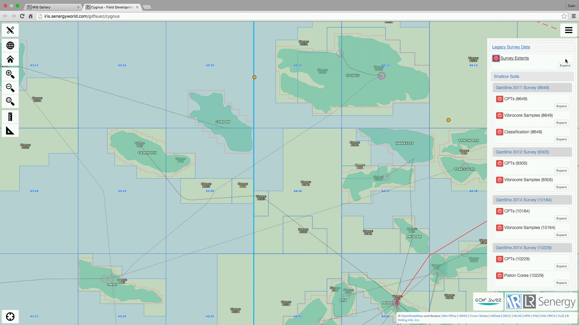
Unexpected soils = potential impact on schedule.
-
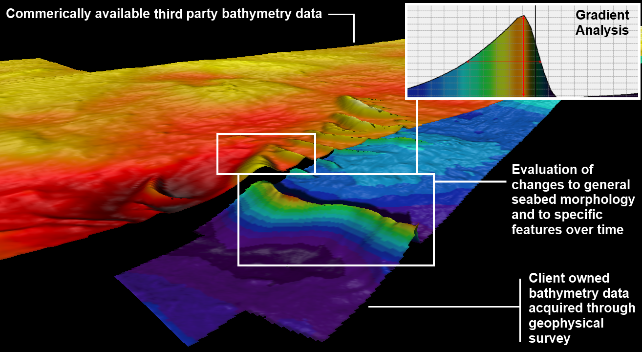
Need quick access to "legacy" survey data
Quick Data Access
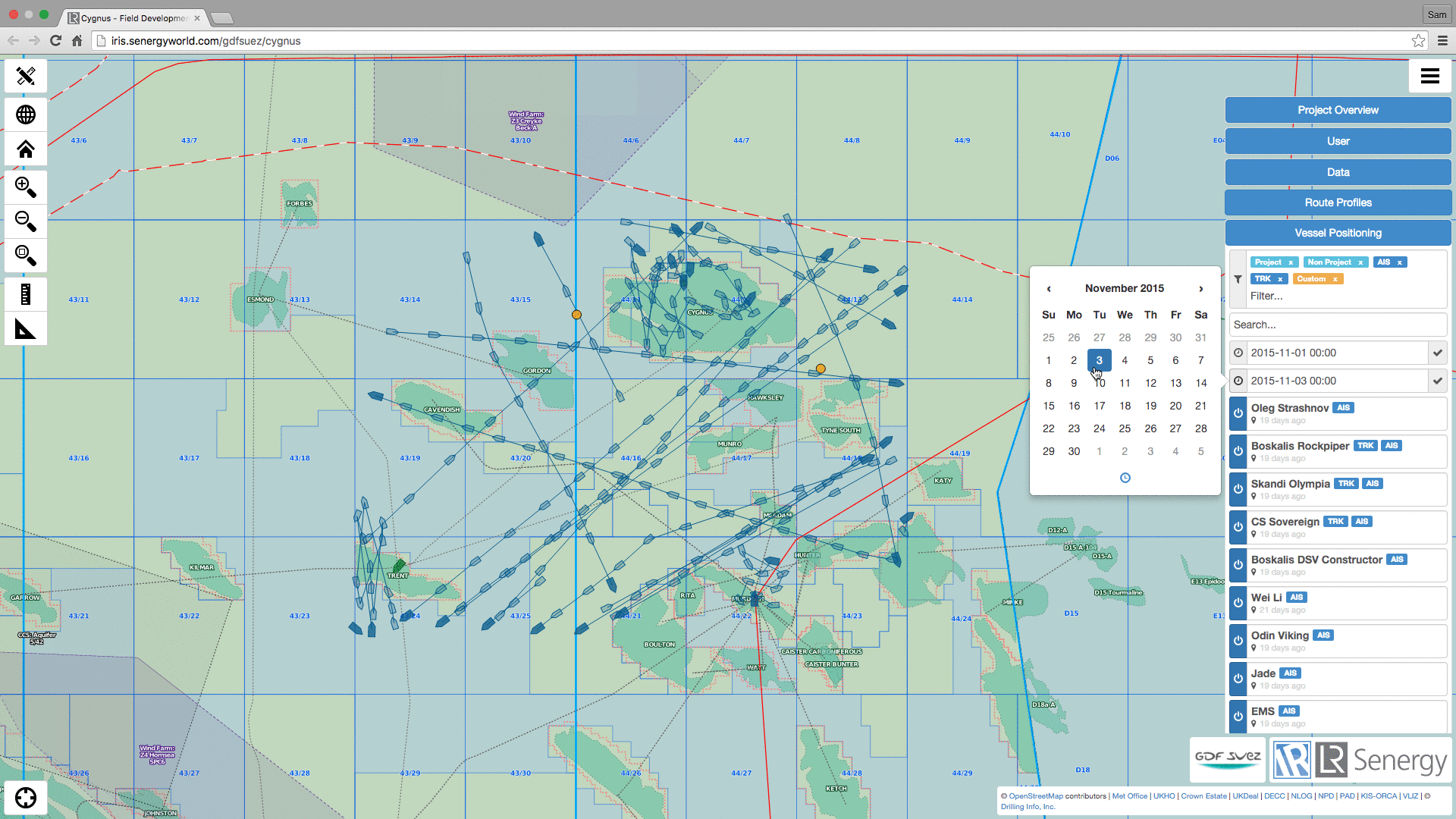
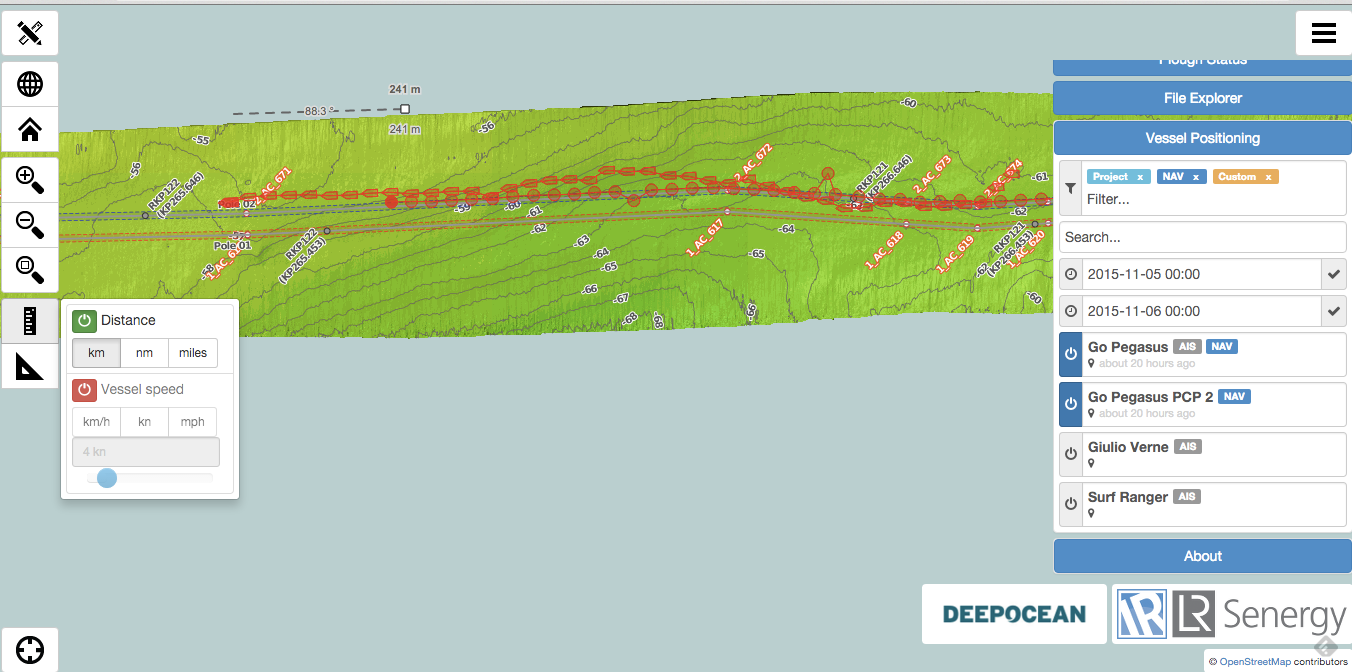
Cable Installation
-
What's the position of the plough in relation to the vessel?
-
Are we in-spec?

Towed Plough Location
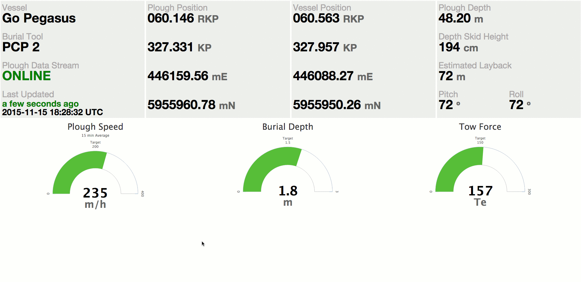
Cable Installation
-
Use sensor data
-
Compare with expected targets?
-
Forecast ahead
Sensor Performance
"It is not all about the map"
Thanks!
Sam Franklin
GIS Manager
sam.franklin@lr-senergy.com
2015-oceanwise-workshop
By samfranklin
2015-oceanwise-workshop
Presentation of LR Senergy's use of web mapping technology to aid decision making in offshore environments
