It Takes a Village to Find a Village:
Supporting Health Research with Geospatial
Stace Maples & Hannah Binzen Wild
Stanford Geospatial Center / Stanford School of Medicine


Hannah:
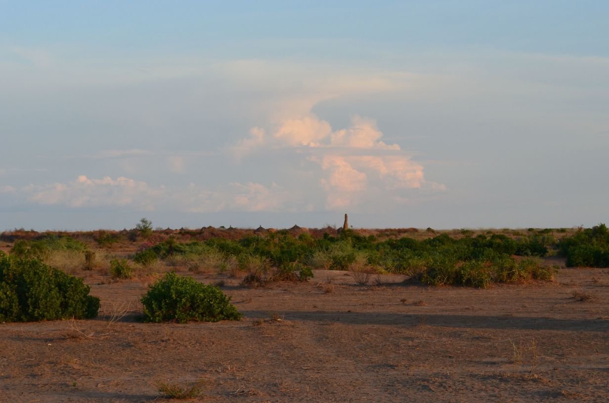
"I can see the settlements in Google Earth, but I know that those images are old and those villages are long gone, but is there a way to get satellite imagery that good, and do a complete settlement survey within a few weeks of the image being taken?"
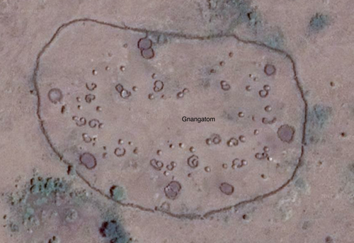
Defining the Area of Interest with OpenStreetMap and the HOT Task Manager

https://tasks.hotosm.org/


Obtaining and Prepping Imagery

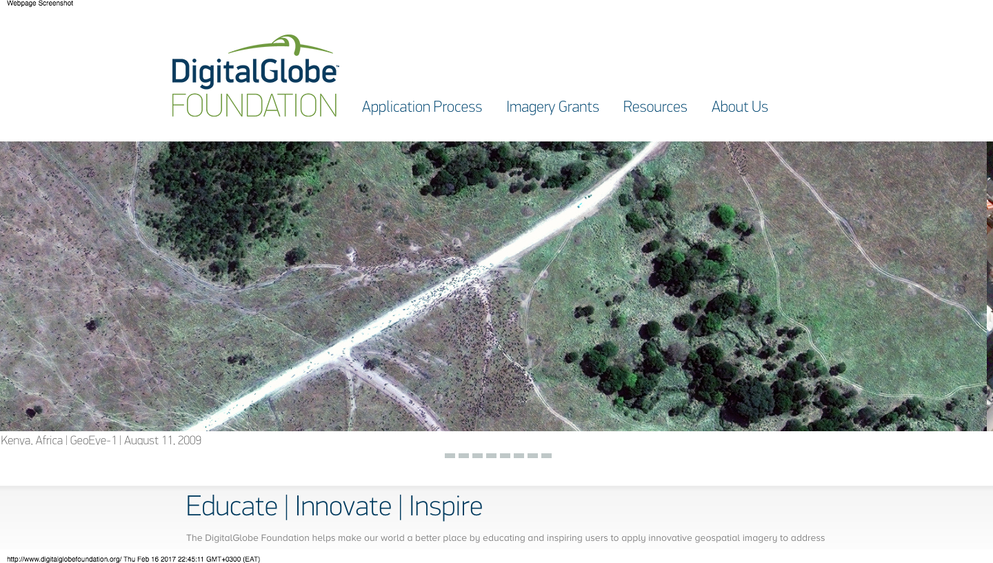
http://foundation.digitalglobe.com/
~5000 sqkm
200gb+
(before pansharpening)
the Geospatial Data Abstraction Library
GDAL
http://www.gdal.org/
So I wrote a python script...
- GeoTIFF
- with JPEG compression
- internally tiled
- in the YCBCR color space
- with internal overviews
- Mosaicked using .vrt (Virtual Raster Mosaic)
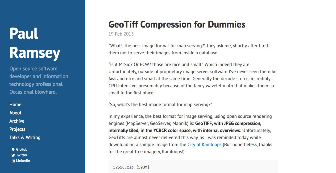
http://blog.cleverelephant.ca/2015/02/geotiff-compression-for-dummies.html
#Import modules
import glob, os, gdal, fnmatch

#Set base directory to location of script
base_directory = os.path.abspath('')

#Make a list of Multispectral directories with 'MUL' in the path
multi_directory_list = glob.glob(os.path.join(base_directory, '*MUL'))

#Make Panchromatic directory [pan_directory] path by replacing 'MUL' with 'PAN'
for multi_directory in multi_directory_list:
    pan_directory = multi_directory.replace('MUL','PAN')
    print(multi_directory)
    print(pan_directory)
    #Make a list of TIF files in the multi_directory
    multi_tiffs_list = fnmatch.filter((os.listdir(multi_directory)), '*.TIF')
    for multi_tiff_name in multi_tiffs_list:
        print(multi_tiff_name)
#Get the matching panchromatic image for the current multispectral by searching for the RowCol
        multi_rowcol_wildcard = '*'+multi_tiff_name[19:24]+'*'
        #print(multi_rowcol)
        pan_tiffs_list = fnmatch.filter((os.listdir(pan_directory)), '*.TIF')
        pan_tiff_name = fnmatch.filter(pan_tiffs_list, multi_rowcol_wildcard)
        #print(pan_tiff_name[0])
#Pan-sharpen the multispectral using it's corresponding panchromatic image using JPEG compression and internal tiles
        print('pansharpen')
        os.system('python gdal_pansharpen.py -co NBITS=12 -co COMPRESS=JPEG -co JPEG_QUALITY=50 -co PHOTOMETRIC=YCBCR -co TILED=YES ' + os.path.join(pan_directory,pan_tiff_name[0]) + ' ' + os.path.join(multi_directory,multi_tiff_name) + ',band=7 ' + os.path.join(multi_directory,multi_tiff_name) + ',band=5 ' + os.path.join(multi_directory,multi_tiff_name) + ',band=3 ' + base_directory + '/sharp_' + multi_tiff_name)
#Add overviews for resulting tiffs
        os.system('gdaladdo --config COMPRESS_OVERVIEW JPEG --config PHOTOMETRIC_OVERVIEW YCBCR --config INTERLEAVE_OVERVIEW PIXEL -r average ' + base_directory + '/sharp_' + multi_tiff_name + ' 2 4 8 16')
#Create a Virtual Raster Mosaic of VRT type from all resulting sharpened TIFF images
print('create VRT mosaic from SHARP images')
os.system('gdalbuildvrt sharpmosaic.vrt *.TIF')
#Haven't finished figuring out how to get a decently stretched image out of this part. More to do!
print('MBtiles out')
print('gdal_translate sharpmosaic.vrt sharpmosaic.mbtiles -of MBTILES')
print('gdaladdo -r average sharpmosaic.mbtiles 2 4 8 16')
https://github.com/mapninja/DGF_parser


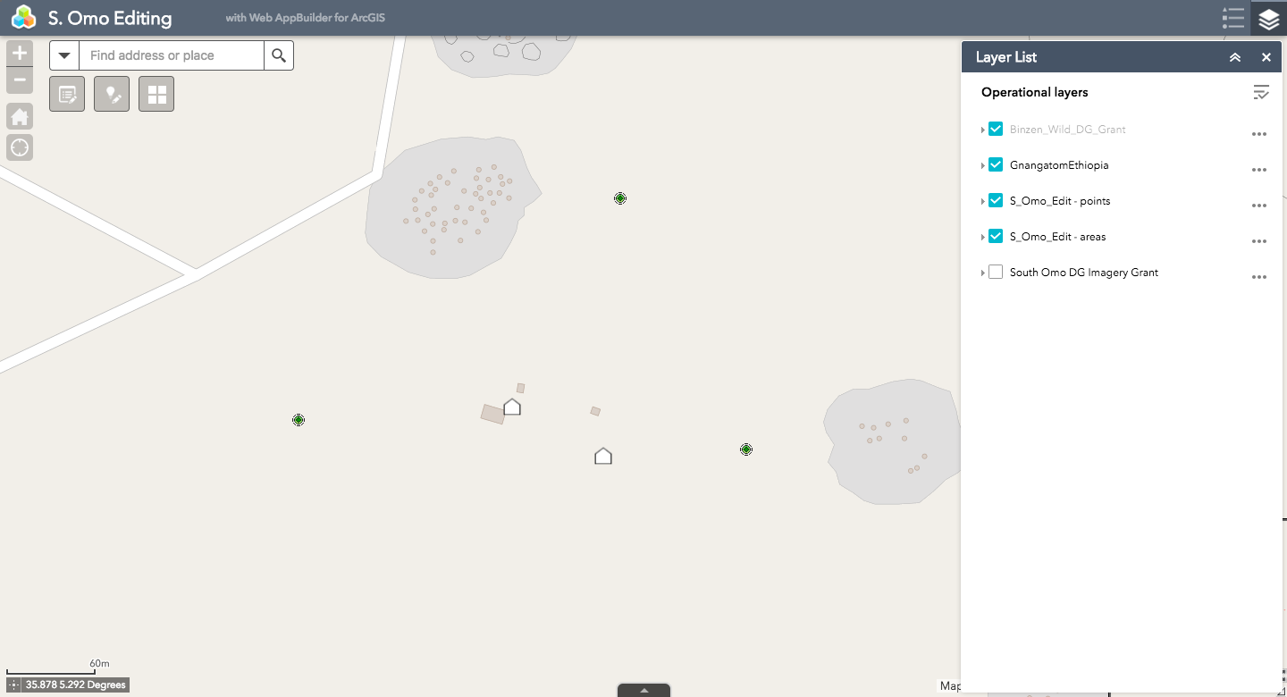
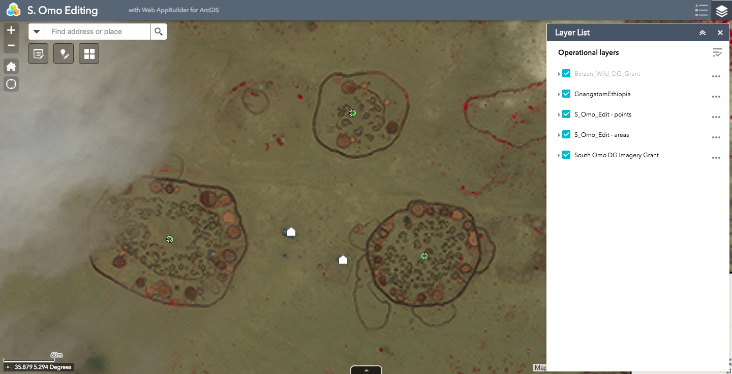
Creating the Recon App
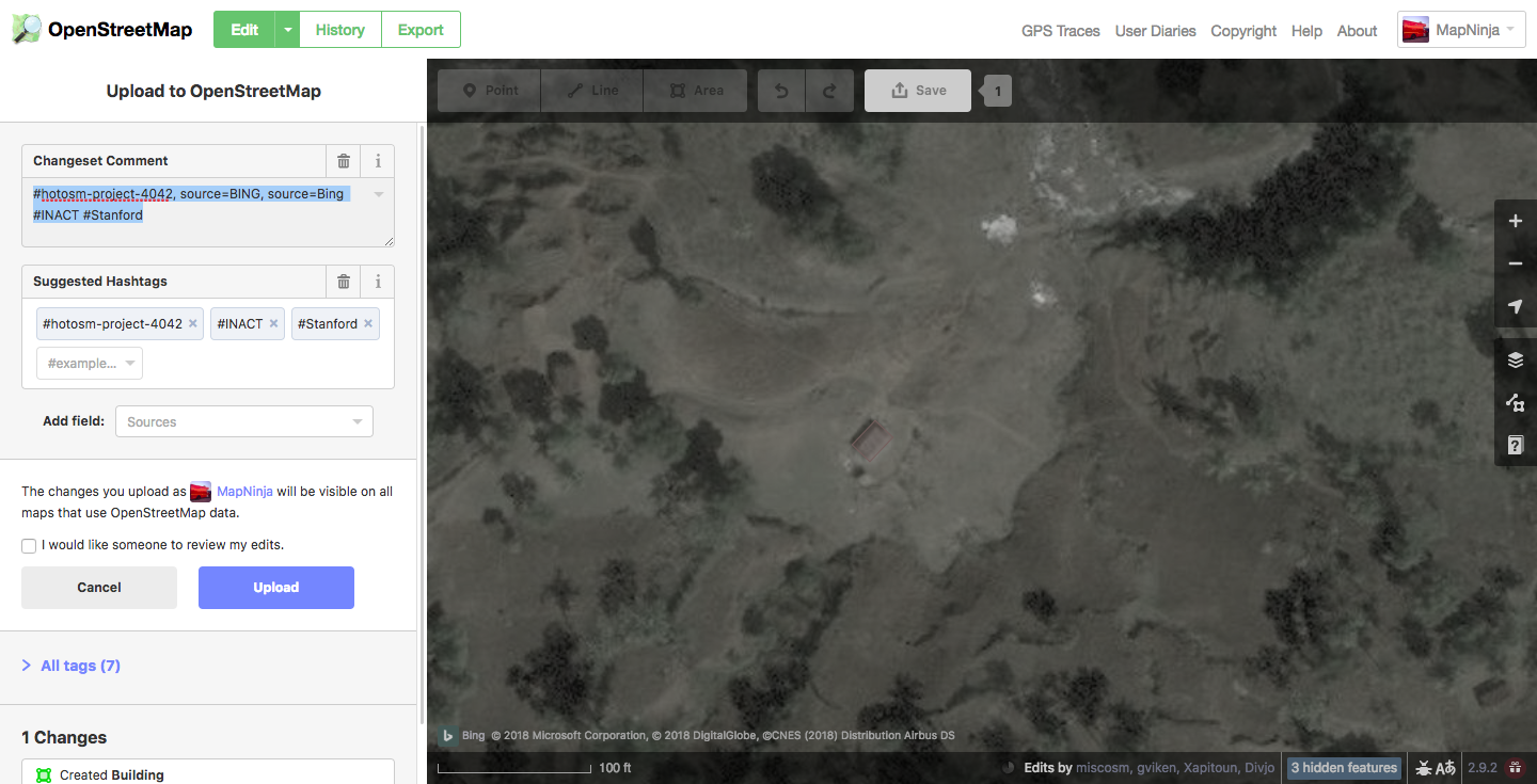
Can't use
OpenStreetMap
(ODbL!, conflict, etc...)
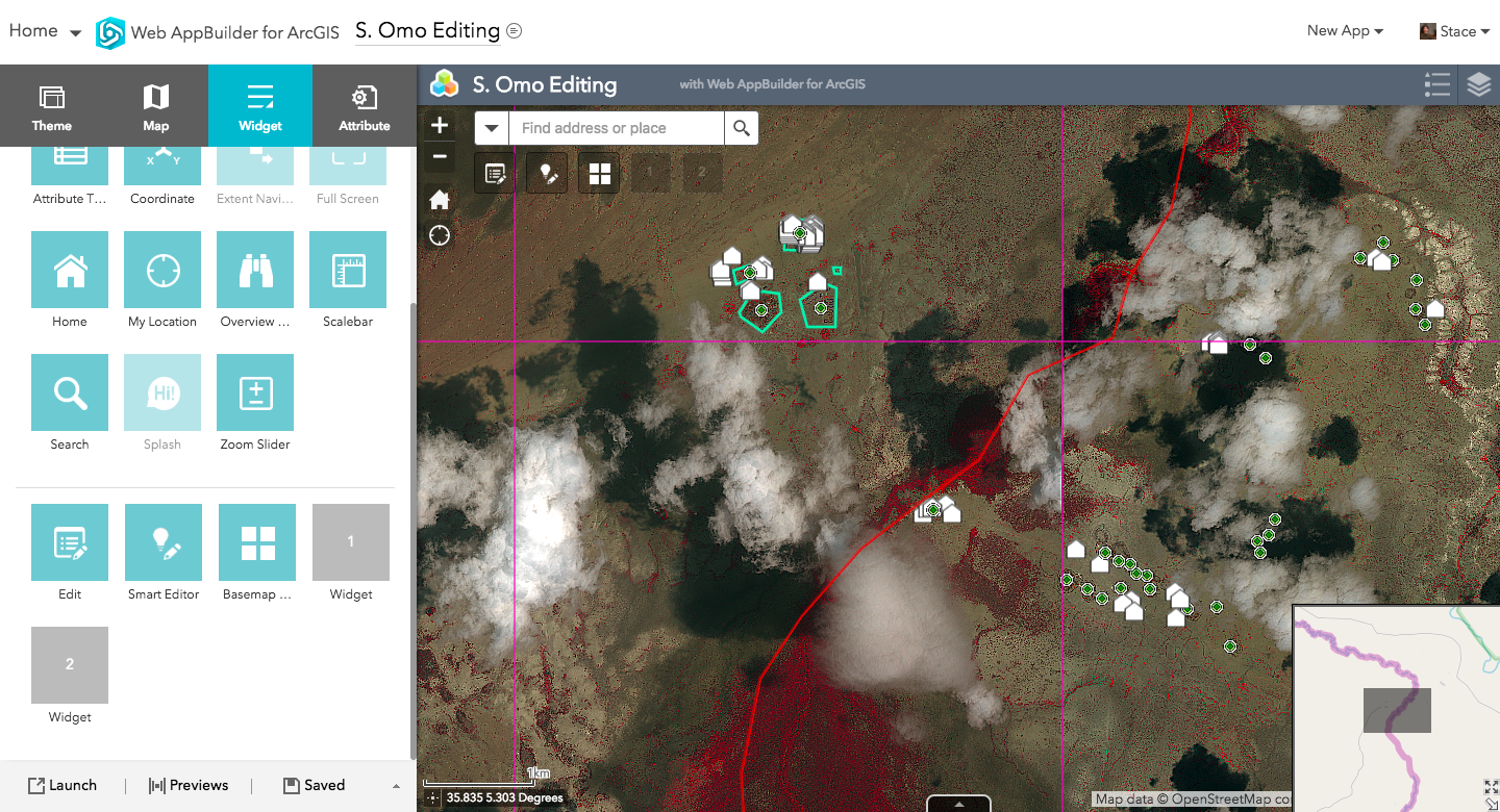
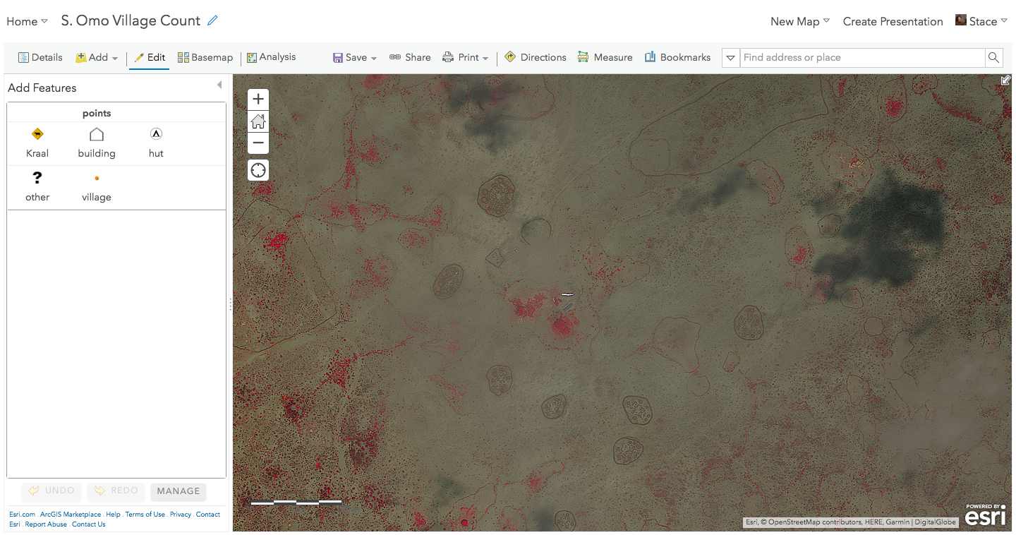
ArcGIS Editing Application
Reconnaissance
(and the problem of scale)
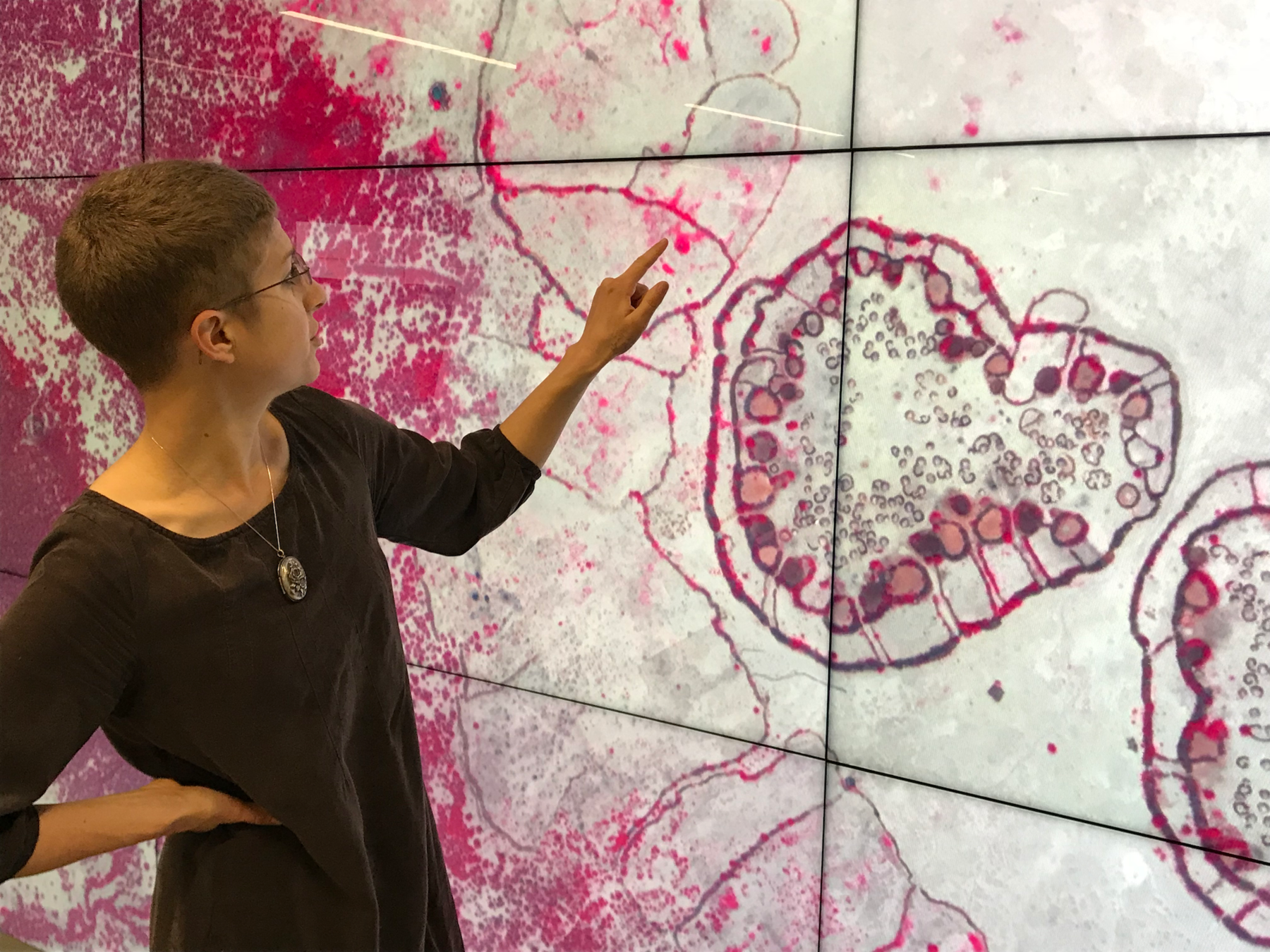

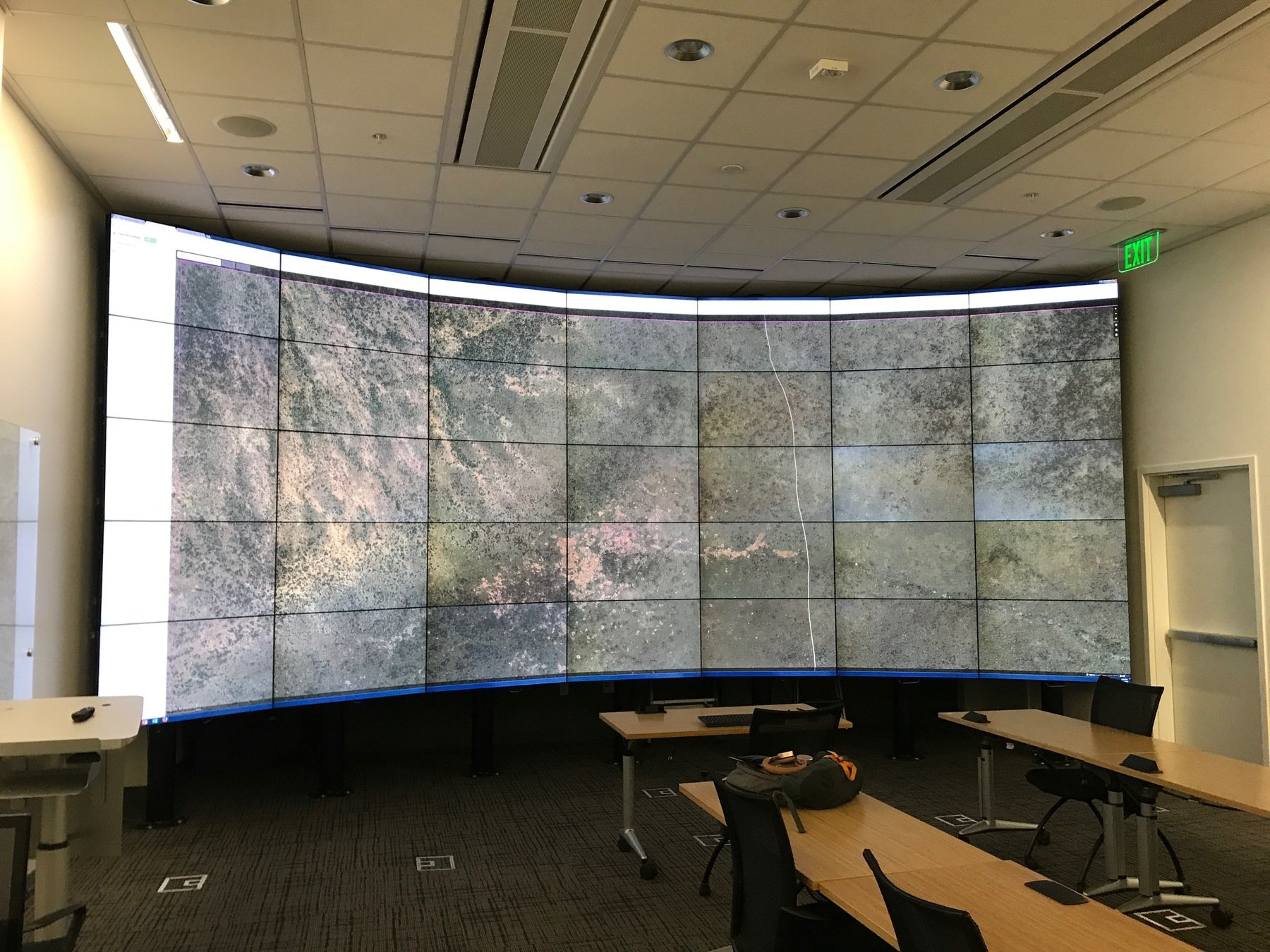
https://icme.stanford.edu/resources/hive
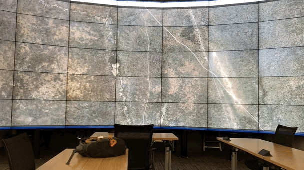
HIVE
13440 x 5400 x .53m pixels
=
20 sq km
Typical Monitor
1440 x 900 x .53m pixels
=
.7 sq km
Or,...
250 shift+arrow pans vs. 7000+
~ 6 hrs
Outcomes
- 5,000+ sq km
- 225 settlements
- only 2 abandoned by arrival

Satellite imagery is still tough to work with at scale, but it's getting better...
For basic data carpentry (pan-sharpening, mosaicking, compositing, tiling, etc...
Go Straight to GDAL!
(it's not cheating, since that what ArcGIS uses!)
Relationships were as important in this project as technology...
DigitalGlobe Foundation
ICME
David Rumsey Map Center
Humanitarian OpenStreetMap Team
OSM Community
Machine Learning?
-
Daily 3m Planet Imagery
-
Excellent OSM-Based Training Data
-
Cheap GPUs and ML Cloud Infrastructure...

gis.stanford.edu
github.com/stanfordgeospatialcenter
@mapninja
stacemaples@stanford.edu
Thanks!
Questions?
@mapninja
stacemaples@stanford.edu
It takes a village.
By Stace Maples


