Earthsys 144: Fundamentals of GIScience
Digitizing Spatial Data
where is your data? gis.stanford.edu
https://slides.com/staceymaples/digitizingdata
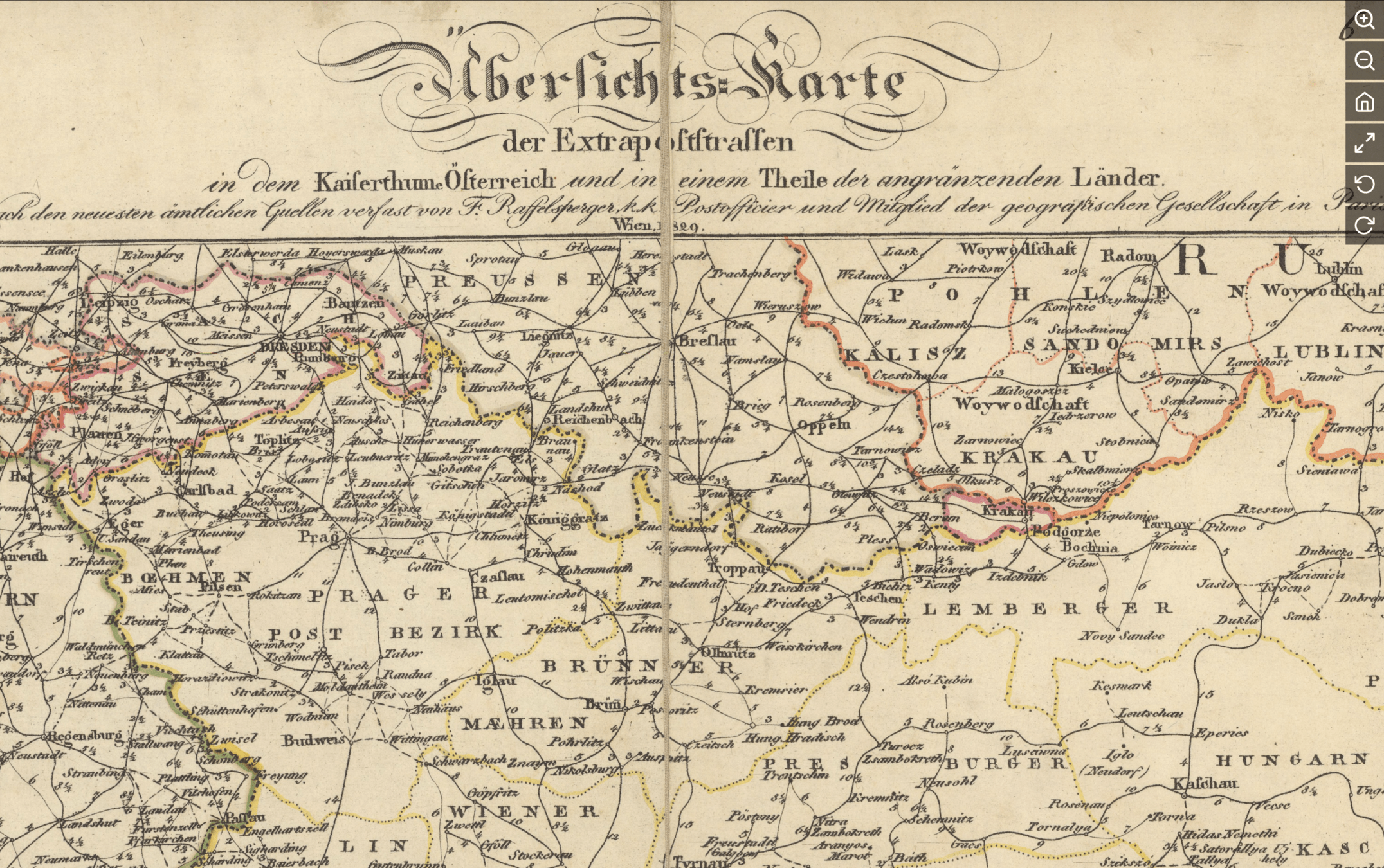
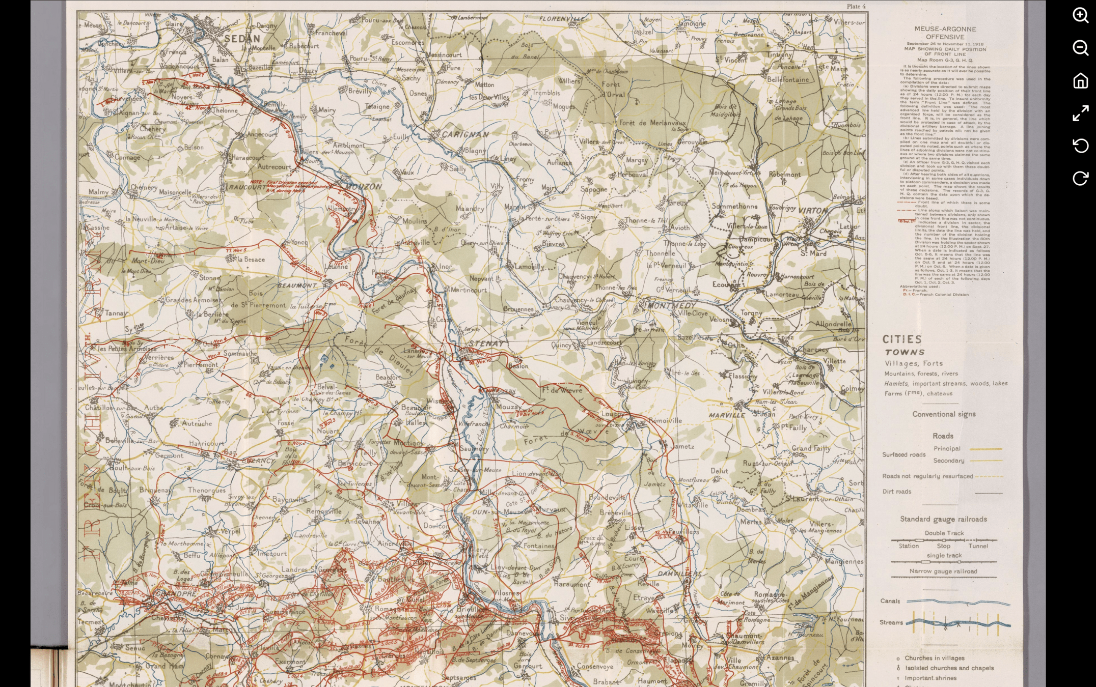
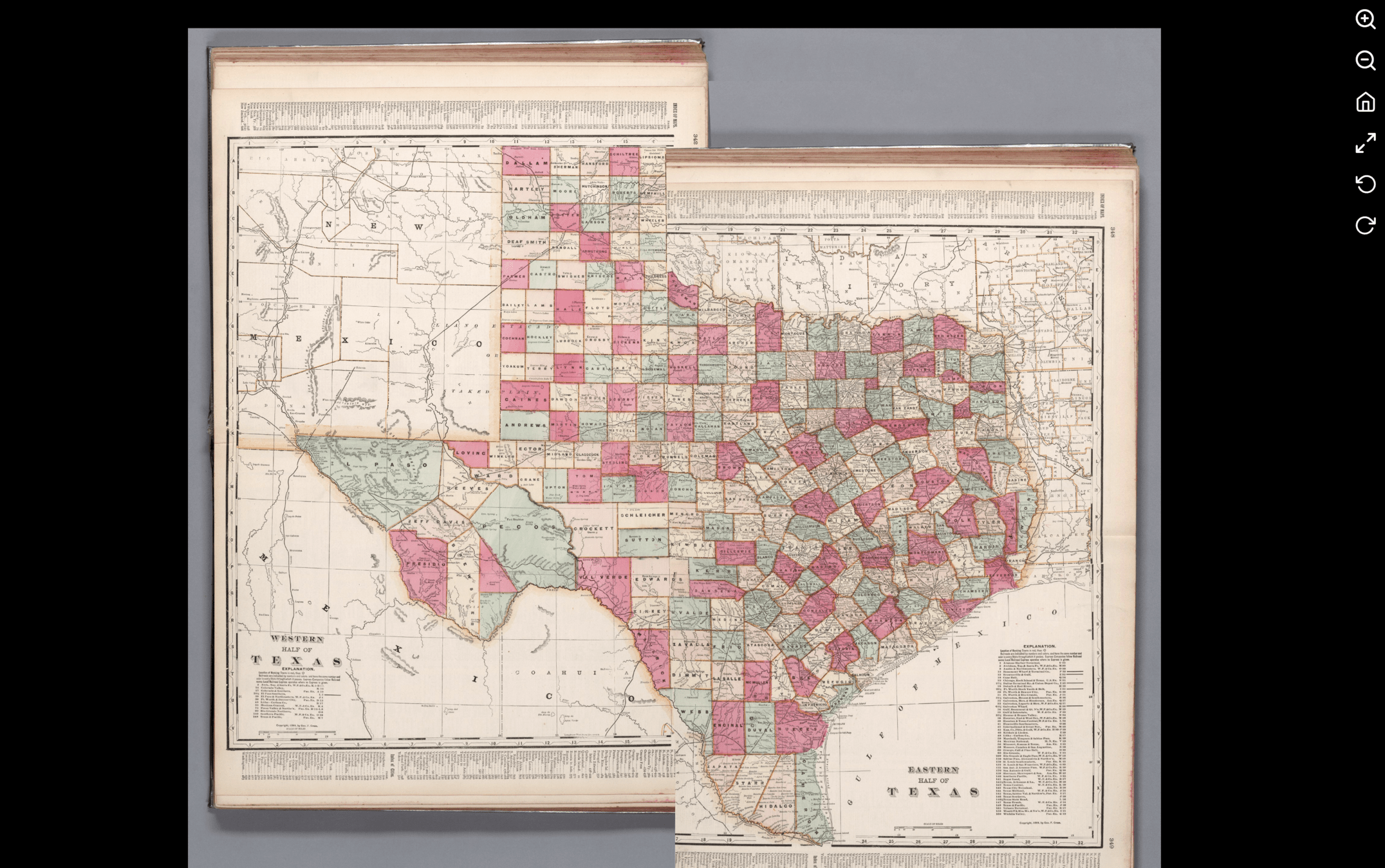
Hardcopy Sources
https://slides.com/staceymaples/digitizingdata
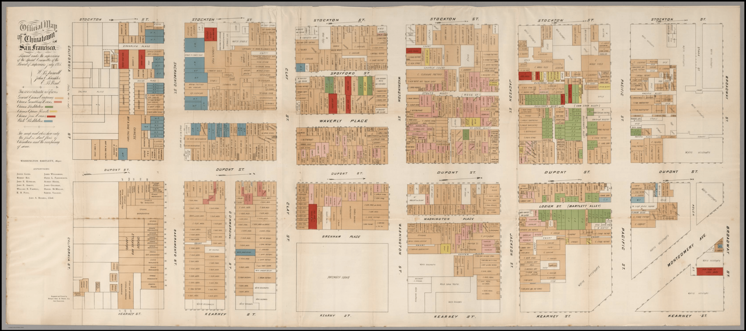
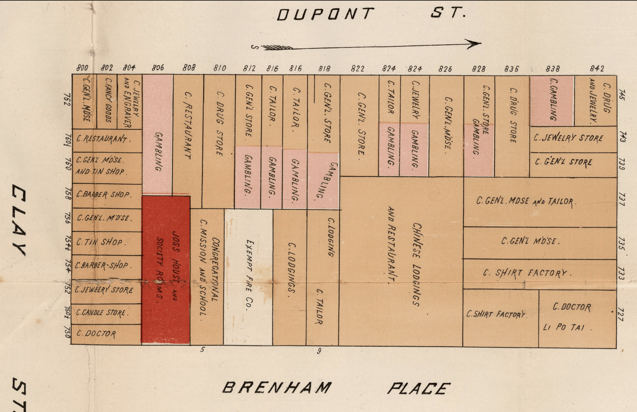
Digitization
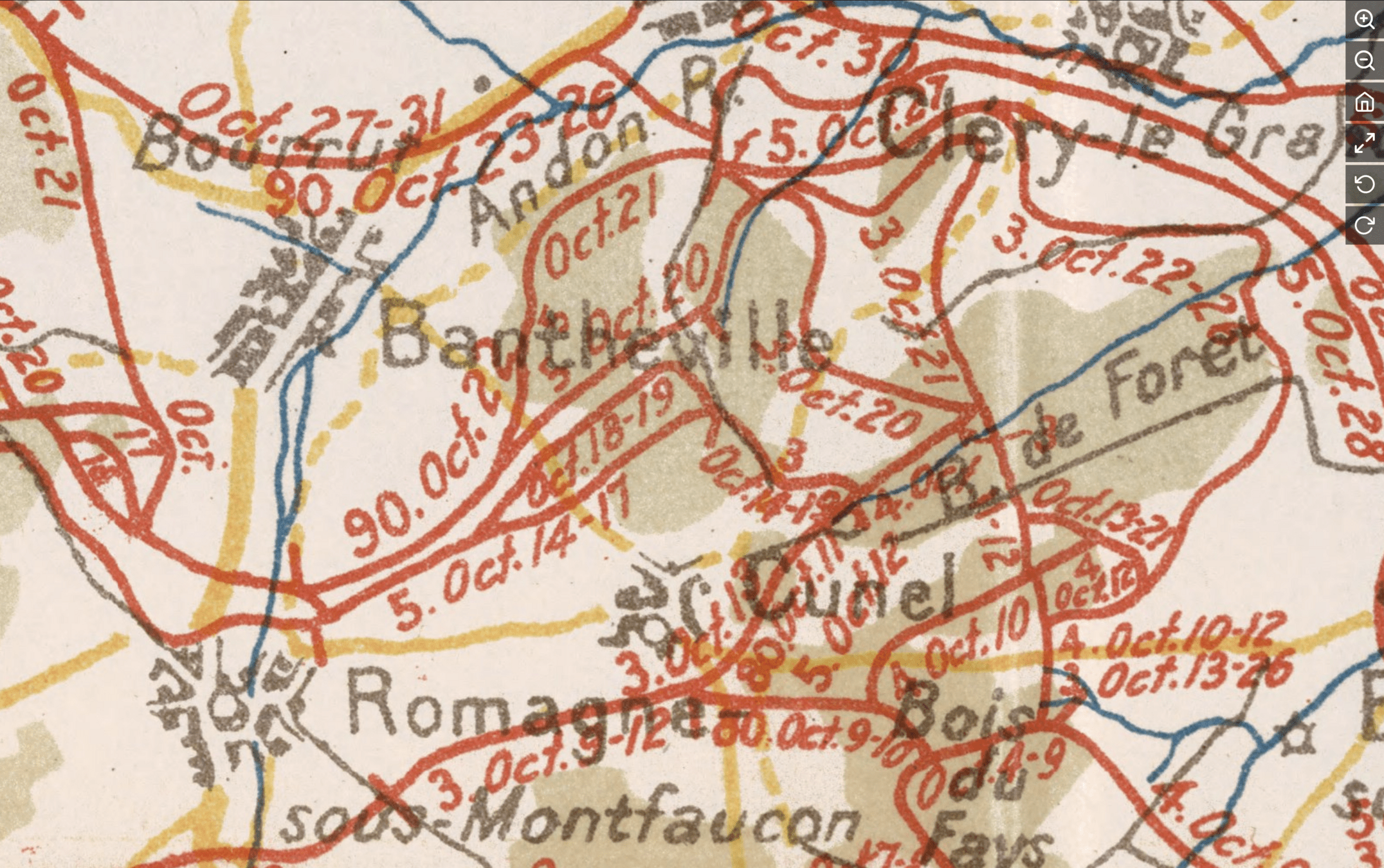
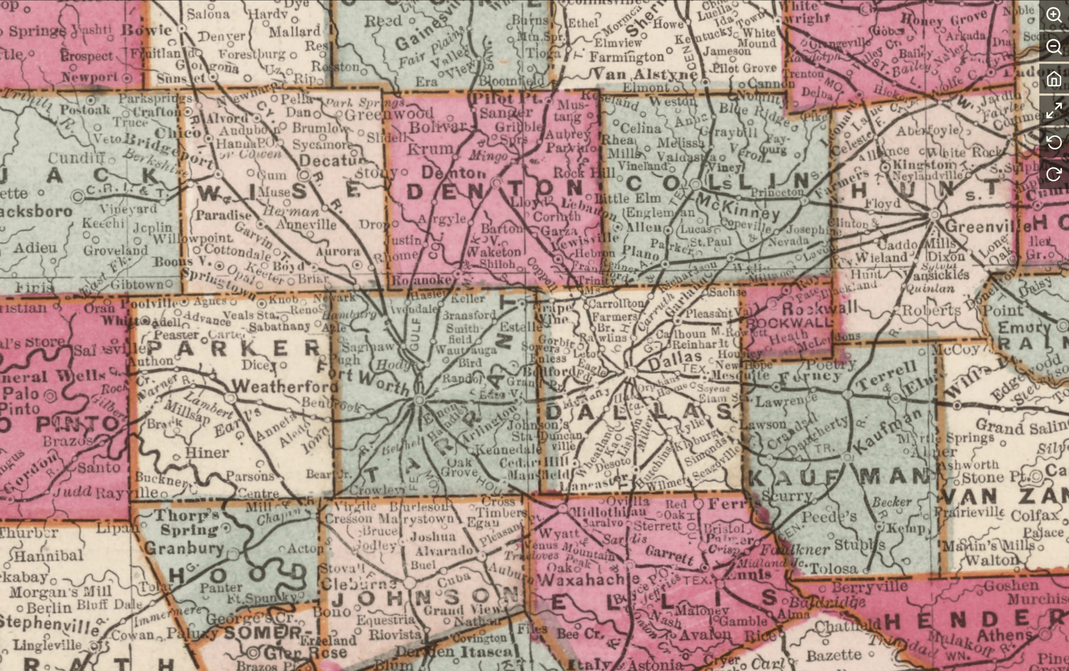
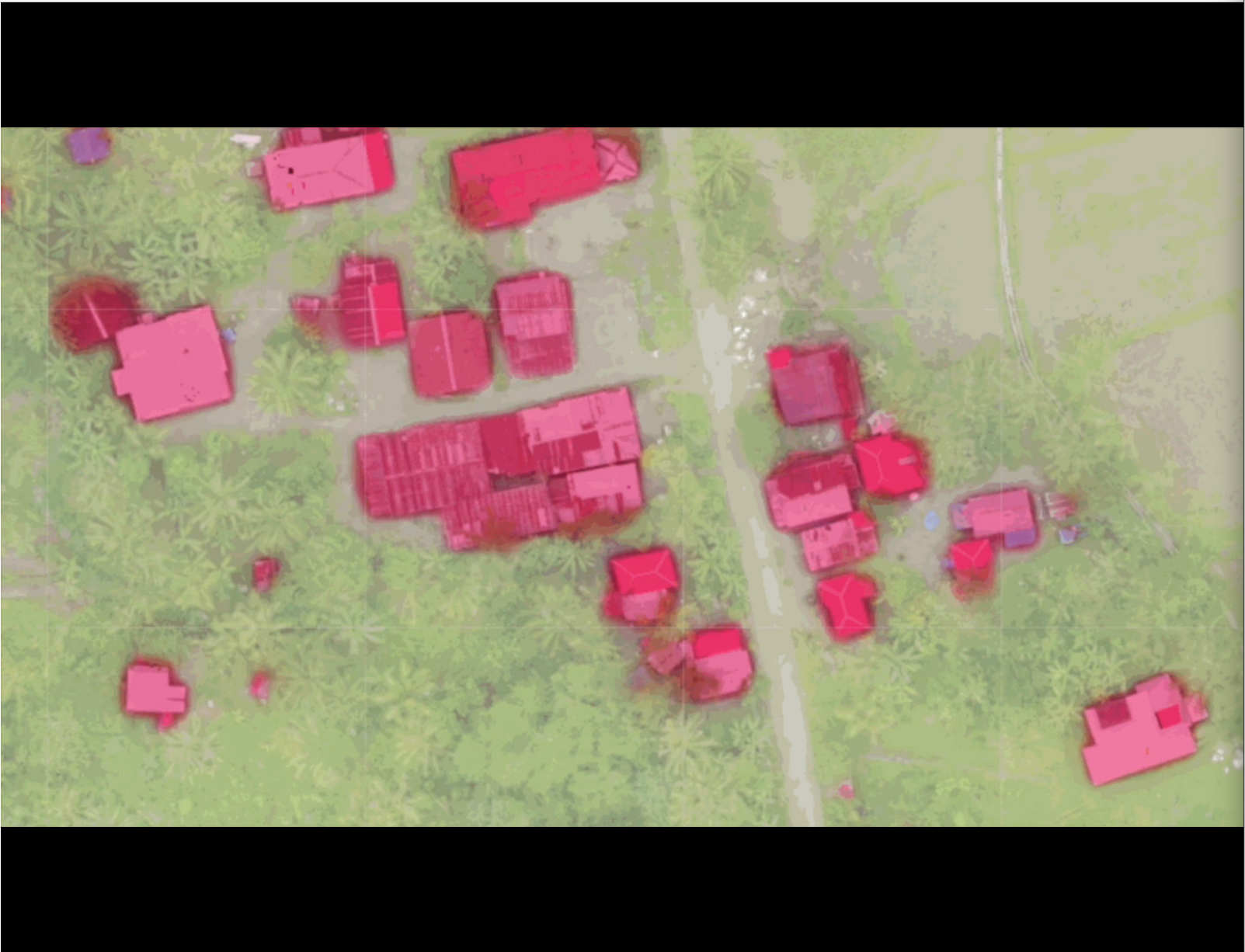
"Heads-down" Digitization
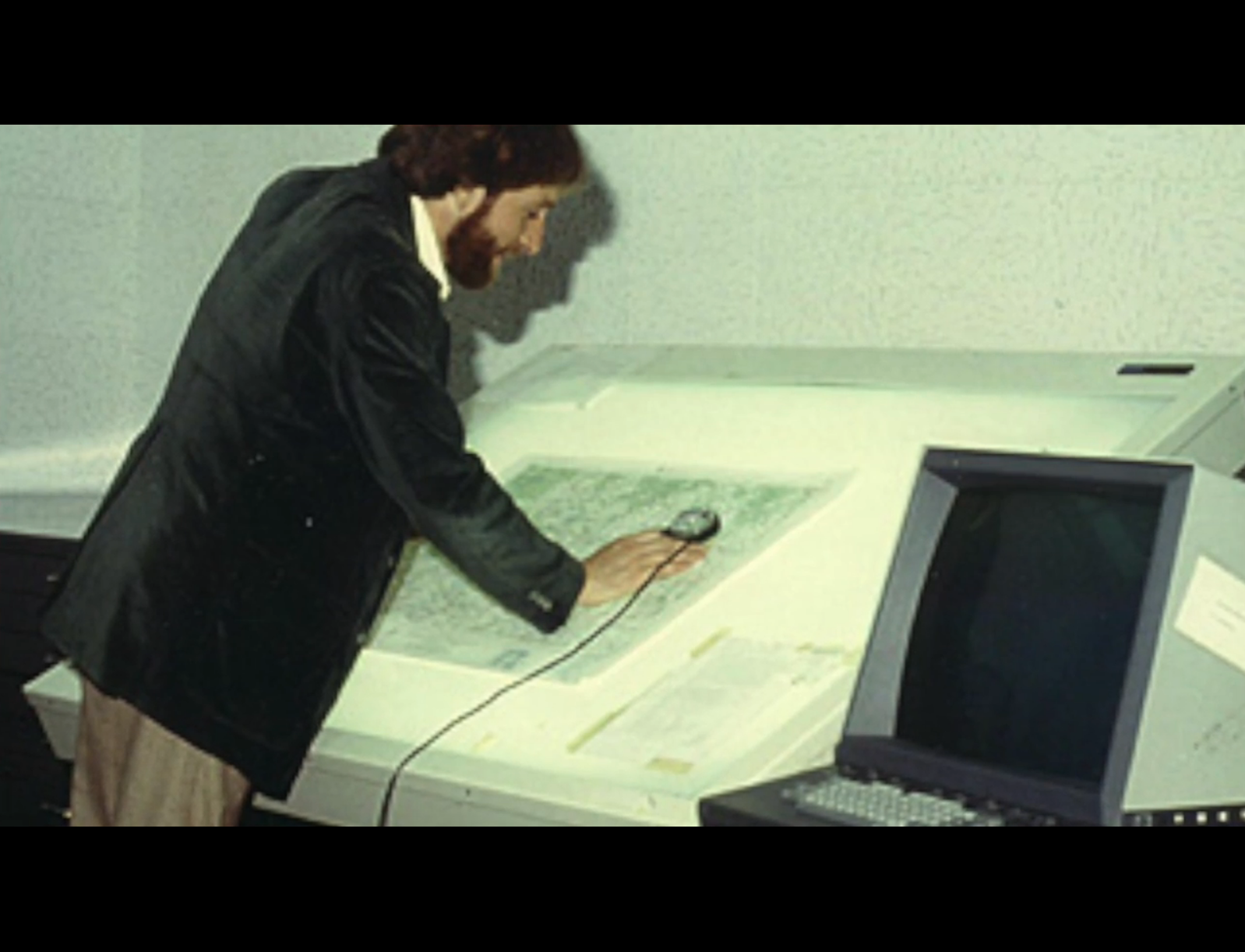
On-Screen/Head's Down Digitization
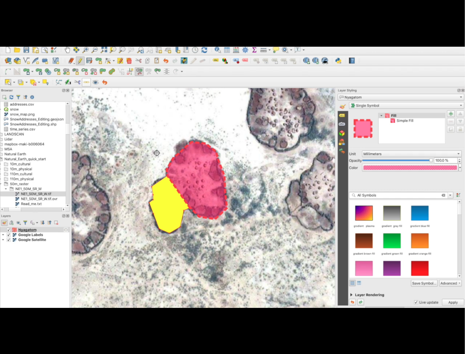
"Heads-up" Digitization

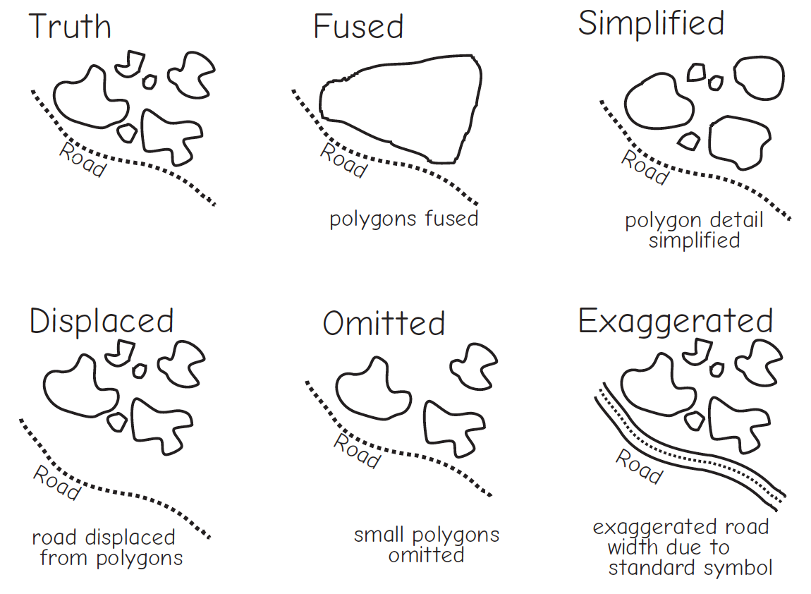
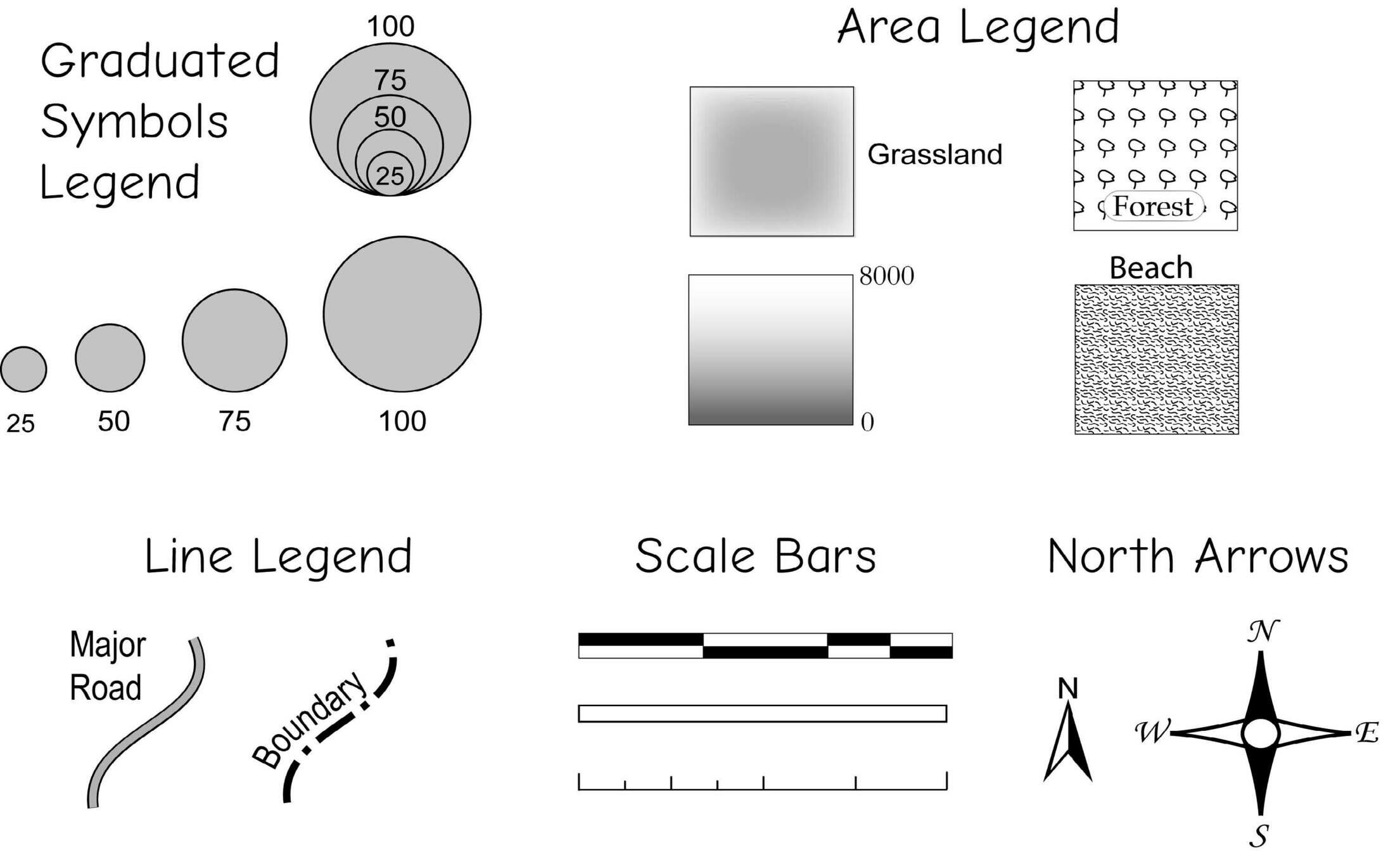
Feature Generalization
https://slides.com/staceymaples/digitizingdata
How long is the coast of Britain?


https://slides.com/staceymaples/digitizingdata
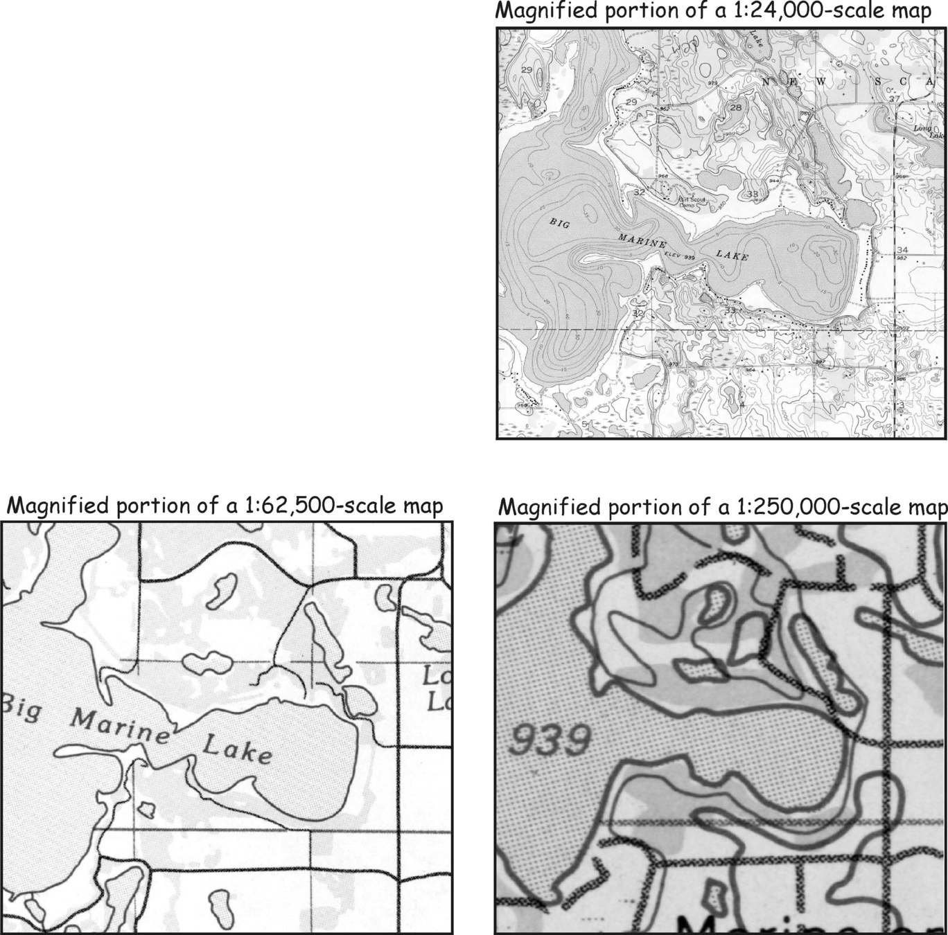
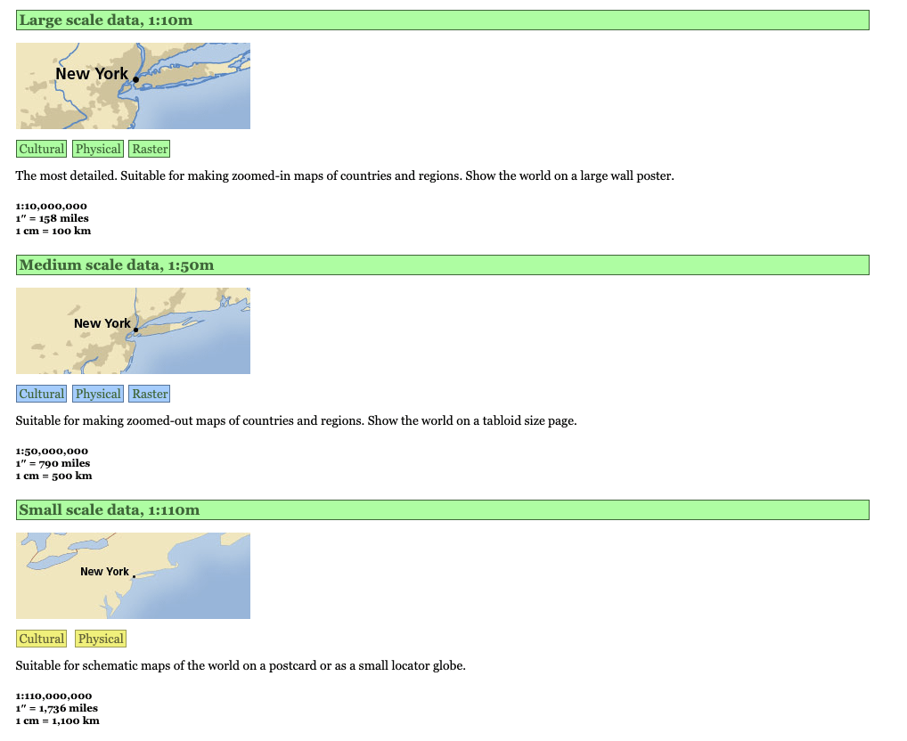
Which is the largest scale map?
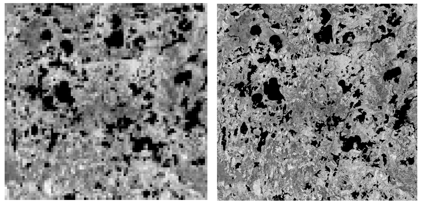
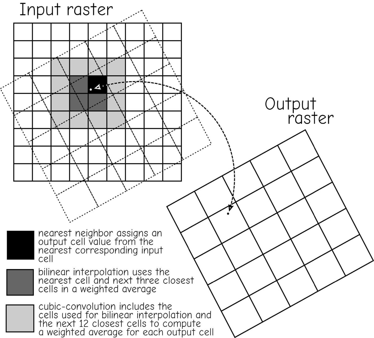
Resampling Raster Geometries
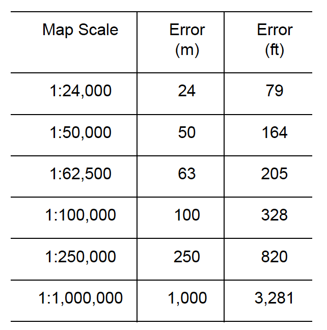
Errors
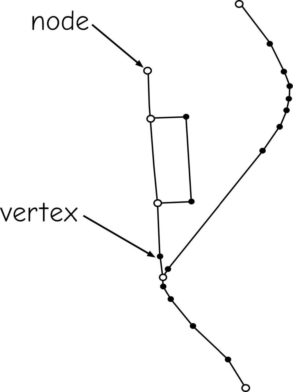
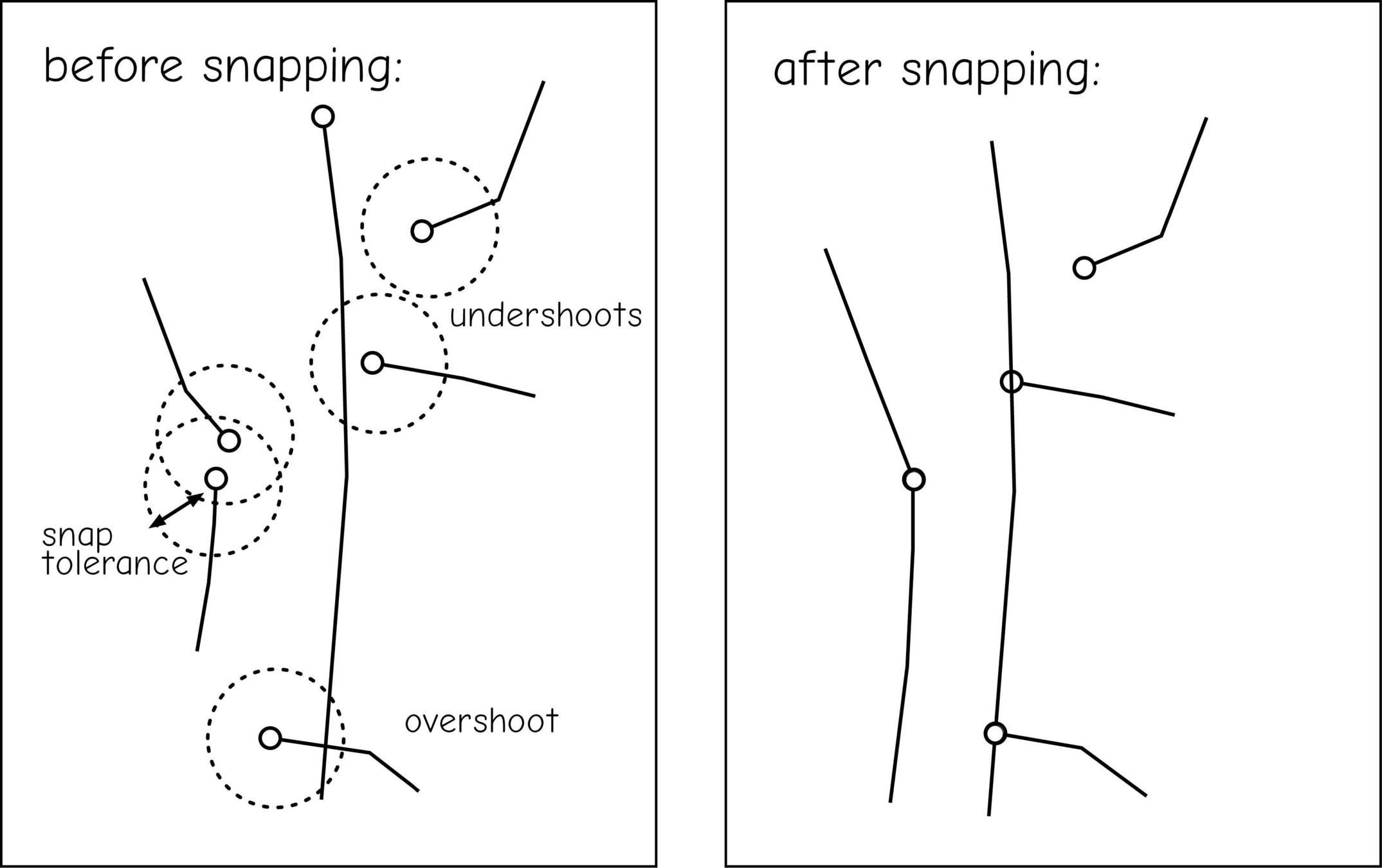
Undershoots & Overshoots
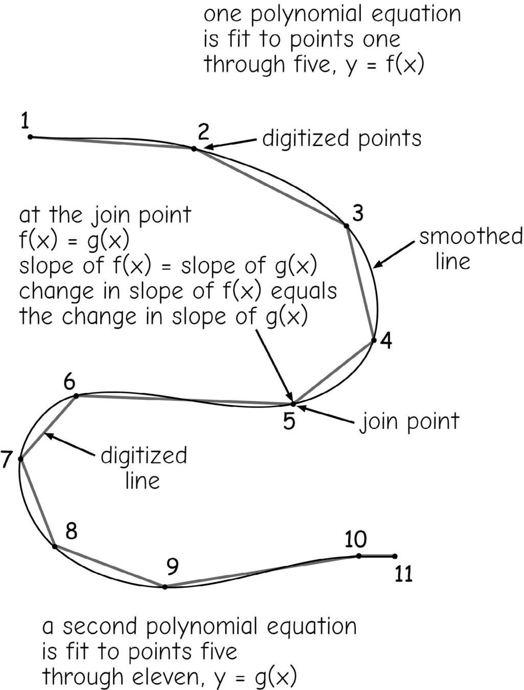
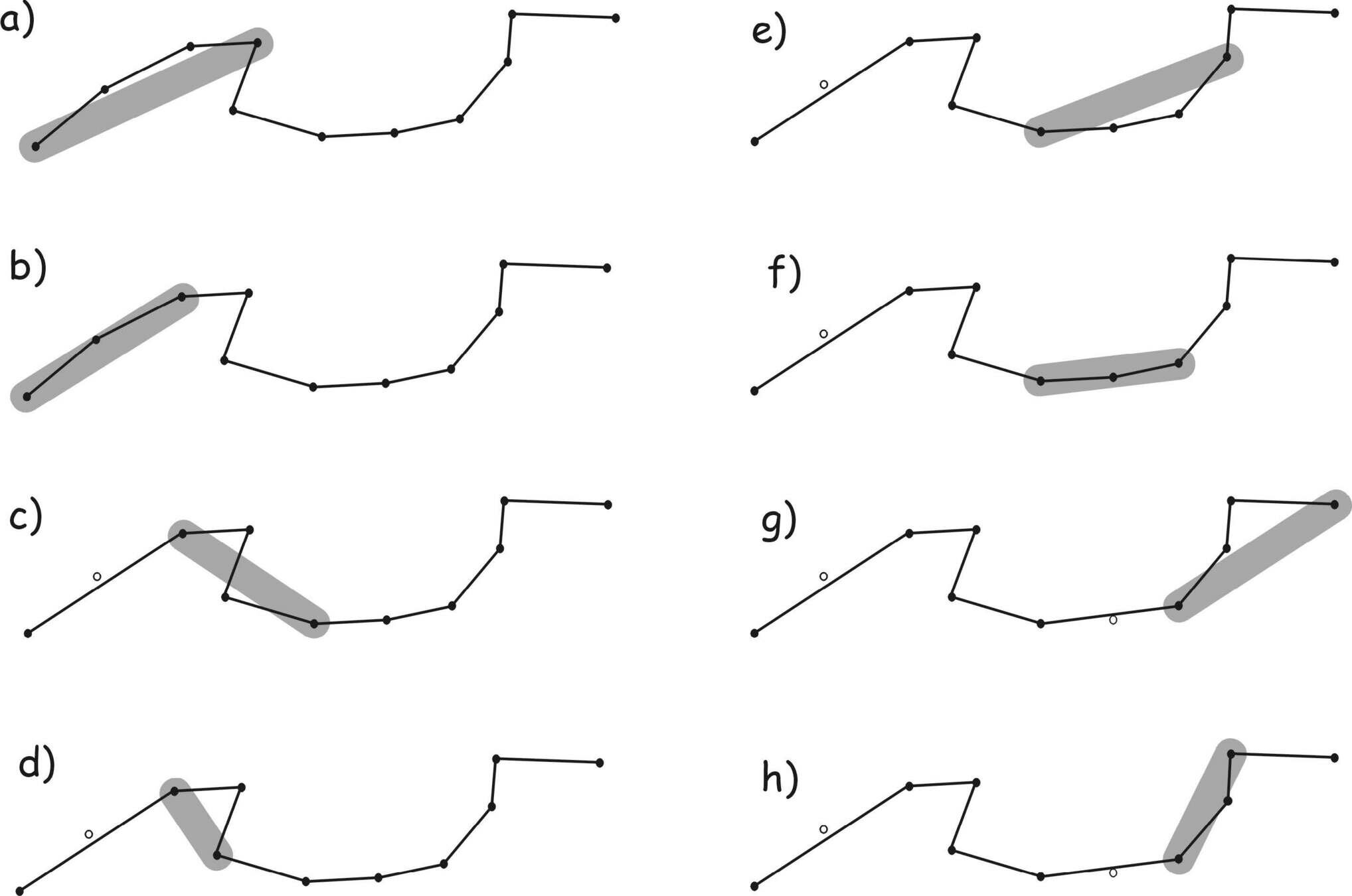
Reshaping
(smoothing & thinning)
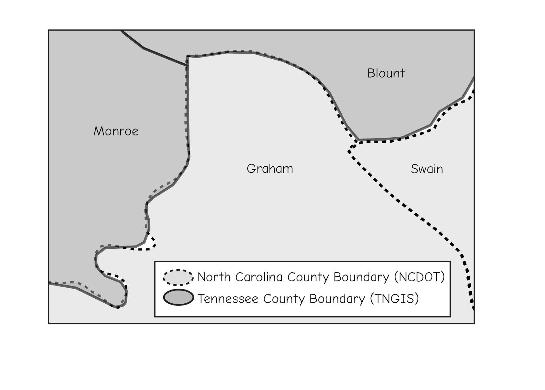
Error Across Layers
Let's talk about this Final Project Proposal
What your proposal should include:
- Your Spatial Question or Project Idea Statement
- Bibliography of any published work you are referencing
- Brief description of the way you might answer your question (don't worry about vocabulary, yet)
- MAX of Two Data Sources that you have identified as useful and type (digital, scanned maps, tabular, etc...)
- Software or platform you are interested in using
- What will the final product be (web map, datasets, print maps, Web Application, sculpture, etc...)
1 page, or 500 words!
Places to get ideas:
- Your other classes! Double-up!
- Your thesis, paper, current research, etc...
- A need in your community that can be addresses with spatial data
- Write a tutorial!
- Esri Map Book
- learn.arcgis.com - use one of these workflows for a place you are interested in (bonus for converting to a QGIS or GEE workflow!)
The most important component of your project is that you bring YOUR interest to it!
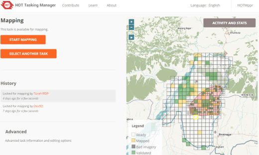
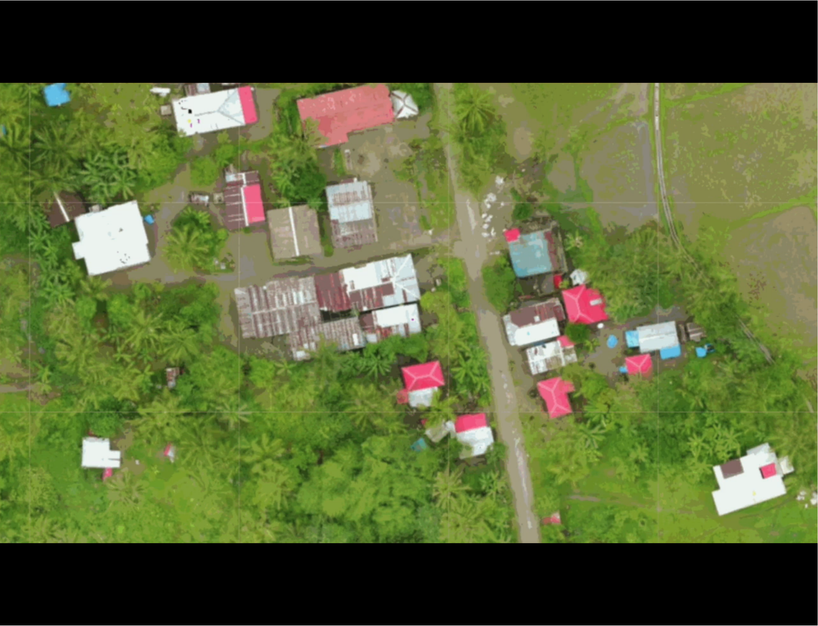
Spatial Data Sources
https://slides.com/staceymaples/digitizingdata
https://slides.com/staceymaples/digitizingdata
https://slides.com/staceymaples/digitizingdata
https://slides.com/staceymaples/digitizingdata
https://slides.com/staceymaples/digitizingdata
https://slides.com/staceymaples/digitizingdata
https://slides.com/staceymaples/digitizingdata
https://slides.com/staceymaples/digitizingdata
https://slides.com/staceymaples/digitizingdata
https://slides.com/staceymaples/digitizingdata
https://slides.com/staceymaples/digitizingdata
https://slides.com/staceymaples/digitizingdata
https://slides.com/staceymaples/digitizingdata
https://slides.com/staceymaples/digitizingdata
https://slides.com/staceymaples/digitizingdata
https://slides.com/staceymaples/digitizingdata
https://slides.com/staceymaples/digitizingdata
https://slides.com/staceymaples/digitizingdata
https://slides.com/staceymaples/digitizingdata
NAIP
National Aerial Imagery Program
https://slides.com/staceymaples/digitizingdata
NLCD
National Landcover Database
https://slides.com/staceymaples/digitizingdata
NASS CDL
National Agricultural Statistical Service Crop Data Layer
https://slides.com/staceymaples/digitizingdata
https://slides.com/staceymaples/digitizingdata
USDA Soils data
Digitizing Data
By Stace Maples


