Earthsys 144: Fundamentals of GIScience
Spatial & Cartographic Data Models
where is your data? gis.stanford.edu
Cartographic Model
cartographic models

cartographic models

map layers

titles

metadata
zones

labels

values
locations

coordinates

locations across layers

spatial data models
layers


vector & raster

vector data model
entities & (spatial) objects

vector data structure

vector representations

representing complex entities

representing complex entities
(con't)

How long is the coast of Britain?


The problem of generalization
topology
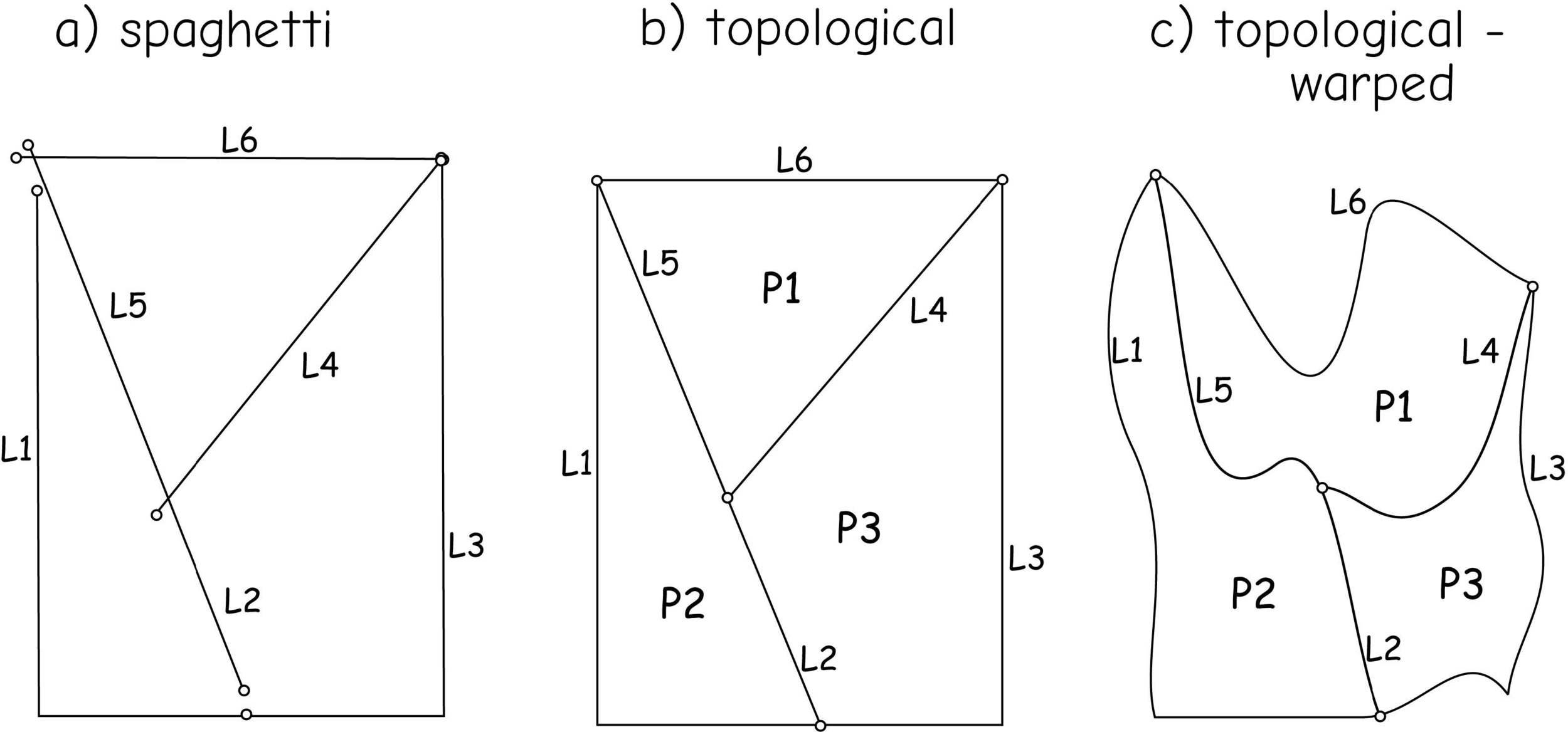
topology

topological rules

topology

attribute data
attribute data

nominal data
ordinal attributes
interval/ratio attributes
raster data model
raster data models

cells

cells

cells

cells

null
"Raster is faster, but vector is correcter"
-Ron Briggs UTDallas
comparisons & conversions
vector vs raster

conversion

other spatial data models

3-dimensional models
3-dimensional models

object-oriented models

multiple models

Spatial & Cartographic Data Models
By Stace Maples


