Deep Learning for Satellite Imagery Feature Detection
Vladimir Iglovikov


Vladimir & Sergey. 3rd out of 419 teams.
$20,000 prize
- Sr. Data Scientist at TrueAccord
- PhD in Physics at UC Davis
- San Francisco, USA
- Kaggle Master
- Deep Learning Engineer
- BS in Computer Science
- Angarsk. Siberia. Russia

Problem description
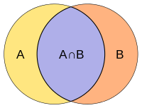
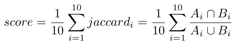
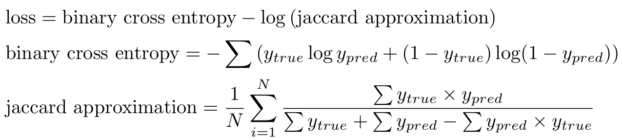
Evaluation metric
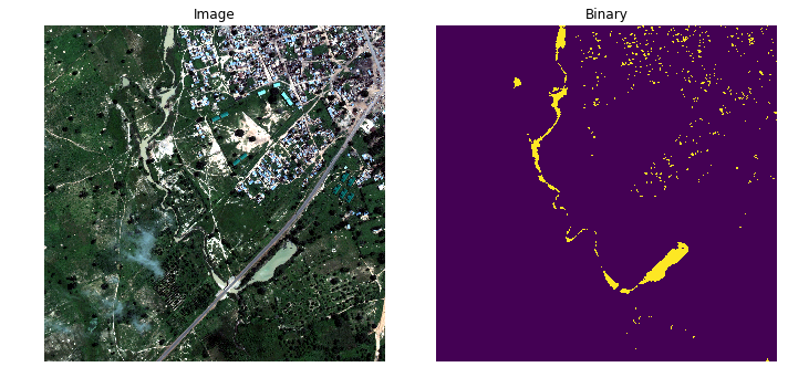
Water classes: sometimes simple solutions work better
NDWI = \frac {Green - NIR} {Green + NIR}
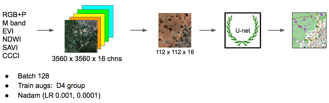
Neural network pipeline
-
Buildings
-
Misc. man-made structures
-
Roads
-
Track
-
Trees
-
Crops
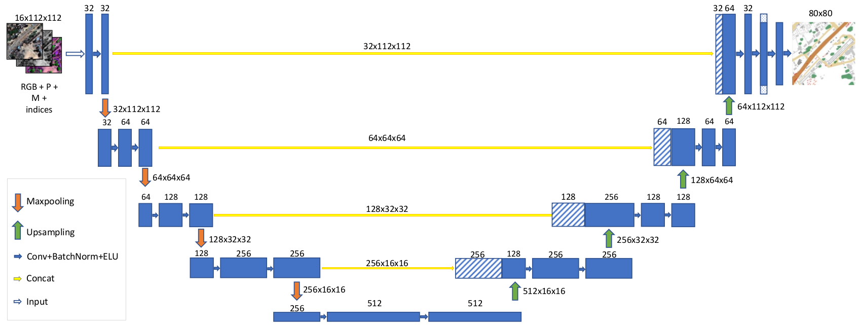
Network architecture
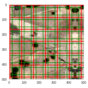
Local boundary effects
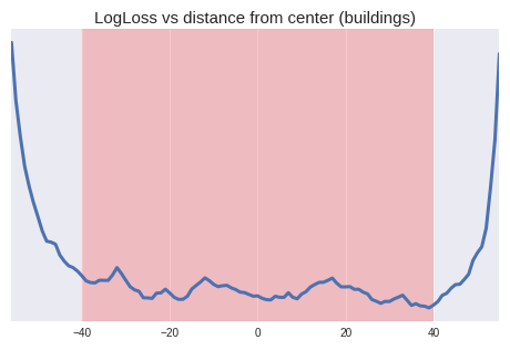
Local boundary effects
Problem
Prediction quality decreases at the edges
Solution
Added Cropping2D layer
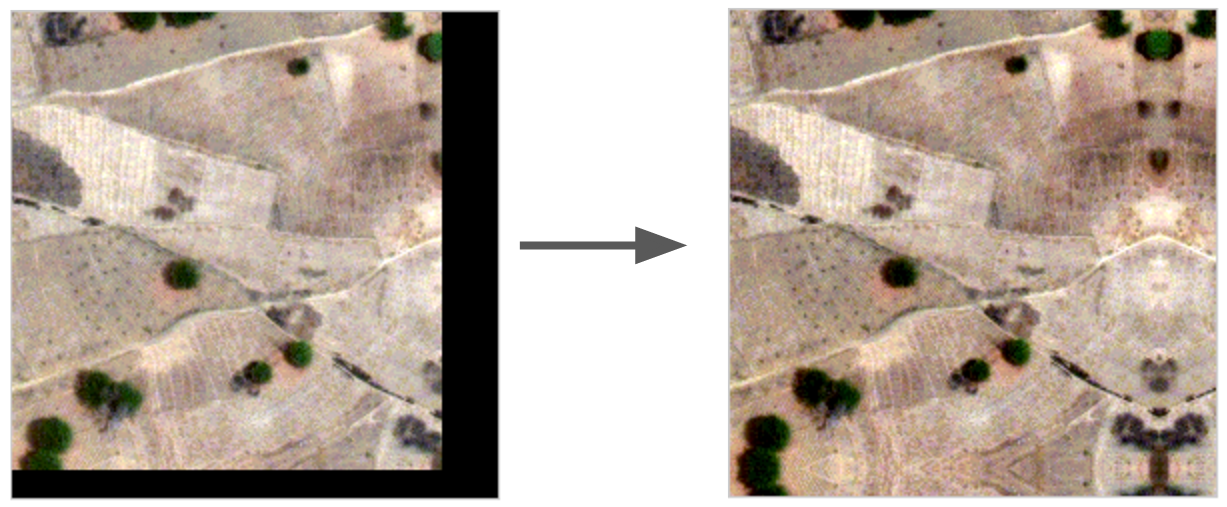
Global boundary effects
Problem
We need integer number of tiles =>
Problem
Zero Padding creates artifacts =>
Solution
Zero Padding
Solution
Reflection Padding
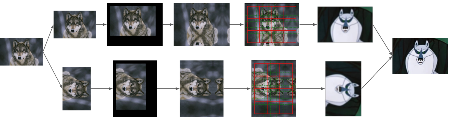
Test time augmentation
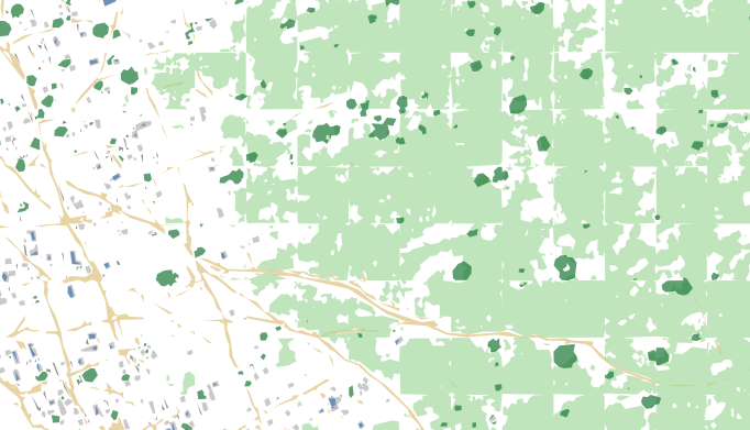
Results
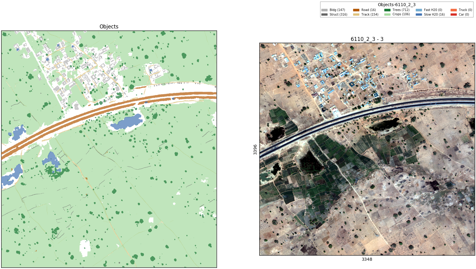
- Water classes => unsupervised
- Car classes => did not predict
- Other classes => U-net per class
- Input 4 indices + M-band + P-band + RGB
- Test time augmentation
Summary
Hardware
Vladimir
Core i7
RAM 32 Gb
Titan X (Pascal)
Sergey
2x Xeon E5-2670
RAM 128 GB
GTX 1080
Copy of Using Deep Learning for Satellite Imagery Feature Detection Challenge
By Vladimir Iglovikov


