SCI-WMS
RPS ASA
What is it?
Web Map Service (WMS) designed around
netCDF and OpenDAP
netCDF
A binary file format common in atmospheric and ocean sciences
OpenDAP
A binary protocol for accessing remote/distributed datasets
motivation
Lack of accessible tools for unstructured meshes (UGRID)
Common WMS doesn't support rendering UGRID meshes while preserving topology between nodes/cells
Consensus building around a UGRID conventions for representation in netCDF
Vast numbers of large Met-Ocean data collections available over OpenDAP
Features
- Styles that preserve topology of UGRIDS
- Sophisticated layer and style specification
- Closely tied to matplotlib
- Support for groups
- Scientifically correct GetFeatureInfo queries
architecture
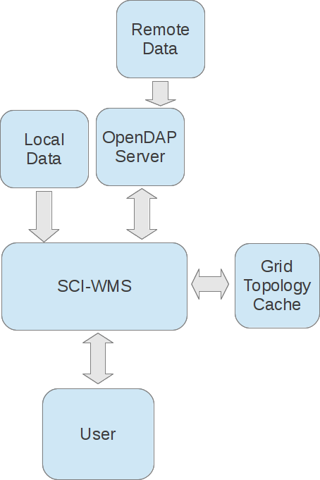
modules
Web: Django & Gunicorn
Plotting: Matplotlib & Basemap
Spatial Operations: Rtree & Shapely
Data: Numpy & NetCDF4
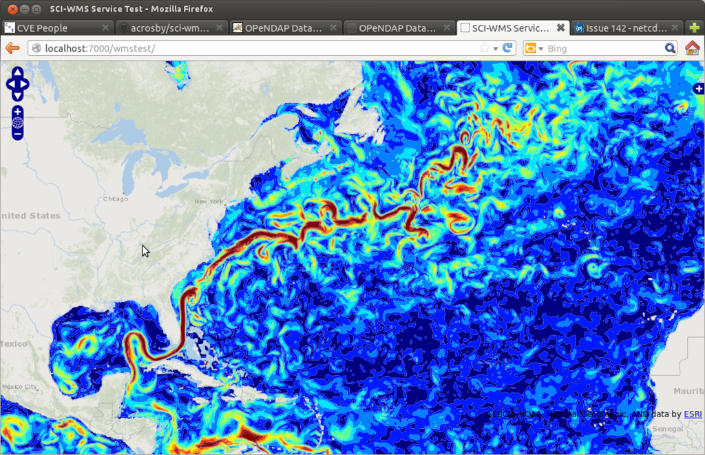
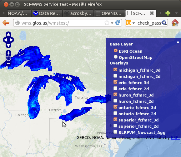
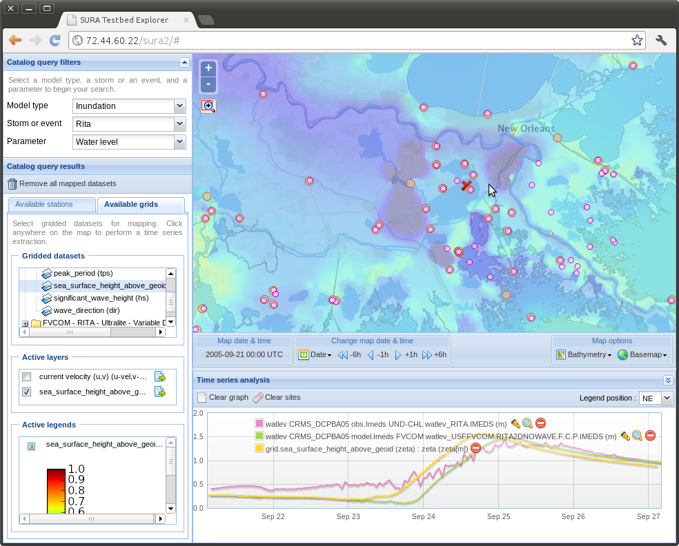
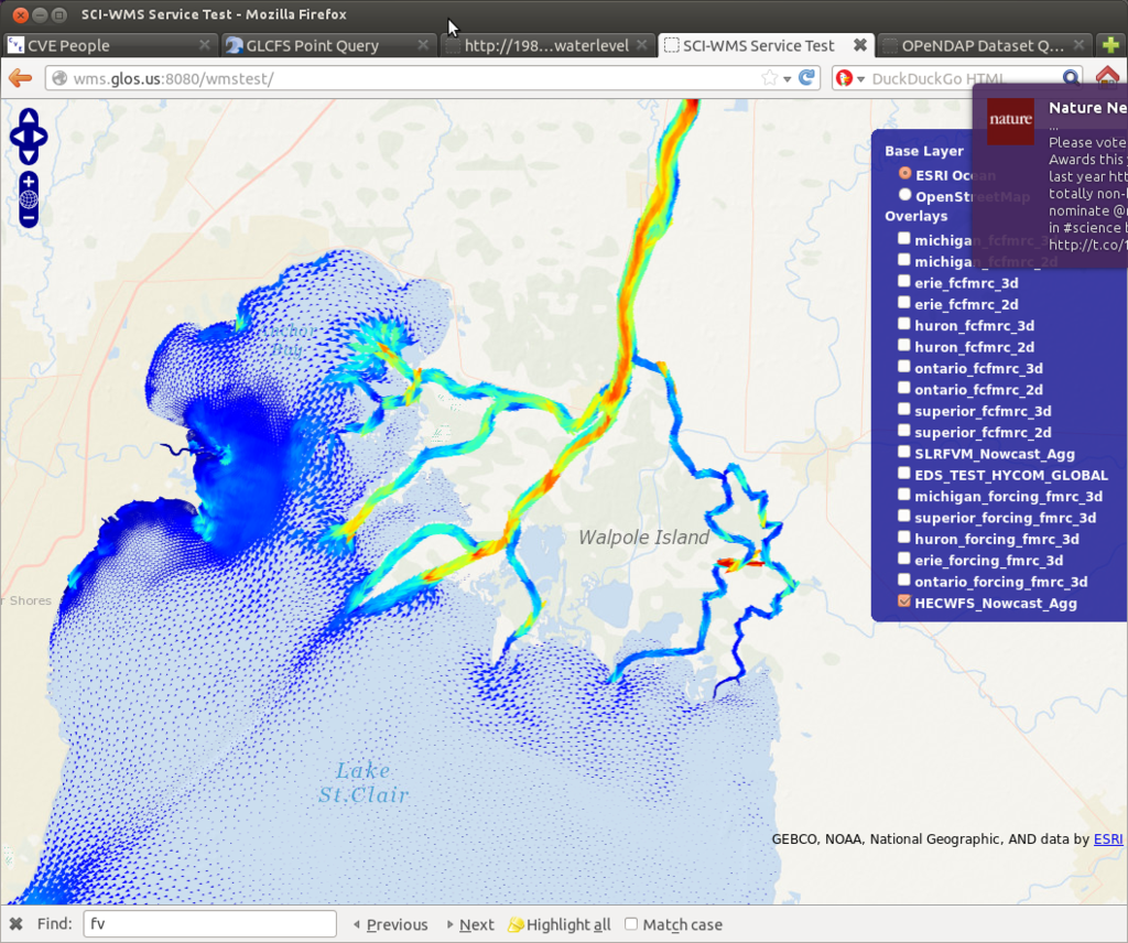
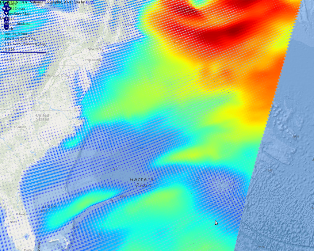
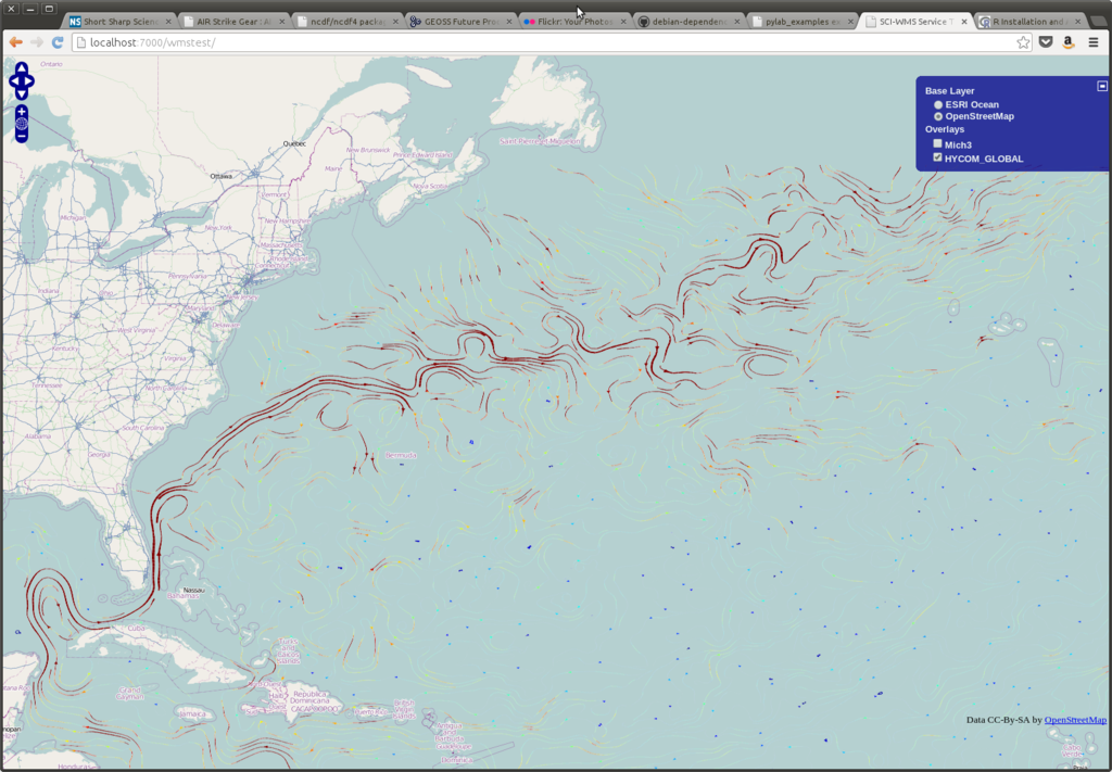
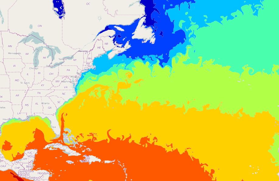
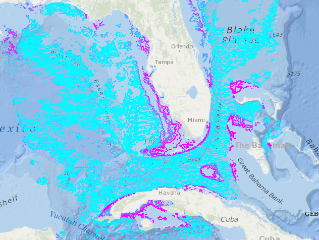
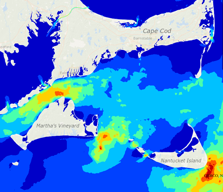
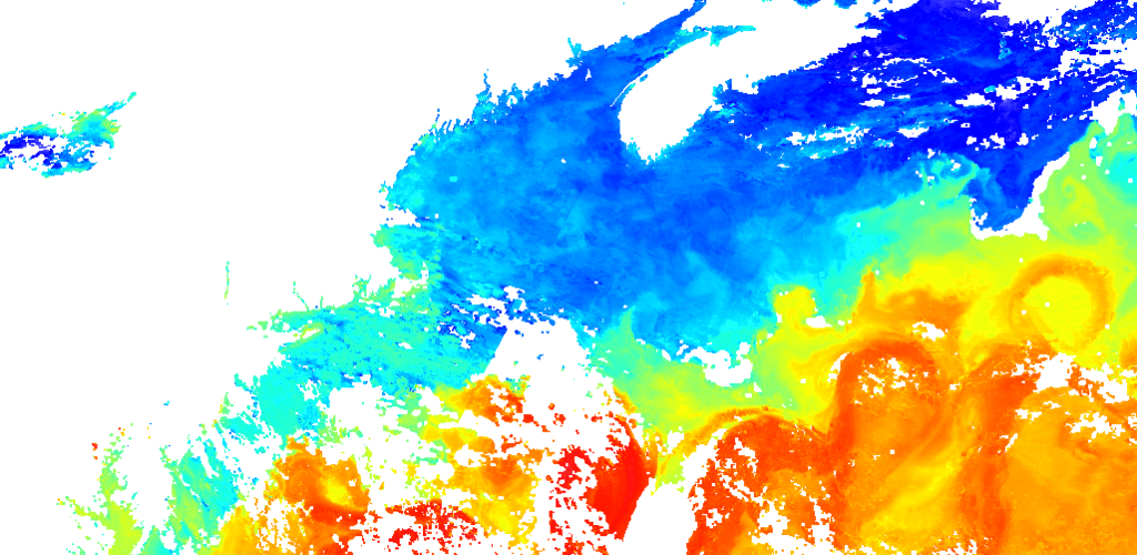
See it in Action
on the Amazon Cloud
(accessing data from around the country)
Next Steps
- More robust topology cache
- Better support for unconventional datasets
- Styles that express uncertainty
- New projections
- Discrete geometries like points, trajectories...
- Leverage hardware rendering
- Interactive HTML5 Canvas responses
Thanks!
Alexander Crosby / acrosby@asascience.com
Google+ @crosbyar
Get these slides: http://slid.es/alexandercrosby/sci-wms
Project Repository: http://github.com/asascience-open/sci-wms
SCI-WMS
By Alexander Crosby
SCI-WMS
SCI-WMS: A Python Based Web Map Service For Met-Ocean Data Accessible Over OpenDAP Or As NetCDF