Modelling the spread of Covid-19 in the UK

June Dalziel Almeida
JUNE
Christoph Becker, Richard Bower, Joseph Bullock*, Tristan Caulfield, Carolina Cuesta-Lazaro*, Aoife Curran, Edward Elliott, Kevin Fong, Richard Hayes, Miguel Icaza-Lizaola, Frank Krauss, James Nightingale, Arnau Quera-Bofarull*, Aidan Sedgewick, Henry Truong, Ian Vernon*, and Julian Willams
* speakers
- Creating a digital twin of the UK (Arnau QB)
- Dynamics of the world (Joseph B)
- Modelling Covid-19 (Carol CL)
- Policies (Joseph B)
- Model fitting and results (Ian V)
- Visualizer demo (Carol CL)
Outline
Creating a digital twin of the UK
Outline
Geography
Demography
Population
Venues
- Households
- Companies
- Schools
- etc.
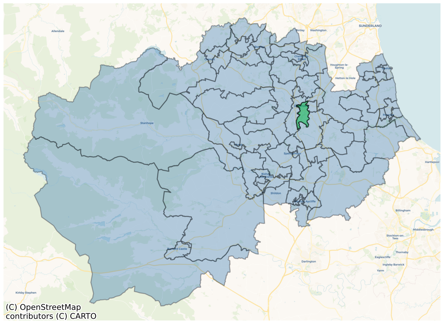
June's Geography
local authority districts
super area (MSOA)
area (OA)
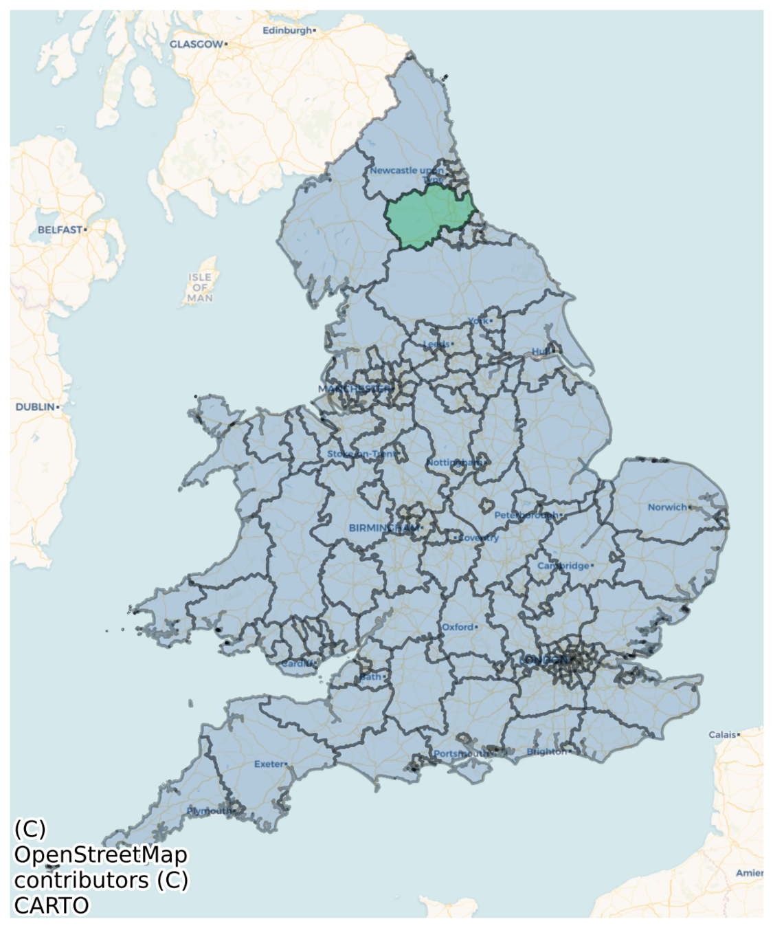
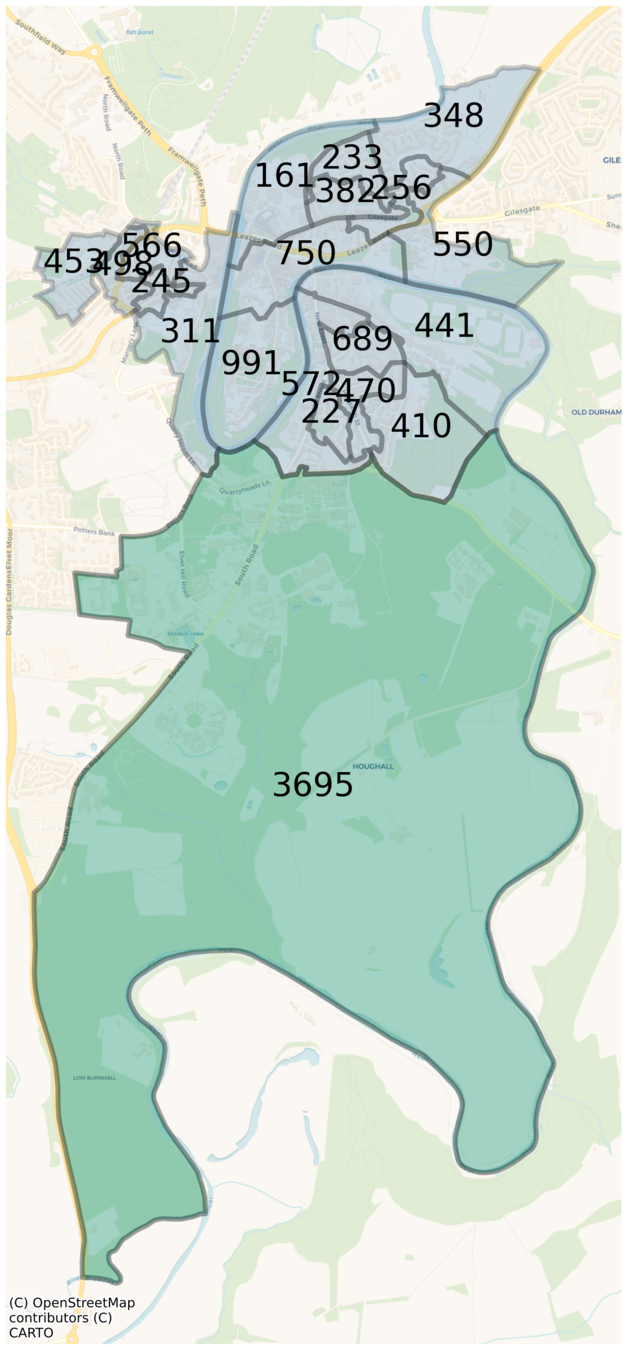
North East => 26,000 output areas
June's Demography

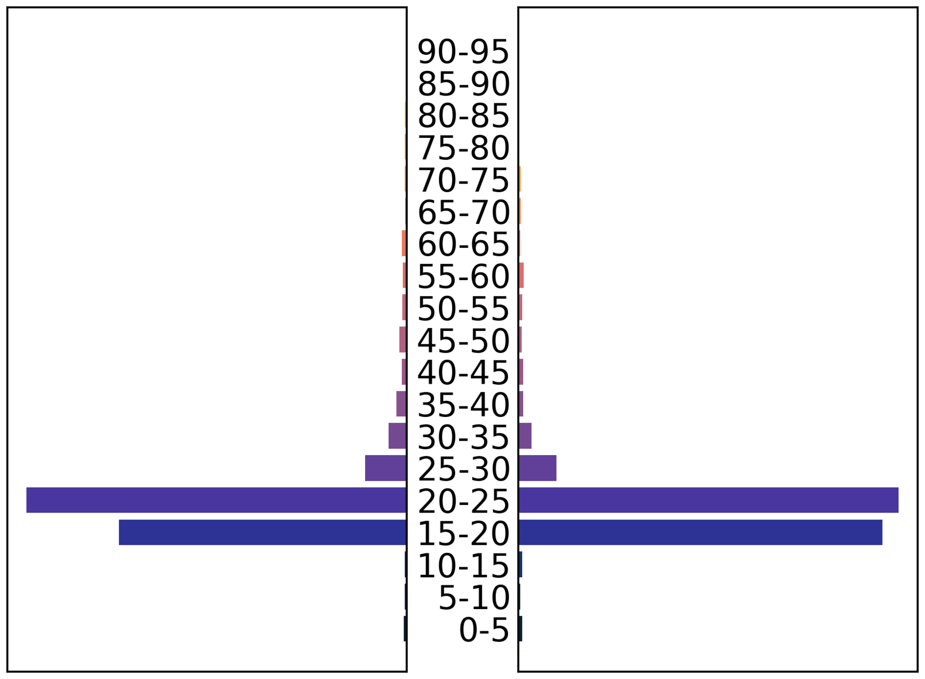
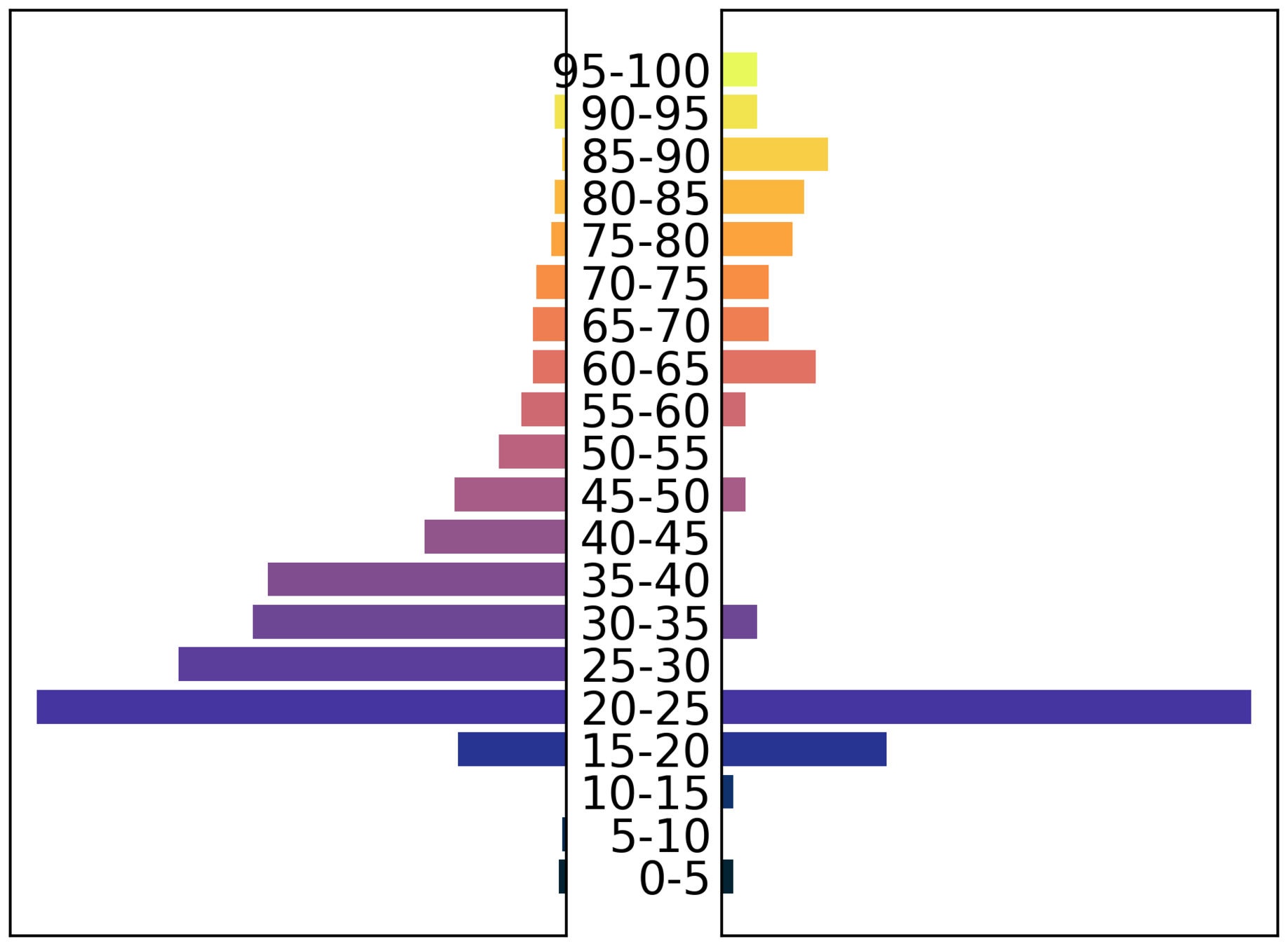
male
female
male
female
Demography
What defines a person in June?
- age (27)
- sex (f)
- ethnic group (Caribbean)
- deprivation index 2 (1-10)
- work sector / subsector (healthcare/doctor)
- mode of transport (public)
- area of residence
- super area of work

Main data source: census data (NOMIS)
Where can people be?

- Residence
- Care Home
- Household
-
Primary activity
- Company
- Hospital
- School
- Care Home
- University
-
Travel
- Commute
- National travel
-
Leisure
- Shopping
- Pubs / restaurants
- Cinema
Residence - Household
- Households based on census data.
area population
- number of households that contain at least one person over 65 years old.
- number of couples
- ....


16 different household compositions
Residence - Household
Tests
North East
London
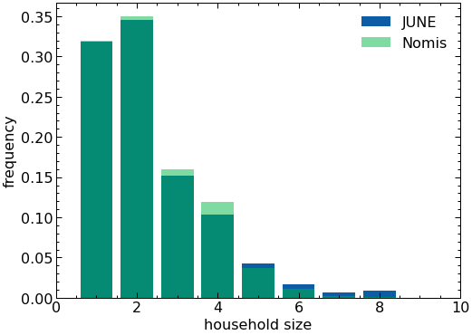

Residence - Household
Tests
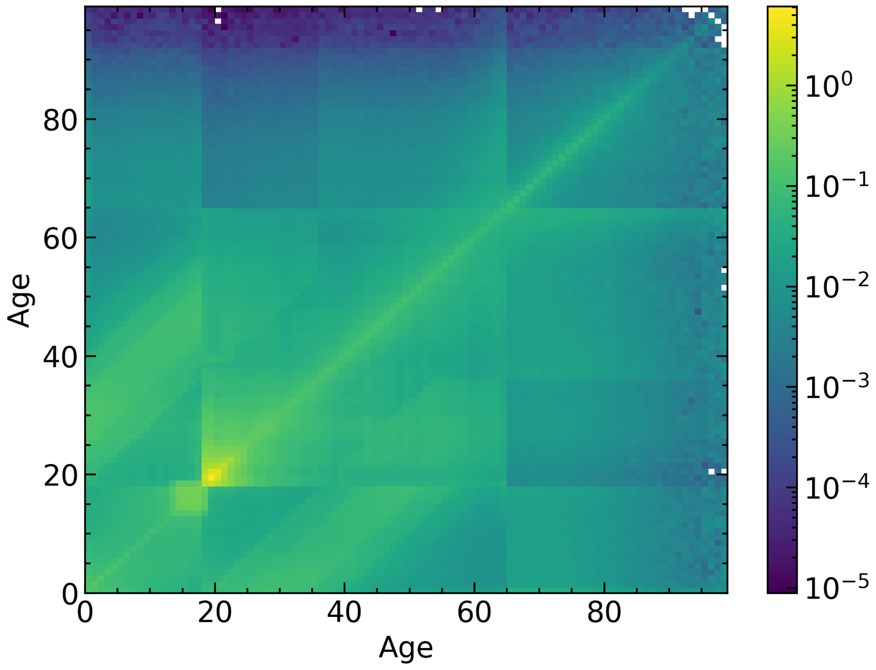
Housemates matrix (London)
Probability
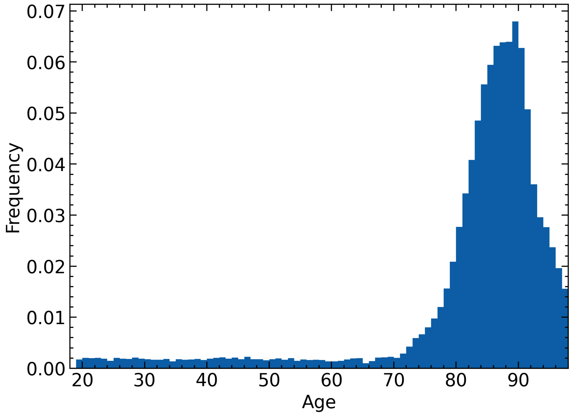
Residence - Care Home
- Each area can have up to one care home
- Location based on census data
- Three populations: residents, workers, and visitors
What can people do?

-
Residence
- Care Home
- Household
- Primary activity
- Company
- Hospital
- School
- Care Home
- University
-
Travel
- Commute
- National travel
-
Leisure
- Shopping
- Pubs / restaurants
- Cinema
Primary activity - School
Data on every school in England & Wales
- Age range
- Location (coordinates)
- Number of pupils
Assign each kid to the closest school that fits their age range.

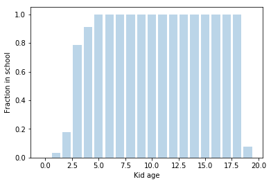
- Kids are subdivided into year groups
- We add teachers assuming constant ratio.
Primary activity - Workplace
- Idea: match residence area => work super area


Flow data
Durham, works in sector X
Newcastle, industry sector X
Sector info also used for medics and teachers.
Workplace - Residence

City of London workers' usual residence
Workplace - Companies
Company size distribution taken from census data
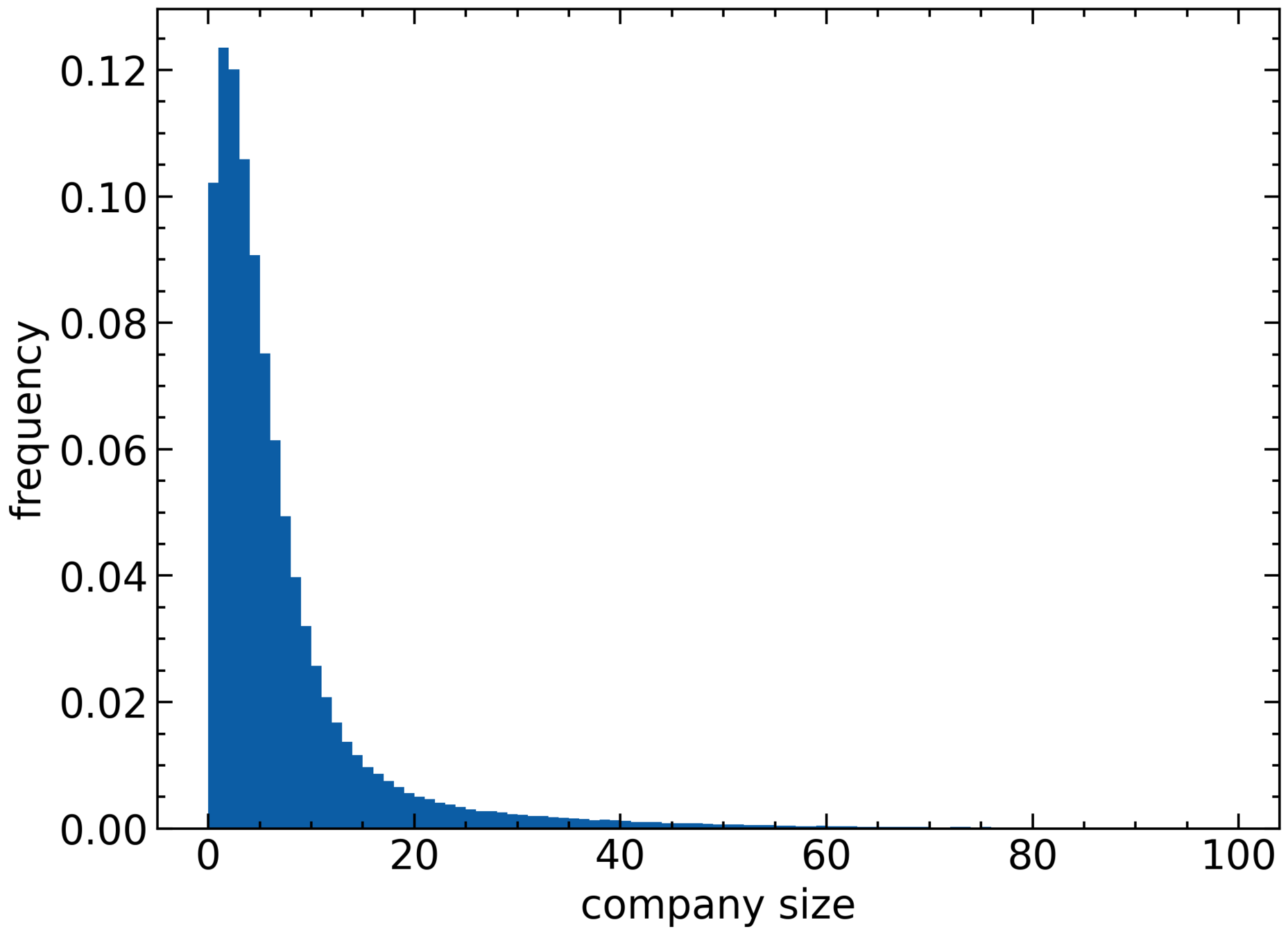
London
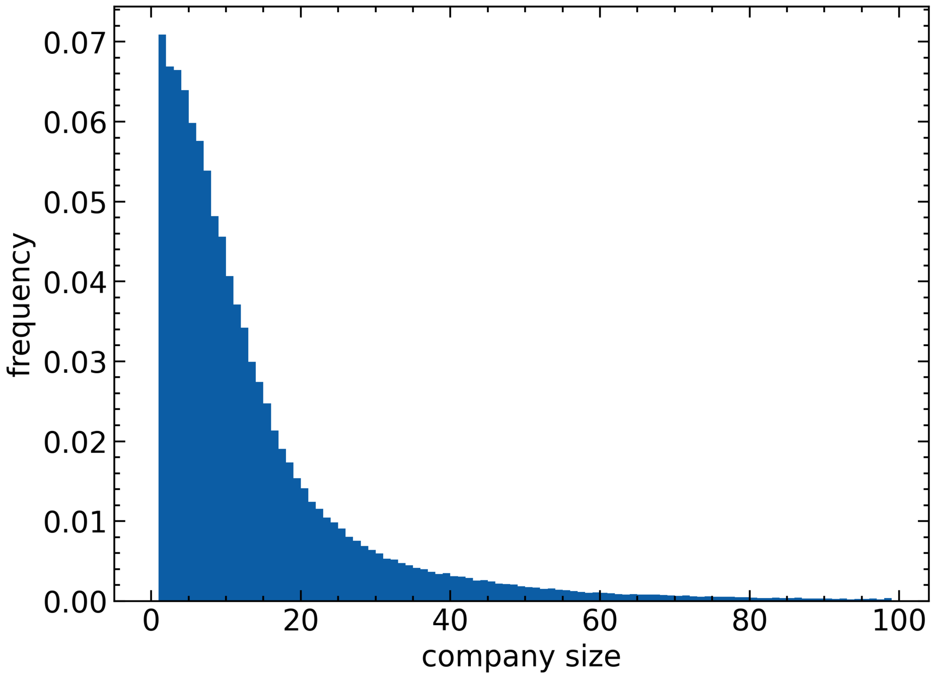
North East
Hospitals
- We model acute hospital trusts
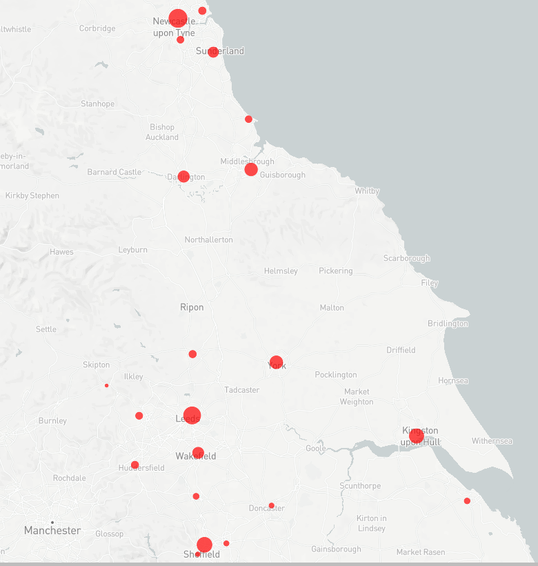
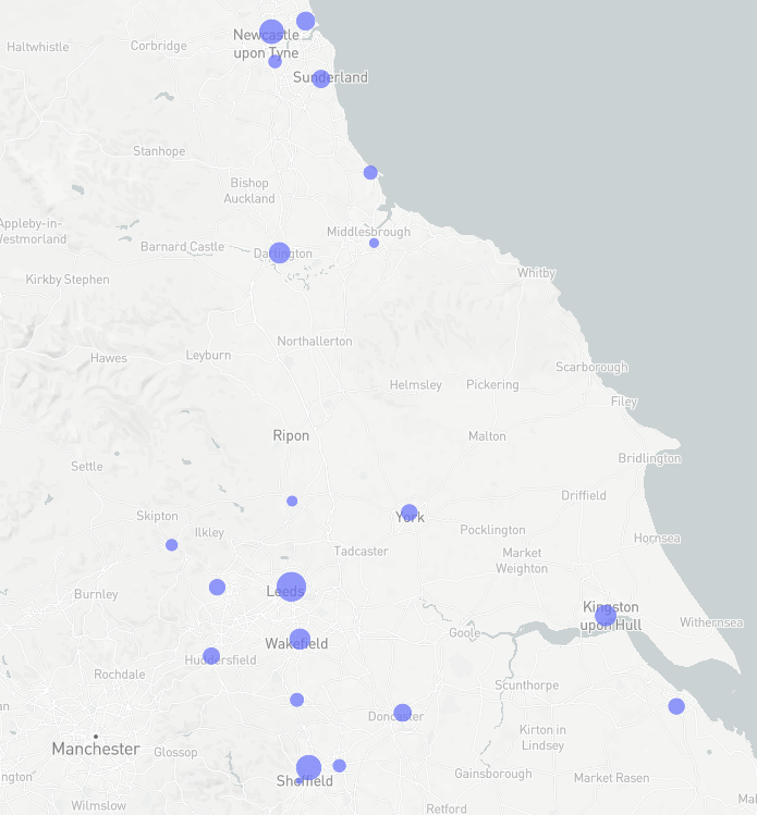
North East region trusts.
beds
ICU beds
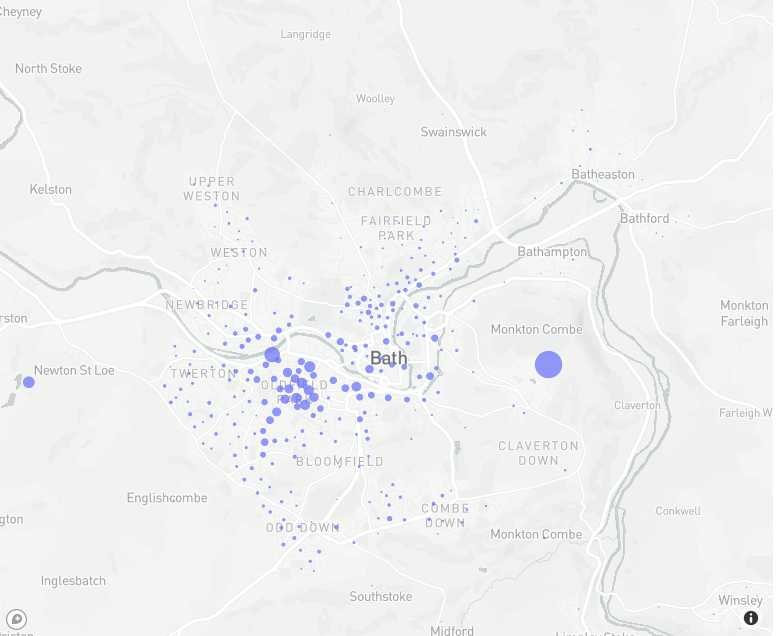
University
- All universities are included at their exact location.
- We match communal and student households to university enrolment.

Durham University student households
University
University of Bath student households
What can people do?

-
Residence
- Care Home
- Household
-
Primary activity
- Company
- Hospital
- School
- Care Home
- University
-
Travel
- Commute
- National travel
-
Leisure
- Shopping
- Pubs / restaurants
- Cinema
Commute
- From census data, we know the method of transport people use.
- Two kinds: Inner city commute, outer city commute


Hub


Hub


- Train carriage's passengers randomised every day.
- Intensity factor captures busy times
National travel (by rail)
- Data on number of travelers at the 15 largest UK cities (internal commutes excluded).
- We match the number of people at each station to infer travel routes in a probabilistic way.
London
Manchester
Liverpool
Birmingham
What can people do?

-
Residence
- Care Home
- Household
-
Primary activity
- Company
- Hospital
- School
- Care Home
- Universities
-
Travel
- Commute
- National travel
- Leisure
- Shopping
- Pubs / restaurants
- Cinema
Leisure
- Exact locations of every single pub, restaurant, grocery store, cinema, etc. from OpenStreetMap


Modelling Covid-19
JUNE
By arnauqb
JUNE
- 1,017


