THE POWER OF MAPS
functions, engagement and persuasion
MoME SU 23
August 07.
Attila Bátorfy, Átló, ELTE University


why do we love maps?
6 month


why do we love maps?

why do we love maps?
we love to know where things are
maps stimulate the brain in two ways: it stimulates our aesthetic sense, but more importantly, it invites us to use the rational side of our brain to analyse things.
maps and dataviz

Functions
aides memoriae (memory aids, mnemonic device)
planning - modelling
representation
A to B - itinerary


Pavlov "map" - bc. ca20 000
Mezhirich "map" - bc ca15000
Beudolina "map" - bc. ca3000
Marshall-islands navigational chart


plan of Nippur - bc. ca1400

Leonardo - Plan of Imola

Plan of St. Gall
Francesco Rosselli (attr) - Pianta della Catena (Florence), ca. 1472

Jacopo de Barberi - View of Venice (detail), 1500

Georg Braun, Frans Hogenberg - Hamburg, 1572–


Jacques Turgot - Birds eye view map of Paris, 1734-36 (detail)
Joseph Daniel von Huber - View of Vienna (detail), 1777

Ferenc Vitéz Collár, Lőrinc Neumayer - Telescopic Map of Hungary, I., 1840, Széchenyi National Library

John Bachmann - Bird's eye view of New York, 1865

Tabula Peutingeriana, Roman itinerary

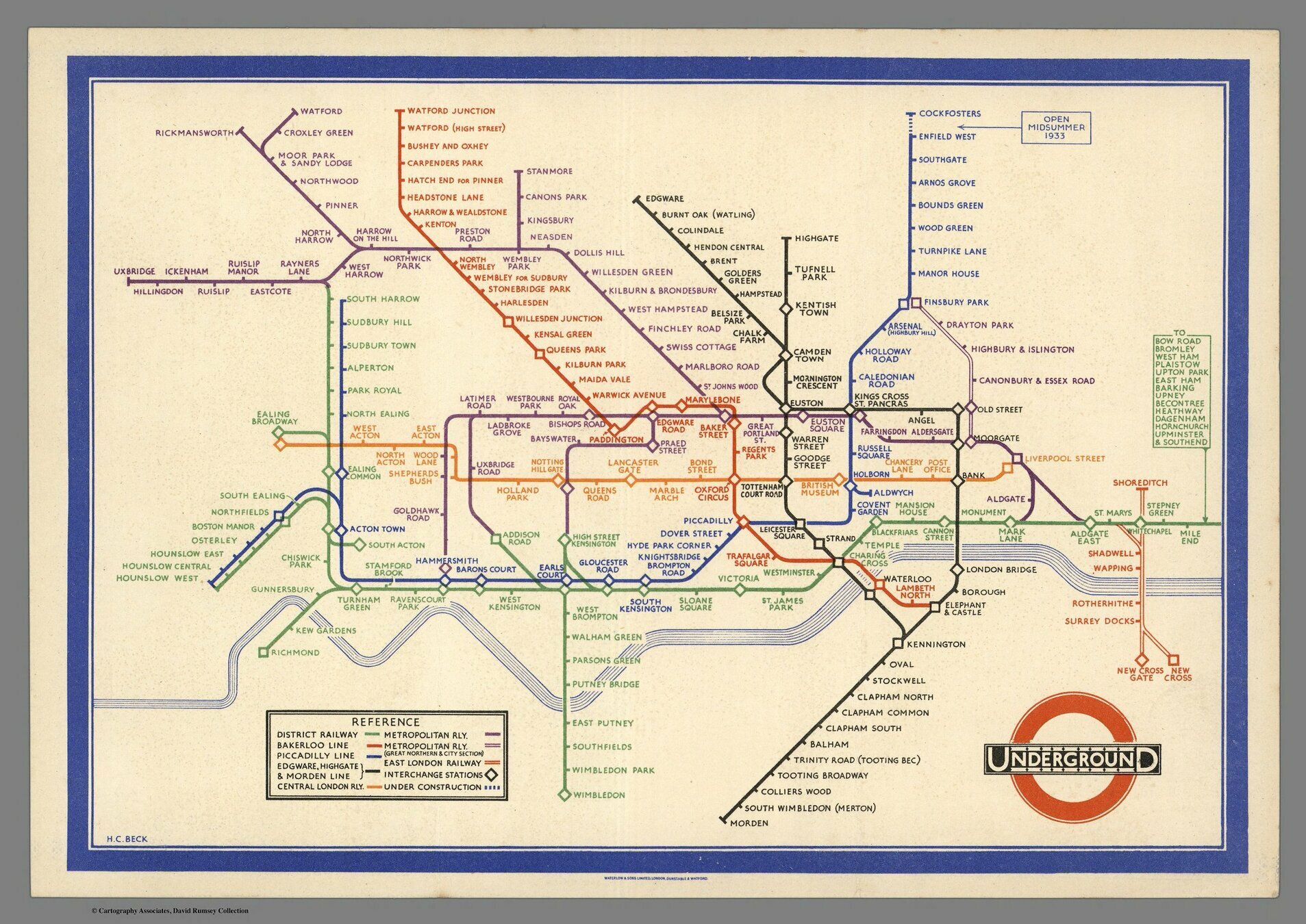
Harry Beck - Subway map of London
Functions
aides memoriae (memory aids, mnemonic device)
planning - modelling
itinerary
"mapping out" / surveying / knowledge
18. century
Englightenment, modernism, measurements
- organizing the state
- beaurocratization
- standardization
- communication
- military logistics
- l'homme moyen of Quetelet
Thematic cartography
new methods
abstraction vs. reality
weather
Edmond Halley - An Historical Account of the Trade Winds, and Monsoons, Observable in the Seas between and near the Tropicks, with an Attempt to Assign the Phisical Cause of the Said Wind, 1686

Edmond Halley - An Historical Account of the Trade Winds, and Monsoons, Observable in the Seas between and near the Tropicks, with an Attempt to Assign the Phisical Cause of the Said Wind, 1686

Alexander von Humboldt - Isothermes according to latitude and longitude lines, 1817

WC Woodbridge - Isothermal map based on Humboldt's observations, 1823
Francis Galton - First modern weather maps, Meteographics, 1863
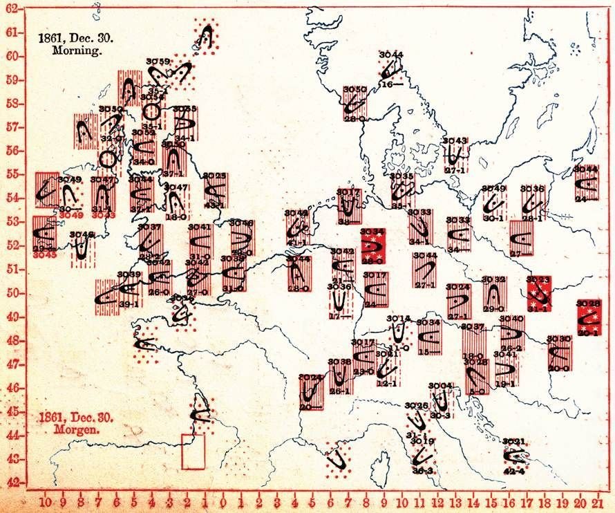
Francis Galton - First modern weather maps, Meteographics, 1863

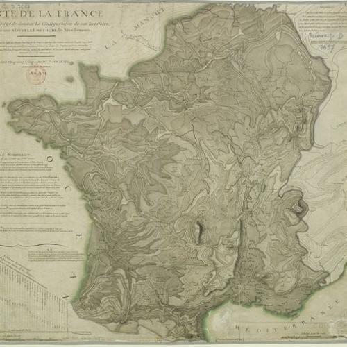
topography and geology
Marcellin du Carla-Boniface - Isoline topographic map
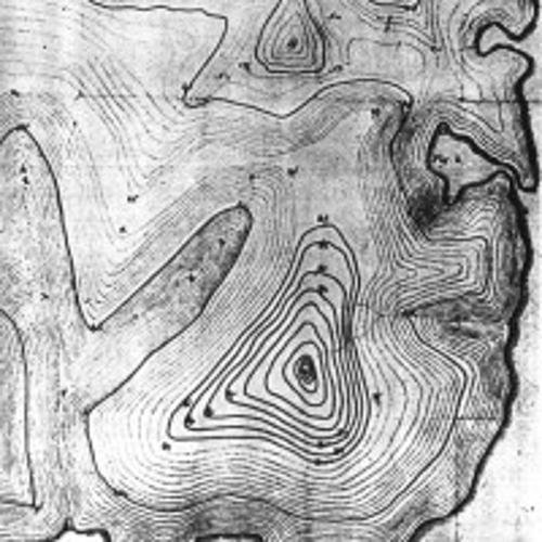
Jean-Louis Dupain-Triel, 1798
Johann Friedrich Wilhelm von Charpentier - First geological map, 1778

William Smith - Geological map, 1815


Luigi Ferdinando Marsigli - Mappa Metallographica..., Danubius Pannonico-Mysicus, 1726
Sámuel Mikoviny: Cross sections of the mines at Selmecz, 1746, Széchenyi National Library


György Buchholtz jr. - Panoramic view of the High Tatra, 1717, Széchenyi National Library

György Buchholtz jr. - Cross section view of the "Dragon-cave" at Deményfalva, 1719

transportation and communication
? - The Danube at Vaskapu (Iron Gate) with the navigable canals, Institute and Museum of Military History 1750


Imre Milecz - Map of salt transportation routes, 1773
Imre Milecz - Map of salt transportation routes, 1773

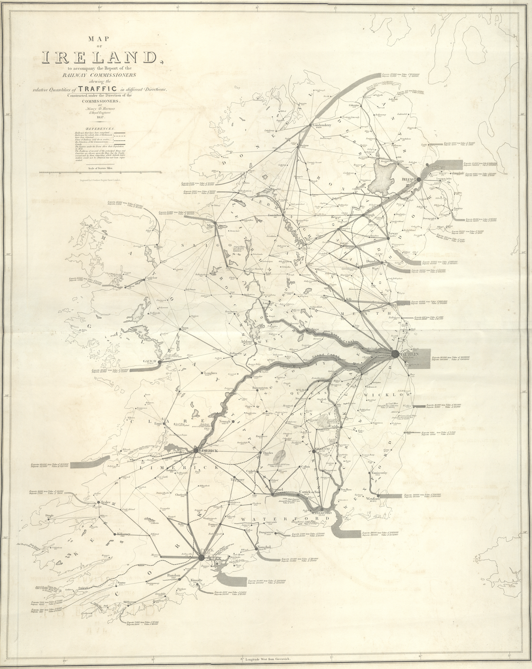
Drury Harness - Traffic of Dublin, 1837
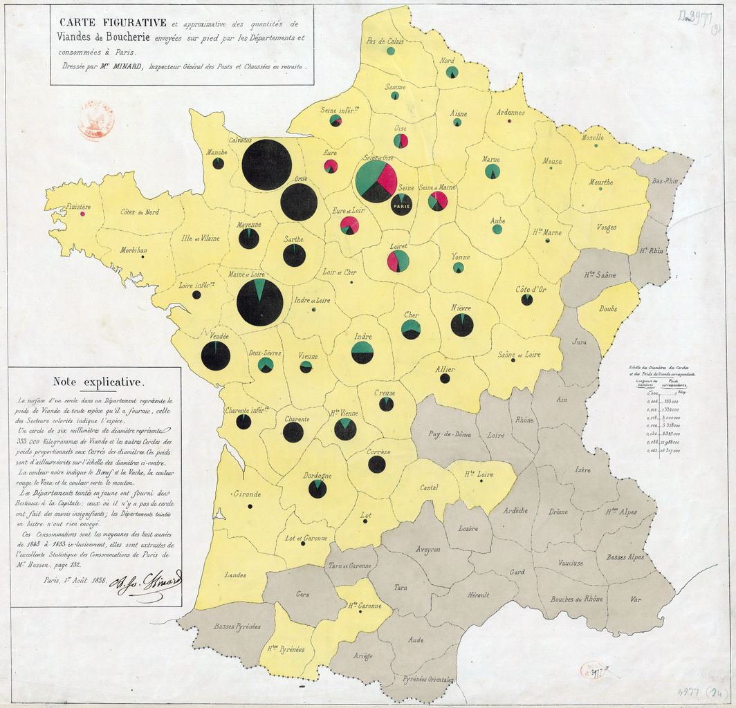
Charles-Joseph Minard - Meat export to Paris, 1862

Charles-Joseph Minard, diagram map, 1858
Martin de Chevalier - Isochrone map of France, 1882

Emile Cheysson et. al - Anamorfic Map, 1889


Franz Raffelsperger - Postal Network of the Habsburg Empire, 1826

Franz Raffelsperger - Postal Network of the Habsburg Empire, 1826
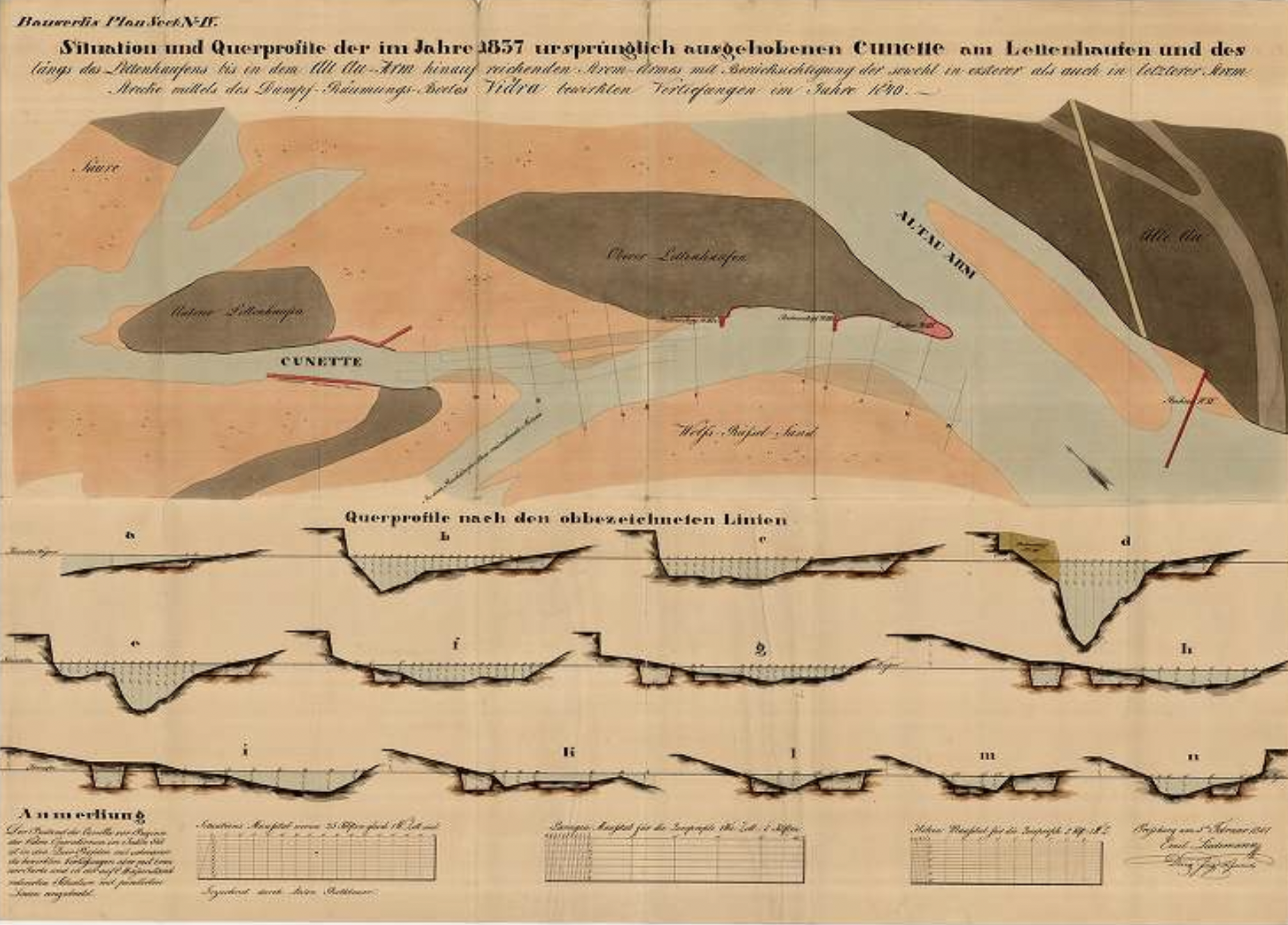
Site map of the regulation of Tisza river

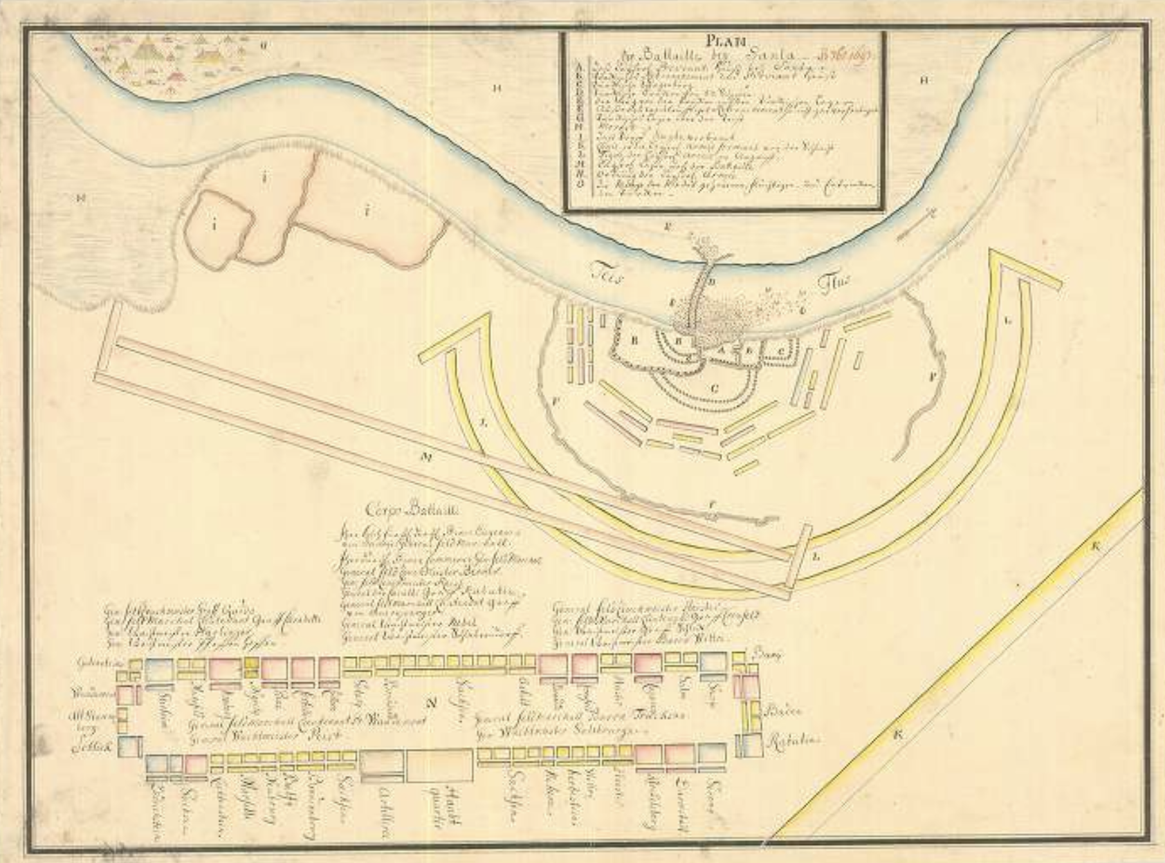
military and war
Anonymous - Battle of Nagyszombat with the orders of the Imperial and the Hungarian army, 1704, Museum and Institute of Military History


diseases
Valentine Seaman (1770–1817)
Yellow Fever Map, 1798

Cholera Map of London, 1849

John Snow ? (1813–1858)
Cholera Map of London, 1854

people
János Mátyás Korabinszky - Ethnographic and religious map of the comitatus Sáros, 1793,
Széchenyi National Library

Charles Dupin, choropleth map, 1826

János Csaplovics - Ethnographische Karte, 1829

André Michel Guerry - Comparative choropleth maps, 1829

Frére de Montizon - Point Density Map, 1830

Frére de Montizon, 1834

James Cowles Prichard and Alexander Keith Johnston - Ethnic Map, 1843

Leon Montigny
Election Map of Paris, 1870

Charles Booth - Poverty Map of London, 1889

Florence Kelley (1859–1932)
Chicago Wage Map
1895

Pál Balogh, Kocsárd Proff - Ethnic Map of Hungary, 1902

Pál Balogh, Kocsárd Proff - Ethnic Map of Hungary, 1902

style and rhetoric
consistency


Anton Rothbauer, Emil Liedemann, 1846
Minard, 1853


Cheysson et. al. 1880–1906
RJ Andrews' collection
Henry Gannett, 1903
David Rumsey Map Collection

Lajos Illyefalvi, 1933–
David Rumsey Map Collection
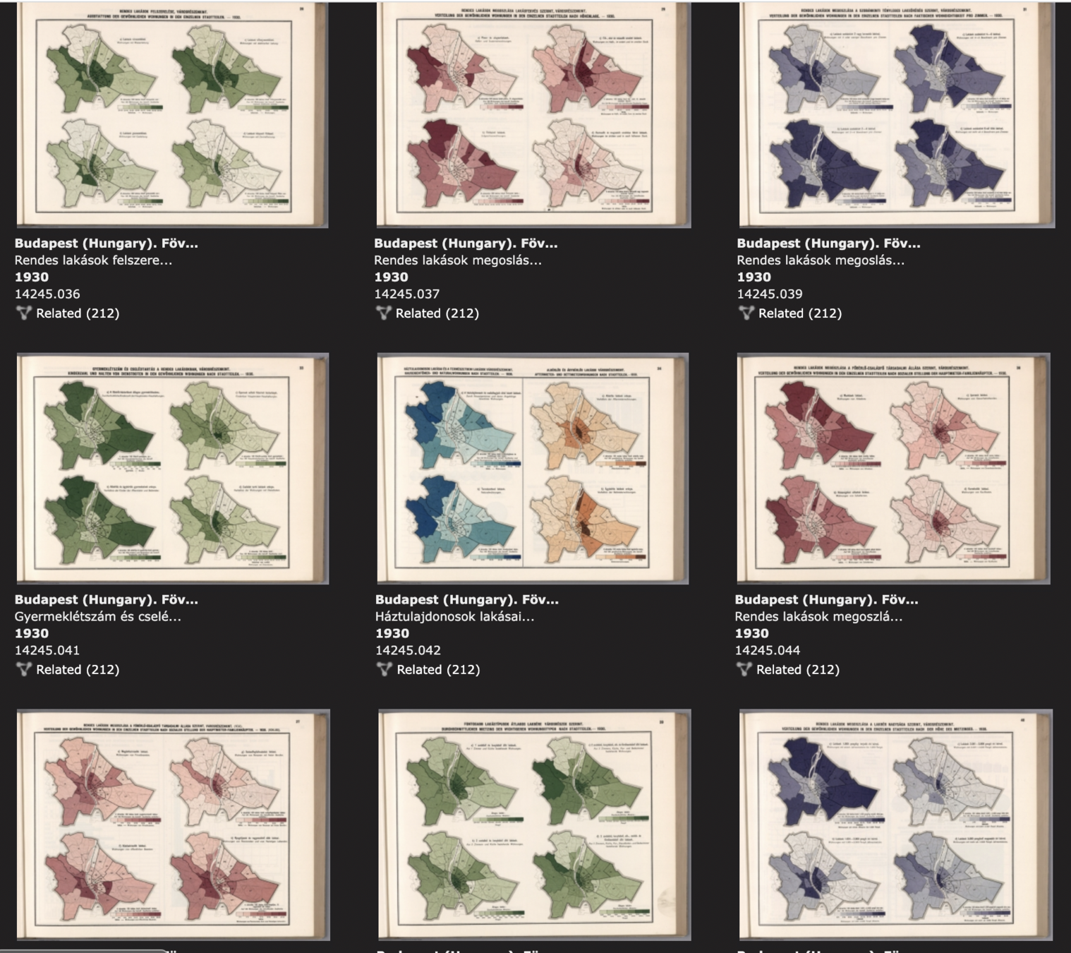
Lajos Illyefalvi, 1933–
David Rumsey Map Collection

Erwin Raisz, 1949–
David Rumsey Map Collection

making maps interesting
Richard Edes Harrison
David Rumsey Map Collection
making maps interesting


Passoneau - Wurman, 1966
David Rumsey Map Collection
the beauty of technology

Passoneau - Wurman, 1966
David Rumsey Map Collection
the beauty of technology

Klichenmann et. al, 1970
David Rumsey Map Collection
the beauty of technology

Klichenmann et. al, 1970
David Rumsey Map Collection
the beauty of technology

Galton, 1875, Times
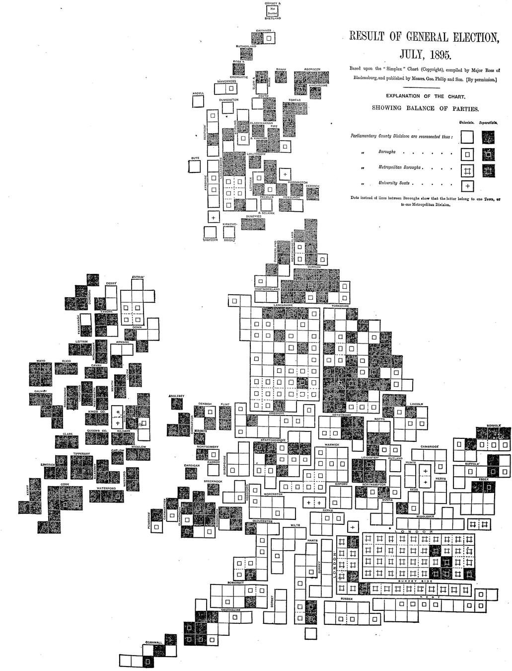
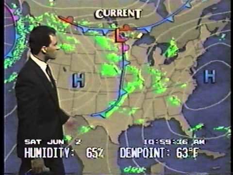
maps in news
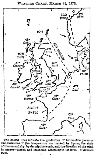
The London Times, 1895
The New York Times, 1896

The New York Times, 1829

George Rorick, 1982


Weather Channel, 1990
NYT


Washington Post

FiveThirtyEight

El País

LSO, 2017
AP


Financial Times

Reuters
rhetoric
Carte rouge, 1920

emphasis

Impeach this map 2016
lie

Tim Meko, Washington Post
exaggeration

Anthony Hearsey, 2020

hyperbole
Craig Taylor, Coral Cities
metaphor
Topi Tjukanov, Vintage isochrones

pastiche, reference
thank you!
batorfy.attila@atlo.team
MoME SU23
By Attila Bátorfy


