Ward Wiz:
Using Python to look up civic data

Problem:
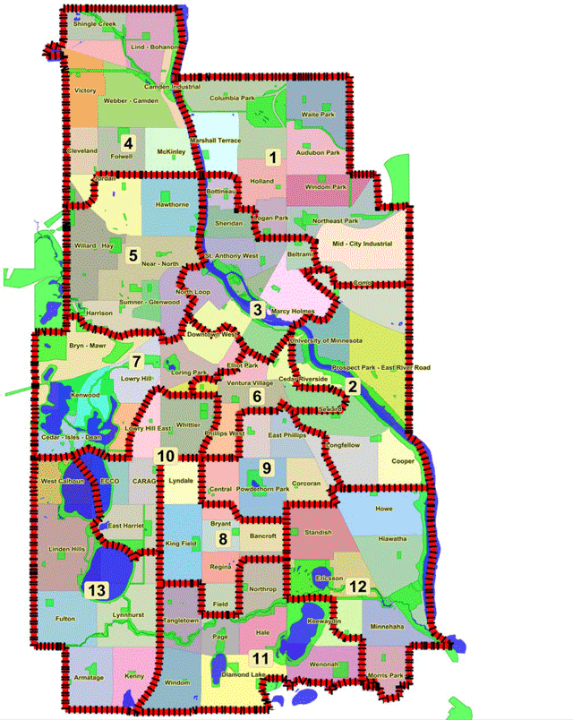
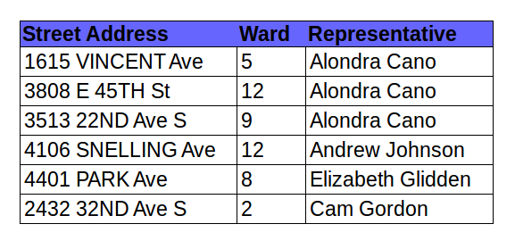
Need to look up city ward information for many Minneapolis street addresses.

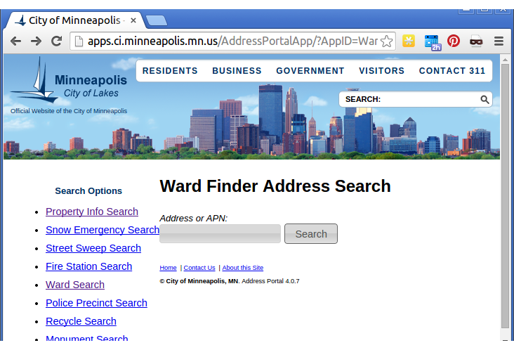
Existing tool: Ward Finder Address Search

Disadvantage: must enter one address at a time. What if you have hundreds of addresses?
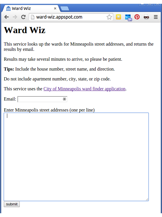
Solution: Ward Wiz

- Google Cloud application
- Uses Python 2.7 and Webapp2
- User pastes a list of Minneapolis street addresses into the textbox.
- User enters his or her email address and clicks Submit.
- Application sends requests to the City of Minneapolis web site in the background.
- Application sends email to user when results are complete.
Code for looking up city wards (wards.py)
import urllib
import urllib2
import re
from google.appengine.api import memcache

URL = "http://apps.ci.minneapolis.mn.us/AddressPortalApp/Search/SearchPOST?AppID=WardFinderApp"

pattern = re.compile(r"/ward([0-9]+)/")

# Look up the ward for a Minneapolis street address.

def get_ward(street_address):
    street_address = normalize(street_address)
    ward = memcache.get(street_address)
    if ward is not None:
        return ward

    values = {'Address': street_address}
    data = urllib.urlencode(values)
    ward = 'NA'
    req = urllib2.Request(URL, data)

    try:
        response = urllib2.urlopen(req)
        url = response.geturl()
    except:
        return 'NA'

    match = re.search(pattern, url)
    if match:
        ward = match.group(1)
    memcache.set(street_address, ward)
    return ward

def normalize(street):
    street = street.strip().upper()
    for stopword in (' MINNEAPOLIS', ' MPLS', ' APT ', ' APT.', ' ROOM ',
                     ' UNIT ', '#', ' NO '):
        if stopword in street:
            index = street.index(stopword)
            street = street[:index].strip()
    return street
Main application code (main.py)
import webapp2
import urllib
from google.appengine.api import mail
from google.appengine.api import taskqueue
import wards

WEB_FORM = """\
<html>
  <head>
    <title>Ward Wiz</title>
  </head>
  <body>
    <h1>Ward Wiz</h1>
    <p>This service looks up the wards for Minneapolis street addresses,
       and returns the results by email. </p>
    <p>Results may take several minutes to arrive, so please be patient.</p>
    <p><strong>Tips:</strong> Include the house number, street name, and direction.<p>
    <p>Do not include apartment number, city, state, or zip code.</p>
    <p>This service uses the
    <a href="http://apps.ci.minneapolis.mn.us/AddressPortalApp/?AppID=WardFinderApp">City
    of Minneapolis ward finder application</a>.</p>
    <form action="/enqueue" method="post">
      <div>Email: <input type="text" name="user"></div>
      <br>
      Enter Minneapolis street addresses (one per line) <br>
      <div><textarea name="streets" rows="20" cols="60" placeholder="2799 1st Ave SE"></textarea></div>
      <div><input type="submit" value="submit"></div>
    </form>
  </body>
</html>
"""

class MainPage(webapp2.RequestHandler):
    def get(self):
        self.response.write(WEB_FORM)


class Enqueue(webapp2.RequestHandler):
    def post(self):
        streets = self.request.get('streets')
        user = self.request.get('user')
        taskqueue.add(params={'user': user, 'streets': streets})
        self.redirect('/')


class TaskRunner(webapp2.RequestHandler):
    def post(self):
        user_address = self.request.get('user')
        streets = self.request.get('streets')
        if user_address and streets:
            streets = streets.split('\n')
            output = []
            for street in streets:
                street = street.strip()
                if street:
                    ward = wards.get_ward(street)
                    output.append("%s,%s" % (street, ward))
            sender_address = "dradcliffe@gmail.com"
            subject = "Your ward information"
            body = "\n".join(output)
            mail.send_mail(sender_address, user_address, subject, body)


application = webapp2.WSGIApplication([
    ('/', MainPage),
    ('/enqueue', Enqueue),
    ('/_ah/queue/default', TaskRunner)
], debug=False)
application: ward-wiz
version: 1
runtime: python27
api_version: 1
threadsafe: true
handlers:
- url: /favicon\.ico
static_files: static/favicon.ico
upload: static/favicon\.ico
- url: /.*
script: main.application
libraries:
- name: webapp2
version: latest
Configuration file: app.yaml
Alternative method
- Look up latitude and longitude for each address. (Geocoding)
- Compare the latitudes and longitudes with the ward boundaries.
- Why? Doing the math ourselves is faster and more reliable than sending hundreds of POST requests.
Geocoding in Python is Easy
import geocoder

address = "1501 Hennepin Ave E, Minneapolis MN"
g = geocoder.google(address)
latitude, longitude = g.latlng
But how do we find the ward boundaries? Open Data Minneapolis!

Ward boundary data
- Ward boundaries are available in GeoJSON format.
- Each ward is represented by a polygon.
- A polygon is a list of [lon, lat] pairs
- Crossing test: A point is inside a polygon if and only if a ray from that point crosses the polygon an odd number of times.

Ward finder using GeoJSON
import json

def load_polygons(filename="City_Council_Wards.json"):
    polygons = {}
    with open(filename) as f:
        wards = json.load(f)
        for feature in wards['features']:
            ward = feature["properties"]["BDNUM"]
            coordinates = feature["geometry"]["coordinates"][0]
            polygons[ward] = coordinates
    return polygons


def point_in_polygon(x, y, poly):
    p = [(x1 - x, y1 - y) for x1, y1 in poly]
    x2, y2 = p[0]
    crossings = 0
    for i in xrange(1, len(p)):
        x1, y1 = x2, y2
        x2, y2 = p[i]
        s = sgn(y1)
        if s != sgn(y2) and (x1>=0 or x2>=0) and sgn(x2*y1-x1*y2) == s:
            crossings += 1
    return crossings % 2 == 1


def get_ward_by_lng_lat(lng, lat, polygons):
    for ward, poly in polygons.iteritems():
        if point_in_polygon(lng, lat, poly):
            return ward
    return 'NA'


def sgn(x):
    if x < 0:
        return -1
    return 1
Looking up City Wards with Python & Google App Engine
By David Radcliffe
Looking up City Wards with Python & Google App Engine
- 1,472


