Geospatial Data

ArcGIS Developers

Raul Jimenez | Esri

Find me as @hhkaos at:

Consuming

Living Atlas of the World

PetaBytes of geospatial data from authoritative data providers

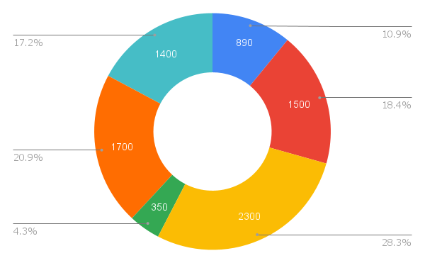
Data services distribution by category

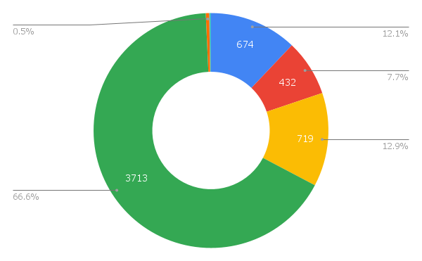
Data services distribution by service type

Living Atlas of the World (LAW) is a subset of data available in ArcGIS

Demo: LAW quick overview

Tile layers

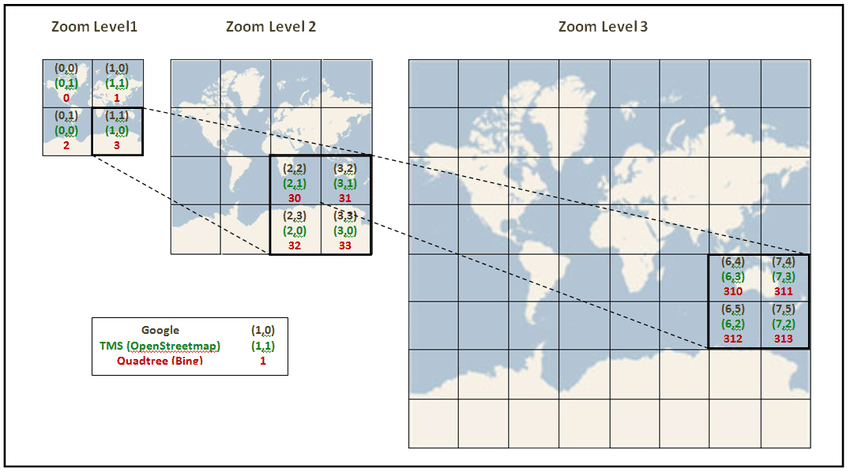
Service type: Tile Map Service (x, y, z), Web Map Tile Service (WMTS) & Esri Tile Layers | Data type: raster or vector

The method of tile indexing used by the major online map providers.

Folders in HD with raster tiles
Entire world can take ~20
TB (raster) vs ~13 GB (vector)

Principle of vector tiling

Main purpose: provide context to data & technical performance: storage and load times.

Example: basemaps (satellite, roads, ...), aerial pictures, large data, ...

Feature layers

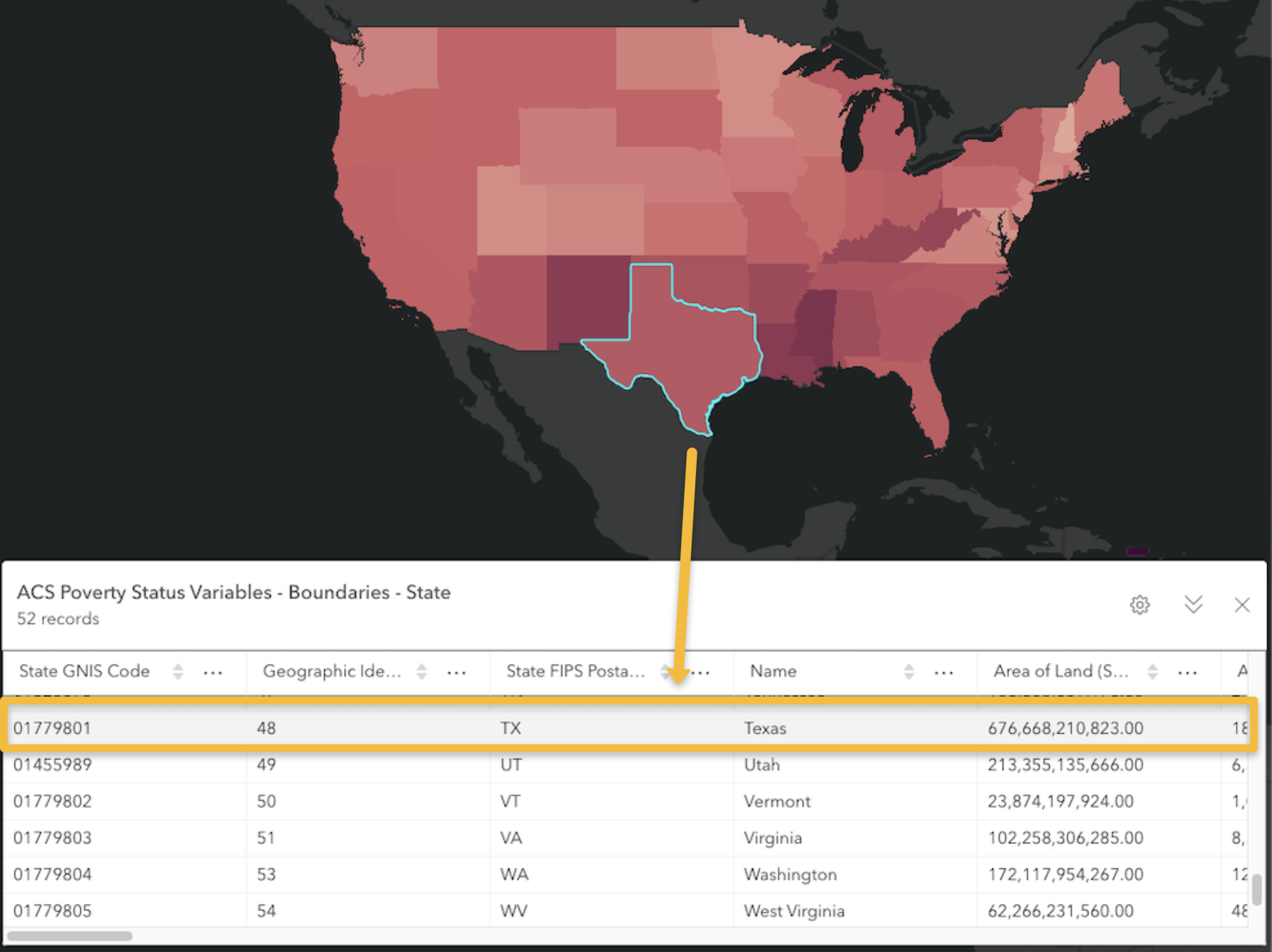
For spatial raw vector data. Similar to GeoJSON, KML, GPX ... but it is managed through a REST API.
 Esri Hosted Feature Layers are optimized, supporting: data tiling, caching, protocol buffers, cartographic generalization, http2, CDNs, and more.

Service type: Esri Feature Layers, Web Feature Service (WFS) | Data type: vector (alphanumberic + shape/geometry)

Main purpose: access, query, and edit raw data interactively

Example: buildings, POIs, roads, live alerts, boundaries, ...

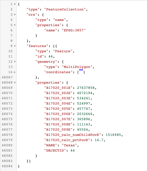
Geometry as GeoJSON

Each shape/geometry (point, line or polygon) as a tuple associated with it

Map Image Layers

Service type: Map Service, Web Map Service (WMS)| Data type: can include both feature and non-feature layers as sublayers

Main purpose: combine the best of raster and vector in a single service

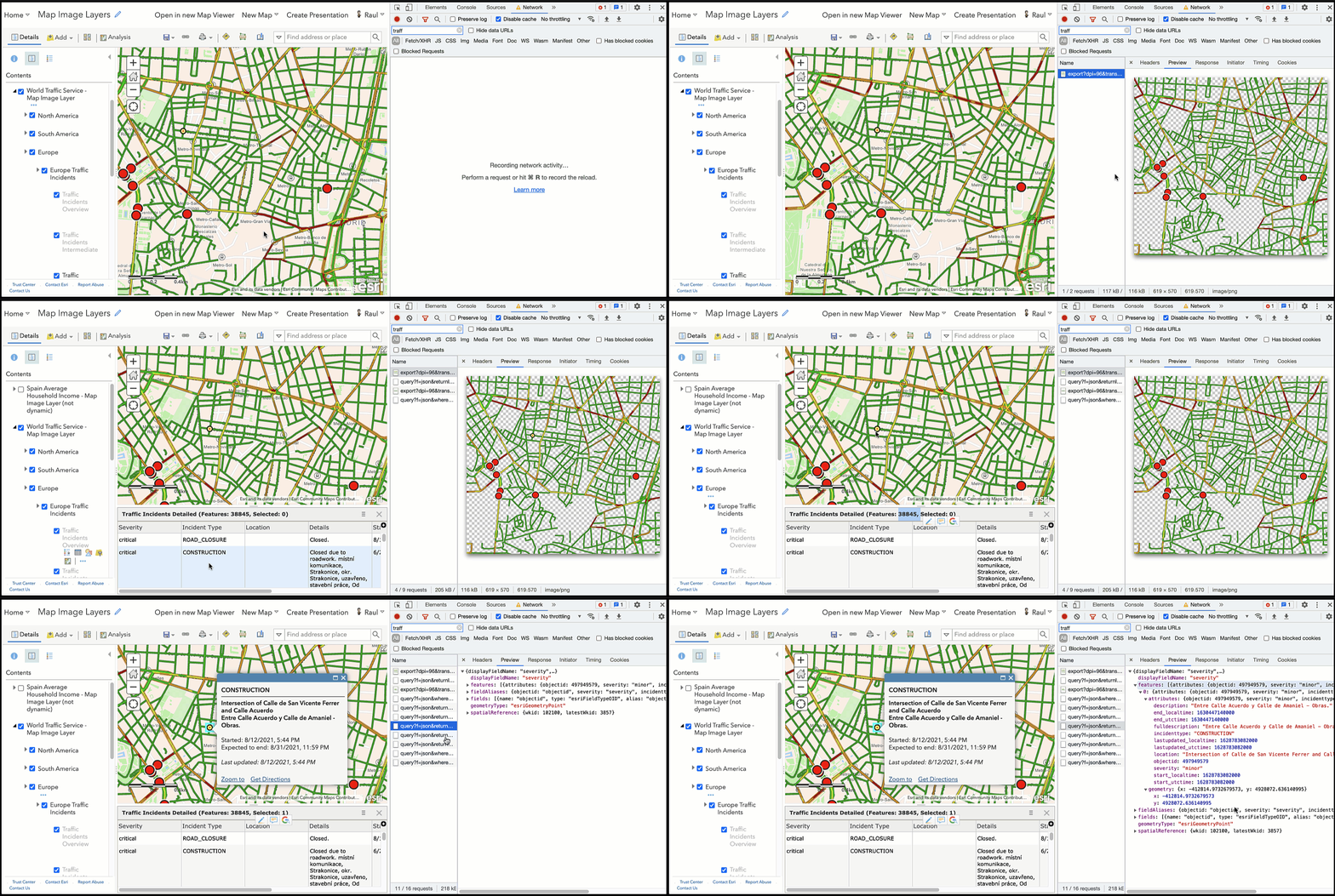
Example: interactive large datasets: demographics by county, large water or traffic models, ...

World Traffic Service - Serving road congestion as a dynamic image and traffic incidents as a queryable layer

Imagery Layers

Service type: Esri dynamic imagery layers (a.k.a. raster layers), Web Coverage Service (WCS) | Data type: raster

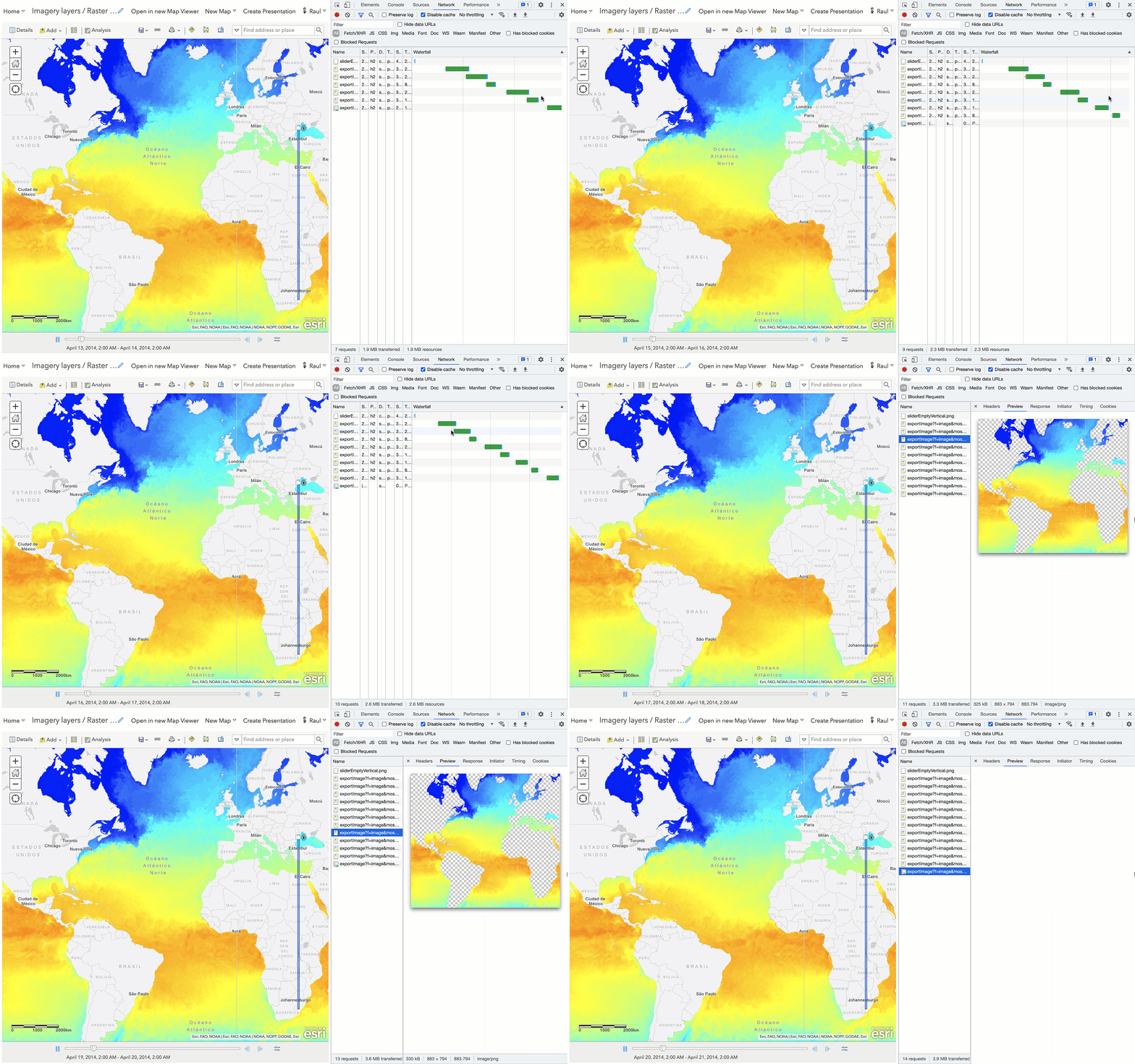
Raster Layer - Export image - Time Animation

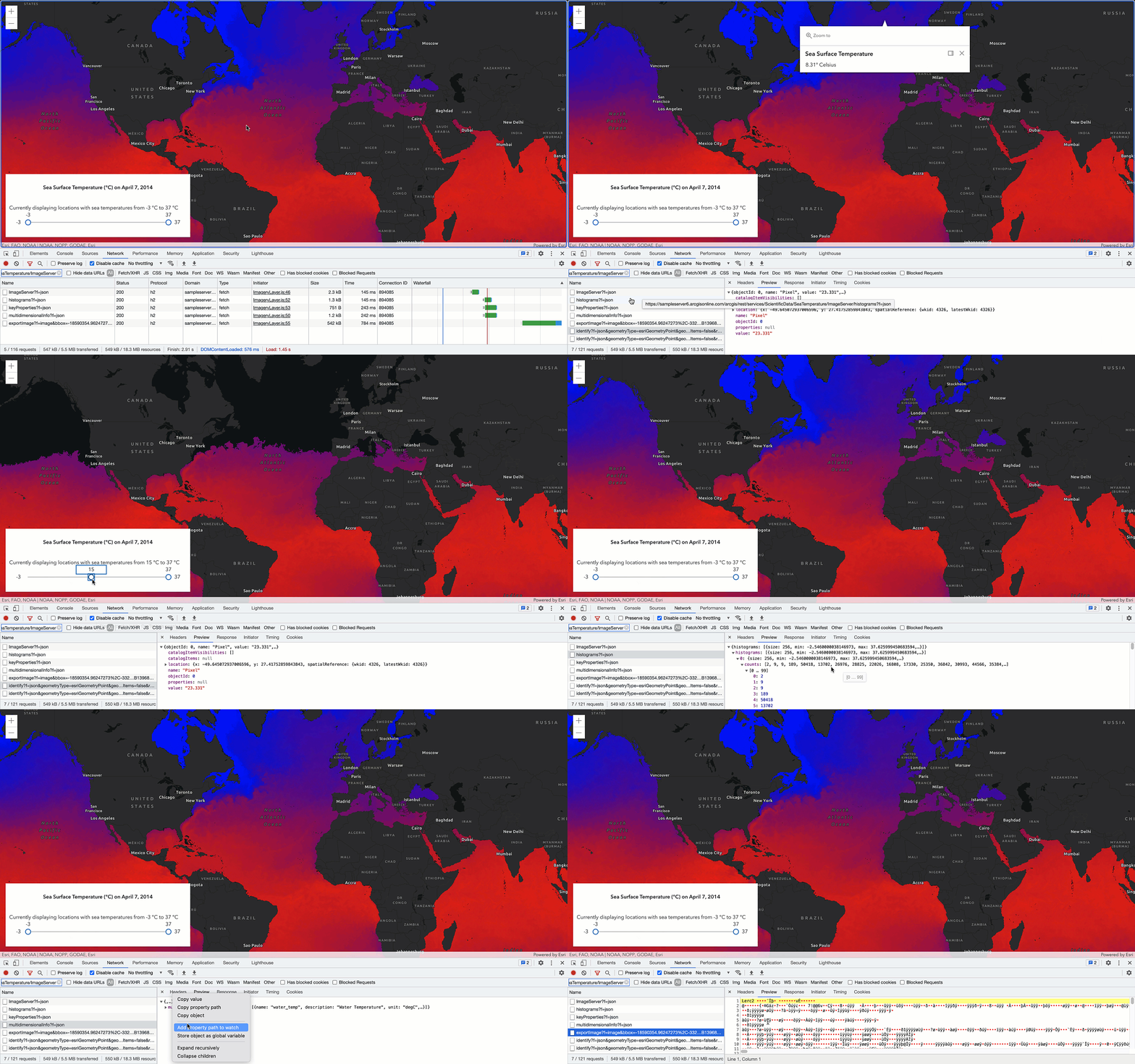
Main purpose: process and analyze large continuous space/time-varying data.

Example: weather data, land cover, vegetation index, elevation data, slopes, ...

Raster Layer - Client Side raw data filtering

Disclaimer

  • Remember, we have reviewed the four most common data types of services, but ArcGIS Platform supports many more (scene services, stream service, KML services, geodata services, etc.).

  • Living Atlas data layers access considerations:

    • Default layers (~5900): free to access and use (no login required).

    • Subscription layers (~1000): free to access and use (login required).

    • Premium layers (~500): paid pers use (demographic layers mainly).

  • Not all data can be downloaded, read Deployment > Content and data.

Other data sources

Thanks


Raul Jimenez | rjimenez@esri.com

Find me as @hhkaos at:

Please check the video description

for aditional sources.

Geospatial Data

By Raul Jimenez Ortega

Geospatial Data

  • 971