
What is the Great Elephant Census?
How was GIS used to manage data?
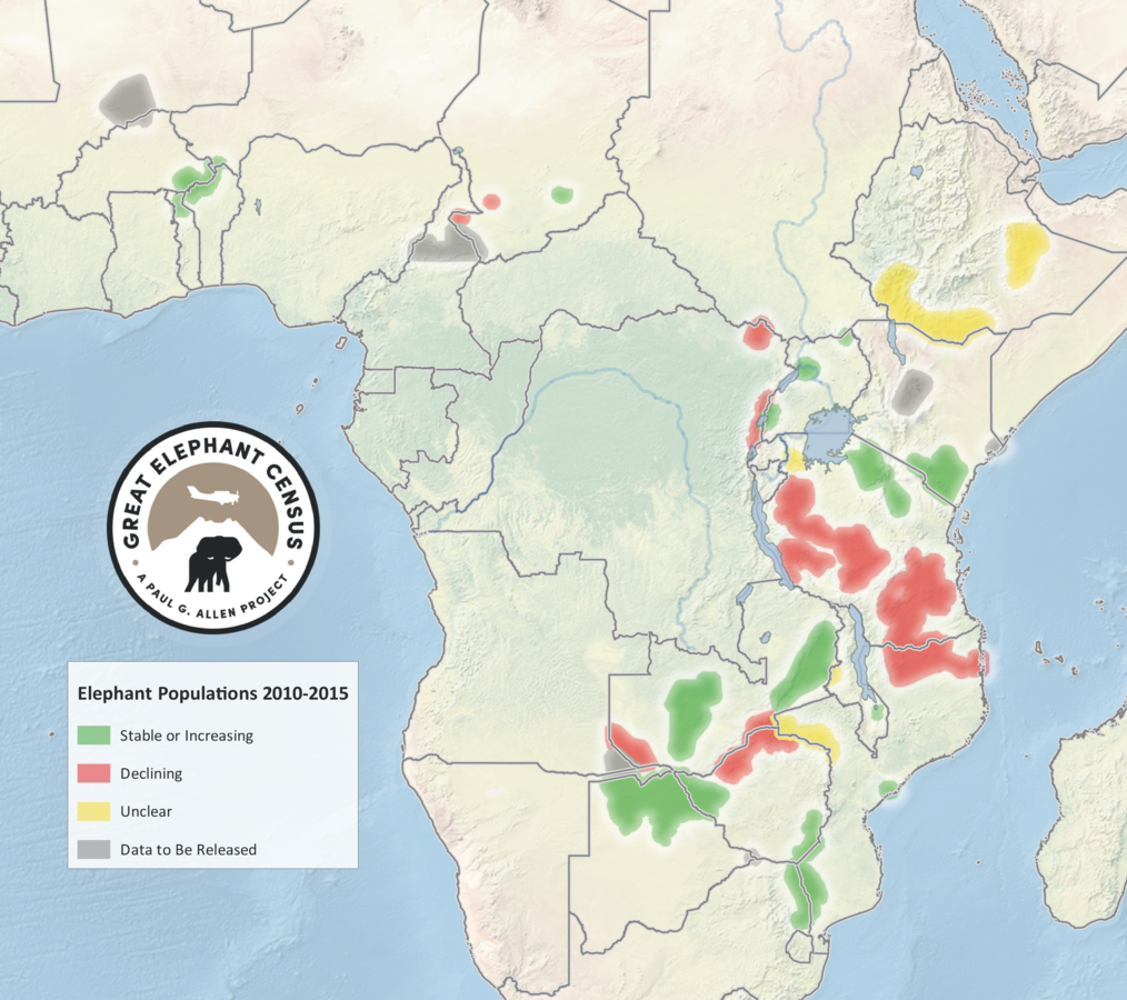
Results + Impacts of GEC
What is the GEC?
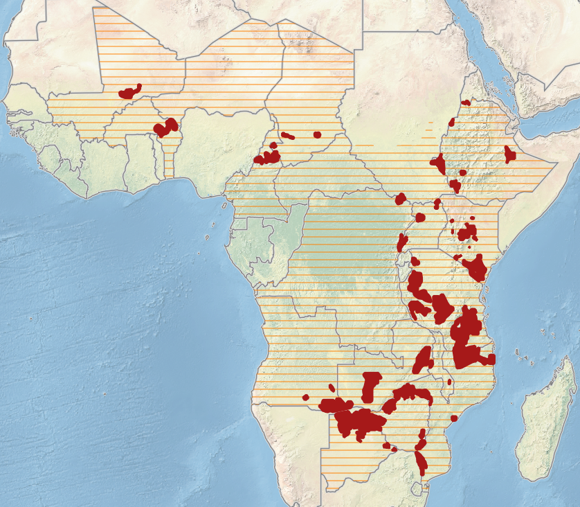
coordinated aerial surveys of savannah elephant range
covering majority of their range
including parts of 20 countries

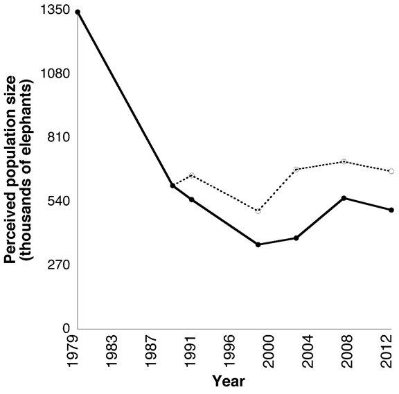
Need for GEC
current data for population status assessment across range
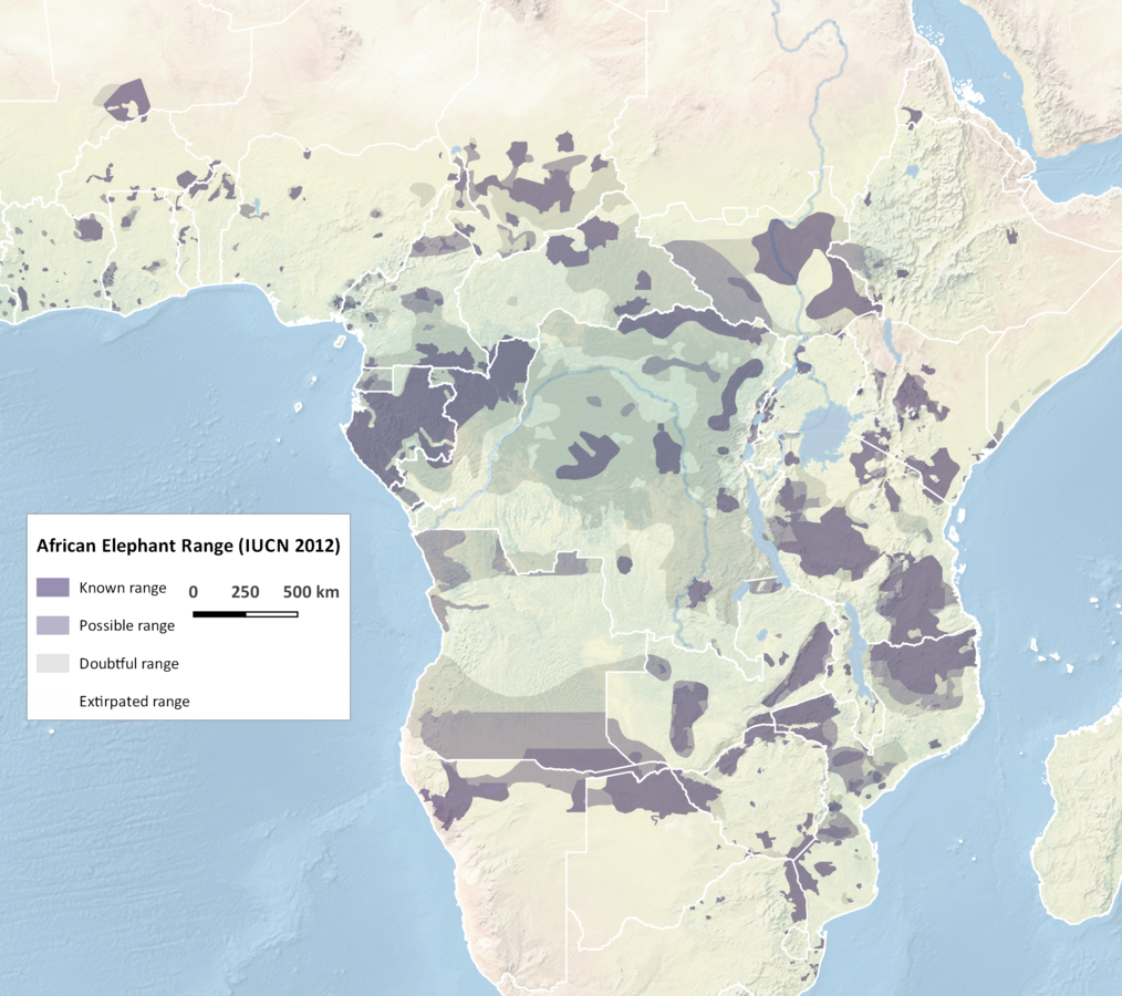
K.S. Gobush/ Save The Elephants, 2013

Ivory ban
Ivory sale to China
Need for GEC
current data for population status assessment across range
GEC implementation
a Paul G. Allen project
Vulcan Inc.
Elephants Without Borders (P.I)

GEC partners
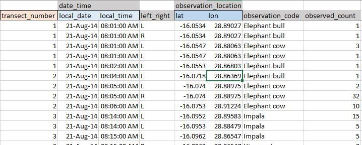
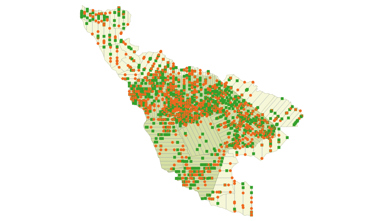
Spatial data collection

observations
audio recorder
camera
Spatial data collection
flight parameters
GPS tracks logs
height above ground
ground speed
Spatial data processing

Spatial data processing
GIS Tasks
compile & process data
- compile survey plan spatial data
- normalize observation records + flight logs
Spatial data validation
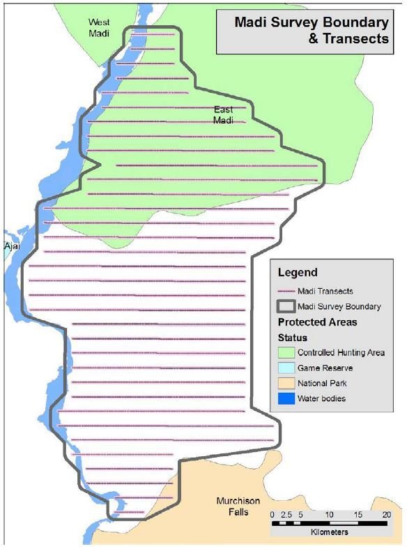
Survey design
- strata
- transects
Spatial data validation
Survey data collection
- flight track logs
- observations records
tools used by GEC
- GIS clients: ArcGIS + QGIS
- GPS utilities: DNR Garmin + GPS Babel
tools built by GEC
- open SQL db backend: PostgreSQL / PostGIS
- Microsoft Excel template for normalizing raw data
Spatial data normalization
Spatial data conversion / management
OGR / GDAL
Python scripts
ogr2ogr -f "SQLite" E:\GIS\Projects\GEC_status.sqlite -progress PG:"server
dbname user password table"-nlt MULTIPOLYGON -nln GEC_survey_strata -lco -dsco
SPATIALITE=yes
Tools for database ingestion
SQL queries
Python
SELECT s.code as survey_code, st.name as stratum_name, count(st.id) as strata_count,
    ST_AREA(geography(ST_COLLECT(st.stratum_boundary))) / 1000000::double precision as strata_area_sqkm
FROM survey_stratum as st
INNER JOIN survey_survey as s on s.id = st.survey_id
GROUP BY s.code, st.id
ORDER BY s.code asc;

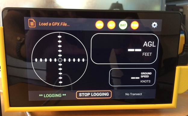
Validation tools
normalized spatial data (Leaflet)
Validation tools
key flight parameters (Python libraries)
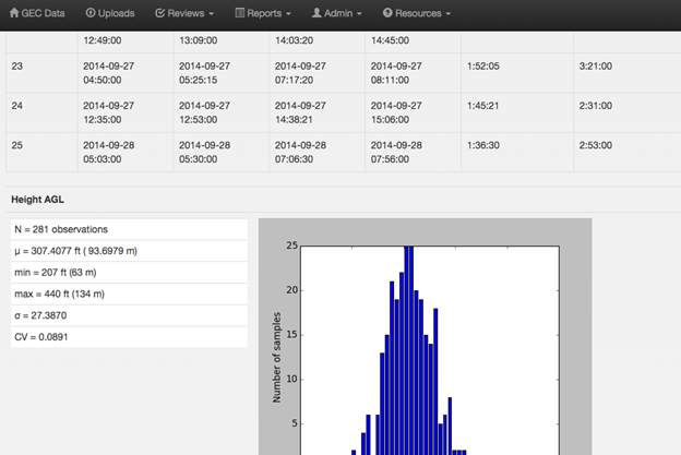
Validation tools
survey data logger
helps pilots stay on track + records data
Results + Impacts of the GEC

Results + Impacts of the GEC
GEC database
Results + Impacts of the GEC

African Elephant Database
- GEC data + reports provided to AfESG
Sept 2016 - African Elephant Status Report
Nov 2016 - CITES Conference of Parties
- complete primary data preserved
- normalized across GEC
- platform for further analysis
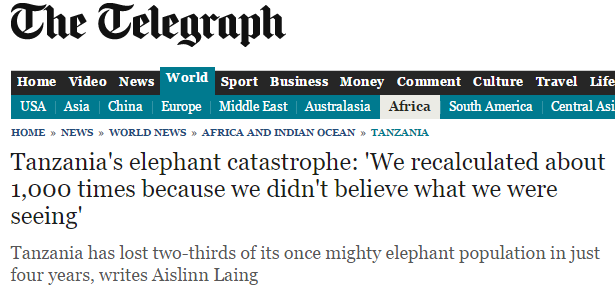
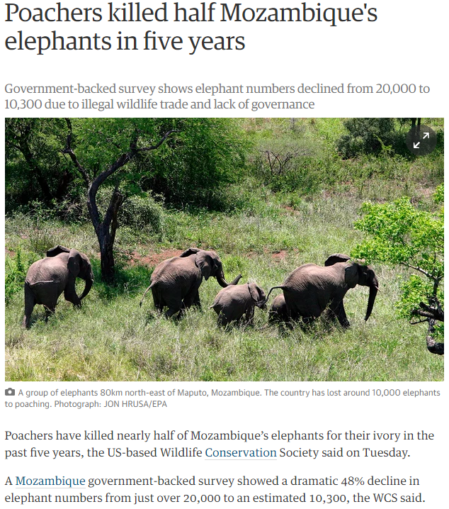
answering questions
status of elephants + other species
status of poaching + human encroachment
Results + Impacts of the GEC
Great Elephant Census
by the numbers:
20 countries
90 scientists
286 crew people
81 airplanes
XX of flights
XX flight miles
9700 hours of flight time
Acknowledgements
Vulcan colleagues:
Kathleen Gobush
Kirk Larsen
Ted Schmitt
many GEC collaborators:

Thank you !
contact me:
joelm@vulcan.com
@j_masselink
Copy of GIS-wildlife-data
By Joel Masselink
Copy of GIS-wildlife-data
Managing large-scale wildlife data using GIS: Great Elephant Census
