Unmanned Aerial System (UAS) & GIS
King County GIS User Group
December 2 , 2015
Peter Keum - WTD GIS Specialist
peter.keum@kingcounty.gov

- Introduction of sUAS
- Use Cases
- Examples of Workflow

small Unmanned Aerial System (sUAS)
Short Back Story

CUGOS April 2014
"Google Guys"


UAS - Unmanned Aerial System
FAA Definition: Unmanned Aircraft (UA) system that is operated by a pilot via ground control or on-board computer.


UAS Categories

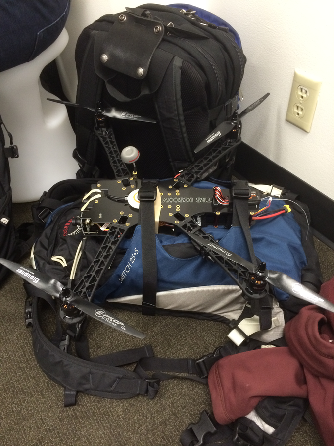
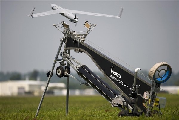
Small
- Size: 1 - 2 meters ( 3 ft - 6.5 ft), < 55 lbs.
- Control: Visual line of sight, Radio control
- DJI Phamtom, 3DR - Solo, Insitu - ScanEagle
Medium
- Size: Equivalent to a car, ~ 1000 lbs.
- Control: Visual Line Of Sight (VLOS) & Beyond LOS, RC & Satellite
- General Atomics -MQ1 Predator
Large
- Size: > 30,000 lbs.
- Control: Visual Line Of Sight (VLOS) & Beyond LOS, RC & Satellite
- Northrop Grumman RQ-4 Global Hawk ~$222 Million


UAS
Unmanned Aerial Systems "Drone"

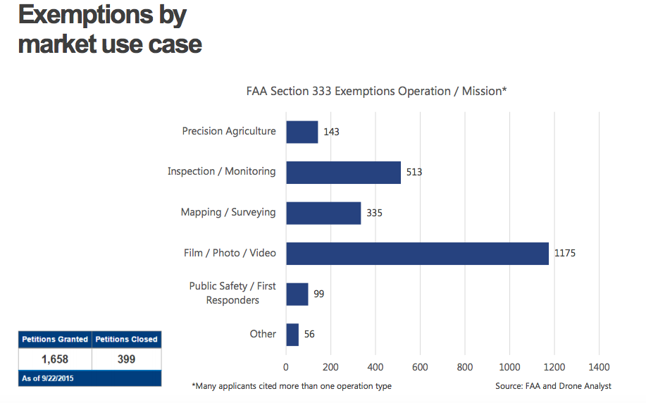
Types of sUAS Operations
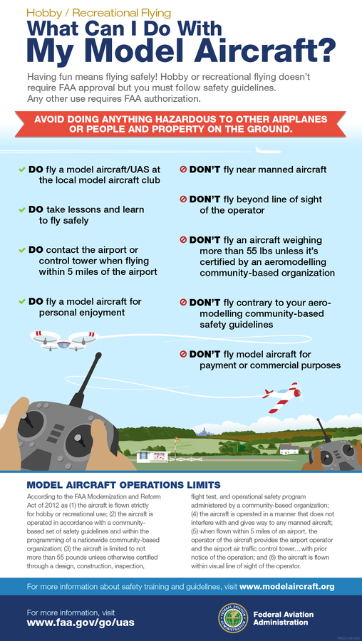
- Model Aircraft (Hobby/Recreation only) Register,not yet
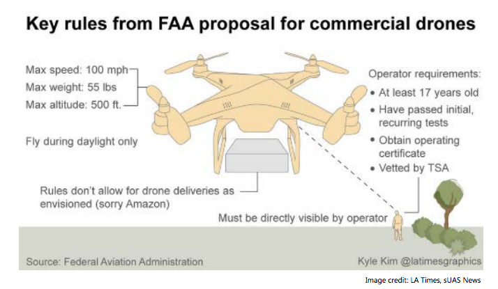
- Civil Operations (Commercial) Section 333 Exemption.
- Public Operations (Governmental)- Cert. Of Authorization (COA) [Ada County in Boise, ID. waiting]

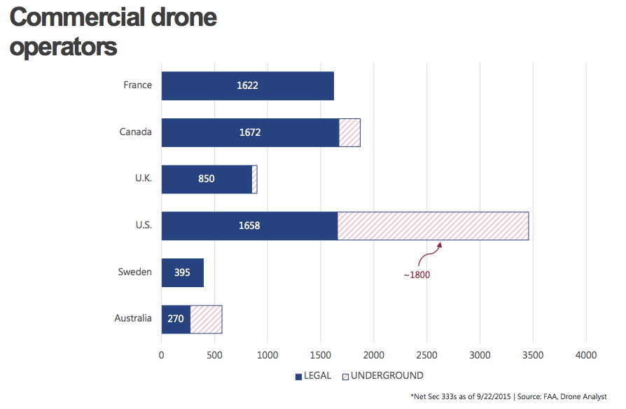
Number of Operators
Why Now?

Cell Phone Technology + Lower $$
- Electronic Control System (ECS)
- Accelerometer & Gyroscope Chip
- GPS Chip
- Lithium Polymer (LiPo) Battery
- Motors


- Economical
- Easy to use
- Quality data collection
- Consistency/accuracy

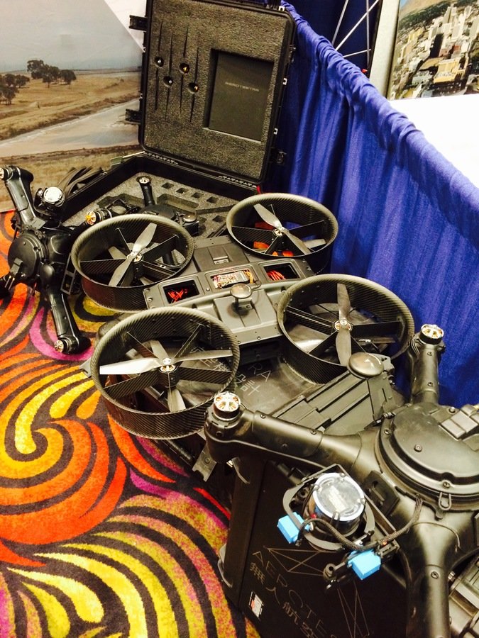

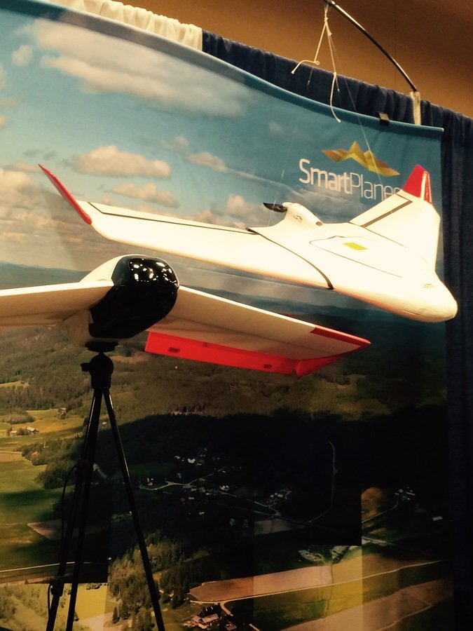
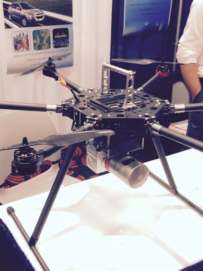
(small)UAS as Platform
Multi-rotors
Fixed wings
- Short flight time (< 20min)
- Cover small area
- Highly maneuverable
- Less expensive
- Access confined spaces more easily
- Long flight time
- Covers large area
- Larger selection of sensors

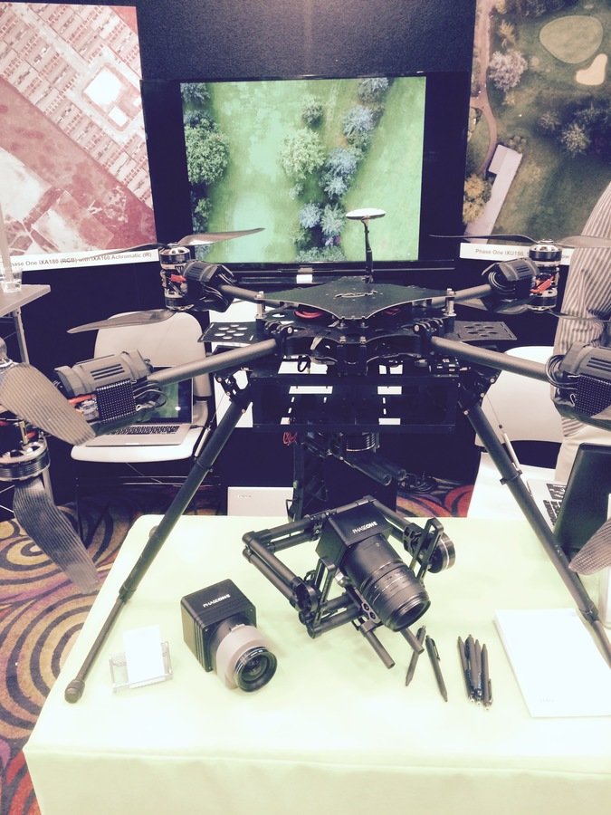
Sensors


Multi-spectral
Thermal Infrared

Lidar Camera

High resolution digital camera
-
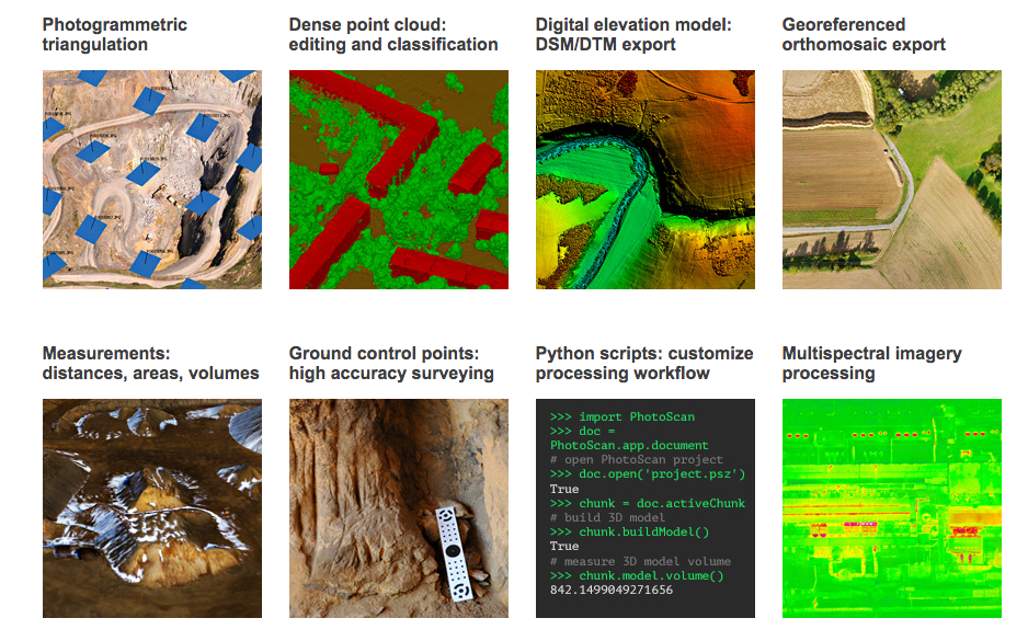
Agisoft PhotoScan - St Petersburg, Russia
- $3500 - Professional Edition
- $180 - Standard Edition
-
Bunder - Open Source
- Linux installation, free to download
-
DroneDeploy - Cloud Based Integrated Solution
- Image Processing for any drone
Application Examples
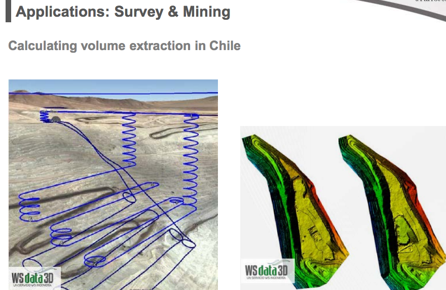


3D Modeling
3D Modeling
3D Modeling


Workflow
1. Aircraft + Sensor (Data Collection)
2. Data Processing
3. Information Products

=
+
Workflow Example 1
Whidbey Island, Langley Downtown example


Step 1. Flight with Data Collection
- Collected 200 Images
- Using Agisoft PhotoScan to stich images
- Alt. Tool - Microsoft Image Composite Editor (ICE)

Step 2. Data Processing
- QGIS to georeference aerial imagery export to tiff file
- Using GDAL
- Or use mbutili to export into tiles
gdal2tiles.py --profile=mercator -z 1-22 yourmap.tif outputfolder
Step 3. Information Product 1
- Create web-map using GitHub's gh-page
git checkout gh-pages
git add outputfolder
git commit -m "Yes... TILE DATA"
git push
Step 3A. Information Product 2
- Using imagery to digitize street, add features to OSM
http://langleywa.github.io/gisdata/tiles/langley-2nd-street-2014-tms/{z}/{x}/{y}.png- Add below url into OpenStreetMap iD Editor
Workflow Example 2
KC Brightwater Treatment Plant &
KC Cedar River Revetment
(river bank protection)
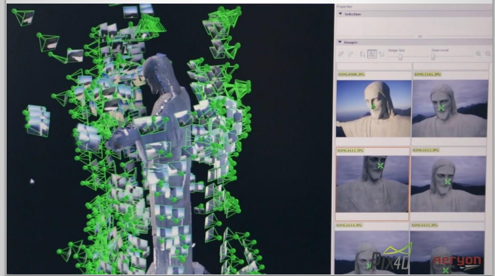
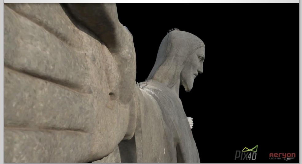
3D Modeling

PhotoScan Sparse Point Cloud

Dense Point Cloud

Textured Mesh

Flying Brightwater TP Odor Control Units
Result
Cedar River Revetment
Pumps
Lesson Learn
- Understanding various platform and sensors
- Various software packages to process captured data
- Various flying techniques for capturing aerial data
UAVs are just another tools in the toolbox
Help decision makers with appropriate analytic information product
What's Next?
- Write a business plan with cost analysis for management
- Roof top facility inspection - WTD
- (Potential) Flooding structure inspection - WLRD
- (Potential) Aerial inventory of landfill - Solid Waste
- Have clear understanding of steps to proceed for FAA's approval of use of small UAVs for public works
- Presentations and Educations
Resources:
- TV Washington: 1 hr video Drone Documentary
- sUAS News
- FAA Section 333
- DJI - Ready to Fly Droe
- 3DR - UAV & Drones
Trailers
END
for now
Thank You!!!
peter.keum@kingcounty.gov
GIS and Drone
By Peter Keum
GIS and Drone
Conference summary and talking points for what sUAV is to KC staffs


