CUGOS
August 15, 2018
@pkeum
pkgeo.com
Small Unmanned Aerial System (sUAS)
Long Pole Aerial Photography
(LPAP)
- Background
- Workflow
- Current Project
Small Unmanned Aerial System (sUAS)
Long Pole Aerial Photography
Small Unmanned Aerial System (sUAS)
Long Pole Aerial Photography
Small Unmanned Aerial System (sUAS)
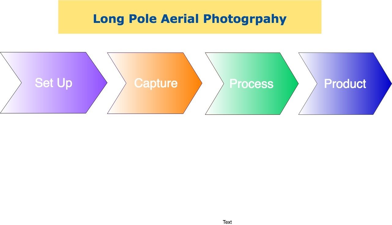
- Set Up
- Data Capture
- Data Process
- Final Product
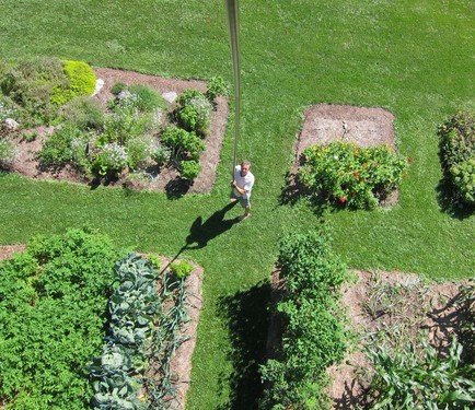
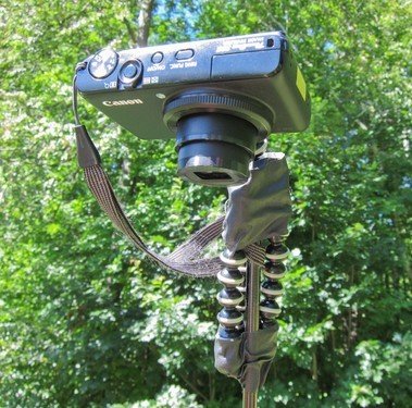
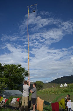
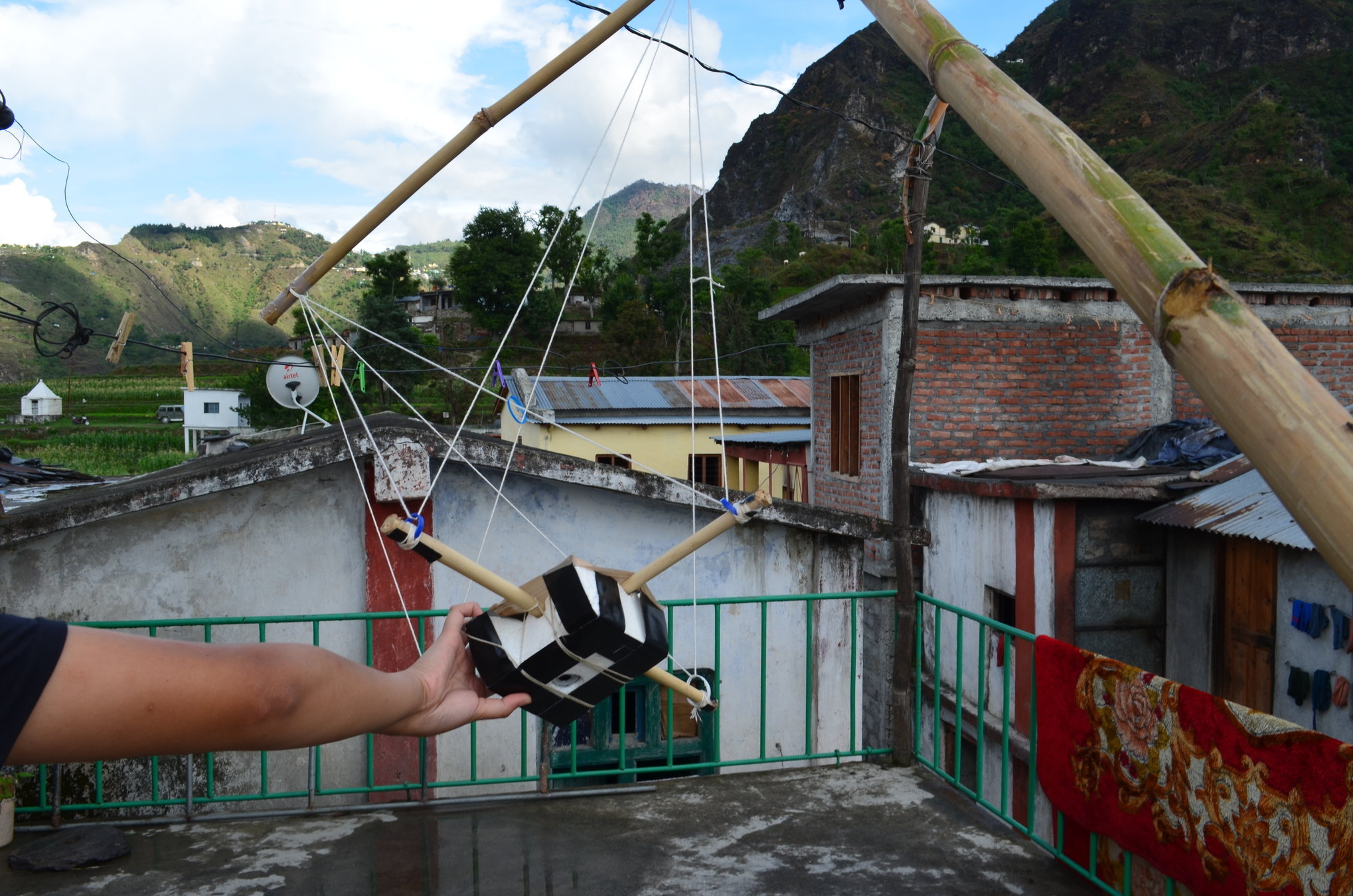
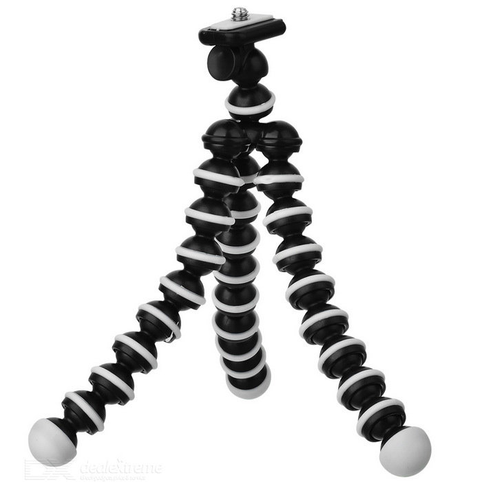
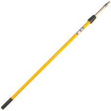
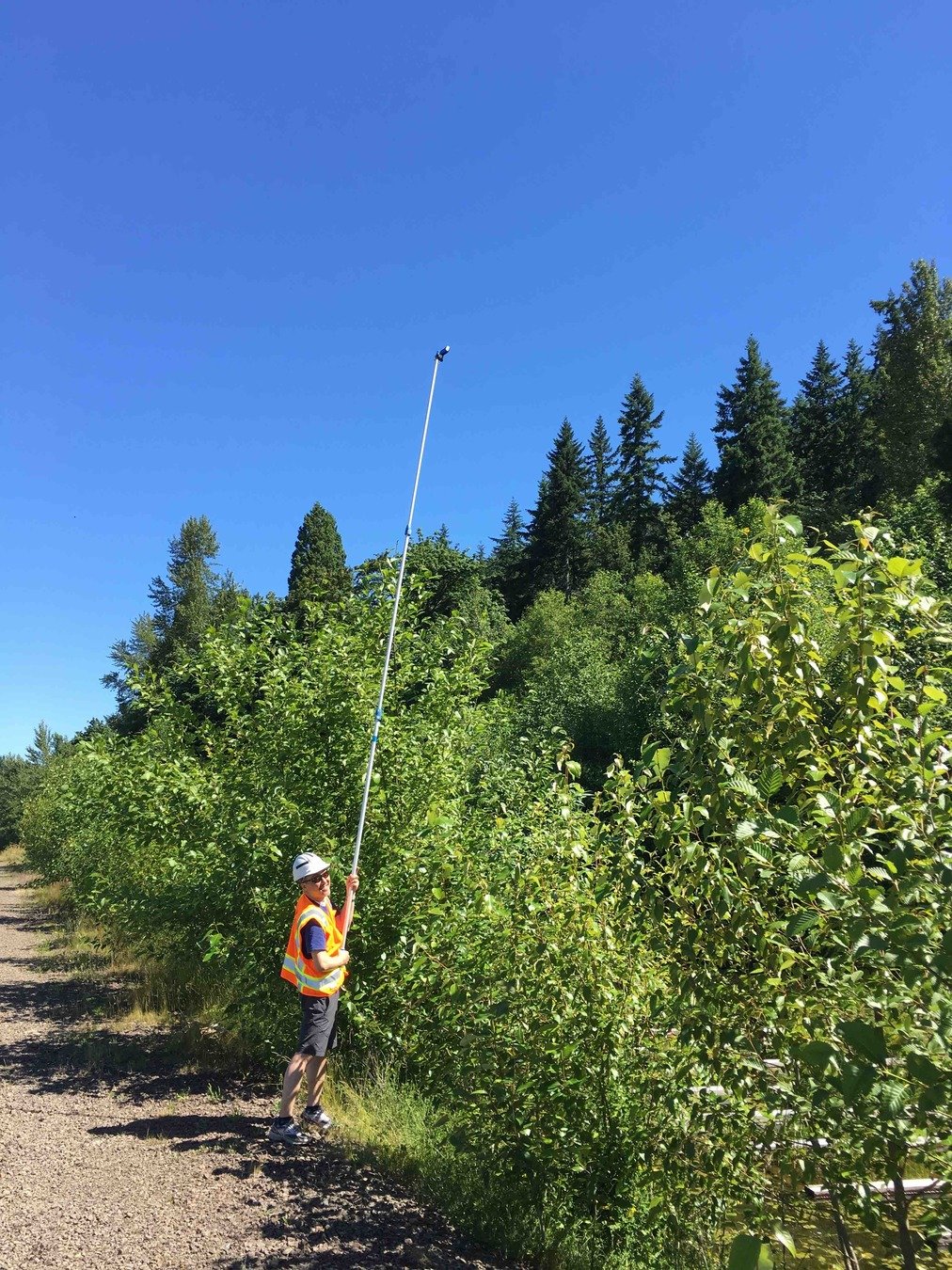
1. Set Up
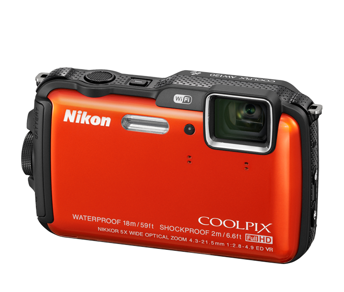
- Camera
- Holder
- Pole
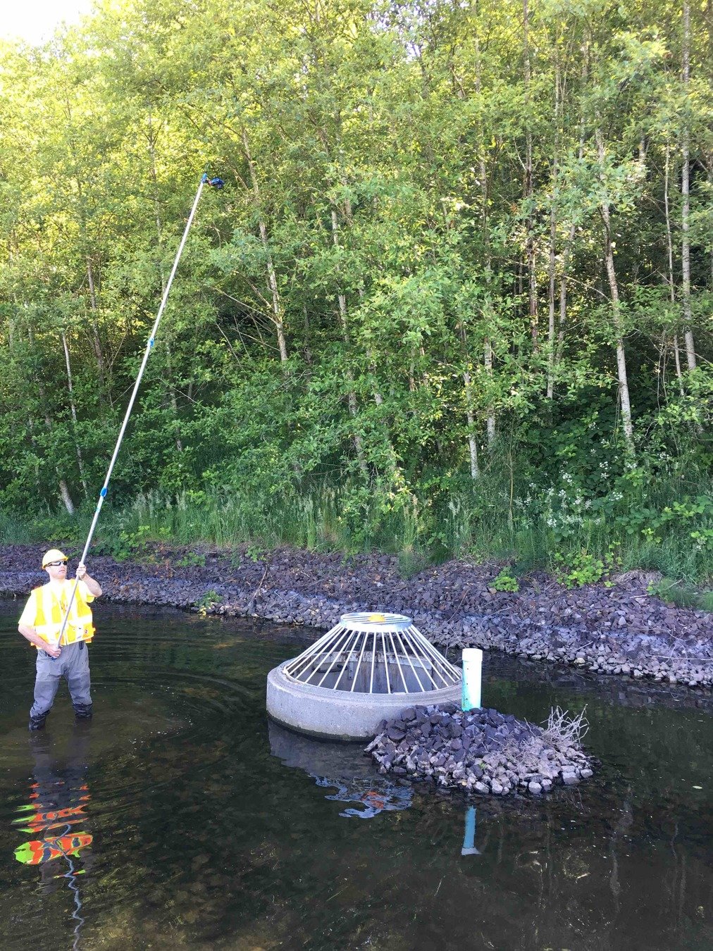
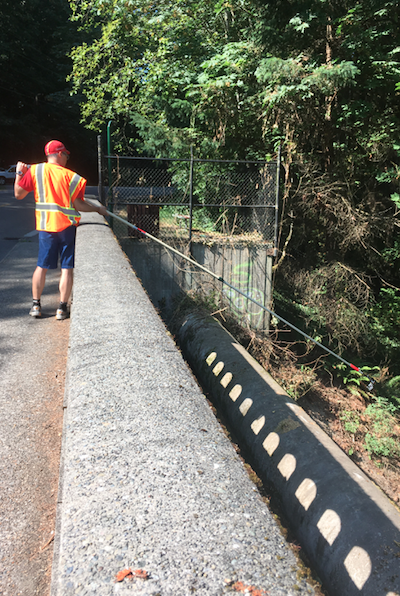
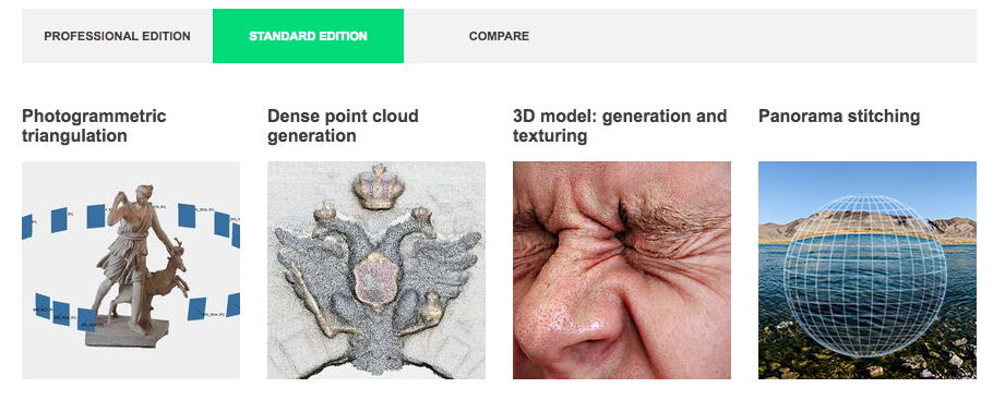
2. Data Capture
3. Data Process
4. Data Process
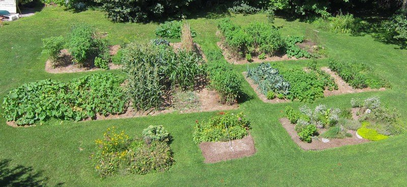
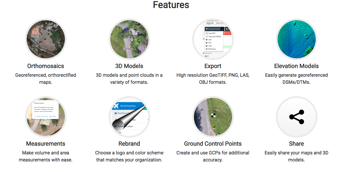
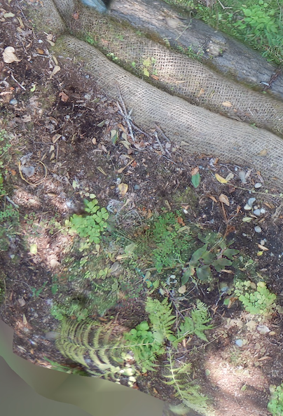
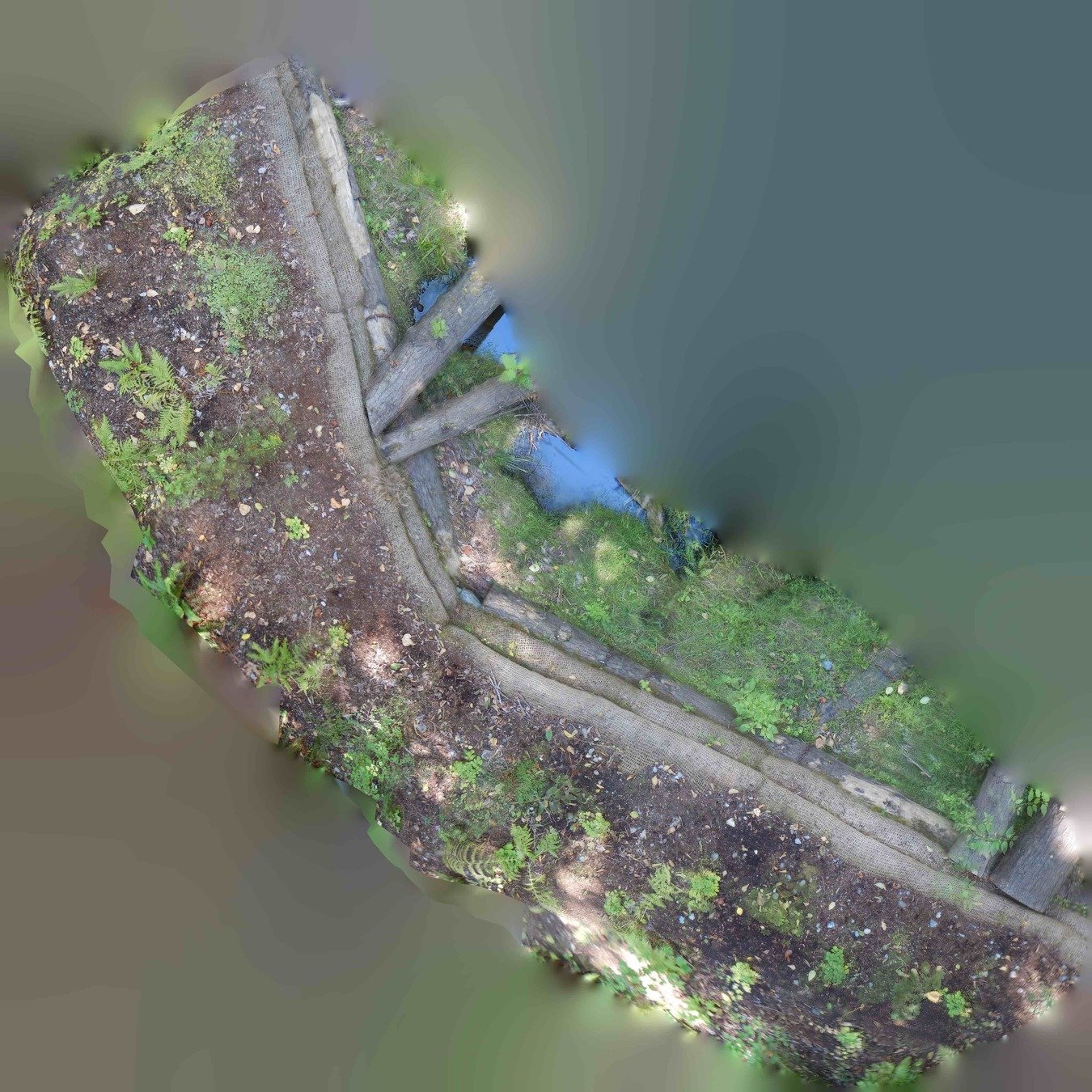
5. Final Products
- Orthomoasic Photo
- 3D Model
- Stiched Imagery

Small Unmanned Aerial System (sUAS)
Long Pole Aerial Photography
- Low Cost != $$
- Low Technology/ KISS
- Low Risk
- Easy to share
- Small area

Small Unmanned Aerial System (sUAS)
Long Pole Aerial Photography
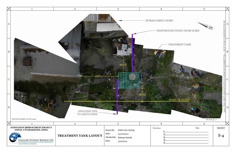
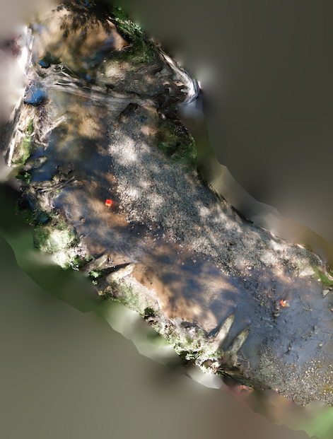
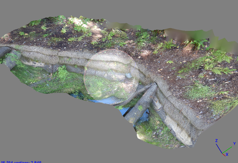
Coal Creek Restoration
Mitigation Site (2018)
- Heavy tree canopy cover
- Need ground coverage
Small Unmanned Aerial System (sUAS)
Long Pole Aerial Photography
Coal Creek Restoration
Mitigation Site
Small Unmanned Aerial System (sUAS)
Long Pole Aerial Photography
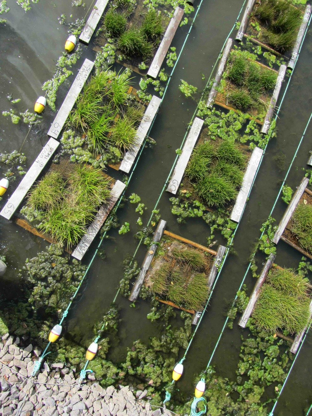
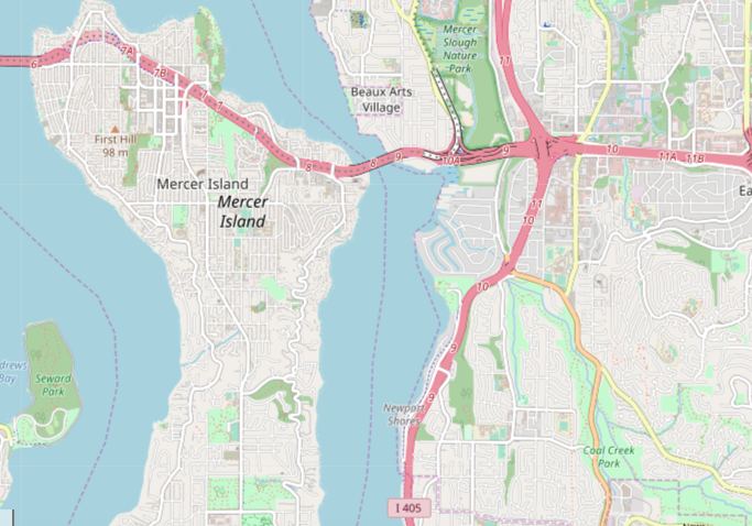
Brightwater Treatment Plant Sediment Trap (2018 -19)
Small Unmanned Aerial System (sUAS)
Long Pole Aerial Photography
(LPAP)
- Background
- Workflow
- Current WTD Projects
- More...(side projects)
CUGOS
Cascadia
Users
of
Geospatial
Open
Source

END
for now
Thank You
peter.keum@kingcounty.gov
CUGOS - Presentation
By Peter Keum
CUGOS - Presentation
Long Pole Aerial Photography Describing workflow using LPAP & SfM


