Workshop #1 : Developing a Drone Program and Uses in a Local Public Agency
WAGISA Conference, Tacoma, WA.
June 16, 2025
Keisha Chinn: WSDOT - Enviro Info Program Manager
Peter Keum, GISP: KC Wastewater Treatment - Drone Program Lead
Schedule: Part 1
Break (10 min)
Break (10 min)
( 8:30 AM - Noon)
1.1
Schedule: Part 2
Break (10 min)
Break (10 min)
( 1:30 PM - 5:00 PM)
1.1
Introduction
-
Name
-
Organization, if there's one
-
Level of understanding
1.1

King County Wastewater Treatment by Numbers
-
2 million residents
-
424 square miles
-
383 miles sewer pipeline (2.5 inch to 14 ft)
-
74 facilities (PS & RS)
-
5 Treatment Plants: 180 MGD ~ Max. 900 MGD

Seattle, WA --> Medford, OR
1.2

1.2
- Price /Performance
- Easy to use
- Quality data collection
- Adopting Rule by FAA

Why Now?
1.2
Cell Phone Technology + Lower $$
- Electronic Control System (ECS)
- Accelerometer & Gyroscope Chip
- GPS Chip
- Lithium Polymer (LiPo) Battery
- Motors


1.2
UAV - Unmanned Aerial Vehicle
FAA Definition: Unmanned Aircraft (UA) system that is operated by a pilot via ground control or on-board computer.


1.2
What's in the name?
UAV = Unmanned Aerial Vehicle
UAS = Unmanned Aerial System
DRONE = Dynamic Remotely Operated Navigation Equipment
RPAS = Remotely Piloted Aircraft System
1.2
UAV Categories

Small - $
- Size: 1 - 2 meters ( 3 ft - 6.5 ft), < 55 lbs.
- Control: Radio control
Medium
- Size: Equivalent to a car, ~ 1000 lbs.
- Control: Visual Line Of Sight (VLOS) & Beyond LOS, RC & Satellite ~ $$$
Large
- Size: > 30,000 lbs.
- Control: Visual Line Of Sight (VLOS) & Beyond LOS, RC & Satellite ~ $$$$


1.2
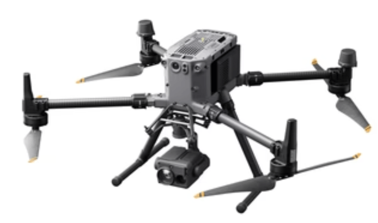
RPAS as Platform
Multi-rotors
Fixed-wing & VTOL

- Shorter flight time (< 45 min)
- Cover smaller area
- Highly maneuverable
- Less expensive
- Access to confined spaces
- Long flight time (>+ 40min)
- Covers very large area

(vertical take-off & land)

1.2
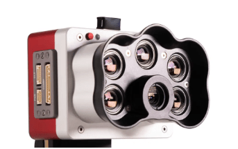
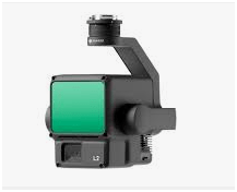
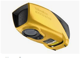
Payload Sensors

Multi-spectral
Thermal Infrared

High resolution digital camera (100 MP)

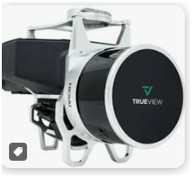
Lidar Camera
Methane
Gas Detector
1.2
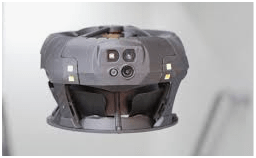
Two Spaces for Drone


Outdoor
Indoor
- GPS Signal
- Automated Flight
- Even, Diffuse lighting
- Open space
- No GPS signal
- Limits on speed and motion
- Manual flight control
- Tight spaces
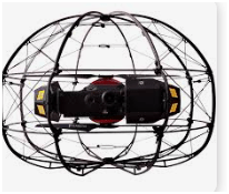
1.2
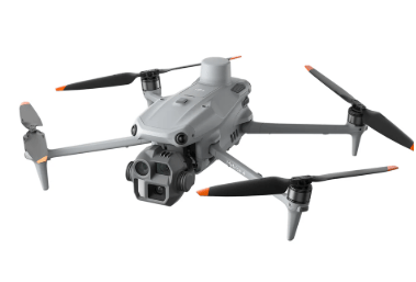
Outdoor
Indoor

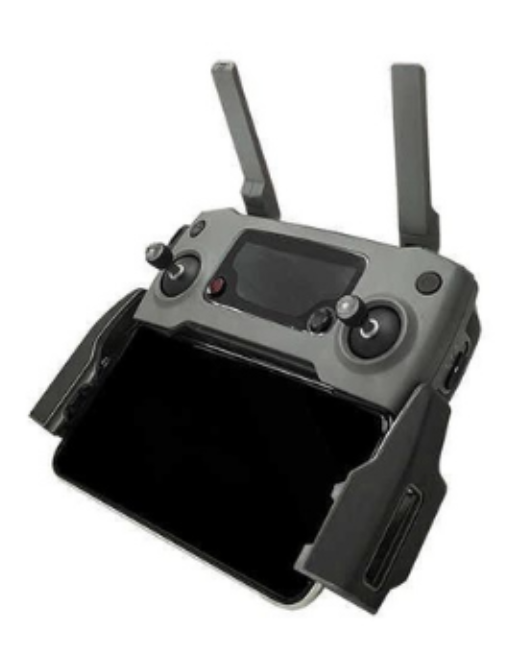
DJI Mavic 2 Pro < $1,800
Flybotix ASIO X ~ $23K
Eilos 2 ~$48K
DJI Matrice Enterprise ~
$5,300

DJI Mavic 2 Pro Ent. Adv ~ $6,500
Cleo Dronut
~ $12K


Mavic 3 Ent
~ $3,800
1.2

1. Aircraft + Sensor (Data Collection)
2. Data Processing & Analyzing (GIS)
3. Information Products
||
+

1.2
Why Use Drones?
Easy - Simple with little effort
Efficient - Results without waste
Effective - Producing Results
3 E's
1.2
Why Use Drones?
1. Easy - Simple with little effort

Automatic
Repeatable
1.2
Why Use Drones?
2. Efficient - Results without waste
Safety of staffs
Save Time & $$

1.2
Why Use Drones?
3. Effective - Producing Results


1.2
Environmental Monitoring
Examples - Effective
August 2022
March 2022


April 2023
1.2

1. Platform + Sensor (Data Collection)
2. Data Processing & Analyzing (GIS)
3. Information Products


1.2
1. Mission Planning Software (data collection) - Flight Control App
- Fly Consistently for overlapping images
- Can fly manually but it's like mowing with scissors


1.2
1. Platform + Sensor (Data Collection)
2. Data Processing & Analyzing (GIS)
3. Information Products
1.2
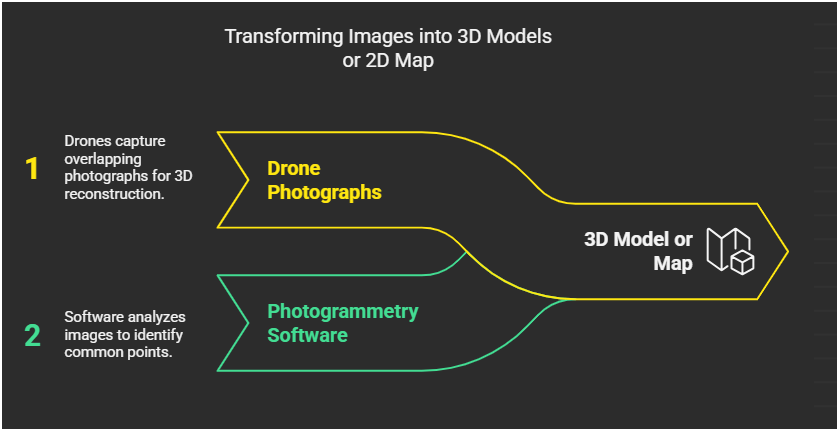
Drone Photogrammetry
1.2
2. Data Processing & Analyzing (GIS)

1.2
1. Platform + Sensor (Data Collection)
2. Data Processing & Analyzing (GIS)
3. Information Products
1.2


1.2

Airplane Orthophoto
Software processed Orthophoto from drone
1.2


1.2
Keisha
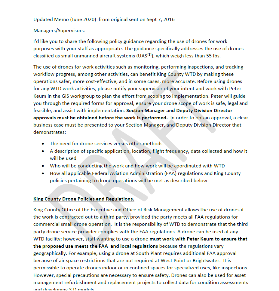
FAA Regulations - Where are we now?

Regulations
1.4
Commercial/Governmental
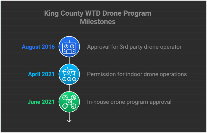
FAA 14 CFR Part 107 Rule, August 2016
-
Need FAA Remote Pilot Certification (General Aviation Pilot license NOT needed)
-
444,960 - Remote pilot certified (2025)
- Year 2017 - 60,000
- Year 2018 - 116,000
- Year 2024 - 350,000
-
420,825 - Commerical Drones Registered
1.4
-
Be at least 16 yrs old
-
Pass the initial aeronautical knowledge exam
-
Online recurring training every 24 month
-
Understand recreational flying requirements
-
Take TRUST
-
Online recurring training every 24 month
1.4
-
Fly under 400 feet above ground level
-
Not to fly < 5 nautical miles around airport
-
Aircraft < 55 lbs.
-
Fly during daytime
-
Fly visual line of sight ( VLOS)
-
No flight over non-participating people
FAA Part 107 Rule
1.4
Hobby/Recreation
-
Self register (over 13 yrs old)
-
Fly under 400 feet above ground level
-
Not to fly < 5 nautical miles around airport
-
Aircraft < 55 lbs.
-
Fly during daytime
-
Fly a visual line of sight ( VLOS)
-
380,007 Recreational Flyer Registereations
- Less than 250 grams (0.55 lbs) - No need to register with FAA
- More than 250 grams register with FAA $5.00
1.4

Schedule: Part 1
Break (10 min)
Break (10 min)
( 8:30 AM - Noon)
2.1
Summary of KC Wastewater Treatment Division RPAS Program

People
+
Technology
+
Organization
=
RPAS Program
2.1
WTD GIS RPAS Program
2.1
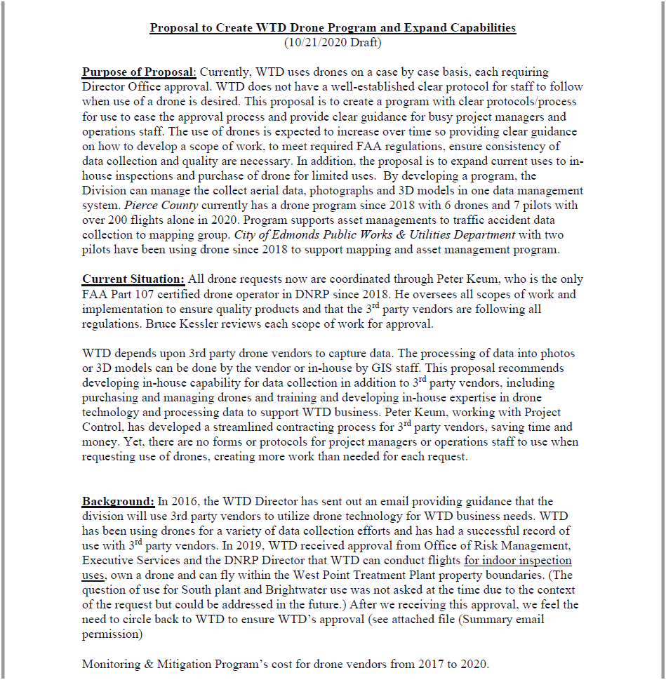

KC WTD Management
KC ORM (Office of Risk Mgmt)
2.1
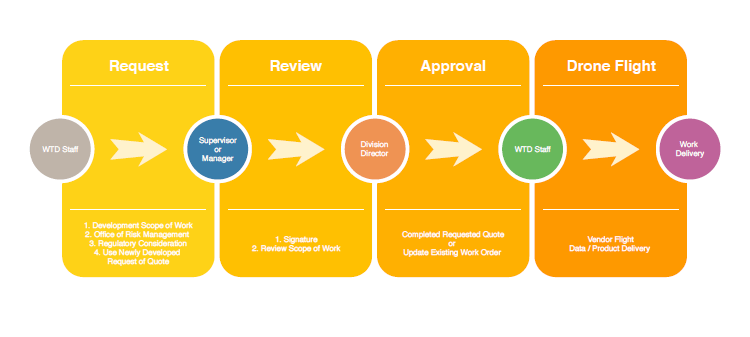
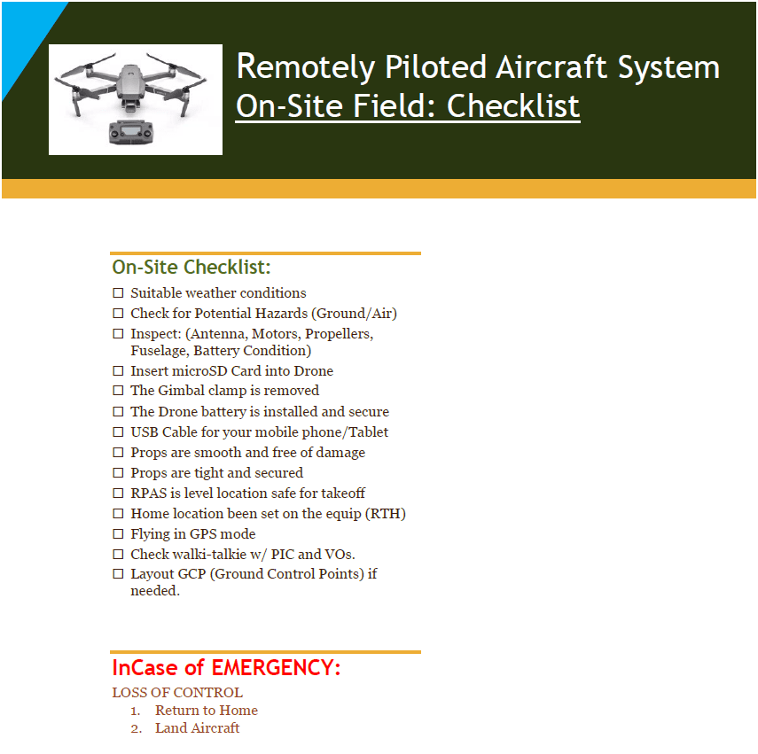
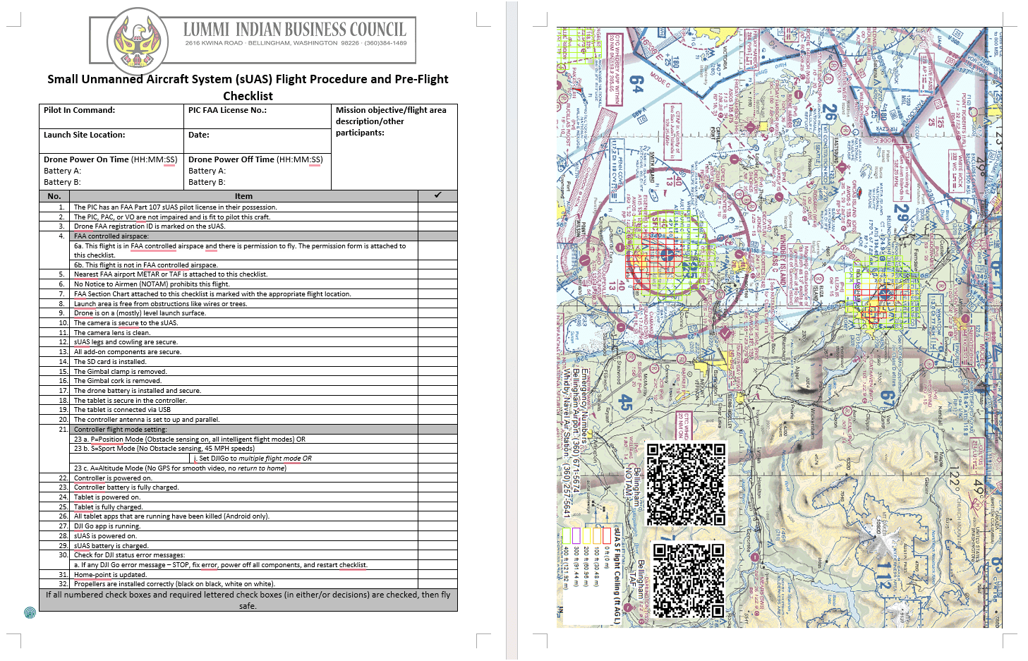
Check List
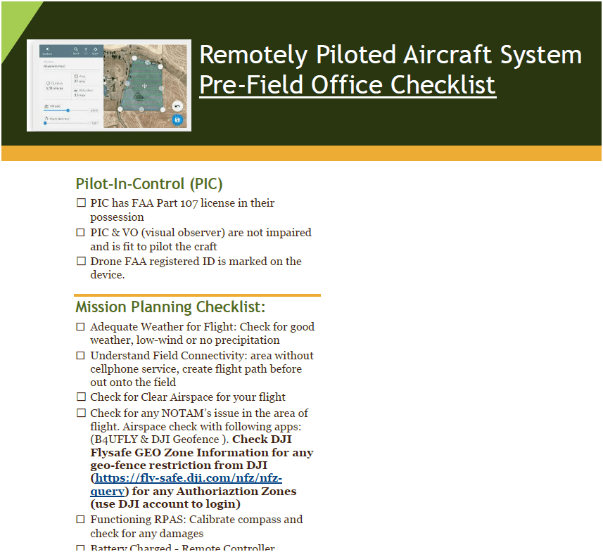
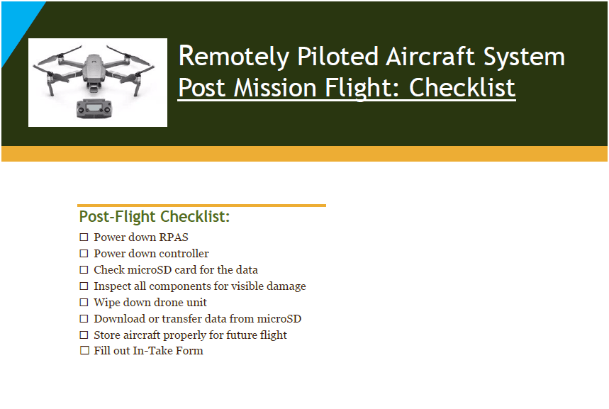
Pre-Flight
On-Site
Post-Flight
2.1
Example
2.1
June 2025
Four FAA Part 107 Drone Certified Pilots - WTD GIS Specialists (Jim, Patrick, Joe, and Peter)
Helping other departments to stand up their own RPAS programs


Joe
2.1
Outdoor
Indoor
DJI Mavic 2 Pro < $1,800
DJI Mavic 2 Pro Ent. Adv ~ $6,500
DJI FPV w/ Modification ~ $1,300
Mavic 3 Ent
~ $3,800
20 MP/ 56x zoom
20 MP
12 MP/ 32x zoom
+ Thermal

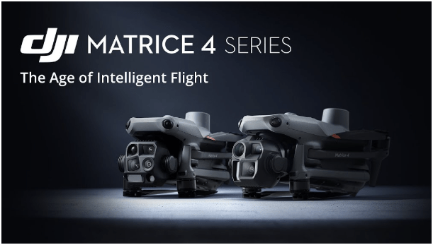
Matrice 4 Ent
~ $5,300
2.1


2021
June - Dec.
2023
Jan. - Nov.
Number of Flights
2022
Jan. - Dec.

+ 480 %
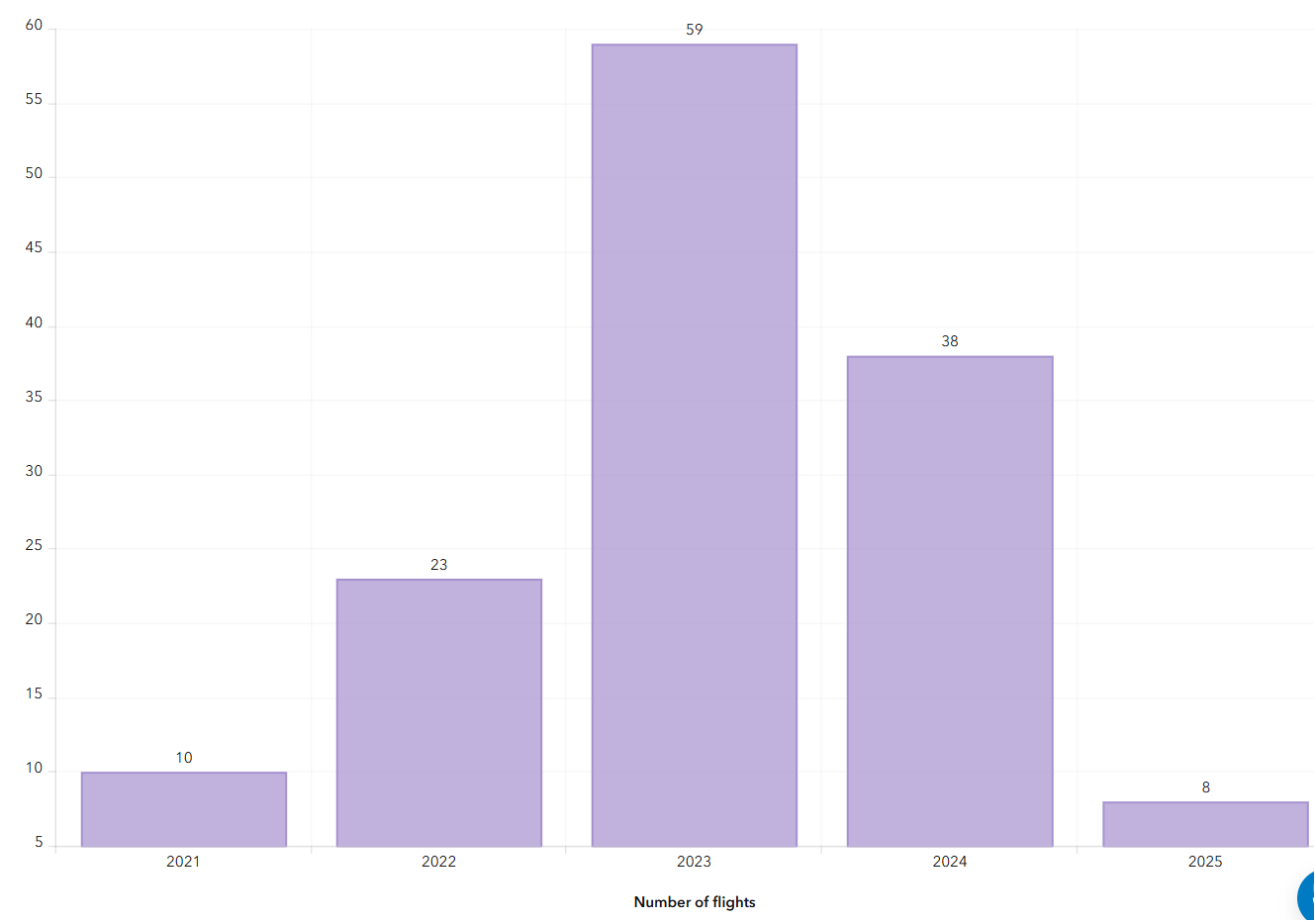
2024
Jan. - Nov.
2.1
Where are we now?

Where are we heading?


2.1
Keisha
Schedule: Part 1
Break (10 min)
Break (10 min)
( 8:30 AM - Noon)
3.1
KC WTD Data Mgmt Plan
3.1
KC WTD Data Mgmt Plan
3.1
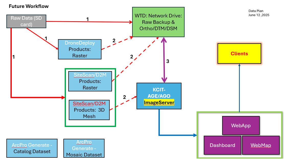
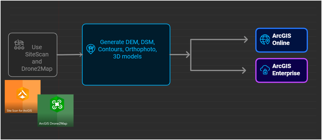
Esri Workflow
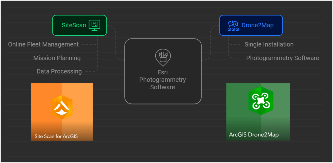
3.1
3.1
- Public
- No AGO Account
- Group Sharing
- Share with everyone
- Security

- Internal Only
- No AGO Account (KC)
- Group Sharing
- Selected Data to share
3.1
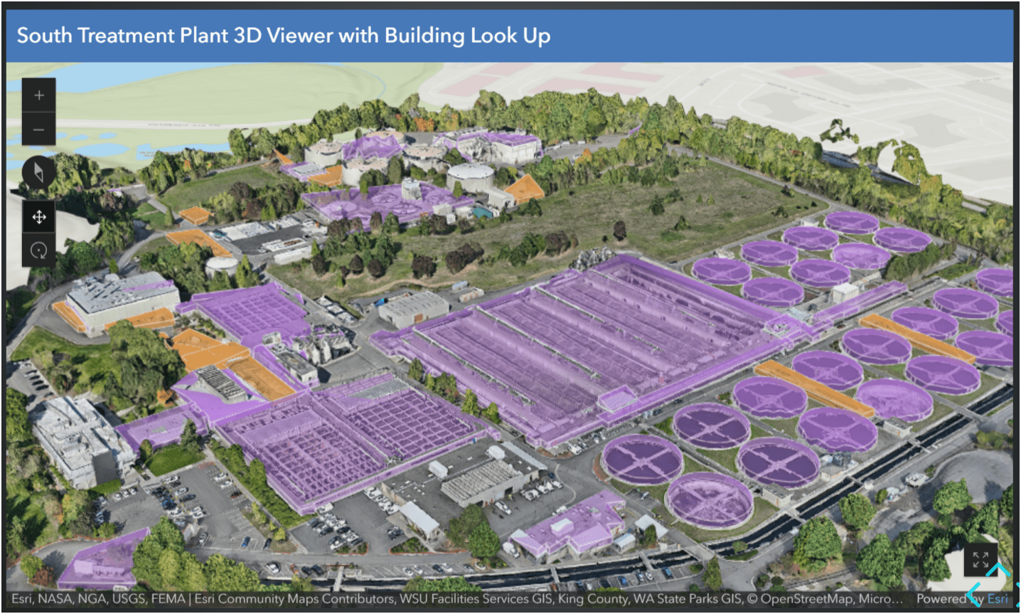
Esri 3D AGO Scene Viewer App - South Treatment Plant
3D Model + Feature Layer
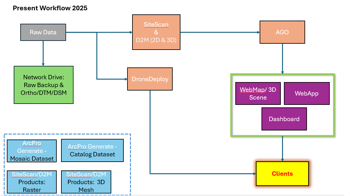
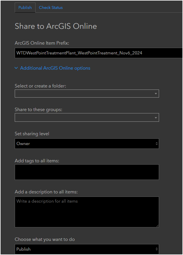
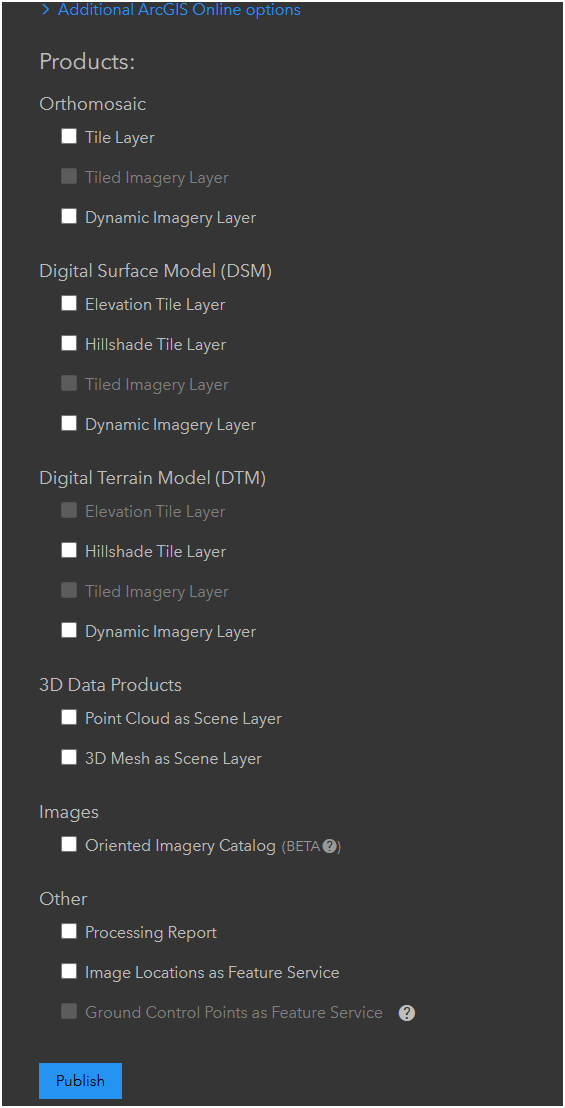
DroneDeploy Workflow
3.1
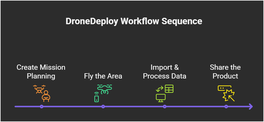
DroneDeploy Workflow
3.1
Examples
Environmental Monitoring
Facility/Construction Monitoring
Keisha
Let's get this drone program (party) started!

- Monthly Meeting - Every 3rd Thursday over Zoom
- Share resources online
- Help educate and introduce new users to the field of drone mapping and GIS
Washington GIS Association Drone Special Interest Group


- Email Sign-up
- Resources
- Every 3rd Thursday
- ZOOM Meeting
- 165 Members

2025 - WAGISA Drone Workshop Part 1
By Peter Keum
2025 - WAGISA Drone Workshop Part 1
Drone workshop for 2025 WAGISA - this is part 1 (intro-building drone program overview) and Part 2 (Best practice of flying drone & integrating drone to GIS)


