Use of Drones for King County Wastewater Treatment
Oct 8, 2025
Peter Keum, FAA Part 107/GISP
King County Wastewater Treatment
Drone Program Lead/ GIS Analyst
Learning Objectives
- King County Wastewater GIS
- Wastewater Treatment Drone Program
- Integration of Drone with GIS
So Let's Dive In!

King County Wastewater Treatment by Numbers
-
2 million residents
-
34 Agencies
-
424 square miles
-
383 miles sewer pipeline (2.5 inch to 14 ft)
-
74 facilities (PS & RS)
-
3 Treatment Plants: 180 MGD ~ Max. 460 MGD

Seattle, WA --> Medford, OR

WTD GIS Team
- 10 GIS Specialists
Supervisor

WTD GIS
Maintain Sewer GIS Data
Capital Project Support
- Capital Construction Projects
- New Coneyance System
- Upgrade facilities
- CSO (Combined Sewer Overflow) Control Program
- Modeling Group
- CIFM (Conveyance, Inspection, and Flow Monitoring) Group
- Asset Management Program
- Capacity Charge
Program Support


WTD GIS
UAV - Unmanned Aerial Vehicle
FAA Definition: Unmanned Aircraft (UA) system that is operated by a pilot via ground control or on-board computer.


RPAS as Platform
Multi-rotors
Fixed-wing & VTOL

- Shorter flight time (< 45 min)
- Cover smaller area
- Highly maneuverable
- Less expensive
- Access to confined spaces
- Long flight time (+ 40min)
- Covers very large area

(vertical take-off & land)

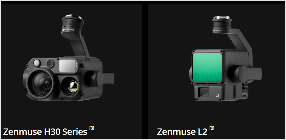
Sensors Payload


Multi-spectral
Thermal Infrared

Lidar Camera

High resolution digital camera (100 MP)

Lidar Camera
Lidar Camera
Methane Gas Dector


1. Aircraft + Sensor (Data Collection)
2. Data Processing & Analyzing (GIS)
3. Information Products
||
+
-
Fly under 400 feet above ground level
-
Not to fly < 5 nautical miles around airport
-
Aircraft < 55 lbs.
-
Fly during daytime or night time operation with appropriate lighting
-
Fly visual line of sight ( VLOS)
-
No flight over non-participating people
FAA Part 107 Rule
KC Wastewater Treatment Drone Program

People
+
Technology
+
Organization
=
Drone Program
WTD GIS Drone Program
October 2025
- Four FAA Part 107 Drone Certified Pilots - WTD GIS Specialists (Jim, Patrick, Joe, and Peter)
- Helping other departments to stand up their own RPAS programs (WLRD, SWD, KCIA, Local Service)


Joe
Current Hardware
DJI Mavic 2 Pro < $1,800 (Retired)

DJI Mavic 2 Pro Ent. Adv $6,500
DJI Avata $1,300


Mavic 3 Ent (2x)
$3,800
20 MP/ 56x zoom
20 MP
12 MP/ 32x zoom
+ Thermal


Matrice 4 Ent
~ $5,300/ $8,500
DJI Mavic 2 Pro (1)
Mavic 2 Ent. Adv. (1)
Mavic 3 Ent (2)
2021
2022
2023
Matrice 4 Ent. (1)
2025
Total: $27,000
Wish List Hardware :-)

$11,000
All WEather
RGB Camera
~ $3,500
Lidar Sensor
~ $ 12,500
Why Use Drones?
3 E's
-
Easy
-
Efficient
-
Effective
Why Use Drones?
Easy - Simple with little effort
Efficient - Results without waste
Effective - Producing Results
Why Use Drones?
1. Easy - Simple with little effort

Automatic
Repeatable
Flight Control App
- Automate Flight Planning - Fly Consistently for overlapping images
- Can fly manually but it's like mowing with scissors


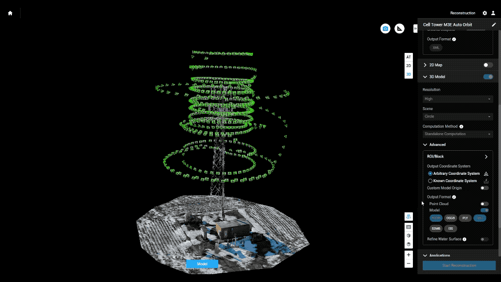
Example: Auto flight plan
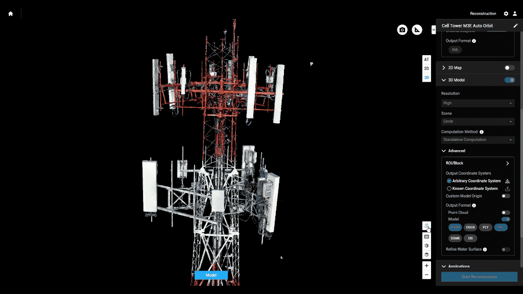
Result 3D Model
Why Use Drones?
2. Efficient - Results without waste
Safety of staffs
Save Time & $$

Why Use Drones?


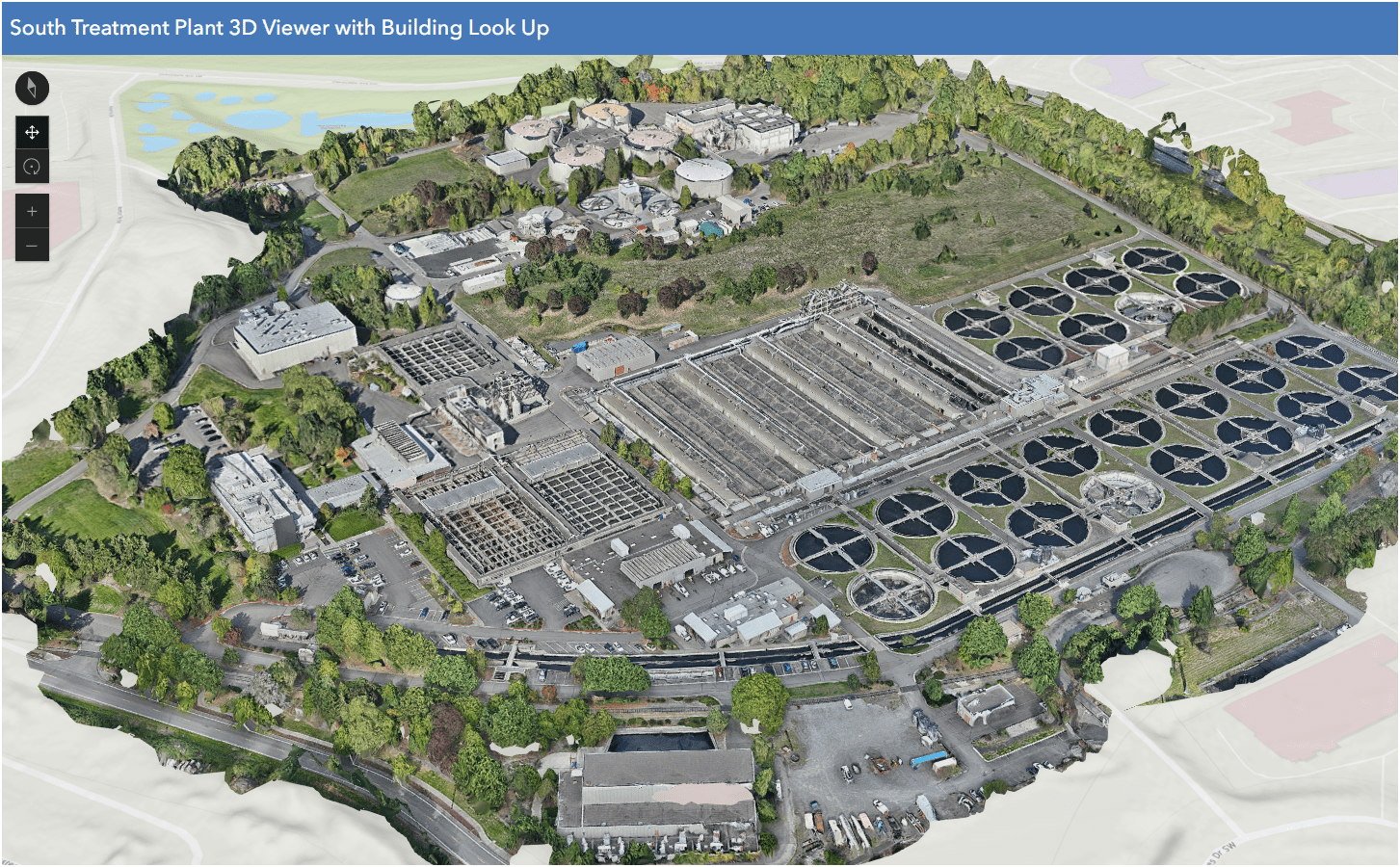
South Treatment Plant
Primary Division Channel
Increase Safety for Staff
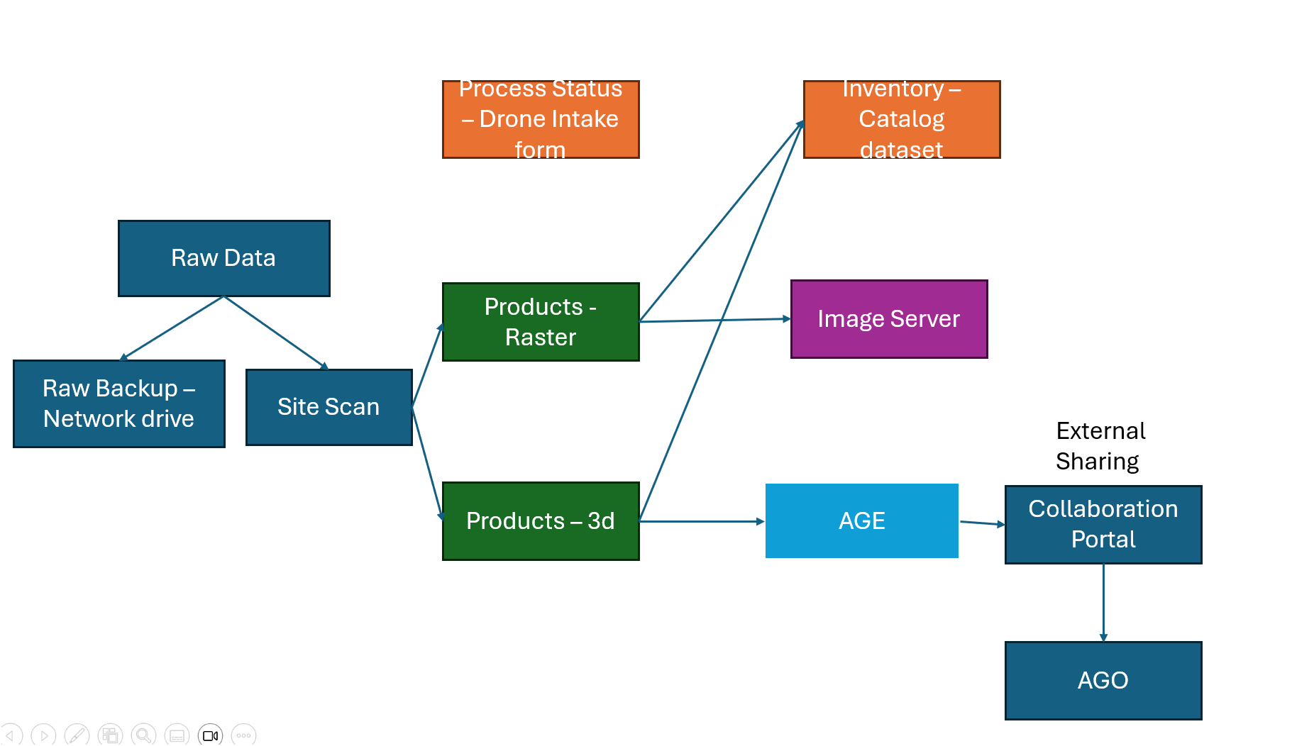
Data Processing - Efficient

- Cloud Storage & Cloud Data Processing
- Flight Planning from Desktop - fly on Mobile (controller)
- Cloud storage/Cloud Processing
- Centralized System
- Project Deliverables
Why Use Drones?
3. Effective - Producing Results


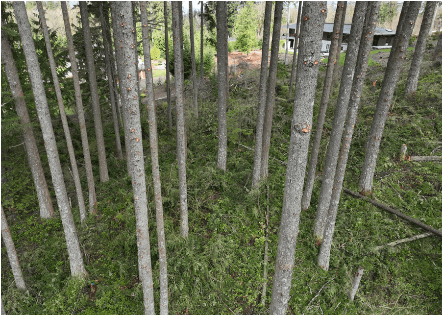
- Environmental Monitoring
Examples - Effective
August 2022
March 2022


April 2023
- Update 2D aerial map
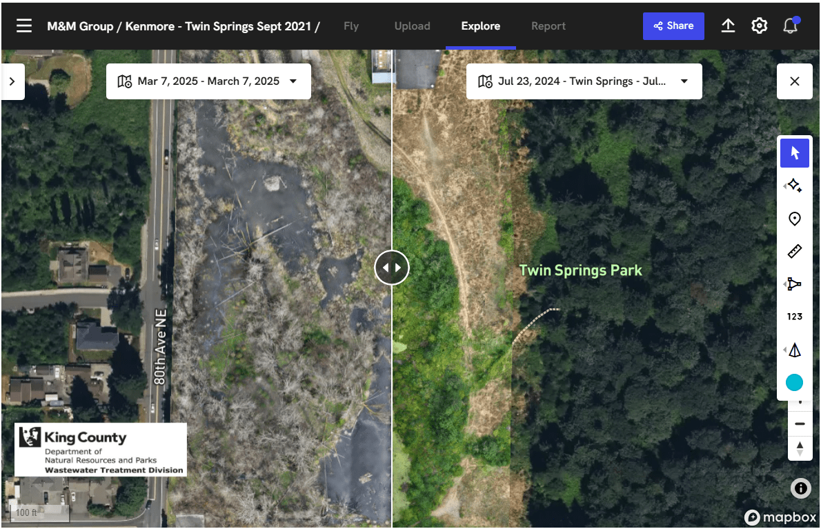
Examples - Effective

- 1172 Photos
- 0.57in/px
- Update 2D aerial map
Examples - Effective


0.57 in/px
Sept 2023
3.0 in/px
2021 KC Aerial
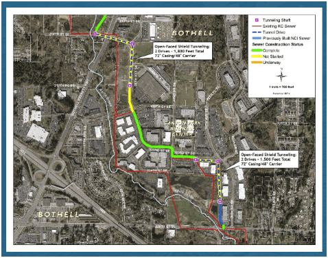
- Construction Site Monitoring
Examples - Effective

Just another Layer
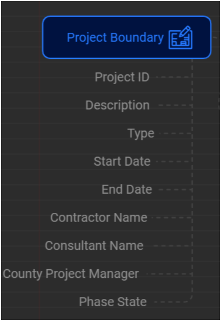
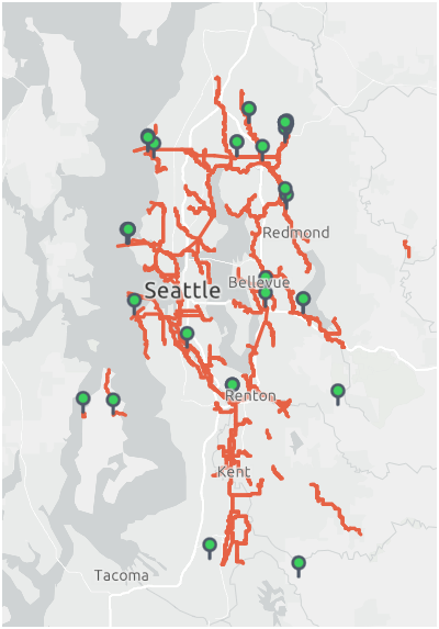
GIS Integration


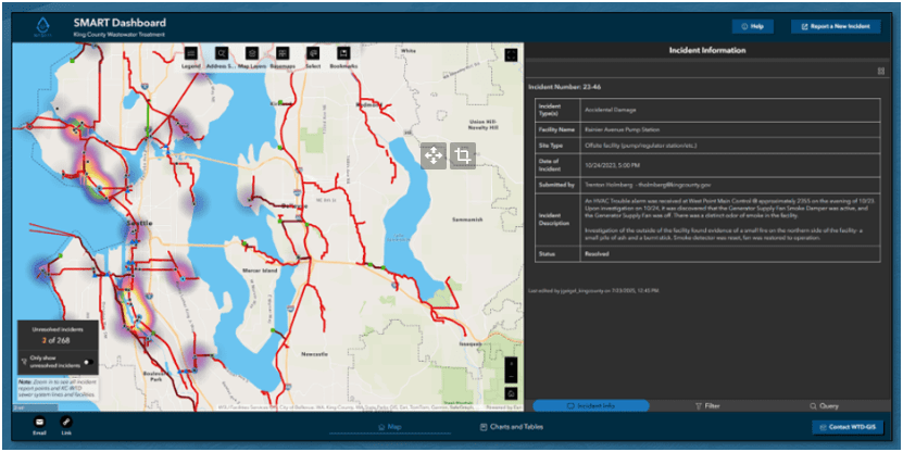
WTD RPAS Dashboard
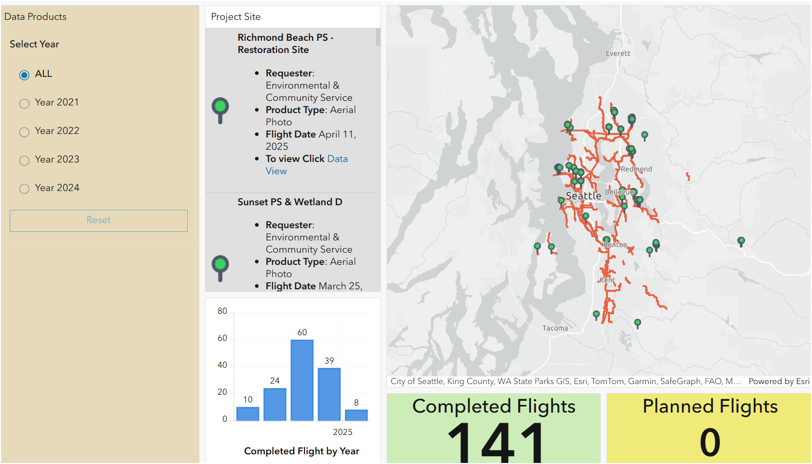


2021
June - Dec.
2023
Jan. - Nov.
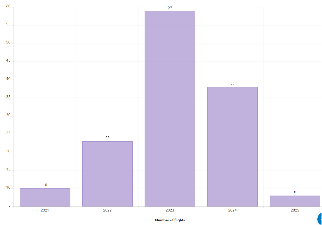
Number of Flights
2022
Jan. - Dec.

+ 480 %

2024
Jan. - Nov.
Examples - Integrating with GIS
Helping KC Parks
Helping KC Parks
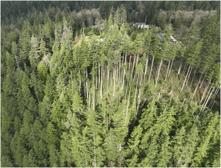
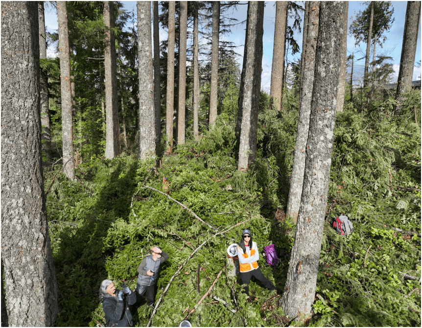
Proof Of Concept
Lidar SLAM Handheld Unit

WHOA!

Washington GIS Association Drone Special Interest Group


- Email Sign-up
- Resources
- Every 3rd Thursday
- ZOOM Meeting
- 165 Members
- Monthly Meeting - Every 3rd Thursday over Zoom
- Share resources online
- Help educate and introduce new users to the field of drone mapping and GIS

peter.keum@kingcounty.gov
WTD Presenation Drone for FMD - Oct 8, 2025
By Peter Keum
WTD Presenation Drone for FMD - Oct 8, 2025
Presentation for KC FMD about WTD Drone program and its use cases.


