State Density in Latin America
A territorial perspective
Rodrigo Rodrigues-Silveira


How to understand the Latin American State beyond its containers, but using them
as analytical lenses?
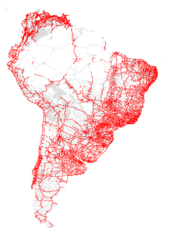
State's territorial imprint


But, density of what?
Sub-national Politics Methodological "Billboard"
- Data quality and availability
- MAUP Scale challenges
- political "spatial fixes" vs multiscalarity
- ecological vs contextual vs individual analysis
- MAUP Zoning challenges
- changes in areas over time
- windows for comparison changing results
- Spatial Dependence
- spatial autocorrelation
- institutional topology and urban networks
- Spatial Heterogeneity (spatial changes in association)
**
**
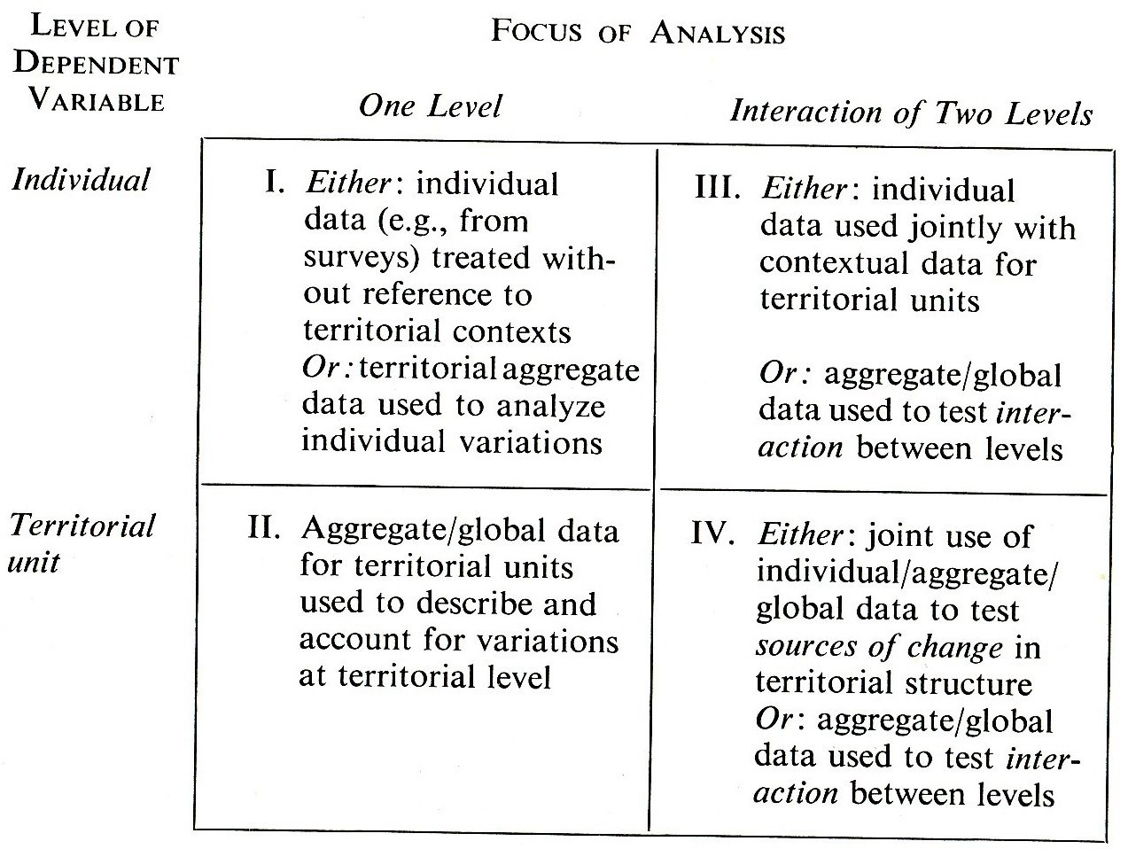
Source: Dogan and Rokkan (1969: 6).
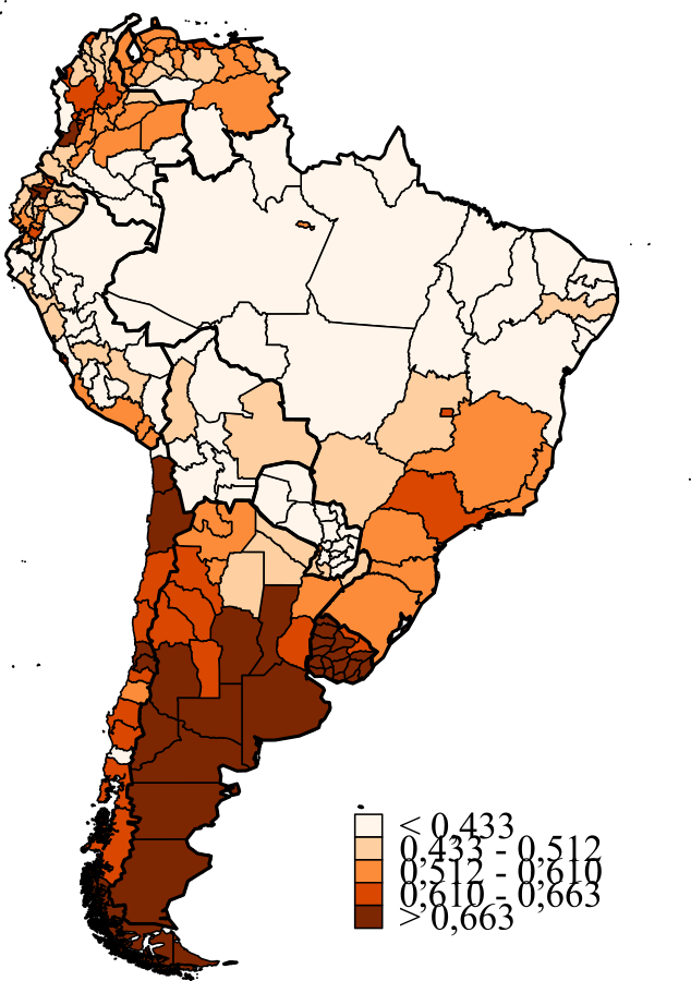
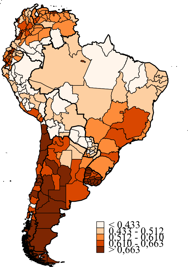
The State Density Index
Peruvian UNDP office (2009) created an aggregative index with five State outputs:
1. Identification (national IDs or birth certificates)
2. Healthcare (doctors per 10 thou. inhabitants)
3. Education (net secondary enrollment rate)
4. Sanitation (HHs with both piped water and sewage)
5. Infrastructure (HHs with access to electricity)
Our proposal
A. Tune the index a little bit
1. Using individuals instead of households
2. Decomposing the index into some societal categories
- location (urban / rural)
- sex (female / male)
3. Using South American second administrative level data as reference for the computation of scores (window for comparison)
B. Check the results by
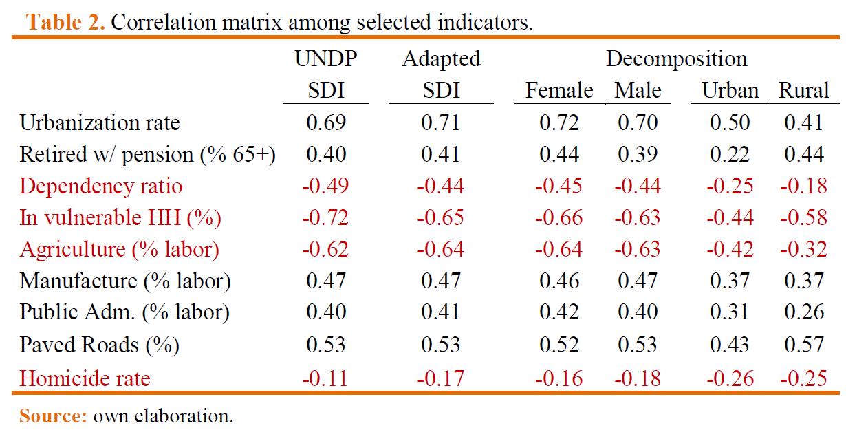
1. Correlating with other socioeconomic variables
2. Contrasting to the literature on L.A. State Building
3. Contrasting to the literature on Subnational authoritarianism
Results for the SDI
Sociospatial Stratification
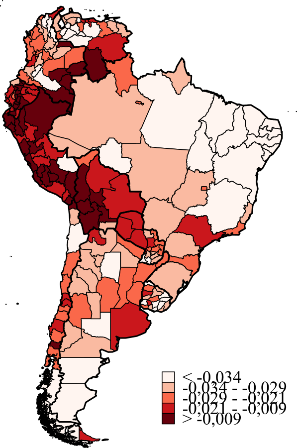
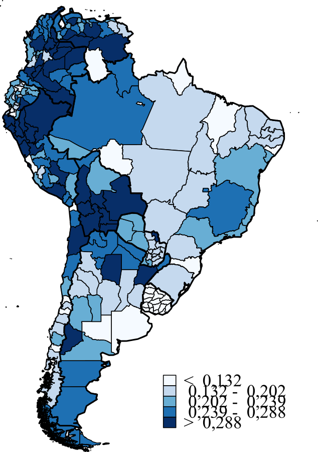
Urban-rural (locational gap)
Male - Female (gender gap)
Socioeconomic Variables
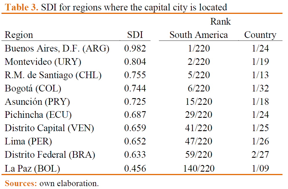
Urban Primacy and Metropolises
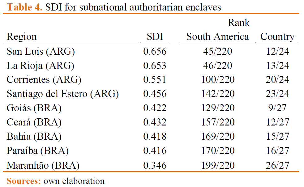
Sub-national authoritarianism
Results
1. South America as window for comparison:
- allows us to frame the results in the debate on State Building and Subnational authoritarianism in L.A.
- allows the comparison of political units beyond national institutional frameworks
- coherent with other socioeconomic indicators
2. Socioeconomic spatial segmentation:
- Urban/rural divide
- Small gender gap, but more pronounced on certain regions
Next steps
Refine the empirical analysis
Select some countries and analyze the topics 1,2,4, and 5 of our methodological "billboard".
Test for the effect of time in the measurement of State Density
Thanks for your attention!
Comments and suggestions are needed!!!
State Density in Latin America
By Rodrigo Rodrigues-Silveira
State Density in Latin America
State Density Index