Earthsys 144: Fundamentals of GIScience
Basic Spatial Analysis, & Networks
where is your data? gis.stanford.edu
Basic Spatial Analysis
Inputs, Operations & Outputs

Spatial Scope
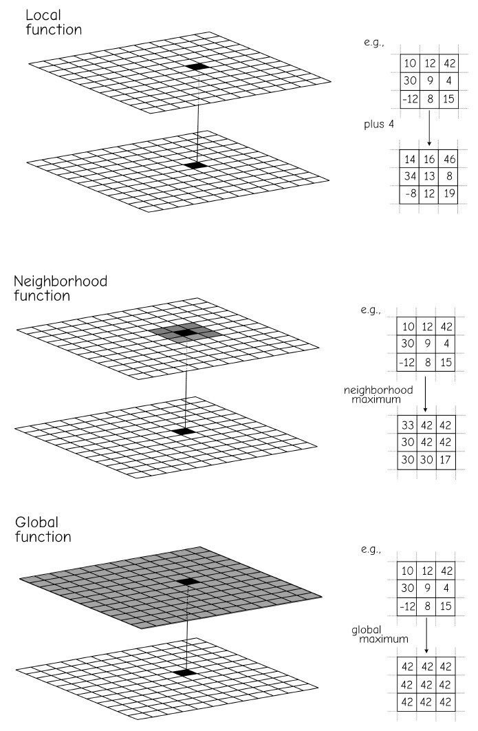
Local Operations

Neighborhood Operations

Global Operations


Selection
Set Algebra
- Less Than (<)
- Greater Than (>)
- Equal To (=)
- NOT Equal To (<>)

Boolean Algebra


Spatial Relationships
Spatial Selections
Adjacency

Spatial Selections
Proximity

Spatial Selections
Containment


Classification


Binary Classification

Data-defined Classification

Equal Interval

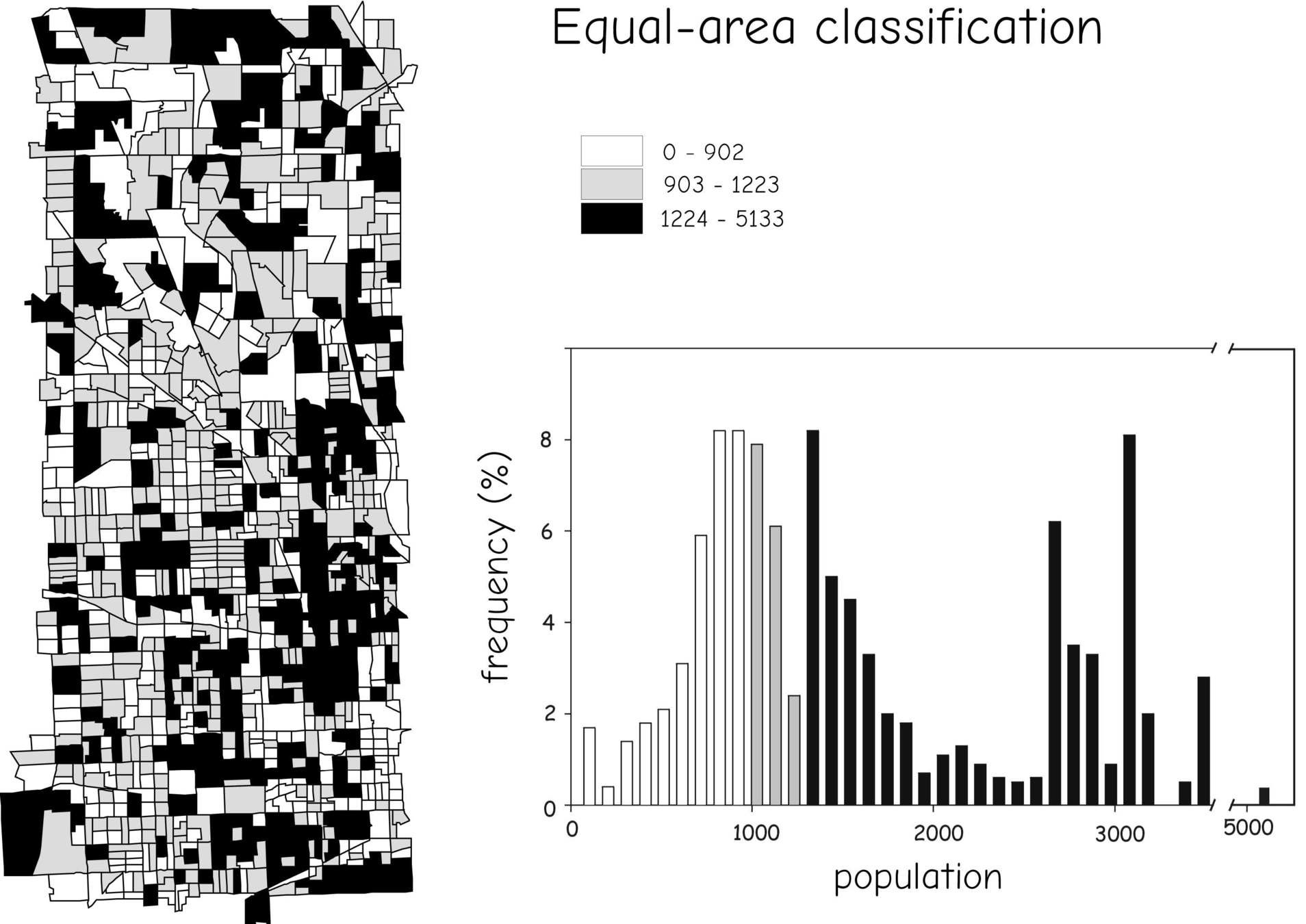
Equal Area or Quantile
Natural Breaks

Dissolve


Aggregating Attributes with Dissolve

Modifiable Areal Unit Problem
MAUP

Modifiable Areal Unit Problem
MAUP aggregaton effect


Modifiable Areal Unit Problem
MAUP Zoning effect

Proximity & Buffers


Vector Buffers

Vector Buffers

Vector Buffers

Overlay


Spatial Joins
count = 3
Clip

Intersect

Union

Erase

Slivers

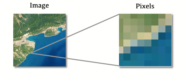
Pt2 - Raster, Network & Basic Spatial Distributions
Scope
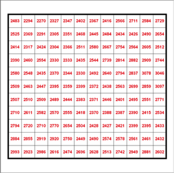
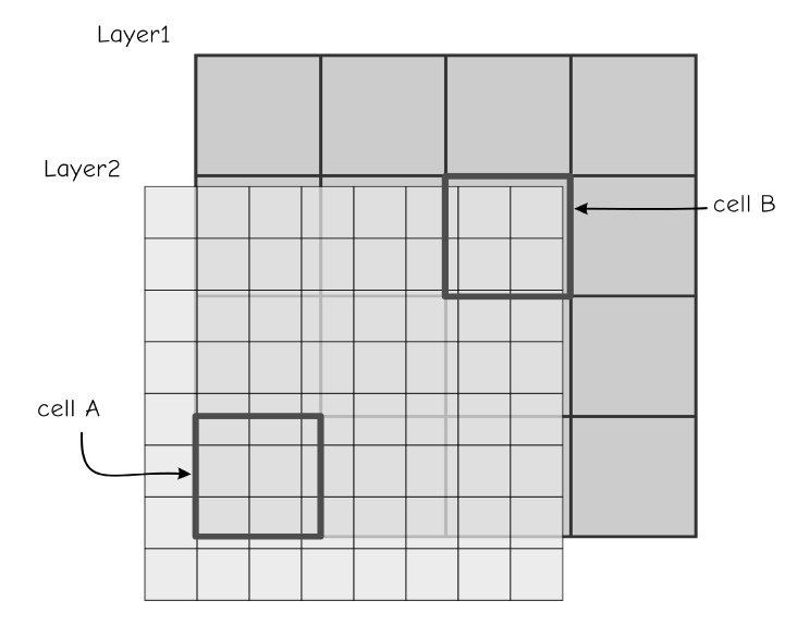
Incompatible Cell SIzes
Raster Overlay

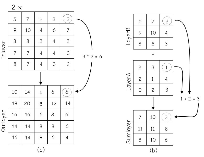
Map Algebra
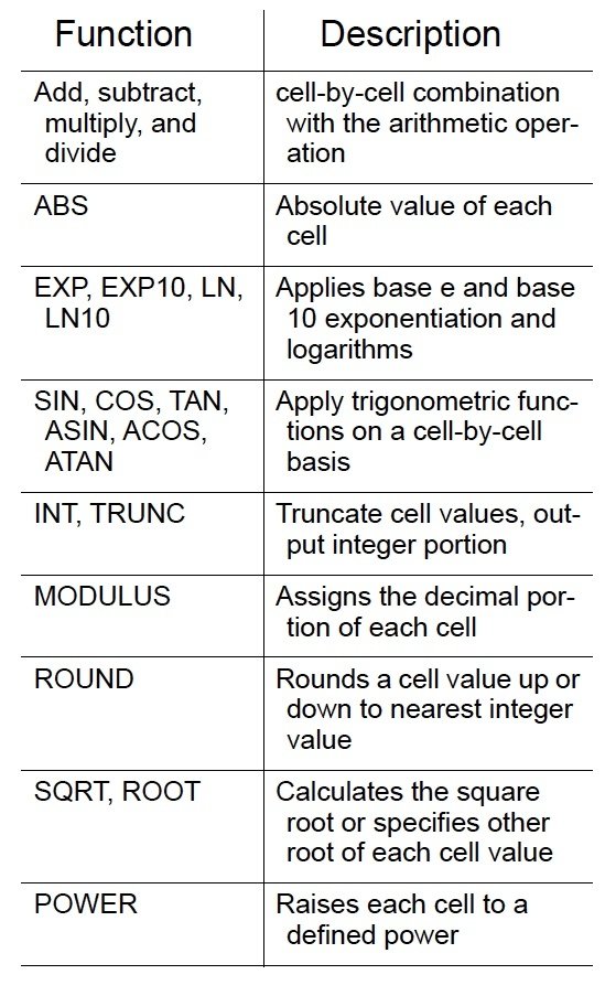
Mathematical Functions
Distance Rasters

Raster Buffers


Raster Overlay

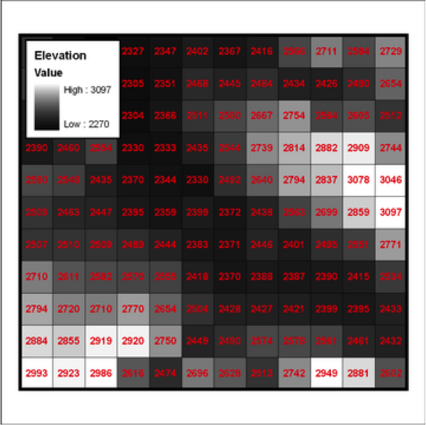
Reclassification


Reclassification


Raster Overlay


Networks

Centers (Nodes) & Links (Edges)

Network Travel Costs

Least Cost Paths

Least Cost Paths

Spatial Allocation

Geocoding

Core Areas & Spatial Central Tendency
Mean Center, Mean Circle & Standard Distance

Convex Hulls & Other "Minimum Bounding Geometries"

Convex Hulls & Other "Minimum Bounding Geometries"

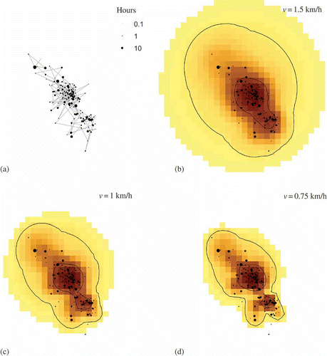
Time-Geographic Density Estimation & GeoEllipses

Time-Geographic Density Estimation & GeoEllipses

Time-Geographic Density Estimation & GeoEllipses

Time-Geographic Density Estimation & GeoEllipses

Time-Geographic Density Estimation & GeoEllipses
Basic Spatial Analysis, Networks & Movement
By Stace Maples


