Centralized Administrative Data Update
CADU
Syafiq Abdul Rahman

-
The Centralized Administrative Data Update system -
Map updating platform for administrative data -
Developed in-house by Geomatics team.
What is CADU ?
-
Mainly use by Geomatic's digitizer and AND’s user of all AND’s sites. -
Used to update and maintain the administrative data such
- street
- building
- landmark
- property
- POI
- junction
- building group
- multi-storey
- multi-floor
- etc.
What is CADU ?

-
Operating System
- Windows 7 or Windows 10
-
ArcGIS Engine Runtime
- Version 9.2
- Microsoft .NET Framework
- Version 4.5 or higher
- Oracle Client Runtime
- Version 10.2.0.5
Technology
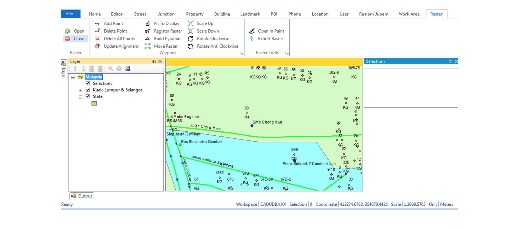
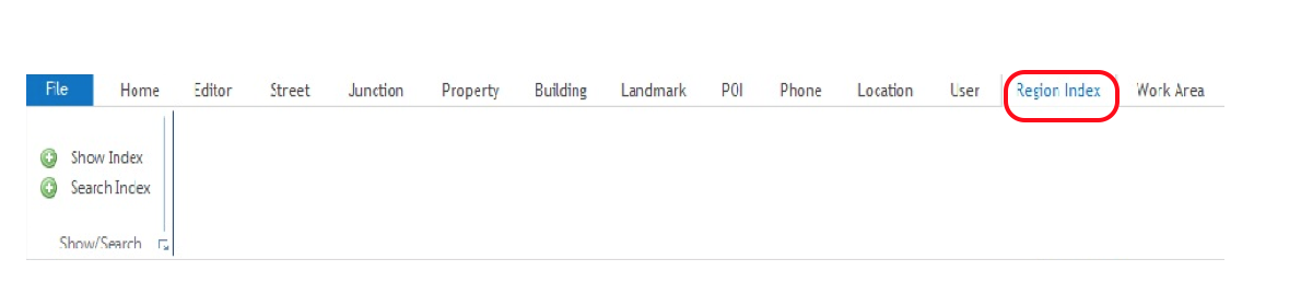
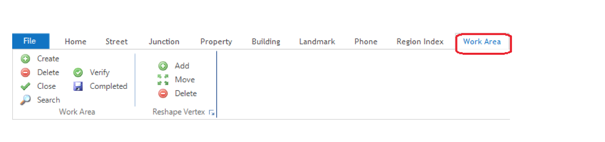
User Interface
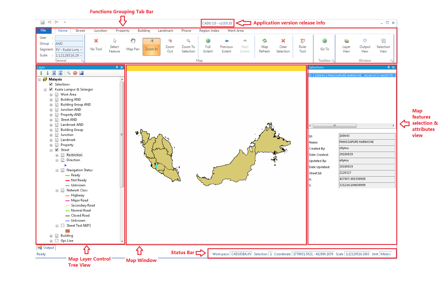
User Interface


User Interface
Life Cycle
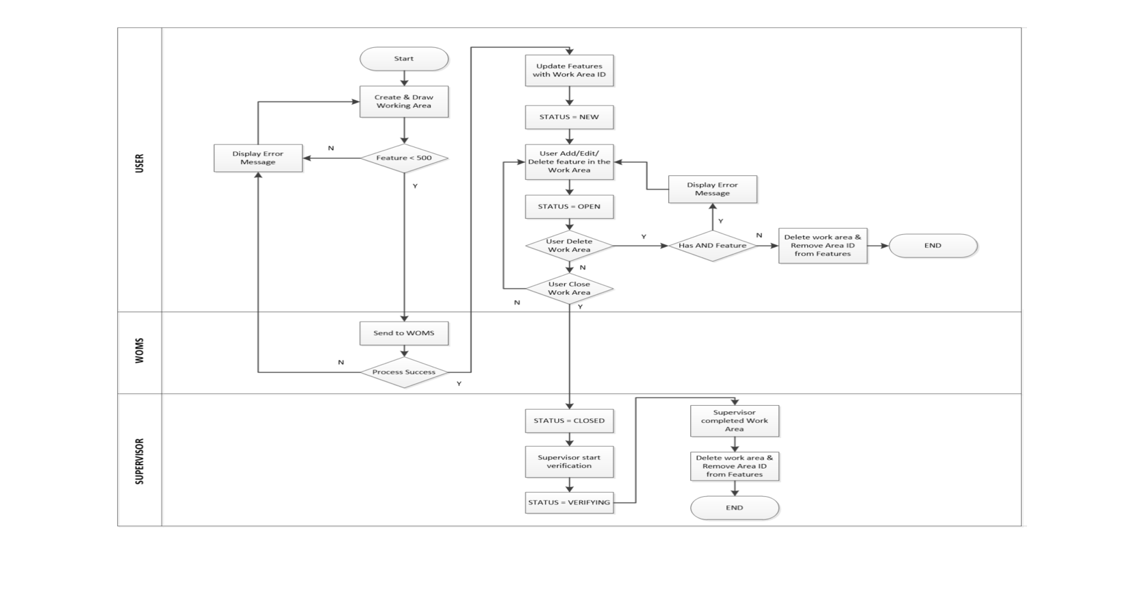
Process Flow
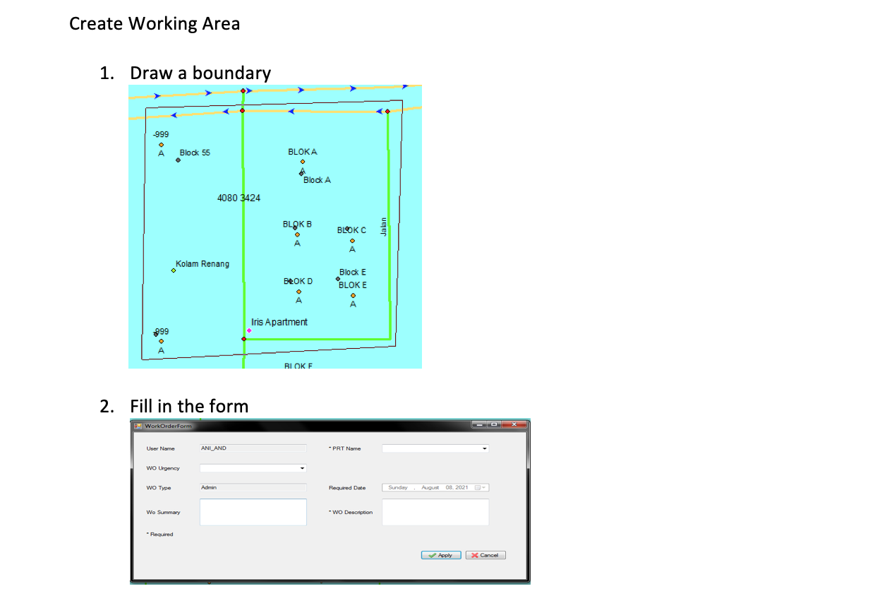
Process Flow
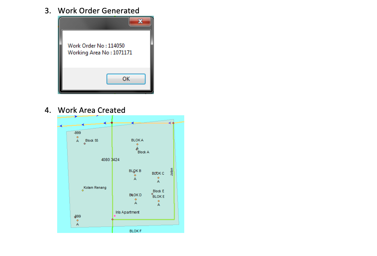
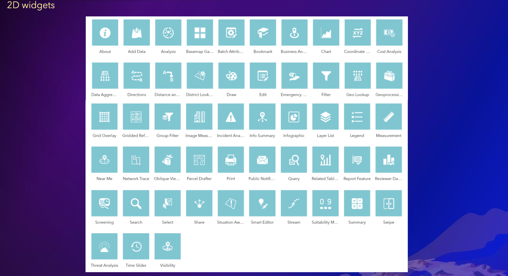
All Function
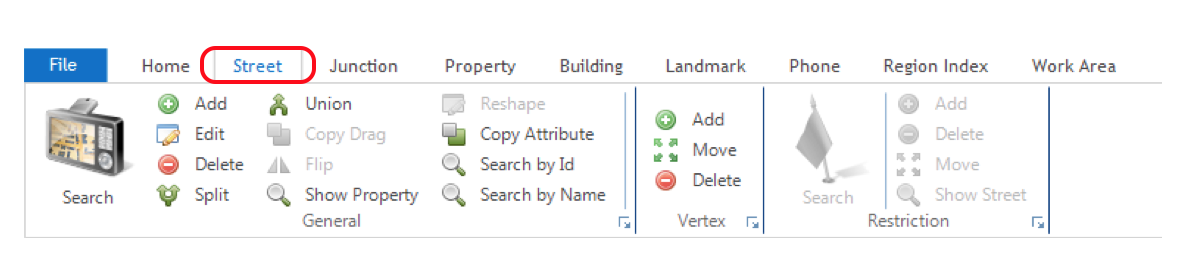
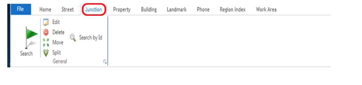

All Function
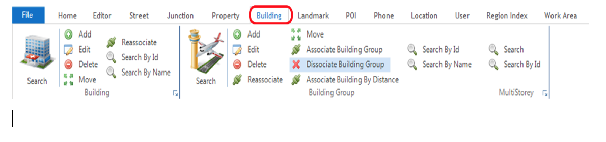
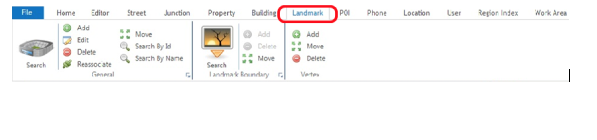
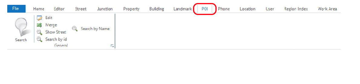
All Function
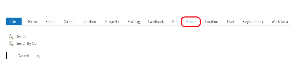
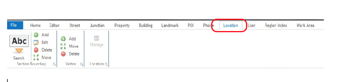
All Function
CADU 1
CADU 2
CADU 2 AND
CADU 3 WEB
CADU 3 DESKTOP
ROADMAP
WHERE WE ARE
- Why the need for CADU 3 ?
- To upgrade the ESRI to newer version
- Consist of web for easy accessible on any device
- Overcome limitation of previous version of ESRI.
CADU 3
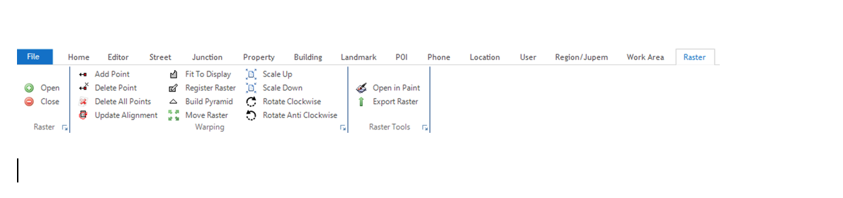
CADU 3 Technology
-
Operating System
- Online ( Web App)
- Online ( Web App)
-
ArcGIS Web App Builder.
- ArcGIS API for Javascript.
- ArcGIS Server Enterprise Edition
- Version 10.9
- Create new apps
without coding
-
Integrated with the
ArcGIS Platform
-
Built with ArcGIS API for JavaScript/HTML
(extensible)
ArcGIS Web AppBuilder
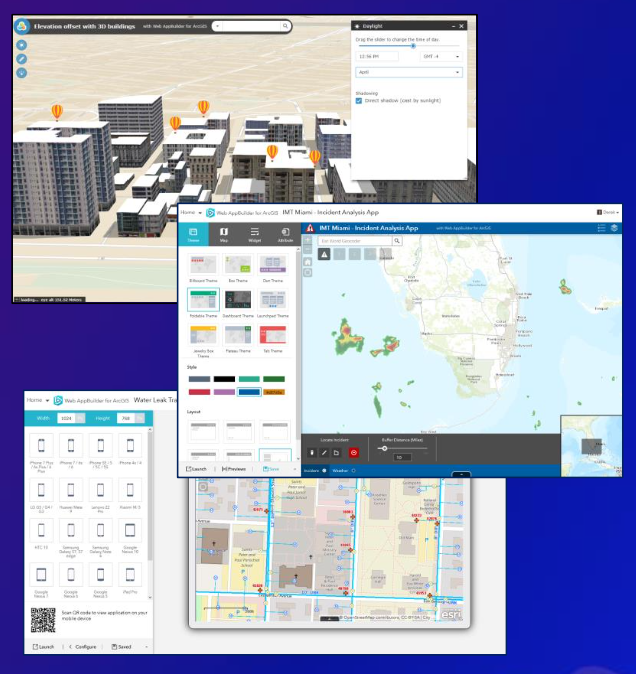
ArcGIS Web AppBuilder
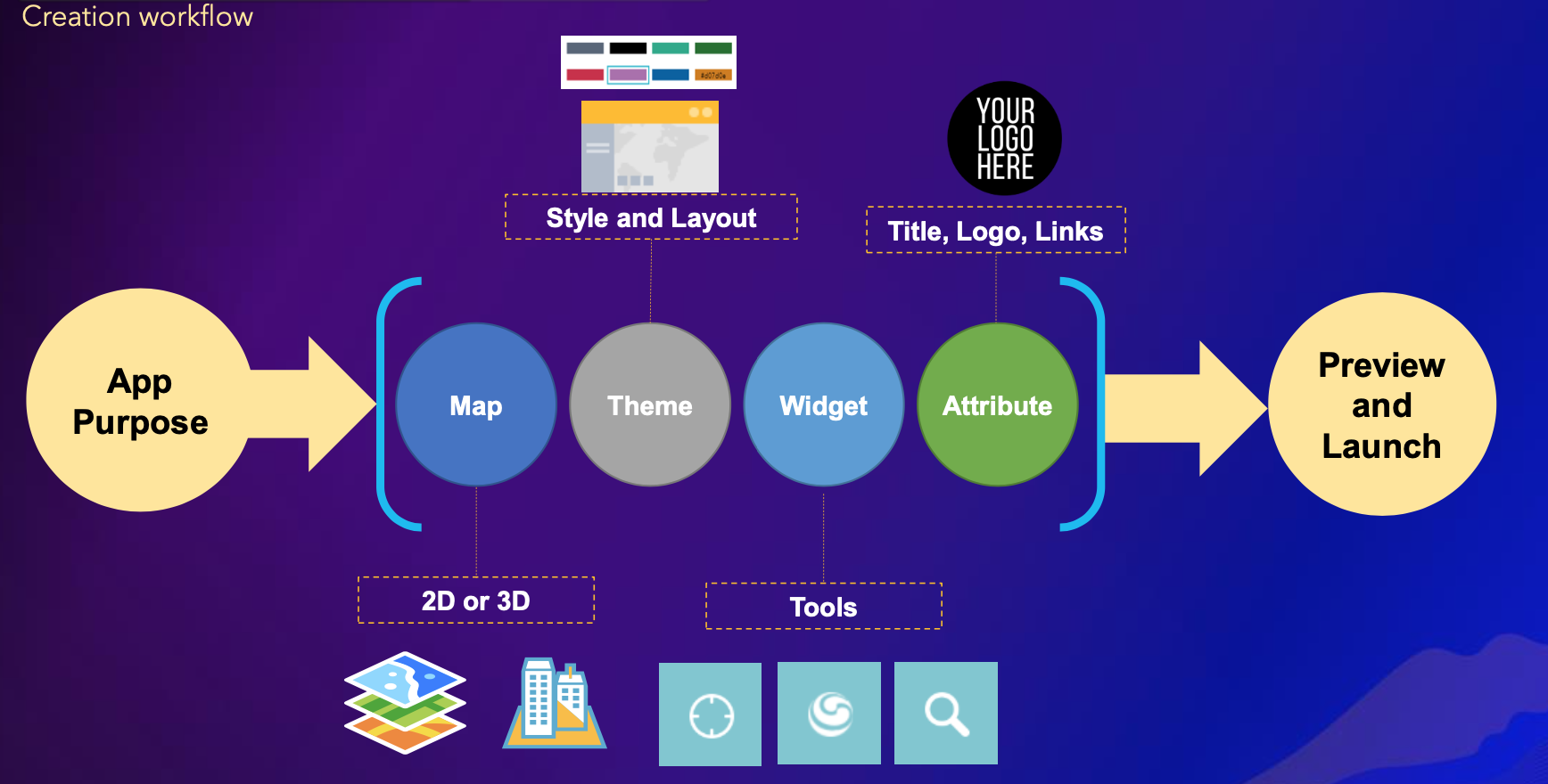
ArcGIS Web AppBuilder

CADU
By Syafiq bin abdul rahman


