Mapillary

What is Mapillary?
Mapillary is a service for crowdsourcing map photos. Using simple tools like smartphones or action cameras anyone can collect photos that are combined into a collective street level photo view.
More about Mapillary
Mapillary, is taking this accessibility to the next level by letting anyone and everyone create their own street-level maps.
They plan to fill in the blanks on existing maps,create their own complete representation of the earth to benefit governments, businesses, nonprofit organizations, and curious explorers alike
More about Mapillary
Up to current date,they have more than 50 million photos, mapped more than 1.2 million kilometers in more than 170 countries.
Furthermore, their technology lets anyone use existing images on Mapillary — and the data that they extract from them.
Mapillary’s ArcGIS integration — built in partnership with Esri, the world leader in Geographic Information System (GIS) software — lets governments, nonprofits and businesses see locations evolve in real-time, arming them with insight into infrastructural problems like inefficient public transportation and changes in road conditions.
Mapillary also provide
How mapillary founded
The idea for Mapillary was something Solem was thinking about around five years ago. After quitting his job at Apple and moving back to Sweden in the summer of 2013, he said the timing finally seemed right to move forward with the concept.
“All of a sudden, a large percentage of the population had good cameras in their pockets and handbags, Internet connectivity was good, and sensors on devices were good. All of these things that weren’t really in place a few years earlier seemed to be widespread and available,” Solem recalled.
Lets take a look at
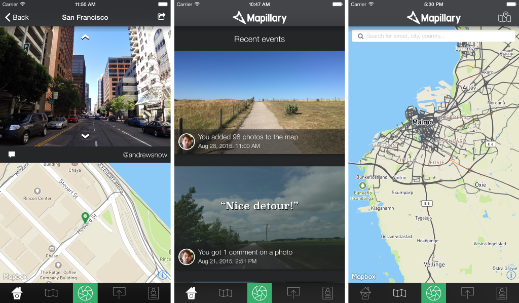
Mapillary App
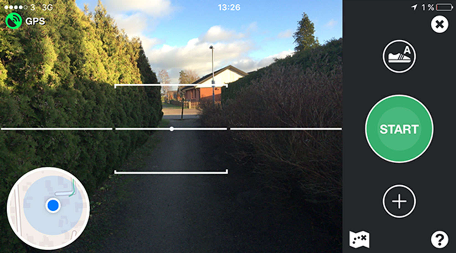
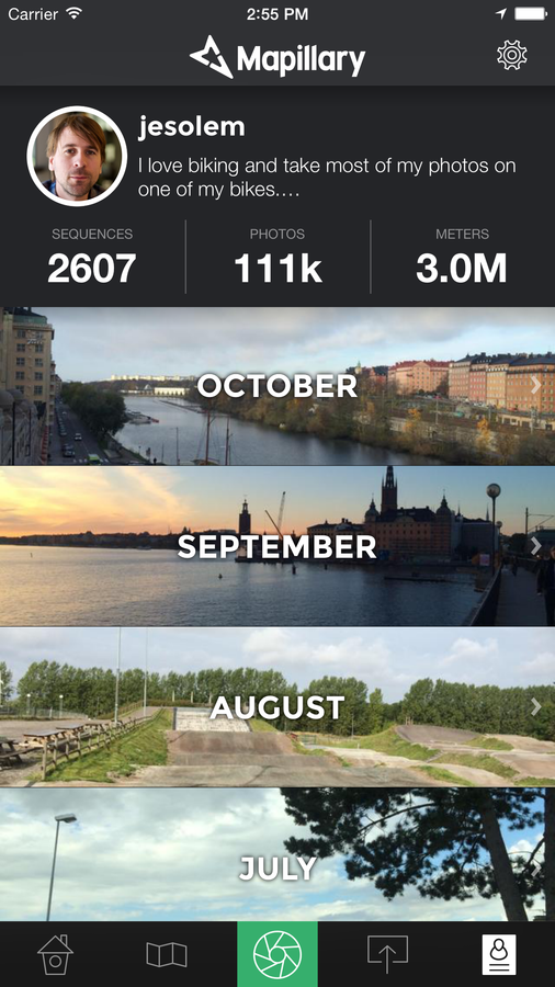
Images are taken with the largest resolution, at 4:3 ratio. One photo takes roughly 2-8MB, giving you about 1000-4000 photos if you have 8GB of free storage on your phone.
Capture will be stopped when you have less than 10% free storage space left, or when your battery level is under 10%.
Note that photos are stored in the app folder and deleted after upload.
Photos are never stored in your camera roll. The only way to view them is through the album view in the app.
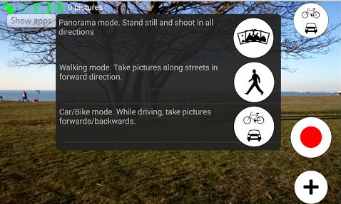
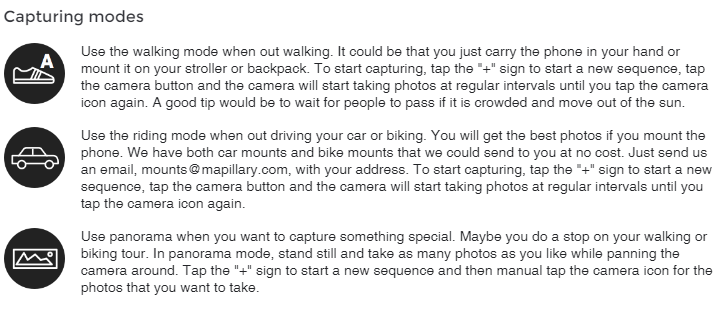
Lets take a look at the example
How Mapillary Generate Income?
Any wild guess?
Scaling up and building a business
As for its business model, although Mapillary is free for personal and non-commercial use, it offers API access for commercial use as an SaaS model for a monthly fee that starts from €99

Process involves
- blurring faces
- blurring license plates
- stitching together nearby photos so users can navigate between them.
“Google Street View is one of several street view services where photos are captured using cars… Coverage is limited to how many cars can be deployed. Also, in many parts of the world the photos are updated only every three to four years, and usually cover only major roads and cities,”
“Mapillary lets users upload photos as often as they like and the capture process is infinitely scalable.”
To compare coverage
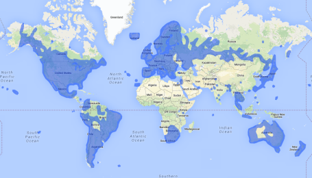
Google Street View
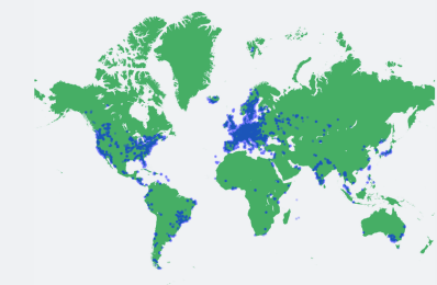
Mapillary’s current coverage
Map
By Syafiq bin abdul rahman


