Who are we?

Syrus Mesdaghi

Technical Lead

syrusm@prominentedge.com

Daniel Berry

dberry@boundlessgeo.com

What will we cover?


  • revise
  • Goal of Rogue / GeoSHAPE
  • GeoSHAPE Components
  • GeoGit Integration
  • Scalability
  • Roadmap
  • Q&A

Developed Under ROGUE Project


  • Part of a set of capabilities known as GeoSHAPE
  • geoshape.org
  • github.com/rogue-jctd
  • Goal: streamline collaboration on geospatial data between distributed partners
  • Since 'partners' can include different government agencies, organizations, volunteer groups
    • GeoSHAPE has to be free and open source 
    • Easy to deploy
  • Each partner will have their own instance of GeoSHAPE
    • Can edit and synchronize with other instances
      • Funded/developed GeoGit (GeoGig) 
    • Fully operational in disconnected mode
  • Includes a mobile app (Arbiter) for data collection

GeoSHAPE Components

MapLoom

Web Editor With GeoGIG integration


github.com/rogue-jctd/maploom

MapLoom

  • OpenLayers 3 + Angular + Bootstrap
  • Embedded in GeoNode, but can be stand alone
  • Bring in layers from local and remote servers
  • Supports time dimension
  • GeoGIG Integration
    • View history of a feature and layer
    • View changes in each commit in 2 way diff manner
    • Sync with remote GeoGIG repositories
    • Conflict resolution in a 3 way diff manner
    • Rever commits
    • Blame / view authors
  • Contribute back! 

GeoNode

Manage Layers, Maps, Users & Groups


github.com/GeoNode/geonode/

GeoNode

  • Made for users as opposed to GeoServer admins
  • Upload / Download Layers
  • Save / Open Maps in MapLoom
  • Manage Users and profiles
  • Manage Groups
  • Manage Permissions
  • Edit Styles

GeoServer

Serves GIS Vector & Raster data through OGC Standards


github.com/geoserver/geoserver

GeoServer

  • It's what does a lot of the heavy lifting
  • Supports GIS Data from numerous sources: PostGIS, GeoGIG, SQLite, Shapefile, etc
  • Meant more for GIS Administrators 

GeoGIG

  • De-centralized / Distributed Version Control System
  • Does not have to be connected to Server
  • Heavily inspired by Git, but had to be rewrite
  • Instead of version controlling lines of text, it version geospatial features
  • You can commit, pull, push, branch, merge, revert, clone, shallow clone, sparse clone, and many operation which exist in git 
  • Coming release will rely on Postgres as opposed to the File System
  • Only use instead of PostGIS when history of features / layers matter
  • github.com/locationtech/geogig

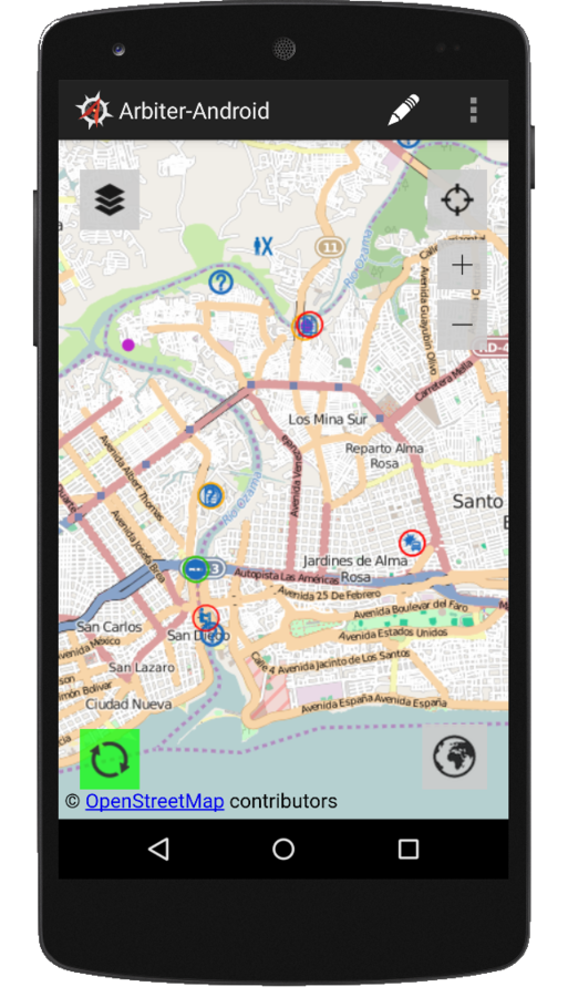
Arbiter

Mobile application for viewing / collecting data

Arbiter

  • Mobile application for viewing / collecting Data
  • Allows you to easily attach photos to features
  • Designed to works in disconnected mode
  • It downloads the vector data based on your Area of Interest
  • Uses mbtiles for the basemap
  • Native Android UI + Open Layers 2 
  • ...

Demo!

Scalability

  • Bullet One
  • Bullet Two
  • Bullet Three

Roadmap

  • Bullet One
  • Bullet Two
  • Bullet Three

Q&A

GeoSHAPE: FOSS GIS Collaboration Platform with Web & Mobile Clients

By Syrus Mesdaghi

GeoSHAPE: FOSS GIS Collaboration Platform with Web & Mobile Clients

The need for a user-friendly web-client that enabled effective geospatial data collection, sharing, and collaboration for the ROGUE project motivated us to move away from our GeoExplorer based web-client. Our new web-client, MapLoom, is based on OpenLayers3, AngularJS, and Bootstrap which addresses key shortcomings of GeoExplorer and provides an intuitive and simple interface for performing complex GeoGit operations. The capabilities include per feature and layer history, viewing difference between revisions, merging, conflict resolution, and synchronizing with multiple remotes through the UI. The ability to synchronize a repository with multiple remotes is just one of the reasons why development of GeoGit was the solution to our needs. GeoGit allows distributed versioned editing of geospatial data at a feature level and allows the repositories to be synchronized even in disconnected or reduced connectivity environments. This talk will cover our experience developing the web-client as well as highlight the use of GeoGit.

  • 2,004