


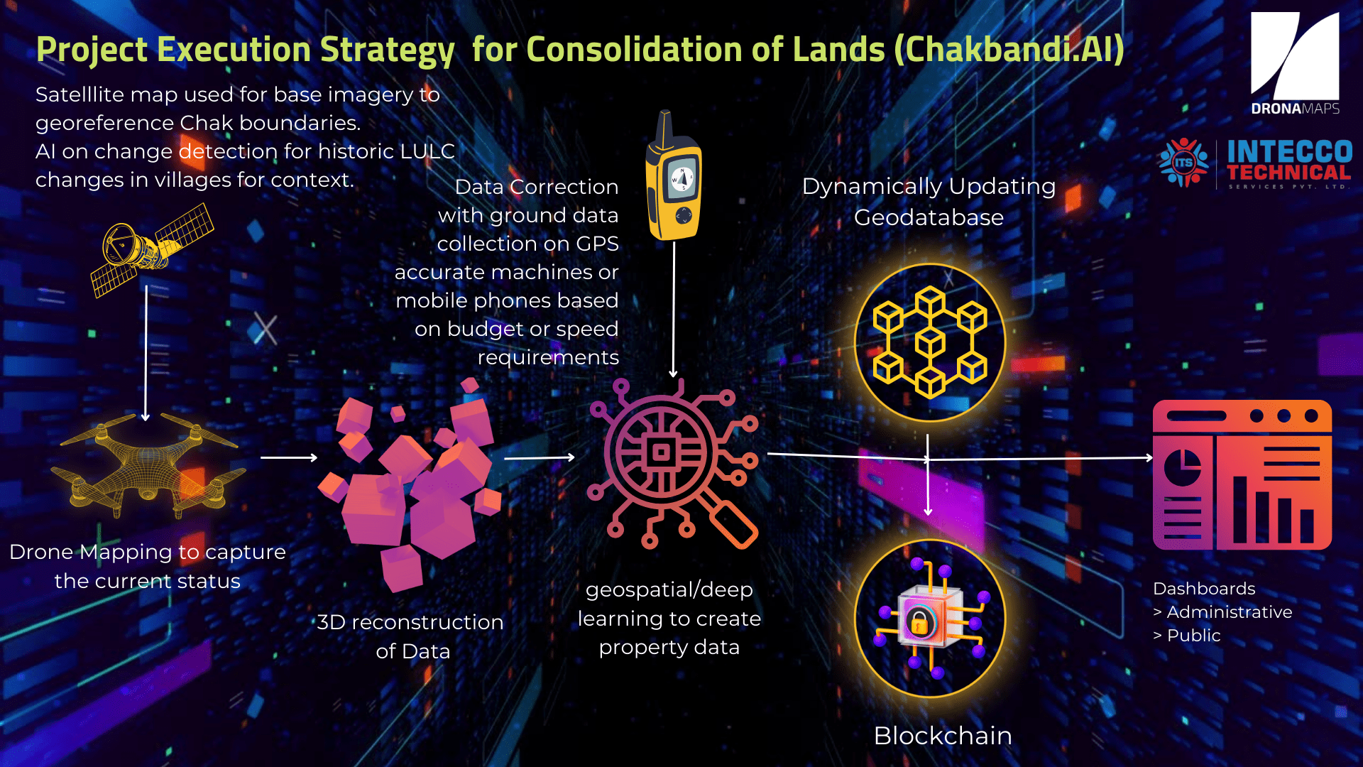
Proof of Concept (PoC)
for Design, Develop, and implement AI, Blockchain, Drone & Rover Survey based Consolidation of Lands (Chakbandi.AI) in Uttar Pradesh
At
Village - Chaudahapras
(Tehsil - Jalalpur, District - Ambedkar Nagar)
Steps of Proof of Concept (PoC)
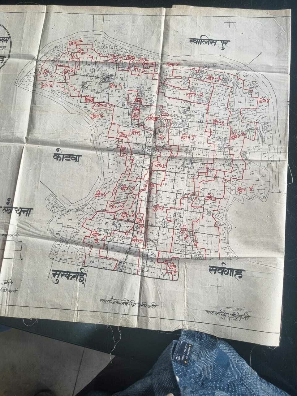
Step - 1 :: Collection of records and Digitisation of Maps
1. Reconnaissance Survey
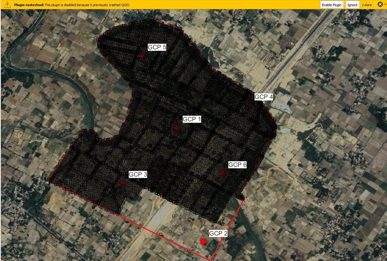
2. Aerial Survey
A. Drone data
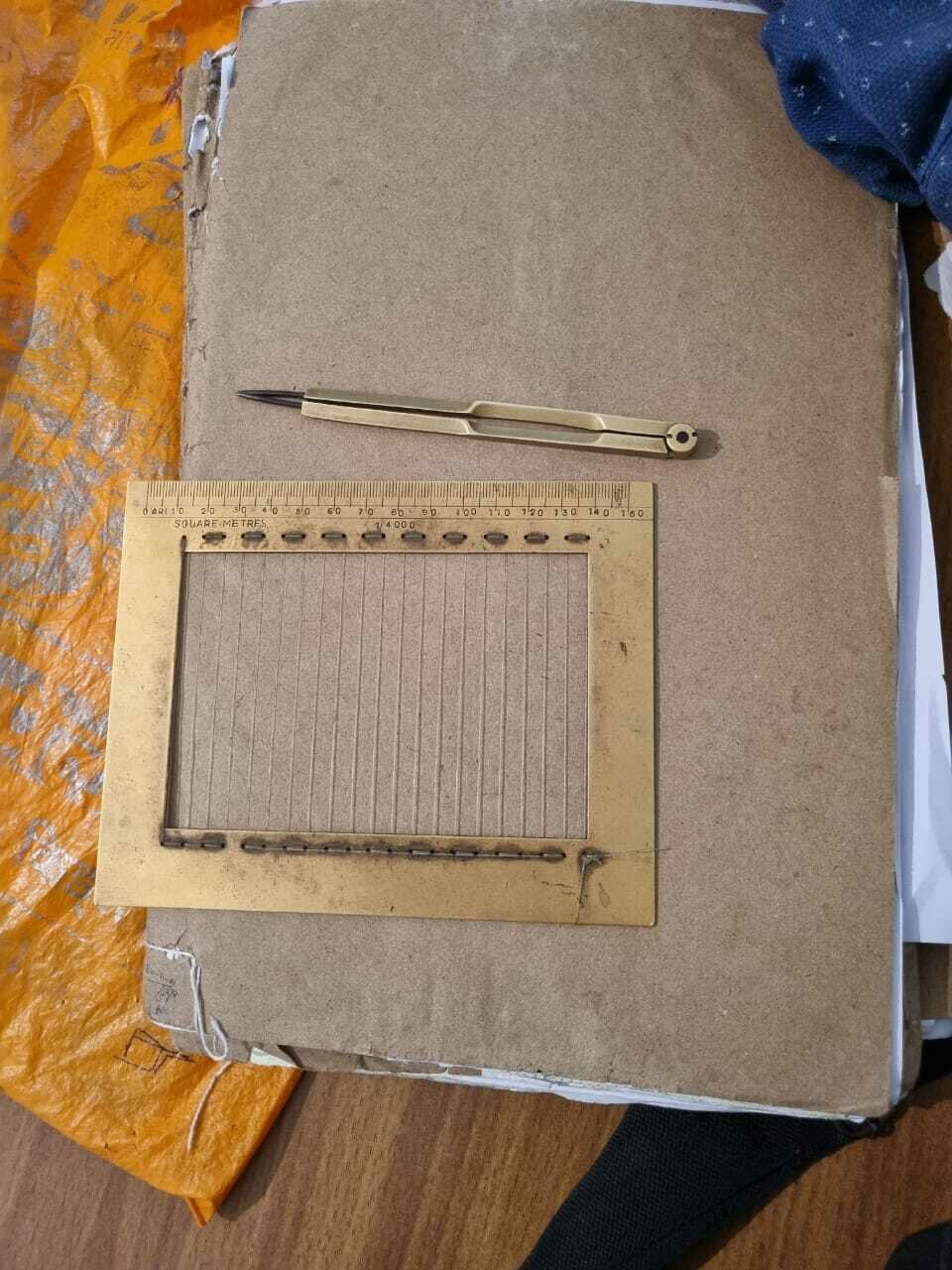
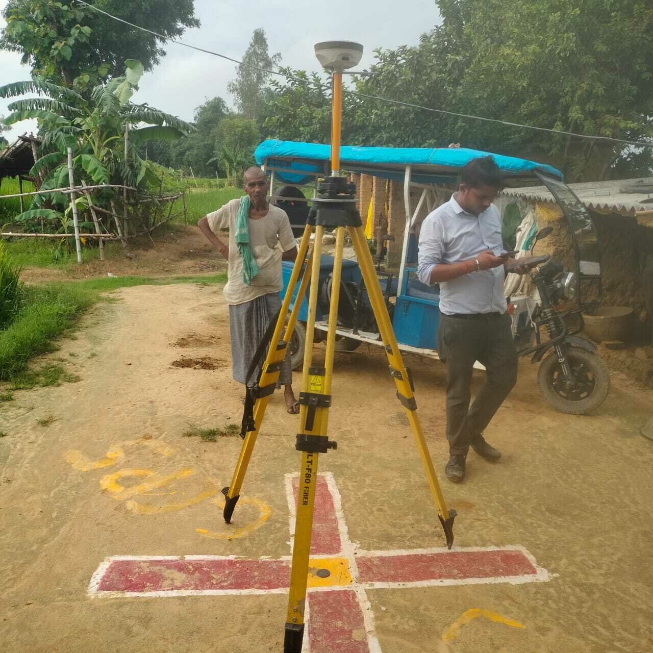
B. DGPS Survey
C. GIS based Village boundary Survey
3. Data collection from district and Revenue office
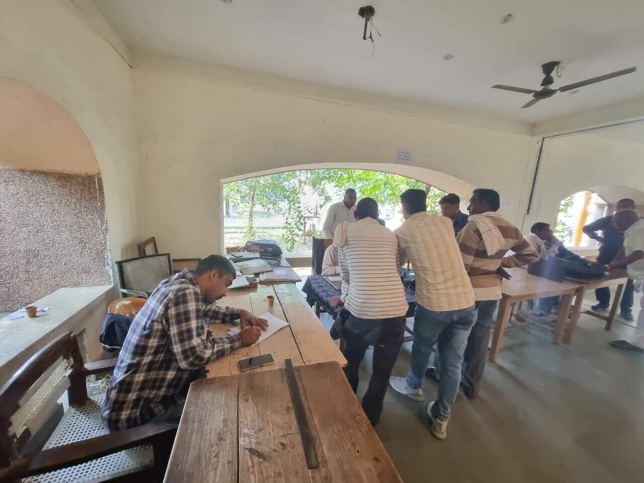
4. Ambedkar Nagar visit to understand the manual process of Chakbandi
5. Chodahpras village visit with Lekhpal and Authorities
6. Map generation (Orthomosaic and DSM)
7. Georeferencing of Gatta Map
8. Digitisation of Gatta Map
9. Digitisation of Khatauni register
10. Digitisation of Khasra register
11. Digitisation of agricultural parcel on
Drone map
12. Integration of Khasra with Gatta Map and
Khatauni
13. Designing and development of web app
Reconnaissance Survey
Choudahpras village visit for understanding and collecting topographical details to plan the aerial and DGPS Survey and collect the documentation (Khasra & Khatauni)
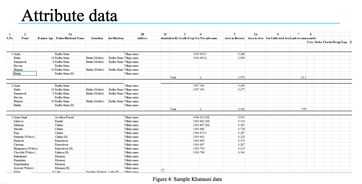
Sample Data Structure
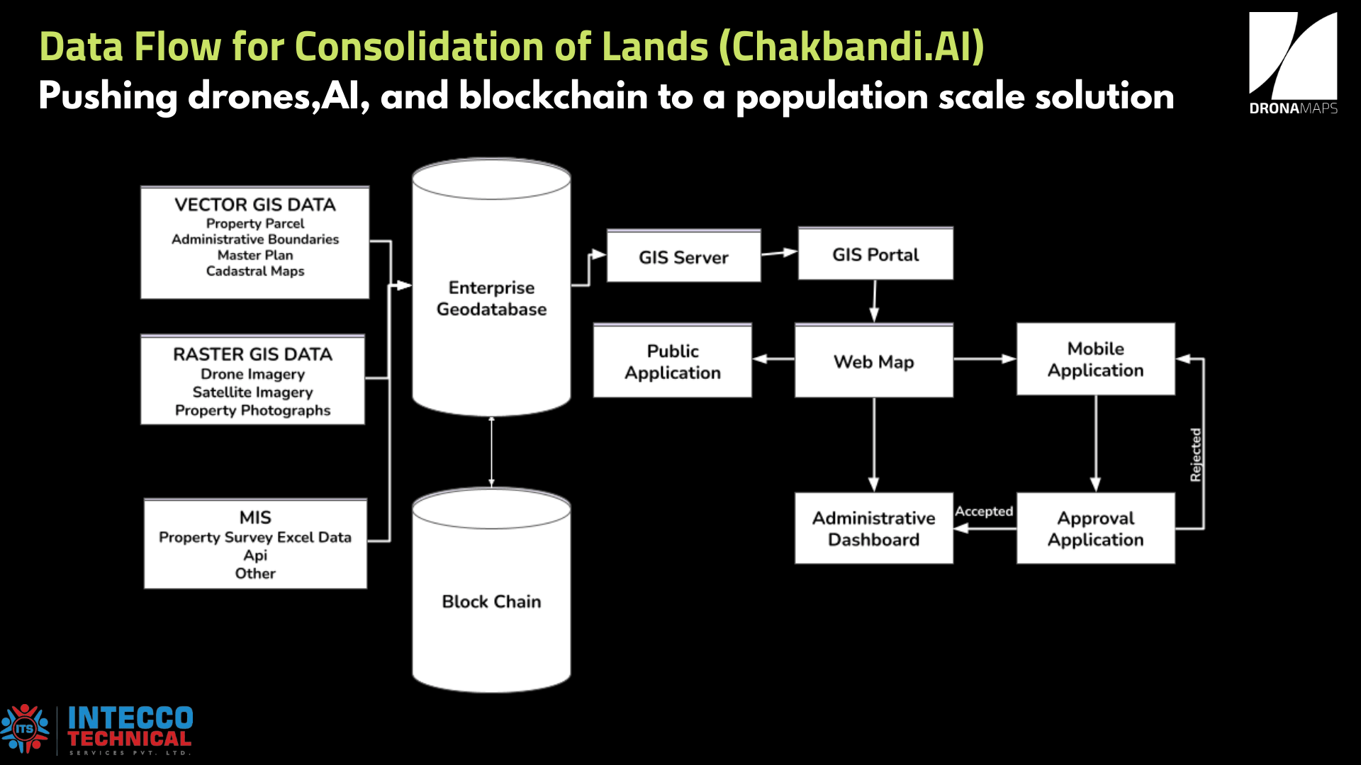
Steps in creating an Information System for Land Consolidation
• Develop an Information System for Land Consolidation (Chakbandi) in Uttar Pradesh
• Linking Bandhobasth, Khatauni and Khasra to different Chakbandi forms
• Linking different Chakbandi forms that will avoid multiple entry of same data
• Auto generate form 41 and 45
• Linking final form 41 and form 45 to digital Khatauni (Revenue Department format)
• Auto generate forms that need to be distributed to land owners
• Auto generate reports whenever required
DGPS and Aerial Survey
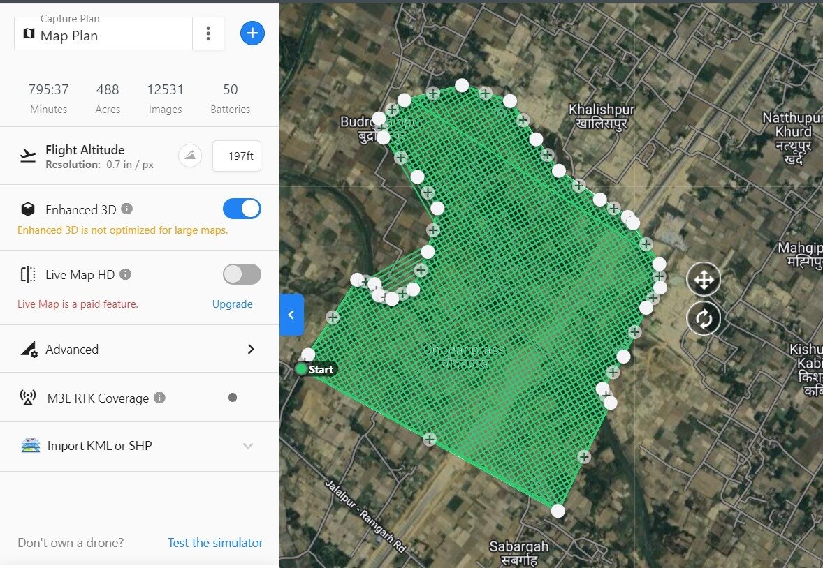
Flight Plans (Top Left)
GCP Placement (Bottom Left)
DGPS (Right)
Mobile Application for Data Collection
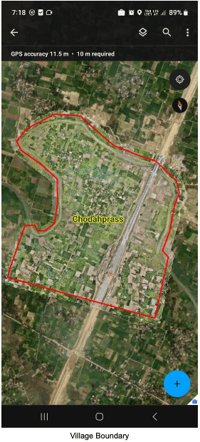
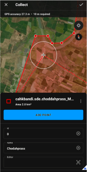
This mobile application allows the field officers to collect the on-ground survey for village boundary & Chak boundary data and upload the same on the portal for further data analysis.
Transforming Land Consolidation in Uttar Pradesh

Minimal
By DronaMaps Private Limited


