MAPPING HAZARDS AND RISK
FEMA FLOOD MAPPING PROCESS
ICON Engineering, Inc.
-
Stormwater and Floodplain Management Specialists
- Floodplain Modeling/Mapping
- Hydrologic and Hydraulic Analysis
- Master Plans, Stream Stabilization, Restoration and Water Quality
-
Locally Based (Centennial, CO)
- Colorado & Front Range Clientele
- Consultant to City of Boulder & CU-Boulder
- Very Active Since 2013 Floods
-
FEMA DFIRMs & Letters of Map Revision (CLOMR/LOMR)
- FEMA/CWCB DFIRM Contractor
- UDFCD LOMC’s - Over 400+ Cases Reviewed
ICON Engineering, Inc.
Craig Jacobson, PE, CFM
- 18 Years Consulting Experience
- Hydrology and Hydraulics, Master Planning Manager
- LOMR/CLOMR, MT2s, Modeling Preparation & Review
- Other
- Instructor: ASFPM Certified Floodplain Manager (CFM)
- Instructor: UWRI FEMA Letters of Map Change Course
- CASFM Organization: Outreach and Training Co-Chair
Eben Dennis
- GIS Coordinator
- Web Mapping Developer
- Nerd
National Flood Insurance Program
A voluntary program based on a mutual agreement between the Federal government and the local community.
In exchange for adopting and enforcing floodplain management regulations, Federally-backed flood insurance is made available to property owners throughout the community.

National Flood Insurance Program
1968 National Flood Insurance Act
- Transferred costs from the taxpayers to floodplain property owners
- Provided financial aid
- Guide development away from flood hazard areas

1973 Flood Disaster Protection Act
- More encouragement for participation!
- Flood insurance required for federally-backed loans
- Limited federal disaster assistance for communities without flood insurance
NFIP Participation
National Flood Insurance Program

Biggert-Waters Reform Act 2012 / Homeowners Flood Insurance Affordability Act 2014
- Reform ending subsidies for insurance
- Mapping on a watershed basis
1994 National Flood Insurance Reform Act
- Community Rating System (CRS)
- Increased flood coverage maximum
- Strengthened mandatory purchase
- Mitigation Grant Program
National Flood Insurance Program
MAPPING
INSURANCE
REGULATIONS


Components of a Flood Insurance Study
Flood Insurance Study Report (FIS)
- Discussion of Flooding History
- Technical Analyses
- Flood Discharges & Frequencies
- Flood Profiles
- Mapping Information

Components of a Flood Insurance Study

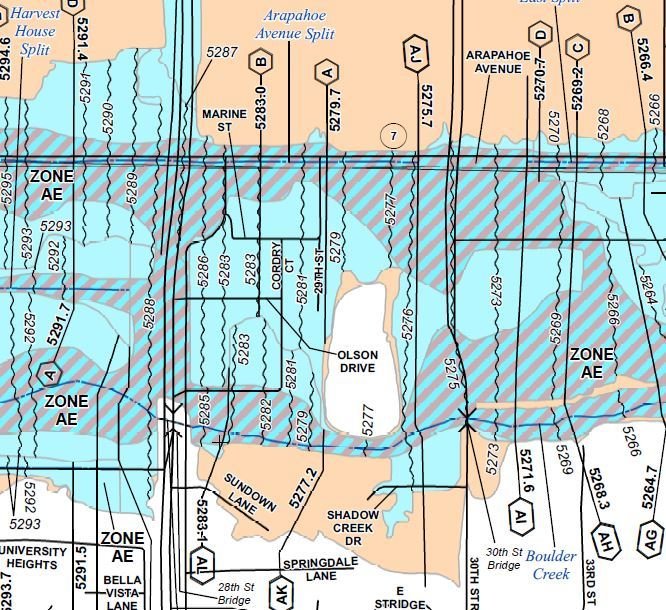
Flood Insurance Rate Map (FIRM)
- Floodplain Inundation Limits
- Flood Insurance Zones
- Base Flood Elevations
- Hydraulic Cross-sections
- Mapping Information
Floodplain Regulation
Basis of Regulation
- 1% annual chance flood
- 100-year event
- Floodway
- Theoretical boundary

“...means the channel of a river or other watercourse and the adjacent land areas that must be reserved in order to discharge the base flood without cumulatively increasing the water surface elevation more than one foot {or stricter local standard}.”
Floodplain Mapping Standards
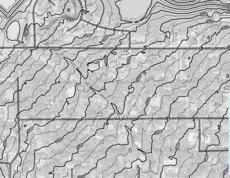
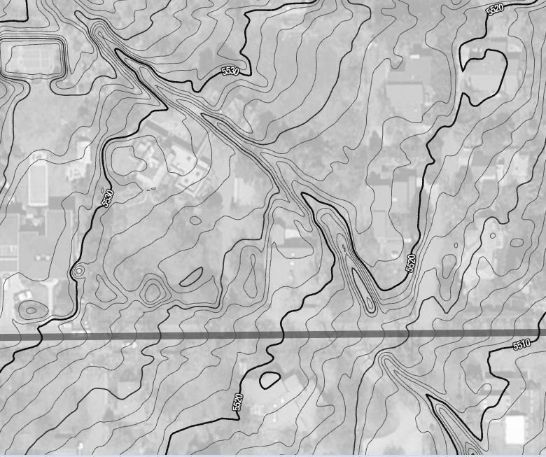
Topography
Aerial Mapping
LiDAR
Survey
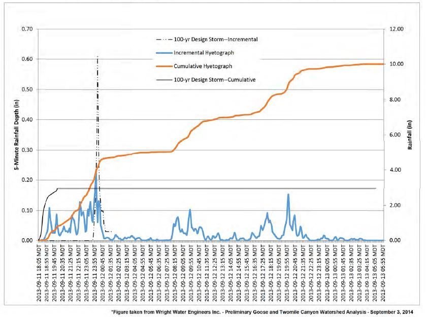
Hydrology
The quantity of water that must pass a given point
Hydraulics
The configuration and “roughness” of the channel and adjacent overbank area that must carry that water


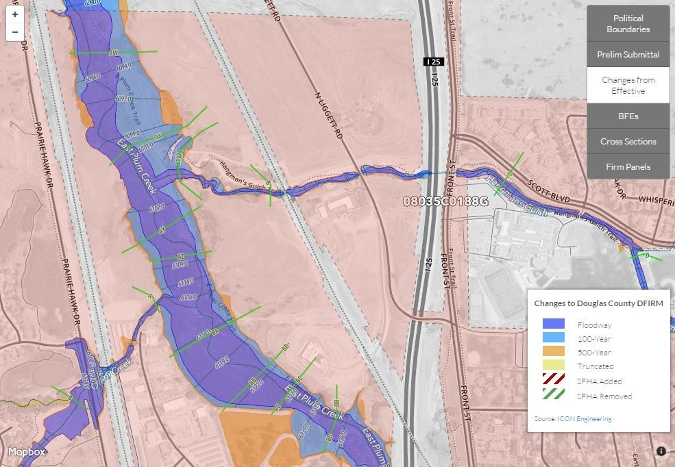
var nfhl = L.tileLayer.wms("https://hazards.fema.gov/gis/nfhl/services/public/NFHLWMS/MapServer/WMSServer", {
    layers: '4',
    format: 'image/png',
    transparent: true

}) .addTo(map);
Limitations
Topography
- Age
- Level of detail
- Fixed in time
- Erosion
- Deposition
Limitations
Hydrology
- Design Assumptions
- Rainfall Intensity
- Storm Duration
- Land Use Projections
- Soil Moisture
- Man-made features
- Dams
- Detention Ponds
Limitations
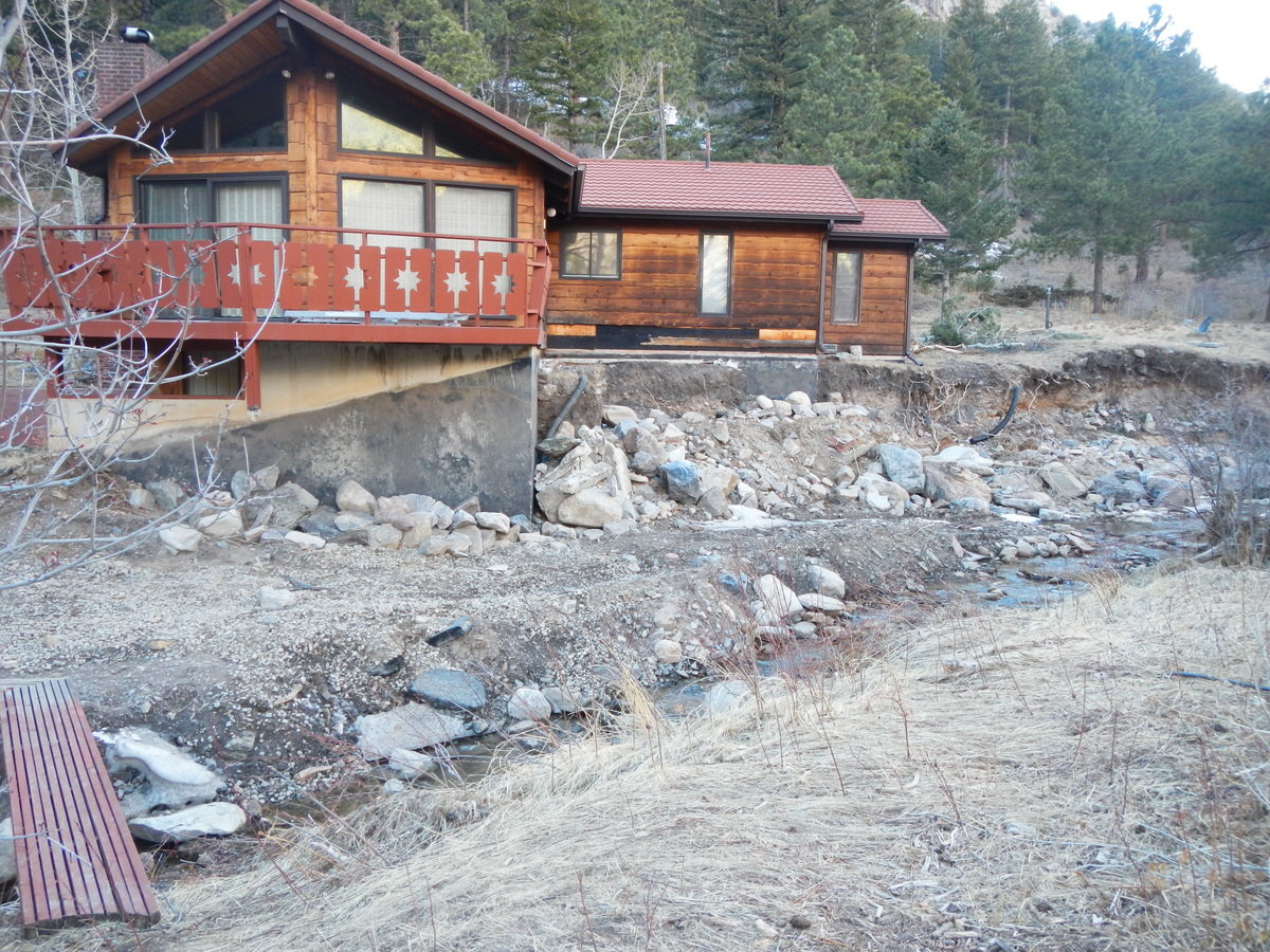
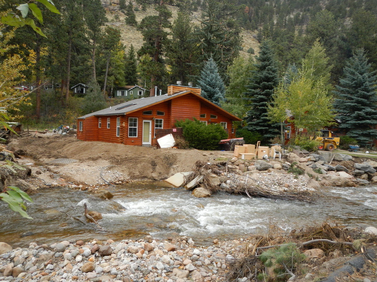
Hydraulics
- Vegetation
- Aggregation
- Degradation
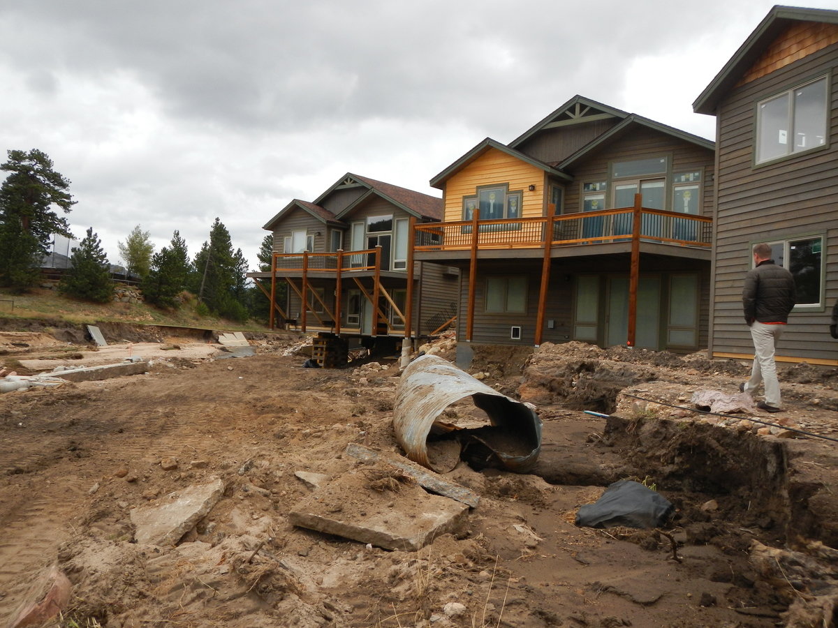
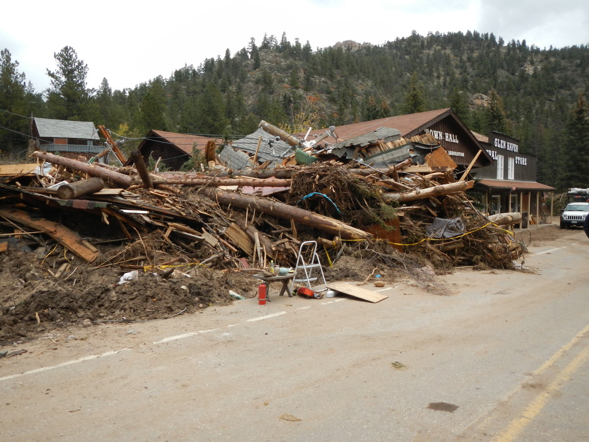
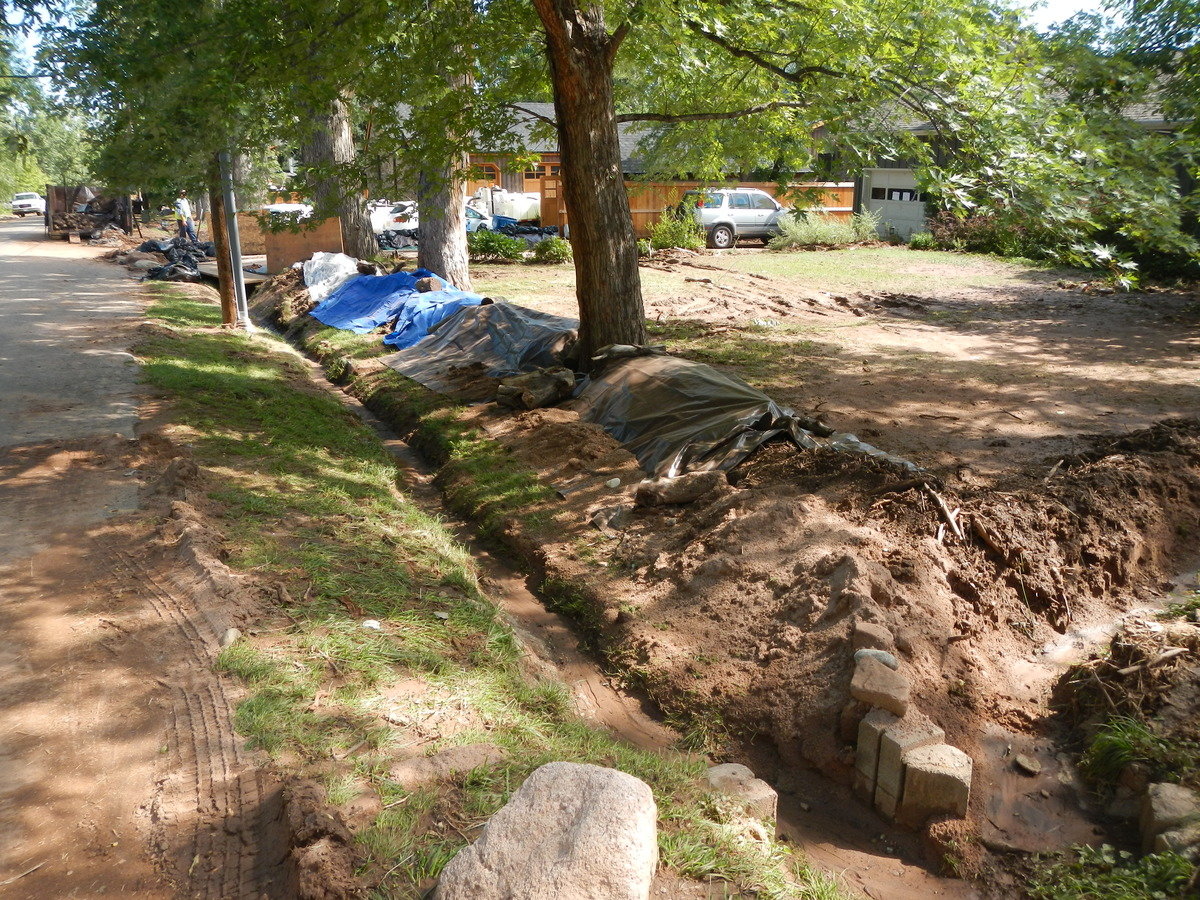
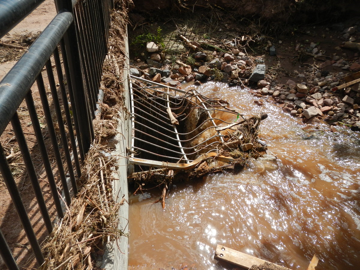
- Erosion
- Debris
- Man-made features
- Bridges/Culverts
- Flood debris
- Human response to flooding
Text
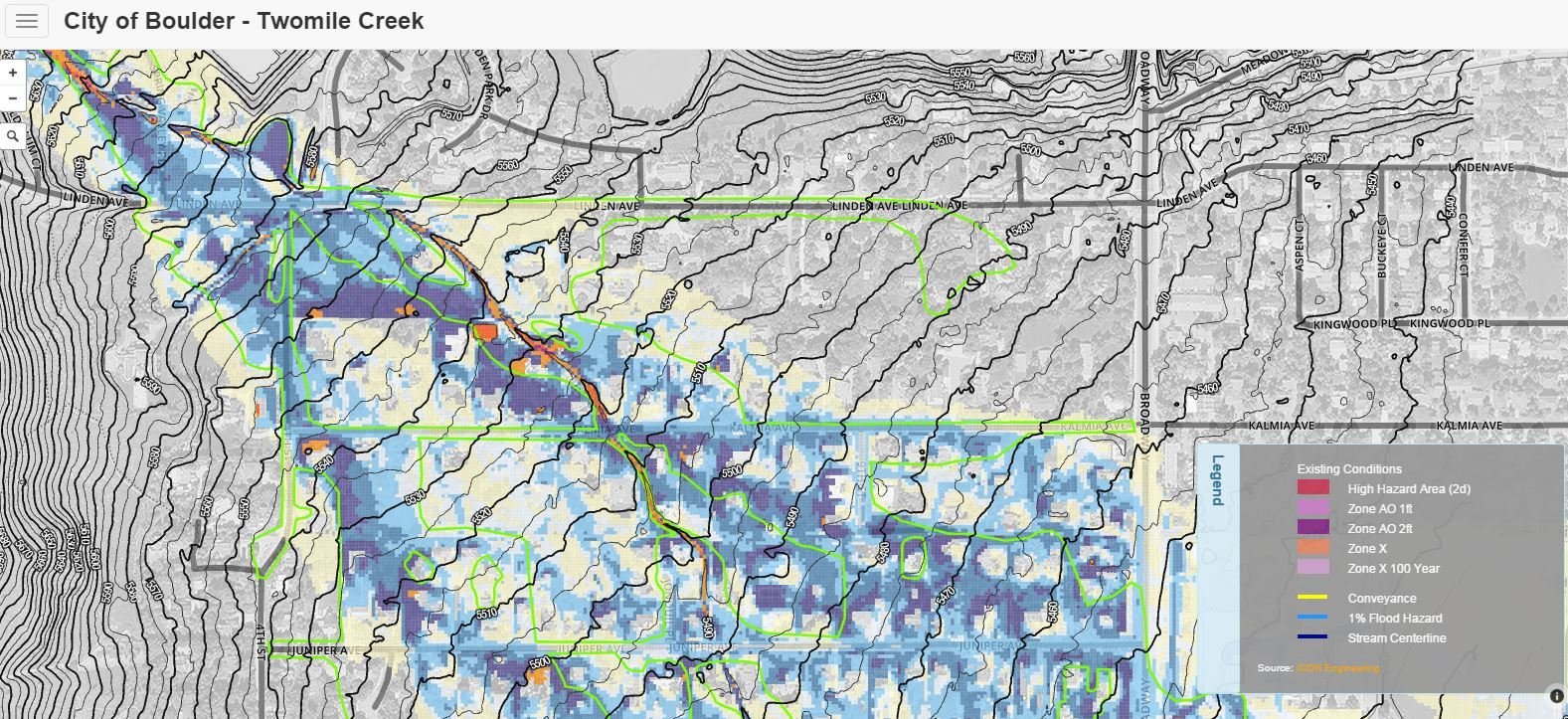
City of Boulder - Twomile Canyon Creek
Next Steps........?
Questions?

Risk Mapping CDJ Edits
By Eben Dennis


