Remotely Piloted Aircraft System (RPAS)
What are they Good for?
April 8 , 2021
Peter Keum - KC WTD GIS Specialist, GISP
Just another tool in the toolbox


WSU Mt Vernon NWREC


CUGOS


Puget Sound QGIS
Short Back Story

CUGOS April 2014

RPAS - Remotely Piloted Aircraft System
FAA Definition: Unmanned Aircraft (UA) system that is operated by a pilot via ground control or on-board computer.


1. Background Information
Categories

Small - $
- Size: 1 - 2 meters ( 3 ft - 6.5 ft), < 55 lbs.
- Control: Radio control
Medium
- Size: Equivalent to a car, ~ 1000 lbs.
- Control: Visual Line Of Sight (VLOS) & Beyond LOS, RC & Satellite ~ $$$
Large
- Size: > 30,000 lbs.
- Control: Visual Line Of Sight (VLOS) & Beyond LOS, RC & Satellite ~ $$$$


RPAS as Platform

Multi-rotors
Fixed-wing & VTOL

- Shorter flight time (< 30 min)
- Cover smaller area
- Highly maneuverable
- Less expensive
- Access to confined spaces
- Long flight time (+ 40min)
- Covers large area
- Larger selection of sensors

(vertical take-off & land)
Multi-rotors

Sensors Payload

Multi-spectral
Thermal Infrared

Lidar Camera

High resolution digital camera (100 MP)

Lidar Camera
Lidar Camera
Methane Gas Dector
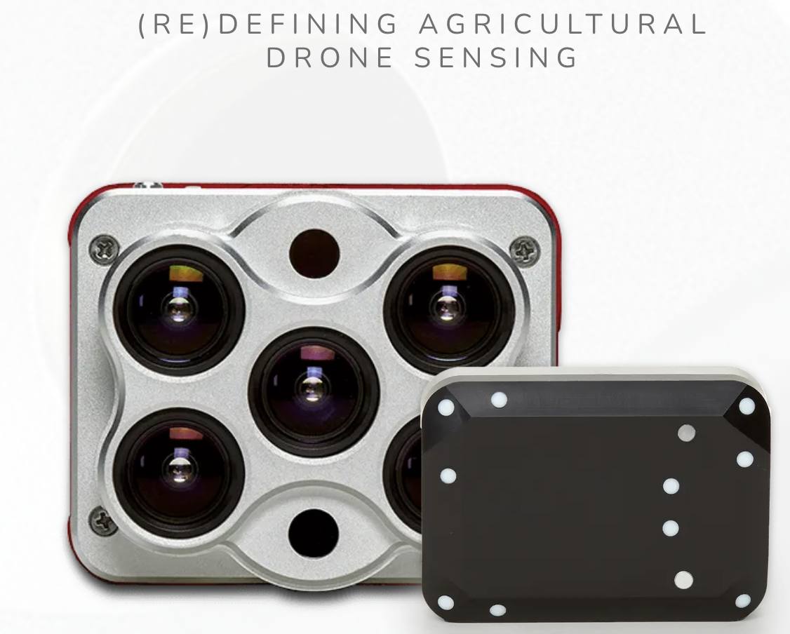
Sensors Payload
High resolution digital camera


1. Aircraft + Sensor (Data Collection)
2. Data Processing & Analyzing
(R, ML, Python, GIS)
3. Information Products
=
+


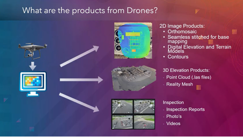
credit: Esri

Information Products


Example: Inspection
Improve Safety,
Save time, Improve efficiency


Two Spaces for Drone
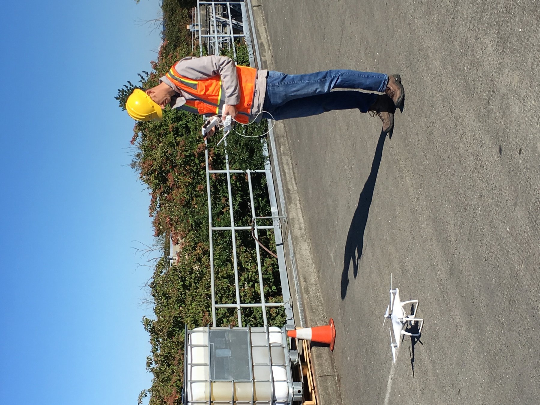


Outdoor
- GPS Signal
- Automated Planning and Flight
- Even, Diffuse lighting
- Open space
Indoor
- No GPS signal
- Limits on speed and motion
- Manual flight control
- Tight spaces
Outdoor
Indoor


DJI Air & Mavic 2 Pro < $1800
Aertos 120 $25,000 +
Eilos 2 $48,000 +
DJI Matrice 300 $12,000 +


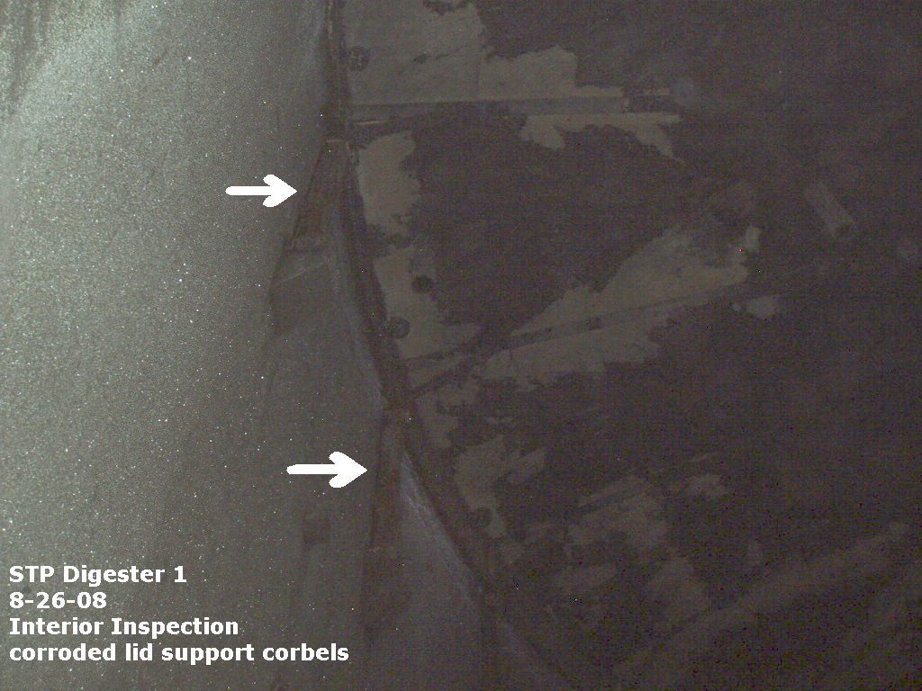
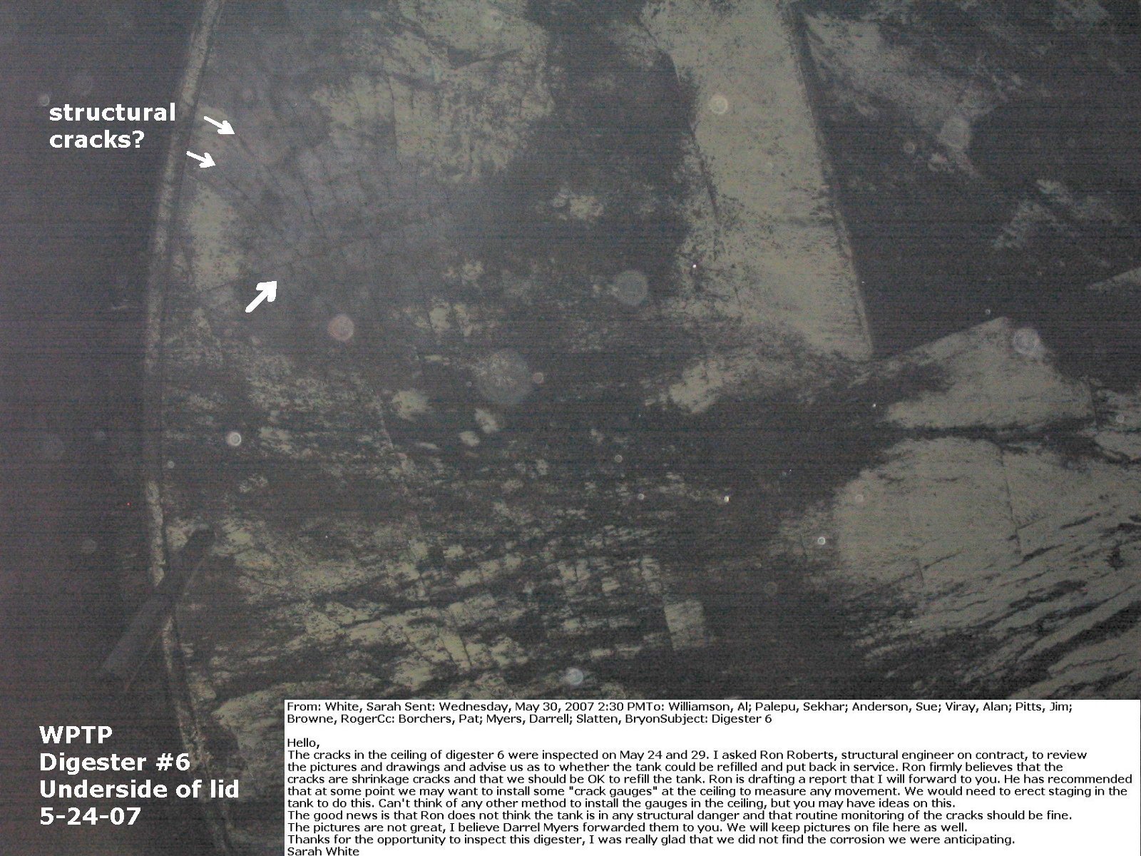
Hazardous Condition
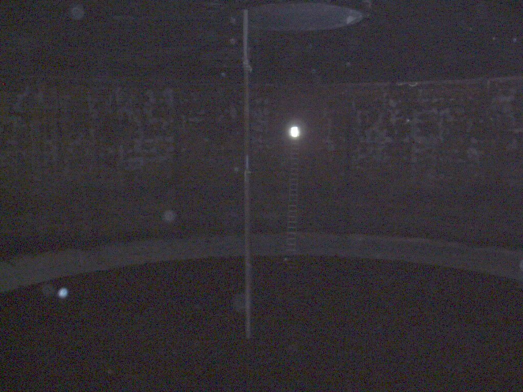


KC West Point TP - Digester
Precision Data Collection


Why Use Drones?
-
Increase Safety for Staff
-
Avoid hazardous condition
-
Precision Data Collection
-
Repeatable & Recordable & Searchable
Standard Workflow

FAA Regulations - Where are we now?

2. Regulations
Commercial/Governmental
FAA Part 107 Rule, July 2016
-
Need FAA Remote Pilot Certification (Pilot license NOT needed)
-
171,744 - Remote pilot certified (2020)
-
441,709 - Commerical Drones Registered
-
Fly under 400 feet above ground level
-
Not to fly < 5 nautical miles around airport
-
Aircraft < 55 lbs.
-
Fly during daytime
-
Fly visual line of sight ( VLOS)
-
No flight over non-participating people
-
Many, Many more
FAA Part 107 Rule
Future Success (personal view)

3. Post Graduate
GPT
General Purpose Technology


GPT

+
=

+
=
1. Aircraft + Sensor (Data Collection)
2. Data Processing & Analyzing (GIS)
3. Information Products
=
+
GPT?
GPT?
GPT?
Information Products


+
=
YOU
Four C's
Critical
Thinking
Communication
Creativity
Collaboration


(Drone/GIS/ [Your work].....), What are they Good for?
Just another tool in the toolbox


Now Let's go use them!
peter.keum@kingcounty.gov
WSU Mt Vernon Soil Science Presentation on April 8, 2021
By Peter Keum
WSU Mt Vernon Soil Science Presentation on April 8, 2021
Presentation for WSU Mt Vernon extension program for Dept of Crop & Soil Sciences Group. Introduction of Drone technology & career searching/steps


