Remotely Piloted Aircraft System (RPAS)
What are they Good for?
March 22 , 2022
Peter Keum - KC WTD GIS Specialist, GISP
Just another tool in the toolbox

FAA Part 107 Certified Remote Pilot
- Introduction to Drone - What is it? How we use it?
- WTD RPAS Pilot Program - Work Flow
- Use Cases - Examples

It's just a toy...

2016


It's just a toy...past examples of what used to be


Why Use Drones?
-
Increase Safety for Staff
-
Avoid hazardous condition
-
Precision Data Collection
-
Repeatable & Recordable & Searchable
- Enabling Temporal/Spatial trend analyses
-
Higher Efficiency of Data Collection improves product development & analytical capabilities

Airplane Orthophoto
Software processed Orthophoto from drone
Benefits
- High Temporal Resolution
- High Spatial Resolution
- Fly Same area many times

Benefits
-
Higher Spatial Resolution
- Monitor continuous changes
- Higher Spatial resolution than Satellite, Airplane

WTD Projects
-
Mitigation & Monitoring Group - 36 flights since 2017
-
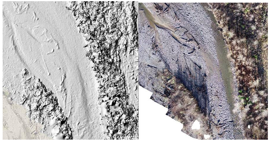
Denny Regulator Station Erosion Project - 3D Model


Few ways to Enhance Communication using Drone Data
-
Better Story Telling Tools for Private & Public Meetings
-
Communicate Traffic Flow Changes, Park Closures, or Construction Work
-
Improve Website and Social Media Contents
- Instagram or Tweets to generate interest of parks
-
Ensures Accuracy with Clear/Readable Images

UAV - Unmanned Aerial Vehicle
FAA Definition: Unmanned Aircraft (UA) system that is operated by a pilot via ground control or on-board computer.


UAV Categories

Small - $
- Size: 1 - 2 meters ( 3 ft - 6.5 ft), < 55 lbs.
- Control: Radio control
Medium
- Size: Equivalent to a car, ~ 1000 lbs.
- Control: Visual Line Of Sight (VLOS) & Beyond LOS, RC & Satellite ~ $$$
Large
- Size: > 30,000 lbs.
- Control: Visual Line Of Sight (VLOS) & Beyond LOS, RC & Satellite ~ $$$$


1. Aircraft + Sensor (Data Collection)
2. Data Processing & Analyzing (GIS)
3. Information Products
=
+


UAV as Platform

Multi-rotors
Fixed-wing & VTOL

- Shorter flight time (< 30 min)
- Cover smaller area
- Highly maneuverable
- Less expensive
- Access to confined spaces
- Long flight time (+ 40min)
- Covers large area
- Larger selection of sensors

(vertical take-off & land)
Multi-rotors
- Shorter flight time (< 30 min)
- Cover smaller area
- Highly maneuverable
- Less expensive
- Access to confined spaces


~ $1,200 -- $14,000
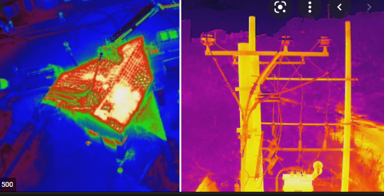
Sensors Payload

Multi-spectral ~ $10 K
Thermal Infrared ~$8K


High resolution digital camera (100 MP) ~$40K

Lidar Camera
~ $15K
Methane Gas Detector ~$67K


New M30T
3/21/22
- 48MP zoom
- 12MP wide
- Laser Rangefinder
- Thermal camera
- IP55 water resistance
- 41 min flight
- ~ $14K
Standard Drone Workflow


1. Platform + Sensor (Data Collection)
2. Data Processing & Analyzing (GIS)
3. Information Products


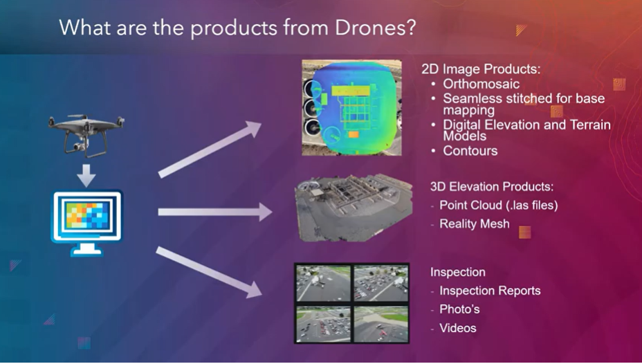
credit: Esri
Two Spaces for Drone


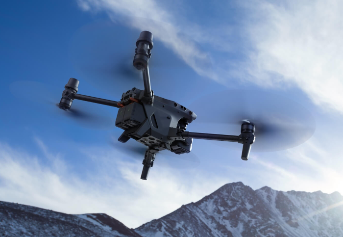
Outdoor
- GPS Signal
- Automated Planning and Flight
- Even, Diffuse lighting
- Open space
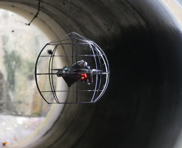
Indoor
- No GPS signal
- Limits on speed and motion
- Manual flight control
- Tight spaces
Outdoor
Indoor


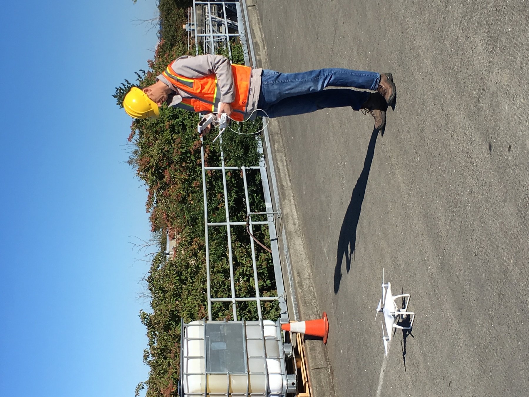
DJI Mavic 2 Pro < $1,800
Aertos 120 ~ $25K
Eilos 2 ~$48K
DJI Matrice 300 ~ $12K


DJI Mavic 2 Pro Ent. Adv ~ $6,500

DJI FPV w/ Modification ~ $6,500
Outdoor
Indoor
DJI Mavic 2 Pro Ent. Adv ~ ~ $7,500
DJI FPV w/ Modification ~ $6,500
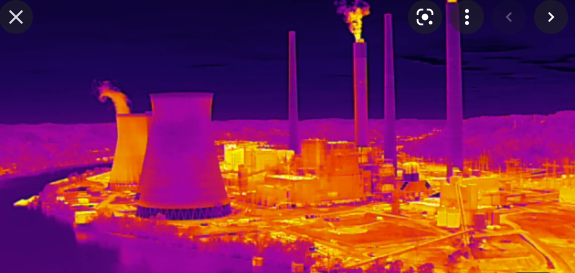
Dual Imaging
- Thermal Camera
- Zoom 32X Visual Camera
Dual Imaging
- Thermal Camera
- Zoom 32X Visual Camera
Indoor
DJI FPV w/ Modification ~ $6,500
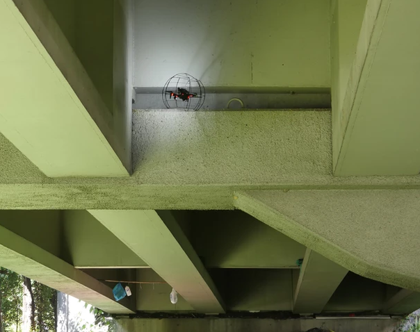
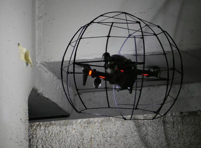
Indoor - Lumicopter
Sensors Payload
High resolution digital camera


Drone

GIS
Great Combo?
&
Great combo !
GIS & DRONE


FAA Regulations - Where are we now?

Regulations
Commercial/Governmental
FAA Part 107 Rule, July 2016
-
Need FAA Remote Pilot Certification (Pilot license NOT needed)
-
171,744 - Remote pilot certified (2020)
-
441,709 - Commerical Drones Registered
-
Fly under 400 feet above ground level
-
Not to fly < 5 nautical miles around airport
-
Aircraft < 55 lbs.
-
Fly during daytime or night time operation with appropriate lighting
-
Fly visual line of sight ( VLOS)
-
No flight over non-participating people
FAA Part 107 Rule
King County WTD
August, 2016 - WTD Policies on Use of Small Unmanned Aircraft Systems (Drones) - Email to Managers/Supervisors:
Approved of using 3rd party drone operator
April, 2019 - "A drone can be used at any WTD facility; however, staff wanting to use a drone must work with Peter Keum to ensure that the proposed use meets the FAA and local regulations because the regulations vary geographically.... permissible to operate drones indoor or in confined spaces for specialized uses, like inspections."
Update WTD Drone Use Procedure
King County WTD
June, 2021 - Approved to Started RPAS Pilot Program
- 3 FAA Part 107 Drone Certified Pilots - WTD GIS Specialists
- One DJI Mavic 2 Pro
- Since June 2021, flown ten plus missions to support Capital and Asset Management Program and Mitigation & Monitoring Program


King County WTD
June, 2021 - Approved to Started RPAS Pilot Program
- 3 FAA Part 107 Drone Certified Pilots - WTD GIS Specialists
August, 2016 - Approved of using 3rd party drone operator
(WTD Managment & Office of Risk of Managment/PA Office)
April, 2019 - "... permissible to operate drones indoor or in confined spaces for specialized uses, like inspections."
(WTD allow to purchase and operate - DNRP Director, ORM)
WTD PM Workflow for using 3rd Party Vendor


Memo Template
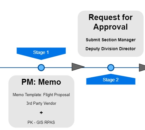
Simple Payment Template


GIS Products


WTD Projects
-
West Point TP & Brightwater TP
July & August 2021 - Panoramic View


WTD Workflow for In-house
X
X
X
Text
Short Email
WTD Project Examples
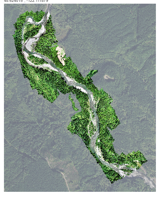
- Kenmore Mitigation Monitoring Site
- North Creek Interceptor Monitoring Site
- West Point Treatment Plant - Digesters - Roof Inspection, Video of the plant for Exec. Office
- South Treatment Plant - Channeling Inspection
- Brightwater Treatment Plant - Digesters - 3D Model, Roof Inspection
Other Project Examples
- Pierce Co
- Channel Migration
- Pano View
- Lummi Nation
- Restoration Project Planning/Monitoring
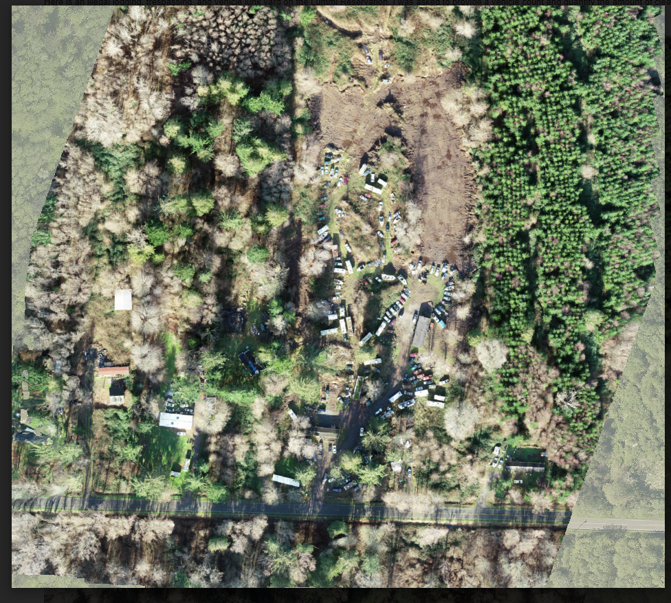
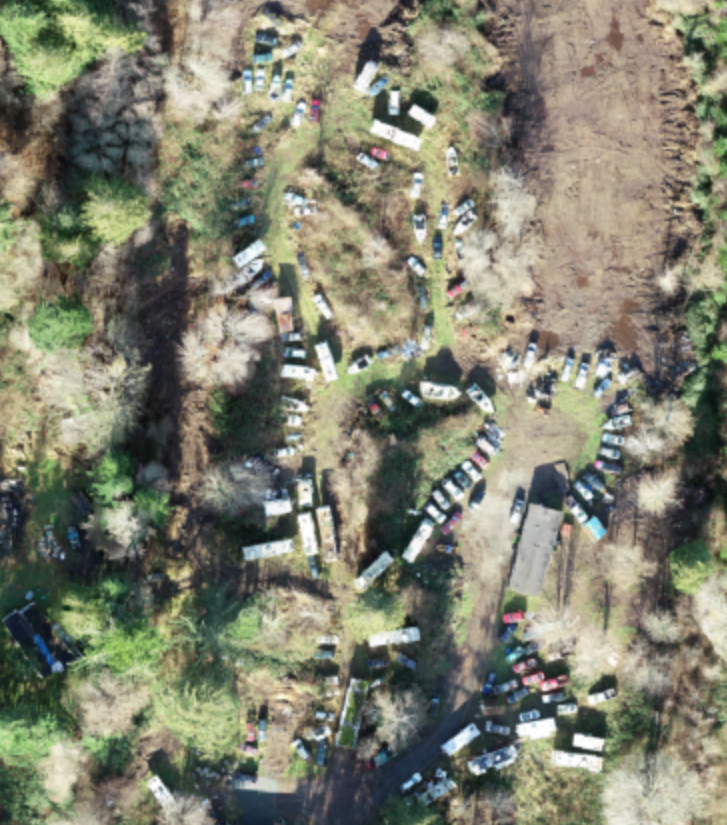
- Illegal trespassing/logging/ Vehical Junk yard
Lummi Nation Examples
Pre-planning for engineered log jams for upper Nooksack River
Restoration Monitoring for the Middle Fork of the Nooksack River
Lummi Nation Examples
Benefits
Give decision makers appropriate analytic information products
- Better Data -> More Knowledge -> Better Decision Making


Benefits

So Where is it going...
-
Increase in Enterprise use of Drone
-
Using it because it does job better
-
-
Successful technology is not thrill but becomes essential and accepted
Where are we now?

Where are we heading?
Drones, What are they Good for?
peter.keum@kingcounty.gov
Just another tool in the toolbox

Let's Go Find Solution
Questions?

Drone Presentation for WLRD Group - 03/22/22
By Peter Keum
Drone Presentation for WLRD Group - 03/22/22
Modified RPAS program presentation: Presenting to WLRD group with focus on various use cases examples from Pierce & Lummi Nation.


