
Working together
for a safer world
SUT North of England Branch
21.09.2016
A case study of enhanced trenching operational oversight through the delivery of an innovative real-time, project management solution


Sam Franklin
Lloyd's Register
About
- Geospatial Lead @ Lloyd's Register
-
Survey & Geo group focuses on Offshore Geo-Surveys, Geo-Engineering, and Installation Support, geospatial
consultancy, data/software services
- Geospatial = maps + location data, now evolving to deal with telemetry
Acknowledgement
Many thanks to Deep Ocean for the opportunity to present this case study and their continued support in developing innovative solutions for the marine cables sector
What am i going
to talk about?
- The Challenge
- Background
- Case Study - Pilot
- Case Study - for real!
- Future
- Takeaways
The "Challenge"
- Deliver trenching/nav data from the vessel to a remote web server (over the air)
- Make trenching data easily accessible to the office team with Iris
- Be able to map the asset position on the seabed in real-time together with surface vessels
Why Monitor?
- Improved visibility = PM oversight. All project data is in one place, available anywhere, anytime.
- Why Slower Progress? Is it "soils" or the "machine". Telemetry will give the answer.
- If there is a problem, looking at the same data mitigates miscommunication between offshore and onshore teams.
- Actual performance data >> improves schedule forecasting.
- Wise to have an independent/redundancy store of data in the event of a incident.
- Finally...

... and those "Unknown Unkowns"
Why Now? A Collision of technologies

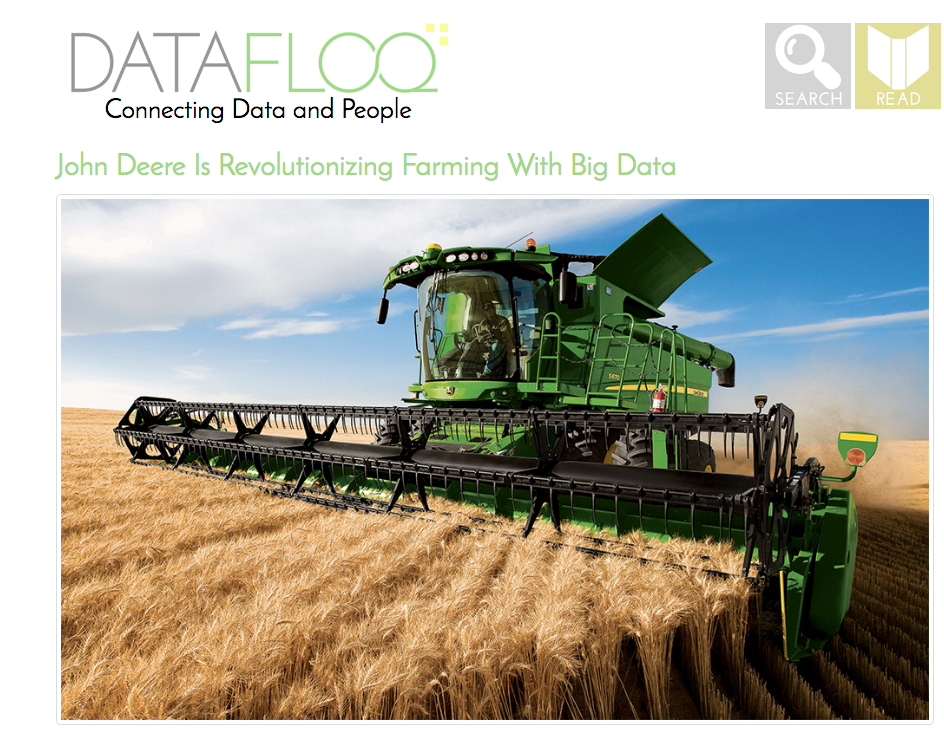
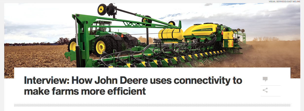
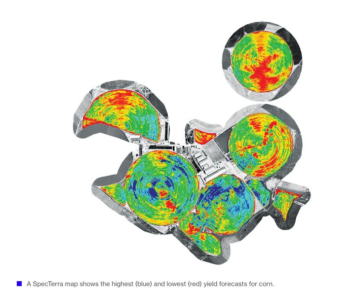
Farming Sector

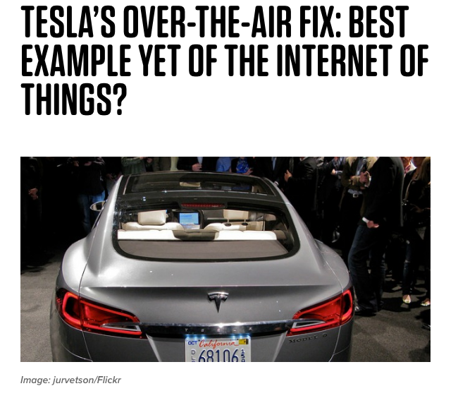
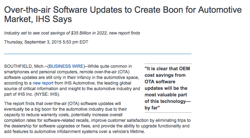
Automotive Sector
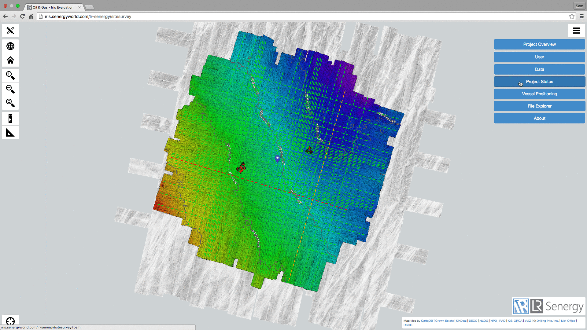
Iris :: Overview
Spatial Data Document Access Vessel/Asset Tracking Metocean Data
Route Profiling Sensor Telemtery Performance Dashboards Inspection Video
Reference Basemap
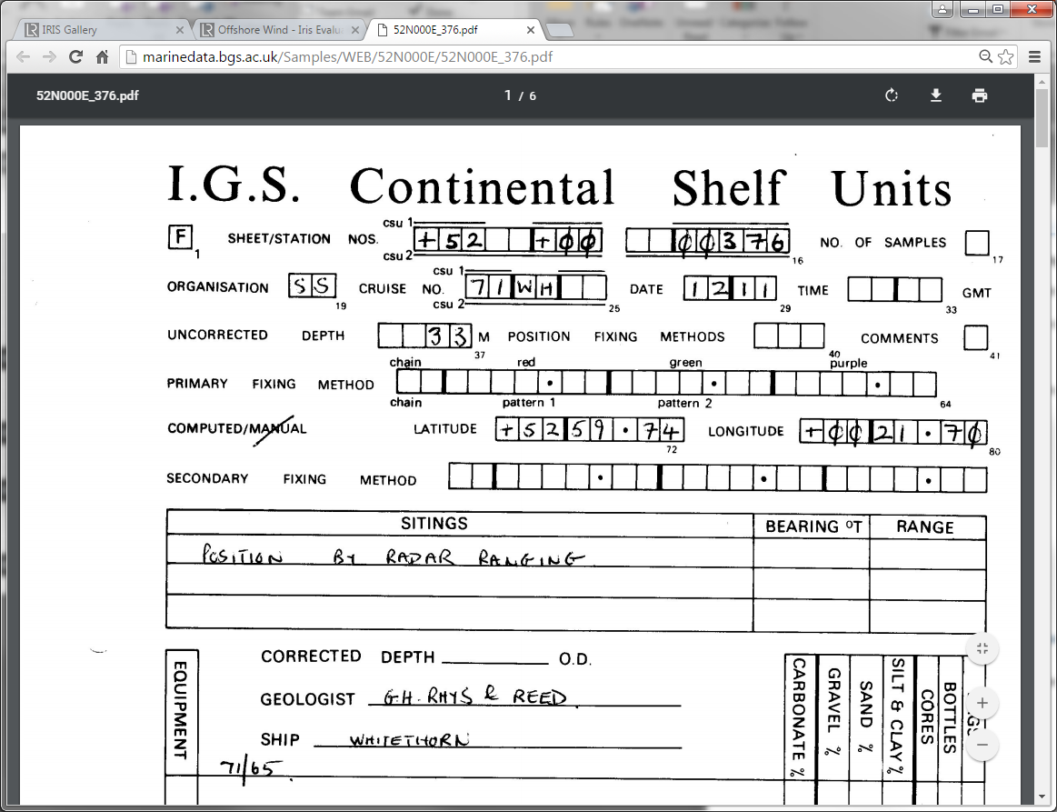
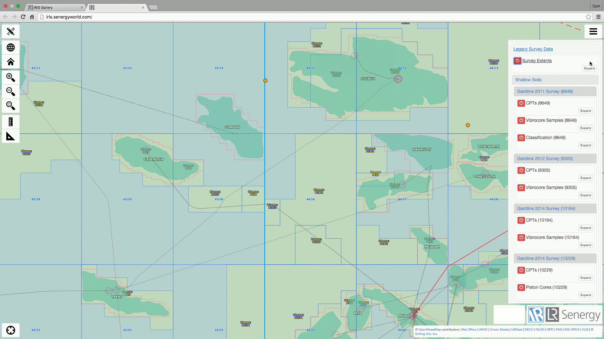
Survey Data
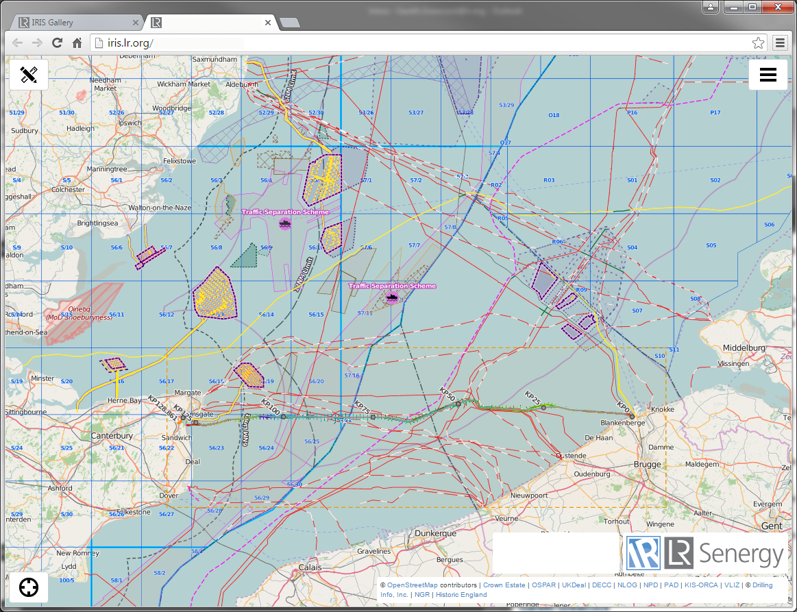
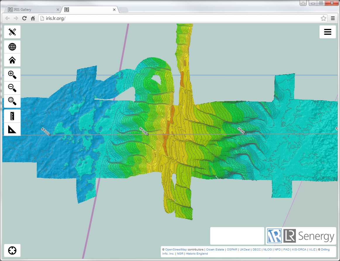
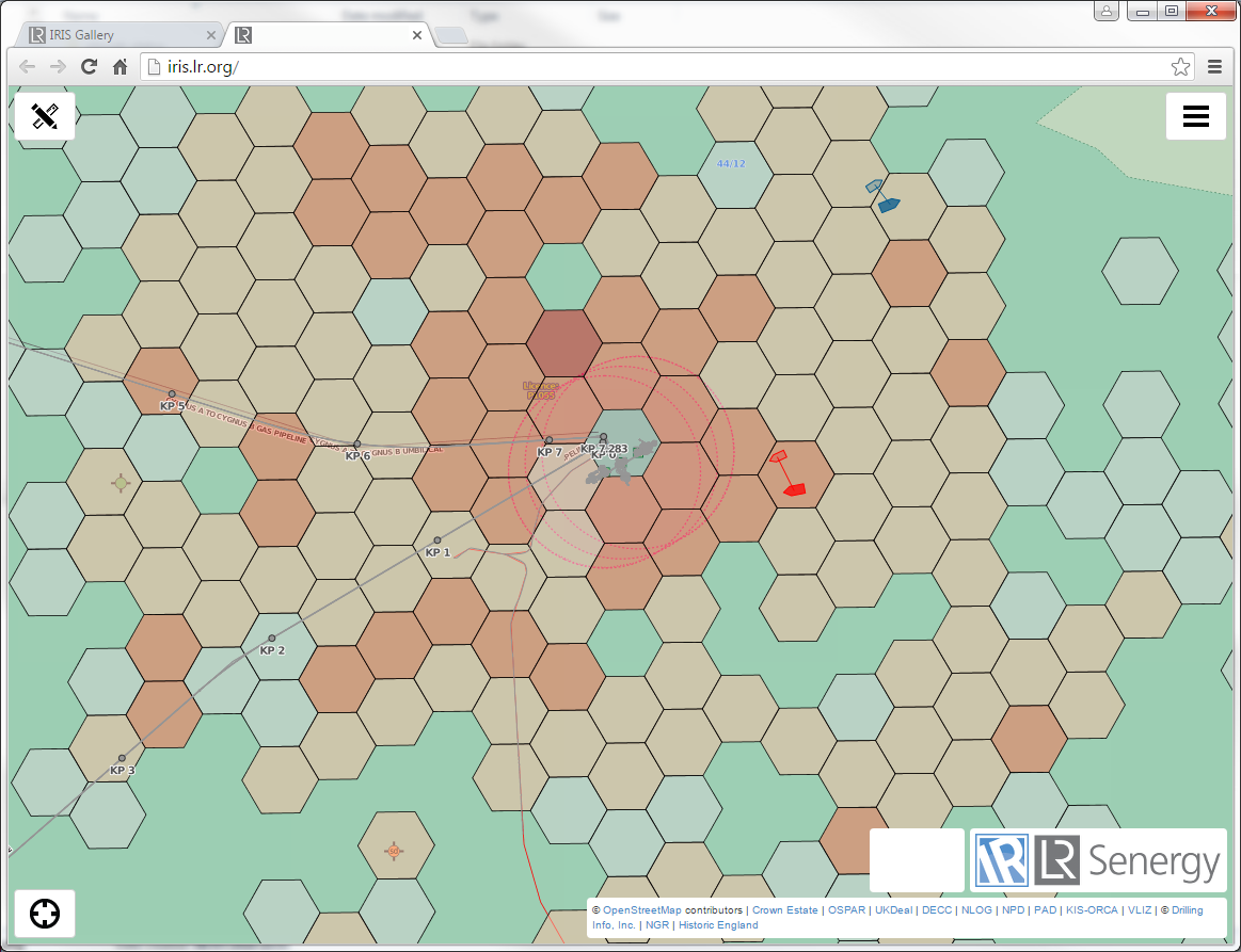
Iris :: Spatial Data Visualisation
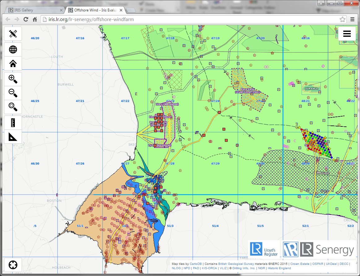
Soils Data
Iris :: Quick Data Access
animated slide
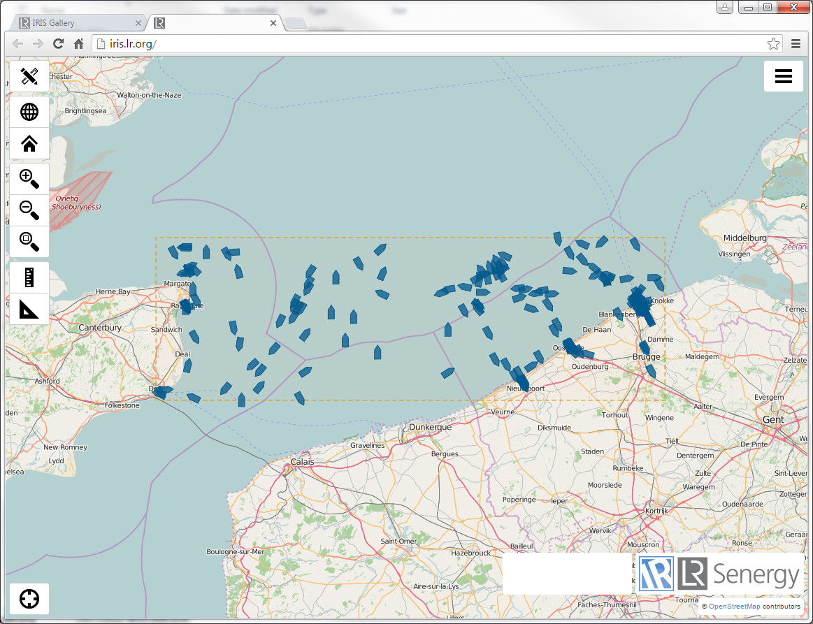
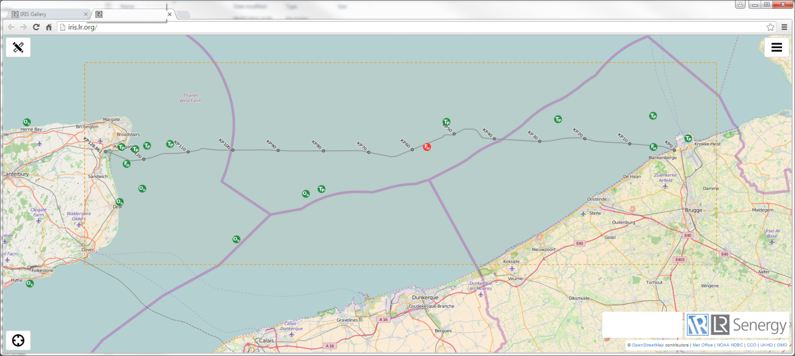
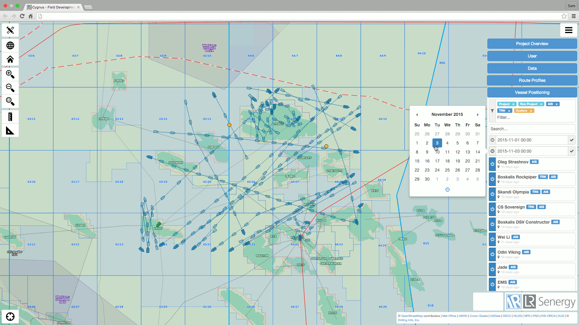
Iris :: Real-time Vessel Tracking
- Track specific project vessels
- Use navigation output, AIS, GPS hardware
- Area vessel tracking - record of all vessels in the project area.
- Vessel density analysis for guard vessel positioning
- Project Forecast Locations - improved planning
- Predicted tidal height and tidal currents at key locations
- Real-time metocean - to cross reference forecasts
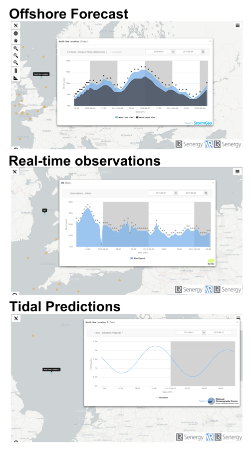
Iris :: Access Metocean Data
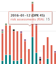
Iris :: Project Status Dashboard
- The Iris Project Status dashboard provides a configurable dashboard to suit a variety of offshore operational projects.
- The Activity dashboard provides a day-by-day breakdown of activities through the duration of the project
- Provides close visibility to project status and HSE statistics.
animated slide
Pilot Objectives
Project
- UK power Interconnector cable installation
- Towed seabed cable plough
Objectives
-
Create a workflow to stream data @ 10 second frequency using no 3rd party hardware
-
Design a Trenching Status Module to visualise trenching/navigation related data in Iris
-
Include asset nagivation/positioning data on web map
Pilot Data Flow
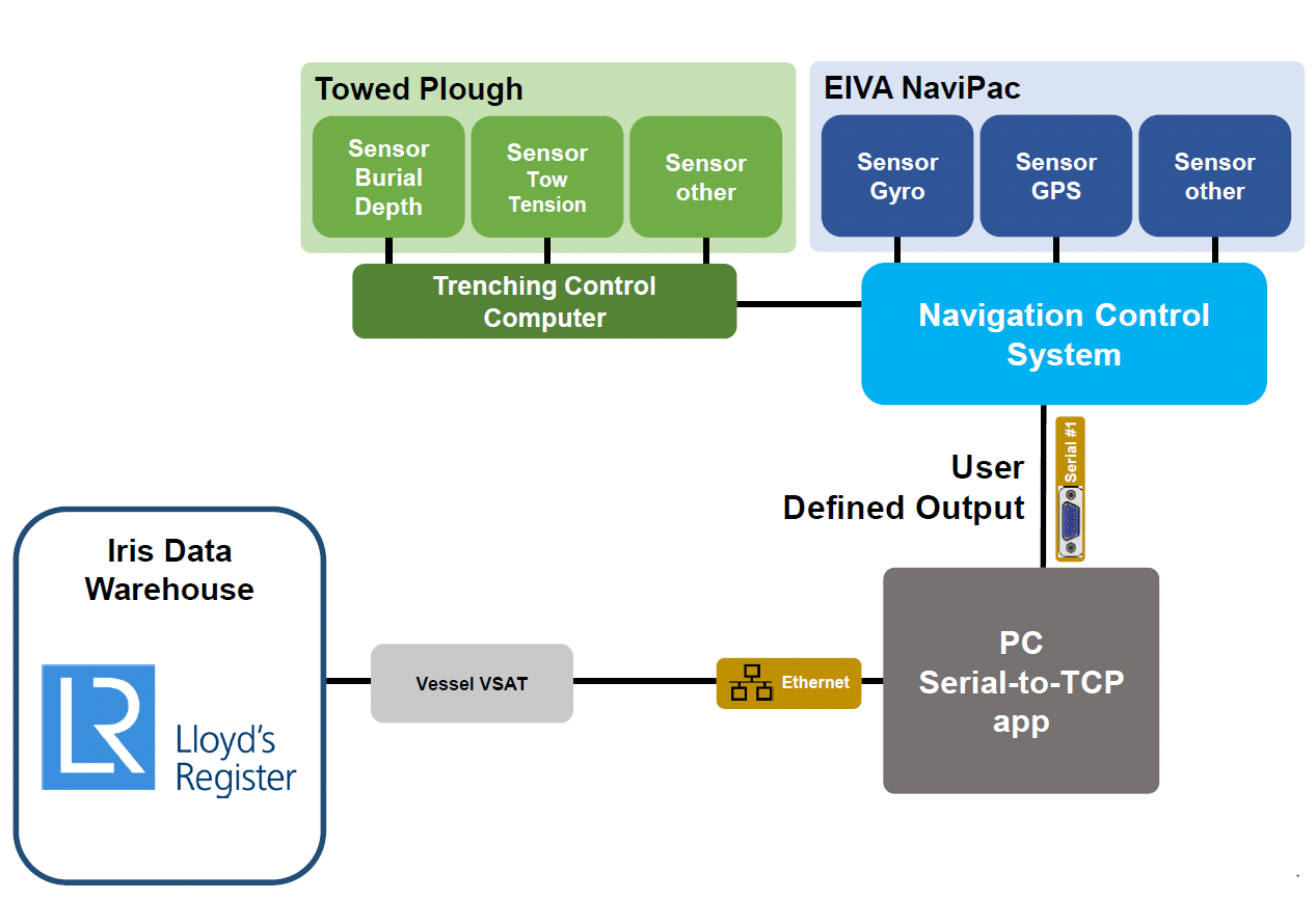
Pilot Data Stream

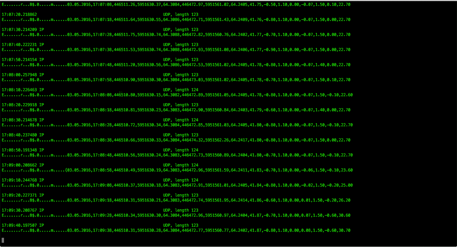
<DATE>,<TIME>,<VESSEL-CRP-EASTING>,<VESSEL-CRP-NORTHING>,<VESSEL-RKP>,<PLOUGH-EASTING>,<PLOUGH-NORTHING>,<PLOUGH-RKP>,<PLOUGH-WATER-DEPTH>,<PLOUGH-TOW-FORCE>,<CABLE-LENGTH>,<PLOUGH-SPEED-15MIN-AVERAGE>,<BURIAL-DEPTH>,<PITCH>,<ROLL>,<DEPTH-SKID-HEIGHT>,<CR><LF>
- ~123 byte telegram @ 10 second burst via UDP
- 1,716,974 row db table stored in PostgreSQL
- 199 "work days" trenching (excluding data outages, standby)
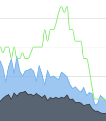
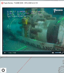
- Real-time telemetry visualised from sensors in the field
- Example shows the "trenching dashboard" during a subsea cable installation
- Telemetry NMEA-style streams multiple parameters at 10 seconds frequency
- Data is continously stored for the duration of the project
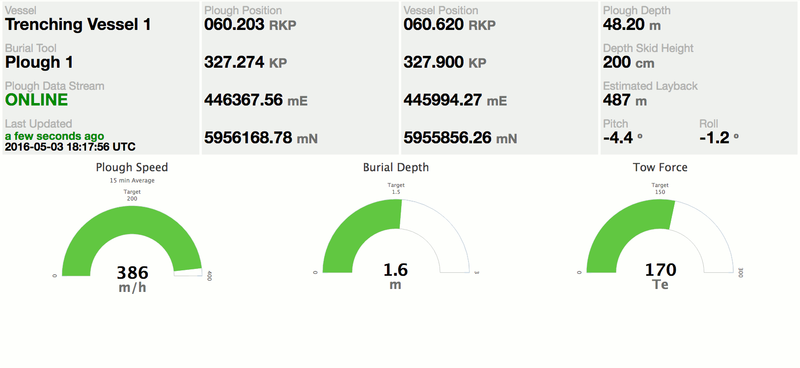
Operational Support | Real-time Telemetry
animated slide
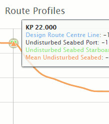
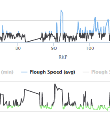
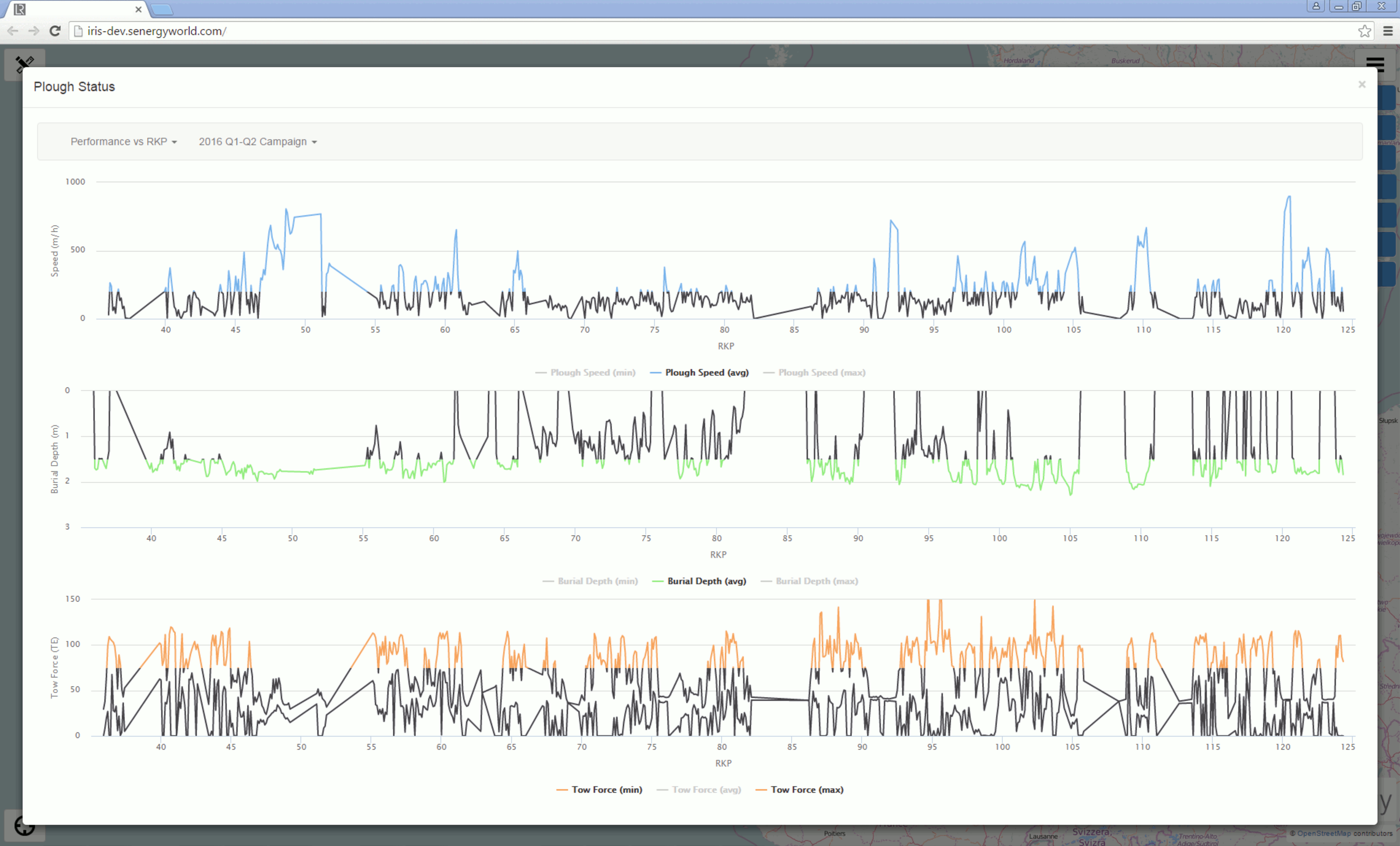
- Review real-time and legacy trenching data over the web
- Quick access to data and data tolerances
- Review trenching data over time or against KP
animated slide
-
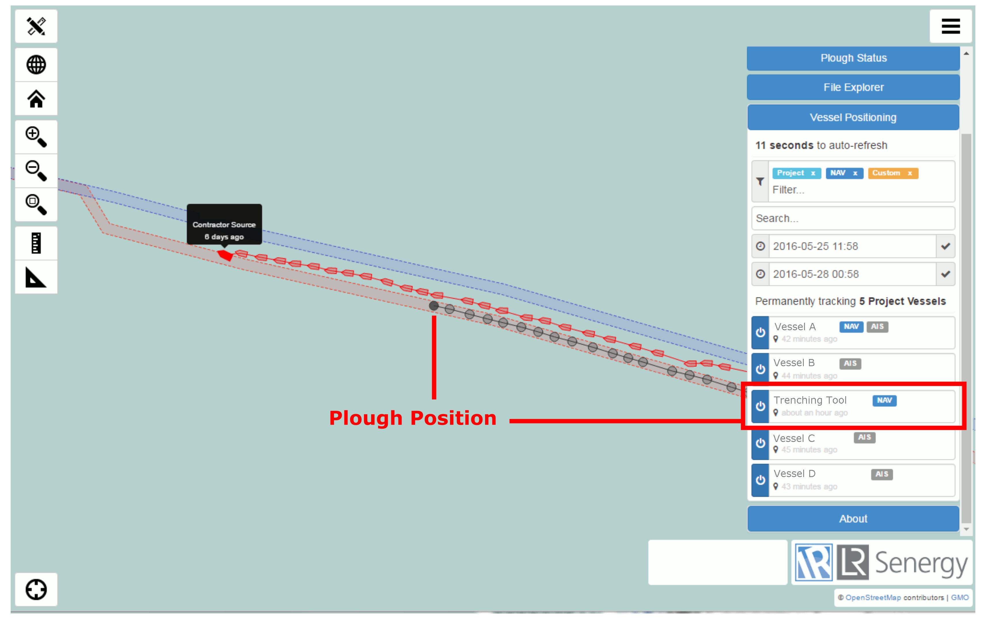
Real-time trenching tool location visualised on the map
-
Trenching tool positions stored for historical analysis
-
Horizontal Tolerance can be reviewed on the fly
Operational Support | Real-time Trencher Positioning
animated slide
Review of Pilot
- Proved the concept of remote data streaming
- Developed the Trenching Status Module User Interface (in two phases) on a real project and got feedback
- Developed subsea asset tracking as well as vessel tracking
- TCP client dropouts + manual restarts
- No remote logging/access to onboard system.
- No telegram validation at source
- Iris - lack of UI to export data
- Iris - desampling of data to render on a graph
- Missed opportunity to track AIS traffic
What Worked
Issues
Things to Fix 80:20 Rule
Problem Dropouts/manual restart + no remote access were the biggests issues.
Solution Deploy our hardware offshore.
Advantages:
- Replace vessel PC+Freeware with lightweight plug+play unit
- VSAT + IRIDIUM redundancy
- Configure output rate remotely
- Scalability. Connect to other marine systems (metocean)
V-NODE Solution
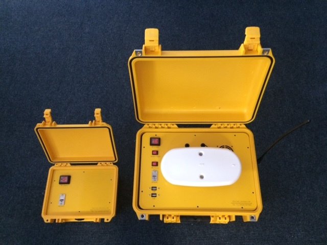
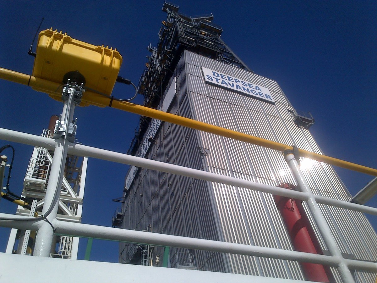
Track record of delivery of Position, heading and AIS streaming on Rig Moves, fixed platforms and survey vessels
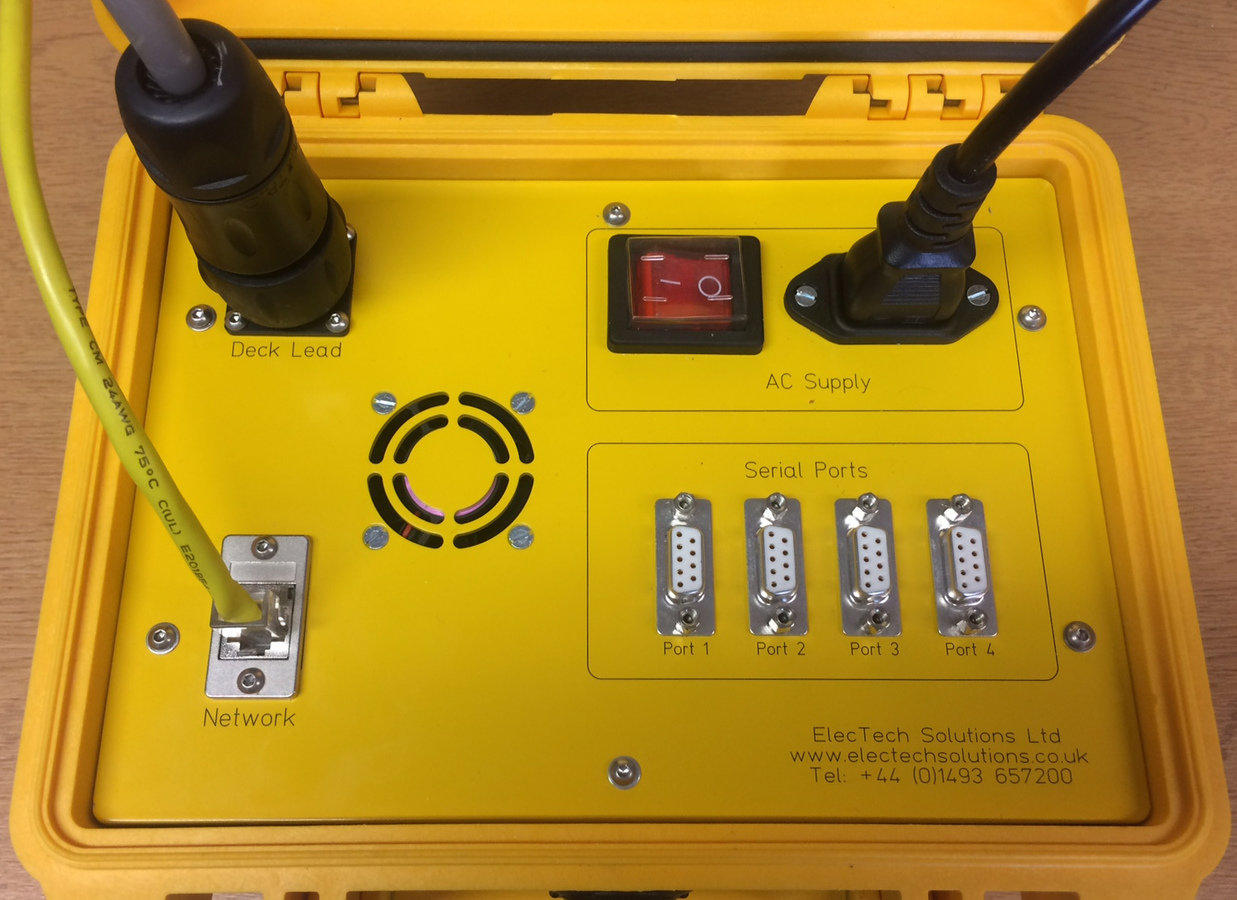
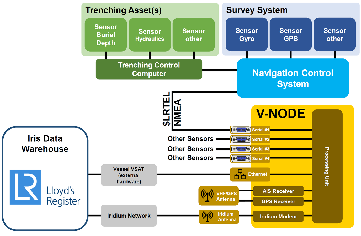
Upgraded V-NODE provided the serial (RS-232) I/O for onboard communications
Revised Data Flow
Improvements
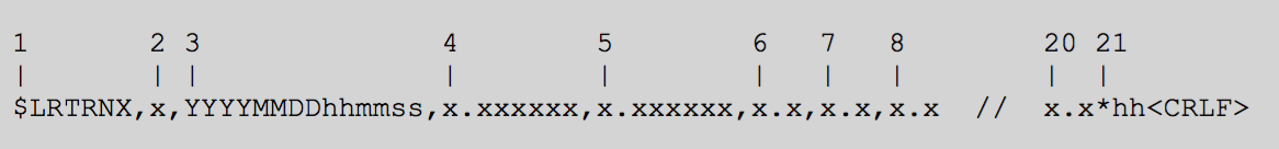
- Telegram specification for QINSy and NaivPac

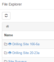
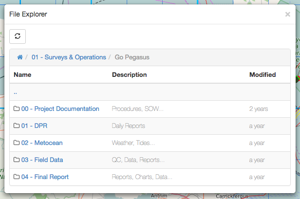
- Auto-export feature - will add a zip to the File Explorer
Future
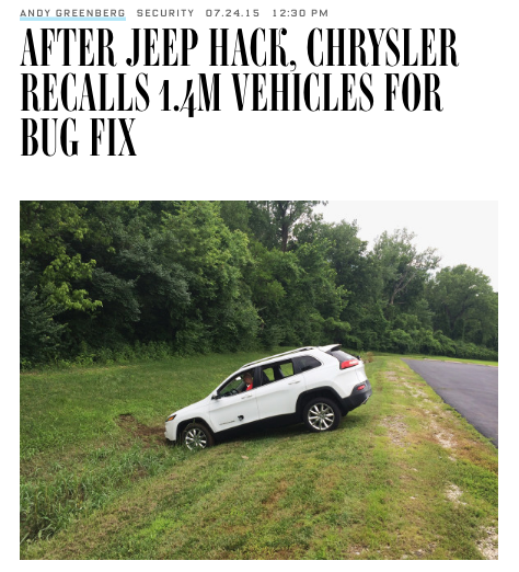
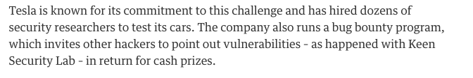
- Data security a big deal. The automotive industry is finding that security researchers are penetrating systems, eg
- Rolls Royce asset telemetry and the data firehose. Will the cables installer industry be ready?
- In other sectors, the OEMs are moving into managed services (Rolls Royce, Siemens, Auto-makers) - will this be the direction for subsea cables?
Takeaways
- Build systems iteratively through pilots to build confidence with project teams
- Open Source and IoT "low-cost" hardware components are no longer for hobbyists. Lowers the "cost of entry" but likely will need professional service support
- Make the raw data accessible to allow engineers and geoscientists to creatively answer question.
Working together
for a safer world
Sam Franklin
GIS Manager
Lloyd's Register Survey & GeoEngineering
+44 (0)1225 485800
Sam.Franklin@lr.org
@samRFranklin
Lloyd’s Register and variants of it are trading names of Lloyd’s Register Group Limited, its subsidiaries and affiliates.
Copyright © Lloyd’s Register. 2016. A member of the Lloyd’s Register group.
A case study of enhanced trenching operational oversight through the delivery of an innovative real-time, project management solution [SUT North of England, Oct 2016 Talk]
By Lloyd's Register
A case study of enhanced trenching operational oversight through the delivery of an innovative real-time, project management solution [SUT North of England, Oct 2016 Talk]
Presentation to SUT North of England Branch Meeting 21.09.2016


