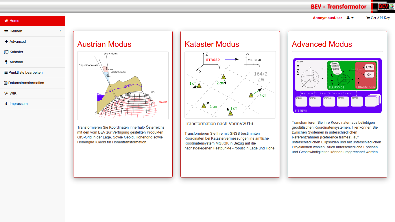
transformator.bev.gv.at
Philipp Mitterschiffthaler
Franz Blauensteiner
Martin Sehnal
Jürgen Fredriksson


CRD
VEL
?


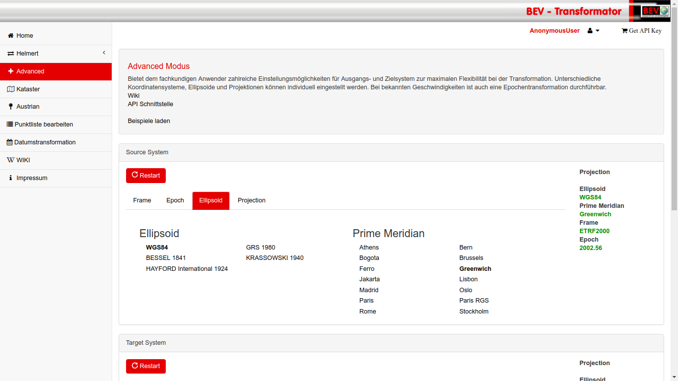
Definition of Coordinates
14 Parameter Transformation

Definition of Coordinates
\lambda = atan(Y/X)
\phi=atan(\frac{Z+e'^2 b sin^3(\theta)}{p-e^2 a cos^3(\theta)})
h = \frac{p}{\cos{\phi}}-N

Definition of Coordinates
y = N \Delta L cos(B) + \frac{N}{6} \Delta L^3 cos^3(B)(1-t^2+\eta^2)+...
x = S_m \frac{N}{2} \Delta L^2 sin(B) cos(B) + \frac{N}{24} \Delta L^4 sin(B) cos^3(B)(5-t^2+9\eta^2+4\eta^4)+...
{
"features": {
"type": "FeatureCollection",
"name": "MyCoordinates_1",
"features": [
{},
{},
{},
],
"crs": {
"type": "BEV",
"name": "MyCRS",
"properties": {
"frame": 301,
"ellipsoid": "EPSG::7004",
"prime_meridian": "EPSG::8901",
"projection": "",
"height_system": "",
"epoch": 2002.56,
}
}
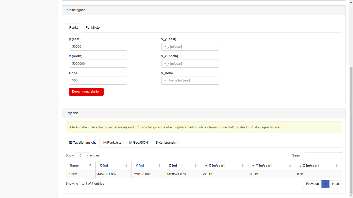
}Definition of Coordinates - GeoJSON in BEV Transformator
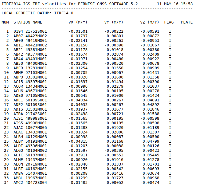
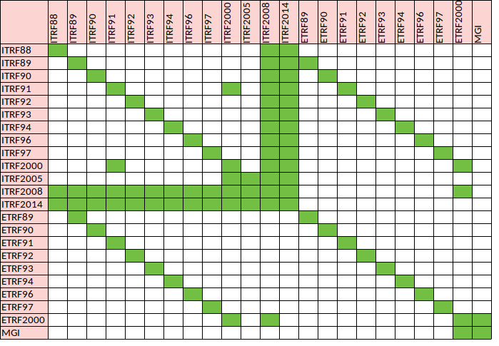
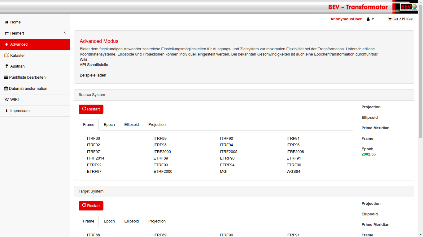
Transformation Parameters between Frames
Example Coordinate Transformation - GRAZ00AUT

Example Coordinate Transformation - GRAZ00AUT


MGI

Josefstadt
(Maßstab)
Hundsheimer Berg (Orientierung)
Hermannskogel (Lagerung)

MGI
| Order | Distance [km] | # |
|---|---|---|
| 1 | 35 | 138 |
| 2 | 18 | 427 |
| 3 | 11 | ~ 1.550 |
| 4 | 4 | ~ 8.600 |
| 5 | 1 | ~ 46.100 |
| 6 | 0,3 | ~ 167.000 |
147T / 224T (~65%) Points with ETRS coordinates


terrestrical measurements 1910-1997

Points
Directions
Distances
Zenith Distances
GPS Baselines 1989-2012

- 50 000 Points
- ~ 3 Baselines/Point
RTK Measurements 2003-2017
- ~ 100.000 Points

Austrian Datum - ETRS 0 order
ETRS 2000 (Epoche 2002.56)

- Session GPS Week 1176 (21.7. - 27.7.02) -> 2002.56
- Computed by OLG und TUW
- accepted by EUREF TWG als official austrian solution
- Datumpoints: GRAZ, WTZR, PENC, ZIMM
ETRS 1st Order

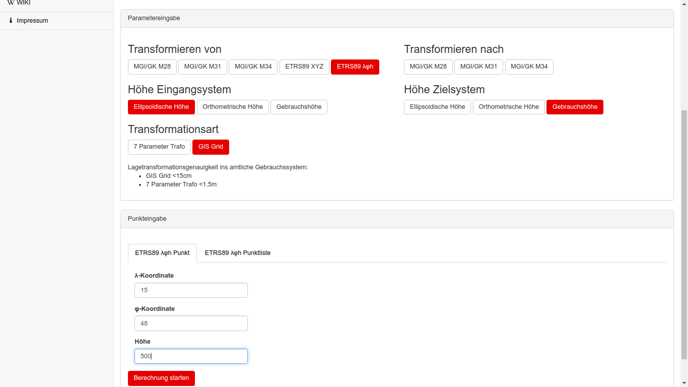
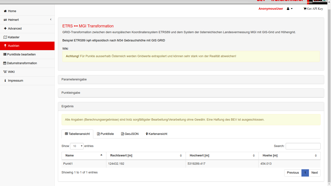
ETRS <-> MGI
X, Y, Z
\phi, \lambda, h
x, y, h
X, Y, Z
\phi, \lambda, h
x, y, h
ETRS
MGI
7-Parameter-Transformation
{
  dX: -577.326,
  dY: -90.129,
  dZ: -463.919,
  a(x): 5.137'',
  a(y): 1.474'',
  a(z): 5.297'',
  dm: -0.0000024232
}
Accuracy < 1.5m
ETRS <-> MGI
X, Y, Z
\phi, \lambda, h
x, y, h
X, Y, Z
\phi, \lambda, h
x, y, h
ETRS
MGI
GIS Grid
Accuracy < 0.15m
ETRS <-> MGI
X, Y, Z
\phi, \lambda, h
x, y, h
X, Y, Z
\phi, \lambda, h
x, y, h
ETRS
MGI
Passpoints
Accuracy < 0.05m
Height
- Datum: Molo Satorio (Triest) 1875
- Transformation with Grid Products
- More or less no more levelling campaigns in future
- Focus on Geoid and Gravity

Height Transformation
All Grid Products are free available
and used at BEV Transformator
https://transformator.bev.gv.at/at.gv.bev.transformator/austrian

Height Transformation


What to do next
- English Version
- Transformation Handbook
- Transform all Geometry Types
- More file formats
- Release 1.1 will launch in 07/2019
transformator.bev.gv.at
Philipp Mitterschiffthaler
Franz Blauensteiner
Martin Sehnal
Jürgen Fredriksson
transformator.bev.gv.at
By Philipp Mitterschiffthaler


