Introduction to ArcGIS
Phil White
Earth Sciences & Environment Librarian
Intro to ArcGIS
Agenda
-
Introductions (2 min)
-
Short presentation (10 min)
-
Resources walkthrough (5 min)
-
ArcGIS Pro orientation (10 min)
-
Adding & visualizing data (20 min)
-
Make a map! (30 min)
-
Wrap-up
Intro to ArcGIS
Dowload the workshop data!
Intro to ArcGIS
What is GIS?
Intro to ArcGIS
A geographic information system (GIS) lets us visualize, question, analyze, and interpret data to understand relationships, patterns, and trends.
Intro to ArcGIS
Who uses GIS?
Intro to ArcGIS
GIS Software
Esri products
- ArcGIS Online
- ArcGIS Desktop (suite of tools containing ArcMap, ArcCatalog)
- ArcGIS Pro
Open source
- QGIS
- R Spatial
- PostGIS/SQL
Bonus
- Python!
Intro to ArcGIS
GIS Data
5 things to remember:
-
Points
-
Lines
-
Polygons
-
Cells
-
And their associated attributes
Intro to ArcGIS
2(ish)Data Types
Intro to ArcGIS
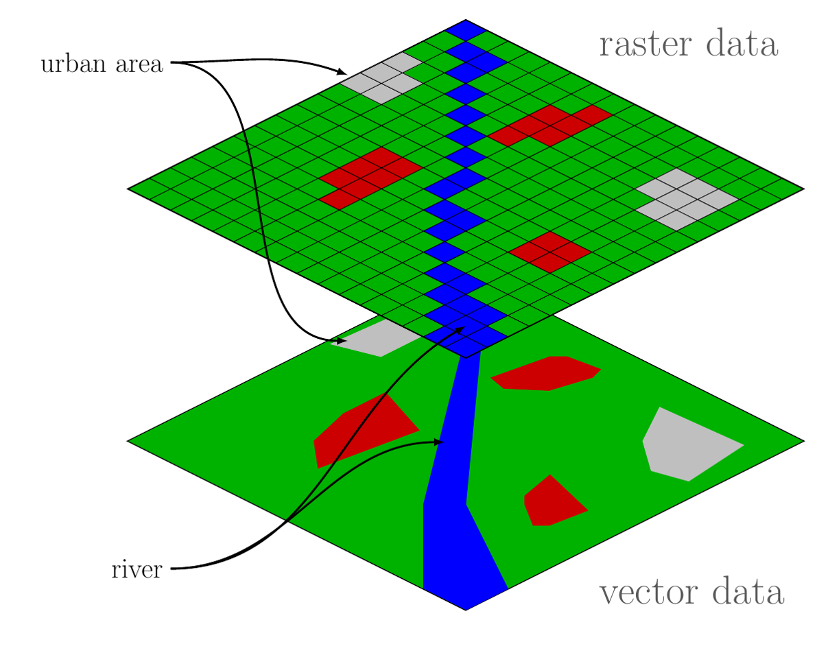
Vector Data =
points, lines, polygons
Intro to ArcGIS
Raster Data =
grid or cells, pixels... basically an image
Intro to ArcGIS
Intro to ArcGIS
Data Formats
Vector
- Shapefile (.shp)
- .KML/.KMZ
- Geodatabase (.gdb)
- Spatialite (aka sql)
- GeoJSON
Raster
- GeoTIFF
- Esri Grid
- MrSID
- Others
Intro to ArcGIS
Resources available to you:
-
libguides.colorado.edu/GIS
-
ArcGIS Online
-
Esri software via CU site license
-
Esri Training Catalog
-
More workshops
-
Esri student licenses
-
Coursework in Geography, Geological Sciences
Intro to ArcGIS
Shameless plug:
Intro to ArcMap
</slideshow>
Intro to ArcGIS Pro
By Philip White
Intro to ArcGIS Pro
Intro slides to ArcMap workshop


