


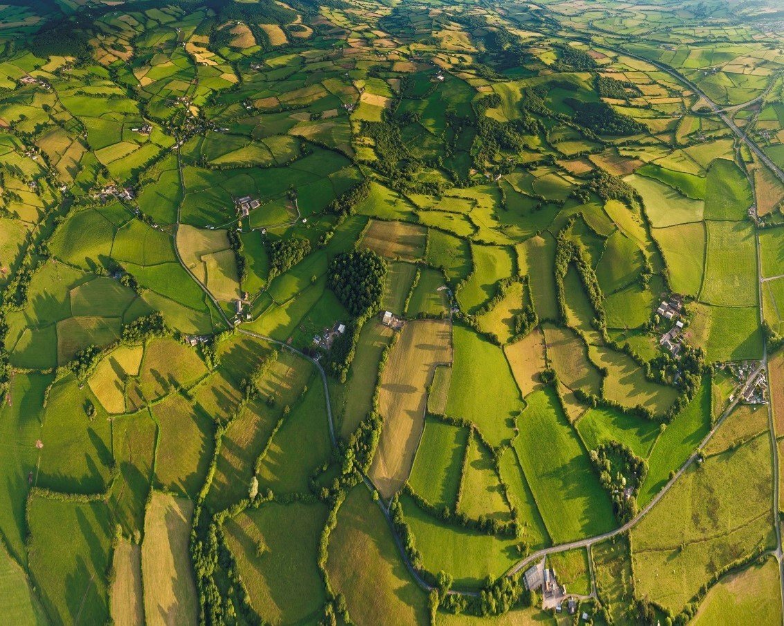
A platform to enable large scale mapping with drones. We use AI/ML and legacy geospatial approaches to streamline the process from data sorting of images, reconstruction into maps, and extracting geospatial analytics from it. We believe that the map is just the raw material, we empower decision makers with robust geospatial insights.
drones everywhere


Product

Data Collection
Reconstruction to Maps
Image Analysis
Settlements
Precision Agriculture

Proprietary pipeline optimised for large-scale data.
Deep learning/ Computer Vision/ legacy geospatial approaches
Applications
AI based Recommendation Engines
Flight plan
GCP
AI based analytics
High Resolution 3-D model
MVDA Web application
Measurement enabled
Geotagged Feature Database attached
FAR calculations
Unauthorised construction tracking
Smart City Survey Application- 2D (Sagar)
Measurement enabled +
Geotagged Feature Database attached
Urban Area (Kanpur)
- Plot Boundary + Built up Area detection
for property tax calculation
- Measurement enabled + attached dashboard
Smart City Survey Application- 2D (Baroda)
Measurement enabled +
Geotagged Feature Database attached
Flood Model
Flood model
25 cm contours
&
Digital Elevation Model to understand the elevation across the terrain
Meet the Squad


Utkarsh Singh
Ayushi Mishra
Founder & CEO
Director of Strategic Partnerships
Johns Hopkins
Johns Hopkins

Niloy Jain
Product Manager
IIM Indore

Sajil KR
Director Geospatial Intelligence
IIT Bombay

Poonam Gupta
Chief of Staff
DU
Laurels
Awarded "Best Startup" by Hon'ble CM of Madhya Pradesh
Awarded "Jury's choice (Most Innovative Startup)" at NASSCOM Product Conclave 2017
NASSCOM Innotrek 2018

Media Mentions


DronaMaps BDA
By DronaMaps Private Limited


