
3D Mapping
BENGALURU
Transforming the city from 2D to 3D.
-
Mission Statement
-
Objectives
-
Operational Plan
-
Approach
-
Benefits

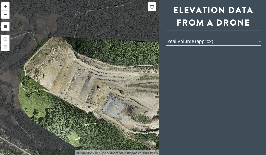
To utilize 3D maps to assess large scale GIS features in 3 dimensions to observe the growth of the city over time.
Close-approach navigation by drones helps capture data to the last centimeter, giving rise to highly accurate measurements and area/volume calculations.
Mission Statement
Objectives
-
Achieve high-density 3D mapping of 5 wards in BBMP AOI using Drones.
-
Integrate all 3D data with GEPTIS and existing GIS systems with ESRI Database level-integration.
- Assess impact on property-taxes, roads and flood responses along with several other use-cases.
- To understand the challenges of extending the 3D mapping to all 198 wards for Bengaluru.
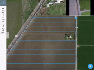
Flight Planning
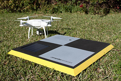
- Ground control points (accuracy 5cm/px)
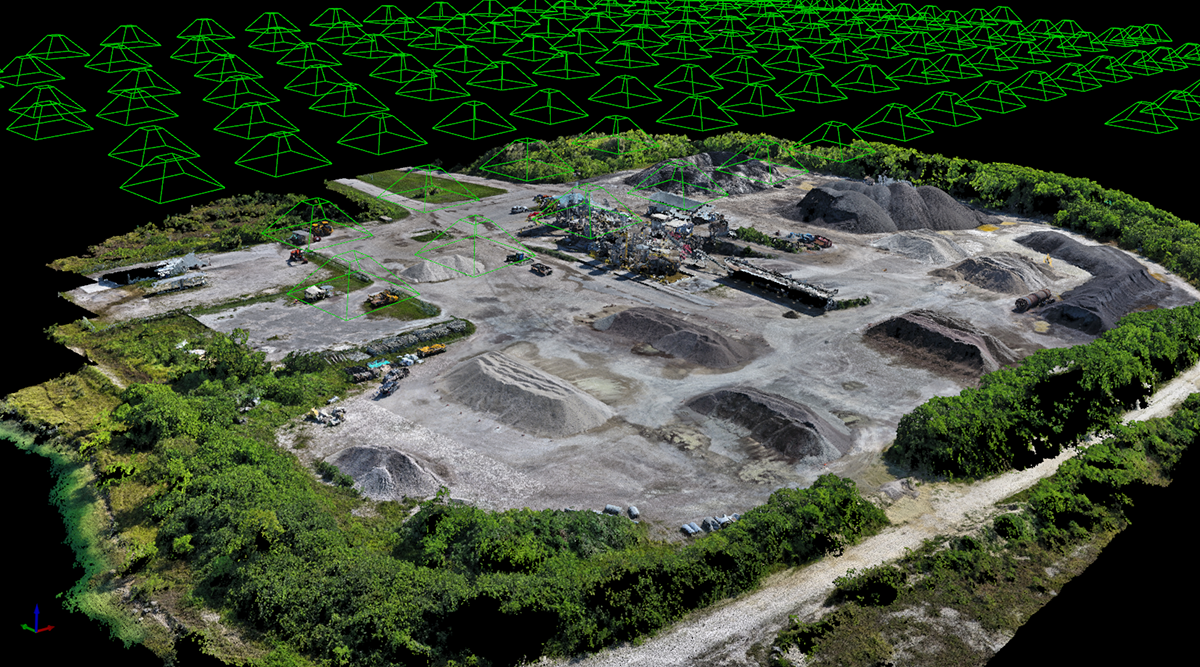
- UAV Formation Flights - swarm of drones capture data in high density.
- 3D Data Capturing
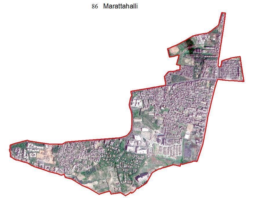
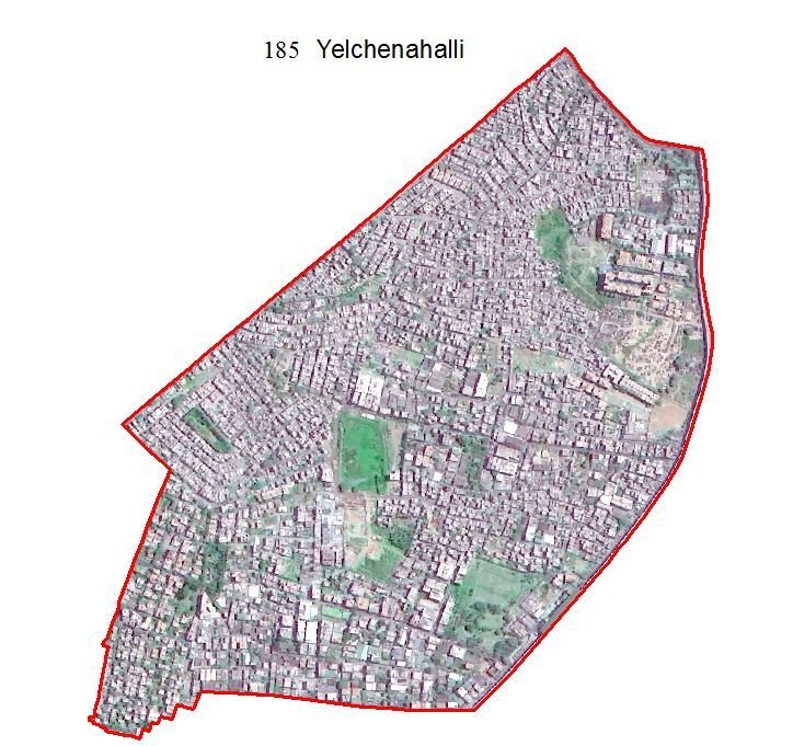
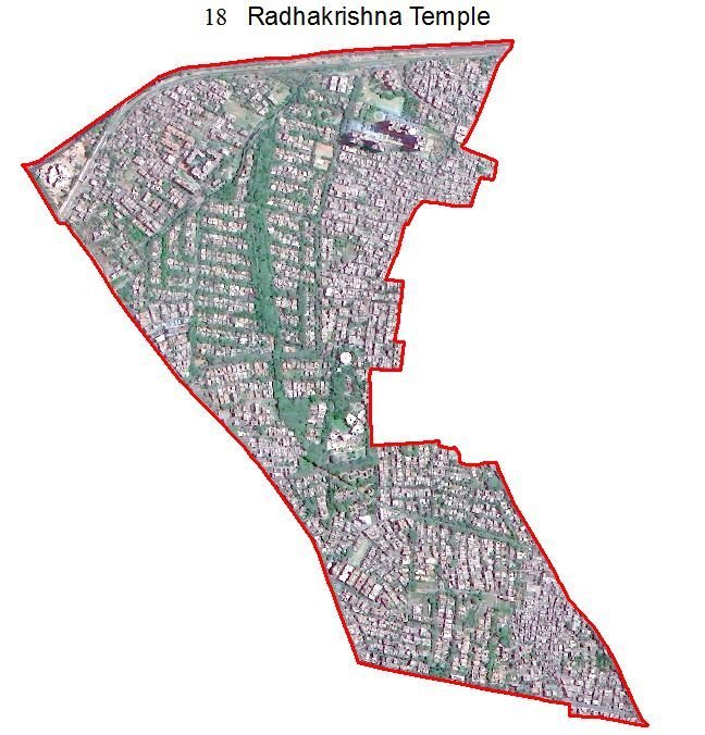

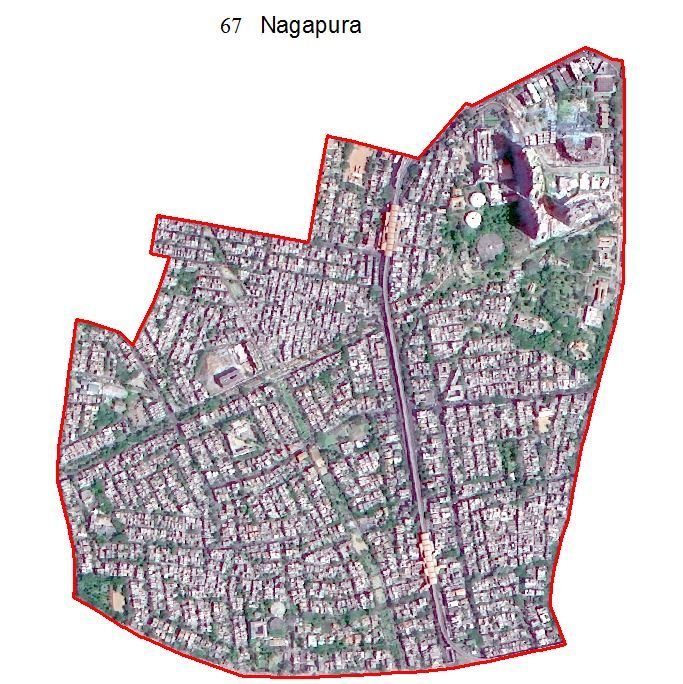
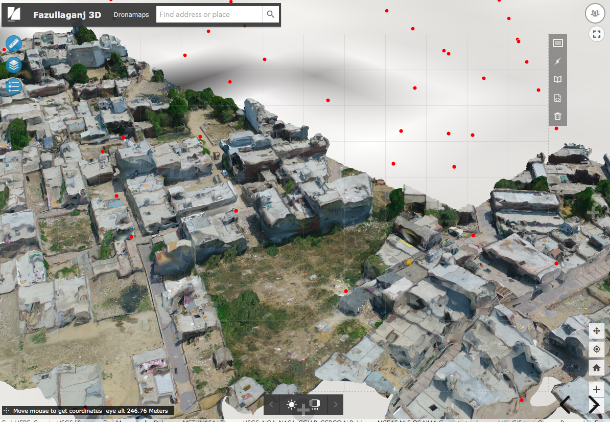
Areas of Interest
5 pilot wards
selected
out of
198 wards
Workflow

Data Collection
Reconstruction to Maps
Image Analysis
GIS 3D Application
Expansion to other analytics

Proprietary pipeline optimised for large-scale drone data
GIS level integration of 3D maps into databases of ArcGIS
Applications
Flight plan
GCP
AI based analytics
How
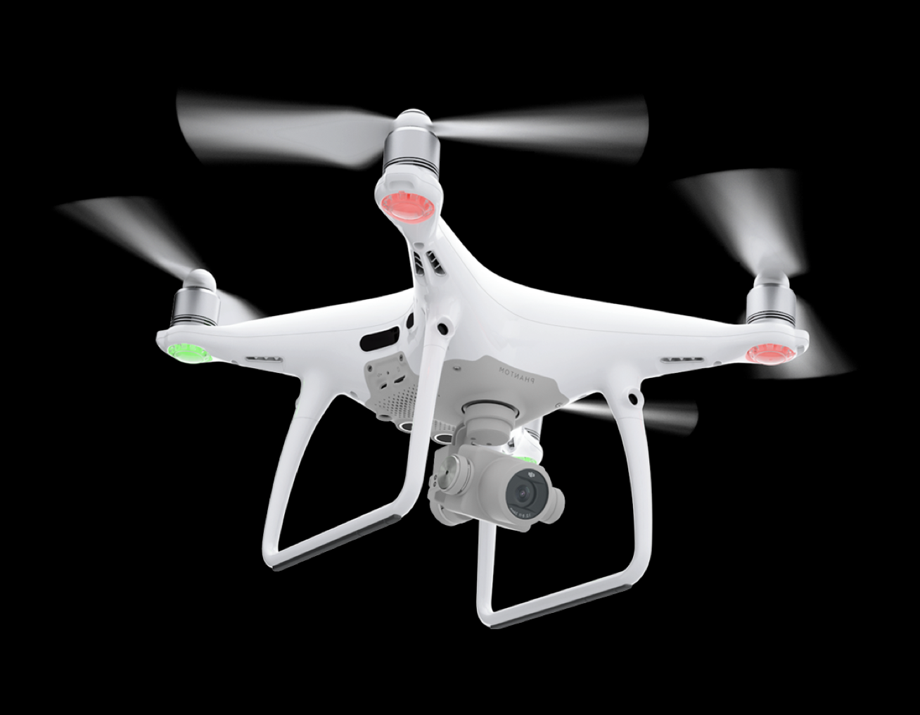
A fleet of autonomous drones will be tasked for a full-grid centimeter level accurate 3D mapping of BBMP areas along with closer approaches around buildings.
BackEnd
After the data-collection, 3D maps will be processed and integrated into the ESRI server system on an on-prem hosted server.

Features
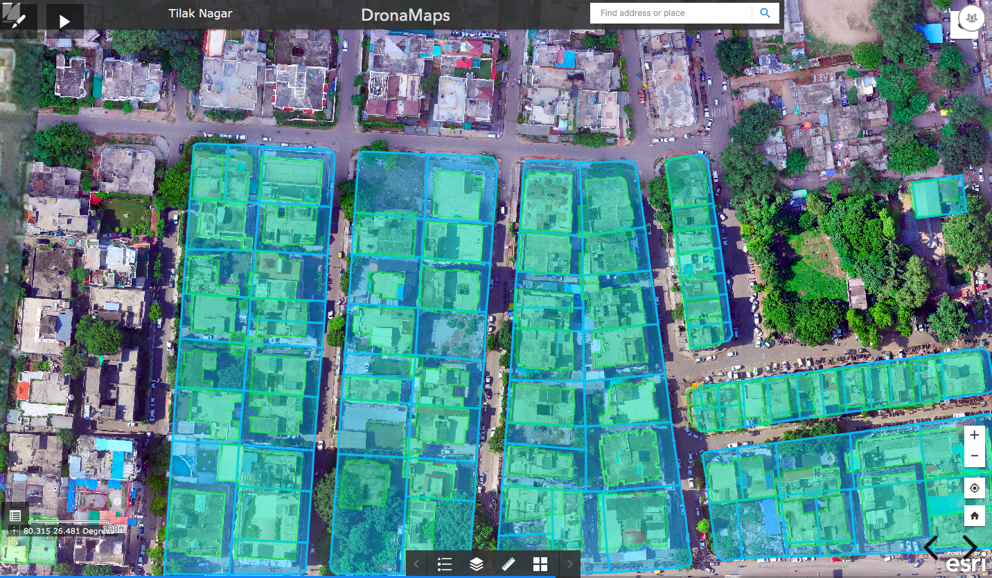
3D Buildings with Front Facade
- Use 3D Maps web-application to assess floor counts, measurements, and link these attributes back to the GIS system enabling more accurate calculation of Property Taxes and building level information.
- Integration with GEPTIS and other spatial datasets.
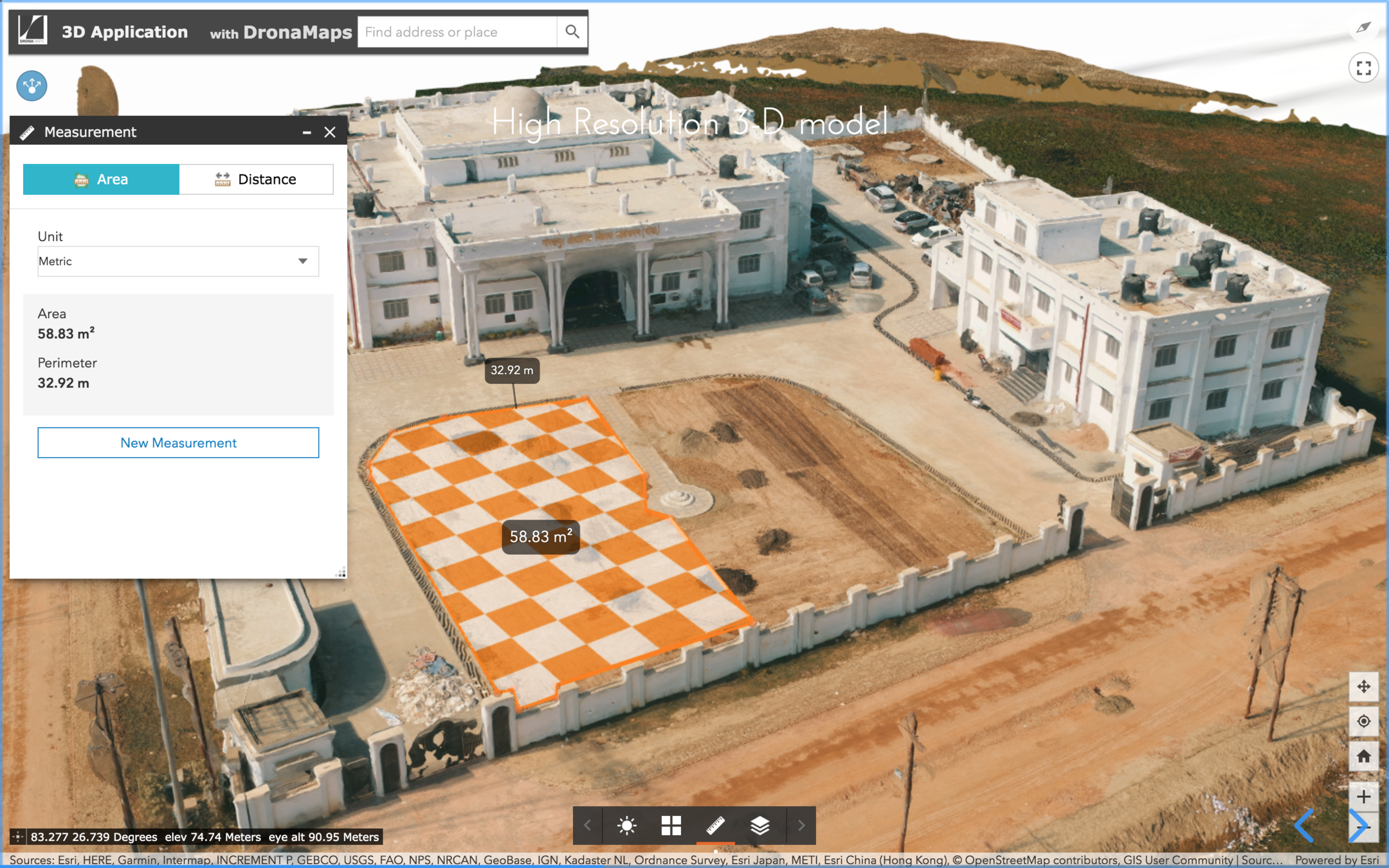
Measurements
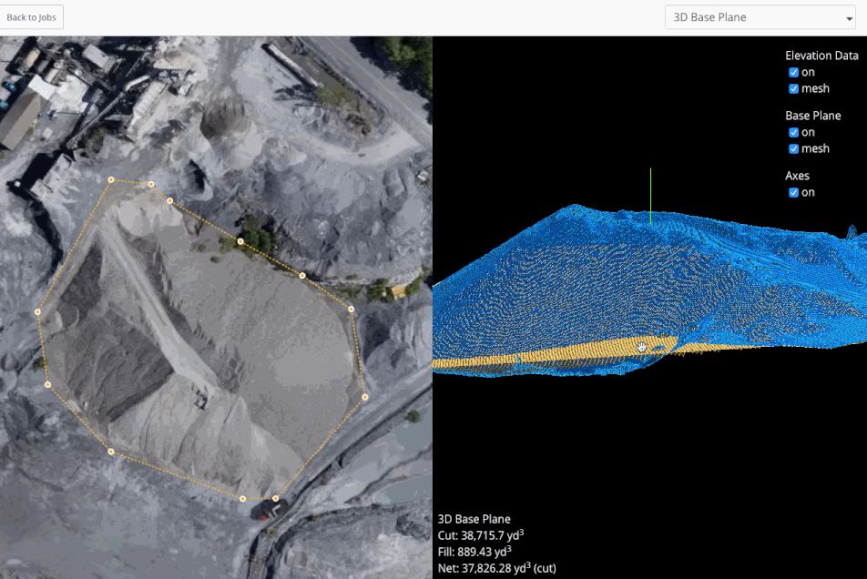
Building and street level measurements in 3D for length, width, height, area and volumes.
Roads and Potholes
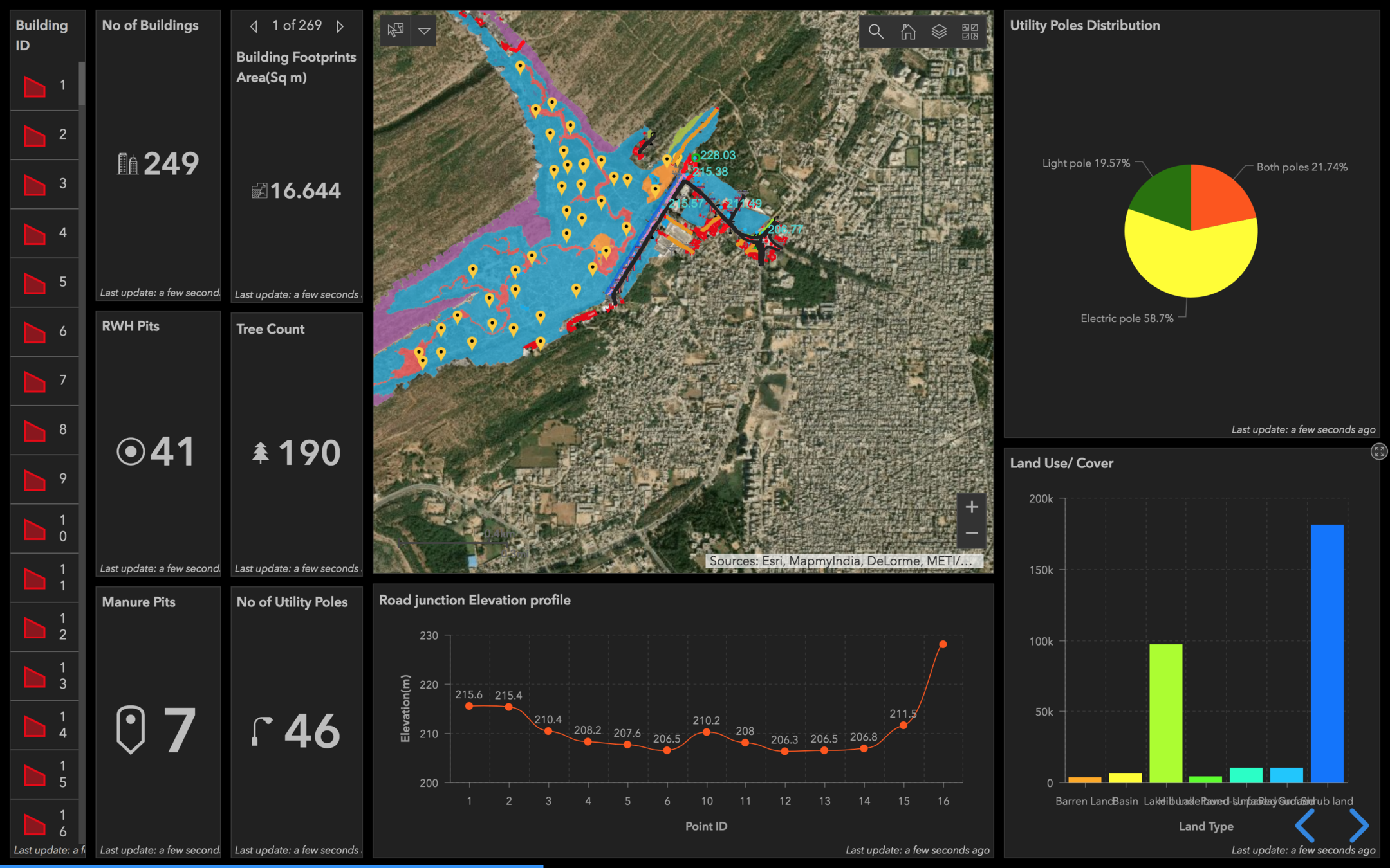
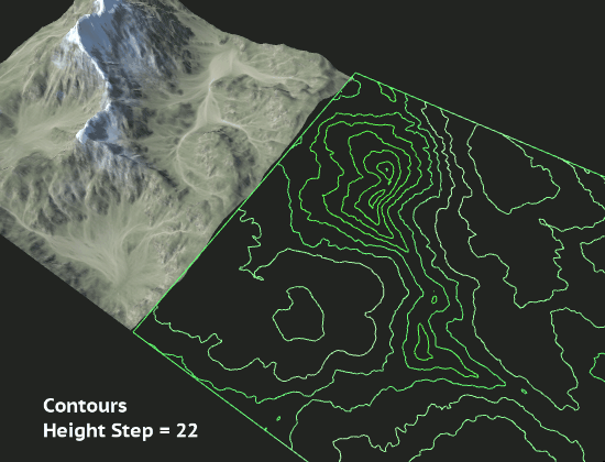
- Provide elevation view and analytics of roads, including potholes (with area/volume calculation) and footpaths with contours and measurements.
- Provide road level flood analysis to identify water puddle areas and flood simulation.
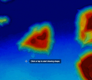
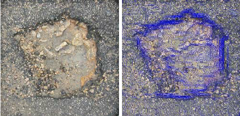
Road Pothole with Contours
Flood Analysis
Street Level Flood Analysis on the 3D data directly inside the ArcGIS system, both using the point clouds as well as lightweight TIN Network Models.
Benefits
-
Deep GIS integration on centimeter level 3D data.
-
Assess and understand property taxes, roads and flood conditions within BBMP.
-
Enable citizen view of areas in 3D, even showcase industrial areas / public zones.
-
Ability to observe change with repeated mappings.
-
Enable Bengaluru to be a first fully-3D drone enabled city of India.
Use large-scale 3D mapping via a swarm of drones capturing data at street level, with special focus on building front-facade and enable measurements of length, area and volume. The scope extends to Roads & Flood Analysis, and further integrating this data with GEPTIS system and solve extended problems by using the data in a wider scale.
1st fully-drone enabled 3D metro-city of India
for
Outcomes
designing the future of
Bengaluru
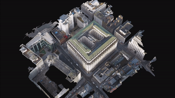
3D MAPS DEMO
BBMP
By DronaMaps Private Limited


