


Commodity Drone
Starting at $1500
High Resolution
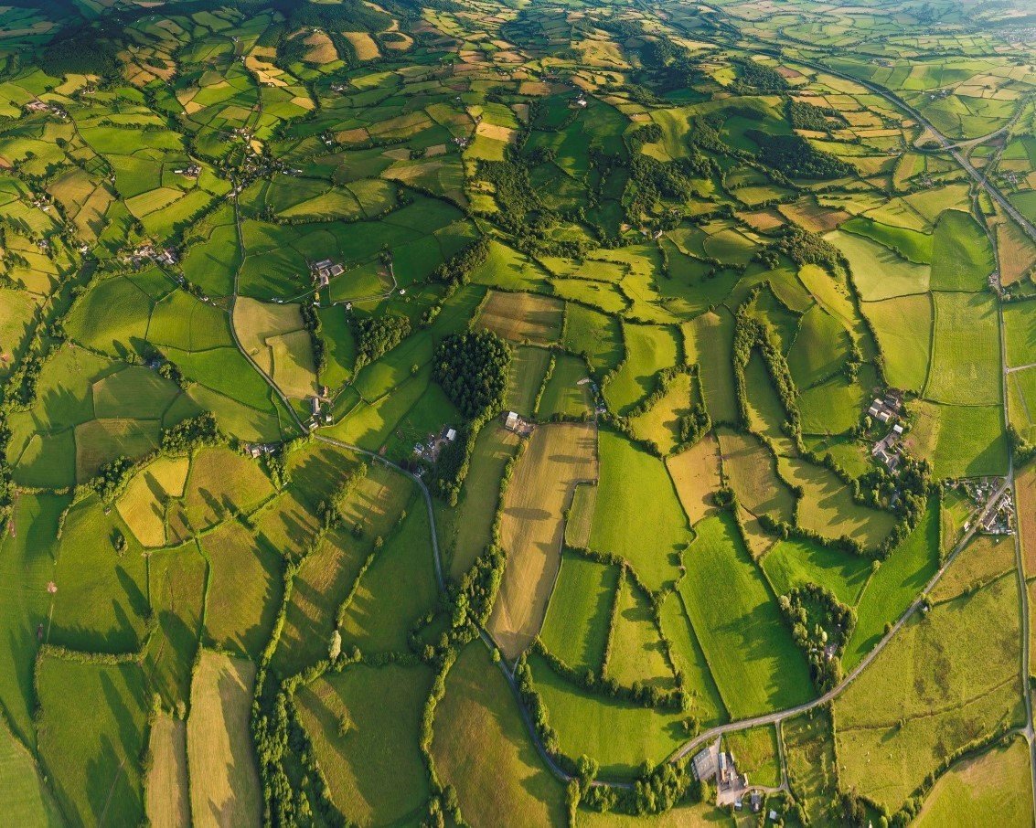
3-5 cm/ pixel
Flexibility:
In Deployment Time, Frequency, and applications
(Urban and agriculture).
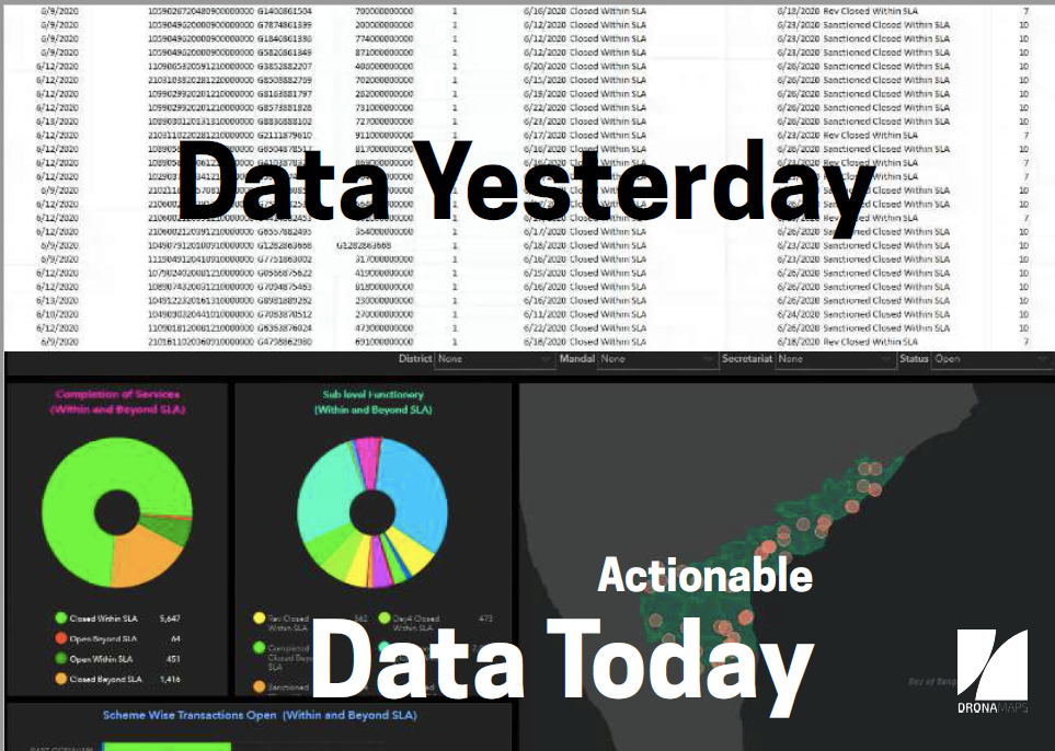
A platform to enable large scale mapping with drones. We use AI/ML and legacy geospatial approaches to streamline the process from data sorting of images, reconstruction into maps, and extracting geospatial analytics from it. We believe that the map is just the raw material, we empower decision makers with robust geospatial insights.

Mapping with a Purpose
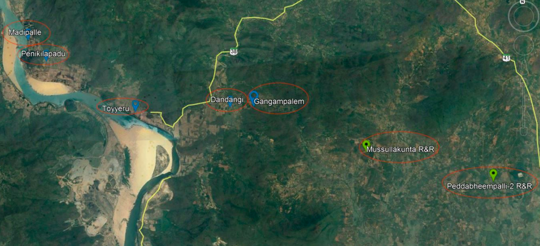
Problem: a dearth of localised geospatial data
Comparison with Satellite Map
Solution: Drone-based Mapping and analytics
Requirement: Faster, Cheaper, easy to share, easy to interpret localised geospatial information that supports repeated mapping and monitoring
10x resolution > satellites
50% time > status quo
20% cost > status quo
Accessible > LIDAR
Pillars to our technology
Drones
Artificial Intelligence and Deep Learning
Approach

Data Collection
Creation of Maps
Image Analysis
Urban/Rural Planning and Development
Precision Agriculture
by Drone Service Providers with
off-the-shelf commodity cameras.
Proprietary pipeline optimised for large-scale data.
Internally developed Advanced computer vision and neural network algorithms to extract relevant data from the maps.
It is this gap we fill that Pix4D and DroneDeploy are missing on.
Applications
- Eliminates the need for a huge manual GIS team.
- Transparent, sharable, and accessible for decision-makers
Capabilities
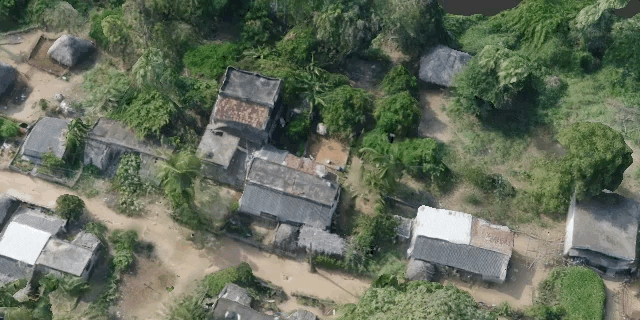
Settlement 3D Mapping
Precision agriculture Analytics
Benefits to Smart Cities
DronaPlots|
The foundation for IoT and mobility solutions for smart cities
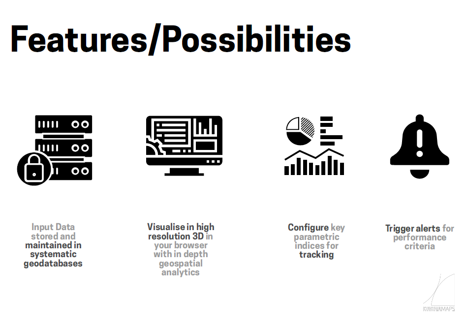
Features:
- Granular 3D data
-Sharable on browser
- accessible to decision -makers
- eliminates the need for a huge team of GIS experts
- transparent
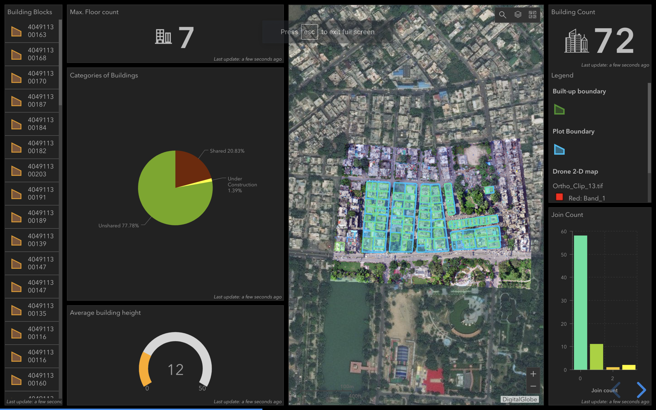
Smart City Survey Application- 2D (Sagar)
Measurement enabled +
Geotagged Feature Database attached
Smart City Survey Application- 2D (Baroda)
Measurement enabled +
Geotagged Feature Database attached
Flood Model
Benefits to ULBs/Municipal Corporations
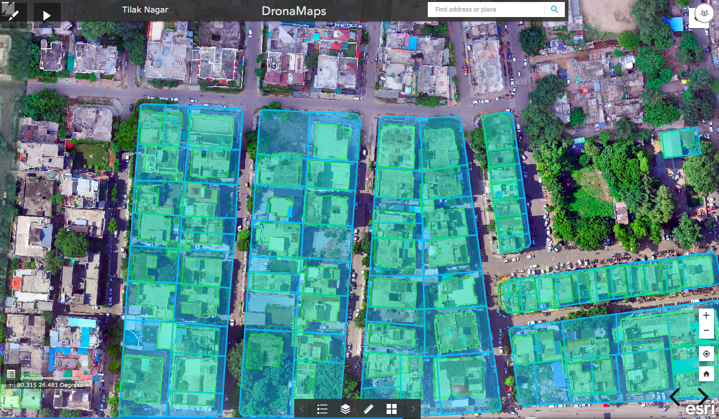
Urban Area (Kanpur)
- Plot Boundary + Built up Area detection
for property tax calculation
- Measurement enabled + attached dashboard
Pipeline Survey Application 2D
(Lucknow)
- Road Network Detection + Junction Elevation
- Measurement enabled
Thank you
DRF & DronaMaps workshop on Smart Cities
By DronaMaps Private Limited
DRF & DronaMaps workshop on Smart Cities
The offerings


