


federica bianco PRO
astro | data science | data for good
dr.federica bianco | fbb.space | fedhere | fedhere
let me introduce myself...
o
astrophysics -> data science
astrophysics stands our as an observational, rather than experimental science
to "observe" the natural status of a system provides advantages. To inquire the system about its status may provide a biased response
(e.g. surveys have many biases)
astrophysics stands our as an observational, rather than experimental science
to "observe" the natural status of a system provides advantages. To inquire the system about its status may provide a biased response
(e.g. surveys have many biases)
astrophysics stands our as an observational, rather than experimental science
to "observe" the natural status of a system provides advantages. To inquire the system about its status may provide a biased response
(e.g. surveys have many biases)
1
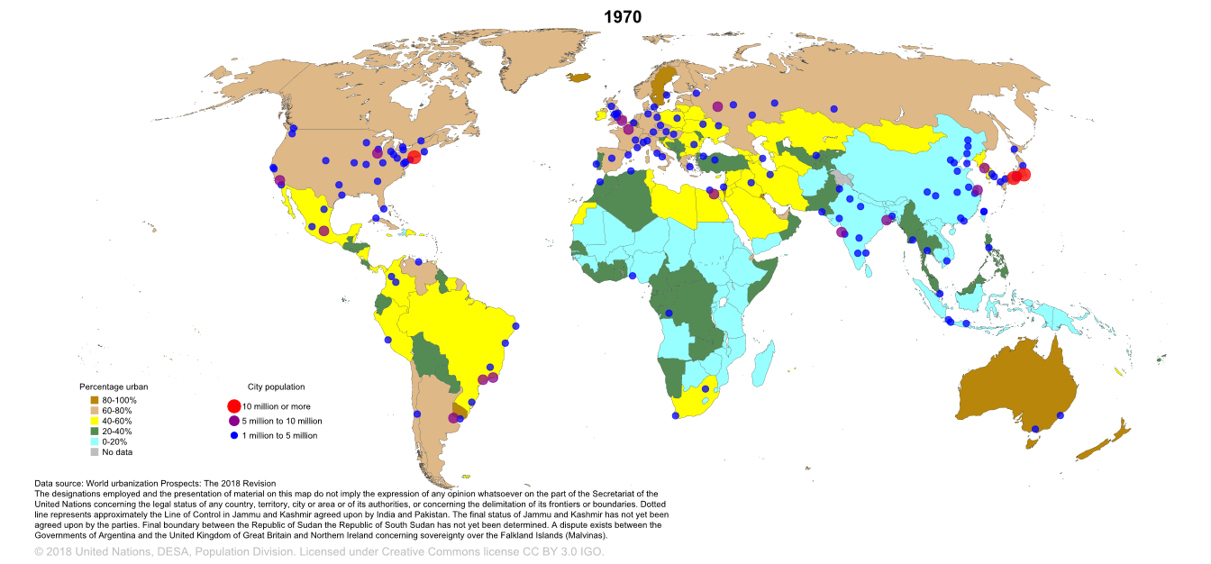
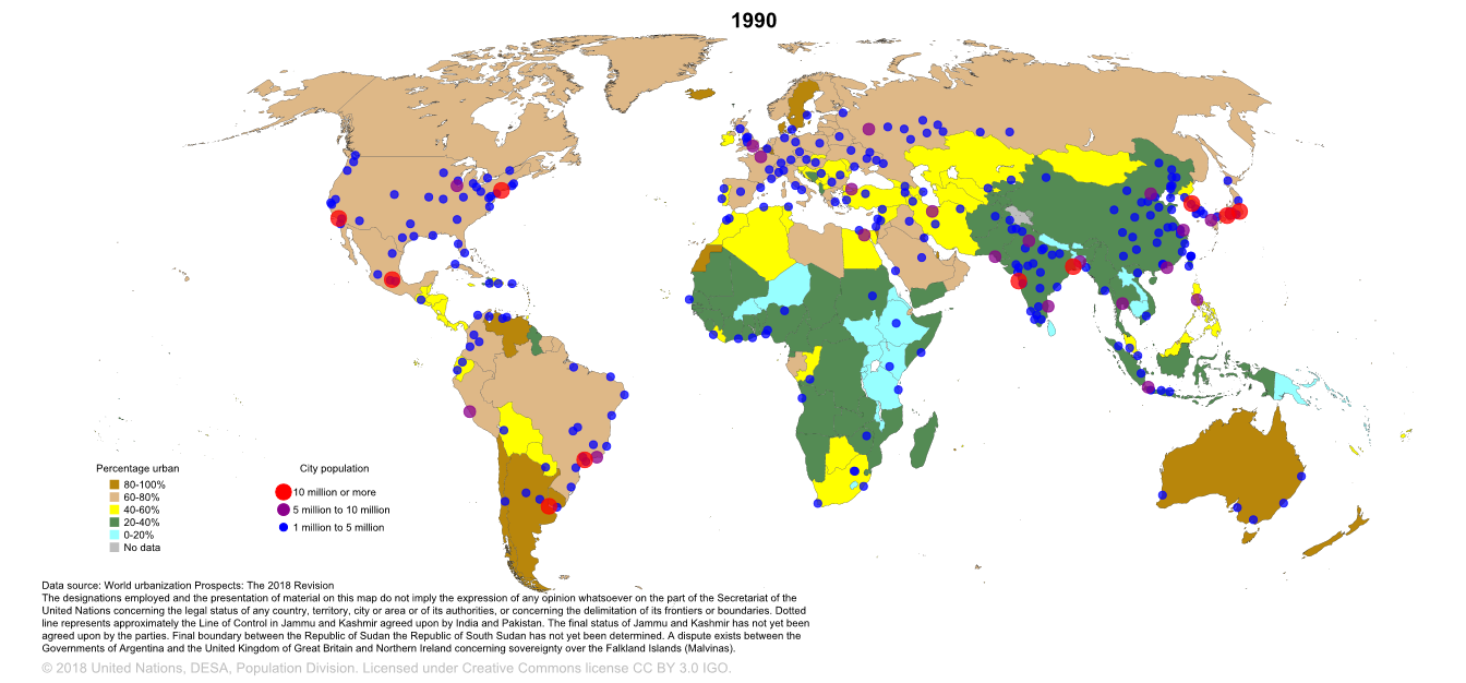
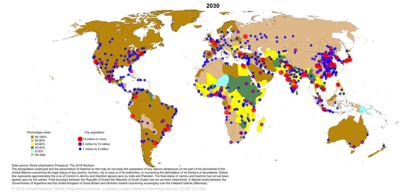
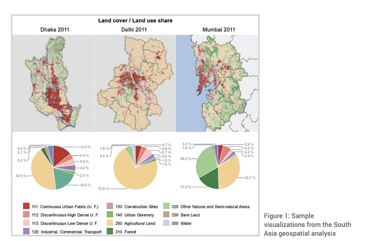
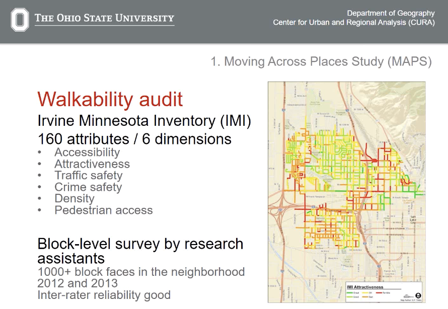
Urban Science
World Urbanization Prospects
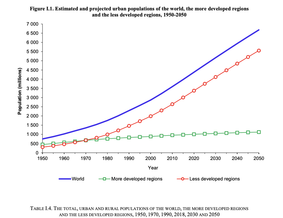
As a consequence, by 1970 the urban population of the less developed regions had surpassed that of the more developed regions (680 million versus 674 million), and the difference increased rapidly thereafter. [...] By 2050, with 5.6 billion urban dwellers, the less developed regions are projected to have 83 per cent of the world’s urban population and 87 per cent of the total world population.
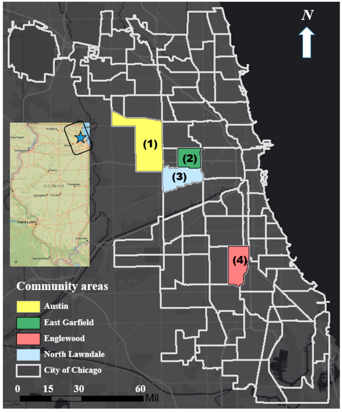
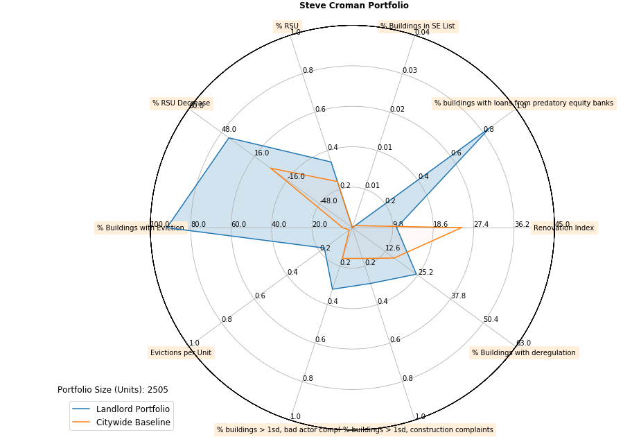
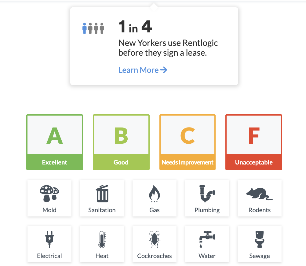
identifying predatorial landlords
(CUSP capstone)
apps to evaluate rental deals
change in business density, income, age, population, racial diversity measures gentrificatoin
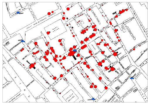
a historical plots that made history
Dr. John Snow 1854
A Cholera Map shows clustering - generally referred to as the first example of data science
Data- and Computational- Urban Science
- writing code to collect data
- writing code to explore the statistical properties of the data
- writing code to make predictions
- writing code to make predictions and investigate what variables were needed to make the prediction (feature importance)
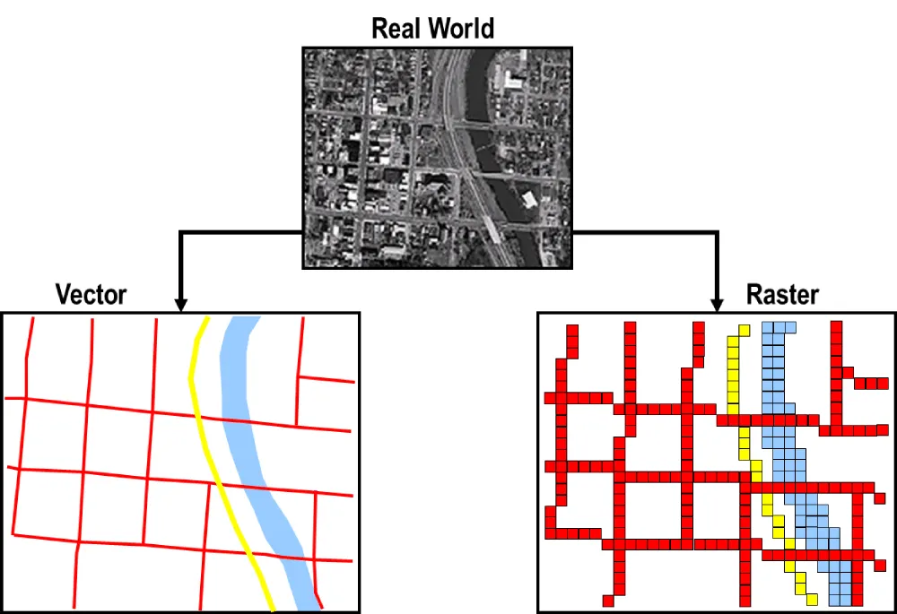
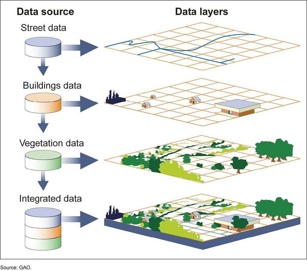
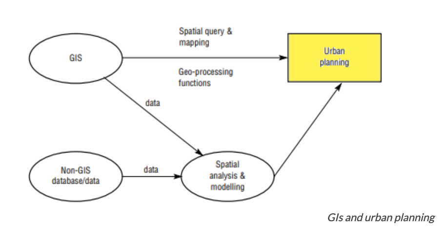
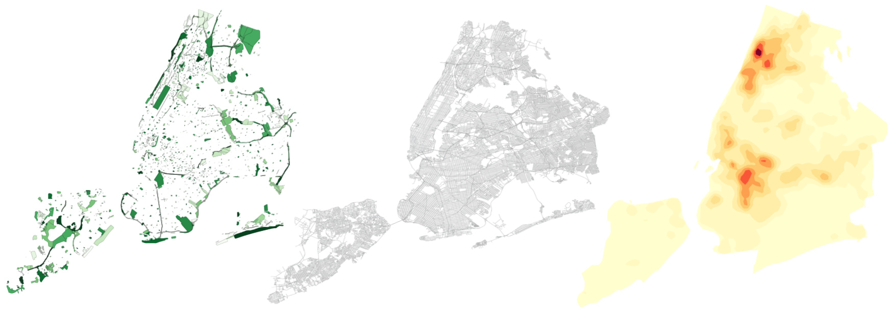
GIS: integrating layers of data
a geographic information system (GIS) is an information system specializing in the input, management, analysis, and reporting of geographical (spatially related) information.
geographical = spatially related
GIS: integrating layers of data
a geographic information system (GIS) is an information system specializing in the input, management, analysis, and reporting of geographical (spatially related) information.
geographical = spatially related
GIS : data integration to data analysis
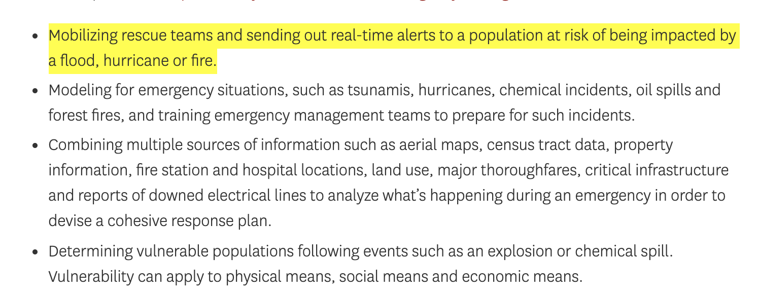
GIS in emergency management
https://gis.usc.edu/blog/why-is-gis-important-in-urban-planning/
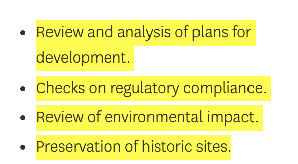
GIS in urban planning
GIS in transportation
Dynamic data collection
Real-time data processing
Real time data serving
GIS in platforms
Dynamic data collection
Real-time data processing
Real time data serving
GIS in platforms
Dynamic data collection
Real-time data processing
Real time data serving
why python??
open source
huge community of developers
extremely popular (great skill on the job market!)
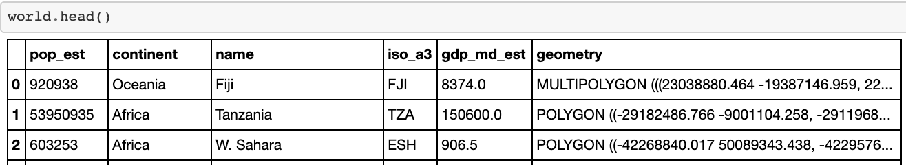
GeoSeries and GeoDataFrame extend the functionality of the pandas data structures.
builds on other python spatial packages to perform manipulation and analysis:
-> inherits all the functionality of pandas
-> added functionality for spatial analysis
GeoSeries and GeoDataFrame extend the functionality of the pandas data structures.
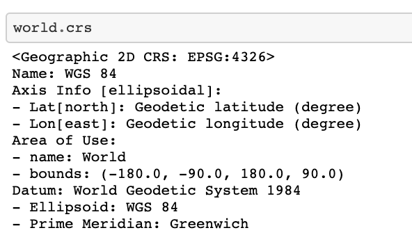
needs a geometry column
the geometry column contains "shapely" objects
Shapely supports the creation of primitive geometry features. These include:
collections are also supported:
GeoSeries and GeoDataFrame extend the functionality of the pandas data structures.
needs a geometry column
may contain coordinates in a separate attribute
http://kjordahl.github.io/SciPy-Tutorial-2015/#1
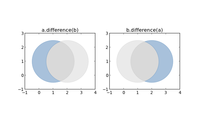
Shapely is a python library for geometric operations using the GEOS library.
Shapely can perform:
Thank you!
fbianco@udel.edu
By federica bianco


