GIS WORKSHOP

Twitter: @code4hk
FB group: Code for Hong Kong
FB group: Code for Hong Kong
Agenda
GIS Concepts & Tools (Loki Chu)
Online Tools
GIS Concepts in Developer Terms
Applications and example
Who attend Code4HK Event for the first time?
Who has any GIS Experience?
Who developed Geo related applications?
Civic Hacking x GIS
Civic Hacking

Open Data
Discoverable, Unconditional, Structured
(From ODHK)
Geo-Related Open Data
Land Use, Air Pollution, Air lanes,
Landfill & waste transmission, Recycle Bin Locations
Think:
What do you want to build?
C4HK Mapping Applications
71map.code4.hk
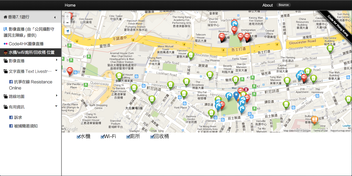
Example: Geolocation, Open Data of Recycle Spots
https://github.com/code4hk/71map
https://github.com/code4hk/71map
Light Pollution
http://lightpollution.hk (TODO )
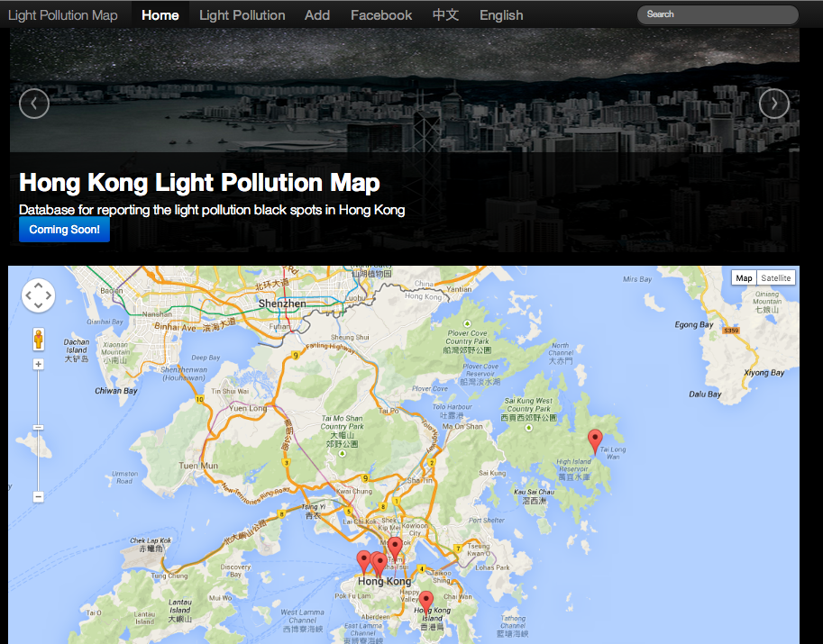
Light Pollution
Basics:
Showing Spots on a Map
Crowd Source Spots
Challenges:
Geocode vs "de-geocode"
Census Explorer
https://github.com/gazetteerhk/census_explorer
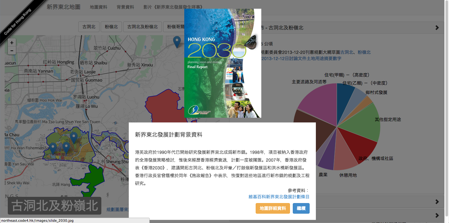
Northeast.code4.hk
Challenge:
Get Correct GeoShapes
Cut GeoShape from PDF using Photoshop
Georeference geoshapes onto layers
https://github.com/code4hk/northeast4hk
http://ozp.tpb.gov.hk/
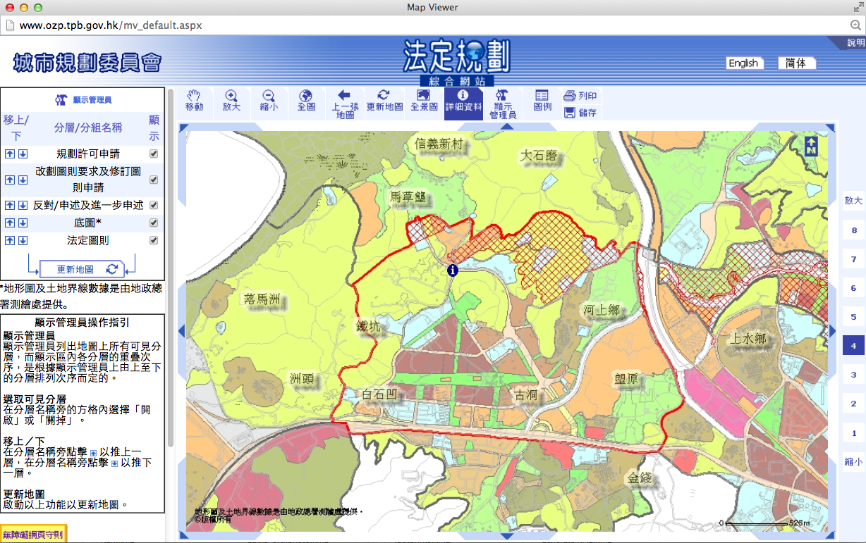
請 用 1024 x 768 解 像 度 及 IE 5.5 或 以 上 版 本 瀏 覽 可 得 更 佳 效 果
Think:
Cloud Service
before you build from scratch
Tools
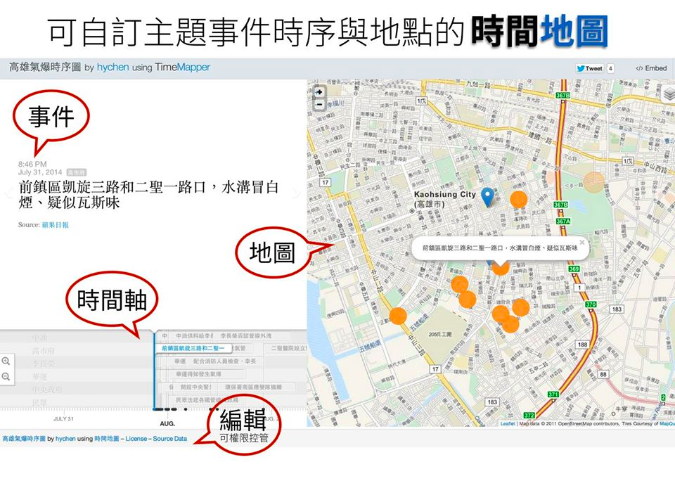
Example: Kao Siung Explosion Map
Example: Real Madrid vs Bayern München
Google Fusion Table
Mapbox
Libraries?
LeafletJS
Mobile-friendly
TimeMapJS
TimelineJS + Map
GIS is hard?
Because sometimes you don't even know what to google
Some Terms
Base Tiles Layer
Open Street Map
Google Map
Traffic, Terrain, Satellite
Open Street Map (OSM)
Open Source
Everyone can draw
Enable quick Reaction, e.g. in disasters
Many Good Stuff - e.g. Express Railway Route
More Terms
Zoom- Level
- Trigger interactions by Zoom-level
Geolocation
-
Find where are you. Example
Geocode & Geocomplete
- Find Geo co-ordinates(lat,lng) from (Text) location
- Example - jQuery Geocomplete
"Reverse Geocode & Geocomplete"
- FInd Text location from Geo co-ordinates
- Use case: crowd sourcing geo locations
Even More Terms
Marker Cluster
-
When there are too many Markers
- Example
Choropleth
GeoShape
Formats
KML
GeoJson
TopoJSON
Why TopoJSON
Think:
Do you really need a Full-blown GIS or a simple MAP
Mapping Visualizations
With D3.js
Upcoming..
Live Streaming, Civic Journalists Technologies Workshop
Data visualization Workshop
New Media Platform Mini-Hackathon
Recycle4HK Mini-Hackathon
Next 2-days-Weekend Hackathon...Planning
Code4HK GIS Workshop
By Chun Yin Vincent Lau


