


A platform to enable large scale mapping with drones. We use AI/ML and legacy geospatial approaches to streamline the process from data sorting of images, reconstruction into maps, and extracting geospatial analytics from it. We believe that the map is just the raw material, we empower decision makers with robust geospatial insights.

Mapping with a Purpose
Problem: a dearth of localised geospatial data
Comparison with Satellite Map
Solution: Drone-based Mapping and analytics
Requirement: Faster, Cheaper, easy to share, easy to interpret localised geospatial information that supports repeated mapping and monitoring
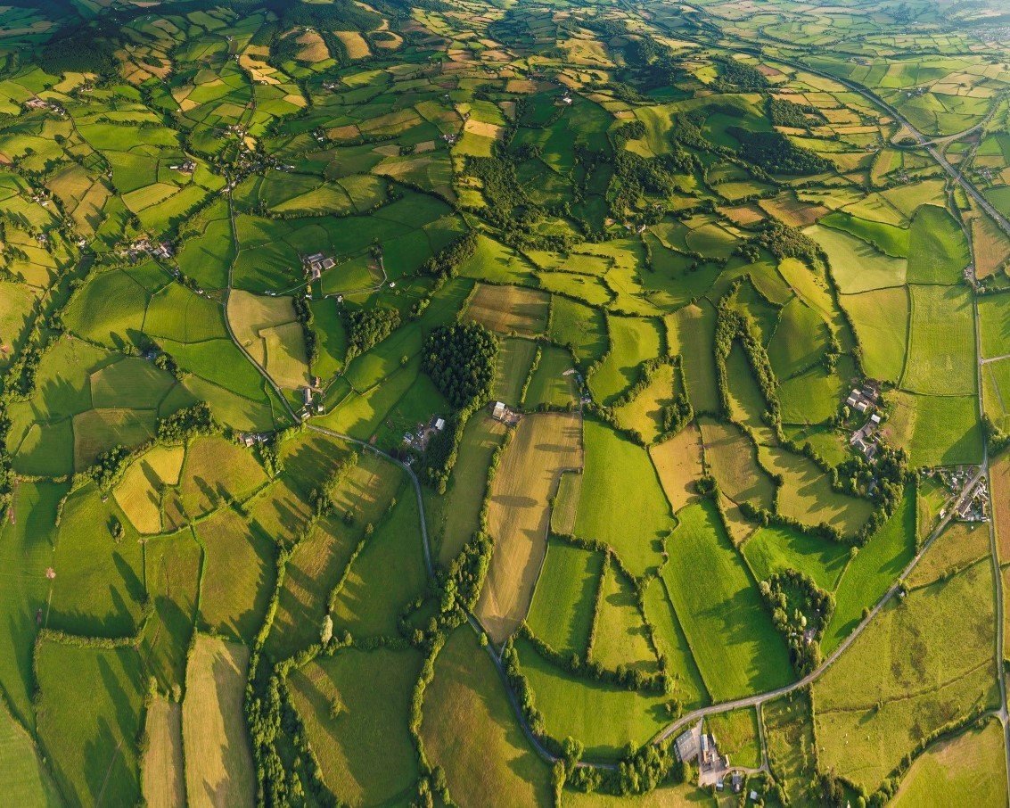
10x resolution > satellites
50% time > status quo
20% cost > status quo
Accessible > LIDAR
Pillars to our technology
Drones
Artificial Intelligence and Deep Learning
Geospatial Intelligence Competitive Landscape
Mapping with data collected through UAVs
Our Niche ( DronaMaps)
Scalable image procurement+Mapping+Automated GIS analysis+delivery in customised sharable formats


Satellite
Accessibility
Granularity
LIDAR
Not dynamic or granular.
Needs GIS team for interpretation
Dynamic with cheap repeated mapping but needs a GIS team to ensure accuracy.
Dense and heavy. Hard to deploy repeatedly and access. Needs dedicated GIS team.
Competitive Landscape
Data Size
Geospatial Analytics
Low
High
Low
High
Nascent
None
Nascent
Survey
Grade
Go to Market
Drone Service Providers
Data Procurement
UP
MP
Maharashtra
AP
Partner Network

End-User

Subscription
Per sq km Variable

Growth Trajectory
2016
Online Platform Launched(subscription model for International audience)
5 sqkm
2017
20 sqkm
X4
420 sqkm
2018
X21
2019
X45
Estimate
(Drone Regulations released)
Expected Revenue: 1.2 Cr
(Engagement fee+
subscription fee)
Drone Service Providers: 100
30 Billion Dollar market with 18% CAGR
in India alone
2020
2021
2022
Order Book: 5 Cr
(Engagement fee
+ subscription fee)
Drone Service Providers: 200
Targets 2021:
- Operational Capacity: 100 Smart Cities (India)
- 30% revenue from International sales (subscription+enterprise)
- 10,000 sqkm mapped
- 600 Drone Service Providers
(2019)
(2018)
(Internally Funded= INR 2 Cr)
(2019- 2022: $5 million funding needed)
Approach

Data Collection
Creation of Maps
Image Analysis
Urban/Rural Planning and Development
Precision Agriculture

by Drone Service Providers with
off-the-shelf commodity cameras.
Proprietary pipeline optimised for large-scale data.
Internally developed Advanced computer vision and neural network algorithms to extract relevant data from the maps.
It is this gap we fill that Pix4D and DroneDeploy are missing on.
Applications
- Eliminates the need for a huge manual GIS team.
- Transparent, sharable, and accessible for decision-makers
Our Approach
Data Collection
Creation of Maps
Image Analysis
Rain Water Harvesting Solution
Horticulture
Flight Plans
GCP marking
DGPS measurement
2D Ortho
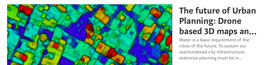
Contour Maps
Flood Maps
Internally developed Advanced computer vision and neural network algorithms to extract relevant data from the maps.
Applications
- Eliminates the need for a huge manual GIS team.
- Transparent, sharable, and accessible for decision-makers
Capabilities
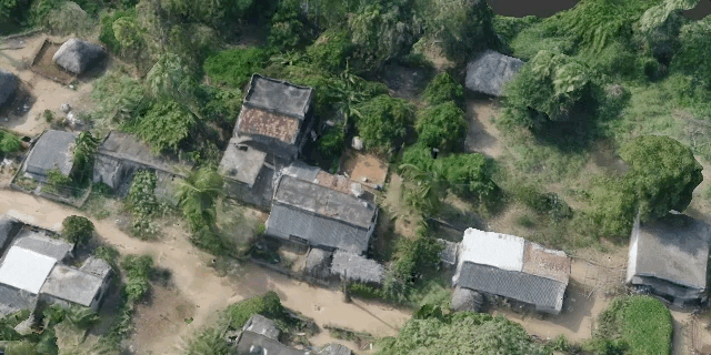
Settlement 3D Mapping
Precision agriculture Analytics
DronaPlots|
The foundation for IoT and mobility solutions for smart cities
Features:
- Granular 3D data
-Sharable on browser
- accessible to decision -makers
- eliminates the need for a huge team of GIS experts
- transparent
Smart City Survey Application- 2D (Baroda)
Measurement enabled +
Geotagged Feature Database attached
Flood Model
Smart City Survey Application- 2D (Sagar)
Measurement enabled +
Geotagged Feature Database attached
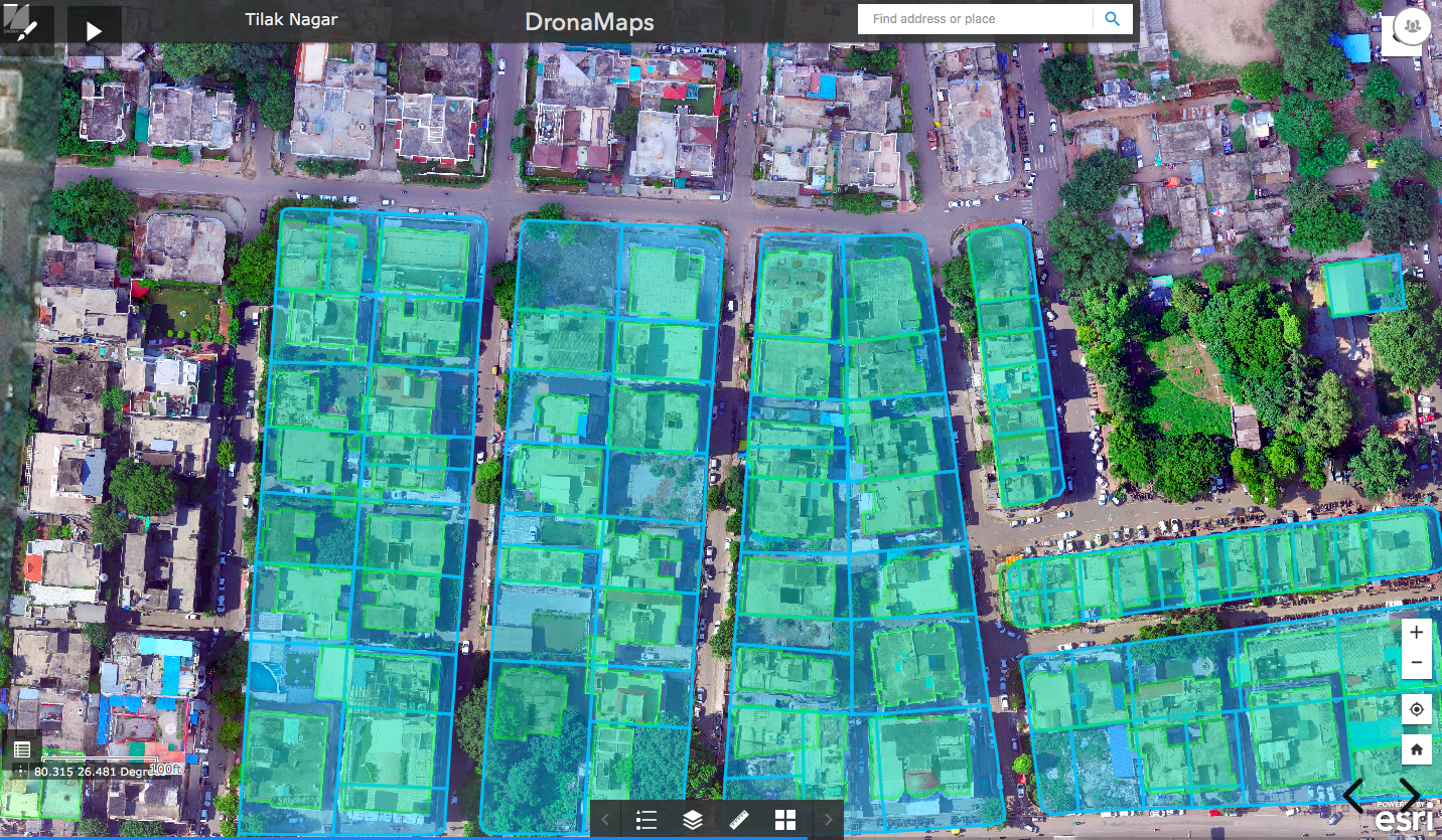
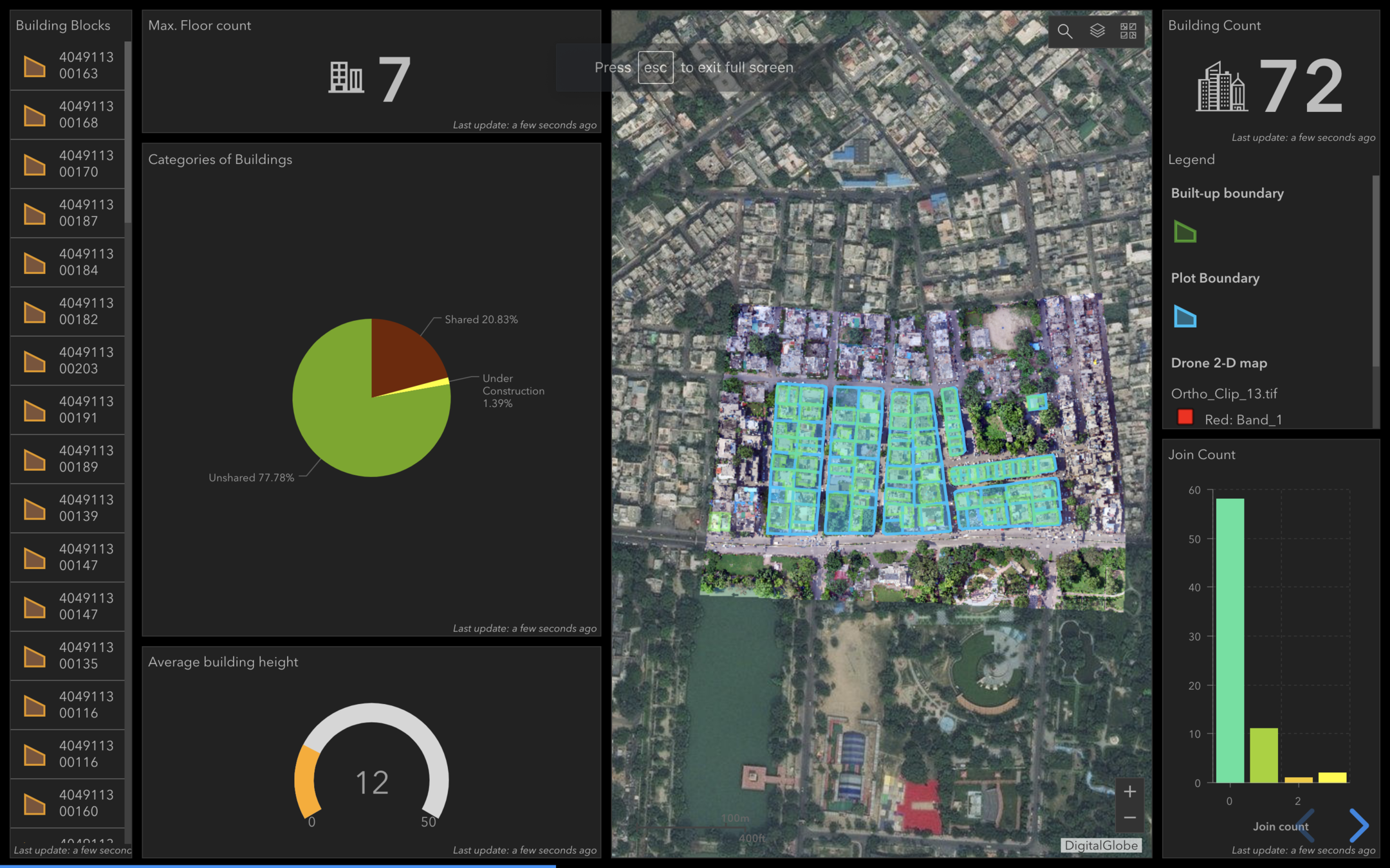
Urban Area (Kanpur)
- Plot Boundary + Built up Area detection
for property tax calculation
- Measurement enabled + attached dashboard
Pipeline Survey Application 2D
(Lucknow)
- Road Network Detection + Junction Elevation
- Measurement enabled
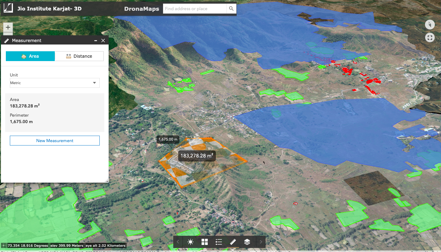
Change tracking/ Construction Survey Application- 2D (Karjat)
Measurement enabled with attached feature database
Change Tracking/ Construction Survey Application- 3D
(Karjat)
Live Contour + Measurement enabled
What you learn?
Field Intelligence: Spot problem areas with NDVI, VARI, and other indices.
Plant Count: Determine stand count
Plant Health Monitor: Diagnose, assess, prevent, and correct the overall status quo and damage to the crops throughout the cropping season. We detect and prevent plant stress and damage from biotic and abiotic factors.
Field Management: Intuitive tools and layers to monitor crops.
Weed Stress Detected
Biological Control

Phalaris minor Retz.
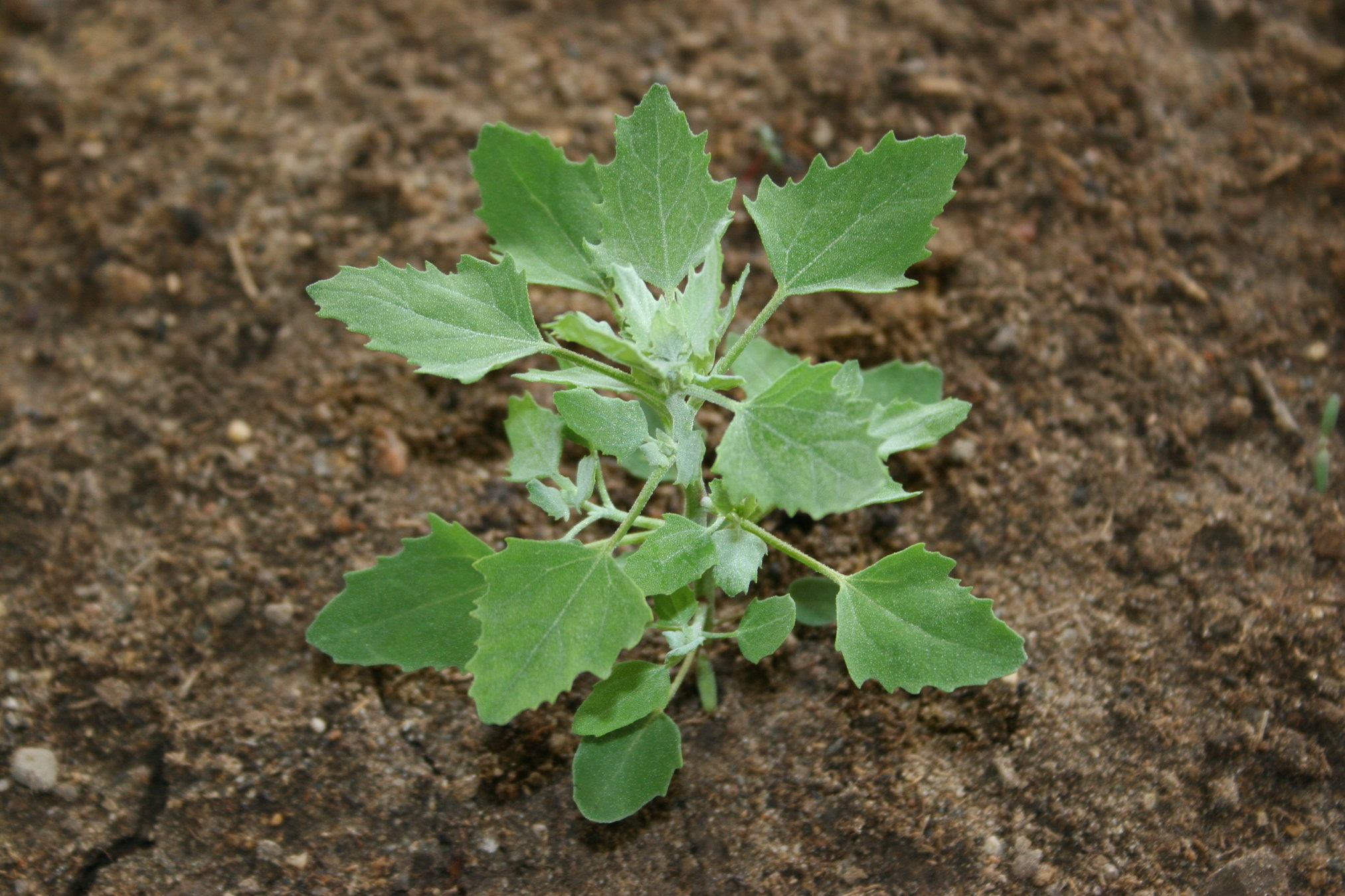
Chenopodium album L.
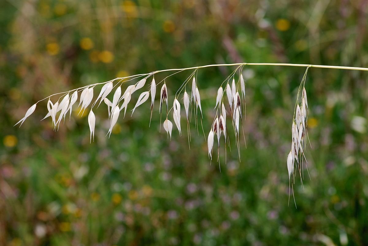
Avenafatua L
Some common weeds in the area:-
Overview:
Chemical Control
Tribunil or Dosonex or Isoproturon @ 2 kgjha in 400-600 litres of water 32-35 days after sowing.
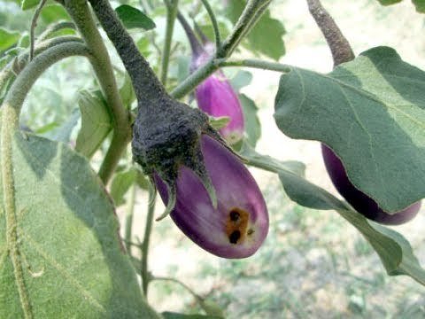
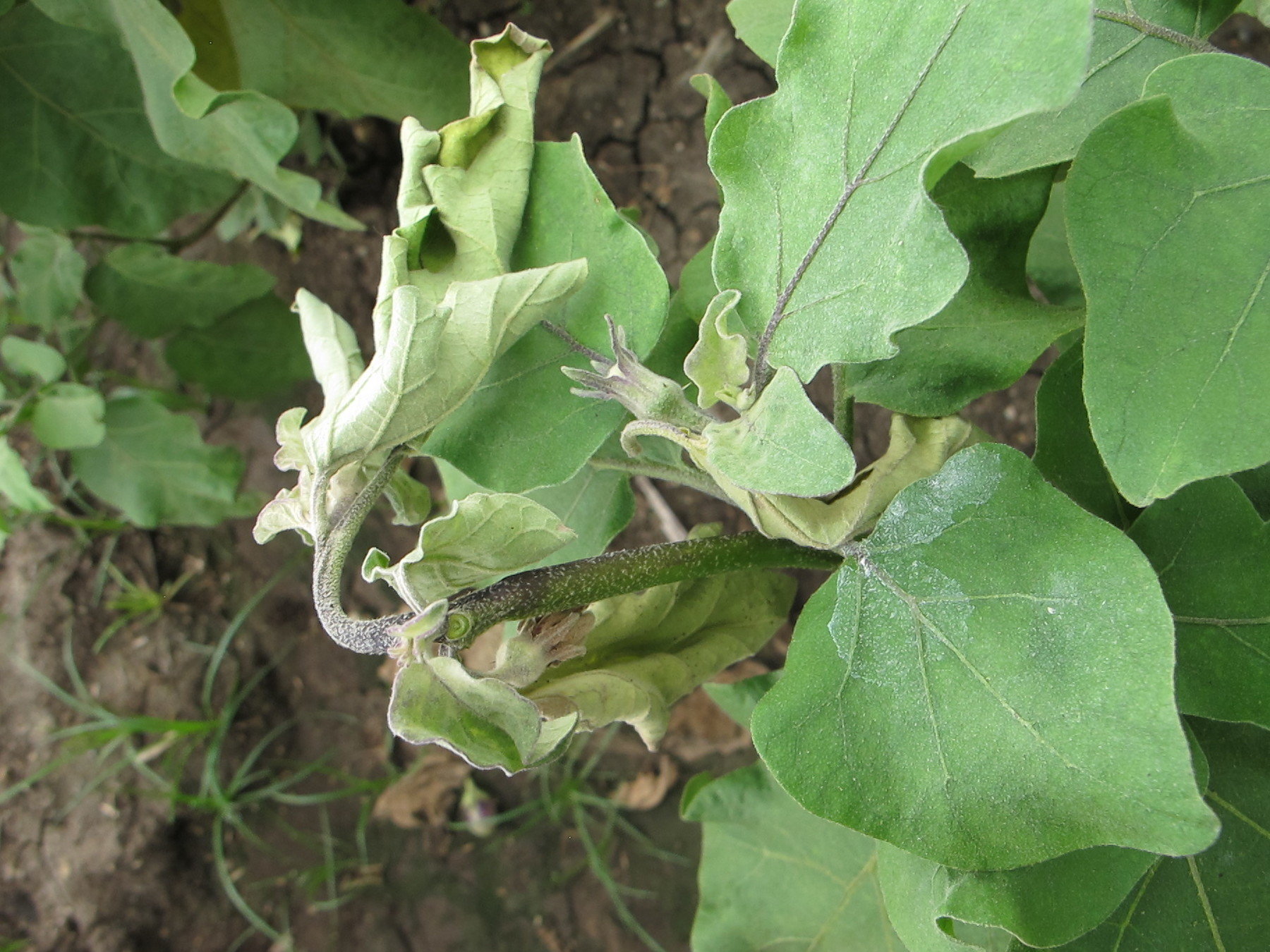
Plant Stress Detected
Biological Control
Fruit Borer
Shoot Borer
Aphid
Some common in pests in the crop in this area:-
Overview:
Chemical Control
Neem Seed Extract at 5% or spinosad or nets with a sticky substance
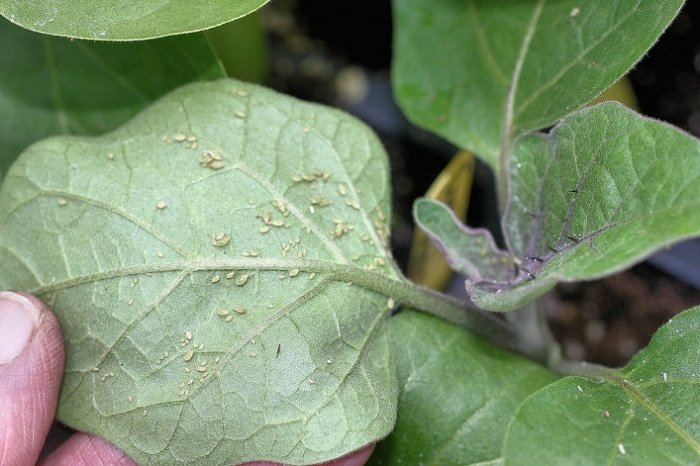
Precision Agriculture Application
- Plant Stress and Soil Estimations
Our Impact
Pipeline Planning in Lucknow (UP)
9 villages with
University of Berkley
Types of crops: 10
No. of farmers: 42
3 Million People
Estimate Lives saved: 30
Property Tax Assessments in Kanpur
Estimate: 200 Cr earnings
Time saved: 50%
Money Saved: 80%
Urban Solutions: Lucknow, Gorakhpur, Sagar etc
Population: 1 Cr people impacted
Meet the Squad


Utkarsh Singh
Ayushi Mishra
Founder & CEO
CoFounder & COO
Johns Hopkins
Johns Hopkins
Poonam Gupta
Co-Founder & Chief of Staff
Delhi University
Team Size 11: 3 GIS and 4 Full Stack + AI/ML Engineers

Our Journey
•Presence: Indore, Vizag, Lucknow, Mumbai, Bengaluru, Gurugram
•Over 3 Trillion Pixels Processed
Notable Projects

•Precision Agriculture Initiative ( Reliance Foundation and Jio)
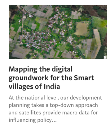
•Smart Village Mori ( University of Berkeley and Andhra government)
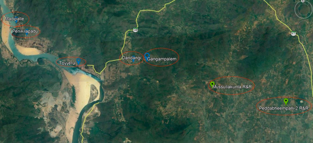
•Rehabilitation and Resettlement (Polavaram Dam, Andhra Pradesh)
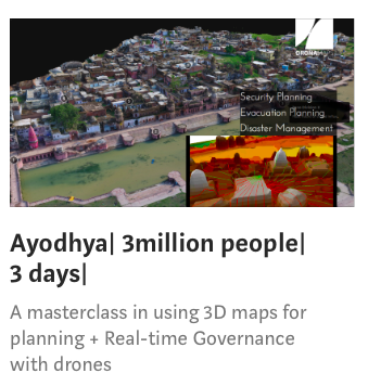
•Planning and Real-time Surveillance of Sawan Jhula Mela (Ayodhya, Uttar Pradesh)
Laurels
Awarded "Best Startup" by Hon'ble CM of Madhya Pradesh
Awarded "Jury's choice (Most Innovative Startup)" at NASSCOM Product Conclave 2017
NASSCOM Innotrek 2018

Media Mentions


DronaMaps.capabilities
By DronaMaps Private Limited
DronaMaps.capabilities
The offerings


